![[Yosemite]](/images/yosemiteicon.png)
We’d picked up our permit in Bishop, and the ranger there suggested that the backpackers’ campground at Mosquito Flat was likely to be full.
That was a problem, so we spent the night before the trip in Bishop. When we arrived at Mosquito Flat the next morning there were only two tents in the campground…so next time we know to check the campground, not the ranger in an office 45 miles away.

This is a lovely hike. The trail leads up along the North canyon wall, with beautiful views of Little Lakes Valley and the peaks above Morgan Pass. For a while you track the stream as it gurgles beside the trail. The junction to Ruby Lake comes quickly, and then you get into the real climb, switchbacking up on the granite, with vistas opening up in all directions.

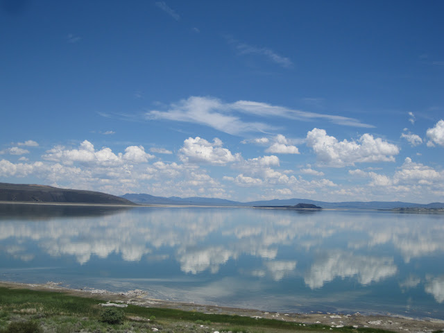
You get a great view of Ruby Lake from above, and then the trail turns the corner and you are climbing straight up to Mono Pass, at over 12,000 feet.
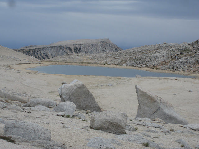
The far side of the pass is a little disappointing—a barren sandy desert with a meagre little Summit Lake sitting in the middle, but once you reach the edge of the ridge, you get great views of Pioneer Basin, Mono Canyon, and the rest of the Sierra. We ate lunch just below Trail Lakes, and ran into ranger Michael Rodman, who not only checked our permits (a first for us!) but also gave us great advice about all of the various destinations on the route. He stopped by our camp later in the day to check out our tent and talk fishing a bit.

On his advice, we camped on a ridge above Fourth Recess Lake, enjoying the 800 foot cascade on the far wall of the lake. Over the course of the afternoon, the clouds had been building, and we watched with some concern as we heard thunder and saw showers in all directions. By 8 p.m. there was only one cloud left in the sky, and I remarked that it looked like we had dodged a bullet.

Five minutes later we were hammered by a hailstorm for close to an hour. While the hailstones weren’t large, they came down in buckets, and the next morning there was at least an inch of hail still on the ground. So much for dodging bullets. Not a lot of fun.

The next day, after we dug out of the hail and dried things off a bit, we packed up and hiked to Mud Lake, the lowest of the lakes in Pioneer Basin. We set up camp on a ridge West of the lake, and then day-hiked up onto the bench above to explore.

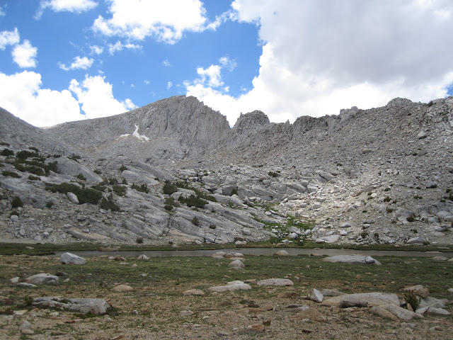
What a beautiful garden! There were lakes everywhere we looked, small trees and grass grew between them, and we spend a couple of hours just wandering along and enjoying the sights. As the day progressed the clouds gathered again, and we decided that an exposed ridge was not the place to camp that night. Instead, we packed up again and descending into Mono Canyon, where we found a protected campsite and enjoyed a lovely evening. In fact, we only got a few sprinkles of rain, although we did see dark clouds and heavier rain up above near our original campsite.

Day three, we packed up and started back towards the trailhead. We wanted to investigate Golden Lake, and so we left our packs near where the trail crosses Golden Creek, and then day-hiked up the creek to the lake. This was a joyous hike—beautiful High Sierra scenery, warm sunshine, a crashing, cascading creek to follow, and a lovely lake at the end. There were some big trout near the outlet of Golden Lake, but they were very deep, and completely uninterested in any flies that I tossed at them.

After a rest at the lake, we hiked back to our packs and ate lunch back on the main trail. A decision needed to be made. The weather was looking worse again, and we were not in a great spot. There are a few campsites at Trail Lakes, but they are a bit exposed. We decided to hike up and look at them—at the very least, it would take us closer to the trailhead, and make the next day a bit shorter.
At Trail Lakes, we didn’t really see a campsite we liked, and so we took one more look at the sky, and decided to try to make it over Mono Pass to Ruby Lake before the storm hit.

That was a cold, windy hike. By the time we got to the pass, it was sprinkling a combination of hail and rain, but only very lightly, and so we kept on moving East and down. By the time we got to the junction with the Ruby Lake Trail, the sky was black and it was clear a big storm was on its way. We chose to hike down into Mosquito Flat and camp at the trailhead campground.

On the last few miles of the trail, we were meeting quite a few day-hikers, and we all descended with a certain amount of focus, looking up at the sky all the time. We arrived at the trailhead about 5 p.m., with a black sky overhead, thunder in our ears, and lightning flashing around.

When I stopped at the car to chat with some fishermen, I only had time for two questions before we were hammered with rain and hail. We threw our packs in the car and sat inside, waiting for the storm to let up so that we could set up camp.
Almost two hours later, the hail was still coming down, and we gave up and drove to Bishop for a warm bed, a hot meal, and a shower. A real shower, with warm water, instead of hail.
The rest of the photos are here: https://picasaweb.google.com/balzaccom/ ... oPass2015#
