Home A - Z FAQ Bookstore Art Prints Online Library Discussion Forum Muir Weather Maps Lodging About Search

Twin Peaks Pass and Stanton Pass - how difficult?

Hiking, backpacking, running, biking, climbing, rafting, and other human-powered activities in Yosemite National Park

Moderators: Wickett, dan

Twin Peaks Pass and Stanton Pass - how difficult?

Postby LVRAY » Wed Jul 15, 2009 10:15 pm

I would like to here from anyone with first hand experience crossing from upper Virginia Canyon into Spiller Creek Canyon via either Twin Peaks or Stanton pass. According to reports I have seen, they are either a class 2 or 3 scramble, though some say the west side of both may be slightly harder than class 3. Which route would be the easiest route to get from Return Lake to Spiller Creek? Or is it possible to drop from the plateau southwest of Return Lake down to Spiller Lake and then on down to Spiller Creek. Is it easier to go east to west or west to east.

In addition, is it possible to go from the West Lake - Par Value Lakes area over to Return Lake without having to drop down into Glines Canyon and over Virginia Pass. There looks to be a another pass northwest of Virgina Pass that may not be too difficult.

Any insights would be greatly appreciated.
LVRAY
Frequent poster
Frequent poster
 
Posts: 35
Joined: Tue Jun 16, 2009 6:26 pm

Postby orion » Tue Feb 09, 2010 9:25 pm

I've looked down on Spiller Lake from Soldier Lake, and it seemed like a reasonable scramble on big talus. The walk up from Return Lake is a pretty basic walk up. At the top, there's interesting patch of krummholz logdepole pine bushes in an otherwise stony fellfield just before the drop to Spiller.

It seemed likely you could camp somewhere where Spiller empties.

I've looked at the other pass from Spiller Canyon several times, and could never make out distinctly where the trail would be. Most likely would follow the snow fields on the left side of this photo and over:
http://www.panoramio.com/photo/11797515

If you look at the google map, you can see clearly the striations to follow, but on the ground it looked cliffy. Probably obvious once you get close up. One the Virginia side, there is a spill of gray talus to follow up to the pass, looks like. I've heard from several sources this pass is doable.
Last edited by orion on Wed Feb 10, 2010 3:30 am, edited 2 times in total.
orion
Veteran-poster
Veteran-poster
 
Posts: 171
Joined: Sun Jan 17, 2010 4:02 pm

Postby bill-e-g » Tue Feb 09, 2010 10:30 pm

This was my response to this question on the yosemitenews forum:

http://yosemitenews.info/forum/read.php ... #msg-16018
User avatar
bill-e-g
Veteran-poster
Veteran-poster
 
Posts: 795
Joined: Tue Jun 24, 2008 5:57 am
Location: Table Lake, YNP

Postby bill-e-g » Wed Feb 10, 2010 1:10 am

Boy, you really got me stumped. I'm fairly certain that is not Spiller Lake.
Just can't figure out what lake it really is.
It's not Spiller, Soldier, or Return.

???

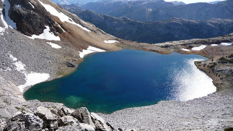
This is Spiller Lake:
Image

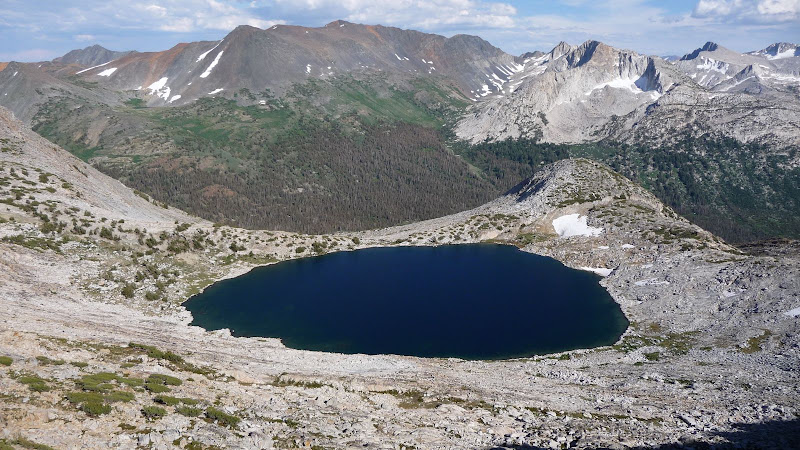
This is Soldier:
Image
User avatar
bill-e-g
Veteran-poster
Veteran-poster
 
Posts: 795
Joined: Tue Jun 24, 2008 5:57 am
Location: Table Lake, YNP

Postby orion » Wed Feb 10, 2010 2:59 am

well, there you go. i remember Spiller looking easier to hike down to the right, but that didn't square with the picture. maybe i'll dig up those old photos and sort that one out if i have the time. probably that little lake just north of Spiller, or maybe Arndt or a McCabe. It was in with photos from Soldier.

...from the shadows i realized it is facing north. That is Iceland Lake.
orion
Veteran-poster
Veteran-poster
 
Posts: 171
Joined: Sun Jan 17, 2010 4:02 pm

Postby bill-e-g » Wed Feb 10, 2010 8:16 am

Iceland, yes. Thanks.

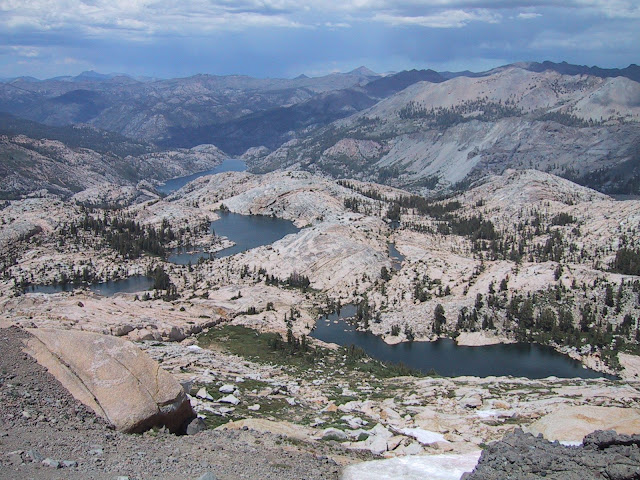
Here it is from Granite Dome:

Image

Need to go to the Emigrant more... just soooo much horse dookie spoils it for me.
User avatar
bill-e-g
Veteran-poster
Veteran-poster
 
Posts: 795
Joined: Tue Jun 24, 2008 5:57 am
Location: Table Lake, YNP


Return to Yosemite Hiking & Backpacking

Who is online

Users browsing this forum: No registered users and 1 guest