Home A - Z FAQ Bookstore Art Prints Online Library Discussion Forum Muir Weather Maps Lodging About Search
CalHotels.US--online reservations now CalHotels.US Lowest Hotel Rates Guaranteed. Click Here For Yours!
Hotel photos, maps, reviews, & discount rates.

U.S. Hotels in California (Yosemite, L. A., San Francisco ), AL, AK, AR, AS, AZ, CA, CO, CT, DC, DE, FL, FM, GA, GU, HI, ID, IL, IN, IA, KS, KY, LA, ME, MD, MA, MI, MN, MS, MO, MT, NE, NH, NJ, NY, OK, NV, MH, MP, NM, NC, ND, OH, OR, PA, PR, PW, RI, SC, SD, TN, TX, UT, VT, VA, VI WA, WV, WI, WY

[Yosemite]

Parking and car retrieval logistics

Hiking, backpacking, running, biking, climbing, rafting, and other human-powered activities in Yosemite National Park

Moderators: Wickett, dan

Parking and car retrieval logistics

Postby Hitech » Fri May 21, 2010 2:29 pm

I’m planning the following trip (mid July) and I am trying to determine the parking and car retrieval logistics. Any help would be most appreciated.

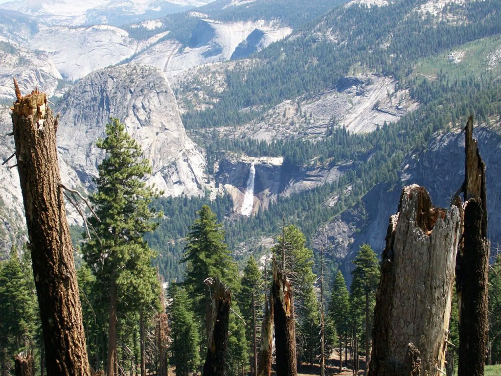
Day 1 – Sunrise at Glacier Pint and then day hikes around there; then either:
a. Hike from here to the crossing at Illilouette Creek and camp there.
b. Drive back to the valley and hike from there along the panorama trail to Illilouette Creek (or thereabouts) and camp there.

Day 2 – Hike to LYV or continue on to Sunrise Creek and camp there.

Day 3 – Day hike to top of half dome, then maybe up to clouds rest or other exploring and back to camp.

Day 4 – Hike down the Mist Trail and back to car.

One thought is that if I park in the valley when I get to the bottom of the Mist Trail I’m back at the car. However, is the first day hiking going to be too much? I guess I did leave time to rest day 2.

If leaving the car at Glacier Point I could always take the tour bus back, but it’s a four hour trip. I’d really like to get back on the road instead of taking a leisurely tour. Any other way of getting back to the car?

Or, is there a better way? On a side note, can you park at the beginning of the Mono Meadow trail?

Thanks.
Hitech
Frequent poster
Frequent poster
 
Posts: 25
Joined: Fri May 21, 2010 2:28 pm

Postby hotrod4x5 » Fri May 21, 2010 5:59 pm

If you leave your car at GP, you don't take the "tour" bus back there, you take the hiker's bus which isn't a 4 hour ride.

If you choose to leave your car in the valley, you can also take the hiker's bus to GP, and then go on the panorama trail as you have indicated. If you start in the valley, it is a long, uphill trek to Illilouette Creek, either via the John Muir trail connecting to the Pano trail, or the 4 Mile trail to GP.
hotrod4x5
Veteran-poster
Veteran-poster
 
Posts: 217
Joined: Tue May 11, 2010 9:37 am
Location: Riverside, CA

Postby baseline bum » Fri May 21, 2010 10:32 pm

I'd definitely take hotrod4x5's suggestion. If you hike up the JMT/Mist Trail to Panorama and down to the creek, you're going to be gaining a needless 2000+ feet while missing scenery like this from the Panorama Trail between GP and Illilouette:

Image

That was a pic I took in late August last year. In mid-July the waterfalls could be way better though (they were crazy in July when I went in 06). You'll also miss a really cool view of Illilouette Falls.
baseline bum
Very frequent poster
 
Posts: 51
Joined: Fri Jul 17, 2009 10:31 pm
Location: San Antonio, Tx

GP to Illilouette it is...

Postby Hitech » Sat May 22, 2010 9:00 am

Sounds exactly like what I want to do. Where can I find out information on the backpackers bus?

Thanks. And, that is a great picture. I'll have to show it to my wife to inspire her (she is going with me :D ).
Hitech
Frequent poster
Frequent poster
 
Posts: 25
Joined: Fri May 21, 2010 2:28 pm

Postby hotrod4x5 » Sat May 22, 2010 9:09 am

http://www.yosemitepark.com/Activities_ ... tTour.aspx I guess the bus to Toulemne Meadows is called the hiker's bus, but you are correct that you will ride the tour bus. But you only go one way, so it isn't 4 hours, it's about 2.
hotrod4x5
Veteran-poster
Veteran-poster
 
Posts: 217
Joined: Tue May 11, 2010 9:37 am
Location: Riverside, CA

Postby baseline bum » Sat May 22, 2010 8:04 pm

Another thing to consider might be to just see if you can rent a locker or something in the valley after descending the Mist Trail on the last day, stash your packs, hike up the Four Mile Trail back to Glacier Point, catch the sunset and your car there, and then drive back down and pick up your packs.

Here's some info about lockers:
http://www.yosemite.org/71/Visitor-Serv ... ndable=0#7

Perhaps someone more knowledgeable could tell you if you'd have a decent shot at getting one, or whether they fill up pretty quick in July.

As for your itinerary, possibly doing HD and Clouds both on day 3 sounds pretty rough. Just looking at a topographic map, that looks like an almost 6500 ft day from LYV. Maybe a better option to get both in might be to just start on trail immediately after catching the sunrise at GP, setup camp at Illilouette, and do a dayhike to HD and back to camp. It'd be a hell of a dayhike for sure (3200 feet or so of elevation gain), but only a few hundred feet of gain more than starting from LYV. Then day 2 could be used to setup camp to make a trip to Clouds Rest convenient for day 3.

Clouds Rest is a not too bad dayhike from Tioga Pass Road also, if you don't do it on the backpacking trip and you have an extra day in the park. It's an amazing summit.
baseline bum
Very frequent poster
 
Posts: 51
Joined: Fri Jul 17, 2009 10:31 pm
Location: San Antonio, Tx

Postby Hitech » Tue May 25, 2010 10:18 am

Thanks for the information on the bus and lockers. It certainly gives me the options I need.

I think we will have to see how we are feeling before determining the exact hikes. I didn’t think that LYV to half dome would be hard, but then I’ve never done it either. We will have to see how we feel each day, but I’ll keep your suggestions in mind. I should probably consider elevation change much more than distance. It’s pretty easy to walk on flat ground. Thanks.
Hitech
Frequent poster
Frequent poster
 
Posts: 25
Joined: Fri May 21, 2010 2:28 pm

Postby baseline bum » Tue May 25, 2010 8:47 pm

My bad... I take back what I said about HD from Illilouette being only a few hundred feet more than from LYV; it'd be about 1000 feet more of elevation gain on the trip there, and 600 more feet on the return trip. It didn't seem like gaining 1000 feet from the creek when I did Panorama, but looking at the map at Yosemitehikes.com (great site BTW), it turns out it was (~5600 at the creek to ~6600 at the highpoint before descending to ~6000 at Nevada Falls and into LYV).
baseline bum
Very frequent poster
 
Posts: 51
Joined: Fri Jul 17, 2009 10:31 pm
Location: San Antonio, Tx


Return to Yosemite Hiking & Backpacking

Who is online

Users browsing this forum: No registered users and 100 guests