Home A - Z FAQ Bookstore Art Prints Online Library Discussion Forum Muir Weather Maps Lodging About Search
CalHotels.US--online reservations now CalHotels.US Lowest Hotel Rates Guaranteed. Click Here For Yours!
Hotel photos, maps, reviews, & discount rates.

U.S. Hotels in California (Yosemite, L. A., San Francisco ), AL, AK, AR, AS, AZ, CA, CO, CT, DC, DE, FL, FM, GA, GU, HI, ID, IL, IN, IA, KS, KY, LA, ME, MD, MA, MI, MN, MS, MO, MT, NE, NH, NJ, NY, OK, NV, MH, MP, NM, NC, ND, OH, OR, PA, PR, PW, RI, SC, SD, TN, TX, UT, VT, VA, VI WA, WV, WI, WY

[Yosemite]

Red Peak Pass

Hiking, backpacking, running, biking, climbing, rafting, and other human-powered activities in Yosemite National Park

Moderators: Wickett, dan

Red Peak Pass

Postby ceeps » Thu Jun 03, 2010 12:53 pm

Hi everybody, I've been planning a 12 day trip starting at Happy Isles on June 10th then proceeding out to Medced Lake, Triple Peak Fork and over Red Peak Pass on June 16th and down to Lower Ottoway Lake.

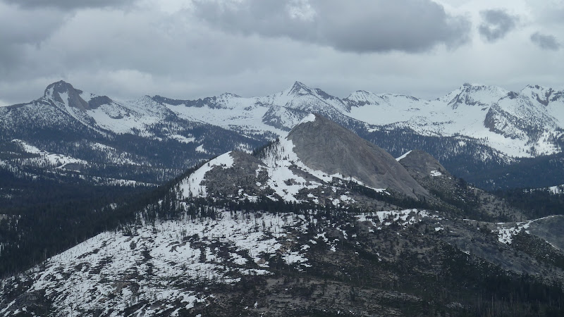
I was wondering if anyone has done this trip before and if you have any advice or comments about the difficulty to expect when climbing Red Peak pass considering the late and heavy winter this year. I will be traveling with a large group of varied experience. I already assume that snow shoes will be very helpful if not critical. What about crampons and other equipment? Anyone done this trip before in snowy conditions and have any input?

Our next goal on this trip will be to go up and over Cloud's Rest and out towards Tenaya Lake around June 20th. I noticed some people on this forum saying they were going to attempt Clouds Rest around the beginning of June. If anyone has any reports of their adventures I would greatly appreciate come input.

Thanks!
User avatar
ceeps
Newbie
Newbie
 
Posts: 6
Joined: Thu Jun 03, 2010 12:33 pm
Location: Hawaii

Postby bill-e-g » Thu Jun 03, 2010 2:01 pm

Yikes. Really?

Honestly I would really not recommend you attempt Red Peak Pass
that early. If you have mountaineering experience then ok.
But "varied" experience... uh.. I really think you are setting yourself
up for failure. I can almost assure you that both sides of the pass
will be covered in many feet of snow. You won't see any trail.
The west side will be really really steep. The east steep but
not as much. Crampons and an Ice Axe.
Ottoway Lakes will be completely frozen.

I've gone over the pass where the east side was 100% snow coverage
but the west the trail was open. And that was the end of July.
There was a picture of the range from Red Peak I posted from
mid July last year ... it will be much worse this yr...
Search for that.

I'll look and see if I have a nice picture of the Clark Range
from Sentinel Dome a couple weekends ago. It won't have
changed much.

I'd recommend you just go up towards Red Peak Pass and then
just turn around when the group becomes uncomfortable.

Have fun. Be safe
User avatar
bill-e-g
Veteran-poster
Veteran-poster
 
Posts: 795
Joined: Tue Jun 24, 2008 5:57 am
Location: Table Lake, YNP

Postby bill-e-g » Thu Jun 03, 2010 8:49 pm

Here's the Clark Range from May 21st from Sentinel Dome.
It snowed some since then so it probably looks very similar now.
Even with a couple weeks of melt... boy...
If you follow the furthest right/south Dome of Starr King straight up
... that saddle there is the almost the same height as the Pass.
(that saddle is the saddle just North of Red Peak)

You should ask when u get your permit. They will probably say
you are embarking on a dangerous venture.

Sure, it's probably doable... but not for varied skill levels IMO.

Image
User avatar
bill-e-g
Veteran-poster
Veteran-poster
 
Posts: 795
Joined: Tue Jun 24, 2008 5:57 am
Location: Table Lake, YNP

Red Peak Pass

Postby KC » Thu Jun 03, 2010 11:21 pm

Took five days two years ago to do this trip from the other direction. It's great, but I did it in August, not early June. If possible, I might hold off on doing it for another month or so. I was hoping to do the Pohono Trail in a week or two but was told it's still pretty snowed in in places by a ranger. As a result, I don't see how Red Peak Pass is possible absent decent mountaineering skills.
KC
Veteran-poster
Veteran-poster
 
Posts: 106
Joined: Tue Jun 01, 2010 12:11 am

Postby ceeps » Thu Jun 03, 2010 11:36 pm

Thanks for your input and sound advice. We'll just go as far as we can and like you said, turn around when the group is no longer comfortable. Nice photo by the way.

What do you think about the descent towards Tenaya Lake from Clouds Rest on the 22nd. Do you have any idea what we can expect from that trail, once again considering that we are a group with "varied experience"?

Thanks!
User avatar
ceeps
Newbie
Newbie
 
Posts: 6
Joined: Thu Jun 03, 2010 12:33 pm
Location: Hawaii

Postby bill-e-g » Fri Jun 04, 2010 6:16 am

I'd still expect loads o snow ... 100% snow coverage beyond CR.
Maybe I said it already but it's just a crazy year for snow.

Maybe Leo will post his experience this year. It was prob. similar
to mine last year. Here's his post:
http://www.yosemite.ca.us/forum/viewtopic.php?p=4228

They do a really good job keeping the conditions more or less
up to date.
http://www.nps.gov/yose/planyourvisit/wildcond.htm

Where I went last weekend was 100% snow over 5 ft. of snow...
all the lakes with 2 ft. of snow ... completely frozen over...
but just beautiful. Snow started about 7000 ft.
I guess no one wants to see how beautiful it can be on account
I didn't see a single person the entire 3 day weekend.

Anyway... for your trip... I wouldn't worry... You got Happy Isle
so you're good. You can just go and play around and probably
keep everyone happy. When you get your permit just ask
about conditions. I'd imagine you'll end up wanting to just
dayhike HD and CR. and then come back down.

You'll love it. It's gonna be spectacular.

Been in love with this place for 15+ years... can't get enough..
:)
User avatar
bill-e-g
Veteran-poster
Veteran-poster
 
Posts: 795
Joined: Tue Jun 24, 2008 5:57 am
Location: Table Lake, YNP

Postby ceeps » Fri Jun 04, 2010 11:03 am

Yea loads o snow is what I expect. Last year we did a trip in the end of May from Mono Meadow trail up to Buena Vista Lake (70% frozen over), then a Summit of Buena Vista Peak in between the lull of a thunderstorm and over Buena Vista pass down to Wawona. Needless to say a good portion of our trip was on snow. But judging by the weather, it looks like this year is going to be an even snowier adventure.
I hear yah about being in love with this place for 15+ years, I am in the same boat. But being out here in Hawaii, I only get to make it out there 1 to 2 times a year now :(

Appreciate your eyes and ears considering mine are so far away atm. Maybe I'll have some nice photos to share when I get back from this trip towards the end of June.

Happy trails!
User avatar
ceeps
Newbie
Newbie
 
Posts: 6
Joined: Thu Jun 03, 2010 12:33 pm
Location: Hawaii


Return to Yosemite Hiking & Backpacking

Who is online

Users browsing this forum: No registered users and 131 guests