by Phil » Sun Sep 27, 2015 9:43 pm
Hey Carol,
Welcome to my dissertation.
Ah, I was under the impression that you were going to try to fit the trip in this season, so that changes things in my mind. With the lottery, that would be staying at the High Sierra Camps (Sunrise, May Lake, Vogelsang, etc...), no lottery for wilderness permits, just book as early as possible. You won't need to worry about seasonal closures (maybe spring season openings for some of the facilities such as Tuolumne and Sunrise), but I can almost guarantee you that your single biggest issue anytime in June is going to be mosquitoes. No kidding! Like you'll fully understand how people in jungles go insane because of insects and that DEET does a real number on mucous membranes when you apply it in the quantities you'll need to even try to get any relief at all. Bring a face net and full rain gear, too.
Okay, so, that said... anytime in June is going to definitely make getting reservations easier. It's way early for most. To give you an example, just fyi, on your proposed route up from Tuolumne to Upper Cathedral Lake, we've been post holing in thigh-deep snow, while it was snowing and hailing, as two thunderstorms converged right over our heads on the 4th of July weekend. Maybe an exception, maybe not, but it happens, and, there will almost definitely be some snow. Make sure you take this winter to practice your navigational skills if there's any chance that there will be snow cover at all. If there is snow, don't leave the trail for any reason, even if you see lots of footprints that head off, and know what a trail blaze on a tree looks like, and how to follow them. No reason to be scared though, just aware and willing to stop and turn around if the situation calls for it, but I'm just going to try to keep you safe since you're new to this. I would bring someone else with you, and maybe even get used to backpacking on some of the lower elevation routes such as the North Rim of the Valley, or even an overnighter to somewhere like Little Yosemite Valley in order to know your gear in the field and to see how you're going to hold up under more controlled conditions.
Which brings me directly to my next concern...your newish hip. You should seriously run that by your doctor!! That's also why I would suggest that you take a friend, at least until you know how it's going to go. You collapse and you're going to sit for a while, even if you have a rescue beacon, or a friend has gone for help. If the weather turns, being alone and crippled, and with not many people coming by because it's not quite peak season, you're possibly going to sit there until you die. That would suck, and I would feel bad having given you any advice at all!
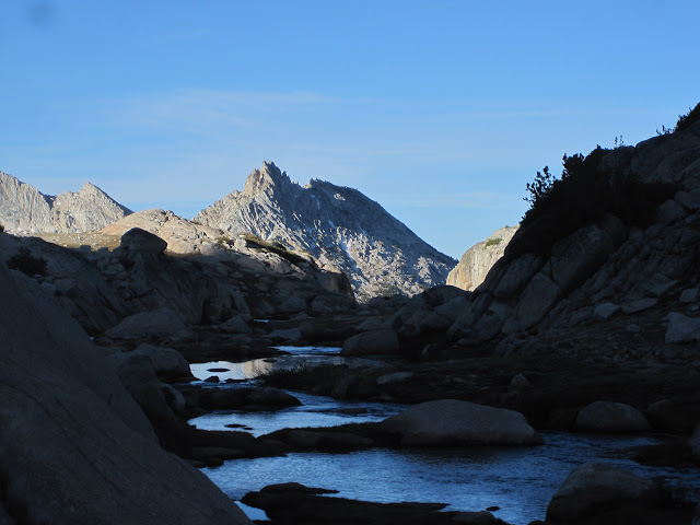
Now let's talk about your route: I would plan at least 4 nights for this (no less than 3), and I'm going to assume that you're doing great and everything except your hip is clicking. I'm going to advise you to go fairly slow and easy in order to see how you do, get used to altitude, and to take advantage of what I consider the best campsites.
Day one- start in Tuolumne Meadows at the JMT trailhead for Cathedral Lakes- night 1, Upper Cathedral Lake. Day 2- From Upper Cathedral to Sunrise. If you need to stop, even though the High Sierra Camp will still be completely shut down, you can overnight it at the backpacker's camp. If you want to continue, leave the JMT and go right up to Upper Sunrise Lake. Go around the other side of the lake for the best campsites, or, you can continue and go to Lower Sunrise Lake. There are some nice sites that are pretty much trailside, but, there are lot's of bears that aren't necessarily dangerous, but good at being kind of pushy- night 2. Day 3- From there, go about 1/4 mile up-trail until you reach the junction with the Sunrise Trail coming up from Tenaya Lake. If you do have any problems and need to bail, this is going to be the fastest way out from where you are, but do keep in mind that when you reach the bottom, you're probably going to have to ford about 100 yards across Tenaya Creek, which might be fast, and probably thigh deep, and, maybe even just an extension of the lake itself if it's a wet year. So let's just say you decide to keep going...when you hit that junction at the top of the Sunrise Trail, follow the signs to Cloud's Rest. It is well worth visiting, but don't plan on camping near the top unless you have plenty of water and don't mind sparse and cramped places. Stay lower, in the flats, at or around the junction that goes back down to the JMT at Sunrise Creek. You'll have a very short hike that day, but it's going to serve you better in the long run, and since you'll have plenty of daylight left, I would advise you to day-hike Cloud's Rest from there, because if you have a full pack and go up and over Cloud's Rest, the descent there is going to be where you're going to have any problems with your hip that you're going to have. It is very steep, and it will hurt...and I can promise you that Stryker didn't stress test their artificial hips in conditions anywhere near it. If you have time, or the flats up there aren't what you have in mind, and you're up for it, you can go ahead and head down that 2.4 mile trail to the JMT and look for campsites there. In my opinion, the best sites along the JMT at Sunrise Creek are going to be up to your left from the junction and along the Creek. If you do decide to go up and over Cloud's Rest, or you want to keep going down the JMT from there toward the Valley, the junction of the JMT and Cloud's Rest just under 2 miles further along also has a few nice sites that are going to be fairly obvious, or, go down a little way and head out into the rocks to the left side of the trail a couple hundred yards or so past that and above the Half Dome spur for better views. The entire area also has lots of bears, in case you were wondering. Everything depends on what you want, need, and are up for- night 3. Day 4- Down to Little Yosemite Valley. You can overnight it there- night 4?, or you can push through about another 4.5 or so miles into the Valley and exit at Happy Isles and stay at the backpacker's camp in the Valley. Pretty much whatever route you end up taking, your travel distance will be about 30+ish miles. Whatever works.
I know I just gave you a lot of info, and I hope it helps. I would keep this post handy, because it's basically, with the exception of a few terrain technicalities, a trip manifest. And if you have any questions, are confused by anything I wrote, need clarification, or just want to bounce around thoughts, no worries.
Anybody want to add anything I might have missed?
![[Yosemite]](/images/yosemiteicon.png)