
[click to enlarge]
| Online Library: | Title | Author | California | Geology | History | Indians | Muir | Mountaineering | Nature | Management |
Yosemite > Library > Big Oak Flat Road > Entering Uncle Sam’s Property >
Next: Upper Flats • Contents • Previous: Above Settlements
|
[click to enlarge] |
Mules have never been much interested in scenery. The modern traveler on the highway dips down to the pebbled brown waters of the South Fork of the Tuolumne; the mule teams of yesterday continued to climb steadily over the mountain. Being up, why should a mule plod downhill and then laboriously pull up again? The change was made when the Tioga Road pushed through the timber and over the summit of the Sierra to this point. The river had to be crossed, so a bridge was built down in the canyon and approach roads slanted up in both directions, joining it to the Big Oak Flat freight route. The Tioga Road did not extend west of the bridge. At first no one went down unless he intended to cross the river but with the coming of the automobile the hills involved did not matter so much, traffic deflected down into the canyon and gradually the stretch of old road between the approaches fell into disrepair.
The modern Big Oak Flat Road to Yosemite (State Highway 120) does not cross the South Fork here; merely touches it. Within sight of the bridge it enters the boundary of Yosemite National Park and ceases to exist, becoming, from there on, a federal project.
On the boundary Carl Inn was erected in 1916 by Dan and Donna Carlon. It burned in four years; was rebuilt and again burned. In 1932 the Park took over their land but, during its short existence, Carl Inn was a popular resort.
The site of Hodgdon’s Stage Station, 1.3 miles beyond the park entrance, is marked by a cottage set in the lower corner of a lush green pasture now known as Cuneo Meadows and facing on the highway. Down the north fenceline of the meadow, to intersect the highway at the cottage, comes a ranch road. About halfway down the slope the old Big Oak Flat Road wanders around the shoulder of the hill and curves gently into the fenceline road, coming the rest of the way coincidentally with it. At the cottage the old road crosses the highway. The women often walked the two miles between Hodgdon’s and Crocker’s for they were near neighbors. The old road is now considered impassable for cars although traveled by Forest Service trucks. The barn that sheltered the stage horses stood on the downhill side of the road just before it merged with the fenceline road. An excavation marks the place. The two original Hodgdon cabins stood a few yards farther up the old road.
This is still part of the section called, originally, Bronson Meadows and is a tempting bit of mountain scenery. Here Jeremiah Hodgdon late of Vermont, settled in May, 1865, claiming it by squatters’ title and later homesteading the land. In addition to his cabins here he owned a foothill ranch between Knight’s Ferry and Keystone1 and an interesting place in Aspen Valley on the old Tioga Road where he built, in ’79, a two-storied log cabin which still stands—the only one of that description in or near Yosemite National Park.
Rough and rugged Hodgdon, always known as Jerry, had six children—a moderate family for the times. His buildings were all constructed of tamarack logs which withstood the extreme weather conditions of the elevation better than any other available wood and which might be found, courteously awaiting the saw and ax, in dense groves of uniform size.
Following the north fence up toward the crest of the rolling meadow, one finds a piling of large boulders shaded by cedar trees. They are pitted with Indian grinding holes. One smooth-topped rock has about forty shallow depressions where the women ground acorns. Another boulder, only slightly removed, has still more. Such out-sized mortar rocks suggest a large community and it is easy to picture the chattering women and children perched among the cedars. The squaws were gregarious and always worked in groups and, apparently, it never occurred to them to disengage any of their progeny.
According to Robert Curtin the remains of an Indian camp of cedar bark huts were to be seen here as late as the 1880s. It was near the meadow but on the left of the highway. A well defined Indian trail led from here to Hazel Green.
To add to the bizarre effect of the busy Indian women, the saddle-tourists headed up the mountain were confronted by Hodgdon’s chief rider and factotem, a Chinese character named Ah Hoy who rode like a demon and made the family’s welfare his business. It was (old-timers assure us) a practical education to hear him swear in pigeon English. He rode until he was old enough to go home to China to die which he then accomplished in spite of all arguments to the contrary. The presence of Ah Hoy, calmly informing them in unexpurgated cattle talk as to what they could and could not do, did not add lustre to the establishment in the eyes of the lady visitors.
Before the wagon road was completed to this point in June, 1870, Hodgdon’s was simply headquarters for his summer cattle-camp. It was a matter of accommodation that the sightseers bound for Yosemite were housed and given meals. No mountaineer could leave tired strangers outdoors on a frosty night to nurse their saddle bruises but one can imagine what a nuisance some of them were. It was during this regime that Helen Hunt Jackson passed this way seeking the beauties of Yosemite and, in justice to that well-known writer, it may be said that it took a good deal to upset her. “Three, four, five in a room,” she repined. “Some on floors, without even a blanket. A few pampered ones, women, with tin pans for wash bowls and one towel for 6 hands. The rest, men, with one tin Basin in an open shed, and if they had any towel or not I do not know. That was a night at Hogdin’s.—Not in the wildest and most poverty-stricken little town in Italy could such discomfort be encountered.”2 Olive Logan contributed her bit about the same time, “The dinner was execrable,” she wrote impolitely; and when after the noon meal they started out on saddle animals, she added, “Everybody is sick and sore. Poor idiots, wandering on horseback over these mountain fastnesses. We all get what we deserve for coming.”3
But still they came and Jerry sensibly decided that he might as well prepare to deal with them comfortably. He built a mountain inn—still rough, but capable of housing sixty people.
He also inaugurated the staging business for his section of Tuolumne County and for some years he and his son, Tom, acted as drivers.4
The saddle trail, used before 1870 and for such time after that date as it took to complete the road to Crane Flat, crossed the highway near Hodgdon’s and paralleled it somewhat to the left proceeding southeast. It passed over a rough and steep country, using a branch of the ancient Mono Trail which remains north of the road. The first telegraph line followed it because of its shorter distance and eventually it became known to its habitual users— guides and cattlemen, as Telegraph Way.
One-tenth of a mile up the road from Hodgdon’s the Indian trail took off to the right, headed for Hazel Green and Bull Creek. From there the road continues to turn and twist steeply through dogwood and giant conifers. There are six miles of such slow progress before striking the new highway at Crane Flat. The road is surfaced but narrow. However as there are no cliffs and the little thoroughfare is safely inclosed in heavy timber most people simply take it as an interesting sample of what the road used to be. To make the picture complete one should visualize dust a foot deep in heavy ruts and every vestige of greenery hidden under its powdery grey coating. It is interesting what an uplift a little properly distributed “black-top” can give to scenery. As the modern traveler threads his way along the narrow, curving ribbon of black road the green gloom of the giant fir forest suddenly wavers into sunshine and the bright cinnamon-brown trunk of a Sequoia Gigantea, or Big Tree, shafts upward toward the open sky. Although the original trail had passed by to the north, the course of the wagon road was deliberately altered to allow the stages to drive through Tuolumne Grove.
For most of the travelers this was the first glimpse of what we now call “the oldest living thing.” And, although the question has been long disputed, there is no doubt in our minds that Tuolumne Grove Sequoia Giganteas were the first specimens ever seen by white men—the Joseph Reddeford Walker Expedition of 1833. This always interesting controversy is dealt with later, in the last chapter.5
It is almost impossible to realize at first glance how large these Big Trees really are. They grow in groups of their peers and even the neighboring firs and pines seem bent on emulating their size and swell to amazing proportions. Joseph LeConte, nature lover of earlier days, wrote: “My first impressions of the Big Trees were somewhat disappointing, but . . . a sense of their immensity grew upon me. If they had stood by themselves on a plain, they would be more immediately striking. But they are giants among giants.”
The trees of Tuolumne Grove seem particularly susceptible to this illusion of mediocrity, although the “Dead Giant” in its hey-day day is said to have measured more than 120 feet in circumference.6 In order to force visitors to realize its size and to provide an additional point of interest, it was decided to tunnel the base of the trunk. The brothers David and James Lumsden were intrusted with the project.
The tree was charred into a black mass at the bottom where a large cavity had been used for years by the Indians as a shelter in which to build their fires and to cook. Lightning and forest fire had done their worst; two cathedral-like spires, shattered and scorched, topped the mighty trunk but the heart-wood was sound. This is attested by John V. Ferretti. As a boy of nine he went on the job with his father who supplied the team. He remembers a slab of wood weighing about one-half ton which was brought down to Priest’s Hotel and made fast to one of the locust trees as a souvenir. The tree tunnel was completed in ’78 and a branch of the road curved out to pass through the strange archway just as it does today.
Mr. P. Andersen traveled to Yosemite in a spring wagon in 1892. He wrote a description of his journey in Danish and sent it to his uncle in Denmark where it was published in a current magazine but never translated until a few years ago. “These trees are not small at all,” he wrote. “Just think, we drove through one of them. This tree is 31 feet in diameter. It may make you think of the women in Copenhagen who jumped over the Round Tower. But this has to be literal when I say we drove through this giant tree with horse and wagon. The tree is dead and burned at the top. About 200 feet of the trunk is still standing and the road goes right through the base of it.”
The archway in 1894 was ten feet wide by twelve in height.
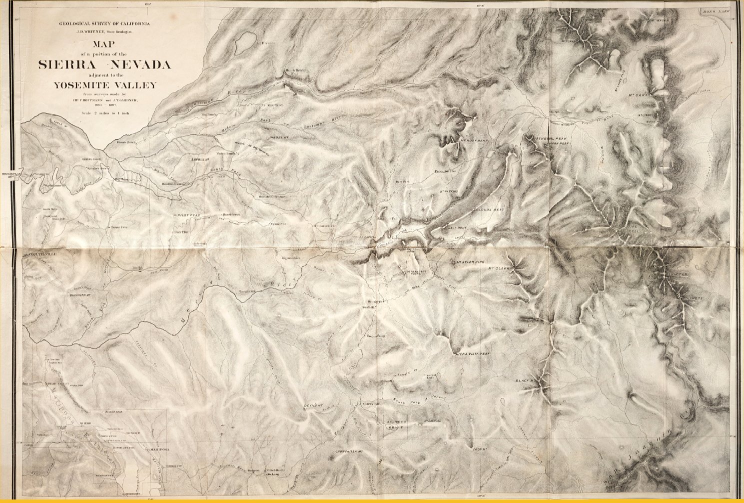
The next point of concern, Crane Flat, shows at an elevation of 6130 feet after one very steep, crooked mile. It was visited and named in 1856 by George W. Coulter, Dr. Lafayette Bunnell and a small party from Coulterville, Mariposa County, who had made their way up the mountain from Black’s on Bull Creek to which a wagon road had already been constructed. They were blazing a suitable saddle trail to join their settlement to the Big Oak Flat (or old Mono) Trail so that they might use its descent into Yosemite Valley. En route they had passed through a meadow boasting a thick growth of hazel bushes, named it Hazel Green, and pushed on to this point—a moist, springy upland. One of the party wrote: “Our next move was to ‘Crane Flat.’ This name was suggested by the shrill and startling cry of some sand-hill cranes we surprised as they were resting on this elevated table.”7 The junction of the two trails was accomplished on the near edge of Crane Flat and the joined trails went on together toward Gin Flat, keeping north of the marshy meadow. It is true that one of the two maps in J. D. Whitney’s The Yosemite Book, 1868, shows the trails joining approximately at Gin Flat but John Muir, who traveled the trail and gave an account of his trip, states that they met at Crane Flat.8 This has been corroborated by several of the old residents along the Big Oak Flat Road who habitually took that route to the valley.
The earliest known habitation in Crane Flat seems to have been a cabin mentioned (as being deserted) by Whitney in 1868.9 There is some likelihood that it belonged to Hugh Mundy who ran sheep in the vicinity but no proof can be obtained.
From the time that naturalists and sightseers began to trek to Yosemite, Crane Flat was important. Animals and tourists alike needed food and shelter. Gobin’s place supplied this need. In the ’70s Louis D. Gobin, with his son, “Ed,” summer-grazed here the cattle and sheep from their acres on the Rock River Road. At first they took in the of times unappreciative travelers simply because someone must do so. They served meals in their small log cabin which sat squarely on the county line so that one-half of the party consumed their dinner in Tuolumne County while those on the other side of the table ate theirs in Mariposa.
James Vick, who wrote “Vick’s Floral Guide,” was snow-bound at Gobin’s in June of 1874. The road now extended to Gentry’s on the brink of the north cliffs of Merced Canyon just below Yosemite Valley and in another month was completed to the valley floor. It was usually open by May but late snow evidently prevented further progress by stage and the party had sent a message to the valley requesting the services of the pack train. Vick was not comfortable but was able to see the viewpoint of his hostess, Mrs. Gobin. Thus: “In about an hour after leaving Hodgins we arrived at Crane’s Flat, where a little mountain hotel is kept by Mrs. Gobin and here we were so near the clouds that our further progress was obstructed by banks of snow, and here we were compelled to remain until saddle horses and pack mules could be sent from the valley to carry us and our baggage over the mountains of snow. The accommodations were not equal to a first class hotel, but the good landlady apologized for the scantiness of her larder, stating that she had only just opened for the season, and her cows had not yet been driven up the mountain, and the chickens were coming with the cows, and the house had tumbled down on account of the weight of snow the past winter, and in the fall of the house the furniture had been destroyed or badly injured; and the accommodations were truly meagre.—We were compelled to remain, snow-bound in June, for more than 24 hours. Almost every hour the report came that the saddle horses were in sight, but they came not, and we remained anxiously awaiting their arrival until three o’clock of the day after our arrival.”
Gobin’s stopping place grew with its necessities and became a comfortable stage station. It burned in ’86 and was rebuilt two years later.
Across from Gobin’s, on the southside of the old road was Billy Hurst’s saloon which served as warehouse, amusement center, address and home away from home to the solitary sheep herders from the camps far-flung on the steep mountain sides and in the aspen-clumped meadows. Billy was, each year, custodian of the supplies which were hauled thus far by pack mule or wagon, depending on how far the road had progressed. Billy stored them and later dealt them out piecemeal as needed. In his way he felt a great responsibility for these lonely men—enough so that he actually died in proof of it.
The little cabin was a popular place. Its owner was an admirer of Bret Harte and decorated his walls lavishly with illustrations of that noted author’s “Heathen Chinee,” cut from magazines. It was also a riotous spot much of the time; the men from the mountains didn’t come down to play cribbage; they could do that at camp. Indians, although legally forbidden liquor, managed to get it at Billy’s and went whooping up and down the trail in bands of twenty or thirty, giving the isolated ranchers cause for reflection, but never, to our knowledge, necessitating any more violent action.
Among the habitues of the establishment was “Smokey Jack” Connell who ran sheep high up in the rocky peaks and came down for an occasional forgivable bender. It was on one of these occasions that he dictated a letter to Billy to be sent to that tolerant lady, his wife, giving her such news as he was in condition to impart. As it was none of Billy’s affair to rewrite the effusion, it was sent in status quo to the great delight of passing teamsters. The last two lines have survived: “The sheep are scattered and gone to hell Your affectionate husband, John Connell.”
There is a specimen of Billy’s flourishing handwriting at the museum in Yosemite. It probably was a source of satisfaction to the illiterate among the herders for whom he was always a faithful amanuensis.
It was while keeping Connell’s herders under some sort of supervision that the naturalist, John Muir, found it possible to explore so much of what was later Yosemite National Park; and, incidentally, learned from personal observation the destruction that an earnest and persevering band of sheep can inflict on the beauties of nature.10
Billy Hurst’s was a true democracy. Sharing the crude and limited space at the bar with these primitive characters were respected ranchers and distinguished visitors. Two lines from a simple and inoffensive doggerel have come down through the years commemorating a night at Billy’s in honor of Lieutenant Governor Gobin of Pennsylvania who was visiting his uncle, Louis Gobin, in the ’80s: “There’s Cloudman full of music and Buchanan full of tune. We drank and ate and stayed up late, at Billy Hurst’s saloon.”
Well, said saloon was warm, lighted, full of cheerful company, whiskey, noise, music, poetry of a sort, and a riotous kind of good fellowship. There were worse places in Tuolumne County. In ’88 it was prospering, but the winter of ’89-’90 saw the end of it. Old-timers still quote that season as the worst snowfall ever known in the mountains.
Billy, a short but powerful, heavy-set man, always waited for the last straggler to come in from the camps before he closed up for the winter months and went below, traveling on snow shoes. This year he waited too long for some who never did get in. Terrible snowstorms followed, one on the heels of another. He tried to get down the mountain during the short interims when he could see to travel but never could make it and always had to turn back. Finally, his strength gave out completely and he became ill, alone in his cabin on the summit.
The people below watched for him and, when they were convinced that he was marooned, they banded together and went after him. He was taken straight to the hospital at Sonora and died there.
* * *
When automobiles were first permitted to enter the Yosemite Valley, various minor changes were made on the road at the higher elevations. Wherever possible, the sharpest turns and steepest grades were improved but the general route remained the same. Then in 1940, a new federal highway was inserted at Crane Flat connecting a brand new Ranger Station and entrance fee gate with the floor of the valley—a highway so insistent and so impressive that it is hard to keep in mind any theater of action in which it did not exist. To connect with this highway at the new gate the Big Oak Flat Road swerves to the right for the final few hundred yards, but the earlier route may be seen traveling straight up the hill through the trees to strike Crane Flat at the present Blister Rust Camp.
From the present Ranger Station one may drive a car 9.6 miles farther along what is approximately the course of the old road by turning left, taking the new Tioga Road for 1.3 miles and then turning off to the right at Gin Flat. But eventually the car will have to come back and go down the highway because the old Big Oak Flat Road has become “no thoroughfare” and winds up against a log barrier at the site of Gentry’s Station.
In the meanwhile Crane Flat itself is a fertile field for study. Two-tenths of a mile down the Tioga Road is the Blister Rust Camp. Through it runs the pioneer road at right angles to the Tioga Road. Gobin’s stopping place was about one hundred feet east of the present buildings. Although the land has been filled in order to level the road, the spot was identified by Mr. Curtin and is recognizable from old photographs. Portions of foundations, bits of crockery and glass gave further proof.
Immediately across the road was Billy Hurst’s saloon where that faithful steward tried to outwait Death and failed. At present tiny pieces of old bottles and china may be found where Hurst threw his refuse to the rear of the kitchen. For a few years the early toll gate stood just beyond his dwelling.
A steep portion of the old Big Oak Flat Road winds its way over the mountain to the left; and roughly parallels the Tioga road, joining it again at Gin Flat.
Somewhere beyond the Blister Rust Camp, in the very early days, the Coulterville Trail curved into and merged with the Big Oak Flat Trail and went on together to the north cliff saddle trail (later the Zigzag) and thence down to the valley floor.
A detour on the saddle trail to Yosemite began here in Crane Flat near where the Coulterville and Big Oak Flat Trails merged. It was for use in the early spring season of heavy snow and cut out the higher portions of the trail through Gin and Tamarack Flats. Apparently when the Coulterville Trail was blazed in 1856, the exploring party did not encounter the heaviest snow until they reached Tamarack Flat. Bunnell wrote: “From this flat I blazed out two trails, the lower for early, the upper for later use; . . .”11 But we know that in succeeding years the detour, always called “The Lower Trail,” commenced at Crane Flat and avoided the climb up to Tamarack and down again. According to Whitney’s map it proceeded down Crane Creek, to just above Big Meadows, thence due east to the regular crossing of Cascade Creek where it joined the upper trail again. It was blazed a full thousand feet lower than the regular trail and was difficult to find; the unaccustomed traveler needed the services of a guide.
The winters in Crane Flat were silent except for the howling of the wind. No human voice was heard. Business for the high mountain area was resumed in mid-spring. J. M. Hutchings’ In the Heart of the Sierras gave a graphic description of the opening of the stage road one year in April.12 Three men, known to be powerful and determined, left Crocker’s early in the morning. They had with them sleigh and four willing horses on snow shoes made of one-inch ash plank fastened firmly to their hooves. By 2:00 A.M. the next morning they had progressed the six miles to Crane Flat but the buildings were completely submerged in 18 feet of snow. The men were forced to wait for daylight before they could locate where the door to the stable would be. They shoveled the snow away on an angle leaving a ramp-like approach to the barn door down which (with ropes fastened strategically to neck and tail) they slid the horses into the refuge of the hay-filled stable. By the middle of the morning they were again on the course of the road which lay far below them under the snow. They made two and a half miles to the top of the ridge and returned to Crane Flat for the night.
The next day they reached Tamarack Flat by 9:00 P.M. when the snow shoveling and horse tobogganing routine began again. It was past midnight when all were sheltered and by that time they were so hungry that they cooked and ate for an hour or two more.
They were now on the downhill stretch toward Yosemite Valley and Cascade Creek was the main obstacle ahead. Snow was piled on the little bridge house-high and roof-steep. They dug a path across which would accommodate one horse at a time and pulled the sleigh over by hand. They reached the snow line and the good warm earth three hours later.
These simply told stories relate difficulties such as we can scarcely conceive. Stories of responsibilities assumed one for another; of dangers faced for a neighbor with no thought of doing otherwise. Stories of the wild and fearsome romance of the lives of the Sierra dwellers.
Next: Upper Flats • Contents • Previous: Above Settlements
| Online Library: | Title | Author | California | Geology | History | Indians | Muir | Mountaineering | Nature | Management |
http://www.yosemite.ca.us/library/big_oak_flat_road/us_property.html