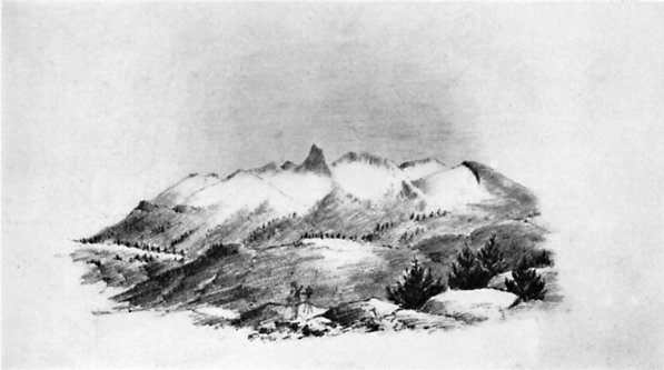
THE OBELISK GROUP (MERCED PEAKS) FROM PORCUPINE FLAT
From a sketch by J. D. Whitney
| Online Library: | Title | Author | California | Geology | History | Indians | Muir | Mountaineering | Nature | Management |
Yosemite > Library > Up & Down Calif. > 1863 Chapter 2 >
| Next: Chapter 3 • Contents • Previous: Chapter 1 |
Excitement at Clayton—Hill’s and Firebaugh’s—Desperadoes—Fresno City—Kings River—Visalia—Desolation and Misery—Crossing Kern River—Storm on the Plains—Cañada de las Uvas—Fort Tejon—San Emidio Ranch—Indian Reservation—Liebre Ranch—Yucca Plants—Tehachapi Pass—Walker’s Basin—Keysville—Walker’s Pass—Indian Wells—Desert Discomforts—Greenhorn Mountain—Tule River—Millerton—Hornitos.
On the San Joaquin Plain.
Easter Sunday, April 5, 1863.
I sent my last letter in such a hurry that I did not have time to finish the account of our trip in the Santa Cruz Mountains, and now so long a time has passed that I will let it go. Suffice it to say, that we had a trip of ten days with some exceedingly pleasant features, had lovely weather, examined a region we had long been anxious to visit, measured the height of a number of mountains, some of them over three thousand feet high, had some most lovely landscape views in the clear spring atmosphere, stopped among the lumbermen and “bachelor rancheros,” had dirty beds with fleas and bugs, and bad feed and fatigue, and finally got back to San Francisco safe and sun-burned. There we had some work to do, and then a rapid preparation for the long trip on which we are now started.
It is desirable to get our Survey in such a form that at the close of the year it can be wound up and the results be in good shape, if such action be considered advisable at that time. The great metallic wealth of this state lies in the Sierra Nevada, and as yet we have not satisfactorily determined the most important problems relating to the geology of that mountain chain. To that we propose to devote this summer’s labors.
This chain and the coast ranges unite, as you will see by the map, in the vicinity of Fort Tejon, some three or four hundred miles southeast of San Francisco. It is desirable to visit this region, which is supposed to throw some light on the structure of both chains. Owing to insufficient rains, the pasturage is very poor and we considered it impracticable, or at least very expensive, to get in there with our wagon and a larger party, so Gabb and I have undertaken to do the work on horseback, trusting to such accommodations as we can find or carry with us; and on this trip we have started. We have a few most indispensable articles, such as blankbooks, paper, extra shirt and socks, packed in our saddlebags; a few instruments, a blanket and oilcloth rolled up and carried behind our saddles—such is our outfit for a trip to extend over a thousand miles in the aggregate and to take us at least two months.
Wednesday, April 1, we left the city and went to Martinez. It was a beautiful evening—the hills about the bay were green and lovely. Thursday we went by stage to Clayton near Mount Diablo, where our mules were. The plain on the north was covered with young grass of the softest green; the majestic oaks scattered over the plain are just coming into leaf.
At Clayton we found all in excitement. Supposed copper mines and quicksilver mines had just been discovered—worthless—and great is the excitement. The town was filled, the one “hotel” crowded, speculators from all the adjacent country were on hand—one heard nothing but “stocks,” and “feet,” and “ledges,” and “claims.” We remained there that day, getting our mules shod, etc., and had the full benefit of the excitement. Among the crowd was one man on his way to the San Joaquin to buy a drove of hogs. He had been for ten years a hog drover for the butchers of San Francisco, and what mines were to other people hogs were to him. He talked “hog” all the time, and it was a relief to find one man not crazy about copper. While we were sitting in front of the hotel a Mexican came in with two small hogs packed on a horse—our drover was interested and admired the horse that would carry live hogs on its back. We left him the next morning, still talking about hogs, totally regardless of copper mines or quicksilver leads.
Friday, April 3, we were off in good season. I rode the horse and Gabb rode my mule, Kate. The horse was inclined to show his Californian nativity when first mounted, but he soon cooled down. It was cloudy. We passed over the low pass at Mount Diablo and struck down the canyon east. It began to rain. There were no houses to stop at, so we kept on and soon got beyond the rain. We struck out on the great San Joaquin plain, stopping at “Dutch Fred’s,” a shanty in a grove of oaks, dignified by the title of “Public House.” Saturday, April 4, we pushed on. It was clear, and at times the snowy Sierra showed dimly in the distance on the east, while Mount Diablo and its range towered grandly on the west.
But this plain is the great feature. The mountains are so dim in the east that they are not conspicuous, so that the plain seems as interminable as the ocean, except on the west. The ground is already dry, the grass very scanty and seldom over two or three inches high. As it grew hotter a mirage flitted around us—a great lake of clear water continually before us for hours. Once the appearance was so deceptive that we took the wrong road, supposing that it led around the water we thought was ahead of us. It took us out of the way, so that we did not strike the right road for some miles. You can have no idea of this extraordinary optical and atmospheric phenomenon. The eye is so deceived that the understanding refuses to dissent from the apparent truth.
Both of us were somewhat stiff after our two days’ riding, so a halt here over Sunday is very acceptable. It is Easter, but it does not seem so here—a quiet house on the river bank, far from the hills, on this monotonous plain.
Visalia.
Sunday, April 12.
Monday, April 6, we started on and rode thirty-one miles without any incident. We stopped that night at Hill’s Ferry, a dirty place, where a drunken “Secesh” made an uproar the whole night. A few vaqueros were managing a lot of wild Spanish cattle, to get them on board the ferryboat, and gave us some specimens of horsemanship and lassoing that were decidedly fine.
Tuesday we came on to Firebaugh’s Ferry—a long fifty miles, a weary ride, and we had nothing to eat the entire day. Nor was this all. In crossing a slough early in the morning, a mixture of very muddy water and very sticky mud, Kate and Gabb got mired. They got out safely, but both cut a sorry figure, wet and covered with sticky mud, the former from head to tail, the latter from head to foot. We pushed on, the sun came out and dried them, and the mud was brushed off.
Firebaugh’s was even a harder place than Hill’s. I ought to have mentioned that near our Sunday’s stopping place a murderer had just been arrested, and that at Hill’s four horses had just been stolen. When we got to Firebaugh’s we found more excitement. A band of desperadoes were just below—we had passed them in the morning, but luckily did not see them. Only a few days before they had attempted to rob some men, and in the scrimmage one man was shot dead and one of the desperadoes was so badly cut that he died on Monday. Another had just been caught. Some men took him into the bushes, some pistol shots were heard, they came back and said he had escaped. A newly made grave on the bank suggested another disposal of him, but all were content not to inquire further. This semi-desert plain and the inhospitable mountains on its west side are the grand retreats of the desperadoes of the state. It is needless to say that knife (newly ground) and six-shooter are carried “so as to be handy,” but I trust that I will ever be spared any actual use for them.
Wednesday we came on to Fresno City—only eighteen miles, but there was no other stopping place for forty miles, so we had to stop. The country had been growing more and more desolate. We had left the trees behind at Hill’s, except occasional willows along the sloughs, and this day, for sixteen miles we rode over a plain of absolute desolation. The vegetation that had grown up last year, the wet year, was dead, and this year none has started. Sometimes no living thing cheered the eye, nothing in sight alive for miles. We crossed the slough ten miles above Firebaugh’s, where there is a ferry, and a solitary shanty stands, the only house for the eighteen miles. We then struck across the plain in the direction of Fresno City, without track or guide, and at last that place loomed up.
Fresno “City” consists of one large house, very dilapidated, one small ditto, one barn, one small dilapidated and empty warehouse, and a corral.1 It is surrounded by swamps, now covered with rushes, the green of which was cheering to the eye after the desolation through which we had passed. These swamps extend southeast to Tulare Lake. We got into the place after much difficulty, but our animals had to content themselves with eating the coarse rushes that grew on the edges of the swamp. The cattle and horses that live on this look well.
Thursday we came on to Kings River,2 forty miles. Two men came with us, and in taking us across the swamp by a “better way,” the horses came through safely, but Kate got mired again and Gabb had to get off and wade it and lead her. A mule mires much easier than a horse, having so much smaller feet. This day’s ride was even more tedious and monotonous in its features. The land was wetter, so was green, but we were nearer the center of the plain, which is here not less than sixty miles wide! We rode upward of thirty miles without any tree or bush—except once a single small willow was visible for two hours, but we passed nearly two miles from it; it was a mere speck.
Hour after hour we plodded on. The road was good but a dead level—no hill or ridge ten feet high relieved the even surface—no house, no tree—one hour was but like the next—it was like the ocean, but it depressed the spirits more. The coast ranges were dim in the haze on the west; the snows of the Sierra Nevada eighty to a hundred miles distant on the east were hardly more distinct; while north and south the plain stretched to the horizon.
About six miles from Kings River we struck a belt of scattered oaks—fine trees—and what a relief! For, except a few cragged willows, shrubs rather than trees, in places along the sloughs, we had seen no trees for the last 130 miles of the trip! We crossed Kings River, a swift deep stream, by ferry, and stopped at a house on the bank, the most like a home of anything we had seen for two hundred miles. The owner was a Massachusetts Yankee, and his wife a very intelligent woman—I noticed an atlas of the heavens hanging up in the sitting room—but she was a Kentuckian and smoked cigarritos as industriously as we did pipes.
Friday, April 10, we came on here, twenty-five miles, crossing an open plain of nearly twenty miles. The morning was clear, and the view of the snowy Sierra most magnificent. Tomorrow we push on, and anticipate a rough time for the next four or six weeks.
Visalia is a little, growing place, most beautifully situated on the plain in an extensive grove of majestic oaks. These trees are the charm of the place. Ample streams from the mountains, led in ditches wherever wanted, furnish water for irrigating. We have stopped here two days to allow our animals to rest and get inspiration for our trip ahead. The Indian troubles east seem quelled, so we apprehend no trouble on that score. The ringleader was killed near here yesterday morning, and another detachment of soldiers has just left to further punish those in the mountains.
One sees many Indians here in various stages of civilization, but generally rather low. On Kings River we visited a camp of the Kings River tribe. They were hard looking customers. They lived in a long building, made of rushes carefully plaited together so as to shed the rain, making a long shed perhaps sixty or eighty feet long. The children were entirely naked; the adults all with more or less civilized clothing. All have very dark complexions, nearly as black as negroes.
Fort Tejon.
May 5.
Monday, April 13, we left Visalia and came on to Tule River, about thirty miles, still along the plain, here very barren, but the Sierra rose quite near us. We stopped at a little tavern and store, with miserable accommodations, but poor as it was, it was to be our last for near a hundred miles. I spent the evening in reading Les Miserables—a returned miner was reading Shakespeare. I question if the next generation here will care for Shakespeare, or any other author, growing up in ignorance, far from school, church, or other institution of civilization.3 The Tule River is a small river, easily forded, with wide stretches of barren sand on either side.
Tuesday we came on thirty miles and stopped at Coyote Springs, about six or seven miles from White River. The road this day was through a desolate waste—I should call it a desert—a house at Deer Creek and another at White River were the only habitations. The soil was barren and, this dry year, almost destitute of vegetation. A part of the way was through low barren hills, all rising to about the same height—in fact, a tableland washed down into hills. We stopped at a miserable hut, where there is a spring and a man keeps a few cattle. He was not at home, but his wife was, and she gave us something to eat, and we slept out upon the ground near our mules. The woman was a fat, ignorant thing, with four little girls who looked like half-savages; in fact, they were scarcely better than Indians.
Wednesday we came on thirty-five miles to Kern River, the most barren and desolate day’s ride since leaving Fresno, and for thirty miles we saw no house. We continued among the low barren hills until we came near Kern River—here we had to leave the road and go down the river nine or ten miles to find a ford. We followed a few wagon tracks, left the hills, and struck down the plain. The soil became worse—a sandy plain, without grass, in places very alkaline—a few desert or saline shrubs growing in spots, elsewhere the soil bare—no water, no feed. We saw some coyotes (wolves) and antelope. Night came on, and still we found neither grass nor river ford. Long after dark, when we began to get discouraged and to fear we would have to stop without water or feed for ourselves or animals, we heard some dogs bark. Soon we saw a light and soon afterward struck a cabin. Here we found some grass, went into the house, made some tea, and then slept on the river bank. Here in a cabin lived a man, wife, and several children, all ragged, dirty, ignorant—not one could read or write—and Secessionists, of course.
Kern River is a wide swift stream, here about twenty or twenty-five rods wide, with a treacherous sandy bottom. I dared not risk our animals in it without seeing what it was, so I hired the man to cross it first with his horse. We crossed safely, but it was up to the horses’ sides most of the way. That day, Thursday, we came on thirty miles to the mouth of this canyon. From Kern River we saw the mountains on all sides of us—the Sierra on the east, the Coast Range on the west, the two joining on the south—the high peaks, some of them capped with snow, rising like a vast amphitheater. The morning was cloudy and clouds hung over the highest peaks. In about six miles we crossed the last slough of Kern River, then struck south for the mountains, across a complete desert. In
|
THE OBELISK GROUP (MERCED PEAKS) FROM PORCUPINE FLAT From a sketch by J. D. Whitney |
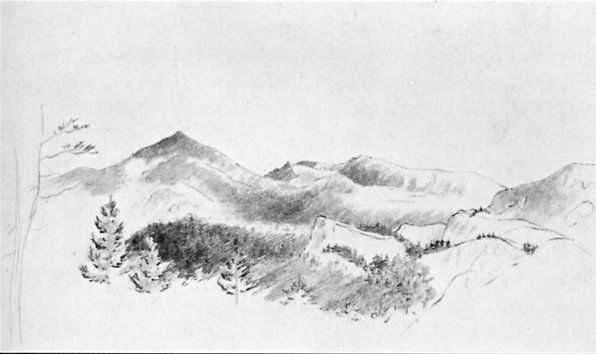
MOUNT DANA AND PEAKS AT HEAD OF TUOLUMNE RIVER From a sketch by J. D. Whitney |
The storm came up black behind us; it stretched like a wall across the valley from mountain to mountain; the clouds grew lower on the peaks. We hurried up our tired and jaded animals, who seemed almost worn out. The storm struck us; but instead of rain it was wind—fierce—and the air was filled with dust and alkali. It was fearful, like a sandstorm on the desert. Sometimes we could not see a hundred yards in any direction—all was shut out in clouds of dust. In the midst of this storm my tired horse fell flat with me and got away; luckily he was too tired to run, and I easily caught him again.
At last the rain set in and wet us thoroughly. It was night when we struck the mouth of the Cañada de las Uvas,4 and found a house. They would not keep us at first, no accommodations, but at last we prevailed and stopped. We got some supper, shivered in the cold, then went to bed. Our host, a young man, with Indian servants, generously gave us his room. There were but two rooms in the house. He, a Spaniard, and two squaws occupied the other room—with a pack of cards and a bottle of whiskey to heighten the pleasure of a social evening.
The last few miles the plain had risen rapidly, until the mouth of the canyon where we were had an elevation of over a thousand feet. The country had improved on this slope, with some grass, while on striking the mountains all was green. All changed, and what a relief! We had ridden on this plain about three hundred miles!
Friday, April 17, we got up, put on our wet clothes, got some breakfast, saddled our wet animals, and started. It still rained some. We came up the canyon four miles to this place, Fort Tejon. The canyon is wild and picturesque and rises rapidly. At about four miles from the entrance it widens into an open, wide valley, and here, surrounded by mountains, is the old Fort Tejon. A pretty grassy valley, at an altitude of about three thousand feet above the sea, covered with scattered oaks of venerable age and size and of great beauty, with mountains rising around to the height of perhaps seven thousand feet, the valley and hills green—picturesque, beautiful, quiet—such is the site of old Fort Tejon.
The buildings, some fifteen or twenty, are neatly arranged, all built of adobe, but many are already falling to ruin. The old stables are crumbling, the corrals are down. After Uncle Sam had located here and had built buildings costing at least $60,000 to $80,000, spending here in all over half a million, of course it turned out that it is on a Spanish grant, and is private property. Under the virtuous reign of Buchanan the proof was got, and the grant was confirmed to a political friend—now a rank Secessionist—a Mr. Bishop, who got the buildings all built to his hand. As there was no further use for the fort, it was vacated two or three years ago.
Here we remained three days. One day we climbed the mountains near and got a grand view of the surrounding region—the coast ranges, the Sierra, the great valley and plain on the north, the distant desert on the east. Sunday I spent quietly here, and remained over Monday.
Tuesday, April 21, we started on a trip in the mountains west. It rained a little. A party was prospecting for silver some twenty miles west; one of the party was here and piloted us to their camp by a wild trail through the mountains. The miners’ camp was at an elevation of perhaps six thousand feet, by a spring, under a grand old live-oak tree. This tree was a beauty, over twenty-eight feet in circumference in the smallest place, with wide spreading branches. High, rugged, and rocky peaks rose on all sides, with more or less snow. We had a hearty dinner of venison, and then sat by the bright and cheerful camp fire, reminding us of old times. The night was cold, and ice froze an inch thick, but we slept warmly.
April 22 was still cold. We rode down the canyon about five miles to see a “copper lead”—found it no copper at all worth noting. A fierce snowstorm set in, so we returned to camp and there spent the rest of the cheerless, comfortless day. The squalls came on every little while. The stormy day was followed by a cold night. April 23, the morning was very clear, the peaks about us intensely white in their new garb of snow. We then rode down the canyon ten miles to San Emidio Ranch, at Mr. Alexander’s.
April 24 we went up the canyon again to further examine the region. The higher mountains are of granite; outside are sandstones, lying in thick strata highly elevated, standing at a high angle. Some of these strata rise in steep, bare ridges, thrust up as it were 1,500 to 2,000 feet above the canyon, or 4,000 to 5,000 feet above the sea, forming grand but peculiar features in the landscape. The next day, April 25, our mule got away and we spent most of the forenoon in catching her, so we could not leave. We spent the rest of the day at the ranch house.
San Emidio Ranch is a large and valuable one, near the mouth of the canyon, commanding a lovely view of the plain, of Buena Vista Lake, and of the coast ranges. Two large springs water the gardens—fruits and grapes grow to perfection—yet nothing would tempt me to live in such isolation. We found three ladies there. Mr. Alexander was absent, but we had a letter from him to the ladies, and we had a hearty welcome, for visitors are scarce there. The ladies of the place were a sister and niece of Mr. Alexander and a visitor from a neighboring ranch (forty miles distant). The ladies had been there three years, had come out from New York for the romantic life on a Californian ranch, but were heartily tired of it now.
Mr. Alexander is a rich man—a single business transaction of his, three years ago, amounted to $90,000. He was now absent, but we met him on his return. He had just refused $15,000 for a thousand cattle—his cattle were numbered by thousands and his horses by hundreds. How did he live? In what style? His house was surrounded by the houses and huts of his Indian and Mexican servants and vaqueros. The residence was of adobe, the floor of rough stones, the furniture rude. The ladies had been eight months without seeing any other white woman. They were twenty-eight miles from their nearest neighbors and forty from their next nearest. They were a hundred and forty miles from their post office (Los Angeles), and the same distance from a doctor—in fact, from any of the refinements of civilization. No wonder that even with all the wealth of their relative they thought California decidedly a humbug.
Sunday, April 26, we bade goodbye to our friends and came on here, twenty-eight miles, a part of the way by the plain. The only incident of note was our killing a very large rattlesnake—his rattles were broken and part gone, but he had eight left. The next day was rainy, and I spent it in writing up my notes and a letter to Professor Whitney.
Tuesday, April 28, we started and rode to the Tejon Indian Reservation, about twenty miles, and stopped at the house of Mr. Boschulty, the Indian agent. The reservation is in a corner of the great valley, the extreme southeast corner. The land rises in a gradual slope to the hills, a regular inclined plane, to the height of some 1,800 or 1,900 feet. It is the prettiest spot I have seen in this part of the state, with plenty of water and ample means of irrigation. The grass is green, the water good. The next day we rode up into the Tejon Pass about fifteen miles, a wild pass, but little traveled now. We killed another big rattlesnake, with nine rattles left, the rest broken off. We saw a large wildcat. I ought to have told of the game we saw in the San Emidio. We saw many deer, ten in one group at one time; another time one came so near that we got a shot at it with our pistols.
To return to the reservation. An Indian woman died, and that night the Indians burned her hut, her clothing, and all her things in the fire—for her use in the next world. We stayed at the reservation until Friday and were most hospitably entertained. In the meantime the superintendent of Indian affairs came down with his secretary. His name is Wentworth, and he seems entirely unfitted for his responsible office.
We returned here on Friday; Saturday we visited a region ten miles northeast. We have now finished here, at least all that our time will allow, and tomorrow we shall leave. We are a hundred miles from Los Angeles, the post office where I will send this letter, if I can, to be mailed.
One more item about the Indian reservation. Lieutenant Beale had it placed there; last year he bought up a Spanish claim and now has it confirmed as a Spanish grant—a tract of twenty-two leagues or 87,750 acres, over 137 square miles!—that is the way to get land.
Murphy’s, Calaveras County.
June 7.
May 6 we left Fort Tejon and crossed through the mountains south, to the Liebre Ranch. The pass is a very picturesque one, 4,256 feet high, with peaks on each side rising several thousand feet higher. The valleys are green, the region beautiful, but all changes on crossing the chain. We passed down a valley, dry and alkaline. Two little salt lakes were dry—the salt and alkali produced by the evaporation covering the ground like a crust of ice. For several miles we followed a line of earthquake cracks which were formed in 1856. The ground had opened for several feet wide, no one knows how deep, and partially closed again. We hear that these cracks extend nearly one hundred miles. In the valley we passed down a woman was killed by her house falling in the earthquake.
The Liebre Ranch belongs to Lieutenant Beale.5 It is eleven leagues (about eighty square miles), and controls nearly all the water and, consequently, feed, for three times that amount, in fact for a hundred miles east. We had a letter from the owner to his Spanish major-domo (head man in charge), and we were hospitably entertained according to the Mexican fashion. We examined the region, crossed the valley into the mountains north, which command a wide view of the rough mountains south and the barren desolate deserts stretching east to the Colorado. This occupied us until May 9, when we bade adieu to Don Chico and followed down the edge of the mountains until near Lake Elizabeth, then struck across the desert north.
Now, I wish I could describe this desert so that you might really appreciate what it is—a great plain, rising gradually to the mountains on each side, sandy, but with clay enough in the sand to keep most of it firm, and covered with a scanty and scattered shrubby vegetation. It does not look so naked as much of the San Joaquin and Tulare plains that are not desert. The shrubs are of cragged growth, and belong to species which can stand the severest drought, for in some years there is scarcely any rain at all during the rainy season—a year may elapse and not an inch of rain fall.
The most noticeable shrub of the region is a species of yucca (yucca gloriosa); the Mexicans call it “palm,” the Americans call it “cactus.” It is neither.6 It comes up, a single stalk, four to six inches in diameter, bristling with stiff leaves of the size and shape of a sharp bayonet. These die below as the plant increases in height, only a tuft remaining at the end. Sometimes it thus stands a single column fifteen to twenty feet high, with a tuft of leaves on the end. More often, however, it branches, and one sometimes sees a tree with numerous such branches, each with its tuft of leaves at the end, the trunk bare and without bark, apparently as dead as a fence rail. The plant is truly magnificent when in flower, spikes of flowers terminating the branches, with an immense number of blossoms, each nearly as large as a lily.
Another species of yucca, much smaller, grows on the drier mountains and is now in flower. It has a tuft of bayonet-like leaves at the bottom, which live and grow many years, like the century plant. At last, a flower stalk eight or ten feet high springs up from the center in an incredibly short time—this bears a pyramid of several hundred delicate greenish-white flowers, each of the size and somewhat the shape of a tulip.7 Of far less interest on this desert is the creosote bush,8 every part of which stinks, making the whole air offensive. Sage bushes (artemisia) make up most of the vegetation, however.
This plain stretches off to the east, and many volcanic knobs rise from it, each perfectly bare of vegetation. At the base of one of these, fifteen miles from any other water, there is a nice spring of pure water. We found no feed, however, so pushed on. It became dark and we entered the mountains at Frémont’s Pass, east of the Tejon Pass. The wind came down fearfully through a gap. At a late hour we struck water and a little grass at Oak Creek, and there we camped and spent a most cheerless night. The wind was cold and it howled, and our poor animals fared nearly as badly as we, for there was scarcely any feed.
Sunday, May 10, very early, we got some breakfast at a house not far off in this miserable spot, and then pushed on about eighteen miles until we struck fine grass and good water and camped about noon. We crossed the ridge to Tehachapi (on your map Tah-ee-chay-pah) Pass. From the ridge we had a wide view out on the desert. The Tehachapi Valley is a pretty basin five or six miles long, entirely surrounded by high mountains, and lies over four thousand feet above the sea. It is covered with good pasturage, and several settlers have located there.
We camped under some magnificent oaks; the one over our heads was over six feet in diameter, with a most magnificent head. We had tea, sugar, two tin cups to make our tea in, crackers, and jerked beef. We made our dinner and supper on this. Strange as it seemed to us, there had been religious service in the valley that day. A Methodist South preacher was visiting a settler and held “meeting” that day in a house, and all of the half-dozen families of the valley turned out. The settlers are “Pike” (Missouri men), and it was delicious to see the women dip snuff.
Monday, May 11, we kept on in a general northerly direction over a terribly rough trail, over mountains and across canyons. From some of the heights we had magnificent views. We worked west nearly to the great valley, then struck east again and camped in a wild picturesque spot on Pass Creek. With my revolver I shot a hare, which made us a supper and breakfast.
May 12 we went up the canyon a few miles, then over a high ridge to Walker’s Basin. This is “The Park” on your map, and lies in the center of the chain about fifteen miles south of Kern River. The trail for the first twelve miles was horrible, a hill 1,000 or 1,500 feet high was so steep that we could scarcely lead our mules up it. The ridge is not sharp, but opens out into pretty little valleys with scattered trees and grass. The view of Walker’s Basin from this ridge is lovely in the extreme—a pretty basin of three or four square miles, perhaps more, green as emerald, surrounded on all sides by very high, rugged, granite mountains, whose gray, bleak, and barren sides are in striking contrast with the green basin below. The creek on which the basin is, flows out through an impassable canyon. We met in the basin a band of Indians, mostly women and children, the widows and orphans of the “braves” killed in the recent battles on Kern River. They were a hard looking set. On passing out of Walker’s Basin we fell in with a man on foot, and we camped together on a stream. Company is desirable in a hostile Indian country, where, sleeping out, the lonely traveler is liable to be “picked off” in the night.
May 13 our provisions were gone, and our supper the night before and breakfast that morning were even more meager than usual. We came on to Keysville that day. We had some grand scenery—on the east, high granite mountains, with enormous precipices of naked rock, while on the opposite sides were mountains nearly as high. On crossing the last high ridge, before sinking into the valley of Kern River, from the summit, a wide view burst upon us, all of rugged, barren, granite mountains, with but few scattered trees—a scene of wild desolation. At the forks of the Kern River is another little basin, like Tehachapi and Walker’s basins—all lying in the middle of the chain, all surrounded by high, granite mountains.
Near these forks is Keysville—you can scarcely see the name on the map. It is the largest place within ninety miles—much more on the west, south, and east—yet it contains but eight houses all told. But it was the largest place we had seen in a month’s travels. We got hay and barley for our hungry and jaded animals, and “square meals” for ourselves, so we stopped over a day. A store, with no floor but the ground, a saloon and “hotel” with ground floor and not a chair about the establishment, are the accommodations which we consider princely after our much harder fare. We have a bunk of boards to sleep on (using our own blankets). Our bedroom has no floor but that made by nature. Such were our accommodations—the best we had seen for some time, and the best we were destined to see for some time to come.
The spot is picturesque—the granite mountains are steep and high, and the Kern River runs through a wild, picturesque canyon. The place derives its importance from a few gold mines near, and from being on the road to the Slate Range, Coso, Owens River, and other mining districts. It was a peculiarly lively time there. Indian troubles in the spring had expelled the miners from some regions. The Indians were now nearly quelled and the miners were returning; but revolvers, rifles, and carbines formed a conspicuous part of every equipage, and I saw no other party so small as ours trusting itself alone. I resolved to go through Walker’s Pass and return, as the great work of this year is to examine the geological characteristics of the Sierra Nevada, and it was thought best to cross the chain at as many points as is possible. We thought the Indians were quiet, and it was considered safe.
May 15 we started and rode up the pass twenty-five miles, following up the Kern River, which for this distance flows in a valley often a mile wide. The bottom is barren granite sand, however, and produces but little feed. A few houses along the way were deserted since the Indian troubles, but at twenty-five miles a man by the name of Roberts holds his place in spite of the Indians, and here we stopped. He has a field fenced with some feed, and we got supper and breakfast, sleeping out in the field near the house.
May 16 we came on to the Indian Wells, through the pass, twenty-eight miles. The valley narrows above Roberts’, but the slope is gradual, although we rise so high. It grows more and more barren, the granite mountains grow less and less timber as we work east. The summit is reached, 5,302 feet above the sea, where a strong breeze draws through, and, although so high, the air is as dry as in a severe drought at home—no wonder that a desert stretches so far on the east. This desert basin is very high, from three thousand to four thousand feet. As we look out on the plain, mountains rise from it in every direction, but they are but detached chains—one can travel all the way to the Colorado River on the plain, which is everywhere a terrible desert. One of the mountain chains, fifty miles distant, is the Slate Range, now creating much excitement because of silver mines discovered there.
This desert is but a continuation of the one described in my last letter. It has less yucca, but like that, is covered with scattered bushes, such as can stand a dryness you cannot appreciate East. Doctor Horn, of Camp Independence, in Owens Valley, a perfectly reliable man, was stationed in that valley last August. He has kept a rain gauge, and from that time to this, the rainy season, there has fallen in the aggregate less than a quarter of an inch of rain! None can fall now until next winter, and possibly not then, and yet these shrubs can live in such a climate, if they get a good wetting every two or three years. A view, comprising a field as large, or nearly as large, as the state of Connecticut, has not a single tree in sight. Such are the Californian deserts.
We descended gradually and curved around the hills for about fourteen miles from the summit to the Indian Wells, where we stopped. A more god-forsaken, cheerless place I have seldom seen—a spring of water—nothing else. Here was a cabin, where we got our suppers. There was not a particle of feed. A little grass (bunch grass) that can grow in a dry climate, occurs four miles distant—it is cut with a sickle, tied up in little bundles, and sold at ten cents per pound—and cracked corn at fifteen cents per pound. This we got for our horses. You can well imagine that the inhabitants of such a place are not the most refined, but they hold a claim four miles distant—“ranch,” they call it—where there is water and some feed, and keep horses that get used up on the desert.
On arriving at this miserable hole the first greeting was inquiries about Indians. Two men had reported seeing a band in the pass where we had come through. Several horses and mules had been discovered shot near there that day, and one man was missing. We had seen no Indians, although we had been well on the lookout.
We spent a most uncomfortable night there. The wind blew and filled the air with sand—sleeping on the ground, it seemed as if we would be stifled at times. I arose at half-past three, my teeth gritty with sand, face black, eyes full. The sand lay half an inch thick in places on my coat, which I had used on my saddle for a pillow. We saddled and came on twelve miles to a poor spring, keeping a brisk lookout for Indians. At the spring we got some breakfast, then pushed on—returned by the same route and reached Keysville on Monday night, May 18.
May 19 we left Keysville and came on over Greenhorn Mountain by the hardest wagon road I have ever seen that was much traveled. In places the road is so very steep that I cannot see how loads are got over it at all. We saw some government teams, where they had to double their six-mule teams to get an empty wagon up the hills. Most of the freight is packed over on mules.
The morning was cloudy, and it began to rain. The rain was mingled with snow, which almost froze us. It thawed as fast as it fell, wetting us thoroughly. We stopped at a place called Greenhorn—a place of two or three miners’ cabins and a store—having made the fourteen miles in four hours. We stopped there over the rest of that day.
Wednesday, May 20, the rain stopped and we rode from Greenhorn to Tailholt (a good sample of Californian names)9 over a very rough road, up and down, sometimes by wagon road and sometimes by trail.
On the west slope of the Sierra there is more timber—scattered oaks and pines—and some of the slopes are covered with chaparral. There is some more grass over the hills, and all tells of a moister climate. From some of the ridges we had wide and magnificent views of the foothills and the great valley on the west, but the coast ranges were shut out by the hazy air. Tailholt is on White River, among the hills, but we struck a very comfortable place to stop.
All these streams flow out into the valley through wild, impassable canyons, but in the mountains the valleys often spread out into little basins, some of which are of exceeding beauty; but being made of granite sand, none are very fertile. We passed two such, the Posé Flat and Little Posé Flat, both little basins, green on the bottom, with a clear stream of water, and fine old oak trees.
May 21 we came on to Tule River, out on the plain, and uninteresting—stopped there one day—then came on to Visalia and stopped over Sunday. At Tule River we were overtaken by some men with a band of horses and mules, which they were bringing from Indian Wells, where we had been. Several had been killed by the Indians, others wounded, and for safety they were bringing them to the Tulare Valley.
Our funds were getting low—no remittance—and we started for San Francisco, intending to inquire for letters at Millerton and Hornitos. We found that we must live economically to get back.
Monday, May 25, we came on thirty miles—all the way on the plain, so nothing of interest. The next day, thirty miles more to Millerton, which is on the San Joaquin near where the old Fort Miller was.10 We struck into the hills just before reaching the place. There is some mining done there. The hotel where we stopped showed a truly Californian mixture of races—the landlord a Scotchman, Chinese cooks, Negro waiter, and a Digger Indian as stable boy. The San Joaquin is here a swift, clear stream, scarcely contaminated by the miners’ washings. The country about Millerton is picturesque. Back of the town a high table mountain of lava is conspicuous for a great distance.
Two days more, all the way through the low foothills, brought us to Hornitos, near Mariposa. Here we found a letter from Professor Whitney instructing Gabb to go to San Francisco and me to go on to Columbia and meet him. Gabb left that night. So we can be said to have terminated that trip. Our poor animals were jaded, for we had ridden them over a thousand miles in less than two months—in fact, I rode 1,100 in the two months. I stopped a day at Hornitos to examine some copper mines there, all of which proved to be very poor; but the people are excited there on the matter of copper, and much money is lost and won in copper speculations.
NOTES
1. Fresno City was at a considerable distance from the site of the present city of Fresno, which was founded ten years after the date of this journey.
2. The members of the Whitney Survey, and many others at that time and since, fell into the error of writing the name of this river in the possessive singular—“King’s.” If the possessive indication is used, it should be in the plural, but the practice recommended by the United States Geographic Board is to omit it altogether. The river derives its name from the Spanish Rio de los Santos Reyes, “River of the Holy Kings,” a designation given in 1805 or 1806 (Francis P. Farquhar, “Spanish Discovery of the Sierra Nevada,” in Sierra Club Bulletin, XIII, No. 1 [February, 1928], 58).
3. Yet this region today has some of the finest schools in the state.
4. “Canyon of the Grapes,” the present Tejon Pass.
5. Edward Fitzgerald Beale (1822-93), co-hero with Kit Carson at the Battle of San Pasqual, bearer of first California gold to reach the East, superintendent of Indian affairs for California, importer of camels to the West, surveyor-general of California and Nevada, minister to Austria, etc.
6. It is the tree yucca or Joshua tree. Jepson cites it as Yucca brevifolia Engelmann; Sudworth, as Yucca arborescens (Torr.) Trelease.
7. A form of the Spanish bayonet (Yucca whipplei Torrey).
9. “There are a number of stories about the naming of the second village on White River. I believe that the following account is correct. When the stage road was built across the mountains it left Dogtown to the south and passed near a mining claim. The miner who owned the mining claim had built a small cabin. On the door of his cabin he had nailed a cow’s tail for use as a handle to pull the door open and closed. Because of this he called his mine Tailholt. Then the stage station, and later the village which grew up around it was called Tailholt.—The name Tailholt was used as a nickname for White River many years after the post office was established.” (San Joaquin Primeval—Uncle Jeff’s Story, arranged by F. F. Latta, printed at the press of the Tulare Times, Tulare, California [1929], pp. 55-56.)
10. Fort Miller was established during the local Indian troubles in 1851, but was soon abandoned. Millerton was for a time the county seat of Fresno County, but in 1874 the seat was moved to the new settlement at Fresno and Millerton became deserted.
| Next: Chapter 3 • Contents • Previous: Chapter 1 |
| Online Library: | Title | Author | California | Geology | History | Indians | Muir | Mountaineering | Nature | Management |
http://www.yosemite.ca.us/library/up_and_down_california/4-2.html