Yosemite > Library >
Place Names of the High Sierra >
S >
Next: T
•
Contents
•
Previous: R
Place Names of the High Sierra (1926)
by Francis P. Farquhar
[
A,
B,
C,
D,
E,
F,
G,
H,
I,
J,
K,
L,
M,
N,
O,
P,
Q,
R,
S,
T,
U,
V,
W,
Y, &
Z.
]
S
| SABRINA, LAKE | [Mount Goddard] |
Named for Mrs. Sabrina Hobbs, whose husband, C. M. Hobbs, was the first
general manager of the Nevada California Power Company, which constructed
a reservoir at this lake in 1907-1908. The name is erroneously spelled Sebrina
on some maps. (W. L. Huber.)
| SADLER PEAK (10,562), LAKE | [Mount Lyell] |
Named by Lieutenant McClure in 1895 for a corporal in his detachment.
Erroneously spelled Sadlier on McClure’s map of 1896 and in S.C.B., 1896,
I:8, p. 334. (N. F. McClure.)
Probably named by Gabriel Moraga’s expedition of 1805. (Chapman:
History of California, 1921, p. 420; Sanchez:
Spanish and Indian Place Names of California,
1922, p. 280.)
| SARDINE LAKE | [Mount Lyell] |
“It bears the inscrutable designation of Sardine Lake. I hailed Bodie with an
inquiry as to the reason for the name, and received his illuminating reply in
one word, ‘Canned.’ I learned later that years ago an ill-fated mule bearing a
cargo of the delicacy consigned to a merchant in some mining-camp of the
Walker River region had fallen off the trail, and after a series of spectacular
revolutions had vanished in the icy waters.” (Chase:
Yosemite Trails,
1911,
p. 299.)
| SATCHER LAKE | [Mount Lyell] |
“Red” Satcher, a stockman. W. A. Chalfant says this is the correct spelling.
| SAURIAN CREST (11,065) | [Dardanelles] |
Named by William E. Colby in 1911, on account of resemblance to an ancient
monster. (W. E. Colby.—S.C.B., 1912, VIII:3, plate LVI.)
| SAWMILL CREEK, PASS | [Mount Whitney] |
James W. Smith had a sawmill on this creek in the ’70s. The pass was crossed
in 1878 by Frank M. Lewis, who had examined it from the west in 1875.
(Chester Versteeg.)
| SAWTOOTH PEAK (12,340) | [Kaweah] |
Climbed by Joseph Walter Lovelace, 1871, while deer-hunting; probably the
first ascent. Climbed by Mr. and Mrs. Harry Trauger, 1873. Known in early
days as Miners Peak. (Chester Versteeg.)
| SCAFFOLD MEADOW | [Tehipite] |
A scaffold was built here by sheepmen on which to place supplies to keep
them safe from bears and other animals.
| SCHOFIELD PEAK (9913) | [Dardanelles] |
Named by Major William W. Forsyth, acting superintendent of Yosemite National
Park, 1909-1912, for Lieutenant-General John McAllister Schofield;
Secretary of War, 1868-1869; Commander-in-chief of the U. S. Army, 1888-1895.
(H. C. Benson.)
Name used by local cattlemen for meadow (altitude about 10,000 feet) on
plateau west of Deadman Cañon. (Jim Barton.)
“. . . This gorge lay directly south of us, and in an hour we had descended to
its head, which we found was guarded by a nearby frozen lake, whose sheer
ice-smoothed walls arose on either side, up and up, seemingly into the very sky,
their crowns two sharp black peaks of most majestic form. A Scylla and a
Charybdis they seemed to us, as we stood at the margin of the lake and
wondered how we might pass the dangerous portal.” (Solomons:
Mount Goddard and Its Vicinity, in Appalachia, 1896, p. 55.)
“‘On the other part are two rocks, whereof the one reaches with sharp peak
to the wide heaven, and a dark cloud encompasses it; this never streams away,
and there is no clear air about the peak neither in summer nor in harvest-tide.
No mortal man may scale it or set foot thereon, not though he had twenty
hands and feet. For the rock is smooth, and sheer, as it were polished. . . .
And therein dwelleth Scylla, yelping terribly.’”
(The Odyssey of Homer, Done into English Prose,
by S. H. Butcher and A. Lang, 1883, book XII, p. 194.)
Dextrurn Scylla latus, laevurn implacata Charybdis
obsidet, atque imo barathri ter gurgite vastos
sorbet in abrupturn fluctus, rursusque sub auras
erigit alternos et sidera verberat unda.
At Scyllam caecis cohibet spelunca latebris,
ora exsertantem et naves in saxa trahentem.
(P. Vergili Maronis Aeneis, III:420-425.)
Named by R. B. Marshall, U.S.G.S., for Clyde L. Seavey; member of the State
Board of Control, 1911-1915, 1917-1921; State Civil Service Commission,
1921-1923; State Railroad Commission (President), since 1923. (R. B. Marshall.)
| SELDEN PASS | [Mount Goddard] |
Named by R. B. Marshall, U.S.G.S., for Selden Stuart Hooper, of San Francisco,
who was with the U.S.G.S. from 1891 to 1898. Erroneously spelled
Seldon on maps. (R. B. Marshall.)
| SENGER, MOUNT (12,253) | [Mount Goddard] |
Named in 1894 by T. S. Solomons for Joachim Henry Senger, professor of
German, University of California, one of the founders of the Sierra Club.
(T. S. Solomons; see S.C.B., 1917, X:2, pp. 136-139.) Born in Germany,
1848; A.B., University of California, 1882, Ph.D., 1888; died, April, 1926.
| SENTINEL DOME, ROCK | [Yosemite] |
“From its fancied likeness to a gigantic watch-tower, is called ‘Sentinel Rock’.”
(Whitney Survey: Geology, 1865, p. 412.) “The present ‘Sentinel’ they [the
mission Indian guides] called ‘Loya,’ a corruption of Olla (Oya), Spanish for
an earthen water-pot. The mountain tribes use, instead, a long-pointed basket,
shaped somewhat like that rock, which the basket is supposed to resemble.”
(Bunnell:
Discovery of the Yosemite,
1880, p. 212. See, also, p. 66.) “The
peak called by us the ‘South Dome’ has since been given the name of ‘Sentinel Dome’.” (Bunnell:
Discovery of the Yosemite,
1880, p. 212.)
| SEQUOIA NATIONAL PARK |
| SEQUOIA NATIONAL FOREST |
Park established by act of Congress, September 25, 1890, and enlarged by act
of October 1, 1890. Named by Secretary of the Interior John W. Noble upon
suggestion of George W. Stewart. The primary purpose of the park was to
preserve the Giant Forest and other groves of big trees, Sequoia gigantea.
(Bakersfield Morning Echo, June 18, 1902.)
“The park was not given a name by the act, and the Secretary finding it
necessary in establishing the required rules and regulations for its government
to give a name to the reservation, called it the Sequoia National Park. The
reason for this naming the park is more weighty than that it is the name of
the trees, for the trees themselves were called Sequoia by Endlicher in honor
of a most distinguished Indian of the half breed, the inventor of the Cherokee
alphabet.
“Sequoyah, meaning ‘he guessed it,’ was the English method of spelling the
Indian’s name, and in transferring it to the tree the eminent botanist gave it
a Latin terminal with substantially the same pronunciation as in English.
By designating the park according to the tree the delicate and appropriate
honor conferred by the scientist in naming the greatest of America’s trees after
the most intellectual of the aborigines who dwelt amid our forests, receives a
national sanction, and as the towering shaft reared by nature remains a living
monument to the fame of the ‘Cadmus of America,’ it is maintained and protected
by our nation’s respect and liberality.”
(Annual Report of the Secretary of the Interior, for 1890, pp. 123-124.)
Forest established by executive order of President Roosevelt, July 2, 1908,
from territory formerly part of the Sierra National Forest. By proclamation
of President Taft, July 1, 1910, Kern National Forest was established from
the southern portion of Sequoia National Forest, and a portion of Sierra National
Forest was transferred to Sequoia National Forest. (Official proclamations.)
Name sequoia given to coast redwood (Sequoia sempervirens) by Stephen
Endlicher in 1847, presumably as Latin form of Sequoya, or Sikwayi, the native
name of George Gist (Guest, or Guess), a Cherokee half-breed, although
Endlicher did not state the source of the name. Sequoya invented an alphabet
and writing for Cherokee language; born in Tennessee about 1760, died in
Tamaulipas, Mexico, 1843. Name sequoia first applied to big tree by
J. Decaisne in 1854. (Jepson: Silva of California, 1910, pp. 127-128, 139;
Hodge: Handbook of American Indians, 1912, part 2, pp. 510-511; Ellsworth:
The Giant Sequoia, 1924, pp. 127-156.)
| SEVEN GABLES (13,066) | [Mount Goddard] |
“The south wall of the gap we found to be the side of a peak, the eccentric
shape of which is suggested in the name Seven Gables, which we hastened to
fasten upon it. . . . We [Theodore S. Solomons and Leigh Bierce] climbed
the Seven Gables on the afternoon of our arrival at the head of the valley—
September 20th [1894].” (S.C.B., 1895, I:6, p. 230. See, also, S.C.B., 1921,
XI:2, pp. 205-206.)
| SHARKTOOTH PEAK (11,630) | [Kaiser] |
Named by Theodore S. Solomons in 1892. (T. S. Solomons.)
| SHAVER LAKE, POSTOFFICE | [Kaiser] |
C. B. Shaver, Michigan lumberman, of the Fresno Flume and Irrigation Company,
which built a sawmill and reservoir in the early ’90s in what was
originally known as Stevenson Basin and Meadows. The property is now
owned by the Southern California Edison Company, which will use the enlarged
reservoir for its water-power system. (L. A. Winchell.)
| SHEPHERD CREEK, PASS | [Mount Whitney] |
The Shepherd family were pioneer residents on the land watered by the creek.
James Shepherd and John Shepherd are mentioned in Chalfant’s Story of Inyo,
1922, p. 301. The pass was named from the creek. (W. A. Chalfant.)
| SHINN, MOUNT | [Mount Goddard] |
Name proposed, 1925, by members of U. S. Forest Service in memory of
Charles Howard Shinn (1852-1924); native of Texas, moved to California,
1858; attended University of California and Johns Hopkins; school-teacher,
newspaper and magazine writer, expert in forestry; head forest ranger, Department
of the Interior, in Sierra National Forest, 1902; forest supervisor,
1904; district forest examiner, 1911-1923; a charter member of the Sierra
Club. (S.C.B., 1925, XII:2, pp. 163-164, portrait.)
| SHUTEYE PEAK (8358), PASS | [Kaiser] |
Old Shuteye, who was blind in one eye, had a rancheria at the western foot of
the high ridge, across which lay one of the principal trails to the eastern side
of the Sierra. (L. A. Winchell.)
| SIBERIAN OUTPOST, PASS | [Olancha] |
Name Siberian Outpost given in 1895 by Harvey Corbett, suggested by its
bleak appearance. The pass was named later. (J. N. Le Conte.) The pass
was called Rampart Pass by Wallace, Wales, and Wright, 1881.
(Mount Whitney Club Journal, 1902, I:1, p. 2.)
Established by proclamation of President Harrison, February 14, 1893, as
Sierra Forest Reserve, under authority of act of Congress of March 3, 1891.
(S.C.B., 1896, I:7, pp. 257-259.—See, also, Robert Underwood Johnson:
Remembered Yesterdays, 1923, pp. 293-296; Badè:
Life and Letters of John Muir,
II, 1924, pp. 257-258, 395-396;
Muir: The American Forests,
in
Atlantic Monthly, August, 1897, reprinted in
Our National Parks,
1901, pp.
331-365.)
Under subsequent acts (June 4, 1897, and February 7, 1905) the boundaries
were enlarged by proclamation of President Roosevelt, July 25, 1905. Further
additions made under name of Sierra National Forest by proclamation of
President Roosevelt, April 20, 1909. Division by proclamation of President
Roosevelt, July 2, 1908, by which the Sequoia, Inyo, Mono, and Stanislaus
national forests were established, each receiving parts of Sierra National
Forest, remaining portion continuing as Sierra National Forest. Proclamation
of President Taft, July 1, 1910, transferred additional lands in watershed of
South Fork of Kings River to Sequoia National Forest. (Official proclamations.)
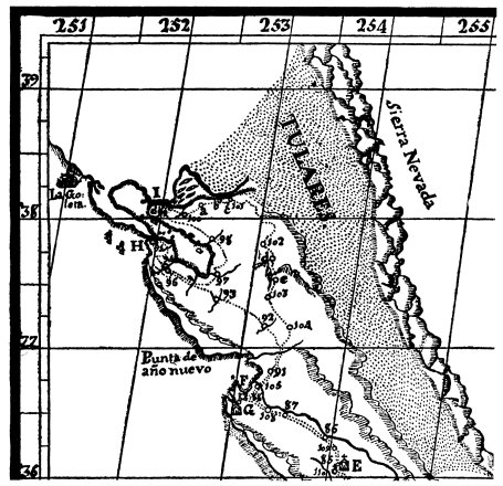
1776 Pedro Font map was the first map that showed “Sierra Nevada.”
(John Carter Brown Library; map not in Farquhar book)
|
Spanish for “snowy range of mountains,” literally “snowy saw-teeth”; used by
Spanish explorers as freely as the corresponding “White Mountains” by English.
In 1542 Juan Rodriguez Cabrillo applied the name to mountains south
of San Francisco (Santa Cruz Mountains); on map by Ortelius, 1564, name
appears near Cape Mendocino; later maps show it farther inland. (Henry R.
Wagner.)
In April and May, 1776, Francisco Garcés visited Tulare Valley and used
name Sierra San Marcos for southern portion of the present Sierra Nevada,
and on Pedro Font’s map of 1777 the whole range is for the first time clearly
shown under designation of Sierra Nevada. (Elliott Coues:
On the Trail of a Spanish Pioneer, 1900,
I, pp. 265-305, especially, note 31 on pp. 291-292.)
“Looking eastward [from a hill near the junction of the Sacramento and
San Joaquin rivers, April, 1776], we saw on the other side of the plain and
about thirty leagues distant a great snow-covered range [una gran sierra
nevada], white from crest to foot. It lies about southeast and northwest, and
from the direction I made out for it, I judged that it possibly might have some
connection to the southward with the Sierra Nevada, which branches off from
the Sierra Madre de California above the Puerto de San Carlos and runs
northwestward as far as the mission of San Gabriel and beyond. However,
we could not discern either end of the range.”
(The Anza Expedition of 1775-1776: Diary of Pedro Font,
edited by Frederick J. Teggart, in
Publications of the Academy of Pacific Coast History,
III:1, 1913, pp. 88-91.)
Earliest known crossing by white men was in May, 1827, when Jedediah
Strong Smith and two companions crossed from west to east on their way
from the valley of California to Great Salt Lake. (H. C. Dale:
The Ashley-Smith Explorations,
1918, pp. 191-194.—C. Hart Merriam:
First Crossing of the Sierra Nevada,
in S.C.B., 1923, XI:4, pp. 375-379.—
C. Hart Merriam, in
California Historical Society Quarterly, October, 1923, II:3, pp. 233-236, and
April, 1924, III:1, pp. 25-29.—
F. N. Fletcher:
Eastbound Route of Jedediah S. Smith, 1827, in
California Historical Society Quarterly, January, 1924, II:4,
pp. 344-349.—
F. P. Farquhar:
Exploration of the Sierra Nevada, in
California Historical Society Quarterly, March, 1925, IV:1 p. 5.)
“Then it seemed to me the Sierra should be called not the Nevada, or Snowy
Range, but the Range of Light. And after ten years spent in the heart of it,
rejoicing and wondering, bathing in its glorious floods of, light, seeing the
sunbursts of morning among the icy peaks, the noonday radiance on the trees
and rocks and snow, the flush of the alpenglow, and a thousand dashing waterfalls
with their marvelous abundance of irised spray, it still seems to me above
all others the Range of Light, the most divinely beautiful of all the mountain-chains
I have ever seen.” (Muir:
The Mountains of California,;
1894, p. 3.)
“On that lowly crag one may stand without change of position and behold
those five wondrous waterfalls [Upper and Lower Yosemite, Vernal, Nevada,
Illilouette]. . . . That this point might no longer remain incognito, but be
known to all lovers of Yosemite, on June 14, 1897, accompanied by Walter E.
Magee and Warren Cheney, of Berkeley, by right of discovery shared by
W. E. Dennison [guardian of Yosemite Valley], I deposited thereon Register
Box of the Sierra Club, No. 15, and took the liberty of naming it Sierra Point,
in honor of the Sierra Club, and raised a flag bearing the name.” (Charles A.
Bailey, in S.C.B., 1898, II:4, p. 217.—See, also,
The Vantage Point of Yosemite,
by Charles A. Bailey, in Sunset, April, 1899.)
| SILL, MOUNT (14,100, approximately) | [Mount Goddard] |
Edward Rowland Sill (1841-1887), poet, and professor of literature at University
of California from 1874 to 1882. Named by Joseph N. Le Conte in
1896. (S.C.B., 1904, V:1, p. 3.)
First ascent by Joseph N. Le Conte, James K. Moffitt, James S. Hutchinson,
Robert D. Pike, July 24, 1903. (S.C.B., 1904, V:1, pp. 13-14.)
| SILLIMAN, MOUNT (11,188) | [Tehipite] |
Named by Brewer’s party of the Whitney Survey, June, 1864, for Benjamin
Silliman (1779-1864); B.A., M.A., Yale, 1796; M.D., Bowdoin, 1818; LL.D.,
Middlebury, 1826; professor of chemistry at Yale, 1802-1853; emeritus, 1853-1864;
or for his son, Benjamin Silliman, Jr., (1816-1885); B.A., Yale, 1837;
M.D., South Carolina Medical College, 1849; LL.D., Jefferson Medical
College, Pa., 1884; professor of chemistry at Yale, 1846-1885; one of the
founders of the Sheffield Scientific School, Yale University.
First ascent undoubtedly by members of the Survey, among whom were
William H. Brewer, Clarence King, James T. Gardiner, and Charles F. Hoffmann.
(Whitney Survey: Geology, 1865, pp. 376-377.) Climbed by S. L. N.
Ellis in 1876. (Mount Whitney Club Journal, 1902, no. 1, pp. 31-35.)
| SILVER PASS, CREEK | [Mount Goddard] |
| SILVER PEAK (11,883) | [Kaiser] |
Theodore S. Solomons named Silver Creek in 1802 on account of its silvery
appearance. He named the peak from the stream; the pass was named subsequently.
(T. S. Solomons.)
| SILVER SPRAY FALLS | [Tehipite] |
“The falls descend in three sections. The water of the [last] is separated into
misty spray before reaching the bottom, and adds much to its beauty; hence
its name, ‘silver Spray’.” (Elliott:
Guide to the Grand and Sublime Scenery of the Sierra Nevada,
1883, p. 15.)
| SIMMONS PEAK (12,504) | [Mount Lyell] |
Named by R. B. Marshall, U.S.G.S., in 1909 for Dr. Samuel E. Simmons of
Sacramento. (R. B. Marshall.)
Members of the Simpson family ran sheep here in the ’80s. Prior to that time
it was called Dougherty Meadow, for Bill and Bob Dougherty, who pastured
horses there. (Chester Versteeg.)
Application for patent to 120 acres in this vicinity was made by S. M.
Simpson, 1898, and patent issued to him April 24, 1900, by State Land Office,
under act of State Legislature of March 24, 1893, contingent, however, upon
proof of condition of land under “Swamp and Overflow” Act of Congress of
September 28, 1850. (Letter from Commissioner of the U. S. General land
Office, April 23, 1921.)
| SING PEAK (10,544) | [Mount Lyell] |
Tie Sing, Chinese cook for the United States Geological Survey from 1888 to
1918; born in Virginia City, Nevada, but unable to prove birthplace on account
of destruction of records by fire, and thus denied the rights of citizenship;
he was nevertheless regarded by those who knew him as a fine American;
killed by an accident while in the field with the Survey in 1918. The peak was
named by R. B. Marshall, U.S.G.S., in 1899. (R. B. Marshall.)
| SMEDBERG LAKE | [Bridgeport] |
Named by Lieutenant Benson in 1895 for Williatn Renwick Smedberg, Jr.,
second lieutenant, 4th Cavalry, U.S.A., then on duty in Yosemite National
Park. (H. C. Benson.)
Born in California, 1871; graduated U. S. Military Academy, second lieutenant,
1893; first lieutenant, 1899; captain, 1901; major, 1916; lieutenant-colonel,
194; colonel, 1920; brigadier general (temporary), 1918.
| SMITH PEAK (7835), MEADOW | [Yosemite] |
“Hetch-Hetchy is claimed by a sheep-owner, named Smith, who drives stock
into it every summer, by a trail which was built by Joseph Screech. It is often
called Smith’s Valley.” (Muir:
Hetch Hetchy Valley, in Overland Monthly,
July, 1873, pp. 49-50.)
| SOTCHER LAKE
(See Satcher Lake)
| [Mount Lyell] |
| SOUTH AMERICA, LAKE | [Mount Whitney] |
Named in 1896 by Bolton Coit Brown on account of the resemblance in outline
to the map of the continent. (See map in S.C.B., 1897, II:1, opposite p. 22.)
| SOUTH GUARD (approximately 13,000) | [Mount Whitney] |
It is not clear from the Davis map of 1896 (see
North Guard),
or from subsequent
maps, just what point was intended to be called South Guard. Viewed
from the west, the peak designated 13,232 feet on the U.S.G.S. map appears to
balance North Guard; from the northeast, the point on the spur designated
12,964 feet appears to balance it; it has also been considered to be a point on
the Great Western Divide just above the 13,000-foot contour line. Walter L.
Huber, James Rennie, Florence C. Burrell, and Inezetta Holt made first ascent
of peak 12,964, July 26, 1916, (S.C.B., 1917, X:2, p. 230); Norman Clyde
climbed peak 13,232, July 17, 1925, and on the same day climbed the third
peak mentioned above.
| SOUTH PALISADE
(See Split Mountain) |
| SPENCER, MOUNT (12,428) | [Mount Goddard] |
Named by Theodore S. Solomons in 1895 as one of the Evolution Group.
(T. S. Solomons.)
Herbert Spencer, author of Principles of Philosophy, 1860-1896; born in
Derby, England, 1820; died in 1903.
| SPILLER, CREEK, LAKE | [Bridgeport] |
J. Calvert Spiller, topographical assistant with Lieutenant M. M. Macomb
on the Wheeler Survey expeditions in Yosemite region, 1878-1879. (S.C.B.,
1918, X:3, plate opposite p. 369;
Annual Report of the Chief of Engineers, War Department, for 1879,
Appendix OO, pp. 2110-2144, 2233-2238.)
| SPLIT MOUNTAIN (14,051) | [Bishop] |
“To the north of this gap the crest rises into a huge mountain with a double
summit . . . which I called Split Mountain.” (Bolton Coit Brown, in S.C.B.,
1896, I:8, p. 309.) Called Southeast Palisade by Wheeler Survey, also known
as South Palisade, but not properly part of the Palisade range. (J. N. Le
Conte.)
First ascent by Mrs. Helen M. Le Conte, Joseph N. Le Conte, Curtis M.
Lindley, July 23, 1902. (S.C.B., 1903, IV:4, p. 262.—See, also, S.C.B., 1922,
X:3, p. 314.)
| STANFORD, MOUNT (13,983) | [Mount Whitney] |
“Professor Bolton Coit Brown first climbed this fine peak [August, 1896],
giving it the name of Mount Stanford. As the latter name has been applied to
a peak near the Placer County summit, it may be held to be ineligible in this
case. In such event, Professor Brown suggests the substitution of the name
‘Stanford University Peak,’ the similar peak to the northeast in the main Divide
being the ‘University of California Peak.’ The Stanford Peak has two crests.
The northernmost, a little the higher and accessible with great difficulty, is the
one to which the name Stanford was especially applied by Professor Brown.
The other was named by him ‘Gregory’s Monument,’ from Mr. Warren Gregory,
who first climbed it. This magnificent viewpoint is easily reached from
Harrison’s Pass.” (David Starr Jordan, in S.C.B., 1900, III:1, p. 109.—See,
also: S.C.B., 1897, II:2, pp. 92-94; S.C.B., 1899, II:5, p. 275; Vernon L.
Kellogg, in Sunset Magazine, November, 1899, p. 17.)
| STANFORD, MOUNT (12,826) | [Mount Goddard] |
Named by R. B. Marshall, U.S.G.S., for Leland Stanford (1824-1893), one of
the organizers of the Central Pacific Railroad. (R. B. Marshall.) Not to be
confused with the peak on the Kings-Kern divide previously named for Stanford
University.
| STARR KING, MOUNT (9179) | [Yosemite] |
Thomas Starr King; born in New York City, 1824; pastor of Hollis Street
Unitarian Church, Boston, 1848, at age of 24; became famous preacher and
lecturer; wrote The White Hills, classic description of White Mountains of
New Hampshire, 1859; came to San Francisco Unitarian Church, 1860; visited
Yosemite, big trees, and Lake Tahoe in 1860; orator for the Union cause in
California, 1861-1864; died in San Francisco, 1864. (Charles W. Wendte:
Thomas Starr King: Patriot and Preacher, 1921.)
“In the angle formed by the Merced and the South Fork Cañon, and about
two miles south-southeast of Mount Broderick [Liberty Cap], is the high
point, called the ‘South Dome,’ and also, of later years, ‘Mount Starr King.’
This is the most symmetrical and beautiful of all the dome-shaped masses
around the Yosemite; but it is not visible from the valley itself. It exhibits
the concentric structure of the granite on a grand scale; although its surface
is generally smooth and unbroken. Its summit is absolutely inaccessible.”
(Whitney Survey: Geology, 1865, pp. 419-420.—See, also, Grace Greenwood—
New Life in New Lands, 1873, pp. 340-341.)
“Did time and opportunity permit, we might climb to its shoulder, and
thence obtain that magnificent view; but could not go beyond this without
jeopardizing life and limb. Less than a dozen persons have been able to
ascend it. The first to do so was Mr. George B. Bayley and Mr. E. S. Schuyler;
followed by George Anderson and the writer [J. M. Hutchings], a few days
afterwards, who having attached ropes over difficult places, enabled Mrs. A. L.
Hutchings and our daughter Florence to ascend it, who were the first and only
ladies, at this writing, that have accomplished the difficult task.” (J. M.
Hutchings:
In the Heart of the Sierras,
1886, p. 473.)
| STATE PEAK (12,609) | [Tehipite] |
Named by R. B. Marshall, U.S.G.S. (R. B. Marshall.)
| STRIPED MOUNTAIN (13,160) | [Mount Whitney] |
“That nearest the pass is strikingly barred across its steep craggy summit with
light streaks. As this is an unusually marked case of this peculiarity and as
it seems well occasionally to have a mountain whose name bears some relation
to its visible character, I called it Striped Mountain.” (Bolton Coit Brown, in
S.C.B., 1896, I:8, p. 309.)
Climbed by George R. Davis, July, 1905; perhaps the first ascent, although
it is easily reached from Taboose Pass. (Letter from Davis to W. L. Huber,
September 24, 1916.)
| STUBBLEFIELD CAÑON | [Dardanelles] |
Origin not definitely ascertained; probably named for a sheepman of the ’80s.
| SUGARLOAF (7997), CREEK, MEADOWS | [Tehipite] |
Named by Brewer party of the Whitney Survey, June, 1864. (Whitney Survey:
Geology, 1865, p. 377.)
| SYMMES CREEK | [Mount Whitney] |
Probably for J. W. Syrnmes, a pioneer settler near Independence; superintendent
of schools, Inyo County, 1870-1873, 1876-1882. (W. A. Chalfant.)
Next: T
•
Contents
•
Previous: R
http://www.yosemite.ca.us/library/place_names_of_the_high_sierra/s.html
