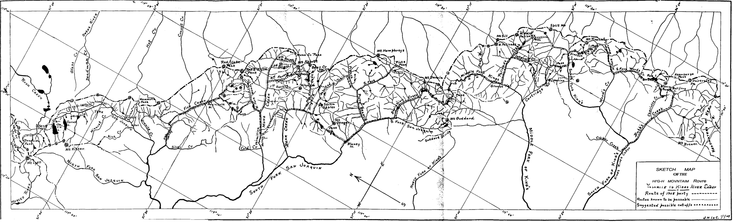
Sketch map of the High Mountain Route, Yosemite to the King’s River Canyon, 1908.
From LeConte, “The High Mountain Route Between Yosemite and the King’s River Canon,” Sierra Club Bulletin 7, no. 1 (January 1909).
[click to enlarge]
| Online Library: | Title | Author | California | Geology | History | Indians | Muir | Mountaineering | Nature | Management |
Yosemite > Library > Yosemite Resources > Chapter IV: Administration of Yosemite National Park, 1905-1915 >
Next: 5: NPS 1916-1930: Mather Years • Contents • Previous: 3: Cavalry 1890-1905
A. The Army Moves Its Headquarters to Yosemite Valley 413
B. Trails, bridges, and Roads 414
1. Trails and bridges 414C. Buildings and Construction 443a) General Trail and bridge Work 4142. Roads 425
b) John Muir Trail 419a) El Portal Road 425
b) Status of Roads in 1913 430
c) Road and Trail Construction Required of the City of San Francisco 431
d) Initiation of Auto Travel in Yosemite 433
e) Effects of Auto Travel in the Park 437
f) The Federal Government Acquires the Tioga Road. 439
g) The Big Oak Flat Road Becomes Toll Free 443
1. Army Camp 4433. Park General 451
2. Yosemite Village 446
a) Schools 451D. Campgrounds 458
b) Powerhouse 456
c) Miscellaneous 456
d) Wood-Splitting plant 457
e) Fire Lookouts and Patrol cabins 457
1. The U. S. Army Becomes involved in Business Concessions 461F. Patented Lands Again Pose a Problem 481
2. Concession Permits in Operation During That Time 462
3. Camp Curry Continues to Grow 470
4. The Camp Idea Expands to Other areas 472
5. The Washburn interests 472
6. The Yosemite Transportation Company 477
7. The Yosemite Valley Railroad Company 478
8. The Shaffer and Lounsbury garage 479
9. The Desmond Park Service Company 479
1. Timberlands 481G. Insect and Blister Rust Control 494a) Lumber interests Eye Park Timber Stands 4812. Private Properties 488
b) Congress Authorizes Land Exchanges 483
c) The Yosemite Lumber Company 484
d) The Madera Sugar Pine Company 488a) Foresta 488
b) McCauley ranch 489
c) The Cascades (Gentry Tract) 490
d) Tuolumne Meadows (Soda Springs) 490
1. Beetle Depredations 494H. The Hetch Hetchy Water Project Plan Proceeds 496
2. White Pine Blister Rust 495
1. The Garfield Permit 496I. Completion of the Yosemite Valley Railroad 513
2. Antagonism to the Project Continues 497
3. The City of San Francisco Begins Acquiring Land 498
4. A New Secretary of the Interior Questions His Predecessor‘s Actions 500
5. The Raker Act 501
6. Construction Begins 505
7. General Character of the System 506
8. Elements of the Hetchy Hetchy System 507a) Hetch Hetchy Railroad 507
b) Sawmills 509
c) Lake Eleanor Dam 512
d) Hetch Hetchy Dam 512
1. Change in Administration of the Parks 518
2. Proposal for a Bureau of National Parks and Resorts 519
3. Establishment of the National Park Service 521
The first army headquarters in Yosemite National Park had been established near Wawona because the state of California still controlled the more logical site—Yosemite Valley—and state officials had made it abundantly clear that they did not want army troops permanently encamped in the valley. In fact, according to former park supervisor Gabriel Sovulewski, the Yosemite commissioners forbade army patrols entering the valley from Wawona from camping farther up the valley than Bridalveil Meadow and strictly limited their movements in the valley, off or on duty.1 With the recession of the Yosemite Valley and Mariposa Big Tree Grove to the United States, Acting Superintendent Maj. H. C. Benson proceeded to the valley on 22 June 1906 with one troop of cavalry, leaving only an outpost at Wawona.
The War Department allotted $1,500 for the erection of new buildings on the present site of Yosemite Lodge and the re-erection of all the buildings that had been located at Wawona during the summer of 1905. In addition, the army built a forage house, saddle rooms for each troop, grain sheds, an orderly room for each troop, and an adjutant’s office. All stables, one for each troop and one for pack mules, had to be built anew. The army camp occupied all the ground west of the Yosemite Creek bridge as far as Rocky Point, including Leidig Meadow.
1. Trails and Bridges
a) General Trail and Bridge Work
Appropriations for improvement and repair of park facilities allowed construction of several trails and bridges during the year 1906. Thomas H. Carter of Wawona contracted for all the work, which included:
a six-mile trail from Hetch Hetchy Valley to Tiltill Valley;
a trail from the crossing of Rancheria Creek at its upper bridge to a point five miles up Rancheria Mountain toward “The Sink”;
a two-mile trail from “The Sink” to Pleasant Valley;
a twelve-mile trail from Pleasant Valley to Benson Lake, along the south side of the lake to its east side, then north to Kerrick Canyon;
a one-mile trail along the north side of Tiltill Valley connecting a trail entering on the southeast with one leaving for Lake Eleanor on the northwest;
three miles of trail from Lake Vernon to Tiltill Valley;
a 3-mile trail along the north side of Hetch Hetchy Valley, extending from the bridge at the upper end of Hetch Hetchy to a point half a mile below Falls Creek;
a fourteen-mile trail in Kerrick Canyon to the point where the trail to Stubblefield Canyon leaves it, then across Thompson and Stubblefield canyons to Tilden Lake; and
bridges over Falls Creek in Hetch Hetchy Valley, over Falls Creek just below Lake Vernon, and over Eleanor Creek within one mile of Lake Eleanor.2
[2. Report on Yosemite National Park, 196-97, and Benson, “Report of the Acting Superintendent of Yosemite National Park,” in Annual Reports of the Department of the Interior for the Fiscal Year Ended June 30, 1906, 656-57.]
In 1907 Carter constructed a four-mile trail from Tilden Lake into Jack Main Canyon; a new trail from Hog Ranch to Hetch Hetchy Valley replacing the old steep and rocky one; and a trail along the north side of that valley.3 Also sometime during 1907 to 1908 Superintendent Benson ordered Register Rock cleared of its grafitti.
[3. H. C. Benson, Major, 14th Cavalry, Acting Superintendent, “Report of the Acting Superintendent of the Yosemite National Park,” 30 September 1907, in Reports of the Department of the Interior for the Fiscal Year Ended June 30, 1907. Administrative. Reports in 2 volumes. Volume I. Secretary of the Interior, Etc. (Washington: Government Printing Office, 1907), 561.]
In 1908 Paul Seagall placed new pegs on the Half Dome route. The Sierra Club supplied the money for a new cable, the end of which Lawrence Sovulewski carried to the top. During the 1908 season, Carter constructed trails from Rancheria Mountain, via Bear Valley, to Kerrick Canyon, and from there, via Slide Canyon, to Matterhorn Peak, connecting with existing trails. The northern part of the park appeared now well supplied with trails, except for the area between Lake Eleanor and Twin Lakes. Also that year the army oversaw replacement of the Pohono Bridge in Yosemite Valley and repair of the iron bridge near the Sentinel Hotel. Day labor repaired the bridge over the Merced River above Kenneyville (Upper Bridge). Louis C. Hill, a supervising engineer, recommended that in the future all bridges constructed be arches of either reinforced concrete or granite, that style being much more satisfactory from both a maintenance and aesthetic point of view.4
[4. H. C. Benson, Major, 14th Cavalry, “Report of the Acting Superintendent of Yosemite National Park,” 30 September 1908, in Reports of the Department of the Interior for the Fiscal Year Ended June 30, 1908. Administrative Reports in 2 volumes. Volume I. Secretary of the Interior, Etc. (Washington: Government Printing Office, 1908), 426-27, and Appendix A, “Roads in Yosemite National Park,” Louis C. Hill, Supervising Engineer, to Hon. James R. Garfield, Secretary of the Interior, 10 December 1907, in ibid., 436.]
No new bridges were built during the 1909 season, but the El Capitan Bridge received a new floor and the bridges over the Merced near Camp Curry and over the Tuolumne in Hetch Hetchy Valley underwent repairs. By 1909 the following bridges crossed the Merced River and Tenaya Creek in Yosemite Valley:
Pohono Bridge (steel), 100 feet,
Sentinel Hotel Bridge (steel), 96 feet,
El Capitan Bridge (wood), 100 feet,
Stoneman Bridge (wood), 92 feet,
Upper Bridge (wood), 100 feet,
Power House Bridge (wood), 86 feet,
Tenaya Creek Bridge (wood), 85 feet.
The U. S. Army Corps of Engineers, believing that all the bridges except Pohono would have to be replaced within a few years, also recommended that they be replaced by stone arch bridges, which would be almost indestructible, more appropriate to the park setting, and “an adequate monument to represent the American Government in architectural work in its national park.”5
[5. Appendix A, “Report on Roads, Trails, and Engineering Structures,” A. R. Ehrnbeck, 1st Lieut., Corps of Engineers, 4 October 1909, in Wm. W. Forsyth, Major, Sixth Cavalry, “Report of the Acting Superintendent of the Yosemite National Park,” 15 October 1909, in Reports of the Department of the Interior for the Fiscal Year Ended June 30, 1909. Administrative Reports, jjn 2 volumes. Volume I. Secretary . of the Interior, Etc. (Washington: Government Printing Office, 1910), 434.]
By the 1910 season, all the important trails outside of the valley had been repaired and those from Tamarack Flat to Aspen Valley and from Hetch Hetchy Valley to Lake Eleanor shortened and improved. A new trail from above Mirror Lake to Tenaya Lake had been completed nearly to the top of the cliff in Tenaya Canyon. Bridge construction in 1910 included a new wagon bridge over the Merced River at the power plant, a new footbridge to Happy Isles, and a new wagon bridge over Cascade Creek on the Yosemite-EI Portal road. By this time names had been formalized for several of the largest bridges in the valley, including Sentinel Bridge over the Merced River near the Sentinel Hotel; Stoneman Bridge across the Merced between Kenneyville and Camp Curry; Clarks Bridge over the Merced near the old orchard in the east end of the valley; Tenaya Bridge over Tenaya Creek; and Secretary Bridge over the Merced near Happy Isles.6
[6. Wm. W. Forsyth, Major, Sixth Cavalry, “Report of the Acting Superintendent of the Yosemite National Park,” 15 October 1910, in Reports of the Department of the Interior for the Fiscal Year Ended June 30, 1910. Administrative Reports in 2 Volumes. Volume II. Secretary of the Interior, Etc. (Washington: Government Printing ‘Office, 1911), 464-65.]
In the fall of 1911 bridge work included replacement of the log bridge over Yosemite Creek near Camp Yosemite and repair of the foot suspension bridge over the Merced near Camp Ahwahnee, badly damaged by high water and floating logs in the river. The heavy floods of the spring and early summer had also carried away part of the bridge over the Tuolumne River in the Hetch Hetchy Valley.7 Trail work also continued. Originally, to reach Merced Lake, hikers had to ascend the Sunrise Creek Trail and cut north of Bunnell Cascade before dropping down to Merced Lake. In 1911 a new trail followed along the Merced River to Bunnell Point and crossed over its tip to Merced Lake, saving four miles.
[7. Wm. W. Forsyth, Major, Sixth Cavalry, “Report of the Acting Superintendent of the Yosemite National Park,” 15 October 1911, in Reports of the Department of the Interior for the Fiscal. Year Ended June 30, 1911. Administrative Reports in 2 volumes. Volume I. Secretary of the Interior, Etc. (Washington: Government Printing Office, 1912), 589.]
During 1912-13, trail construction included completion of: a trail branching off of the Mirror Lake-Tenaya Lake trail at Snow Creek and proceeding to North Dome and Yosemite Point; a trail from Tenaya Lake to Clouds Rest, passing between Clouds Rest and Sunrise Mountain, via Forsyth Pass; a spur trail from the Forsyth Pass trail to the junction of the Merced Lake and Sunrise trails; a trail from McClure Fork to Washburn Lake; and a trail from the junction of the Yosemite Fall and Eagle Peak trails, via White Wolf and Harden Lake, to Hetch Hetchy Valley; as well as changing of the Sunrise trail from its junction with the old Clouds Rest trail to its junction with the Merced Lake trail.
Bridges constructed during 1912-13 included two horse and pedestrian bridges over the Merced River between Merced and Washburn lakes, one over the Merced River above Nevada Fall, and another over 11lilouette Creek; a wagon bridge over Tenaya Creek on the valley floor; two footbridges on the Happy Isles trail; and a small footbridge over a branch of Yosemite Creek on the Lost Arrow trail.8 Also a contractor, Oscar Parlier of Tulare, California, began construction of three reinforced-concrete arch bridges on the road passing by the foot of Bridalveil Fall. The government constructed the spandrel walls and roadway involved.
[8. Gabriel Sovulewski, Park Supervisor, “Report of the Park Supervisor,” 15 October 1913, in Reports of the Department of the Interior for the Fiscal Year Ended June 30, 1913. Administrative Reports in 2 volumes. Volume I. Secretary of the Interior, Etc. (Washington: Government Printing Office, 1914), 732, 734. The McClure Fork of the Merced River became Lewis Creek in 1944. See discussion in Chapter V, fn. 8.]
Labors during the 1914 season consisted primarily of improving trails in the south and southeastern parts of the park. About three miles of new trail constructed from Washburn Lake south to the Lyell Fork of the Merced River opened up a beautiful section along the main canyon of the Merced. A trail that ran from the Wawona ranger station along the South Fork of the Merced for several miles before bearing north to the main Buck Camp trail at the Buck Camp ranger station was named for Ranger Archie Leonard. Leonard had supposedly first blazed the trail in the early 1900s during his scouting and guide work in the park for the U. S. Army troops. A sixty-foot-span foot and horse bridge of wood and steel trusses, known as the Register Rock Bridge, was constructed over the Merced River below Vernal Fall.9
[9. Gabriel Sovulewski, Park Supervisor, “Report of the Park Supervisor,” 27 September 1914, and David A. Sherfey, Resident Engineer, “Report of Resident Engineer,” 30 September 1914, in Reports of the Department of the Interior for the Fiscal Year Ended June 30, 1914. Administrative Reports in 2 volumes. Volume II. Secretary of the Interior, Etc. (Washington: Government Printing Office, 1915), 730, 735.]
New trails constructed during 1914 and 1915 included: the Donohue Pass trail—from the junction of Ireland Creek and the Lyell Fork of the Tuolumne River to Donohue Pass; the Buck Camp trail—from Illilouette Fall, along Illilouette and Buena Vista creeks, joining the Buck Camp trail at Johnson Lake; the Merced Pass trail—from its junction with the Mono Meadow trail to Merced Pass; and partial relocation of the Merced Lake trail near Merced Lake. In addition, the California Construction Company of San Francisco constructed a new El Capitan Bridge in 1915, a combination steel and wood truss structure with a span of 87-1/2 feet.10
[10. Gabriel Sovulewski, Park Supervisor, “Report of Park Supervisor,” 30 September 1915, and David A. Sherfey, Resident Engineer, “Report of the Resident Engineer,” 30 September 1915, in Reports of the Department of the Interior for the Fiscal Year Ended June 30, 1915. Administrative Reports in 2 Volumes. Volume I. Secretary of the Interior, Etc. (Washington: Government Printing Office, 1916), 923, 926.]
b) John Muir Trail
Theodore S. Solomons, a mountain-climbing enthusiast and one of the founding members of the Sierra Club, first conceived of a pack trail across the southern High Sierra paralleling the main crest as a young boy of fourteen. He arrived in Yosemite in 1892 to begin the first of a series of organized explorations of the region to find a practicable route. Early reconnaissance work, lacking detail, had previously been undertaken during 1864 and 1865 by Professor William H. Brewer of the California Geological Survey and his assistants. Later John Muir had explored many of the upper canyons of the San Joaquin and King’s rivers. Solomons was primarily working, however, in areas of the Sierra whose main features remained completely unknown. During his 1892 trip, Solomons concentrated chiefly on the Middle Fork of the San Joaquin River to the mouth of the South Fork. Other trips in 1894 and 1895 further explored the upper regions of the San Joaquin River basin and basically established the route that now constitutes the northern half of the John Muir Trail.
In 1887 Joseph N. LeConte, professor of mechanical and hydraulic engineering at the University of California, and nephew of geologist Joseph LeConte, began making regular trips into the Sierra making scientific observations and triangulating major peaks. In 1893 he compiled all data available on the portion of the Sierra Nevada adjacent to King’s River and published a map. A larger and more inclusive one published by the Sierra Club in 1896 showed the results of explorations to date. After Solomons’s groundbreaking, other explorers subsequently penetrated new areas and established new landmarks which facilitated perfecting of the route. In 1898 LeConte followed Solomons’s route south from Yosemite and pioneered a way to King’s River Canyon. Because the southern part of the route avoided the High Sierra at its most beautiful point, however, it was still not considered the true high mountain route that Solomons had striven for.
LeConte continued working out and piecing together bits of the route until he finally completed the desired 228-mile route in 1908. His 1909 map outlines in detail most of the present John Muir Trail.
By that time the areas at either end of the route had been well mapped, making the whole region known, although as yet inaccessible to most people. Yosemite National Park already had a decent trail system, but most of the rest of the proposed route lay in national forests. The northern part consisted primarily of Indian paths and sheep trails, while farther south various agencies, including the U. S. Forest Service, Fresno and Tulare counties, and the Sierra Club had built or financed improvements on trails in various sections. It still remained difficult to pass from one region to another and most of the trail was only generally indicated on maps.
Meanwhile, in 1901 the Sierra Club had begun its annual summer Outings. During 1914 a member, Meyer Lissner, suggested that the state of California undertake a program to improve and construct High Sierra trails to make that area more accessible. He proposed that the club formulate a program to seek appropriations for trail development. The club immediately appointed a committee to develop the idea. Meanwhile, John Muir, leader of the Sierra Club for many years, died, and William Colby, secretary of the club and the man drawing up the bill, inserted a provision to name this proposed trail along the Sierra crest the John Muir Trail, in honor of the man who so enthusiastically explored and publicized the beauties of the High Sierra.
On 28 January 1915 State Senator William J. Carr introduced the bill in the California Senate and Assemblyman F. C. Scott introduced it in the lower house. Governor Hiram Johnson signed the bill into law on 17 May 1915, and the legislature appropriated $10,000 for the work. State Engineer William F. McClure, required by the bill to select a practical route from Yosemite to Mount Whitney along the crest of the Sierra, made two field inspections to establish the exact route. It was decided, after several conferences with representatives of the Sierra Club and Forest Service, that the trail would begin at Yosemite Valley and ascend to Tuolumne Meadows;
|
Illustration 56.
Sketch map of the High Mountain Route, Yosemite to the King’s River Canyon, 1908. From LeConte, “The High Mountain Route Between Yosemite and the King’s River Canon,” Sierra Club Bulletin 7, no. 1 (January 1909). |
|
[click to enlarge] |
thence across Donohue Pass and Island Pass to Thousand Island Lake and past the Devils Postpile, Fish Creek, North Fork of Mono Creek, Vermilion Valley, Bear Creek, Blaney Meadows, Evolution Creek, Muir Pass, Grouse Meadow, Palisade Creek, upper basin of the South Fork of Kings Riveg,, Pinchot Pass, Woods Creek, Rae Lake, Glen Pass, Bullfrog Lake, Bubbs Creek, Junction. Pass, Tyndall Creek, and Crabtree Meadows to Mount Whitney.11
[11. Walter L. Huber, “The John Muir Trail,” Sierra Club Bulletin 15, no. 1 (February 1930): 40.]
McClure asked officers of the Forest Service to supervise the trail’s construction, which they did without charge. Initial work began in August 1915 on connecting completed portions of the trail and would continue for several more years as the state legislature provided additional appropriations.12
[12. Roth, Pathway in the Sky, 25, 27-28, 38, 41-42. Also see Theodore S. Solomons, “A Search for a High Mountain Route from the Yosemite to the King’s River Canon,” Sierra Club Bulletin 1, no. 6 (May 1895): 221-37; Joseph N. LeConte, “The High Mountain Route Between Yosemite and the King’s River Canon,” Sierra Club Bulletin 7, no. 1 (January 1909): 1-22; Huber, “John Muir Trail,” 37-40; Theodore S. Solomons, “The Beginnings of the John Muir Trail,” Sierra Club Bulletin 25, no. 1 (February 1940): 28-40.]
2. Roads
a) El Portal Road
In connection with their proposed railroad up the Merced, the Yosemite Valley Railroad Company had offered to build a wagon road from El Portal connecting with the Coulterville toll road. Upon completion, the road would become a public highway. The company would construct those few miles, at an estimated cost of $80,000, if Congress made no similar appropriation for such a project. When Congress did not, the company planned to proceed on construction and have both its railroad and a wagon road in operation for the 1907 travel season. To complement that endeavor, the Department of the Interior allotted $8,000
|
Illustration 57.
Map of Yosemite Valley showing roads and projected revisions, 1912-13. From Automobile Club of Southern California Road Department Report on Condition of Roads into Yosemite Valley, 1912, in Central Files, RG 79, NA. |
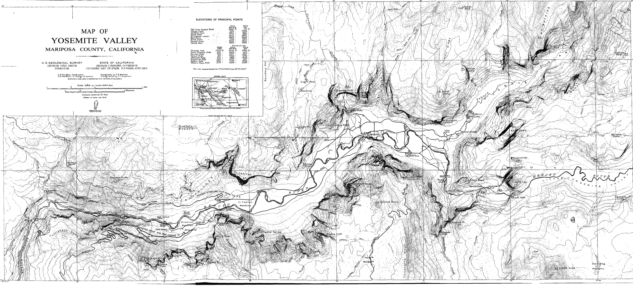
[click to enlarge] |
Although the new wagon road facilitated travel into the valley from El Portal, it remained an uncomfortable journey. The majority of park visitors followed this route, which led from the terminus of the Yosemite Valley Railroad along the north bank of the Merced River for ten miles before crossing to the south side of the river over the Pohono Bridge and proceeding on to the Sentinel Hotel. The first ten miles of the road remained for several years extremely rocky, narrow, and tortuous. In 1908 Acting Superintendent Benson complained about the deplorable road conditions into and around Yosemite Valley: “The one great drawback to the visitor’s pleasure is the fact that he is driven over rough roads so dusty that when he arrives at his destination his dearest friend could not recognize him.”13 Benson stressed that the valley roads needed widening, macadamizing, and watering.
[13. Benson, “Report of the Acting Superintendent of Yosemite National Park,” in Reports of the Department of the Interior for the Fiscal Year Ended June 30, 1908, 425.]
The first actual roadwork the federal government performed after recession of Yosemite Valley involved improvement of the El Portal road. In 1909 work began on macadamizing it from the El Capitan Bridge to the Sentinel Hotel along the south side of the Merced. A year later that portion had been graded and culverts installed. Traveling conditions over the El Portal-Old Yosemite Village road improved in 1910 with installation of a sprinkling system with water for the new road section, provided by two 5,000-gallon tanks installed between Camp Ahwahnee and the El Capitan Bridge. During the fall of 1912 and summer of 1913, grading and macadamizing proceeded on the El Portal road in the area of Camp Ahwahnee.
The work of widening the lower sections of the road began on 10 May 1913. By the first of October almost two miles had been widened from ten to twenty-five feet to incude a guard wall, ditch, and eighteen-foot roadbed. Construction work involved drilling and blasting through the large boulders and solid granite formation through which the road wound. Rock debris from this effort was thrown down the slope toward the Merced River.
b) Status of Roads in 1913
In 1913 the government owned forty-six miles of road within Yosemite National Park, including nineteen on the floor of Yosemite Valley, on both sides of the Merced River from the Pohono Bridge to Mirror Lake; the nine miles of the El Portal road, from the Pohono Bridge to the western park boundary; four miles of the Wawona Road, from the valley floor to Fort Monroe on the southern rim; four miles of the Big Oak Flat Road, from the valley floor to Gentry’s on the valley’s northern rim; and ten miles of roads in the Mariposa Big Tree Grove. A lack of planning had resulted in an excessive number of unattractive roads in the valley that intruded on the landscape.
In addition, approximately 106 miles of wagon road existed in the park, either toll roads or otherwise privately owned, including 19 miles of the Coulterville Road, whose franchise expired about 1920; 10 miles of the Big Oak Flat Road, whose franchise expired 20 January 1921; 45 miles of the Tioga Road, whose franchise expired 8 January 1934; and 32 miles of the Wawona-Glacier Point Road, whose franchise expired 16 November 1927.
These roads were all in poor condition in 1913. Prior to the 1920s, most road work involved maintenance and repair with only minor improvements. Until the roads were paved, park crews accomplished renovation work each spring with horse teams and hand tools—filling ruts and washouts, spreading gravel, and sprinkling the roadbed. Exclusion of autos from the park from 1907 to 1913 contributed in large part to the continuing deterioration of park roads. The increased use of the roads after that time eventually applied the necessary pressure that resulted in resurfacing and realigning of existing routes and construction of new ones. Travel over roads into the valley had dropped to such an extent after construction of the Yosemite Valley Railroad that the various road companies found it no longer profitable to maintain them. Consequently, the Coulterville and Tioga roads had been practically abandoned, although the Yosemite Stage and Turnpike Company continued to collect tolls on the Wawona Road, keep it in repair, and operate a horse-drawn transportation line over it. Visitors also continued to use the Big Oak Flat Road to some extent.
Another road, built by cattlemen and others living or working in the area, led from the Tioga Road to Hog Ranch via Ackerson Meadow. That private road branched off the Tioga Road about one mile from Carl Inn, outside the park. Only a ford existed across the Middle Fork of the Tuolumne River until about 1915, when a bridge was completed and approaches built on each end. That road became an important link in the trip to Hetch Hetchy Reservoir that the park transportation system inaugurated in 1918, although Congress did not provide funds and authorize its maintenance by the National Park Service until 1922.
c) Road and Trail Construction Required of the City of San Francisco
M. M. O’Shaughnessy, city engineer for the city of San Francisco and chief architect of the Hetch Hetchy Project, appeared before the Public Lands Committee in 1913 and offered to spend one million dollars on roads and trails for the benefit of visitors to Yosemite as the Secretary of the Interior might direct.14 The act of Congress approved 19 December 1913 granting the city and county of San Francisco certain rights-of-way in, over, and through public lands in Yosemite National Park and Stanislaus National Forest specified that the grantee would construct on the north side of the Hetch Hetchy Reservoir site a scenic road or trail (to be determined by the Secretary of the Interior) above and along the proposed lake to a point designated, and a trail leading from that road or trail to Tiltill Valley and to Lake Vernon and a road or trail to Lake Eleanor and Cherry Valley via Miguel Meadow. Likewise it directed the city to build a wagon road from Hamilton along the most feasible route adjacent to its proposed aqueduct from Groveland to, Hog Ranch and into the Hetch Hetchy dam site. The city of San Francisco rebuilt approximately four miles of that road—a typical mountain track used only by horse-drawn vehicles—eliminating the steep grades so that it could be used to truck in supplies and equipment for the Hetch Hetchy Project prior to construction of the Hetch Hetchy Railroad. Congress also requested a road along the south slope of Smith Peak from Hog Ranch past Harden Lake to a junction with the Tioga Road.
[14. E. P. Leavitt, Acting Superintendent, Yosemite National Park, to the Director, National Park Service, 9 November 1927, in Box 84, Hetch Hetchy, “Gen’l 1926-1927,” in Yosemite Research Library and Records Center, 2-9, 14.]
The purpose of the road or trail along the north edge of the reservoir and of the trail from that route to Tiltill Valley and Lake Vernon was to allow accessibility to the large park area in the Rancheria Mountain district that would become isolated when construction of the Hetch Hetchy reservoir flooded all the trails up the valley previously leading into that area.
The city could build other roads or trails through the public lands necessary for its construction work subject to the approval of the Secretaries of Agriculture and the Interior. Those roads and trails would be assigned free of cost to the federal government, which would be reimbursed by the city for maintenance costs. The money received would be kept in a separate fund and applied to the building and maintenance of roads and trails and other improvements in Yosemite and other national parks in the state.
d) Initiation of Auto Travel in Yosemite
In 1900 Frank H. and Arthur E. Holmes had driven a Stanley Steamer over the Chowchilla Mountains to Wawona. Over the next few years, state officials allowed the few cars who ventured in free access to Yosemite Valley. That goodwill evaporated after 1906 when Yosemite Valley became part of Yosemite National Park and the volatile Major Harry C. Benson, acting superintendent, began overseeing park affairs. Irritated by driver disobedience of the strict regulations he had instituted for auto travel, and dismayed by plans for an impending trip to the valley by the Oakland Automobile Dealers Association, Benson secured approval from the Secretary of the Interior in 1907 to ban autos from Yosemite Valley. Lobbying efforts by various automobile associations to reopen the main roads of the park to motorists reached their peak in 1912, when a joint delegation representing the Automobile Club of Southern California, the Los Angeles Motor Car Dealers’ Association, the Los Angeles Chamber of Commerce, and other large organizations made an appointment to meet with Secretary of the Interior Walter L. Fisher in the park to personally appeal their case.15
[15. Richard G. Lillard, “The Seige and Conquest of a National Park,” American West 5, no. 1 (January 1968): 67-68; “To Seek Opening of Yosemite to Motorists,” 7 October 1912, in Los Angeles Real Estate Bulletin and Building News, Box 3, Washburn Papers, Yosemite Research Library and Records Center.]
It was at this mid-October 1912 second National Parks Conference involving park superintendents, concessionaires, the Secretary of the Interior and other officials, and several interested groups and individuals, that John Muir was called upon for his opinion as to whether autos should be allowed in the parks. At that point Muir, with the same vision that characterized his views on the environment, pronounced that the era of automobiles had arrived. He believed that autos would allow more people to enter the valley and that no group of men could prevent them from becoming the means of travel for the future.16 All roads in and about Yosemite in 1913 had been built for horse-drawn vehicles and not designed as possible auto roads. Opposition from several quarters arose to the entrance of autos into the national parks, principally on the grounds that the unsuitable roads would cause many accidents between autos and horse-drawn conveyances.
[16. “Yosemite Retrospect and Prospect,” speech given by William E. Colby, Camp 14 Anniversary Program, 30 June 1939, in Separates File, Y-4, Yosemite Research Library and Records Center.]
On 30 April 1913, Secretary Franklin Lane rescinded the order barring automobiles from Yosemite National Park, stating that
This form of transportation has come to stay, and to close the park against automobiles would be as absurd as the fight for many years made by old naval men against the adoption of steam in the navy. . . . I want to make our parks as accessible as possible to the great mass of people.17
[17. “Lane Opens Up Yosemite Park to Automobiles,” Fresno (Calif.) Republican, 30 April 1913, in Miscellaneous Facts File, Wawona Road, Y-20d, Yosemite Research Library and Records Center.]
The immediate question from interested parties in nearby counties concerned the number of roads to be opened to autos. The Interior Department decided to first open only the Coulterville Road—a route in such poor condition that even horse-drawn vehicles rarely used it. The department feared that if all roads opened at the same time without proper regulation, the resulting number of accidents could seriously retard the entire process. Eventually it would open all roads to auto travel, but only gradually and after careful study.
At the time of Secretary Fisher’s conference at Yosemite Valley in October 1912, he concluded that it would not be safe for autos to enter Yosemite Valley over the Wawona Road, although they could safely travel to the rim of the valley over the Wawona-Chinquapin-Glacier Point road. The Madera County Chamber of Commerce particularly desired to have the Madera-Wawona road opened to auto traffic as soon as possible and determined to ask for a federal appropriation to improve the road from near Fort Monroe to the valley floor. It feared that the initiation of auto traffic to the park over other roads would adversely affect Madera County’s economy and depreciate the value of the Wawona toll road.
On 5 August 1913, the Interior Department published regulations governing the admission of automobiles into Yosemite National Park. The inadequate surfaces of the park roads and their many narrow stretches and abrupt turns that complicated auto travel necessitated strict rules regarding the acquisition of permits, the hours of entrance and departure, and time and speed allowances for reaching destinations. Autos could approach the park only by the Coulterville and Big Oak Flat roads. Those traveling on the latter had to turn west at Crane Flat and get on the Coulterville Road to enter the valley. Once on the valley floor, cars were restricted ‘to the road north of the Merced River.18
[18. Lewis C. Laylin, Asst. Secretary of the Interior, “Regulations Governing the Admission of Automobiles Into the Yosemite National Park,” 5 August 1913, Box 3, Washburn Papers, Yosemite Research Library and Records Center.]
The Coulterville Road opened to automobiles on 23 August 1913, and during that season the army established additional outposts for checking auto traffic at Merced Grove and Cascade Creek. By the summer of 1914, an allottment of $2,500 allowed repair work on the Wawona Road between the valley floor and Fort Monroe. After completion of that work, establishment of a telephone checking system, and the publication of regulations for their use, the Wawona Road and the road to the Mariposa Big Tree Grove also opened to auto traffic, on 8 August 1914. The Big Oak Flat Road opened on 16 September of that year. Cars remained restricted in usage by a variety of regulations until 1916, when the glorious era of horse and stagecoach rides to Yosemite ended.
The memoirs of early auto visitors to the park seem to focus mostly on the narrowness and steepness of the roads. Because the time restrictions on travel within the park often left people stranded at park entrance stations after closing hours, rangers learned to keep extra supplies of cots and canned goods on hand. They also had to care for pets, which were not allowed in the park, until their owners’ return and retain any firearms brought in.
In February 1913 the Madera, Yosemite, Big Tree Auto Company was organized and replacement of stagecoaches by buses began. In 1915 this company, under agreement with the Yosemite Stage and Turnpike Company, formed the “Horseshoe Route” stage line running from Raymond to Mariposa Grove, Wawona, Glacier Point, and Yosemite Valley. Auto travelers to Yosemite who wished to see as much as possible in one trip often availed themselves of the Horseshoe Route. It entered the valley via the Mariposa Big Tree Grove and Inspiration Point and left it by way of El Portal. The Horseshoe Route stage line ultimately sold out to the Yosemite Park and Curry Company in 1926.
During the automobile era, J. R. Wilson devised another interesting way to see the park. In 1913 he constructed a six-mile road of eight percent grade, costing $40,000, that ran behind the Del Portal Hotel in El Portal and on to the Merced and Tuolumne groves. Referred to as the Triangle Route because it led from El Portal at one corner to the Merced and Tuolumne groves at another, and to Yosemite Valley at the third, it passed through extremely scenic country, which made it a favorite with tourists. As an added thrill, autos could pass through the hollowed-out tunnel in the Dead Giant Tree in the Tuolumne Grove. From the Big Trees the route led to Yosemite Valley via the Big Oak Flat Road. After crossing the Merced River over El Capitan Bridge, autoists could turn west and head back to El Portal. Wilson had a permit to operate three auto stages over this road during the 1913 season.
A. B. Davis, who had a permit for that route in 1915, also obtained a permit in July 1914 to construct the four-mile “Davis Cut-off.” Davis, one of the promoters of the Foresta subdivision, conceived of this route linking Foresta with Crane Flat as an additional way to attract buyers. That route began northwest of Big Meadow and ran north beyond its junction with the Coulterville Road to Crane Flat and the Big Oak Flat Road, enabling tourists to visit Foresta, tour the Tuolumne Grove, and then descend into Yosemite Valley. Davis also organized the Big Trees Auto Stage Company.19
[19. Sargent, Yosemite’s Rustic Outpost, 22. Sargent states the road was built in the early summer of 1914. Other sources have stated a year later.]
On 1 June 1915 the Yosemite Stage and Turnpike Company replaced its old horse-drawn stages with an automobile service that transported tourists between the Mariposa Grove and Yosemite Village. This new, faster mode of transportation, however, also enabled visitors from the valley to visit the grove and return in one day without having to stay overnight at the Wawona Hotel. On 16 July 1915 rental auto service began on the valley floor to carry tourists from camp to camp and around the valley and to make special trips over the Tioga Road. One of the reasons for the service, in addition to restricting the volume of traffic on the poor valley roads, was to pacify tourists who were not allowed to run their personal autos around the valley floor. The Department of the Interior had decided upon that policy because the average tourist’s unfamiliarity with the valley’s turnouts, sharp curves, trail junctions, and stage schedules increased the chance of accidents.
e) Effects of Auto Travel in the Park
Few people, especially in the Interior Department, realized the impact the auto would have on the national parks, indeed on the country as a whole. The auto enabled a new class of tourists to visit the park—those who had never before been able to take a vacation, who often lacked any knowledge or appreciation of America’s unique scenic areas, and who had little education or understanding of how to properly enjoy such areas: “For the first time, the under-privileged family of small means, by the use of an automobile was able to take advantage of our great national playgrounds and at last the original conception of the National Park movement was on a fair way to being realized.”20
[20. Paper delivered by Donald Tresidder before a meeting of the Conservation Forum in Yosemite National Park, 1935, Yosemite Research Library and Records Center.]
Even in the early days of the auto, congestion became common at the park entrances, along its roadways, and in parking areas. On summer evenings, cars solidly lined the valley roads as their owners gathered to watch the firefall. Although cars alleviated some of the pressure on valley meadows by lessening the need for cultivation of stock feed, enabling those areas to develop into scenic attractions, they still managed to inflict severe damage by driving and parking on them. Campgrounds overflowed into Stoneman and Leidig meadows and later even onto the Ahwahnee Hotel grounds. Because Yosemite Valley contained a high concentration of scenic values within a small area, the influx of motor travel threatened havoc on its scenic integrity. Trampled grass and shrubbery, scattered litter, traffic congestion, air pollution, the lack of adequate traffic control, overcrowded facilities, and unhappy visitors finally forced park officials to realize they needed a management plan for growth and development to ensure maximum enjoyment of the area with minimum damage to the resources.
Although the Park Service did over the next few years reassess its objectives and develop a group of experts in landscaping, engineering, sanitation, traffic control, and education who studied the new problems and formulated plans for the proper use and preservation of the national parks, some problems created by auto travel remain to plague park administrators. By the late 1960s, the ever increasing visitation to Yosemite, brought about by the popularity of auto travel and improved road surfaces, raised traffic congestion again to unacceptable levels, causing the Secretary of the Interior to note as late as 1969 that “the private automobile is impairing the quality of the park experience.”21
[21. George B. Hartzog, Jr., “Clearing the Roads—and the Aii—in Yosemite Valley,” National Parks & Conservation Magazine (August 1972): 16.]
Little realizing the problems that lay ahead of them, officials in the fledgeling National Park Service only gradually began to see that the arrival of the auto would drastically change visitation numbers and patterns in Yosemite and the course of park development. For many Americans, auto touring became a recreation in itself, prompting the need for better road access to popular sites and some method of traffic control. Because people could get to the park faster, they often intended to stay longer. If they planned on staying two weeks, they usually wanted something to do besides look at scenery. Most of them also desired all the amenities they could get at home. As the park provided more accommodations, more restaurants, better food and dry goods services, and other support facilities, it also required more employees who needed housing and various community services, such as schools and hospitals. In an attempt to provide these, as well as a variety of recreational and educational experiences, the federal government and the concessioners embarked on a period of construction and development that would markedly change both the visitor experience in Yosemite and the historic landscape.
f) The Federal Government Acquires the Tioga Road
The outstanding legacy of the Great Sierra Consolidated Silver Company was its wagon road, which increased the accessibility of the Tuolumne Meadows region. It never carried rich silver shipments, and the new heavy machinery purchased for use in the Sheepherder tunnel that should have passed over it was instead sold at auction in San Francisco after the mine closed.
As previously alluded to, upon the wagon road’s completion, its owners obtained a fifty-year franchise to charge toll for travel over it between Tuolumne and Mariposa counties. They never erected collection gates for tolls, however, and tourists, stockmen, and army patrols freely passed over the road. After the mining company ceased operations, it remained open, but received only periodic maintenance. It remained passable despite occasional fallen trees, washouts, and numerous rough spots. There was increasing sentiment, however, for its purchase by the federal government because of its importance as a patrol road. Some even believed that the road already belonged to the government by default because it had never been a toll road and appeared to have been literally abandoned by the owners for years. But had it been?
The story of the changes of ownership of the Great Sierra Wagon Road is as complicated as that of the Tioga Mine itself. William Swift obtained the road toll franchise from Road Superintendent William C. Priest at the same time he acquired the properties of the Great Sierra Consolidated Silver Company. Upon Swift’s death, his brother Rhodolphus acquired both the mine properties and the road, which remained the property of his heirs until 1915.
During that period the law firm of Wilson and Wilson handled business pertaining to the road for its owners. The attorneys believed that the light travel on the road was responsible for its eventual neglect and argued that if the road were completed down the eastern slope of the Sierra Nevada, traffic would increase and the owners would resume collecting tolls to finance maintenance work. In the meantime, campers and other heavy users of the road performed necessary repairs such as bridge replacement. The attorneys claimed, nonetheless, that the owners had regularly expended some money on repairs and annually paid their property taxes. Despite the controversy over the road’s status, the federal government never pursued its threat of condemnation and the owner’s lawyers continued to maintain that the government had no claim to the road except by purchase.
The opening of Yosemite to automobile traffic raised again the subject of acquisition of the Tioga Road, which, since 1890 and the establishment of the national park, had remained a private enterprise. Attempts through the years to get Congress to appropriate money to purchase the right-of-way had failed. The Interior Department, therefore, remained unable to repair the road and open it to tourist use. On 21 January 1915, a Californian, Stephen T. Mather, became Assistant to the Secretary of the Interior, with jurisdiction over the national parks.
One of the Mather’s most notable projects at Yosemite involved the purchase of the Tioga Road. In casting about for a project to lead off his administration of the parks, Mather turned to Yosemite, which, in view of two international expositions scheduled for the state of California, was destined to receive increased visitation. Because the old mining road constituted the only potential auto route across the Sierra, its ownership and improvement by the federal government would be extremely popular with Californians and economically beneficial both to the state and the federal government.
The Tioga Road’s owners still held the right-of-way and toll privileges handed down from the original owners. Mather, therefore, decided to acquire the outstanding but valid toll road rights from the Swift estate. Aided by leaders of the Sierra Club, especially William Colby, Mather managed to contact the owners of those rights, who eventually offered to sell them. Interested parties east of the mountains, meanwhile, undertook to secure state cooperation to improve the road up Lee Vining Canyon from Mono Lake to the park line. As noted earlier, recommendations had previously been made for a route up the eastern slope of the Sierra to connect with the Great Sierra Wagon Road, replacing the treacherous horse trail down Bloody Canyon that connected the Tioga Mine with Mono Valley. A new route to the east had been touted as not only facilitating mine haulage from the mountains but also providing accessibility to Yosemite Valley and the High Sierras. In 1902 construction had begun on the Tioga Pass-Lee Vining route, and by 1905 all but five miles east of the pass had been finished. Although that stretch was finally completed by 1908, the Tioga Road lay in such a state of disrepair that the trans-Sierra route as a whole was practically impassable.
Mather and his friends ultimately raised the funds necessary to acquire the Tioga toll road rights. Mather spent several thousand dollars of his own money on the purchase, while philanthropists, civic groups, the Sierra Club, and private individuals provided the rest. Mather then discovered that no law existed under which the Secretary of the Interior could accept a gift of this kind. The chairman of the Appropriations Committee turned down Mather’s request to Congress for authority to accept gifts for the benefit of the national parks. Ultimately Senator James Phelan and Congressman William Kent of California succeeded in securing the requested authority to accept gifts for Yosemite. Mather transferred formal title to the Tioga Road and the toll rights and easements to the federal government on 10 April 1915. As soon as Congress accepted the Tioga Road, Mather allocated national park funds to repair bridges, culverts, and the roadbed. Park crews rushed work through the summer. By mid-July the Tioga Road was passable, and opened to auto traffic on 28 July 1915.
Horace M. Albright, then an administrative clerk in the office of Assistant Secretary of the Interior Mather, years later recalled the drive up to Tioga Pass for the dedication ceremony marking the opening of the road. What later provided a humorous anecdote, at the time constituted a hair-raising experience probably endured by many early travelers over the old, single-lane Tioga Road:
Will L. Smith was the driver of the car—a Studebaker, I think—in which three of us rode; Mr. McCormick [vice-president of the Southern Pacific Railroad] in front with Will Smith; Emerson Hough [Saturday Evening Post writer] and I in the rear seat, Hough on the outside; that is, overlooking the gorge, and I behind McCormick. Will Smith had been over the road many times and knew every turn, but we did not know this. He wanted us to see everything so he would describe scenes for us, even rising in his seat to point them out and sometimes turning around and pointing back, but never stopping the carl Whenever he did this, I would open the car door and put my foot on the running board, so when the car went over I possibly might fall on the road’s edge. Mr. Hough would be right on top of me ready to fall out with me. About the third time this happened, Hough said hoarsly in my ear, “Damn this scenery-lovin’ S. O. B.”22
[22. Horace M. Albright, “Horace Albright Recounts Opening of Tioga Road,” Inyo Register (Bishop, Calif.), 15 June 1961. See Keith A. Trexler, The Tioga Road: A History, 1883-1961, rev. 1975, 1980 (Yosemite National Park: Yosemite Natural History Association, 1961), for a comprehensive history of the road and its construction.]
g) The Big Oak Flat Road Becomes Toll Free
Another important event took place in July 1915 when Tuolumne County purchased the Big Oak Flat Road leading into Yosemite Valley for $10,000 with the intention of making it toll free. It gave the portion from the park boundary to Gentry’s to the federal government. After the state and county repaired their portion of the old highway by regrading and eliminating sharp curves and steep grades, the trip to Yosemite over that route became much easier. Assistant Secretary Mather then announced that the portion of that road within the park would also be repaired. The federal government had formerly declined to spend money on its improvement as long as private parties held any part of the road.23 The government also established a checking station at Gentry’s and one on the valley floor.
[23. Leon J. Pinkson, “Tuolumne Secures Road to Yosemite,” San Francisco Chronicle, 27 June 1915.]
1. Army Camp
An inspection report on Camp Yosemite in 1909 noted that its buildings, of the most temporary character, proved suitable for occupancy only during the summer months. The troops and officers quartered in wooden-floored tents. Soldiers performed most camp construction work. The army stables had only roofs, their sides and ends open to the weather. Saplings cut near the camp formed the framework of the stables and of two large storage tents. Two dining rooms exhibited similar construction. Only the headquarters, the bakery, the quartermaster and commissary storehouses, two company kitchens, the blacksmith shop, the guardhouse, and the officers’ mess had been enclosed. Those buildings had walls of rough pine boards and battens, shingle and shake roofs, rough floors, unfinished interior walls, and half-sash stationary windows. They stood on temporary wooden foundation sills. The Chief Quartermaster of the Department of California recommended that if Camp Yosemite continued in that locality, more substantial buildings be constructed. Any new buildings should be fashioned entirely of wood, with native mountain pine used for the exterior and interior finishes, with roofs and sides covered with unpainted shakes.24[24. Robert R. Stevens, Chief Quartermaster, Department of California, Memo for Adjutant General, Department of California, 28 June 1909, in Office of the Quartermaster General, General Correspondence, 1890-1914, RG 92, Records of the Office of the Quartermaster General, NA.]
The War Department in 1911 began erection of two temporary barracks, two lavatories, and seven frame cottages at Camp Yosemite, as well as installation of a water and sewer system. These were still built to the old army summer residence standards and of the same design formerly found in tropical army posts. The buildings were completed and accepted 20 December 1911.25
[25. Forsyth, “Report of the Acting Superintendent of the Yosemite National Park,” in Reports of the Department of the Interior for the Fiscal Year. Ended June 30, 1911, 591-92, 596.]
By 1912 day labor under the supervision of the resident engineer had built four small cottages “of an appearance appropriate to the environment” for the resident engineer, a clerk, and two electricians. Frame buildings adjacent to the military camp, they sat upon concrete foundations and had electric lights and plumbing. The army also erected a reinforced concrete magazine for the storage of high explosives on the north side of the Merced River opposite Bridalveil Meadow.26 During the 1913 season, the acting superintendent lived in the officers’ clubhouse at the army camp.
[26. Wm. W. Forsyth, Major, First Cavalry, “Report of Superintendent of Yosemite National Park,” 30 September 1912, in Reports of the Department . of the Interior for the Fiscal Year Ended June 30, 1912. Administrative Reports in 2 volumes. Volume I. Secretary of the Interior, Etc. (Washington: Government Printing Office, 1913), 665, 669-70. The U. S. Army built residences 1, 2, 4, and 5 now within the Yosemite Village Historic District in 1911-12. The army barracks later served as the original Yosemite Lodge buildings. None of those structures remain. Joe Desmond also acquired tent platforms left by the army and used them in constructing the floor of the Yosemite Lodge dining room. Although frame army buildings were not unusual, Forsyth’s remark that they harmonized with the surroundings shows a continuing awareness of the principles that would later characterize the Park Service’s rustic architecture program.]
The need for adequate medical service in Yosemite Valley had been an issue for many years. In 1880 the Yosemite commissioners had urged that a doctor reside in the valley throughout the year and requested an appropriation for his income. The state legislature made no such allotment, however, and for many years Mariposa provided the nearest medical service unless a doctor happened to vacation in the valley during the summer. The army surgeons accompanying the cavalry troops during the period of army administration often also served the public. In 1912 the army constructed a temporary two-story, board-and-batten hospital building at Camp Yosemite. Commanded by an officer of the Medical Corps, the hospital admitted civilians during the tourist season. After troops withdrew from the park in 1914, the War Department authorized a civilian doctor employed by the Interior Department to practice medicine in the facility.
During the summer of 1915 two San Francisco physicians and surgeons opened the hospital building for the practice of medicine and the sale of drugs under authority of the Department of the Interior. The old War Department building was slightly remodeled and provided with a new operating room. Despite the small staff, accident victims and sick cases could be adequately cared for. This facility served as the valley hospital until 1929.
2. Yosemite Village
Acting Superintendent Benson, in his 1908 report to the Department of the Interior, described the status of buildings in Yosemite Village. By that year the valley contained forty-six buildings, all of them frame except for the stone LeConte Memorial Lodge. The buildings comprised the residences, barns, stables, and outbuildings used by the concessioners and the Department of the Interior. The barns and stables appeared to be in good shape. Benson thought all the valley residences unsightly, except for John Degnan’s house, and unsuited to the valley. The park supervisor, Gabriel Sovulewski, lived in the log cabin that J. M. Hutchings had built forty years earlier and that appeared in danger of collapsing. The hotels looked old and dilapidated, while the park superintendent’s frame office, the most recently constructed building in the valley, comprised a patched-over but still serviceable structure moved in from another locality. “The village, so called, has grown up since 1900, and resembles the temporary houses built for a county fair more than the residences and offices of a government institution,” Benson complained.27
[27. Benson, “Report of the Acting Superintendent of Yosemite National Park,” in Reports of the Department of the Interior for the Fiscal Year Ended June 30, 1908, 431.]
In 1910 workers completed an attractive cottage designed to replace Park Supervisor Sovulewski’s log cabin residence. After Army headquarters moved to Yosemite Valley, Acting Superintendent Benson requested that Gabriel Sovulewski, employed by the Quartermaster Department in San Francisco, report for duty in Yosemite Valley as park supervisor, the man who would work with the troops during the summer and continue to tend to park management and operations during the winter months. Sovulewski arrived on 12 August 1906 and, as a year-round resident, was housed (or at least cooked his meals) in the old Hutchings cabin, an uncomfortable domicile showing the wear and tear of years of neglect. It was razed in 1910 with construction of Sovulewski’s new residence, the first one built in the valley by the Department of the on Interior. It stood in a prominent location in front of Yosemite Fall.28 Workers also enlarged the blacksmith shop in 1910 and made minor repairs and improvements on nearly all park buildings used by the government.29 In 1911 Major Forsyth reported that the building used by the superintendent as a residence and office had been remodeled and enlarged, but remained unsuitable as living quarters. He recommended that the building serve only administrative purposes and that a separate residence be constructed for the superintendent. The army also constructed a new barn that year, in about the same location as the current government barn. It included a tack room, equipment warehouse, shoeing platform, and another small building.30
[28. Pavlik, “The Hutchings-Sovulewski Homesite,” 5-9.]
[29. Forsyth, “Report of the Acting Superintendent of the Yosemite National Park,” in Reports of the Department of the Interior for the Fiscal Year Ended June 30, 1910, 467.]
[30. Forsyth, “Report of the Acting Superintendent of the Yosemite National Park,” in Reports of the Department of the Interior for the Fiscal Year Ended June 30, 1911, 591. This barn became the center of park operations’ up into the 1920s. An arsonist burned the structure in 1972, destroying a variety of historical cavalry equipment.]
By 1913 Yosemite Village served as the focal point of settlement and activity in the valley. There visitors could find souvenirs and entertainment as well as groceries, rooms, and tourist information. At that time the village area north of the South Road, from west to east, contained a general store and post office, Boysen’s and Foley’s studios, the administration building, Best’s Studio, the dance and lecture pavilion, offices, the Cosmopolitan Bathhouse, Ivy Cottage, River Cottage, and the Sentinel Hotel. On the south side of South Road, west to east, stood the chapel, Pillsbury’s Studio, a butcher shop (later used for meat and beer storage by the Curry Company), John Degnan’s house, Degnan’s bakery, the Wells Fargo office, Rock Cottage, Oak Cottage, and Cedar Cottage. Scattered about the village were miscellaneous residences, tents, and outbuildings. Jorgensen’s Studio stood across the river and the Masonic31 Lodge west of the village behind the chapel. During the 1913 season, the old Lick House, the former boardinghouse near the stables, was repaired to accommodate civilian rangers Oliver R. Prien and Forrest Townsley.
[31. Allan Kress Fitzsimmons, “The Effect of the Automobile on the Cultural Elements of the Landscape of Yosemite Valley,” MA thesis, San Fernando Valley State College, 1969, 37. According to Laurence Degnan, the Masonic Lodge building originally served as a warehouse for Nelson Salter’s general store, which Salter had acquired from John Garibaldi, who had succeeded Mrs. Angelo Cavagnaro and had moved the store from its original location in the fork of the road north of the present chapel site. The warehouse probably had a post-1900 construction date. Laurence V. Degnan to Wayne W. Bryant, Jr., Park Naturalist, 30 November 1953, in Separates File, Y-4b, #24, Yosemite Research Library and Records Center.]
In June of that year, Acting Superintendent Maj. William T. Littebrant recommended to the Secretary of the Interior that he send a board comprised of one landscape architect, one structural architect, and one civil engineer to the park to formulate a plan for its further improvement. He pointed out that so far improvements from year to year had depended upon the individuality and particular qualifications of each acting superintendent. Littebrant believed that park improvement should be a continuous process in accordance with a well-considered plan so that improvements one year became a continuation of those of the preceding year. As the system existed now, each superintendent had to renew the request for appropriations each year, making it uncertain as to whether work unfinished one year would be pursued the next. Also whenever a new superintendent arrived, he reformulated plans, and that practice did not lead to cohesive park planning.
Littebrant emphasized that the park was entering a new era, but that
The buildings in the Yosemite village are little more than a lot of shacks without architectural beauty, placed without plan or with careless, well designed absence of plan. . . . Any new constructions should be in harmony with the grandeur of the cliffs and the delicacy of the falls. The coloring of the buildings should not be in violent contrast with the grey of the rocks or the beauties of the pine and cedars. Concessioners should not be allowed to erect buildings designed by different architects without knowledge of the general plan- . . . The plan of the new village will call for artistic talent.32
[32. Major William T. Littebrant, Acting Superintendent, to Secretary of the Interior, 18 June 1913, in Central Files, RG 79, NA, 3. Basically, Littlebrant was requesting that buildings be constructed in the rustic style later developed and refined by the Park Service during the 1920s and 1930s.]
Littebrant suggested that in the future, stables, garages, and warehouses be placed on the north side of the Merced River and below the army post, far enough to permit expansion of the latter. Arguing that points of interest in the valley lay mostly above the army post and the Sentinel Hotel, Littebrant called for removing everything in that area that detracted from the beauty, grandeur, and harmony of the scene and rebuilding in a new location permanent structures following a selected design. Littebrant wisely discerned that the recommendations of a board of specialists such as he suggested would carry more weight with the Secretary of the Interior and with Congress than would those of the various acting superintendents.
This idea of Littebrant’s appealed to the Interior Department, and Assistant to the Secretary Adolph C. Miller duly conceived a program for the betterment of the park, which would include selection of the best locations for future roads, trails, and bridges; the clearing and trimming of wooded areas to provide attractive vistas; the proper location and arrangement of a new village in the valley; and general beautification. Although he attempted to follow through on this comprehensive general plan for development of the valley floor by appointing an advisory commission of talented and public-spirited citizens of standing in California, who agreed to provide their services with only reimbursement for expenses incurred, he ran up against a stumbling block.
Section 9 of the Sundry Civil Act of 4 March 1909 stated that no part of the public moneys or of Congressional appropriations would be used to pay expenses of any commission unless its creation was authorized by law. Unfortunately, no such authority could be secured at that time. The matter of an advisory board, therefore, lay in abeyance; in order to keep the project moving, however, Miller appointed Mark Daniels Landscape Engineer in 1914 and entrusted him with the task of working out a plan for the landscape treatment of Yosemite Valley.33
[33. Adolph C. Miller, Assistant to the Secretary of the Interior, to Mark Daniels, 24 January 1914, and Miller to Leslie W. Symmes, 16 April 1914, in Central Files, RG 79, NA.]
During the 1915 season, conditions on the valley floor were studied with the intent of finding ways to relieve the congestion around the village as well as of designing a properly planned new village. Three plans were drawn regarding that subject, while studies continued on new hotels for the valley floor and Glacier Point and tentative plans took shape for twelve new carefully designed village buildings. The Department of the Interior also began to consider a new plan of concession operation in the park that would grant a concession to one large operator who would build a grand hotel on the valley floor, a smaller one at Glacier Point, and fifteen mountain inns in the high country. Under the terms of the proposed agreement, the concessioner would receive a permit of twenty years’ duration and share his net profits with the government.34
[34. Mark Daniels, “Report of the general superintendent and landscape engineer of national parks”; George V. Bell, Superintendent, “Report of the Superintendent of the Yosemite National Park,” 1 October 1915;] Gabriel Sovulewski, Park Supervisor, “Report of Park Supervisor”; and David A. Sherfey, Resident Engineer, “Report of the Resident Engineer,” 30 September 1915, in Reports of the Department of the Interior for the Fiscal Year Ended June 30, 1915, 848-50, 853, 907-8, 912-14, 916, 918, 923, 925-26.]
In 1915 the acting superintendent provided a room in the administration building to house a collection of the different varieties of animals, birds, insects, woods, and flowers indigenous to Yosemite. Dr. Joseph Grinnell, director of the museum of vertebrate zoology of the University of California, supplied the exhibits, while the park ranger force helped secure and stuff birds and animals and assemble the wild flowers. The collection became of great interest not only to visitors, but also to the ranger department and park employees. This innovative exhibit became the cornerstone upon which the National Park Service constructed its later interpretive and museum programs for the park. The room housing these exhibits, the Bureau of Information, was established in the superintendent’s office in Yosemite Village during the 1915 season. In addition to providing information regarding road, trail, and camp conditions and scenic points of interest, it helped map trips, assign visitors to camps, handle correspondence related to tourist queries, collect auto fees, issue permits authorizing the entrance of autos over park roads, and keep statistical reports on travel.
3. Park General
a) SchoolsAs mentioned in an earlier chapter, in 1897 valley Guardian Galen Clark had reported to the Yosemite Valley commissioners the need for a new schoolhouse and had suggested using the abandoned stage/telegraph office for that purpose. That building, constructed only a year earlier, stood on the road between the Sentinel Hotel and the Stoneman House, at the site of the present LeConte lodge. By 1907 it had evolved into a good public school attended by a dozen or more students, “including a few bright Indian children.”35 In 1909 the army
|
Illustration 58.
Map showing residence 5 (#2) built in 1912 by the U. S. Army near the present intersection of the shuttlebus and residence roads. The Park Service moved it in 1921 to the residential area where it is still used for employee housing. The schoolhouse (#3) moved to the north side of the Merced served as a residence after completion of a new school in 1918 until torn down in 1956. |
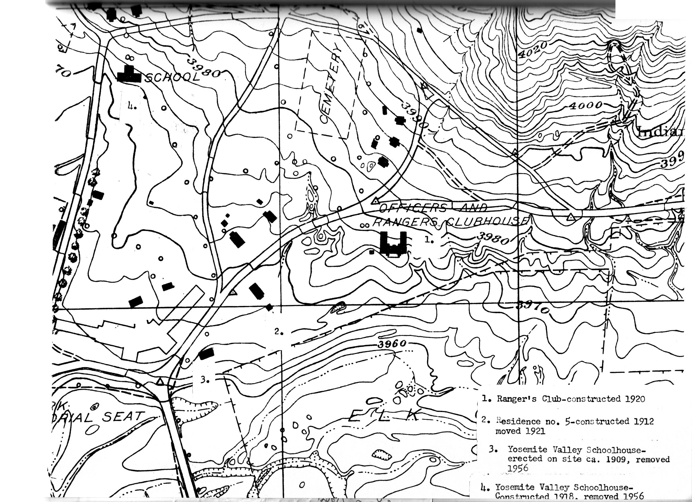
[click to enlarge] |
|
Illustration 59.
Crane Flat ranger patrol cabin, now at Pioneer Yosemite History Center, Wawona. Photo by Robert C. Pavlik, 1984. |
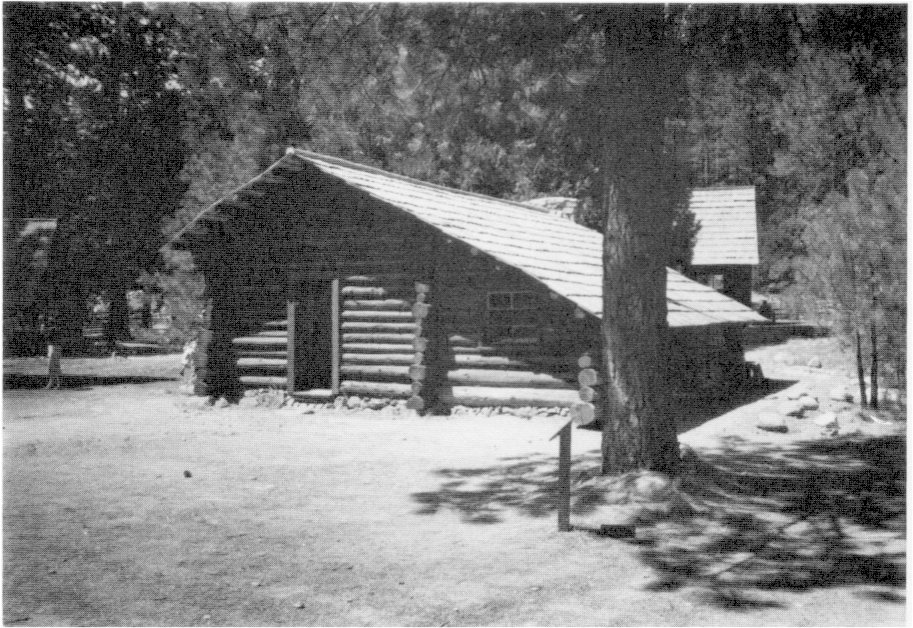
[click to enlarge] |
[35. Foley, Foley’s Yosemite Souvenir and Guide, 1907, 65-66.]
b) Powerhouse
In 1909 work began on fixing up the valley power plant, which needed to be replaced by one with a greater capacity. The iron pipe furnishing water to the plant ran through a tunnel of loose earth and stone, which had begun to cave in. During the 1910 season, a large appropriation enabled opening of a new trench for the pipe around the old tunnel. In 1911 laborers installed a new Pelton wheel in the power plant and a power-transmission system from Camp Ahwahnee to the rock quarry near Pohono Bridge. That enabled the water tank pumps and the rock crusher to operate during the summer by electric power. The two pumping stations in the valley and the pipeline along the El Portal road, necessary for the operation of the sprinkling wagons along that route, appeared to be operating successfully.36
[36. Forsyth, “Report of the Acting Superintendent of the Yosemite National Park,” in Reports of the Department of the Interior for the Fiscal Year Ended June 30, 1911, 591, 596.]
c) Miscellaneous
In 1910 park crews constructed cottages with barns and stables at Cascade Creek and Arch Rock for the use of road laborers and the drivers of road-sprinkling wagons.37 In 1911 a granite seat, a memorial to Galen Clark, was completed and placed about a quarter of a mile south of the foot of Yosemite Fall. In 1912 workers built rubble masonry wing dams along the Merced River where its banks suffered on heavy erosion.38
[38. Forsyth, “Report of Superintendent of Yosemite National Park,” in Reports of the Department of the Interior for the Fiscal Year Ended June 30, 1912, 670.]
[37. Forsyth, “Report of the Acting Superintendent of the Yosemite National Park,” in Reports of the Department of the Interior for the Fiscal Year Ended June 30, 1910, 467.]
d) Wood-Splitting Plant
During the 1914 season, a wood sawing and splitting plant was installed in Yosemite Valley to cut logs into firewood. Thicket clearing, an important part of work on the valley floor, protected growing trees from fires and destruction by rapid-growing dense undergrowth. The Interior Department sold the wood obtained in this manner to campers, concessioners, and department employees, and also used it in connection with sanitation projects and in public buildings. The plant consisted of a drag-saw, circular saw, wood splitter, and emery wheel, driven by an electric motor.39
[39. Sovulewski, “Report of the Park Supervisor,” and Sherfey, “Report of Resident Engineer,” in Reports of the Department of the Interior for the Fiscal Year Ended June 30, 1914, 732, 735.]
e) Fire Lookouts and Patrol Cabins
In 1915 construction plans included two triangulation stations to be used as fire lookouts. Their locations on Mount Hoffmann and Sentinel Dome would make it possible to locate a fire within the district instantly and ascertain its exact location. (Ruins of the Mount Hoffmann lookout are still visible.) Other important additions to the park during the 1915 season consisted of three new patrol cabins—at Crane Flat, Hog Ranch, and the Merced Grove. The four-room log cabins with shake roofs measured thirty-two feet three inches by twenty-five feet and functioned as outpost checking stations. The checkpoints became necessary after the removal of U. S. Army troops, the entry of autos, and the employment of civilian rangers to protect the park. Tuolumne County’s purchase of the Big Oak Flat Road and the elimination of tolls increased the need for control stations on the park entrance road to regulate traffic, register cars, and collect fees. Each patrol cabin also had a twelve by twenty-foot shed stable of native poles and shakes.
The popularity of camping persisted in Yosemite Valley even after hotels and commercial camps came into existence. Originally there had been no restrictions on where camps could be struck or on site use in Yosemite Valley and horses could be grazed anywhere in the open meadows. The first campgrounds had been established by traditional use, primarily along the Merced River. Later, as stores and other services sprang up at the eastern end of the valley, the state commissioners tried to establish formal public campgrounds near them in order to free the rest of the valley floor for stock grazing and farming.
After the recession of the Yosemite Grant, Park Supervisor Sovulewski immediately became involved in a multitude of park administrative problems related to visitation. For instance, no sanitary or toilet facilities of any type existed in any of the campgrounds below Yosemite Village, so that camping in campgrounds nos. 1 to 5 west of the village was discouraged. Gradually those camps were entirely abandoned. The unfortunate conditions at certain campsites finally forced the superintendent to restrict camping to designated areas in the upper valley by the early 1900s.
After Benson left the park in October 1908 to relieve the commanding officer in Yellowstone National Park, Sovulewski took charge of the park and army property as Custodian. In May 1909 Col. William W. Forsyth took command of the park. He pondered the question of numbering campgrounds in the valley and decided to leave the old numbers and start with new ones to avoid confusing old-time park visitors. The original camps in Yosemite Valley consisted of:
Camp No. 1—EI Capitan Meadow. Early campers needed meadows for pasturing their horses and mules. Abandoned for sanitary reasons soon after 1906.
Camp No. 2—Bridalveil Meadow. Used almost exclusively by army troops when in the valley between 1890 and 1906. Abandoned for sanitary reasons soon after 1906.
Camp No. 3—west of Yosemite Village on the south side of the Merced River in the trees at the west end of the meadow near Galen Clark’s house. Abandoned for sanitary reasons soon after 1906.
Camp No. 4—Leidig Meadow, including portion of present Yosemite Lodge grounds. Retired from public use upon establishment of army headquarters in the valley. Abandoned for sanitary reasons also soon after 1906.
Camp No. 5—east of Yosemite Creek bridge, extending as far as the apple orchard and Hutchings’s cabin, including the area later occupied by the park supervisor’s home. Abandoned for sanitary reasons soon after 1906.
Camp No. 6—very old site. Later used by government and Yosemite Park and Curry Company employees. Located south of present park headquarters on north side of the Merced River.
Camp No. 7—still in original location along Merced River north of Camp Curry. Eventually divided by new road, creating two separate camps. East portion became No. 15.
Camp No. 8—located above Royal Arch Creek and included present Ahwahnee Hotel grounds. Erection of the hotel in 1926 forced its abandonment.
Camp No. 9—old site on Tenaya Creek adjacent to and including Royal Arch Meadow. Known as the “Organization Camp.”
Camp No. 10—near Iron Spring on Tenaya Creek, south of the old Mirror Lake Road. Contained only limited space, and camping was discouraged as demand for space in the area grew. Abandoned with change of road alignment to Mirror Lake in the administration of Superintendent Washington B. Lewis.
Camp No. 11 —originally intended to include the area now occupied by the Curry Company stables and extending eastward, but that area never functioned as a public campground. Number 11 was then assigned to its present site south of Camp 14 on the road to Happy Isles.
Camp No. 12—located across the Merced River from Camp No. 14, near Yosemite Park and Curry Company stables.
Camp No. 13—never existed for reasons of superstition.
Camp No. 14—still in original location, northeast of Camp Curry.
Camp No. 15—one-half of original Camp No. 7.
Camp No. 16—originally open to auto camping, but then reserved for visitors desiring rental equipment and housekeeping facilities. Northwest of Camp Curry on south side of Merced River.
Camp No. 17—known at one time as “Camp Tecoya,” later utilized for permanent residences of employees of Yosemite Park and Curry Company. (Now commonly referred to as Lower Tecoya)
Camp No. 18—later occupied by post office and photographic studios in New Village.
Camp No. 19—formerly a public campground, then used exclusively by government employees. Located about 600 feet southwest of Sentinel Bridge. Beginning in 1912, the gradual segregation of employees and park visitors in campgrounds began.
Camp No. 20—now occupied by the Church Bowl.40
[40. Sovulewski, “The Story of Campgrounds in Yosemite Valley,” 82-84.]
1. The U. S. Army Becomes Involved in Business Concessions
As described in an earlier chapter, enterprising individuals began constructing tourist accommodations and providing visitor services soon after the first party of sightseers entered Yosemite Valley in 1855. Those first crude but usually serviceable cabins and hotels were subsidized by individual enterprise and, after 1864, subject to the whims and caprices of the Board of Yosemite Valley Commissioners. In 1866 the commissioners disallowed private claims upon lands in the valley, and after that time business concessions could only be established in accordance with the regulations of the commissioners and through state contracts. During their administrative period, the Yosemite Valley commissioners had authorized a variety of concessions including hotels; photographic studios; camps; a bakery; grocery stores; curio stores; toll trails; livery, transportation, and blacksmithing services; and saddle horses. They had also entered into agreements with toll road builders and stage route operators. After Congress accepted the recession of the Yosemite Grant in 1906, the Department of the Interior assumed responsibility for the smooth and equitable operation of business concessions throughout the valley, grove, and backcountry. In fulfilling that responsibility, the U. S. Army officers who administered the national park became responsible for contracts with business concessioners.41[41. Homer W. Robinson, “The History of Business Concessions in Yosemite National Park,” 14 March 1947, typescript, 9 pages, in Separates File, Yosemite-Concessions, Y-16, Yosemite Research Library and Records Center, 1-3. Also Robinson, “The History of Business Concessions in Yosemite National Park,” Yosemite Nature Notes 27, no. 6 (June 1948): 83-90.]
2. Concession Permits in Operation During That Time
At the time of the recession, a number of leases were in effect for the provision of visitor services for the period 1 November 1905 to 31 October 1906. Lessees included:
Len C. Fish, who ran a bowling alley immediately west of the dance hall;
J. B. Cook, proprietor of the Sentinel Hotel;
B. F. Sears, who ran a studio and transacted business in a portable tent;
Galen Clark, who lived west of Yosemite Village;
David A. Curry, who ran Camp Curry at the foot of Glacier Point and also utilized about thirty acres of land around the Lamon orchard;
J. B. Cook, proprietor of Camp Yosemite at the foot of Yosemite Fall. In 1909 the federal government, having decided to officially name the military post in the valley “Camp Yosemite,” requested that Cook change the name of his camp to avoid confusion. It then became “Camp Lost Arrow”;
Yosemite Stage and Turnpike Company, which operated stables and transacted station business in the valley;
Coffman & Kenney, operating stables at Kenneyville and providing saddle and transportation services around the valley. The Kenneyville complex stood on the road connecting Camp Curry with the north valley road. By 1913 an extensive group of stables, corrals, livery, shops, and residences lined the road. Coffman and Kenney also operated the valley blacksmith shop.
J. T. Boysen, operator of a studio and general photographic business;
Nelson L. Salter, who occupied two buildings and ran a grocery store and general merchandise business and a laundry and who rented tents and outfitted campers. (William D. Thornton later took over the ); business);
Yosemite Transportation Company, which operated stables and ran a stage line to and from the valley;
J. B. Cook, operator of the Glacier Point Hotel;
Hallett-Taylor Company, which occupied the Studio of the Three Arrows, conducting a general photographic business. (About 1907 Hallett-Taylor sold the business to the Pillsbury Picture Company of Oakland);
B. M. Leitch, who occupied a cabin at the Mariposa Big Tree Grove and sold curios, photographs, etc.;
Mrs. John Degnan, who sold bread;
John Degnan, who occupied a house in the village;
Charles B. Atkinson, who lived in Sinnings’s cottage;
D. J. Foley, who operated the Yosemite Tourist Printing Office and Studio and ran a general photographic business;
Chris Jorgensen, who occupied the Jorgensen Studio and grounds between the road crossing Sentinel Bridge and the road running toward Kenneyville and the river;
George Fiske, photographer, who occupied the former Sierra Cottage;
Mrs. Elizabeth Glynn, who occupied a residence in the village;
D. S. Tyer, who did curio work;
Ben W. Sears, who ran a studio;
R. B. Dexter, who occupied the former Julius Starke Studio (since 1903) immediately west of the Studio of the Three Arrows and sold artistic woodwork and curios; and
H. C. Best, who occupied a studio immediately east of the Guardian’s cottage and sold photographs and paintings.42
[42. “Leases in Yosemite Valley Now in Effect, the Names of the Lessees, For What Purpose Issued and the Premises Leased, Date of Expiration and Amount of Yearly Rental,” no date (1905), in Letters Received by the Office of the Secretary of the Interior Relating to National Parks, 1872-1907 (Yosemite), RG 79, NA.]
|
Illustration 60.
Plat of land leased to J. B. Cook, Chris Jorgensen, and Coffman and Kenney, plus locations of Camp Yosemite and Camp Curry. H. C. Benson to Secretary of the Interior, 22 October 1906, Letters Received by the Office of the Secretary of the Interior Relating to National Parks, 1872-1907 (Yosemite), RG 79, NA. |
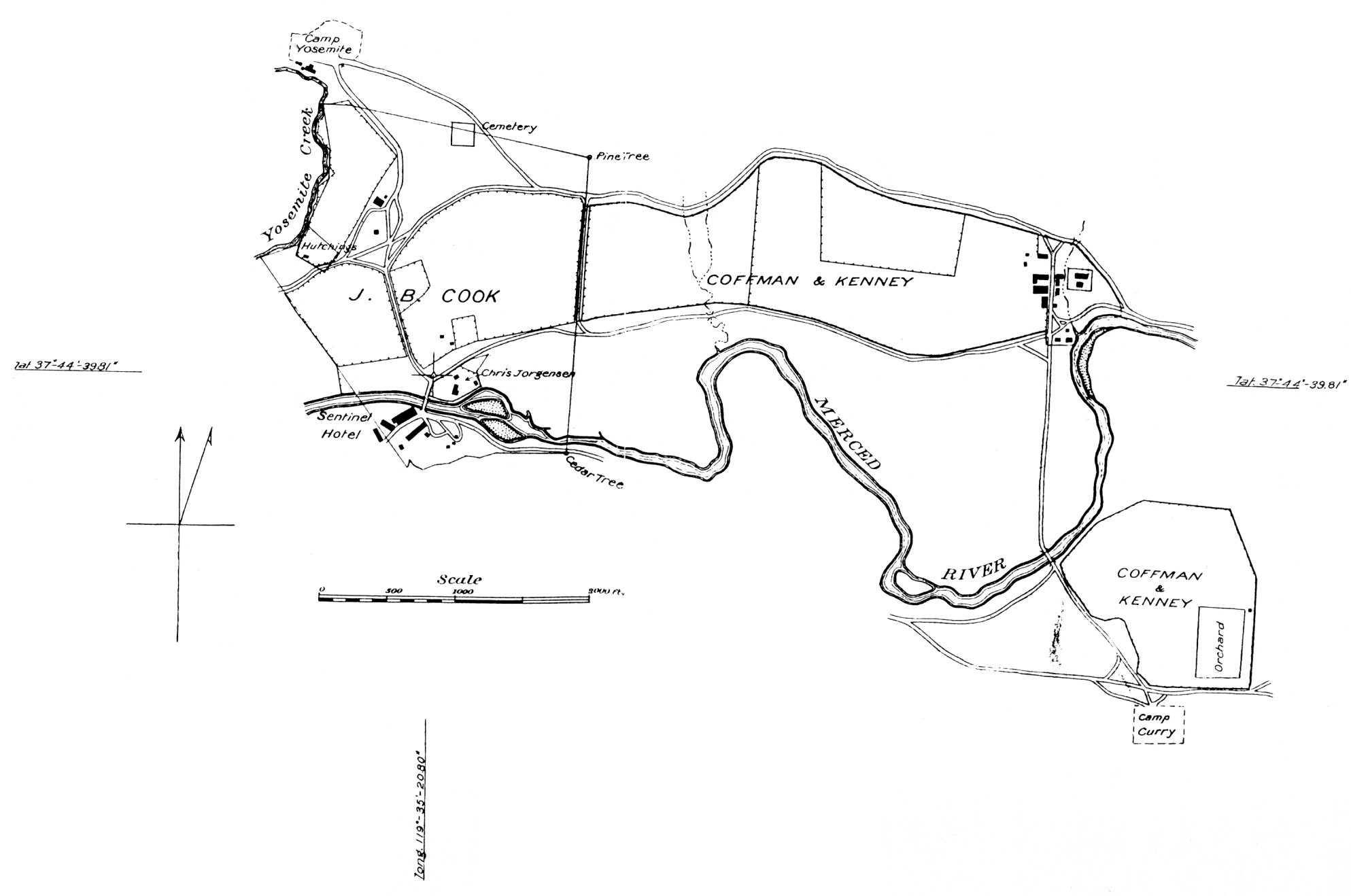
[click to enlarge] |
In early October 1906 Benson reported that the barroom adjunct to the Sentinel Hotel (Ivy Cottage) had been closed in accordance with the Secretary of the Interior’s instructions. It occupied one-third of a nice building just east of the post office and between it and the hotel. The other portion of the building served as a billiard room and barber shop and included a sleeping room for the barber.43
[43. H. C. Benson to Secretary of the Interior, 9 October 1906, in Letters Received by the Office of the Secretary of the Interior Relating to National Parks, 1872-1907 (Yosemite), RG 79, NA.]
When sending a plat of the land leased to J. B. Cook, Chris Jorgensen, and Coffman & Kenney, together with the locations of Camps Yosemite and Curry, to the Secretary of the Interior (see Illustration 59), Benson noted that Camp Yosemite lay outside the land leased by Cook as did the Cosmopolitan, then occupied by a post office and express office, the rear of which contained sixteen bedrooms. That building, the former Guardian’s office, had been used by the hotel since 1900, when it was turned over to them after a new Guardian’s office was built in 1899.44
[44. H. C. Benson to Secretary of the Interior, 22 October 1906, in Letters Received by the Office of the Secretary of the Interior Relating to National Parks, 1872-1907 (Yosemite), RG 79, NA.]
Shortly after the federal government took control of Yosemite Valley and the Mariposa Grove, it instructed the acting superintendent to advise all holders of yearly concessions that renewals would be granted for the 1907 season under the same conditions as before, although the rates might be changed in some instances to make them more uniform for like privileges. Permits were accordingly granted for the next year to Best, Boysen, Clark, Coffman & Kenney, Cook, Curry, the Degnans, Fiske, Foley, the Hallett-Taylor Company, Leitch, and Salter. The Yosemite Stage and Turnpike Company and the Yosemite Transportation Company also renewed their permits.45
[45. Report on Yosemite National Park, in “National Parks and Reservations,” in Annual Reorts of the Department of the Interior for the Fiscal Year Ended June 30, 1906, 200-202.]
Major Benson was not at all pleased with the concession situation when he entered duty in the park in 1906. He noted then that concession privileges up to that time had depended on whether the applicant had influential friends on the state board of commissioners. The unequal amounts paid for similar privileges by different people showed that favoritism had influenced the granting of privileges. Benson stated frankly to the Secretary of the Interior that “The place has, during the last few years, come to resemble Coney Island. In my opinion most of these concessions are totally unnecessary and should not be renewed.”46
[46. H. C. Benson, Acting Superintendent, Yosemite National Park, to Secretary of the Interior, 6 August 1906, in Letters Received by the Office of the Secretary of the Interior Relating to National Parks, 1872-1907 (Yosemite), RG 79, NA, 1.]
Benson recommended that only the leases for the following persons or companies be continued:
Coffman & Kenney blacksmith shop, which provided an essential service shoeing the hundreds of horses entering each summer and repairing wagons and autos;
John Degnan, a laborer in the valley and a twenty-year resident;
Yosemite Transportation Company and Yosemite Stage and Turnpike Company, which provided regular stage service from railroad terminals to the valley;
B. M. Leitch, a justice of the peace and the only person residing in the Mariposa Grove, where he answered tourist questions. His presence there added greatly to the grove’s security;
Galen Clark, a gentleman more than eighty years of age, whose concession allowed him to live in a small house in the valley;
George Fiske, whom Benson considered the most desirable of the photographers with franchises. He had lived in the valley for more than thirty years and was one of its few permanent residents; and
Camps Yosemite and Curry, whose franchises Benson recommended be continued for the next season, although he thought the camps should be removed as soon as sufficient accommodations could be provided in more permanent buildings.47
[47. Ibid., 1-4.]
By late summer 1906, Benson decried the fact that cheap buildings filled the valley, their occupants considering themselves tenants of the government and expecting large federal outlays on their buildings and surroundings. The longer the government allowed many of those people to stay, Benson warned, the harder it would eventually be to get rid of them. Benson cited several examples of flimsy construction work in the valley;
Best’s Studio—A one-story building measuring fifteen by forty-eight feet, Best’s Studio stood twenty feet east of the superintendent’s office. Constructed of undressed lumber and covered with roofing paper, the building’s exterior had been painted to simulate stone;
Boysen’s Studio—A sixteen by thirty-four-foot building of undressed lumber with battens, the studio included an addition of the same material measuring thirty-four by twenty-six feet. It stood eighty-five feet west of the superintendent’s office, between Foley’s Studio and Salter’s store;
Galen Clark’s residence—This one-story building of undressed lumber with battens, measuring ten by thirty feet, had been built forty years earlier. It stood on South Road, one mile west of the superintendent’s office;
John Degnan residence—This two-story frame cottage with porch, constructed of lumber with battens, was painted white. The main structure measured thirty-two by thirty feet, a wing measured sixteen by twelve feet, and a one-story addition in the rear, eight by thirty feet;
R. B. Dexter—Dexter occupied the former Starke Studio, a one-story shake building measuring fifteen by sixty feet;
D. J. Foley—Foley conducted business at the Yosemite Tourist printing office and studio, a shake building measuring twenty-four by eighteen feet. A front room measured twelve by twenty feet. It stood twenty-five feet west of the superintendent’s office;
Hallett-Taylor Company—This company operated out of the Studio of the Three Arrows, a one-story, painted-board building measuring forty by twenty feet. It stood opposite Salter’s store;
N. L. Salter—Salter leased a two-story building, twenty-five by forty feet, with a one-story addition in the rear measuring twenty-five by fifteen feet. The lower story was built of surfaced lumber and the second story of shakes. It stood twenty-four feet west of Boysen’s Studio on the north side of the main street at its west end; and
George Fiske—Fiske’s shake residence measuring twenty by forty feet, had a separate studio of the same size and material and several outbuildings. The structures stood about 200 yards west of Galen Clark’s residence.48
[48. H. C. Benson to Secretary of the Interior, 18 August 1906, in Letters Received by the Office of the Secretary of the Interior Relating to National Parks, 1872-1907 (Yosemite), RG 79, NA, 1-2, and H. C. Benson to Secretary of the Interior, 28 September 1906, in Letters Received by the Office of the Secretary of the Interior Relating to National Parks, 1872-1907 (Yosemite), RG 79, NA, 1-2.]
3. Camp Curry Continues to Grow
Word of the David Currys’ new enterprise had spread quickly among their friends and professional acquaintances over the past few years, and the arrival of the Yosemite Valley Railroad at El Portal in 1907 provided just the impetus Camp Curry needed to grow and thrive. In addition to increasing travel to the park, the railroad facilitated bringing in supplies and making improvements to the physical structure of the camp.
After the recession of Yosemite Valley in 1906, Curry continued to- be granted yearly permits for his operation. Camp Curry, which could accommodate more guests than either the Sentinel or Glacier Point hotels, was also far more popular, quickly becoming the dominant housing unit in the park. Even after the establishment of Camps Lost Arrow and Ahwahnee, Camp Curry maintained its popular appeal. In 1907, and every succeeding year, Curry applied for a long-term franchise, but the Department of the Interior did not grant a five-year lease until 1917, the year Curry died. During those intervening years, however, the department granted his applications for additional privileges, so that by 1915 Camp Curry provided many services in addition to housing and food that had been unavailable in 1906. They included a laundry; a store selling bread and pastry to the public; a fruit stand; a cigar, candy, and news stand; a bathhouse and swimming tank; and a barber shop.
In 1911 the Department of the Interior authorized the Curry Camping Company to provide accommodations for 100 people in addition to the 400 previously authorized. More than 3,500 guests showed up that year. On 18 October 1911, Curry officially incorporated the “Curry Camping Co.,” with all stock owned by the Curry family. On 18 July 1912, fire partially destroyed the camp, originating in the laundry adjoining the dining room where several hundred guests were enjoying lunch. Pines that caught fire spread blazing needles among the camp tents, destroying about seventy of them along with personal effects. The guests aided in fighting the fire until a troop of cavalry arrived and took charge. Although the office, dining room, and most of the tents were saved, the loss amounted to about $20,000.49 Although the Currys had no insurance, they determined to rebuild.
[49. “Camp Curry Burned in Yosemite Valley,” Riverside (Calif.) Daily Press, 19 July 1912. The loss included the laundry building, the ice and meat house, damage to the bakery and storeroom, plus the destruction of linens, meats, lumber and shakes, tents, tent equipment, and tent platforms. Robinson, “History of Business Concessions,” “Curry Camping Company,” 1.]
At the end of October 1912, buildings at Camp Curry consisted of an office, twenty-four by thirty feet; a dining room and kitchen, forty by eighty feet; a bakery with bake oven, thirty-eight by forty-three feet; and the old bathhouse. In 1913 the department approved plans for the construction of an auditorium, eighty-six by sixty-four feet, and a new bathhouse. The company completed a new sewer system and swimming pool in July of that year, the latter located adjacent to the dining room and measuring ninety feet nine inches long by forty feet wide by eight feet deep. The new pool featured a cobblestone railing, a diving platform, and a cobblestone bathhouse. The bathhouse, rail, and platform no longer exist. That year more than 4,000 visitors utilized the 254 guest tents. Forty-six other tents housed employees. In 1914 the Park Service ended one of Camp Curry’s best-loved traditions by banning the Glacier Point firefall due ostensibly to its artificiality and the publicity surrounding it, which did not seem harmonious with national park interests. It was also due in large part to the friction that had developed between the Department of the Interior and David Curry over concession control. Foster Curry built the original rustic Camp Curry “Welcome” sign that same year. By 1915 the camp had a visitor capacity of 800 to 900 people, with a total guest count of more than eight thousand.50
[50. Robinson, “History of Business Concessions,” “Curry Camping Company,” 1-2.]
4. The Camp Idea Expands to Other Areas
The success of Camp Curry spurred competition. In 1901 Camp Yosemite, operated by J. B Cook near the foot of Yosemite Fall, began service. Located on a sandy slope in a grove of black oaks, on the former site of the Hutchings sawmill, the operation continued until 1915. Renamed Camp Lost Arrow in 1909, it contained a few office buildings, a dining room and kitchen, and bathhouses and lavatories. Its tents, accommodating 250 guests, had board floors covered with canvas and contained three-quarter or double beds, washstands, mirrors, and chairs.
Camp Ahwahnee, owned by W. M. Sell, at the foot of Four-Mile Trail facing Yosemite Fall, opened on 1 May 1908 and continued operations until about 1917. The first camp reached by the stage entering the valley from El Portal, it boasted modern conveniences such as bathrooms with hot and cold water. The dining room, a large, airy, frame building, offered superb views of nearby scenery.51
[51. “Different Routes Lead to Valley,” San Francisco (Calif.) Chronicle, 25 June 1916.]
5. The Washburn Interests
In mid-May 1908 E. P. Washburn called Major Benson’s attention to the need for a shed near the stable in Yosemite Valley to protect the Yosemite Stage and Turnpike Company’s vehicles that had to remain in the valley overnight. He suggested that a structure measuring forty-eight by twenty-four feet would be adequate. Evidently Washburn hoped the government would erect the building, but the Secretary of the Interior responded that the department had no objection to the stage company’s erection of the shed at its own expense, on a site selected by the superintendent, provided that it became government property upon completion.52
[52. E. P. Washburn to Major H. C. Benson, 14 May 1908, and Washburn to Benson, 18 May 1908, in Box 24, Misc. Correspondence, Washburn/ Wawona, “Misc. Corr. 1908”; and Benson to Washburn, 24 June 1908, in Box 3, Washburn Papers, “File of Misc. Army Correspondence,” in Yosemite Research Library and Records Center.]
By the end of May 1908, E. P. Washburn had nearly completed installation of an electric light plant, powered by a water-driven pelton wheel, that would furnish light for the Wawona Hotel, cottages, and outbuildings. A month later the plant was working to everyone’s satisfaction.53
[53. Unsigned letter to J. B. Davis & Son, 30 May 1908, in Box 24, Misc. Correspondence, Washburn/Wawona, “Misc. Corr. 1908,” in Yosemite Research Library and Records Center; unsigned letter to A. Everett Ball, 29 June 1908, in Box 24, Misc. Correspondence, Washburn/Wawona, “Misc. Corr. 1908,” in Yosemite Research Library and Records Center.]
In replying to questions about his properties in 1910, Washburn described the buildings then located at Eight-Mile, Eleven-Mile and Chinquapin stations and at Grouse Creek and Glacier Point. He stated that the Yosemite Stage and Turnpike Company owned eighty acres of patented land and the buildings thereon at Eight-Mile Station and sixty acres of land and its buildings at Chinquapin Station. The former consisted of a house and a barn, while at the latter stood two barns, a shed, and a residence. The stage company also used the buildings on patented land at Eleven-Mile Station belonging to the Wawona Hotel Company. They included one barn and a small employee’s house. Structures at Grouse Creek and at Glacier Point stood on government land. The former consisted of a large barn and a dwelling, while the latter site held only a barn.54
[54. Unsigned (E. P. Washburn?) to Thomas Turner, 22 April 1910, and unsigned (E. P. Washburn?) to Major Wm. W. Forsyth, 17 May 1910, in Box 24, Misc. Records and Correspondence, Wawona/Washburn, Yosemite Research Library and Records Center.]
In 1911 the Yosemite Stage and Turnpike Company leased its staging business from Yosemite Valley to Glacier Point, Wawona, and the Mariposa Grove to Frank G. Drum and the Yosemite Transportation Company. The deal included 175 horses, twelve eleven-passenger stages, twelve eight-passenger stages, two five-passenger stages, and
|
Illustration 61.
Map of Wawona Hotel and points of interest in vicinity, ca. 1909-1912. From Washburn Papers, Yosemite Research Library and Records Center. |
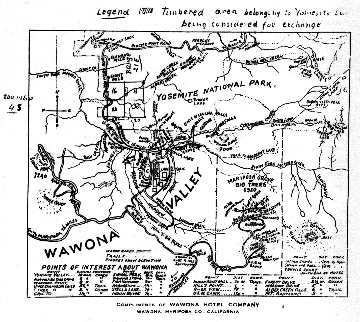
[click to enlarge] |
By 1912 Superintendent William Forsyth wanted to move the barns and stables, the coach shed, and the cottage in the valley belonging to the Yosemite Stage and Turnpike Company to a less objectionable location. At the time they stood only a few hundred yards from the village on one side and Camp Lost Arrow on the other, within 200 yards of the schoolhouse and the cottages of the supervisor and electricians, and within 100 yards of the storehouses and workshops of the department. Their location in the center of the populated part of the valley, and the fact that their unsanitary premises attracted bothersome flies, prompted Forsyth to select another site for them near the barns and stables of the Yosemite Transportation Company at the upper end of the valley. In November 1912 Forsyth ordered the stage company to move by 1 May 1913.
In that latter year Frank Drum decided not to operate the valley stage line again, and so the Yosemite Stage and Turnpike Company reapplied for a permit.55 Drum, meanwhile, in accordance with government regulations, estimated the revenues and expenses of the stage company during his lease period ending 31 October 1912. He included a list of the property he had used during that time, which adds further information on the size of the buildings described by Washburn in 1910:
[55. Notes on “Stage Companies,” in Separates File; Wm. W. Forsyth to Secretary of the Interior, 25 October 1912, and Forsyth to Yosemite Stage & Turnpike Co., 11 November 1912, in Box 63, Yosemite Stage & Turnpike Co., Yosemite Research Library and Records Center.]
Yosemite Valley-horse shed, 16’ x 32’
house, 24’ x 48’ [these figures appear to be
reversed]
Grouse Creek—barn, 46’ x 48’
house, 14’ x 32’
Chinquapin — barns, 42’ x 40’ and 32’ x 40’
horse shed, 16’ x 40’
house, 16’ x 32’
Glacier Point—barn, 38’ x 32’
Eleven Mile—barn, 24’ x 42’
house, 16’ x 24’
Eight Mile—barn, 40’ x 42’
house, 16’ x 32’
Four Mile—barn, 40’ x 42’
house, 16’ x 32’
Wawona—barns, 58’ x 96’ and 32’ x 80’
granary, 16’ x 32’
harness shop, 16’ x 68’
wagon shed, 26’ x 126’
blacksmith shop, 24’ \J8l
paint shop, 24’ x 80’56
[56. A. S. Mann, Secretary, Yosemite Stage and Turnpike Company, to Colonel W. W. Forsyth, 1 March 1913, in Box 63, Yosemite Stage & Turnpike Company, Yosemite Research Library and Records Center. In 1909 the Secretary of the Interior, after inspecting Yellowstone and Yosemite national parks, became convinced that the government needed to adopt a more advanced policy in regard to park maintenance, improvements, and operations. He believed that the transportation lines, hotels, and other concessions in those parks could no longer be considered experimental because of the steady stream of visitors that frequented them and the large profits they realized. The secretary decided, therefore, that a reasonable share of those profits should be devoted to park maintenance. He subsequently imposed on all concessioners a franchise or use tax based on gross earnings for the enlargement of the maintenance fund. He also instituted a system of accounting and inspection for the government’s protection. Drum probably submitted this report in accordance with the new directives. Excerpt from Report of the Secretary of the Interior, 1909, under “National Parks and Reservations,” in Notes and Correspondence, Sierra Club Bulletin 7, no. 3 (January 1910): 197.]
6. The Yosemite Transportation Company
From 1908 on, after completion of the wagon road from El Portal to Yosemite Valley, the Yosemite Transportation Company, later a subsidiary of the Yosemite Valley Railroad, ran horse and auto stages from the terminus of the railroad at El Portal to the various camps and hotels in Yosemite Valley. As mentioned earlier, by 1912 the company had leased the Yosemite Stage and Turnpike Company’s routes within the park. The D. J. Desmond Company purchased the Yosemite Transportation Company on 1 September 1916.57
[57. Notes on “Stage Companies,” in Separates File, Yosemite Research Library and Records Center.]
7. The Yosemite Valley Railroad Company
In 1909 the Department of the Interior granted the Yosemite Valley Railroad Company permission to erect a building in Yosemite Valley, to be known as the “Transportation Building.” The railroad company intended to rent space to representatives of all valley transportation operations. Additional groups to be housed in the building included the telephone company, Wells Fargo, and possibly representatives of the Santa Fe and Southern Pacific railroads. The company planned a log building, about twenty by thirty feet, similar to their depot at El Portal. The building would provide a central place for the obtainment of transportation information. 58 It also functioned as a horse and motor stage terminal for visitors arriving from the El Portal railroad depot.
[58. O. W. Lehmer, Supt. and Traffic Mngr., Yosemite Valley Railroad Co., to E. P. Washburn, 22 December 1909, in Box 69, Wawona/Washburn Correspondence, Yosemite Research Library and Records Center.]
A year later, in 1910, Acting Superintendent Forsyth reported that the Yosemite Transportation Company had built an attractive office building in Yosemite Village, nearly opposite the superintendent’s office. The twenty-four-foot square structure’s exterior consisted of pine poles and cedar bark. The Pacific Telephone and Telegraph Company occupied part of the building.59 Because it served as a telegraph and express office, the name “Wells Fargo” became associated with it. The building, now in the Pioneer Yosemite History Center, is an exceptional example of the rustic style of architecture as first developed in the Yosemite region before creation of the National Park Service. Its builders used cedar bark strips in decorative patterns as exterior sheathing material on the wood frame. It was similar in construction to the Yosemite Valley Railroad depot at El Portal, no longer extant; the Curry and Tresidder cabins and the original Curry Company registration office at Camp Curry; and to the Pohono Studio in the New Village.
[59. Forsyth, “Report of the Acting Superintendent,” in Reports of the Department of the Interior for the Fiscal Year Ended June 30, 1910, 467.]
8. The Shaffer and Lounsbury Garage
In 1913 Richard Shaffer and E. Lounsbury opened the first automobile garage in Yosemite National Park, opposite the army headquarters. Needing more room, they erected a canvas garage in 1914 on a site near the front of the present Yosemite Museum. The garage utilized a drill press, emery wheel, lathe, air compressor, and other equipment that operated off a long shaft powered by a gasoline engine. It had also a complete blacksmith shop and a variety of bench tools. The prosperous business employed eight or nine mechanics. The garage operated on a yearly basis, under a government lease, from 1913 to 1915. The garage closed in 1916, when the Desmond Company took over most of the park concessions. In 1918 Shaffer and his brother Harold opened another garage in the old army stables, which operated for only about one year until the Yosemite National Park Company took it over.60
[60. “The First Garage in Yosemite,” data supplied by Dick Shaffer in interview with C. P. Russell, 22 April 1951, in Separates File, Yosemite-Concessions, Y-16, Yosemite Research Library and Records Center.]
9. The Desmond Park Service Company
Stephen Mather began to worry by early 1915 that the park would be completely incapable of handling the increased tourist trade as a result of the California expositions of that year. To remedy the situation, he persuaded California busnessmen in San Francisco and Los Angeles to put up capital resulting in formation of the D. J. Desmond Company. In 1915 the Department of the Interior granted the D. J. Desmond Company a one-year lease to operate a hotel and camp, under the name of Camp Yosemite, and to operate an auto sightseeing service on the floor of the valley. The permit stipulated that if the season’s operation were successful and satisfactory to the Department of the Interior, it would grant Desmond a twenty-year contract. The permit allowed him to occupy 4-1/2 acres that held two large remodeled barracks buildings with attached cottages, two bath and lavatory buildings, and 156 canvas bungalows.
Dick Shaffer, an early partner in the enterprise, recalled that the Desmond Company had first held meetings in the San Joaquin Valley to interest people in its concession project for Yosemite and to sell stock. Joe Desmond, whose name was used for the company, had been a caterer in Los Angeles. When the Owens Valley Aqueduct project got underway, Desmond managed the construction messhalls. He gained much publicity through that job and became well known. A. B. C. Dohrmann and Larry Harris, who were pushing the Yosemite concession project, subsequently decided to bring him in on their plans.61
[61. “Some Historical Facts Regarding the Desmond Company,” C. P. Russell interview with Dick Shaffer, 2 July 1951, in Separates File, Yosemite-Concessions, Y-16c, Yosemite Research Library and Records Center.]
The Interior Department ultimately adopted the policy of preferential contracts favored by Stephen Mather because of the large investments required to provide the quality and extent of services and facilities needed for the ever-increasing tourist trade. That type of contract reduced investment risks and thereby gave concessioners some financial protection. This policy of having one strongly favored public utility operator in each park also enabled the government to more easily control and supervise their activities so that tourists would not be constantly subjected to competitive selling efforts by rival concessioners. By giving the Desmond Company this one-year lease, the Interior Department hoped that it would prove responsible and efficient and eventually absorb all other concession operations.62
[62. Charles Nordhoff, as early as 1873, remarked in regard to the better management of Yosemite Valley that the state of California should ask Frederick Olmsted to draw up a plan for the improvement and management of the valley,
and then offer to any responsible company a lease for twenty, or even fifty years, of the whole Valley, subject to such conditions as might be prescribed in the law or agreement to be drawn up by Mr. Olmsted. . . . a corporation with a lease of twenty or thirty years could very well afford to put up large and commodious hotels, and spend a hundred or even two hundred thousand dollars in beautifying this “National Park;” because their profit would be certain, and the sale of their improvements to a successor, at the end of the lease, sure. The value of their improvements would be permanent and constantly increasing. It would be only necessary for the State to guard sufficiently their character.
Nordhoff, California, 78.]
1. Timberlands
a) Lumber Interests Eye Park Timber Stands
Interior Department policy concerning the acquisition of private patented lands within national park boundaries remained nebulous. The first Congressional purchase of patented holdings, in Sequoia National Park, did not occur until 1916. Regarding Yosemite, specifically, as mentioned in the previous chapter, Congress believed that the private timberlands remaining in the park after the 1905 boundary change lay too high in altitude and too remote from industry to ever become a menace to the park’s integrity. Early in the present century, however, the prospective timber values of forested areas rapidly gained importance. By 1907 the patented timber claims in Yosemite were becoming an increasing source of controversy.
Acting Superintendent Benson pointed out in that year that some of the finest sugar pine timber in California lay within the park along the line of the Wawona Road from Wawona to Chinquapin Station. Michigan lumbermen had already inspected it and obtained an option on its purchase. The large tract of timber excluded by the 7 February 1905 act had already been bought and a railroad constructed into the stand. The Sugar Pine Lumber Company, formerly operating forty miles south of the park, had by then completed a steam-powered, narrow-gauge logging road to within two miles of the former southern park boundary and was rapidly denuding the mountains. By 1907 the Yosemite Valley Railroad was within a’ mile of the western park boundary, threatening future logging activity in private timber stands within the park. Clearly something had to be done to protect the park’s principal scenic features and the viewsheds along its main highways. Benson again urged the immediate purchase of patented lands in the park before logging began, noting that one of the primary purposes of the recommendations of the congressional commission of 1904 had been to reduce the number of private claims in the park to an extent that would justify the government purchasing the remaining ones.63
[63. Benson, “Report of the Acting Superintendent of the Yosemite National Park,” in Reports of the Department of the Interior for the Fiscal Year Ended June 30, 1907, 559. Benson reported that the timberlands transferred to the forest reserve by the 7 February act had been sold to the Sierra Railroad, which constructed its line from Chinese Camp to Hodgdons to carry out the timber cut by the West Side Lumber Company. H. C. Benson to Secretary of the Interior, 5 June 1906, in Letters Received by the Office of the Secretary of the Interior Relating to National Parks, 1872-1907 (Yosemite), RG 79, NA, 1.]
Major Forsyth, in 1912, repeated the urgent recommendations of previous years that the government extinguish titles to all patented lands in the park. By that time the Yosemite Lumber Company had built its logging railroad from El Portal to the park boundary near Chinquapin and was cutting timber and shipping the logs to its Merced Falls sawmill. The company had already surveyed a route to continue the railroad through the park to Alder Creek where it claimed an additional 6,000 acres of timberlands. Forsyth warned that the clear-cutting in the vicinity of Chinquapin would spread to all patented timberlands in the park in the near future unless the government purchased them.
b) Congress Authorizes Land Exchanges
On 9 April 1912, Congress passed Public Act No. 117, S. 5718: An Act to authorize the Secretary of the Interior to secure for the United States title to patented lands in the Yosemite National Park, and for other purposes. This act had been designed to facilitate the acquisition of patented forest lands in Yosemite by offering in exchange equal values in decayed or matured timber that could be removed from the park without affecting its scenic beauty. It also authorized acquisition of private forests near public roads by giving in exchange timber of equal value on park lands in less conspicuous parts of the park so that logging activities would not be visible to park visitors.
An act of Congress approved 13 May 1914, designed to preserve scenic features and consolidate certain forest lands belonging to the United States within Sierra National Forest and Yosemite National Park, authorized the Secretary of the Interior to exchange government-owned lands in the national forest for privately owned timberlands of approximately equal area lying within the boundaries of the national forest and the national park. The act also provided that the lands acquired by the government in the Sierra National Forest would become a part of the park. Those timber exchange acts enabled National Park Service Director Stephen Mather to make a number of exchanges of park lands for private lands in Yosemite.64 Between 1915 and 1923, the federal government acquired the privately owned timberlands bordering the Wawona Road for a distance of sixteen miles and also screened portions of the Big Oak Flat Road. In accomplishing this, the government permitted the cutting of timber on 6,000 acres of federal park lands and received in return 6,100 acres of timberlands in fee, 6,100 acres of lands already cut over or on which stood timber reserved for cutting, and 610 acres of standing timber.
[64. Robert Sterling Yard, “The Problem of Yosemite Forests,” National Parks Bulletin 9, no. 55 (May 1928): 1-2; “National Parks,” in Sierra Club Bulletin 9, no. 4 (January 1915): 316.]
c) The Yosemite Lumber Company
One of the reasons for construction of the Yosemite Valley Railroad had been the potential for a profitable timber-hauling revenue generated by the immense stands of sugar pine that grew on each side of the upper Merced River canyon. Many coveted that particular wood for homes, furniture, wood carving, and other uses that required texture and durability. Railroad officers endeavored to persuade logging interests to invest in those forests, an effort culminating in August 1910 in formation of the Yosemite Lumber Company, headed by F. M. Fenwick, a prominent lumber operator on the West Coast. After purchasing 10,000 acres of timber between El Portal and Wawona, the company pondered how best to retrieve the logs that lay in the mountain regions opposite El Portal. The most practical method of tapping its holdings seemed to be by means of an incline railroad. In addition, the company completed a modern mill in 1912 at Merced Falls, a stop on the Yosemite Valley Railroad that also contained drying and storage yards, a planing mill, a finishing plant, and the company town.
The incline rose 8,300 feet in a straight line to a height of 3,100 feet above the Merced River canyon floor with a 78% grade in one section. It branched from the Yosemite Valley Railroad tracks on a Y and crossed the Merced River on a trestle. Construction had almost ended by the summer of 1912. The lumber company also built a logging railroad extending back from the top of the incline on Henness Ridge into the timber stands and eventually to Empire Meadow. The hoist house area at the top of the incline became Camp One, the starting point for the logging railroad. Initial cutting took place at Camp Two, about two miles farther back along the line. As timber was cut, the railroad was pushed farther back and new camps built. Logging usually lasted from April to November, or until the heavy snows hit. The mill operated on a year-round schedule.
Cables and donkey engines hauled the felled timber to the logging railroad where men loaded the logs onto standard-gauge flatcars equipped with a bulkhead in front to keep logs from sliding off while on the incline. Shay (gear-driven) locomotives delivered the loaded cars at the top of the incline where a cable and steam hoist lowered them to El Portal for transport via the Yosemite Valley Railroad to Merced Falls. The special flatcars used ensured that the logs did not have to be transferred enroute from the forests to the mill. The faint trace of this logging incline, which operated from 1912 to 1923, is still visible on the hillside across from the present El Portal store. Its route is now used as a television line right-of-way.
In May 1913 the lumber company reorganized and bought 20,000 acres of timber on the north side of the Merced River, where it also built a logging incline and railroad. By late 1913 the company began logging its holdings in the Sierra National Forest immediately west of the park boundaries and contemplating initiating cutting on its lands inside the park during the 1914 season. Those holdings adjoined or included the Yosemite Valley-Wawona road for a distance of more than twelve miles between Grouse Creek on the north and Alder Creek on the south. The possible clear-cutting of this stretch concerned the Interior Department because that road formed the principal thoroughfare for travel into the park from the south and constituted probably the most scenic drive within the park. The clear-cutting of timber there would severely affect the beauty of the park. Interior Department concerns focused on public viewing of the slash and devastation caused by logging operations; it believed that timber cutting in less visible areas did not materially injure the park.
To prevent the depressing effect that such activity would have on visitors, the Interior Department suggested an exchange of the
|
Illustration 62.
Collapsed trestle at top of north side incline, Yosemite Lumber Company. Photo by Robert C. Pavlik, 1984. |
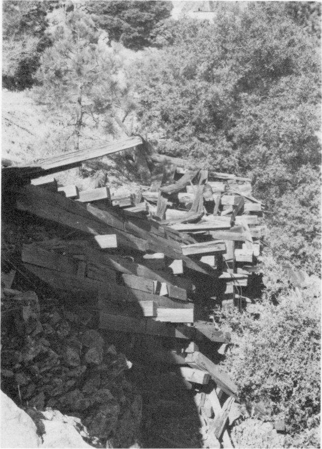
[click to enlarge] |
d) The Madera Sugar Pine Company
The activities of the Madera Sugar Pine Company also concerned the park. Incorporated on 8 May 1899, the company had selected an area south of Fish Camp and about one mile east of the Yosemite stage road for its main mill site and named the lumber camp “Sugar Pine.” The company began operations in 1900 on timber it owned in Madera and Mariposa counties, later purchasing or leasing more tracts as needed. It constantly relocated an extensive system of rail lines to reach new timber areas each season.
By the early 1900s the company had extended logging operations north from the mill into the timber along Big Creek near Wawona. By 1909 E. P. Washburn expressed concern over timberland owned by the company along the road between Wawona and the Big Tree Grove. It comprised a half-mile stretch between Four-Mile Station and the entrance to the grove and extended about one mile west of that point. Because the beauty of the drive from Wawona to the grove depended on the forest through which it passed, the cutting of any part of those woods, Washburn believed, would detract from the interest and pleasure of the experience. Such concerns lasted until the depression of the 1930s ended the company’s operations in 1933.65
[65. Hank Johnston, Thunder in the Mountains (Los Angeles: Trans-Anglo Books, 1968), 29-31, 49, 51, 90; unsigned [E. P. Washburn?] to H. W. Fairbanks, 25 August 1909, Box 24, Misc. Correspondence, Wawona/Washburn, Yosemite Research Library and Records Center.]
2. Private Properties
a) Foresta
Articles of incorporation for the Foresta Land Company were filed at Sacramento, California, in December 1912. A closed corporation with only three stockholders—Milton E. Morris, Charles P. Snell, and Seymour Lee—the company took possession of 200 acres of patented land purchased from the estate of the late James McCauley, who had obtained it long before it became part of the national park. The Foresta tract, on the western park boundary about twelve miles from Yosemite Valley, had been included within the park in 1890. The early homestead grants were originally deeded to Snell, his wife Cora L. Snell, and V. W. Lothrop in 1912, who deeded them to the Foresta Land Company. The name “Foresta” designated the area as a forest tract.
The company staked, numbered, and blocked about 1,200 lots, measuring 50 by 100 feet in size, and sold them at one hundred dollars each as vacation lots for camping during the summer in what hopefully would become a permanent, high-class summer settlement. As mentioned, the group also built a six-mile-long wagon road from El Portal to the subdivision in 1913 after initiating a campaign of high-pressure real estate ads in May 1912. Although the company sold a large number of lots, its promotion scheme eventually failed. Summer assemblies similar to the popular chautauquas of the day, an attempt to attract intellectuals to Foresta, were possibly held during 1914 to 1916 but, if so, were sparsely attended. Little is known of Foresta activities during 1915.
b) McCauley Ranch
Near the community of Foresta, near Crane Creek, and outside the western boundary of Yosemite National Park, on property purchased by the Park Service from Horace Meyer, is a small sawmill plant. It employed a circular saw and a traveling carriage powered by a “stove-top” semi-diesel engine housed in an open wood frame shed cut into the hillside. The shed is open on the north and south ends and on the downhill (west) side. Built about 1913 by Fred and possibly John McCauley after the death of their father in 1911, it functioned initially as a gas engine-powered mill. About 1915, however, the McCauleys purchased a second-hand semi-diesel engine from an El Portal mine. They sold much of their lumber to Camp Curry and in Foresta as well as in El Portal.
c) The Cascades (Gentry Tract)
By 1915 problems with patented lands in Yosemite continued to draw the Secretary of the Interior’s attention. Even the limited success of the Foresta development encouraged other owners of patented lands to contemplate establishing similar tourist operations. Those landowners possessed all the advantages of government administration without paying anything toward park maintenance, as required of concessioners on public land in the park.
C. B. Hollingsworth, who had come into possession of the property about 1914 or 1915, tried to exploit this 150-acre tract on the Big Oak Flat Road. According to government records, he subdivided it into lots and laid out a townsite called “The Cascades” with the intent of establishing a summer resort similar to Foresta. The site lay about one-quarter mile west of the Gentry checking station.66
[66. C. G. Thomson to the Director, 21 October 1930, in Central Files, RG 79, NA. According to Shirley Sargent, Charles Snell had been one of the original purchasers, in 1911, of the land near the Gentry entrance station and had laid out The Cascades townsite. It was mortgaged in 1913, and that is possibly when Hollingsworth acquired it. Sargent, Yosemite’s Rustic Outpost, 13.]
d) Tuolumne Meadows (Soda Springs)
Through the years, the Sierra Club has acquired various properties in the California mountains. They included undeveloped lands as well as lodges or huts, either on their own property or on sites leased from the federal government. The club has received some parcels of land as gifts and has purchased others to protect certain important holdings from exploitation or use as building sites. The lodges serve as recreation centers for members and their guests, as sources of mountaineering information, or as emergency shelters.
In the fall of 1911, J. J. McCauley decided to sell his property at the Soda Springs in Tuolumne Meadows. A large number of Sierra Club members contributed the necessary funds in 1912 to purchase it, to prevent undesirable development there. The club acquired the land in fee simple on 13 June 1912. The club then raised a subscription to erect a small lodge in the meadows, and drew plans in 1913. With the death of Sierra Club director Edward ‘Taylor Parsons after a short illness in 1914, the club decided to dedicate the lodge as a memorial to Parsons. It would commemorate his devoted work in behalf of the Sierra Club and his strong opposition to the Hetch Hetchy Project, as well as his contributions to conservation and the mountaineering work of the club, which Parsons had directed for many years. It was built during the summer of 1915.
A stone building with a single large room with fireplace, it served as a reading room and library and as a gathering place in the evenings in connection with the Sierra Club camp for members and their families established on the surrounding property in the meadows during the summer of 1915. The lodge also served as headquarters for members of the club who visited the meadows. During the summers, a custodian lived in the McCauley cabin adjacent to the lodge. The Lembert cabin and its surrounding fences had by that time been crushed by snow or otherwise deteriorated.
Bernard Maybeck, well-known American architect (1862-1957) who designed the Palace of Fine Arts in San Francisco and several buildings on the University of California campus at Berkeley, designed the lodge, assisted by Mark H. White of the firm of Maybeck and White, San Francisco, California. Maybeck did all the original designs and sketches and White developed them in detail. The structure has functioned through the years as a meeting place, emergency shelter, and information base for visitors to Tuolumne Meadows.
Placed in an alpine setting, Parsons Lodge appeared more relaxed in style than the LeConte Memorial Lodge. It perfectly reflected its natural setting in terms of texture, color, and shape. New building methods resulted in inserting concrete cores in the battered stone walls,
|
Illustration 63.
Parsons Memorial Lodge, Tuolumne Meadows. Photo by Robert C. Pavlik, 1984. |
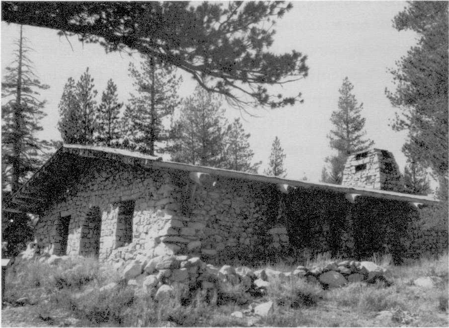
[click to enlarge] |
[67. In 1979 information forwarded to the curator at Yosemite National Park suggested that Bernard Maybeck served as the architect-designer of Parsons Lodge rather than Mark White. The latter served as Maybeck’s assistant. In the firm of Maybeck and White, Maybeck performed all the original design work. White then developed the designs. He did not do any original designs or take any independent commissions during their association from 1902 to 1938. Marilyn M. Fry, “Parsons Memorial Lodge, Tuolumne Meadows, Yosemite National Park,” 1978, typescript, 2 pages and letter, Marilyn M. Fry to Jack Gyer, Curator, Yosemite National Park, 17 July 1979.]
1. Beetle Depredations
As early as 1869, John Muir had seen “ghost forests” north of Soda Springs, which he believed fire had caused. Twenty-five years later, Lieutenant McClure noted a “dead forest” through which the troops marched. In 1903 rangers noted “white flies” on the pine trees, and by 1913 the Department of the Interior realized the need to wage a campaign against beetle depredations in park forests. The control of damage by needle borers and bark beetles continued for the next several years as part of Yosemite’s regular park operations. The Bureau of Entomology of the Department of Agriculture cooperated with the park in protecting the sugar, yellow, and Jeffery pine stands and the lodgepole forests.
Each lodgepole needle-miner caterpillar, which matures into a tiny moth, eats, or hollows out, several pine needles, causing them to yellow and die. Heavy infestation results in a forest of dead trees similar to the ones seen by Muir and others early in Yosemite’s history. Although the Park Service has treated the needle-miner as a pest, some entomologists have believed the insect acts as a control device, keeping pine forests healthy by thinning them out. The mountain pine beetle will frequently attack trees that the needle-miner has already weakened. Beetle epidemics follow patterns, outbreaks having occurred from 1910 to 1922 and 1933 to 1940, causing extensive ghost forests.68
[68. Roth, Pathway in the Sky, 63-64.]
2. White Pine Blister Rust
White pine blister rust, which became one of the most serious fungal diseases of native coniferous forests, arrived in northeastern North America through stock imported from European tree nurseries more than eighty years ago. As early as 1908 imported rust-infected pines were planted on the eastern seaboard. By the time state officials became aware of the presence of the blister rust fungus, it had become solidly established in America and had advanced beyond the point of eradication.
Under favorable conditions and within a short period of time, a few infected pines easily spread the disease by spores to distant ribes plants (currant and gooseberry bushes), which acted as hosts and infected healthy pines near them. Foresters attempted to control blister rust through ribes eradication, thinking that the elimination of wild currant and gooseberry bushes would slow or stop the spread of the rust altogether.
It became apparent, however, that the spread of the blister rust was fast becoming a national problem, one that would require coordinated efforts on the part of the federal government as well as individual states and private individuals. In the fall of 1915 the Interstate Committee for Suppression of the Pine Blister Rust was organized and $50,000 requested from Congress to fight the disease. With that money the committee began a survey to determine the infection’s extent. In 1916 the committee reorganized as the Committee for the Suppression of Pine Blister in North America, and later as the American Plant Pest Committee. 69 This type of mobilization would eventually lead to a blister rust control program within Yosemite National Park and environs.
[69. Ray R. Hirt, “Fifty Years of White Pine Blister Rust in the Northeast,” Journal of Forestry 54, no. 7 (July 1956): 435-38.]
1. The Garfield Permit
The Hetch Hetchy Project, which had lain dormant for the past few years, surfaced again during this period. The issue would become more heated, because by 1908 a few more tourists were visiting Hetch Hetchy Valley, which had become one of the more popular side trips of a visit to the park. Numerous short trips around Hetch Hetchy—to Lake Eleanor, Lake Vernon, Rancheria Mountain, and Tiltill Valley—could be made within a day’s ride from Yosemite Valley. Slightly longer overnight trips could be made to Tilden Lake, Pleasant Valley, and Jack Main Canyon. This new interest in that area meant that the city of San Francisco would encounter more opposition as it pursued its plan to dam Hetch Hetchy Valley.
In 1907 Theodore Roosevelt’s new Secretary of the Interior, James R. Garfield, reopened the question of granting reservoir rights-of-way in the Hetch Hetchy Valley and at Lake Eleanor to the city of San Francisco. The secretary granted a hearing at San Francisco and, after extended conferences and the submission of briefs pro and con, reinstated the Phelan application on 11 May 1908, granting the option the city desired until the matter could be submitted to the voters and definite action taken. That approval, known as the “Garfield Permit,” granted the city rights-of-way for dams, reservoirs, and aqueduct lines. The reinstatement depended upon the filing of certain stipulations that afforded protection to the park lands and to the rights of the Modesto and Turlock irrigation districts relevent to the use of the flow of the Tuolumne River. The stipulations also provided that the -Lake Eleanor site would be developed to its full capacity before development began on the Hetch Hetchy site. The people of San Francisco showed their support for the project by voting a $600,000 bond issue in 1908 for the purchase of privately owned lands and water rights.
In rendering his decision, Secretary Garfield reiterated that the water supply of San Francisco was inadequate and unsatisfactory. He believed that domestic purposes, especially in terms of a municipal water supply, constituted the highest use to which water and storage basins could be put. The next best use of water and water resources, he stated in his decision, was for irrigation. Despite the beauty of Hetch Hetchy Valley, Garfield believed it to be less of a wonder than Yosemite Valley. Furthermore he stated that the valley would not be destroyed by this use, only its character changed. Instead of an “unusable” meadow floor, the valley would contain a beautiful lake.
This partial loss of scenery in the park would result in many advantages to the public: a pure water supply to San Francisco and other Bay areas, water for irrigable land in the Tuolumne and San Joaquin valleys, a cheap and bountiful supply of electric energy, a public highway built by the city reaching into that section of the park, and a patrol for the Hetch Hetchy area, furnished by the city, which, in protecting the water supply, would also guard against forest fires.70
[70. Decision of the Secretary of the Interior, James Rudolph Garfield, re Application for Lake Eleanor and Hetch Hetchy Valley Reservoir Sites, 11 May 1908, in “Notes and Correspondence,” Sierra Club Bulletin 6, no. 5 (June 1908): 321-27.]
2. Antagonism to the Project Continues
Despite the Secretary of the Interior’s views, thousands of mountaineers, nature-lovers, and naturalists remained staunch in their opposition to the water project. In John Muir’s opinion,
This use of the valley, so destructive and foreign to its proper park use, has long been planned and prayed for, and is still being prayed for by the San Francisco board of supervisors, not because water as pure and abundant cannot be got from adjacent sources outside the park,—for it can,—but seemingly only because of the comparative cheapness of the dam required.71
[71. John Muir, “The Hetch-Hetchy Valley,” in Sierra Club Bulletin 6, no. 4 (January 1908): 216-17.]
Muir presented many arguments against the proposal. First, the Hetch Hetchy Valley served as a delightful campground. Because of its position relative to other high country park features, hikers used it as a starting point for excursions into the surrounding mountains and canyons. Submerging the Hetch Hetchy Valley would make it inaccessible as well as the Tuolumne River canyon passageway and the main part of the Tuolumne River valley. Muir argued that rather than being a “common” meadow, the floor of Hetch Hetchy comprised a natural landscape garden worthy of preservation. Contrary to becoming a beautiful mountain lake when filled, it would become a reservoir whose level would periodically fluctuate, exposing ugly mud banks and drifting waste. Muir also questioned the purity of Hetch Hetchy water because of the campground sewage draining into it, especially from Tuolumne Meadows. He concluded his lament for the valley’s future by stating: “Dam Hetch-Hetchy! As well dam for water-tanks the people’s cathedrals and churches, for no holier temple has ever been consecrated by the heart of man.”72 Unfortunately, the city of San Francisco could more easily demonstrate an immediate need for fresh water than the preservationists could the importance of the Hetch Hetchy and Tuolumne canyons to tourists.
[72. Ibid., 220. The Sierra Club, in seeking allies in the Hetch Hetchy Valley, exchanged support with the American Civic Association, which was leading a campaign against harnessing the Niagara River in New York for hydroelectric power. This east-west alliance helped formation of a national preservation movement.]
3. The City of San Francisco Begins Acquiring Land
In connection with preliminary work on the dam at Lake Eleanor, by 1909 the city had surveyed a dam site in Section 3, Township 1 North, Range 19 East, and had begun to clear and explore for foundations for the structure. It had also established a camp site and temporary buildings for laborers. The Department of the Interior approved preliminary canal surveys in February 1909.73
[73. Forsyth, “Report of the Acting Superintendent of the Yosemite National Park,” in Reports of the Department of the Interior for the Fiscal Year Ended June 30, 1909, 426.]
Having acquired a permit to the lands and waters tributary to the Tuolumne River in the northern part of the park, the city of San Francisco began to acquire lands in the Hetch Hetchy Valley. It purchased from private owners 1,100 acres of patented lands within the park and adjacent forest reserves, 600 of which lay on the valley floor. The other Hetch Hetchy Valley lands, about 500 acres, belonged to the federal government. Later a congressional bill provided for the exchange of those 500 acres for an equal number of acres owned by the city outside of the reservoir sites and within the national park and adjacent reserves.
Properties within Yosemite National Park that the city of San Francisco acquired over the years in connection with the dam project included lands at: Hetch Hetchy reservoir, below the ultimate flow line, 571 acres, acquired in 1908 and 1909; Hog Ranch (Mather), 328 acres, acquired in 1909, required for use in connection with the Hetch Hetchy Railroad operation and as a sawmill site (a 1 June 1930 boundary change placed the easterly 80 acres of that tract within the park boundary); Lake Eleanor, below the ultimate flow line, 656 acres, acquired in 1910; Lake Vernon, 121 acres, acquired in 1918; Miguel Meadow, 160 acres, acquired in 1918, which was held by the city as a possible site for a headquarters in connection with future reservoir and aqueduct construction in that area; Poopenaut Valley, 80 acres, acquired in 1918 by condemnation proceedings against the Yosemite Power Company, located almost entirely within the site of a proposed reservoir to be constructed in the future; Mather, the Dudley property, 320 acres, acquired in 1919 and 1920, adjoining the national park boundary as it existed prior to 1930 (the 1 June boundary change placed the easterly 160 acres of that tract within the park)74
[74. M. J. Bartell, “San Francisco Public Utilities Commission, Hetch Hetchy Water Supply, Lands Now and Formerly Owned by City and County of San Francisco in Yosemite National Park and Vicinity,” September 1937, in Box 85, Hetch Hetchy, Yosemite Research Library and Records Center, 1-2.]
4. A New Secretary of the Interior Questions His Predecessor’s Actions
On 4 January 1910, the people of San Francisco authorized the issuance of $45,000,000 in bonds for the construction of the Hetch Hetchy Project. That same year, however, a new Secretary of the Interior under President William Taft, Richard A. Ballinger, entered office, and certain groups of environmentalists started a movement to revoke the portion of the Garfield Permit relating to Hetch Hetchy Valley. Ballinger left office after issuing an order directing the city of San Francisco to show cause against this revocation. Because of the possibility that the city would always be subject to the whims of different Interior Department administrations, city authorities asked Congress for an outright grant of the desired privileges.
President Taft ordered an investigation, and the Secretary of War detailed an advisory board of U. S. Army Engineers to the Secretary of the Interior to exhaustively examine all alternative sources of water for the city’s use. A final hearing on the matter was held before the Secretary of the Interior during 25 to 30 November 1912. On 19 February 1913 the army board submitted its report to the secretary who transmitted it to Congress.
The board’s report to Walter L. Fisher, Ballinger’s successor, recommended the Tuolumne supply as the cheapest and most economical for the city’s use and as affording the greatest hydro-electric development possibilities. It stated the necessity of using Hetch Hetchy Valley as a reservoir site to conserve the full flow of the upper Tuolumne River. Because the board foresaw that sooner or later irrigation needs would demand the use of that valley as a reservoir, it saw no reason to delay its construction until the Lakes Eleanor and Cherry sources had been fully developed. An editorial in the Sierra Club Bulletin protested that the board of army engineers had in fact found several satisfactory water sources, water from any one of which would have been sufficient in quantity and quality for use by the city of San Francisco. Because the determining factor in the selection of Hetch Hetchy Valley had been cost savings,
the passage of the Hetch-Hetchy bill must be regarded as the first act in a movement to break down our national park policy, and to expose the parks to commercial exploitation by municipal politicians and engineers.75
[75. W. F. B., “The Hetch-Hetchy Situation,” in Editorials section, Sierra Club Bulletin 9, no. 3 (January 1914): 174.]
Although it realized that this project could probably not be stopped, the Bulletin added that
The widespread and vigorous expressions of public sentiment in the press and elsewhere in opposition to the unnecessary invasion of the National Parks for commercial and utilitarian projects has been of permanent value in making similar projects more difficult if not impossible in the future, and our National Parks as a whole,, are more secure as a result of the Hetch-Hetchy fight.76
[76. Ibid., 176.]
5. The Raker Act
After taking testimony and examining all reports, Secretary Fisher opined that Congress alone had the power to grant the privileges sought by San Francisco. After much argument in Congress, both houses finally passed the Hetch Hetchy Grant, known as the “Raker Act,” and President Woodrow Wilson signed it into law on 19 December 1913. Wilson stated that he had signed the bill “because it seemed to serve the pressing public needs of the region concerned better than they could be served in any other way and yet did not impair the usefulness or materially detract from the beauty of the public domain.”77 Through the Raker Act, named for California Congressman John Edward Raker, the city’s rights were forever vested in 420,000 acres of the public domain.
[77. President Woodrow Wilson, statement on signing of Hetch Hetchy bill, 19 December 1913, in Box 84, Hetch Hetchy: Gen’l 1910-1916, Yosemite Research Library and Records Center. House bill 7207 granted authority to the city and county of San Francisco to secure water from Yosemite National Park, under certain conditions, and certain rights-of-way through the park.]
The Raker Act granted to San Francisco rights-of-way and the use of public lands for the construction, operation, and maintenance of reservoirs, dams, conduits, and other structures necessary to the development and use of water and power. It also, however, imposed many conditions and obligations upon the city, such as:
constructing scenic roads and trails in Yosemite National Park and donating them to the federal government (described earlier in this chapter);
enforcing sanitary regulations within the watershed;
recognizing prior rights of the Turlock and Modesto irrigation districts to the water;
completing the Hetch Hetchy Dam as rapidly as possible;
developing electric power for municipal and commercial use;
not diverting beyond the San Joaquin Valley any more of the Tuolumne River water than required;
not selling or giving Hetch Hetchy water or power to private persons or corporations for resale;
and paying an annual rent of $15,000, rising to $30,000 after twenty years.78
[78. City and County of San Francisco, San Francisco Water and Power, 10.
Although John E. Raker’s name is forever tied to the controversial Hetch Hetchy bill, it should be noted that this representative in Congress of the 2d California district played a major role in some important and beneficial national park legislation during his career. Judge Raker’s congressional work began in March 1911, at which time he began taking an interest in national park affairs. Particularly interested in the sequoias and coast redwoods, he introduced the first bill in Congress to establish Redwood National Park and secured the final enactment of a bill designed to save the Calaveras Grove of Big Trees.
The lack of a directing force in national park administration bothered him a great deal, as did the lack of proper machinery in Washington to care for park interests. When President Taft finally urged Congress to establish a bureau to administer the national parks, Raker early in 1912 introduced H. R. 22,995, “A Bill to Establish the National Park Service, and for other Purposes.” The bill did not pass, largely because of disagreement on the appropriation features of the measure.
In April 1913 Raker again introduced his Park Service bill, H. R. 104. It also failed because of the matter of expenses. Meantime, the Raker Act passed. He had introduced it because Yosemite National Park lay in his district, but he did attempt to insert some provisions to protect the park landscape. Soon after Stephen Mather became Assistant to the Secretary of the Interior in 1915, he conferred with Raker regarding National Park Service legislation. In December of that year Raker introduced H. R. 434, similar to others he had fostered. Congressman William Kent of California introduced a second bill, not realizing the existence of Raker’s bill. The House Committee on Public Lands drafted a new measure combining the best features of both bills. The new bill was reported favorably and became law on 25 August 1916—the organic act of the National Park Service.
Judge Raker later proved very active in behalf of the National Park Road Act of 9 9, 1924, under which Congress appropriated seven and a half million dollars for road and trail construction in the parks. He also became involved in legislation in 1912 and 1914 authorizing timber exchanges in Yosemite to preserve the beauty of the Wawona and Big Oak Flat roads. An important advocate of America’s national parks throughout the period of their organization and policy development, he died in 1926. Horace M. Albright, “The Late Congressman Raker as a National Park Legislator,” 8 February 1926, in Central Files, RG 79, NA, 7 pages.]
As it turned out, then, the “aesthetic” conservationists, who believed that aesthetic values should not be subordinated to utilitarian ones, allied with various nature lovers and supported by another loyal group who championed the wilderness as representing all that is good in the American character, were unable to prevail despite their articulate concerns. The concept of multiple-purpose planning and the regulation of development of natural resources on the public domain, supported by President Theodore Roosevelt and his chief forester, Gifford Pinchot, proved a formidable foe. This latter coalition gained additional support from Franklin K. Lane, who, prior to becoming Secretary of the Interior, had committed himself to the completion of the Hetch Hetchy Project as city attorney of San Francisco. His arrival in the fray spelled eventual success for the new utilitarian-minded conservationism geared to the needs of a rapidly expanding American industrial economy.79
[79. Donald C. Swain, Wilderness Defender: Horace M. Albright and Conservation (Chicago: University of Chicago Press, 1970), 318; Robert Shankland, Steve Mather of the National Parks, 3d ed., rev. (New York: Alfred A. Knopf, 1970), 48. Water development proposals would become a continuing battleground between environmentalists and developers. William Mulholland, who brought water to Los Angeles from the Owens Valley in the early 1900s, did not hesitate to tell Park Service Director Horace Albright exactly what he would do with Yosemite Valley:
. . . what I would do, if I were custodian of your park, is I’d hire a dozen of the best photographers in the world. I’d . . . pay them something and give them all the film they wanted. I’d say, “This park is yours. It’s yours for one year. . . . And then I’d leave them be. And in a year I’d come back, and take their film, and send it out and have it developed. . . . And then I would print the pictures in thousands of books and send them to every library. . . . And then . . . do you know what I would do? I’d go in there and build a dam from one side of that valley to the other and stop the goddamned waste!”
Marc P. Reisner, Cadillac Desert: The American West and Disappearing Water (New York: Viking Press, 1986), 95.]
Ultimately the irrigation districts and even the Spring Valley Water Company ended up supporting the Hetch Hetchy plan once their rights were assured. The city ratified the act in 1914 and the Hetch Hetchy construction program began. Consolation for the defeated opponents of the Raker Act lay in the fact that a newly aroused constituency had become involved in the fight for conservation of the Hetch Hetchy Valley, signalling a new and vital growth in the national park movement. Hopefully those advocates of wilderness preservation would unite again in the future to prevent similar attacks on the parklands. They did join forces again before long in pushing enactment of the National Park Service Act of 1916.
6. Construction Begins
The impending construction job on the Hetch Hetchy water project posed immediate problems for the city of San Francisco, which was still rebuilding after the devastating earthquake and fire of 1906. In addition to the engineering challenges involved in constructing such a system over vast distances and through mountains to inaccessible locations, the rise in prices during World War I threatened rapidly escalating costs. Other problems, such as political interference and slow appropriations, could be less easily controlled by engineering solutions. Some of the finest engineers of the period willingly accepted the challenge, however, because they believed in the task and because they respected the leadership of City Engineer Michael M. O’Shaughnessy. A graduate of Royal University in Dublin, O’Shaughnessy had more than twenty-five years’ experience in engineering work in California and Hawaii to his credit.
City Engineer C. E. Grunsky and his successor Marsden Manson drew up plans for the Hetch Hetchy Project. When O’Shaughnessy came to the city in 1912, he engaged the services of John R. Freeman, a well-known consulting engineer, to prepare a preliminary design of the entire project, with estimates. O’Shaughnessy and his staff made some important changes to this “Freeman Plan” to add to the system capacity, ease supply and construction problems, and lessen taxpayer expenses. Although no immediate need existed for the Hetch Hetchy water supply, electric power development was of vital importance. San Francisco wanted to generate power as soon as possible so that the revenue from power sales could pay interest and redemption charges on bonds.
The city decided, therefore, to first build the Hetch Hetchy dam to about three-quarters of its final height and develop about 60% of its ultimate capacity. An aqueduct westward would be completed to Moccasin Creek and a powerhouse put in operation there as soon as possible. Another section of the aqueduct would be built from Alameda Creek across the bay to Crystal Springs Reservoir, which would later carry Hetch Hetchy water as the system progressed westward. The rest of the aqueduct would be built in time to have the mountain water ready for delivery when Spring Valley sources proved no longer adequate.80
[80. City and County of San Francisco, San Francisco Water and Power, 12-13.]
The Hetch Hetchy water supply project contemplated Hetch Hetchy Valley as its principal reservoir site. The new system was designed with a view to ultimately furnish 400,000,000 gallons of water daily to San Francisco and the other cities of the Metropolitan District in the San Francisco Bay region. On its way to San Francisco, the water would pass through several large power plants, generating continuous horsepower that would materially assist in the development of the industrial and agricultural regions of which San Francisco was the financial center.80
[81. Nelson A. Eckart and Leslie W. Stocker, “San Francisco’s Hetch Hetchy Water Supply,” Part I: Sites for Three Reservoirs Including Tributary Watersheds Will Have an Area of 652 Square Miles—Construction Planned to Extend Over a Number of Years, in Compressed Air Magazine 27, no. 8 (August 1922): 208, 210.]
7. General Character of the System
The city of San Francisco secured three reservoir sites by congressional enactment and by purchase of privately owned lands and rights. Hetch Hetchy, Lake Eleanor, and Cherry Valley would together have a storage capacity of 570,000 acre-feet. The engineers located the headworks of the main aqueduct twelve miles down the Tuolumne River from Hetch Hetchy dam at a point called Early Intake. From there a conduit would take the water to a tunnel terminating at the Priest Reservoir, serving the Moccasin Creek power plant. This stretch from Early Intake to Priest Reservoir became the Mountain Division of the aqueduct.
The Foothill Division covered another seventeen miles of tunnel extending through the Sierra foothills to the east side of the San Joaquin Valley. Water would cross that valley in three parallel lines of steel pipe to a tunnel through the Coast Range to Irvington gatehouse. From there it would be distributed to the three principal divisions of the Metropolitan Water District through three branches, one going west to the San Francisco peninsula, one northwest to Oakland and other East Bay cities, and the last south to San Jose and the Santa Clara Valley. The system op employed gravity flow from the mountains to San Francisco.82
[82. Ibid., 210-11.]
8. Elements of the Hetch Hetchy System
a) Hetch Hetchy Railroad
Groveland, a small mountain town on the Big Oak Flat Road into Yosemite, became field headquarters for the Hetch Hetchy water supply system. There the city of San Francisco erected an office, machine shops, car repair shops, warehouses, a hospital, and employee dwellings, completely revitalizing the community.
Before work could commence on the initial phases of the construction program, transportation for men and equipment had to be supplied. The nearest railroad lay fifty-five miles from Hetch Hetchy by rough mountain roads and trails that would be impassable for wheeled vehicles in winter. How could the estimated 300,000 tons of cement and other structural materials needed be brought in most efficiently and economically? Motor trucks would be too expensive to operate. The best method of ensuring completion of the project within cost estimates appeared to be construction of another rail line.
The new Hetch Hetchy Railroad connected with the Sierra Railway at Hetch Hetchy Junction, twenty-six miles east of Oakdale, where the city located a roundhouse and supply depot. From there the line extended sixty-eight miles east into the Sierra to the rim of Hetch Hetchy Valley at the site of the proposed dam. Built on the ridges, the line enabled a downhill haul of supplies to the construction site. Leaving Hetch Hetchy Junction, the line descended into the Tuolumne River canyon, which it followed upriver, crossing the Tuolumne on a steel bridge below Jacksonville. At Moccasin Creek the railroad began the steep climb to the summit, via Grizzly Gulch to Priest and on to Big Oak Flat and Groveland. It then continued east past Hamilton Station, descended to the South and Middle forks of the Tuolumne River, past Hog Ranch to Poopenaut Pass. From there it descended six miles to Damsite. Much of the old route is now the highway to the Hetch Hetchy reservoir.
The first construction on the project consisted of a nine-mile road from Hog Ranch to Hetch Hetchy, formerly only a trail. Construction started late in 1914, with the roadbed built wide enough that it could be converted to a highway following the construction years, in accordance with provisions of the Raker Act. The road was completed in 1915 and put in operation as a truck and auto route. Later the city laid rails on it and completed the entire Hetch Hetchy Railroad line by the end of 1917. Of the total trackage, only five miles were level, the rest characterized by long, steep grades. Thirteen wood trestles and two large steel bridges spanned gulches and the river.
The standard-gauge road, costing approximately $2,000,000, served the main dam construction site and all working points on the thirty miles of main aqueduct east of the Sierra Railway and the power development on Moccasin Creek. Steam locomotives navigated the many sharp curves and steep grades on the route. In addition, the line offered several gasoline rail-busses for passenger service. Given a choice, the city would have avoided operating the railroad itself, but it could not interest the Southern Pacific, Santa Fe, or Sierra railroads in taking over management. The Hetch Hetchy Railroad became, therefore, the first steam railroad of any extent built and operated by a municipality and one of only two operating in a national park (the other at Grand Canyon). A rather unusual, but highly functional, line, it employed several innovative practices and became highly successful despite being run by city engineers rather than professional railroad men. Operated as a common carrier, it aided in developing the country through which it passed by providing relatively cheap freight transportation. It also carried out lumber from private sawmills along the line. Through these services it helped reduce the cost of the water project to the taxpayers. Additionally, the railroad resulted in great savings in dam equipment shipping costs, hauling the tons of supplies needed for only one-tenth the cost of motor trucks.83
[83. “History of the Hetch Hetchy Railroad,” The Western Railroader 24, no. 10, Issue No. 262 (October 1961): 2-12; Ted Wurm, Hetch Hetchy. and Its Dam Railroad (Berkeley, Calif.: Howell-North Books, 1973), passim, provided much information on the railroad and the construction of O’Shaughnessy Dam.]
b) Sawmills
With its extensive land purchases, the city of San Francisco acquired valuable timberlands near its construction sites that provided lumber for Hetch Hetchy development work. It built a large steam-powered sawmill at Canyon (Canon) Ranch, near Hetch Hetchy, in April 1915. When timber supplies there gave out, a larger mill started operations at Hog Ranch (renamed “Mather” in 1919), adjacent to the railroad line and nine miles from the dam site. The mill turned out 20,000 board feet of lumber daily, which went to the various construction camps along the Mountain Division of the aqueduct for concrete forms, camp buildings, flumes, tunnel timbering, railroad ties, and other uses. (The Mather mill pond later became a swimming pool, part of the city of San Francisco’s recreational facilities at Camp Mather.) A small sawmill at
|
Illustration 64.
Lake Eleanor Dam, view to west. Photo by Robert C. Pavlik, 1984. |
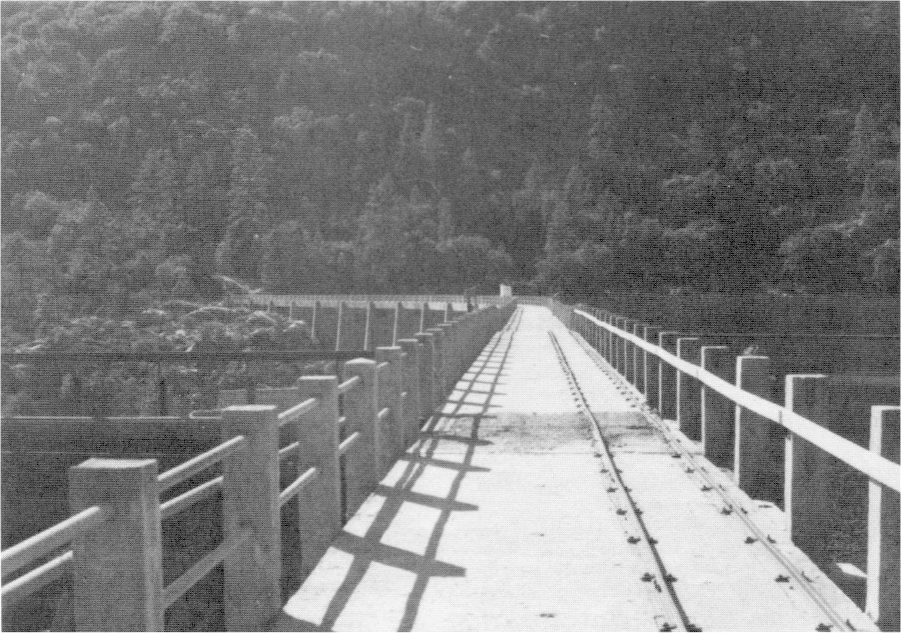
[click to enlarge] |
c) Lake Eleanor Dam
A small hydroelectric plant at Early Intake on the Tuolumne River generated all the power for construction work between Hetch Hetchy and the Moccasin Creek powerhouse. Water to turn the wheels at the powerhouse came from Lake Eleanor, connected to Hetch Hetchy by a twelve-mile, thirteen-switchback road built in 1916-17. At Lake Eleanor workers completed the first dam of the Hetch Hetchy system in 1918. A buttressed, multiple-arch concrete structure 70 feet high and 1,260 feet long, it contains twenty forty-foot-span arches.
A small dam diverted water from Lake Eleanor and the natural flow of Cherry River into the Lower Cherry Aqueduct, which terminated on the hill above Early Intake powerhouse, turning its flow into a penstock which led to the Pelton-Francis turbines. From there electricity was transmitted to the many construction sites throughout the Mountain Division. This pioneer powerhouse, a frame building with walls and roof of corrugated, asbestos-protected metal, continued in operation until 1960, adding its electric production to that of Moccasin. After that time, Lake Eleanor’s waters were diverted through a mile-long tunnel into the Lake Lloyd Reservoir on the Cherry River.
d) Hetch Hetchy Dam
As stated earlier, the city’s plans called first for construction of the Hetch Hetchy dam to about three-fourths of its final height. It would be completed when the demand for increased water and power development justified the additional investment. The dam would block the Tuolumne River at the narrow gorge where the stream flowed from the valley, backing water up for about seven miles. Engineers designed the dam as a concrete, arched gravity type structure with five vertical contraction joints sealed by strips of sheet copper.84 Preliminary work in preparation for construction of the major impounding reservoir of the Hetch Hetchy system began in 1915. Erection of camp buildings took place in September on a flat overlooking the valley above the dam site, and a mile-long wagon road blasted out of the cliff led from there into the valley below, where another camp stood.
[84. City and County of San Francisco, San Francisco Water and Power, 14, 16, 18-19; Eckart and Stocker, “San Francisco’s Hetch Hetchy Water Supply,” Part II: Details of Some of the Constructional Facilities That Are Helping in the Execution of This Titanic Task, in Compressed Air Magazine 27, no. 9 (September 1922): 247-50, and Part III: The Structural Features of the Dams for the Lake Eleanor and the Hetch Hetchy Reservoirs, in Compressed Air Magazine 27, no. 10 (October 1922): 283-88. Part IV of this series is entitled “Details of the Aqueduct Tunnels and of the Mechanical Facilities Employed in Their Construction.” Vol. 27, no. 11 (November 1922): 315-20.]
Workers laid the last rail on the Yosemite Valley Railroad, connecting Merced with El Portal, on 25 April 1907, thereby providing easier and faster access to Yosemite National Park. The original line never changed except for the relocation of 16.7 miles in 1924-26 from Merced Falls to Detwiller to make way for water backed up by the newly built Exchequer Dam. As originally laid, the track between Merced and El Portal contained 505 curves. As mentioned, although railroad construction stopped at El Portal, the railroad company spent $73,260 building a wagon road from El Portal into Yosemite Valley. Before the completion of the Ail-Year Highway in 1926, the Yosemite Valley Railroad ran a profitable passenger and auto-ferry business, building special loading ramps in Merced and El Portal. The railroad located its headquarters in the new Merced depot and built a smaller, rustic station at El Portal.
The first hotel to serve tourists in El Portal comprised a tent camp that the Yosemite Valley Railroad established in 1907 north of present Foresta Road (original railroad bed), across from the present library. Two years later it built the Hotel Del Portal to cater to
|
Illustration 65.
“Portion of the Yosemite Valley Railroad showing the Yosemite Lumber Co. R. R. and the Yosemite Sugar Pine Lumber Co. R. R. since 1907,” drawn by Robert L. La Plaine. From Johnston, Railroads of the Yosemite Valley. |
[click to enlarge] |
The luxurious four-story Hotel Del Portal contained a big lobby, an office, two dining rooms, a music room, a barber shop, a pool room, a bar, and a large kitchen on the ground floor. The upper floors held more than 100 guest rooms and the bathrooms. A wide covered porch extended the length of the ground floor. On the east end of the building stood a loading ramp where tourists boarded horse stages for the trip to Yosemite Valley. The hotel had the form of a U, with the front part facing south. The two wings of the hotel, the same height as the front of the building, had gable roofs on the top floor. A patio with lawns, flowers, and a fountain filled the space between the two wings.
A short battle for the tourist trade ensued between the new railroad and the previously unchallenged horse-drawn stages, but the faster rail line seemed preferable to most visitors. In 1907 D. K. Stoddard, a Merced stagecoach operator, moved his business to El Portal and carried train passengers into the valley under a five-year contract. The railroad bought that stage line in 1911 and began using autos on a limited basis in 1912. Secretary of the Interior Lane granted this Yosemite Transportation Company permission to use autos, and in November 1913 the first auto stage made the run from El Portal to the valley. By the spring of 1914, the company had added three new auto stages.
The village of El Portal, north of the Merced River and at the western boundary of Yosemite National Park, contains about eighty-five structures built after 1905 when survey and construction work on the Yosemite Valley Railroad began. The older section of El Portal served as a residential area for railroad workers. Three railroad employee houses built about 1908 still exist although they have had minor alterations. They are one-story, two-bedroom, frame buildings with covered front porches extending their full width. Located north of Foresta Road across from the present library, they are still used as residences. The railroad company also constructed a two-story frame store around 1909. It ceased operating in 1915 when its contents were moved to the Hotel Del Portal. The town served as an overnight stop and transfer point for tourists visiting Yosemite Valley by rail. After staying overnight at the Del Portal Hotel, they could take wagons, and later automobiles, into the park. The town continued to grow with the addition of the Yosemite Lumber Company operations.
A state sanitary inspector described the village of El Portal to the California Board of Health in 1915. He mentioned that it consisted of the Hotel Del Portal and several cottages and tents used as dwellings and several buildings used as stables, garages, and the like. Although only thinly populated during the winter, the town’s population ballooned during the summer months as thousands of train travelers poured into Yosemite Valley. The inspector noted several hog pens owned by the hotel located on the bank of the Merced River about one-quarter mile below the hotel. The hotel also had a number of tents connected with it, on the hillside several hundred feet away, used as sleeping quarters by employees. A lumber and canvas hotel laundry stood several hundred feet downhill from the hotel. Its Chinese employees cooked, ate, and slept in the structure. Several other cottages and tents located near the stable owned by the Yosemite Transportation Company were occupied by employees of that operation.85
[85. Edward T. Rose to W. A. Sawyer, 6 September 1915, Sanitary Report No. 251, in Bates and Wells, Late Aboriginal and Early Anglo Occupation of El Portal, 39-40.]
1. Change in Administration of the Parks
As mentioned earlier in this chapter, on 10 March 1914, the Interior Department commissioned Mark Daniels as landscape engineer in the park, with the important duty of preparing a comprehensive general plan for the development and improvement of the floor of Yosemite Valley. Later, in an attempt to increase the efficiency of administration of the various national reservations and reduce the cost of superintendence, the department commissioned Daniels on 4 June 1914 as General Superintendent and Landscape Engineer of the National Parks under the Department of the Interior. The title of the various officers in charge of the immediate work in the parks changed from superintendent to supervisor. Because Daniels’s additional duties compelled him to be absent from Yosemite most of the time, immediate supervision of that park fell to Park Supervisor Gabriel Sovulewski.
Even though, as pointed out earlier, army troops and their officers had often welcomed detail in the national parks, for several years their superiors had believed that such duty eroded army discipline and robbed the men of important training time in military matters. The army had accomplished what it had needed to do. It had kept order, built roads and trails, and fought threats to park integrity. Because of the expense to the War Department of maintaining details of troops in the parks for peaceful protective purposes and the drain on park revenues due to their presence, and because the conditions that had led to the authorization of troops had radically changed, the federal government decided that a military presence was no longer required in the Yosemite, Sequoia, and General Grant national parks.
Beginning in 1914, the Department of the Interior assumed management of the park, and civilian rangers replaced the military troops. To this group of men fell the tasks of enforcing park rules, registering tourists, confiscating firearms, guarding against poachers and cattlemen, supervising automobile traffic, and fire fighting. In addition to the five regular rangers already employed, the Interior Department engaged ten temporary ones to help fulfill the above duties. In 1915 park rangers fell into two classes: mounted men, or park rangers of the first class, and unmounted automobile checkers, or park rangers of the second class.
These new employees were temporarily housed in buildings previously used by the War Department at Camp Yosemite, all of which were turned over to the Interior Department. Further need was seen, however, for an administration building, a storehouse, a superintendent’s residence, outpost quarters, and rescue lodges.
2. Proposal for a Bureau of National Parks and Resorts
As early as 1910, the Secretary of the Interior, noting the increased importance of national parks in America, recognized that setting apart those areas for the people remained the only practical means of preserving their grandeur from human desecration. Certain parks, he stated, were even worthy of being called national institutions, Yosemite among them. Increased travel to the parks evidenced the growing interest in those areas by people both in the United States and foreign countries.
The secretary recommended that definite policies for the maintenance, supervision, and improvement of existing parks be established, enabling them to better serve the convenience and comfort of tourists and campers as well as ensuring preservation of their natural features. They should include comprehensive plans for roads, trails, telegraph and telephone lines, sewer and water systems, hotel accommodations, and transportation systems. Realizing that such plans would require liberal appropriations as well as some sort of departmental organization to administer them and provide efficient field administration and inspection of public works and concessioner operations, the secretary proposed creation of a bureau of national parks and resorts. A commissioner would head the bureau, aided by superintendents, supervising engineers, landscape architects, inspectors, park guards, and other employees as needed. The supervision of the national parks, a duty that had grown in volume and importance, could no longer be satisfactorily handled by the small force available in the Secretary of the Interior’s office.86
[86. “Report of the Secretary of the Interior,” from the Annual Report of the Secretary of the Interior for the Year 1910, in Sierra Club Bulletin 8, no. 1 (January 1911): 58-63.]
Again in 1911 the Secretary of the Interior recommended that because many of the problems in park management were the same throughout all of the national parks, it would be advantageous and economical to group all the national parks and reservations under one administrative bureau. Beginning in 1911, the first of several National Park conferences, this one at Yellowstone, involving Department of Interior officials, acting superintendents, and other key individuals, discussed the common problems, development, and administration of the parks. Yosemite and Berkeley hosted other conferences in 1912 and 1915. Those meetings greatly influenced the eventual establishment of the National Park Service, because a concensus gradually developed that due to changing conditions, military protection did not meet park needs. The individual operation and maintenance of parks; the conflicting jurisdictional responsibilities between the Interior, Agriculture, and War departments; and the resultant lack of policy coordination, resulted in sloppy and ineffective management. Due to that haphazard method of administration, no effective national park policy toward conservation could develop. Only a separate bureau, lobbying solely for their welfare, could get the parks the money, publicity, and protection they required.
For several years also conservationists and military superintendents had been trying to obtain congressional approval for a bureau to oversee park affairs. The path had been difficult because many congressmen still could not see the advantages of preserving vast, remote western areas simply for the sake of “zealous knots of wilderness enthusiasts.” The idea of a system of parks remained new and little understood. Constitutents and their representatives alike saw such actions as a dangerous extension of government authority over rich lands that could be opened to grazing and mining. After all, few people yet could afford to visit those areas and appreciate the variety of scenic landscapes needing preservation. That situation would change, however, as automobiles made the population more fluid.
A special lobbying effort by the American Civic Association about 1910 won over President William Howard Taft and resulted in a special congressional message on 3 February 1911, in which he recommended the establishment of a bureau of national parks as being essential to proper park management. Meanwhile, Secretaries of the Interior Walter L. Fisher, under President Taft, and Franklin K. Lane, under President Woodrow Wilson, both sympathetic friends of the parks, resorted to interim measures to straighten out park affairs. By 1911 W. B. Acker, assistant attorney in the Office of the Secretary, was instructed to devote part of his time to park business. In 1913 Lane upgraded park supervision to the assistant secretary level and put Dr. Adolph C. Miller, chairman of the Department of Economics at Berkeley, in charge of national parks. The next year he assigned Landscape Engineer Mark Daniels direct administrative responsibility over the parks, although on only a part-time basis. After Daniels’s resignation, Robert C. Marshall of the U. S. Geological Survey became the first full-time national parks administrator.
3. Establishment of the National Park Service
In 1915 Secretary Lane named Stephen T. Mather, a wealthy Chicago borax tycoon, philanthropist, and lover of the Sierra, to replace Miller as assistant secretary. Finally, on 25 August 1916, President Wilson signed a congressional act establishing the National Park Service. The new bureau began functioning when Congress approved funds in April 1917. Mather became the first director of the new bureau, authorized to regulate and promote the national parks, monuments, and reservations, while conserving scenery and wildlife. Horace Albright became Mather’s second-in-command, serving as acting director from 1917 to 1918 and as director after 1929.
During his fourteen-year tenure, Mather shaped national park administration for the future by laying down policies and precedents that have endured through the years. By means of his famous and lavish backcountry mountain trips, on which he feasted and feted influential editors, writers, conservationists, and others who could most ably promote the national park idea, Mather sold preservation of America’s resources to Congress and the general public.
Mather had a powerful impact on Yosemite, his favorite park. He organized an advisory committee of experts to safeguard the park’s natural features and concentrated his efforts and his resources on trying to retrieve the Minarets-Devils Postpile region eliminated in 1905; on acquiring the Tioga Road; on providing more and better facilities -for visitor and employee use; on starting interpretive and other educational programs; on eliminating private holdings; on locating a new, less intrusive village site; and on superintending the consolidation of rival concessioners.
U. S GOVERNMENT PRINTING OFFICE: 1987—773-038/60,006 REGION NO. 8
Next: 5: NPS 1916-1930: Mather Years • Contents • Previous: 3: Cavalry 1890-1905
| Online Library: | Title | Author | California | Geology | History | Indians | Muir | Mountaineering | Nature | Management |
http://www.yosemite.ca.us/library/yosemite_resources/latter_cavalry_years.html