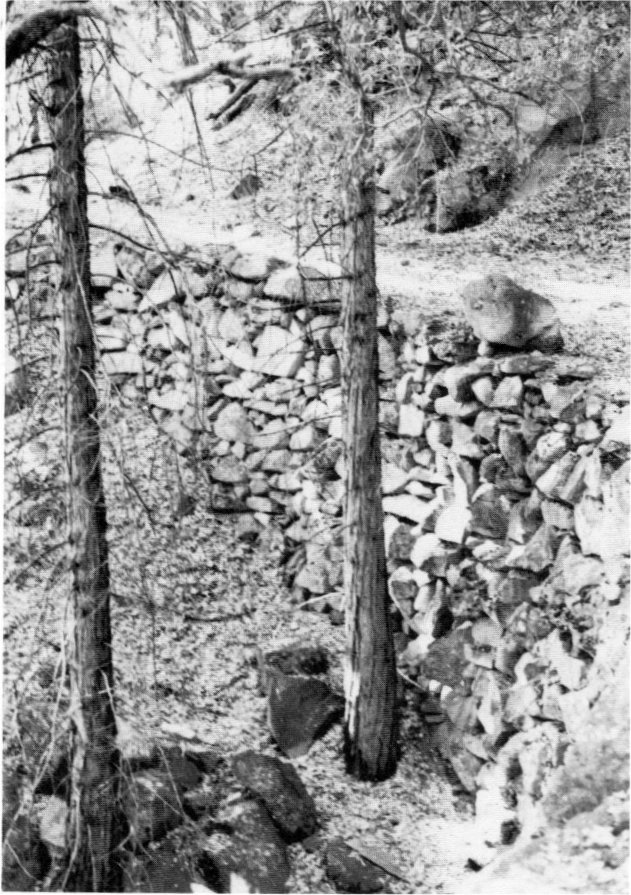
Rock wall cribbing and old roadbed of Coulterville Road (on USFS land), view to east.
Photo by Robert C. Pavlik, 1984.
[click to enlarge]
| Online Library: | Title | Author | California | Geology | History | Indians | Muir | Mountaineering | Nature | Management |
Yosemite > Library > Yosemite Resources > Chapter II: Yosemite Valley as a State Grant and Establishment of Yosemite National Park, 1864-1890 >
Next: 3: Cavalry 1890-1905 • Contents • Previous: 1: Early History
A. Interest Mounts Toward Preserving the Yosemite Valley and Mariposa Grove 51
1. Yosemite Act of 1864 51B. State Management of the Yosemite Grant 65a. Steps Leading to the Preservation of Yosemite Valley 51
b) Frederick Olmsted‘s Treatise on Parks 55
c) Significance of the Yosemite Grant 59
1. Land Surveys 65
2. Immediate Problems Facing the State 66
3. Settlers‘ Claims 69
4. Trails 77a) Early Survey Work 775. Improvement of Trails 89
b) Routes To and Around Yosemite Valley 78
c) Tourist Trails in the Valley 79(1) Four-Mile Trail to Glacier Point 80
(2) Indian Canyon Trail 82
(3) Yosemite Fall and Eagle Peak Trail 83
(4) Rim Trail, Pohono Trail 83
(5) Clouds Rest and Half (South) Dome Trails 84
(6) Vernal Fall and Mist Trails 85
(7) Snow Trail 87
(8) Anderson Trail 88
(9) Panorama Trail 88
(10) Ledge Trail 89a) Hardships Attending Travel to Yosemite Valley 896. Development of Concession Operations 114
b) Yosemite Commissioners Encourage Road Construction 91
c) Work Begins on the Big Oak Flat and Coulterville Roads 92
d) Improved Roads and Railroad Service increase Visitation 94
e) The Coulterville Road Reaches the Valley floor 951) A New Transportation Era Begins 95f) The Big Oak Flat Road Reaches the Valley Floor 100
2) Later History 99
g) Antagonism Between Road Companies increases 103
h) The Wawona Road Reaches the Valley floor 106
i) Roads with in the Reservation boundary 110a) Hotels and Recreational Establishments 1147. Schools 159(1) Upper Hotel 115b) Stores, Studios, and Other Services 145
(2) Lower Hotel/Black‘s Hotel 122
(3) Leidig‘s Hotel 122
(4) Mountain View House 123
(5) Wawona Hotel 126
(6) La Casa Nevada 133
(7) Cosmopolitan Bathhouse and Saloon 135
(8) Mountain House 138
(9) Stoneman House 139(1) Harris Campground 145c) Transportation in the Valley 154
(2) Degnan Bakery 146
(3) Fiske Studio 147
(4) Bolton and Westfall Butcher shop 147
(5) Flores Laundry 148
(6) Cavagnaro Store 148 (7) Stables 148
(8) Sinning Woodworking shop 148
(9) Stegman Seed Store 149
(10) Reilly Picture Gallery 149
(11) Wells Fargo office 150
(12) Folsom bridge and Ferry 151
(13) Chapel 151
d) Staging and Hauling to Yosemite Valley 155
8. Private Lands 164a) Bronson Meadows (Hodgdon Meadow) area 1679. The Tioga Mine and Great Sierra Wagon Road 243(1) Crocker station 167b) Ackerson Meadow 171
(2) Hodgdon ranch 167
c) Carlon or Carl Inn 171
d) Hazel Green 171
e) Crane Flat 174
f) Gin Flat 175
g) Tamarack Flat 176
h) Foresta/Big Meadow 177(1) McCauley barn 180i) Gentry station 188
(2) Meyer barn No. 1 (Saltbox) 181
(3) Meyer barn No. 2 (Cribwork interior) 181
(4) Big Meadow Cemetery 181
j) Aspen Valley 189(1) Hodgdon cabin 189k) Hetch Hetchy Valley/Lake Eleanor area 192
(2) East Meadow Cache 192(1) Miguel Meadow cabin 193l) White Wolf 198
(2) Kibbe cabin 196
(3) Elwell cabins 196
(4) Tiltill Mountain 197
(5) Lake Vernon cabin 197
(6) Rancheria Mountain cabin 197
(7) Smith Meadow cabin 198
m) Soda Springs and Tuolumne Meadows 199(1) Lembert cabin 201n) Tioga pass 207
(2) Tuolumne Meadows cabin 206
(3) Murphy cabin 206
(4) Snow Flat cabin 207(1) Dana fork cabin 207o) Little Yosemite Valley 210
(2) Mono pass cabins 210(1) Washburn/Leonard cabin 210p) Yosemite Valley 211(1) Pioneer Cemetery 211q) Glacier Point 232(a) White Graves 212(2) Lamon cabin 222
(b) Indian Graves 218
(3) Hutchings cabin 222
(4) Muir cabin 224
(5) Leidig cabin and barn 225
(6) Howard cabin 226
(7) Happy Isles cabin 227
(8) Clark cabin 227
(9) Four-Mile Trail cabin 228
(10) Mail Carrier Shelter cabins 228
(11) Stegman cabin 228
(12) Hamilton cabin 228
(13) Shepperd cabin 229
(14) Manette cabin 229
(15) Whorton cabin 229
(16) Boston cabin 229(1) McGurk cabin 232r) Wawona 234
(2) Mono Meadow cabin 233
(3) Ostrander cabin 233
(4) Westfall Meadows cabin 234(1) Pioneer Cemetery 234s) El Portal area 242
(2) Crescent Meadows cabin 235
(3) Turner Meadow cabin 235
(4) Buck Camp 235
(5) Mariposa Grove cabins 236
(6) Chilnualna Fall 237
(7) Galen Clark Homestead Historic site 237
(8) Cunningham cabin 240
(9) West Woods (Eleven-Mile station) 240
(10) Other Homesteaders 241(1) Hennessey ranch 242
(2) Rutherford Mine 243a) Early activity in the Tuolumne Meadows area 24310. Management of the Grant by the Yosemite Commissioners 258
b) Formation of the Tioga Mining district 244
c) The Great Sierra Consolidated Silver Company Commences Operations 246
d) Construction of the Great Sierra Wagon Road 250
e) The Tioga Mine Plays Out 256a) Replacement of the Board of Commissioners, 1880 25811. Establishment of Yosemite National Park 289
b) Report of the State Engineer, 1881 259(1) Protecting Yosemite Valley from Defacement 260c) Remarks on Hall‘s Report 268(a) Preservation of the Water shed 260(2) Promoting Tourism 262
(b) Regulation of Use of the Valley Floor 261
(c) Treatment of the Valley Streams 262(a) Improving Approaches to the Valley 263(3) Lands caping 266
(b) Improvements to Travel In and About Yosemite Valley 263
(c) Trails 264
(d) Footpaths 264
(e) Bridges 265
(f) Drainage and Guard Walls 265
(g) Hotels, Stores, Houses 266
(4) Agricultural Development 267
(5) River overflow 267(1) Yosemite Valley River Drainage and Erosion Control 269(2) Yosemite Valley Vegetative Changes 273d) Report of the Commissioners, 1885-86 279(a) Fire Suppression 273(3) Mariposa Grove Management Problems 277
(b) Drainage of Meadows 276
(c) Introduction of Exotics 277
e) Report of the Commissioners, 1887-88 282
f) Report of the Commissioners, 1889-90 288a) Accusations of Mismanagement of the State Grant 289
b) Arrival of John Muir in California 296
c) John Muir and Robert Underwood Johnson Join forces 298
d) Response of the Commissioners to Charges of Mismanagement 300
e) Comments on the Controversy 301
f) The Yosemite National Park Bill Passes Congress 304
g) Comments on the Preservation Movement and Establishment of Yosemite National Park 305
Mariposa Grove
1. Yosemite Act of 1864
a) Steps Leading to the Preservation of Yosemite Valley
The widespread publicity on Yosemite Valley, coupled with a nascent thrust toward scenic preservation, prompted a few respected far-seeing California residents to push for passage of a law to protect Yosemite’s outstanding features for all time. The conviction that man was destined to use and unreservedly exploit the country’s wilderness prevailed by the mid-1850s. The westward-moving pioneers had ruthlessly conquered both the Indian populations they met and the land acquired from their dispossession. As farms and towns appeared, settlers overplowered fields, overgrazed grasslands, ravaged forests for building materials and firewood, and exterminated wildlife for food and profit. It was then that a countermovement began, spearheaded by such respected authors as Ralph Waldo Emerson and Henry David Thoreau, and by important painters such as George Catlin, who saw the need to preserve some of America’s landscapes. The discovery of Yosemite Valley provided the first believable evidence that the United States had a valid claim to cultural recognition through scenic wonders. Yosemite became the object of scenic nationalism and was popularized as such in the press of the time.
At the same time, during the 1850s and 1860s, many in California lamented the loss of rare giant trees to lumber interests, of alpine meadows to sheepmen, and the misuse of lands in Yosemite Valley for commercial exploitation and economic gain. Foremost among those individuals were Starr King, who became one of the leaders in the effort to save Yosemite Valley; Judge Stephen Field, who early visualized the site’s need for a geological survey and who had much to do with its accomplishment by Josiah Dwight Whitney, assisted by William H. Brewer and Clarence King; Frederick Law Olmsted, regarded as the founder of landscape architecture in America, who had designed Central Park in New York City—a revolutionary attempt to develop a natural landscape in the heart of a large city. Immediately after his arrival in California in September 1863 to manage the famed Mariposa Estate grant formerly owned by John Charles Fremont, Olmsted became enthusiastic about Yosemite Valley and worked tirelessly for its conservation; Jessie Benton Fremont, wife of John; Israel W. Raymond, one of the most active workers on the Yosemite park proposal; Dr. John F. Morse, a San Francisco physician; Josiah D. Whitney, California’s state geologist; and William Ashburner of the Whitney survey party.
Those individuals were astute and practical enough to realize that political action was required to permanently save the natural wonders of Yosemite from destruction. Israel Raymond, the California representative of the Central American Steamship Transit Company of New York, addressed a letter to California’s junior senator John Conness, urging him to present a bill to Congress on the preservation of Yosemite Valley and the Mariposa Big Tree Grove. That important missive of 20 February 1864 stated: “I think it important to obtain the proprietorship soon, to prevent occupation and especially to preserve the trees in the valley from destruction. . .”1 Conness in turn sent a letter to the Commissioner of the General Land Office, J. W. Edmonds, in March requesting that he prepare the final draft of the bill and send it on using Raymond’s language and boundary descriptions of Yosemite and the Mariposa Big Tree Grove. In introducing the bill on 28 March 1864, Conness made it clear that the bill had come to him from various gentlemen in California of taste and refinement and that the General Land Office also favored it.
[1. Huth, “Yosemite: The Story of an Idea,” 29.]
Aiding passage of the proposal were memories of an unfortunate incident in 1852 that had greatly advanced the idea of preservation of the giant sequoias—the stripping of one-third of the bark of one of the trees in the Calaveras Grove of Big Trees by two businessmen, who shipped it East for display and then put it on exhibition in London in 1854. That act of vandalism created furor in California/ especially when the tree began to decay, and aroused an overpowering preservationist sentiment in both the East and the West that forced people to ponder their responsibilities in regard to the protection of nature. The publicity accorded the sacrifice of that tree advanced the idea of conservation of giant sequoias by making their plight known.
On 30 June 1864, Congress passed an act segregating for preservation and recreational purposes the
“Cleft” or “Gorge” in the Granite Peak of the Sierra Nevada Mountains, situated in the county of Mariposa . . . and the head-waters of the Merced River, and known as the Yosemite Valley, with its branches and spurs, in estimated length fifteen miles, and in average width one mile back from the main edge of the precipice, on each side of the Valley, with the stipulation, nevertheless, that the said State shall accept this grant upon the express conditions that the premises shall be held for public us£, resort, and recreation; shall be inalienable for all time. . . .2
[2. The Yosemite Guide-Book (Cambridge, Mass.: University Press, 1870), 2. Conness further stated in the Senate hearing that the grant areas
are for all public purposes worthless, but . . . constitute, perhaps, some of the greatest wonders of the world. The object and purpose is to make a grant to the State, on the stipulations contained in the bill, that the property shall be inalienable forever, and preserved and improved as a place of public resort. . . .
Ibid. According to the Yosemite Valley commissioners, the area’s governing body, although the Yosemite Grant covered fifty-six square miles, only about three percent of the tract could be made useful for any other purpose than that to which the act of Congress devoted it—namely, as a place for public resort and recreation. The section of the grant along the foot of the bluffs was either too high, very rocky, or covered with such a thick growth of heavy timber that it was rendered “entirely unfit for purposes of cultivation.” On the valley floor, only 745 acres were meadowlands, while the rest were fern lands requiring clearing and cultivation before they could be farmed. Obviously, agricultural pursuits were being considered from the beginning. Biennial Report of the Commissioners to Manage the Yosemite Valley and the Mariposa _Big Tree Grove For the Years 1887-88 (Sacramento: State Printing Office, 1888), 8.]
The Yosemite Grant included 36,111 acres and was entrusted to the state of California with certain stipulations. The act also granted, under similar conditions, four sections of public land, or 2,500 acres, containing the Mariposa Grove of Big Trees (see Appendix D). The grove was included in the grant to protect it from logging and other commercial exploitation. The purpose of the grant, as indicated by the stringent boundaries that ignored the ecological framework of the region, was to preserve monumental scenic qualities rather than an ecosystem. Although the words “national park” were not used in the legislation, in effect the Yosemite Grant embodied that concept, although neither Congress nor the federal government accepted any responsibility for the valley’s preservation or improvement. The act clearly stipulated that the valley and grove were to be managed by the governor of California and eight commissioners appointed by him and serving without pay, although the state would fund their traveling expenses. On 28 September 1864, Gov. Frederick F. Low of California proclaimed the grant to the state, and, in accordance with the act’s stipulations, appointed eight commissioners to manage the area: Frederick Law Olmsted, J. D. Whitney, William Ashburner, I. W. Raymond, E. S. Holden, Alexander Deering, George W. Coulter, and Galen Clark.
As chairman of the first board of commissioners to manage Yosemite Valley and the Big Tree Grove, Olmsted took the lead in efforts to organize management of the grant. Because he established a permanent camp in the valley and directed protection of the area prior to the state’s formal acceptance of the grant, he has been referred to as its first administrative officer. The commissioners agreed to hire one of their number as an on-the-scene employee, or Guardian, of the grant. Galen Clark initially served in that capacity, from 1866 to 1880. (See Appendix E for a list of the state Guardians of Yosemite Valley.) The Guardian’s duties were to patrol the grant and prevent depredations; build roads, trails, and bridges; bestow and regulate leases for the erection of hotels and other improvements; use the incomes from those leases to preserve and improve the valley; and serve as the commission’s liaison with the residents of the valley. The commissioners believed that the Guardian and/or a sub-Guardian should always be present in or about the valley and Big Tree Grove, at least during the visitor season, and that they should have police authority to arrest offenders on the spot.3
[3. Biennial Report of the Commissioners to Manage the Yosemite Valley and the Mariposa Big Tree Grove, For the Years 1866-7 (San Francisco: Towne and Bacon, 1868), 7. Ultimately the lack of authority in the Guardian position led to the continuance of activities detrminental to the welfare of the valley and grove.]
b) Frederick Olmsted’s Treatise on Parks
At this point, note should be taken of an important document authored by Frederick Law Olmsted in response to a request by the Board of Yosemite Commissioners. That body asked Olmsted to prepare a report for the California legislature defining the policy that should govern management of the grant and making recommendations for its implementation.
Throughout 1865 Olmsted worked on this statement in which he presented a set of reasons for the establishment of parks and a detailed plan of management for Yosemite Valley in particular. The plan conformed with his belief that Congress, by setting aside this area, had recognized the ideal of free enjoyment of scenic areas by all classes of people and the state’s duty to preserve Yosemite Valley and the Mariposa Grove for that purpose forever. This document, finished in August 1865, never received widespread exposure or the critical acclaim due it. Its significance lies in its philosophical arguments for the creation of state and national parks, in the sweeping scope of its political and moral justifications for establishing pleasure grounds for the masses.
Olmsted believed two factors had influenced Congress to set aside the Yosemite Valley and Mariposa Grove. One, interestingly enough, in terms of the “worthless lands” theory of park establishment, involved Congress’s belief that a direct pecuniary advantage would accrue to the country in terms of tourist dollars as the valley became more accessible. 4 Olmsted regarded this as only an incidental factor in establishment of the grant, however.
[4. Frederick Law Olmsted, “The Yosemite Valley and the Mariposa Big Trees: A Preliminary Report,” 1865, with an introductory note by Laura Wood Roper, repr. from Landscape Architecture 43, no. 1 (October 1952): 17.]
More importantly, he felt the government recognized a duty to protect its citizens in their pursuit of happiness against any obstacle presented by the actions of selfish individuals, such as the aggrandizement of land for personal gain:
It is a scientific fact that the occasional contemplation of natural scenes of an impressive character, particularly if this contemplation occurs in connection with relief from ordinary cares, change of air and change of habits, is favorable to the health and vigor of men and especially to the health and vigor of their intellect beyond any other conditions which can be offered them, that it not only gives pleasure for the time being but increases the subsequent capacity for happiness and the means of securing happiness. . . .
If we analyze the operation of scenes of beauty upon the mind, and consider the intimate relation of the mind upon the nervous system and the whole physical economy, the action and reaction which constantly occur between bodily and mental conditions, the reinvigoration which results from such scenes is readily comprehended. Few persons can see such scenery as that of the Yosemite, and not be impressed by it in some slight degree. . . .5
[5. Ibid., 17, 20.]
Olmstead noted that although the rich could afford to provide recreational opportunities for themselves, the government had to provide them for others, often by withholding scenic places from the grasp of individuals and opening them to all persons for recreation of the mind and body: “The establishment by government of great public grounds for the free enjoyment of the people under certain circumstances, is thus justified and enforced as a political duty.6 The Yosemite legislation had been enacted, Olmsted perceived, in realization of the fact that the humble masses could appreciate beauty and art as much as the privileged classes did.[6. Ibid., 21]
Olmsted believed the main duty of the commissioners entailed enabling the masses to benefit from the major attribute for which the valley and grove had been set aside—their natural scenery:
The first point to be kept in mind then is the preservation and maintenance as exactly as is possible of the natural scenery; the restriction, that is to say, within the narrowest limits consistent with the necessary accommodation of visitors, of all artificial constructions and the prevention of all constructions markedly inharmonious with the scenery or which would unnecessarily obscure, distort or detract from the dignity of the scenery.7
[7. Ibid., 22]
Olmsted warned the state to use care to protect the values of the area as a museum of natural science and not permit the sacrifice of anything of value to future visitors:
. . . it is important that it should be remembered that in permitting the sacrifice of anything that would be of the slightest value to future visitors to the convenience, bad taste, playfulness, carelessness, or wanton destructiveness of present visitors, we probably yield in each case the interest of uncounted millions to the selfishness of a few individuals. . . .
An injury to the scenery so slight that it may be unheeded by any visitor now, will be one of deplorable magnitude when its effect upon each visitor’s enjoyment is multiplied by these millions. But again, the slight harm which the few hundred visitors of this year might do, if no care were taken to prevent it, would not be slight if it should be repeated by millions.8
[8. Ibid.]
Olmsted recommended laws to prevent the unjust use of this public property, to prevent carelessness of the rights of posterity as well as of contemporary visitors. In addition to its preservation duty, the state had an obligation to make the park accessible to the masses, including provision of transportation facilities, camping accommodations, and a good access road to the park to shorten the trip and lessen its cost. Such a road would also enable bringing in supplies and provisions so that trees would not have to be cut down in the grant or the valley floor farmed.
Olmsted noted that the commission also proposed a road to and around the Mariposa Grove as a fire barrier, a road around the valley floor with turnouts, footpaths from that trail to outstanding scenic points, and construction of five cabins in the valley to be used as free resting places for visitors and to rent camp equipment and sell provisions. Finally Olmsted recommended that because of the beautiful scenery, natural scientists and artists be represented on the board of commissioners.
It is unfortunate that Olmsted’s views did not gain a wider audience in the state legislature and elsewhere. Certainly if his recommendations had been followed, at least some of the later problems in park administration might have been avoided and the park values have suffered less. Obviously Olmsted was philosophically years ahead of his time and voiced thoughts whose significance the majority of people were as yet unable to comprehend.
The California legislature met every two years, and that of 1864 had already adjourned when President Abraham Lincoln signed the Yosemite Grant into law. Therefore not until 2 April 1866 did the state legislature pass an act accepting the grant from Congress, confirming the appointment of the commissioners, and conferring on that body full power to manage and administer the trust by making all rules, regulations, and by-laws for the government, improvement, and preservation of the area. The act also contained provisions making it a penal offense to commit injurious acts on the premises and other sections relative to further survey work, while appropriating $2,000 for carrying out the above actions.
c. Significance of the Yosemite Grant
At the time the legislation setting aside the Yosemite Grant passed Congress, it caused little stir across the nation, despite the fact that it set an important national precedent. It constituted the first instance of a central government anywhere in the world preserving an area strictly for a nonutilitarian purpose—the protection of scenic values for the enjoyment of the people as a whole:
This was not an ordinary gift of land, to be sold and the proceeds used as desired; but a trust imposed on the State, of the nature of a sotemn compact, forever binding after having been once accepted.9
[9. Quoted by Douglass Hubbard, “Olmsted - Prophet,” in Yosemite, Saga of a Century: 1864-1964 (Oakhurst, Calif.: The Sierra Star Press, 1964), 9.]
Additionally, many have expressed their belief that the Yosemite Grant marked the beginning of the national park movement in America and in the world and should be regarded as the first unit of the later National Park System. Finally, the Yosemite act constituted the first establishment of a state park and was thus the beginning not only of the California State Park System but of state parks nationwide.10
[10. Frederick A. Meyer, “Yosemite - The First State Park,” in Yosemite, Saga of a Century, 16. To bolster the argument that Yosemite was the point of departure from which a new theory of conservation evolved, the following quotations are presented that predate the establishment of Yosemite National Park:
Most fittingly has Congress set the Yosemite apart from the public domain, and consecrated it to mankind, as a National Park and pleasure-ground forever, (p. 458)
. . . the Mariposa Grove being also included in the Congressional grant which set aside the Yosemite as a National Park. . . . (p. 462)
From notes made on a trip in May 1867 by Gen. James F. Riesling, Across America, 1874. And,
. . . the Yosemite Valley is a unique and wonderful locality: it is an exceptional creation, and as such has been exceptionally provided for jointly by the Nation and State - it has been made a National public park and placed under the charge of the State of California, (p. 22)
This, the first application in print of the term “national park” in reference to Yosemite, is from J. D. Whitney, The Yosemite Book, 1868. Memorandum, Granville B. Liles, Actg. Supt., Yosemite National Park, to Regional Director, Western Region, NPS, 7 November 1963.]
In 1864 George P. Marsh published Man and Nature, the first treatise to approach the theme of conservation in a scholarly fashion. A widely read author, Marsh’s ideas probably influenced the men responsible for the Yosemite Grant. As early as 1865 a group of dignitaries from the East Coast, representing the nation’s press, visited the new Yosemite state park as guests of Mr. Olmstead. Among those important people were Schuyler Colfax, speaker of the U. S. House of Representatives; Samuel Bowles, editor of the Springfield (Mass.) Republican; Charles Allen, the attorney-general of Massachusetts; and Albert D. Richardson, war correspondent of the New York Tribune. In a travel account published later, Bowles stated that
This wise cession and dedication [of the Yosemite Valley] by Congress, and proposed improvement by California . . . furnishes an admirable example for other objects of natural curiosity and popular interest all over the Union. New York should preserve for popular use both Niagara Falls and its neighborhood and a generous section of her famous Adirondacks, and Maine one of her lakes and its surrounding woods.11
[11. Samuel Bowles, Across the Continent (Springfield, Mass.: Samuel Bowles & Company, 1865), 231. - Albert Richardson referred to Yosemite as “A Grand National Summer Resort” in Beyond the Mississippi, published in 1867 but based on his trip to the valley two years earlier, quoted in William R. Jones, “Our First National Park: Yellowstone? . . . or Yosemite?” Audubon Magazine 67, no. 6 (November-December 1965): 383-84.]
The national scope, permanence, and importance to future generations attributed to the Yosemite grant were also apparent in a Saturday. Evening Post editorial in 1868:
The Great American Park of the Yosemite. With the early completion of the Pacific Railway there can be no doubt that the Park established by the recent Act of Congress as a place of free recreation is for? all the people of the United States and their guests forever.12
[12. New York Evening Post, quoted in Sacramento (Calif.) Daily Union, 29 July 1868, 3.]
The preceding statements indicate that from the beginning the true significance of the Yosemite Grant was perceived as being not simply preservation of one particular local scenic area, but the possible initial step in a precedent-setting systematic approach to a national program of preservation of areas of unique scenic interest, beauty, and curiosity. It became the first official recognition that man should not always subjugate nature, but also enjoy it recreationally and aesthetically, and that the government’s role was to preserve areas for that purpose.
The Yosemite Grant was not the product of a nascent public concern for ecological values of the environment. Preservation of scenery and natural curiosities for public enjoyment dictated its establishment, not its biological attributes. Few in America yet understood watershed functions, forestry principles, or the basic interrelationship between plants, animals, and man.
The Yosemite Grant constituted possibly the initial major manifestation of a growing American concern with the loss of its wilderness and its pioneer values. The Yosemite Grant tied in with an early reaction to despoliation and avarice and a fear of the private appropriation of large tracts of land in the public domain.13 By the late 1860s and early 1870s, the American public began experiencing a variety of emotions as a result of fundamental changes in society during and after the Civil War. A period of romantic idealism expressed nostalgia for a dwindling frontier experience. At the same time, Americans felt alarm at the rising tide of materialism, which would increase during the period of the Industrial Revolution. That repugnance fostered and strengthened an emotional reaction—a spiritual attachment to Nature and its basic, simpler values. Feelings of inadequacy in terms of cultural background as compared to the great European civilizations led to a fascination with monumentalism. Celebrating the scenic grandeur of America’s West became a way of competing successfully with European culture and traditions. Yosemite Valley certainly was regarded by its early visitors as a nationalistic resource, an outstanding example of America’s worth in the eyes of the world.
[13. Joseph L. Sax, Mountains Without Handrails: Reflections on the National Parks (Ann Arbor: University of Michigan Press, 1980), 8.]
One of the prerequisites of Congress’s acceptance of early national parks would be that they have little economic value and thus be worthless for anything other than pleasuring grounds. Early preservationists found that resistance to the establishment of public scenic areas could be offset if they were touted as so remote as to be economically worthless to the country. Legislators continued to feel for many years in regard to the establishment of new park areas that valuable commercial resources should be either excluded at the outset or opened to exploitation regardless of their location.14 Proponents of the Yosemite Grant assured Congress that the valley would be worthless for mining, logging, grazing, or agricultural interests. It is interesting, however, that the state intended from the beginning to make money from the area, through lease arrangements, which could be reinvested in park development. The valley also was a money-making proposition for settlers who sold provisions and provided accommodations to tourists. Through the years the valley has proven a lucrative source of money from tourism and commercial recreation activities. It was actually the potential value of the valley and the Mariposa Grove in terms of commercial tourism and logging activities that many backers of the grant feared would lead to its exploitation and eventual destruction.
The wording of the legislation and comments by visitors and writers of the time are sufficient proof that the object of the grant was to preserve a scenically outstanding area of nationwide value, to establish a true national park, even though it was a park to be managed by a state government. The fact is that in 1864 the federal government was far less diversified than now and no one yet envisaged all-encompassing federal legislation to conserve state areas for national park purposes. In addition, the country’s leaders were much too involved in the problems and strategies of the Civil War to ponder the philosophical implications of what they were doing for the nation at large. President Lincoln himself probably had little inkling of the impact of his signature on the bill setting aside Yosemite Valley as a park. Other matters were occupying his thoughts: an attempt within the Republican party to unseat him as president; Maj. Gen. William T. Sherman’s repulse at Kennesaw Mountain, Georgia; and Lt. Gen. Ulysses S. Grant’s investment of Petersburg, the key to Richmond, Virginia. It is easy to see how
The Yosemite Act was lost in the tides of war, and only in recent years has its monumental significance been evaluated by historians. It is clear now that the reservation of Yosemite marked perhaps the most significant single event in the changing relationship of Americans to the land they live on.15
[14. Alfred Runte, National Parks: The American Experience (Lincoln University of Nebraska Press, 1979), 48.]
[15. Harold Gilliam, “Centennial of a Pioneer’s Dream,” San Francisco Chronicle, 28 June 1964.]
Despite the fact that Yellowstone was the first federal venture in the field of preservation, it did not advance the concept of conservation in the first years of its existence. Yosemite, on the other hand, began growing and developing as soon as it was set aside, and became a proving ground for new ideas in conservation and park management. Olmsted quickly formulated plans for the best management of the park, and the California legislature voted appropriations for improvements as soon as possible. The early establishment of Yosemite Valley as a park unit under state control significantly influenced the later development of both the National Park System, the California State Park System, and state park systems nationwide, which all benefitted from the experience and knowledge of park principles and management gained in those early Yosemite years. Olmsted’s penetrating analyses of park problems and opportunities were strongly influenced by his Yosemite experience, and his reports are the origin of much of the best of today’s park principles.16
[16. Meyer, “Yosemite - The First State Park,” in Yosemite, Saga of a Century, 17.]
Carl P. Russell stated that it was apparent that the original proponents of the Yosemite act—the scientists, educators, and journalists who visited and described Yosemite and the congressmen and senators who envisioned the initial concept and formulated the legislation—thought of the Yosemite Grant as more than the first state park. They also perceived it as the first official embodiment of the concept that there are places of beauty and of scientific interest that should not be appropriated by individuals or private interests. This was the birth of the National Park idea.17 And it should be noted that when the National Park System was extended in 1890, it was to protect additional areas in California, around Yosemite as well as the present Sequoia National Park and General Grant Grove—areas in a state where the concept of national and local parks was developing in a thoughtful way.
[17. Carl P. Russell, “Birth of the National Park Idea,” in ibid., 7.]
1. Land Surveys
The state legislature had created the California Geological Survey in 1860 and appointed Josiah Whitney, one of the most respected geologists in America, as its head. Whitney was instructed to make a complete geological survey of the state and submit a report of his findings containing maps and diagrams, scientific descriptions of geological and botanical discoveries, and specimens of same.
As soon as the state of California accepted the Yosemite Grant, it determined to obtain certain statistical data. Land surveys, necessary to establish the boundaries of the grants, were made in the fall of 1864 by Clarence King and James T. Gardner, appointed U. S. deputy surveyor for that purpose. (Gardner later changed the spelling of his name to Gardiner.) Their notes were filed in the office of the U. S. surveyor general of California, who forwarded the official plat of the grant to Washington and to the commissioner of the General Land Office. Gardner also drew a map of the Yosemite Valley, showing the grant boundaries and the topography of its immediate vicinity.
The legislative act accepting the grant also authorized the state geologist to further explore the grant and the adjacent Sierra Nevada in order to prepare a full description of the country with maps and illustrations, to be published and sold to prospective visitors. In 1865 a party consisting of King, Gardner, H. N. Bolander, and C. R. Brinley set out to make a detailed geographical and geological survey of the High Sierra adjacent to Yosemite Valley. Another geological survey party under Charles F. Hoffmann continued additional surveys during 1866.
Two editions of the Yosemite survey work originally published in the state geological survey publication Geology in 1865 were planned for publication, both with text, maps, and illustrations, but only one with photographs. It would be called The Yosemite Book (1868), the other the Yosemite Guide-book (1869). The text was a thorough guide to the valley and surrounding mountains, while the accompanying map was acclaimed as the first accurate map of a high mountain region prepared in the United States. Carleton E. Watkins’s photographic illustrations complemented the text. The book greatly increased visitation to the valley by providing information necessary to travelers. Hoffman and his party also surveyed the valley floor and plotted on a map the number of acres in each tract of meadow, timber, and fern land and the boundaries of individual settlers’s claims and the number of acres each had enclosed. They also surveyed the Big Tree Grove, and measured, plotted, and numbered the largest trees.18
[18. Report of the Commissioners to Manage the Yosemite Valley . . . . For the Years 1866-7, 3-6.]
2. Immediate Problems Facing the State
Yosemite Valley’s reputation as one of the most scenic wonders of the world continued to grow. The long, tiring stage or horseback trip; the expense of hiring horses, guides, and packers; and the exorbitant charges demanded by hotelkeepers, however, limited the number of visitors.
Access to the valley was one of the main problems addressed after establishment of the grant. From the north, travelers on horseback usually took the seventeen-mile wagon road from Coulterville to Black’s Hotel at Bull Creek, where they stayed overnight, covering the thirty-two miles into Yosemite Valley the next day. These travelers had to pay to cross the Merced River on Ira Folsom’s ferry, three-fourths of a mile below the Lower Hotel. The only alternative was to follow an unsatisfactory trail farther up the valley on the north side and cross the Merced over a log bridge Hutchings had erected prior to 1865 opposite his hotel, between Yosemite Fall and Sentinel Rock, replacing the crude log structure Hite built in 1859. In order to improve this situation, the Yosemite commissioners prior to 1866-67 erected a good saddle horse bridge across the Merced at the foot of Bridalveil Meadow, near where the trail from the north entered the valley. This Lower Iron Bridge (later Pohono Bridge) enabled visitors to make a full circuit tour of the valley if desired, without the delay and expense of the ferry ride.
The commissioners did not consider it their duty to improve the approaches to the valley, much to the disappointment of neighboring counties. They decided rather that this should be left to competition between the counties, towns, and individuals interested in securing that travel business. The commissioners slightly improved the trail from Yosemite Valley up the Merced Canyon to Vernal Fall so that visitors could ride nearly to its foot. They also placed a bridge across the river above Vernal Fall, facilitating the trip to the top of Nevada Fall. They proposed soon to place a convenient staircase near the ladders at Vernal Fall to make the ascent easier and less dangerous. In the valley the commissioners intended to increase accessibility to all points of interest; remove all obstacles to free circulation, such as trail charges; improve the road around the valley floor; and build a bridge over Ililouette Creek. They considered bridges across the Merced at the upper end of the valley and across Tenaya Creek imperative.19
[19. Ibid., 11, 13.]
High water in the winter of 1867-68 swept away all bridges across the Merced River. James Hutchings vividly described that flood:
On Dec. 23, 1867, after a snow fall of about three feet, a heavy down-pour of rain set in, and incessantly continued for ten successive days. . . . Each rivulet became a foaming torrent, and every stream a thundering cataract. The whole meadow land of the valley was covered by a surging and impetuous flood to an average depth of 9 feet. Bridges were swept away, and everything floatable was carried off. And, supposing that the usual spring flow of water over the Yo Semite Fall would be about 6 thousand gallons per second, as stated by Mr. H. T. Mills, at this particular time it must have been at least 12 or 14 times that amount, giving some eighty thousand gallons per second.20
[20. Hutchings, In the Heart of the Sierras, 492.]
Nothing was left of the new bridge built by the commissioners, although the timbers of Hutchings’s bridge were carried only a short distance away. A traveler to the valley in April 1868 mentioned that he found that the valley
had been nearly all overflowed during the past Winter. The water was up to his [Hutchings’s] hotel, all around his Winter cabin, and over his garden. It was nearly six feet higher than Hutching’s [sic] bridge, (or rather where the bridge was)—for it lays on the bank below. The covering can be made available for another bridge, which is already being built, and will probably be ready for use as soon as travel will commence. All the bridges are carried away; a small portion of Yo Semite bridge remains in a wretched condition; the fences are mostly washed away, and the general damage done is very great; the ferry boat has gone, together with the tree to which it was fastened. . . .21
[21. “A Trip to the Yo Semite Valley on Snow-Shoes,” Mariposa (Calif.) Gazette, by G. C., 17 April 1868; Mariposa (Calif.) Gazette, 10 April 1868. Hutchings replaced his previous log bridge with a finished timber bridge with a superstructure. In 1878 the state replaced that with an all-metal, steel-arched iron truss bridge (Upper Iron Bridge, later Sentinel Bridge). In 1872 Hutchings noted that his bridge across the Merced was the only one in the valley. J. M. Hutchings, Scenes of Wonder and Curiosity in California (New York: A. Roman and Company, publ., 1872), 111. The Sentinel Bridge was refurbished in 1898 and used until 1918. A new concrete bridge, completed in 1919, was widened in 1960. Another iron truss bridge was built about 1878-79 at the foot of Cathedral Rocks. Destroyed during the heavy winter of 1889-90, for many years its wreckage lay across the river alongside the new timber bridge that replaced it before the ironwork was finally salvaged. To prevent destruction of valley bridges by heavy snow loads, it was the practice for many years to rip up the plank flooring of some of them just before the snow fell, leaving the floor timbers open until spring. Laurence V. Degnan to Douglass H. Hubbard, 8 August 1957, in Separates File, Yosemite-Bridges, Y-19, #2, Yosemite Research Library and Records Center.]
The major tasks facing the commissioners in the years immediately following passage of the Yosemite act involved increasing visitation by improving access routes, accommodations, and rates for visitor services, and at the same time exercising some control over development and land use. The first step in accomplishing these goals was to acquire all structures and land in the new park.
3. Settlers’ Claims
Prior to the establishment of the state grant, land in Yosemite Valley was a part of the public domain and therefore open to pre-emption and settlement under the homestead laws of the United States. Because the land was unsurveyed, no plats were filed in the U. S. Land Office. Locations given simply by metes and bounds were entered on the county records and considered to be legal guarantees of title until the land was surveyed.
The Yosemite act stipulated that the Yosemite Valley and Mariposa Grove of Big Trees would no longer be open to homestead entry. Instead, ten-year leases would be granted for portions of the park, with the incomes derived from the leases to be used for the preservation and improvement of the grant and its roads, two obviously incompatible activities. Although proponents of the Yosemite bill, in an effort to eliminate delays, had assured Congress that there were no settlements in the valley, several claims had, in fact, been filed prior to passage of the legislation. Those individuals had occupied land in good faith under the pre-emption laws of the United States, and several had also bought the improvements of earlier settlers for rather large sums of money, assuming that their rights would be protected despite the new conditions.
The two men especially concerned over the prospect of losing their Yosemite Valley property were J. M. Hutchings and James C. Lamon. Another was Ira B. Folsom, who owned the ferry across the Merced River and the ladders at Vernal Fall. Although other people claimed houses and land in Yosemite Valley, they did not officially petition the commissioners. Many could probably not have claimed rights on the basis of permanent residence.
According to a petition by Hutchings, the 118 acres he and his family had settled upon had been homesteaded as early as 1856 by Gustavus Hite, Buck Beardsley, and others. In 1858 and 1859 Hite had built the two-story Upper Hotel on the site and a bridge across the Merced River. In addition he had cultivated the land and planted fruit trees. Hite ultimately went bankrupt, and his title to the land and improvements had been sold at public auction to Sullivan and Cashman of San Francisco. The property was then leased to various parties until the spring of 1864, when Hutchings purchased the rights and improvements and moved his family to Yosemite Valley.
Hutchings proceeded to erect several farm buildings, consisting of a small log house, a large barn and shed, corrals, fences, a bridge across the Merced River, and another over Yosemite Creek. In addition to cultivating a vegetable garden and planting grapevines, he established an orchard of 200 fruit trees in the vicinity of the present Yosemite Village and set out strawberry, raspberry, blackberry, gooseberry, and currant bushes. He also grew cereals and grasses and dug irrigation ditches. Although Hutchings had made his improvements after the state grant was established, the commissioners decided to deal leniently with him because they felt that the development had been done with an eye to the preservation of the beauty of the valley. In addition, Hutchings had done more than anyone to publicize the wonders of Yosemite, through his California Magazine and his lithographic reproductions of Thomas Ayers’s drawings.
James Lamon, born in Virginia in 1817, had come to California in 1851 and worked in the sawmill and lumber business in Mariposa County until 1858. After visiting Yosemite in 1857 and 1858, he bought the possessory rights of Charles Norris, Milton Mann, I. A. Epperson, and H. G. Coward, who had filed on 160 acres each. The land had not been officially surveyed nor had the original petitioners validated their claims by residence or improvement. Lamon took possession of 219 acres in 1859 at the upper end of Yosemite Valley, east of the present Ahwahnee Hotel and north of Curry Village. Near the junction of Tenaya Creek and the Merced River, he built the first log cabin in Yosemite and established the first bonafide homestead through settlement.
In 1861 Lamon filed claim to another 160-acre homestead. In the vicinity of the present concession stables, he established two orchards of about 500 fruit trees each, bearing apples, pears, peaches, plums, nectarines, and almonds; planted more than an acre of strawberry, blackberry, raspberry, gooseberry, and currant plants; cultivated several acres for a vegetable garden; sowed crops; and constructed irrigation ditches, cabins, and outbuildings.22 He also helped construct the Upper Hotel in 1859. At first Lamon lived in the valley only during the spring and summer, moving to the foothills when snow fell; he later became a year-round resident. Lamon sold the products of his orchards and garden to early hotel keepers and tourists.
[22. “The Settlers of Yo-Semite. Memorial of J. M. Hutchings and J. C. Lamon.” (To the Senate and Assembly of the State of California), December 1867?, in library, Society of California Pioneers, San Francisco, California, 1-2; National Register Nomination—Inventory Form, Lamon Orchard, 5 October 1975.]
Public opinion tended to oppose the maintenance of such homesteads, although most Californians felt that Hutchings and Lamon should not be ejected without liberal compensation for their loss. Some believed that because the state could not conduct farming, gardening, or hotel keeping services for visitors, men such as Lamon and Hutchings should be allowed that privilege. On the other hand, the Mariposa (Calif.) Gazette reported:
We have heard considerable complaint on the part of visitors to the Yo Semite Valley about the fencing in of the better part of the grazing land. By this the parties going there have trouble in obtaining proper grazing for their animals, and are annoyed in passing through the Valley. . . . Whatever may be the squatable [sic] rights of these individuals [Hutchings and Lamon] it is evident that their fencing in any part of the Valley will prove a nuisance so far as it effects the public, and is contrary to the evident intention of Congress. . . . The law enacted by the last Legislature gives ample power to the Commissioners to take charge of this property, and to remove all intruders. It is certainly the desire of the people . . . that this law be strictly enforced. . . . they [Hutchings and Lamon] should receive a favorable consideration . . . but they should be required to keep their fences down, and the lands claimed or occupied, free for all to pass over.23
[23. “Yo Semite Valley,” Mariposa (Calif.) Gazette, 14 July 1866.]
It was evident even to the Yosemite commissioners that the claims of Hutchings and Lamon, because of the improvements that had been made, would have been valid under the laws of the United States if the land had been surveyed and opened to pre-emption. Because it had not been, and never would be now that it was in a state park, neither Lamon nor Hutchings nor any of the other settlers in the valley held valid title to the land they occupied nor could they hold any hope of ever obtaining a right to it in fee simple. Hutchings and Lamon protested that, in view of all the labor and expense they had contributed to open and develop the valley both for their families and for the public, it was unjust to wrest the fruits of their toil without warning or adequate recompense.
The Yosemite commissioners proposed to buy the claims of the valley settlers and lease the land back to them. Because Lamon’s holdings were inconspicuous, and in recognition of the useful work he had accomplished in the valley, the commissioners offered Lamon the best deal they could under the circumstances—a lease of the premises for ten years at a nominal rent of $1.00 per year. Hutchings’s long residence in the valley and his careful efforts not to mar the landscape, as well as the fact that his hotel was not a particularly lucrative proposition, disposed the commissioners to offer him the same arrangement—a ten-year lease of his 160 acres, including the hotel and house, at a low rent. Hutchings, however, still claiming the rights of a settler on the basis of having purchased land already pre-empted, and probably hoping that public sympathy would influence the legislature to grant better terms, refused to accept a lease or acknowledge the right of the Yosemite commissioners to the land, and convinced Lamon to do the same. At that point legal proceedings were instituted against both men as trespassers.24
[24. Report of the Commissioners to Manage the Yosemite Valley . . . For the Years 1866-7, 8-10.]
Fearful that they would be ejected from their homes, Hutchings appealed to the California legislature, asking that it grant him the land he occupied in Yosemite Valley under the National Pre-emption Law and the Possessory Law of California. In 1868 that body passed a bill, subject to Congressional ratification, allowing Hutchings the 160 acres of land occupied and improved by him at Yosemite, with the proviso that the state could lay out roads, bridges, paths, and whatever else was necessary for the convenience of visitors anywhere they wanted in the valley, even through homestead lands. The act would take effect after its ratification by the U. S. Congress.
Governor H. H. Haight was less sympathetic when Assembly Bill No. 238 granting lands in Yosemite Valley to Hutchings and Lamon reached his desk. He ultimately returned the bill to the legislature, leaving the responsibility for its passage with that body. His strongest objection to the act was that he believed it was a repudiation and violation by the state of the trust and related obligations that had been accepted with the specific intent of using it only for specific public purposes. Granting Hutchings’s request would be tantamount to approving conversion of the entire valley to private ownership.
Haight pointed out that although the grantees were only asking for a portion of the land, others in the valley also had made improvements and would want to retain ownership of them. With such a large portion of the lands withdrawn from supervision, it would then, be useless for the state to attempt to control the valley. Hutchings and Lamon, holding 320 acres, would in effect have a monopoly of the usable land in the park. Also it was imperative that public access to every part of the valley be unrestricted if this was to remain truly a public reservation as contemplated by Congress. Governor Haight suggested that it was improper for the state to take such approval action without the assent of Congress. Instead of setting such a dangerous precedent, he continued, the petitioners should be either paid the fair value of their improvements as of the date of the act of Congress establishing the grant or given a lease at a nominal rent for a certain term of years.25
[25. “Veto Message of the Governor in Relation to Assembly Bill No. 238, an Act Granting Lands in Yosemite Valley,” 4 February 1868, in Bancroft Library, University of California, Berkeley, California, 3-4.]
The California legislature voted to approve the grant over the governor’s veto, and petitioned Congress to ratify their actions. Leading Eastern newspapers were adamant in their opinions on the subject of the alienation of lands in Yosemite. Pronouncing the action of the California legislators extremely unwise, a New York Tribune editorial reiterated the widespread feeling that Yosemite was not just a state park, but a pleasuring ground for the world:
Certainly, we do not think we make too large a claim when we ask of Congress, in the name of the whole country and of the world of civilized men, to refuse this petition. . . . let Congress absolutely refuse to acknowledge their [Hutchings’s and Lamon’s] right to settle upon the land itself, and so defeat the object for which the valley was ceded to the State. That object was one of the largest and noblest that any State any where, or at any time in the world’s history, has proposed to itself with a view to the health and enjoyment of its people; and the fact that the General Government gave the land for such a purpose, and that the State accepted it, showed a high state of civilization. Barbarian or half-civilized States do not so respect great natural wonders, nor propose to devote them to the enjoyment of the world. . . . If Californians do not see their own interests more clearly, and if they will not respect the rights of the whole country, it is the bounden duty of Congress to protect us in the possession of this most splendid of Nature’s gifts to the American people. . . .26
[26. “Yo Semite at the East,” New York Tribune, 24 June 1868, reported in San Francisco Bulletin and quoted in Mariposa (Ca.) Gazette, 17 July 1868.]
Although Congress pointed out that federal jurisdiction over the lands had ceased, its members proceeded to offer some comments. The House agreed with the state legislature’s decision, declaring that the two homesteads constituted so small a fraction of the entire valley that their retention in private ownership could in no way interfere with public enjoyment of the valley as a “pleasure ground.” Attempts to dispossess them, it was argued, could imply serious trouble for other settlers who in good faith had settled on public lands under the pre-emption and homestead laws of the United States. Many House members were sympathetic to Lamon and Hutchings, who they felt were not speculative squatters, but adventurous pioneers:
as regards the question of a pleasure-ground, it only concerns the comparative few who will have the means and leisure to visit the valley, and these could see and enjoy quite as much if its thousands of acres were carved up into smiling homesteads, whose owners would probably guard the valley as carefully as any official appointed by the State.27
[27. Report of Comm. on Public Lands on House bill no. 184 - “An act to confirm to J. M. Hutchings and J. C. Lamon their pre-emption claims in the Yo-Semite valley, in the State of California,” in U. S. Congress, House Committee on Public Lands, “The Yo-semite Valley and the Right of Pre-Emption,” no date, in Bancroft Library, University of California, Berkeley, California, 10.]
The bill in favor of Hutchings and Lamon passed the House but was blocked in the Committee on Public Lands by the Senate. The resolution, therefore, was not acted upon before the final adjournment of Congress, and as a result the act of the state legislature had no force. Still refusing to accept leases, Hutchings and Lamon took their dispute into the courts. The District Court of the Thirteenth Judicial District found for the defendant Hutchings, a decision the governor and the Yosemite commissioners appealed to the state supreme court. In 1871 that body reversed the judgment of the district court. In 1873 Hutchings lost his final appeal in the U. S. Supreme Court.
Both the California Supreme Court and the U. S. Supreme Court ruled that the act of the state legislature granting Hutchings 160 acres of land violated two of the conditions of the trust—that the lands be held for public use, resort, and recreation, and that they be inalienable for all time. The U. S. Supreme Court noted that the act of the legislature was inoperative, by its own terms, until ratified by Congress. Congress had never taken that action and probably would never sanction “such a perversion of the trust solemnly accepted by the State.28
[28. John T. McLean, “A Statement Showing the wrong done to, and the pecuniary damage and loss suffered by, The Coulterville and Yosemite Turnpike Company (a Corporation) from the illegal action of the State ” January 1887, in Letters Received by the Office of the Secretary of the Interior Relating to National Parks, 1872-1907 (Yosemite), RG 79, NA, 2, 9-12.]
In 1874 the California legislature established the precedent for land acquisition in Yosemite by appropriating $60,000 to extinguish all private claims in Yosemite Valley, and the Hutchings interests, after bitter contention, were adjudged to be worth $24,000. Lamon received $12,000 as compensation for his claims; A. G. Black received $13,000 and Folsom $6,000. The balance of the fund was returned to the state treasury. Although Hutchings continued to refuse a lease, Lamon finally accepted one.
Hutchings, Lamon, and the other settlers in the valley failed to see how their efforts to commercialize and homestead the land and farm and hunt in the valley posed any threat to Yosemite’s unique beauty and wilderness character. Although the adverse decision by the U. S. Supreme Court engendered many ill feelings between the state and the valley residents, it helped insure the future of a new concept—that certain lands should be protected and preserved for the public good.
4. Trails
a) Early Survey Work
The beginning of tourism to Yosemite increased the state’s need to know more about the region in order to provide accurate travel information. As mentioned earlier, efforts began through public surveys to reproduce on paper the various features of the Yosemite wilderness and the trails penetrating it. The California Geological Survey cursorily surveyed the Yosemite High Sierra in 1863, but investigated more thoroughly from 1864 to 1867 as a result of the creation of the state grant. A party directed by Capt. George M. Wheeler, in charge of geographical surveys west of the 100th Meridian, labored in the Yosemite area in the late 1870s and early 1880s, and produced a large-scale topographic map of Yosemite Valley and vicinity in 1883. First Lieutenant M. M. Macomb, 4th U. S. Artillery Regiment, detailed to the Wheeler party, first surveyed Hetch Hetchy Valley in 1879.
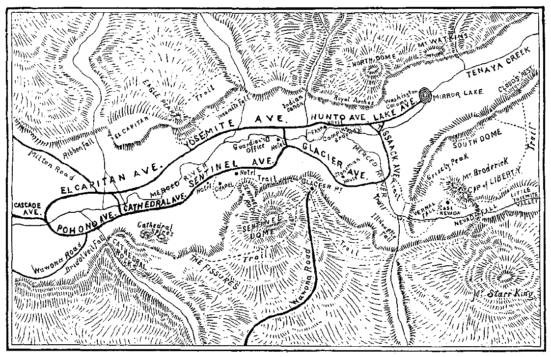
The few old Indian trails and sheepherders’ paths that existed in the Yosemite region were rarely blazed or otherwise delineated so that it was almost impossible to plot them. The earliest maps show the old Mono Trail over Mono Pass, branching in the area of Tuolumne Meadows, with one arm cutting over to the north wall of Yosemite Valley where it was joined by the Coulterville Trail as it climbed from the valley to the north rim. Another arm passed over Clouds Rest and Sunrise Creek, across Little Yosemite Valley, up Buena Vista Creek, and then down to the foothills. The Mono Trail also connected with the Mann brothers’ 1856 trail by continuing from Little Yosemite Valley through Mono Meadow to Ostrander’s, near Peregoy Meadow on the present Glacier Point road. The early survey map also included a route from Ostrander’s to Sentinel Dome that the state survey party blazed in 1864. Travelers reached the Mariposa Grove of Big Trees by a trail from Clark’s Station, while a trail entered Hetch Hetchy Valley from a point on the Big Oak Flat Road between Sprague’s and Hardin’s ranches, west of the present Big Oak Flat entrance to the park.
b) Routes To and Around Yosemite Valley
Because of their high altitude, all of the early trails to Yosemite Valley were susceptible to heavy snowstorms beginning in the fall and continuing well into the spring, so that they could be used only a small part of the year. Only one route tried to avoid the heavy drifts of the high ridges by taking advantage of the lower, relatively snow-free passage through the Merced River Canyon. The Hite’s Cove route was suggested as early as 1871, one of its primary advocates being James A. Hennessey, who was cultivating a commercial garden in the area now encompassed by the town of El Portal. The proposed route started from the settlement of Hite’s Cove, on the South Fork of the Merced River some distance above its confluence with the main channel. A wagon road already connected that village with Mariposa. From Hite’s Cove the trail crossed the ridge to the Merced River, continued upriver to Hennessey’s ranch, then followed the river for a mile or so before diverging from the stream into the mountains and intersecting the Mariposa-Yosemite Valley trail at Grouse Creek. That route, probably based on a previously existing Indian trail, was not heavily used because of its discomforts and difficult grade. The later winter mail route for Yosemite Valley, however, connected Jerseydale and Yosemite via the trail through Hite’s Cove and along the Merced River canyon.
Charles Leidig stated that his parents, Fred and Isabel, came to Yosemite Valley in 1866 over a horse trail via Jenkins Hill down into the Merced River canyon. They then followed up the canyon to the valley, suggesting this is one of the earliest historic routes into Yosemite Valley.29 Lieutenant N. F. McClure, Fifth Cavalry, U. S. Army, shows a trail running along the north side of the Merced River to a point just below the Coulterville Road junction at The Cascades. The trail appears to originate from Hazel Green, allowing access from areas west of the present park. One branch comes south through Anderson’s Flat to Jenkins “Mill,” while the other comes south from Hazel Green through Big Grizzly Flat and the Cranberry Mine area.30
[29. Paden and Schlichtmann, Big Oak Flat Road, 278-79.]
[30. N. F. McClure, “Map of the Yosemite National Park,” prepared for use of U. S. troops, March 1896.]
In 1885 the Mariposa Gazette carried an article by James A. Hennessey, written from his ranch on the Merced River, in which he stated that a trip in August to Wawona with a cargo of vegetables and orchard produce had been his first excursion out that way for the season. He also reported:
My new trail from the ranch intersecting the Mariposa and Yosemite Road, one mile east of West Woods, is nearly completed. I passed over it this trip. As soon as I have this trail completed I will commence on another from Fish Camp to Fresno Grove of Big Trees and the California Saw-mills. After that I expect to improve the old Mono and Mariposa Trail. With these trails in proper condition I can reach Tioga from my place in forty-two miles. This route would take in West Woods [Eleven-Mile Station], Peregoy’s Meadows, Little Yosemite, Clouds’ Rest Mountain and Soda Springs. It will be an excellent route and will bring plenty of tramps through to the county after it becomes known.31
[31. 15 August 1885, in Laurence V. Degnan to Douglass H. Hubbard, 3 September 1957, in Separates File, Yosemite-Trails, Yosemite Research Library and Records Center.]
c) Tourist Trails in the Valley
One of the major deficiencies of the Yosemite Valley floor was the lack of footpaths enabling visitors to enjoy short walks from their hotels to scenic points of interest. Only a narrow boardwalk led from Black’s Hotel to the Upper Hotel. By 1864, however, two improved scenic trails out of the valley already existed, one to Vernal Fall, the other to Mirror Lake. The beginning of much of the present Yosemite trail system was laid after establishment of the state grant, when it became imperative that the Board of Yosemite Commissioners improve the faint Indian trails so that eager hikers could reach the valley rim and backcountry beyond. The small annual legislative appropriations could not accomplish extensive trail work or many other improvements on grant lands. As a way of raising revenues, therefore, the commissioners extended toll privileges for a specific length of time for trail construction just as they had for roads. Under that system, various grantees constructed the Four-Mile, Snow, and Eagle Peak trails. In 1882 the commission purchased the Mist and Glacier Point trails and soon after bought the others. The state did little further trail building on the valley up to 1906. Trail building in the backcountry was accomplished by the U. S. Army after 1891.
(1) Four-Mile Trail to Glacier Point
James McCauley, an Irishman, came to Hite’s Cove, California, in 1865 to mine. In 1871 he entered into a contract agreement with the Yosemite commissioners to build a toll trail from the south side of the Yosemite Valley floor up to Glacier Point. McCauley selected John Conway to survey the route and build the trail. Conway was one of the most famous trail builders in Yosemite, making many of the points on the valley rim accessible to later visitors. Conway and a trail crew began work in late November 1871 and worked until snow stopped their progress. Starting up the next spring, they had completed the trail to Union Point when Conway was injured in an accident. Because they had completed the survey to Glacier Point, trail work continued to completion in early summer 1872.
Helen Hunt Jackson described the Four-Mile Trail as
. . . a marvelous piece of work. It is broad, smooth, and well protected on the outer edge, in all dangerous places, by large . rocks; so that, although it is far the steepest trail out of the valley, zigzagging back and forth on a sheer granite wall, one rides up it with little alarm or giddiness, and with such a sense of gratitude to the builder that the dollar’s toll seems too small.32
[32. H. H. [Helen Hunt Jackson], Bits of Travel at Home (Boston: Roberts Brothers, 1894) 127. She also mentioned stopping to rest at Union Point, where she thought McCauley evidently lived, “in a sort of pine-plank wigwam, from the top of which waved the United States flag.” Ibid., 133. This was more likely an equipment storage shed.]
In the 1920s the Park Service slightly rerouted the trail and changed its grades until it is now nearer five miles long; it still, however, retains the historic name. When the Yosemite Valley commissioners initiated their policy of eliminating all private holdings as rapidly as possible, they requested $7,500 from the state legislature in 1877 to purchase trails from their private owners. An act for the purchase of trails in Yosemite Valley and the Mariposa Grove finally passed in March 1881. As stated previously, that bill appropriated $25,000 from the state treasury, part of which was intended for purchasing and making free the trails within the Yosemite Grant constructed and controlled by private individuals. In 1882 the state purchased the Four-Mile Trail from McCauley for $2,500 and made it toll free.
The old abandoned trail parallels the present one up the talus slope below Sentinel Rock. It begins on the valley floor about fifty yards east of the present trail and proceeds via five switchbacks to the base of Sentinel Rock, which it avoids by swinging 1,300 yards to the east. After another 200-yard swing to the west, the old trail enters another series of switchbacks to avoid a short rock-filled chimney at an elevation of 1,200 feet above the floor. From there to Union Point is another irregular series of zigzags, turning to the east and southwest, a prime example of Conway’s engineering competence. Union Point is 2,314 feet above the valley floor, and from there one can see Yosemite Fall, Half Dome, North Dome, El Capitan, Cathedral Rock and Spires, and the Big Oak Flat and Wawona roads.
The trail continues in several long, gentle switchbacks to an elevation of 7,000 feet. There it squeezes east under and over precipitous granite cliffs, emerging within sight of Glacier Point’s overhanging rock. Then the early-day hiker followed a level stretch of trail and made the last climb of a 100-yard rise to Glacier Point.
The impressive engineering and construction skills of the builder are apparent everywhere. Abandonment of the trail and construction of the present one in 1923 have hastened obliteration of the old trail, but only in the narrow, rock-filled chimney below Union Point is one unable to follow its course. The modern trail, paralleling the old, traverses an additional 0.6 mile to eliminate a one-step grade. The present Four-Mile Trail, therefore, is actually 4.6 miles long.33
[33. “Pioneer Trails of Yosemite Valley: The Four Mile Trail,” author unknown, in Separates File, Yosemite-Trails, Y-8, Yosemite Research Library and Records Center.]
(2) Indian Canyon Trail
This deep ravine in the wall east of Yosemite Point sheltered an Indian trail to the north rim of the valley. In 1874 James Hutchings paid for construction of a horse trail up Indian Canyon to Yosemite Point, which by 1877 had already fallen into disrepair. Construction of Conway’s Yosemite Fall and Eagle Peak trail made this one obsolete. The trail carried traffic for only a few years. Cosie Hutchings Mills recalled in 1941 that Fred Brightman, while working at the livery stable in the valley, had attempted to construct a trail up Indian Canyon, possibly between 1885 and 1888, but had been deterred from completing it by a huge rockslide.
(3) Yosemite Fall and Eagle Peak Trail
In 1867 James Hutchings reported that during the winter he had constructed “a good, substantial bridge across the Yosemite Creek . . . so that parties can now visit the foot of the lower Yosemite Fall with more comfort and less danger than formerly.”34 John Conway started the Yosemite Fall toll horse trail in 1873 and first completed it just to the foot of Upper Yosemite Fall. By 1877 he had finished the trail to the top of the fall on the north rim, and by 1888 to Eagle Peak. Conway refused to sell it to the state in 1882 for what he considered an unjust offer. It was subsequently announced in the Mariposa Gazette that the Board of Yosemite Commissioners had declared all trails and roads in the valley toll free, except for the Eagle Point Trail, whose owner refused to recognize the order of the board and surrender his franchise.35 Conway was finally forced to sell in 1885 for $1,500. The present trail closely follows the original.
[34. “Yo-Semite Valley,” in San Francisco Alta, quoted in Mariposa (Ca.) Gazette, 1 June 1867.]
[35. 10 June 1882, in Laurence V. Degnan to Douglass H. Hubbard, 3 September 1957.]
(4) Rim Trail, Pohono Trail
The Pohono Trail route appeared on Lieutenant McClure’s 1896 map, but its original builder and date of construction are uncertain. Originally an Indian trail, it led from Yosemite Valley up past Old Inspiration Point. The rim trail, which meets the Pohono, was constructed in parts by the state during the 1890s and taken over by the cavalry after 1905. About 1906 the trail’s name changed from Dewey Trail to Pohono Trail. The rim trail follows the south rim of the valley from near Sentinel Dome, via The Fissures, deep rock clefts just east of Taft Point, across Bridalveil Creek some distance behind Bridalveil Fall, then on to Dewey and Stanford points and the old stage road at Fort Monroe. It joined the early trail from the South Fork to Charles Peregoy’s Mountain View House in present Peregoy Meadow, which was practically abandoned after 1875 when the Wawona Road was completed to Yosemite Valley. That Alder Creek Trail, one of the oldest in the region and a main early route to Yosemite, led from Wawona through Empire Meadow, across the headwaters of Alder Creek, and along the level to Westfall and Peregoy meadows, and eventually struck the Pohono Trail. One can then turn left to the valley via Old Inspiration Point roughly along the route of the original Pohono Trail or turn right toward Glacier Point.
(5) Clouds Rest and Half (South) Dome Trails
The original trail to Clouds Rest formed a segment of the old Mono Trail. In 1882 the commissioners had recommended that the trail be shortened, which was accomplished, along with improvements, in 1890. In 1912 the Department of the Interior further improved it. Wheeler’s map also showed the spur trail to the base of Half Dome. Although several others, including James Hutchings, had earlier attempted to scale the 8,892-foot monolith of Half Dome, George C. Anderson, the Scottish blacksmith of Yosemite Valley, was the first to finally climb it, on 12 October 1875. A carpenter and former seaman, and prominent in the early trail building days of Yosemite, Anderson accomplished his climb of Half Dome with only drills and a hammer. By driving wooden pins and iron eyebolts into the granite five to six feet apart, he could successively fasten a rope to each bolt and pull himself up, resting his foot on the last spike while he drilled a hole for the next. He followed this painstaking process for 975 feet. Within a week six men, including Galen Clark, then age 61, and one woman, pulled themselves up to the top by Anderson’s rope. John Muir was the ninth person to make the climb, on 10 November 1875. Anderson’s plan of building a staircase to the summit of Half Dome died with him when he succumbed to pneumonia on 8 May 1884.
The cable that Anderson fastened to the bolts enabled Half Dome to be scaled for several years thereafter by the few who dared to meet that challenge. During the winter of 1883-84, sliding ice and snow broke the rope Anderson had installed and ripped out some of the eyebolts. It was again impossible for others to reach the top until several mountaineers duplicated the original climb and replaced the rope. The ropeway had to be replaced again in 1895 and 1901. Park Supervisor Gabriel Sovulewski recalled that Paul Segall replaced old pegs in 1908. John Muir wrote in 1910 that no one had
attempted to carry out Anderson’s plan of making the Dome accessible. For my part I should prefer leaving it in pure wildness, though, after all no great damage could be done by tramping over it. The surface would be strewn with tin cans and bottles, but the winter gales would blow the rubbish away. . . . Blue jays and Clark crows have trod the Dome for many a day, and so have beetles and chipmunks, and Tissiack would hardly be more “conquered” or spoiled should man be added to her list of visitors. His louder scream and heavier scrambling would not stir a line of her countenance.36
[36. Shirley Sargent, John Muir in Yosemite (Yosemite, Calif.: Flying Spur Press, 1971), 24.]
(6) Vernal Fall and Mist Trails
The Vernal Fall Trail started at Happy Isles and followed the south bank of the Merced canyon to the vicinity of Clark Point. From there one could take either the Mist Trail, passing along the steep cliffs of the Merced and enveloped much of the way with spray from Vernal Fall, or the regular Merced River Trail. The latter is one of the most historic trails in the park, forming one of the earliest segments of the present trail system.
By 1864, when the state began to manage the Yosemite Valley, a trail to the top of Vernal Fall along the south side of the Merced River already existed, its origin unknown. It probably began as an Indian trail, providing access to Little Yosemite Valley. It may have been the path followed by members of the Mariposa Battalion as they searched for Chief Tenaya’s band. Occasional references connect Stephen M. Cunningham to early trail work in the Vernal-Nevada falls area. Cunningham, born in New York State in 1820, served as a justice of the peace for Mariposa in 1852 and became a business associate of James Savage. After serving in the Civil War, he returned to Yosemite Valley and the Mariposa Grove, where he became a guide and curio seller.
John Olmsted wrote in 1868, upon arriving at a spectacular view of Vernal Fall from Lady Franklin’s rock:
The real hard work was now to be done. Above us the path grew steeper and steeper, until it led along the face of a sloping rock partially covered with muck—where the wind blew furiously, and the spray from the fall was blinding. At this juncture I availed myself, for once, of the strong hand of the guide. On a slippery shelving rock, with a seething cauldron on our left, a precipice on our right, with a boggy, slushy path rising before us, a thick penetrating spray eddying around, filling our eyes and ears, the wind roaring, and bellowing, and lashing against us, and the thunders of the cataract booming on our ears—surely this was a position to be sought but once in a lifetime, and to be endured but once more, and that from necessity.
Soon, however, the whole party were safely at the foot of a high rock, parallel with the face of the fall, where stood a ladder about sixty feet long, nearly perpendicular. Stepping from the top round on to a ledge of rock, I found another ladder some twenty feet high, at right angles with the first, from the top of which a little smart climbing brought the party to a smooth expanse of rock at the very verge of the Vernal Fall.37
[37. John Olmsted, A Trip to California, 1868, in Separates File, Y-4C, #29, Yosemite Research Library and Records Center, 80.]
During 1869 and 1870, Albert Snow rebuilt the old trail for horse travel connected with his La Casa Nevada hotel operations and for stock that he grazed in Little Yosemite Valley.
Today’s Mist Trail, from above the present Vernal Fall bridge on to the top of the fall, is essentially the same as the original route, except that the trail used to end at Fern Grotto, where a platform and wooden ladders provided access up and over the rim. They were built either by Cunningham or by Ira Folsom, who operated the ferry across the Merced River in the valley. A visitor in 1876 recalled that
There is an awfully pokerish ladder fastened against the cliff, on which you can go down and get very wet. It is painful and rather dangerous, but a great many,, persons escape, and they only charge you seventy five cents.38
[38. Dio Lewis, Gypsies (Boston: Eastern Book Co., 1881), 170-71. The Mariposa (Calif.) Gazette of 10 June 1882 stated that Drew’s ladders at Vernal Fall had been purchased by the Board of Yosemite Commissioners. Laurence V. Degnan to Douglass H. Hubbard, 3 September 1957. This must refer to Colwell O. Drew, a cattleman utilizing Drew’s Meadows near Hog Ranch. A co-owner of La Casa Nevada, he married the Snows’ only daughter, Maria.]
The Vernal Fall Trail toll house, no longer extant, measured twenty feet long by fourteen feet wide. It stood under the edge of an immense granite overhang, called Register Rock, with that stone forming the back part of the house and half of the roof. That same boulder sheltered a livery stable and other outbuildings.39 Major Harry Benson ordered Register Rock, upon which so many early and some famous visitors to Vernal and Nevada falls inscribed their names, painted over in 1906-1907.
[39. Churchill, Over the Purple Hills, 168-69.]
The state of California purchased the Mist Trail and the ladders in 1882 for $300. Within the next few years, wooden stairs replaced the dangerous ladders, and railings were erected in 1892. James Hutchings, in describing the Mist Trail, wrote in his book published in 1886:
Let us seek the “ladders,” so called from the original, but which have been transformed into substantial steps (to which the old term “ladders” still clings), by which we can descend to Fern Grotto, on our way to the foot of the Vernal Fall wall.40
[40. Hutchings, In the Heart of the Sierras, 453.]
(7) Snow Trail
In 1870 Albert Snow, the first known trail builder in Yosemite Valley, constructed a horse trail from the valley floor to Register Rock, the beginning of the Mist Trail, and over to the flat between Vernal and Nevada falls, where he had constructed a hotel. The route of that original trail, which zigzagged up to Clark Point and down to Silver Apron, can be picked up at the junction just above Register Rock. It generally followed the new trail but was much steeper. Then, just after crossing the bridge near Silver Apron, one can find to the right a section of the trail leading directly to the site of La Casa Nevada. The road from La Casa Nevada to Emerald Pool is part of George Anderson’s unfinished trail from Happy Isles.
(8) Anderson Trail
In 1882 George C. Anderson contracted with the Yosemite commissioners and began construction on a trail up the north bank of the Merced River from Happy Isles Bridge to Vernal Fall. He originally planned to build the trail all the way up the north side to the top of the falls near Snow’s hotel, but when costs began to run way over budget and the trail ran into a granite cliff through which it would be necessary to blast, the commission ordered the project stopped. In 1885 the commissioners had a connection built from a point on Anderson’s trail uphill to a new bridge below Vernal Fall, across which it joined the Snow Trail. Anderson’s abandoned trail left the present path about three hundred feet below the bridge at Vernal Fall and continued uphill—broad, substantial, and wide as a wagon road — until it ended abruptly in a grove of trees. The earlier south trail along the Merced ultimately fell into disuse. Anderson built a blacksmith shop along his trail that is mentioned in some of the old commissioners’ reports. Its remains were cleaned up by National Park Service crews in 1957.
(9) Panorama Trail
In 1871 John Conway laid out a horse trail—his first trail building venture in the park, possibly prompted by Washburn and McCready—from Snow’s hotel site to the top of Nevada Fall and on to Little Yosemite Valley along the north side of the Merced River. Washburn and McCready built the original trail from Glacier Point toward Nevada Fall in 1872, following Illilouette Ridge and dropping down to join the Mono Trail at the bridge in Little Yosemite Valley. In 1885 the Echo Wall Trail section of the Panorama Trail was built to Glacier Point directly from Nevada Fall. It later became the Eleven-Mile or Long Trail. In 1893 the commissioners’ reports stated that the Panorama Trail had been rebuilt after long disuse, as had the bridge over Illilouette Creek.
(10) Ledge Trail
By 1871 James Hutchings was guiding parties of hikers over a hazardous route he had blazed that climbed 3,200 feet in one and one-half miles from in back of Camp Curry to Glacier Point. Because of the hazards connected with its use, the National Park Service refused to recognize this as an official trail and discontinued its maintenance.41
[41. Some of this information on early trails came from John W. Bingaman, Pathways: A Story of Trails and Men (Lodi, Calif.: End-Kian Publishing Co., 1968), 20-27.]
5. Improvement of Trails
a) Hardships Attending Travel to Yosemite Valley
Although in the late 1850s the newly discovered Mono diggings east of the Sierra began attracting miners and packers and stimulating trans-Sierra travel over the Mono Trail, Yosemite Valley would not be reached by wagon for many years yet. Until the mid-1870s passengers and freight entered the valley on horses and mules over rough, steep trails. The number of registered visitors to the valley increased steadily from year to year as returning travelers disseminated word of the park’s grandeur. The tourism potential was strong from the beginning, but the uncertain travel conditions remained a hindrance.
Towns neighboring Yosemite Valley quickly lost patience with what they perceived as a lack of foresightedness on the part of the Yosemite commissioners. Although the Yosemite Valley and Big Tree Grove had been surveyed, nothing tangible was being provided by the legislature for their improvement, which would help attract visitors and fatten the coffers of local businessmen:
There is no longer reason for hoping for assistance from the State in either improving these places, or the roads that lead to them, and it now becomes a matter of importance to the people here to consider whether they cannot afford to take the case in their hands., so far as to raise money to improve and rebuild the roads. 42
[42. “The Trails to Yo Semite Valley,” Mariposa (Calif.) Gazette, 24 March 1866.]
The number of visitors who willingly accepted the adversities of the Yosemite trip during the early years was phenomenal, but many wryly commented on the crude facilities and rough passage found along the way. One early traveler who made the trip from the south in 1867 recounted that
The most difficult mountain in the way, after leaving Mariposa, is Chowchilla, some sixty-five hundred feet above the sea, and it is decidedly in the way; the trail over it being zig-zag in its course, and is exceedingly difficult. Up and up we went, on an angle varying from thirty to forty degrees, struggling through the dry dust and loose rocks surrounded by pine trees, manzanita and sage brush, the summit seemingly but a short distance up, but when reached not there. We stopped and rested often in our ascent, and in about two hours we were on the summit, fatigued and jaded, as were our horses. After that we plodded on, up and dowri hills, following the trail till we reached Clarks’s [sic]. . . .43
[43. “Yo Semite Valley” (Correspondence of the Hartford (Conn.) Courant), in Mariposa (Calif.) Gazette, 29 June 1867.]
The Chowchilla Mountains route was notorious for its rugged terrain, steep grades, and difficult course even after it became a wagon road in 1870. Not all of the trip was uncomfortable, however, for having finally arrived at Clark’s establishment, that same 1867 visitor enjoyed a succulent dinner of venison and chicken, bread, coffee, milk, and sweetmeats. He likened Clark to Robinson Crusoe,
monarch of all he surveys, and at his rancho he entertains the traveler in a style peculiar to himself. Although his guests are not supplied with all the comforts of modern degeneracy, they are sure of a good table, good beds and good attention, much better than they can with any reason expect in such a wild, inaccessible place, and at rates which., for moderation are somewhat surprising to California visitors.44
[44. Ibid.]
That same year Mariposa County residents petitioned their board of supervisors to survey for a public wagon road from Mariposa to the South Fork of the Merced, terminating at Clark’s hostelry It was obvious to them that the needs of travelers for better accommodations and routes would have to be met from that end if Mariposans were to acquire their fair share of the increasing tourist trade. Already sensing the keen competition for tourist dollars from Coulterville to the north, Mariposans felt that there should be a good road to Yosemite Valley on each side of the Merced River.45
[45. “The Proposed Wagon-Road to the South Fork,” Mariposa (Calif.) Gazette, 16 February 1867; “Wagon Road to the South Fork,” Mariposa (Calif.) Gazette, 23 February 1867; “Road to Yo Semite,” Mariposa (Calif.) Gazette, 16 March 1867.]
b) Yosemite Commissioners Encourage Road Construction
After the Yosemite Grant was established, as an inducement for individuals or companies to build access routes into the valley, the commissioners offered to grant certain parties franchises to construct trails and roads in and about the park. Paying the cost of those improvements themselves, the builders were allowed in return to collect tolls for the use of their roads. It was stipulated, however, that those roads and trails would pass to the state and become free whenever the legislature appropriated money for the commissioners to reimburse the amounts expended in construction.
By 1869 several road companies were at work, their backers realizing that the first stage route completed to Yosemite would be heavily used. In Mariposa County the “Mariposa and Big Tree Grove Turnpike Company” had been organized the previous summer to build a carriage road as far as Clark’s and ultimately on into Yosemite Valley. The “Yo Semite and Big Tree Grove Turnpike Company” had also been incorporated earlier to build a turnpike from Coulterville via Black’s, Bower Cave, and Deer Flat, into Yosemite Valley, thence by Inspiration Point, the “Meadows,” Clark’s, and the Big Tree Grove to Mariposa. The “Mariposa Big Trees and Yo Semite Turnpike Company,” of which Galen Clark was president, was formed for the purpose of constructing a wagon road from Mariposa to the South Fork and the Big Trees. The road was to connect with the Hogan Ranch road west of the main branch of Chowchilla Creek, cross Chowchilla Mountain to Clark’s ranch on the South Fork of the Merced, and proceed to the Mariposa Grove of Big Trees. In August 1869 a traveler noted two available routes to the valley, one via Mariposa and the other via Big Oak Flat and Harding’s mill. The latter was the cheapest, steepest, and most uncomfortable. The Mariposa route was somewhat longer but easier to travel in comparison.46
[46. “The Yo Semite Roads,” Mariposa (Calif.) Gazette, 12 February 1869; “New Road Company,” Mariposa (Calif.) Gazette, 12 March 1869; “The Chinese Camp Turnpike,” Mariposa (Calif.) Gazette, 23 July 1869; and “What the ‘Chicago Party’ Says,” in Mariposa (Calif.) Gazette, 20 August 1869.]
c) Work Begins on the Big Oak Flat and Coulterville Roads
Big Oak Flat (earlier Savage’s Diggings), an early mining community thirty miles west of Yosemite National Park, gave its name to the Big Oak Flat Road, the second access for wheeled vehicles built into Yosemite Valley.
A group of men in Tuolumne County had organized the “Chinese Camp and Yo Semite Turnpike Company” in September 1868 with the intent of building a turnpike road from Chinese Camp, through Big Oak Flat, First and Second Garrote, across the Pilot Peak ridge, through Hazel Green and Crane and Tamarack flats, to a point on the summit overlooking Yosemite Valley.47 George W. Coulter was president of the organization and Charles B. Cutting secretary. The state of California granted the company a franchise in February 1869 and a formative meeting for the project took place in Chinese Camp on 19 March. In September 1869 George E. Sprague, L. E. Stuart, and John B. Smith of Garrote, in Tuolumne County, obtained from the Yosemite commissioners the exclusive privilege for that company to build a wagon road within the grant, entering the valley on the north side of the Merced River. The road was to be completed by 1 July 1871. By June 1870 it stretched from Big Oak Flat, through First and Second Garrote, past Sprague’s, Hamilton’s, and Hardin’s ranches, and on beyond the Hodgdon Ranch on the edge of the grant to Crane Flat. On 20 January 1871 the company incorporated as the Yosemite Turnpike Road Company. By July 1871 the Big Oak Flat Road had only reached Gentry’s Station at the northwestern edge of the Yosemite Grant atop the cliff above Yosemite Valley. There time and money ran out. Although the state extended the deadline for completion of the road, on 1 January 1872 the company forfeited its franchise and apparently did not ask to have it renewed.
[47. According to Erwin G. Gudde, California Place Names (Berkeley: University of California Press, 1960), Garrote acquired its name from the execution of a thief by strangulation. A second execution a few miles away resulted in First and Second Garrote. By 1879, First Garrote had adopted the name Groveland.]
The people of Coulterville realized that they also needed a road into Yosemite Valley to remain competitive in the tourist trade. In 1870 citizens of Mariposa County residing at and near Coulterville incorporated the Coulterville and Yosemite Turnpike Company to build a wagon road from Bower Cave, the eastern extremity of the public road leading toward Yosemite Valley, on the North Fork of the Merced River, to the western boundary of the Yosemite Grant. During 1870-72 a wagon road was constructed from Bower Cave (a limestone cavern and later a tourist stop), up the south slope of Pilot Peak, by Hazel Green, to Crane Flat, where a junction was made with the Big Oak Flat Road to Gentry’s. The final miles to the valley floor were made on horseback.
d) Improved Roads and Railroad Service Increase Visitation
Those two routes, in addition to the wagon road built by Galen Clark and others from White and Hatch’s to Clark’s ranch on the South Fork of the Merced River, greatly improved accessibility to Yosemite by 1872. The horseback ride to the valley was reduced on the north side to eight miles from Gentry’s, the terminus of the Big Oak Flat Road; to thirteen miles from Crane Flat, where the Coulterville Road ended, via Gentry’s; and on the south side to twenty-six miles from Clark’s Station.
The completion of the Central Pacific Railroad through the San Joaquin Valley in the early 1870s brought an influx of visitors to Yosemite, with Berenda, Raymond, and Merced serving as staging points as railroad construction advanced. In 1871 the Central Pacific Railroad completed its “Copperopolis Short Line” from Stockton to Milton, in Calaveras County. From there stages carried the passengers through Chinese Camp, Jacksonville, Priests’s Grade, and Big Oak Flat to the valley. The California Lumber Company established Madera on the Southern Pacific Railroad in 1876, from which a stage road ultimately led via Coarse Gold, Fresno Flats (Oakhurst), and Fish Camp to Wawona.
Despite their gradual improvements through the years, trails into Yosemite remained steep and dangerous, and travel over them entailed various levels of discomfort and fatigue that continued to discourage many park visitors. To make the most of one’s visit,
a “round trip” was recommended, the tourists coming into the valley by way of the Coulterville trail and leaving by way of the Mariposa trail. No road came closer to Yosemite than Mariposa. Ten days was the minimum a traveler should allow for the journey from San Francisco, and of this three days could be spent in the valley, one in the Big Trees, the remaining six being spent in transit.48
[48. Elizabeth Foote, “Interesting Notes from the “Whitney Guide Book,” Yosemite Nature Notes 16, no. 9 (September 1937):66.]
The improvement of trails up to this point always stopped short of the valley floor because of the great expense of forging a way down the granite walls on either side of the valley. The first official report of the Yosemite commissioners to the state legislature, in 1867, described the difficulty and cost of making the valley accessible by wagon road. It pointed out that the valley could not be entered by following the Merced River upstream, as might be supposed, because of the narrow and precipitous canyon walls. Instead one had to descend 3,000 feet into the valley from above. Building a safe wagon road from any of the existing trail termini down to the valley floor was judged to be difficult and expensive, if not impossible. Such gloomy assessments deterred the only prospective builders of such a road—the companies with interests in the three routes leading to Yosemite. The Coulterville and Yosemite Turnpike Company, however, finally took the initiative.
e) The Coulterville Road Reaches the Valley Floor
1) A New Transportation Era Begins
In the summer of 1872, that company, through its president, Dr. John T. McLean, applied to the Yosemite commissioners for the exclusive privilege of extending its wagon road into Yosemite Valley and collecting tolls for the use of the part of the road within the grant after it was constructed. The road within the limits of the grant was to be free to teams exclusively hauling hay and grain as feed for horses and cattle stabled in the valley and lumber for building purposes (a positive commentary on the board’s attitude toward preservation of the valley floor). It was to be completed within the year 1873.
Because the commission had heard nothing further from Sprague and his associates, and assumed that they were content to have passengers over their road enter the valley via the Coulterville trail from Gentry’s as had been the practice since completion of their road to that point in 1871, it entered into a contract with McLean’s company, leasing it the right-of-way for a period of ten years. Such an exclusive privilege would somewhat offset the cost of the venture because it would secure for the company all travel into Yosemite from the north side of the Merced River.
Indeed, the commissioners granted this exclusive privilege because they did not think anyone would be willing to advance the large sum needed for the enterprise unless they had the assurance of being able to command all the travel on one side of Yosemite Valley. A second reason for their willingness to assure such a monopoly was their belief that the desire of the Mariposa business community to retain its share of Yosemite-bound travel would result in construction of a competing wagon road to the valley from the south side of the Merced. The commissioners felt that one road on each side of the river would suffice for several years to come and that more could not be built without dividing travel to such an extent that parties who advanced funds would receive no remuneration for their investment.
While the Coulterville crew was surveying in search of the best route over which to continue its road to the valley floor, Dr. McLean discovered a stand of Big Trees, which he named the Merced Grove because of its proximity to the Merced River. He immediately perceived the potential tourist attraction of these huge sequoias. Although it would cost $10,000 more than to build from Crane Flat down Crane Creek to Big Meadow, it was decided to reroute the road east from Hazel Green along the southern slope of the dividing ridge between the Tuolumne and Merced rivers, through the Merced Grove of Big Trees to Big Meadow, and then on into the Merced Canyon, past the western boundary of the grant, to the Lower Iron Bridge on the valley floor. The Coulterville Road became an expensive proposition when it was decided to detour through the Merced Grove. That decision caused abandonment of six miles of already completed road to Crane Flat and necessitated construction in a granite formation, between Crane Creek and the Merced River canyon floor, that required expensive blasting.
The deep snows of the winter of 1872-73 delayed construction, so the state extended the contract time to the end of 1874. Continuing work during 1873 and 1874, the company finally completed the road on 18 June 1874,
and on that day stage coaches and carriages, filled with passengers, first passed from the towns on the railroad in the San Joaquin Valley, and from the foothill towns of the Sierra Nevada over this road into the Yosemite Valley. The completion of this road made access to Yosemite easy, speedy and comfortable, by wheeled vehicles, instead of tiresome, difficult and dangerous, on horseback, and over trails; and was celebrated in the valley by bonfires, firing of cannon, a procession, a public meeting, and general rejoicing; the press of the State and of the United States noticing the event as one in which not only California but the Nation was interested and to be congratulated.49
[49. McLean, “A Statement,” 23.]
The pioneer route to Yosemite, the Coulterville Road signaled a new era in tourism by opening the valley to wheeled vehicles. The last portion of the road, at The Cascades, featured a frightening grade, lacking curves or turns. It was a straight, steep, dangerous stretch, built straight down the side of the Merced River canyon. The Coulterville Road, in its entirety, left the San Joaquin Valley at Modesto, went east through La Grange, past Red Mountain, to Coulterville, Dudley’s Hotel and Ranch, and Bower Cave, and on to Hazel Green, the Merced Grove, and Big Meadow, and then descended into the Merced River canyon. Its total cost from Bower Cave to the Lower Iron Bridge was $71,000, including the branch from Hazel Green to Crane Flat.
The main division of the Coulterville Road was twenty-seven miles long, from Bower Cave on the North Fork of the Merced River east to the “Blacksmith Shop,” a hole in the rocks on the north side of the Merced where a forge had been established in 1874. That spot lay one-sixteenth of a mile west of The Cascades, near where Cascade Creek emptied into the Merced River, on the west boundary of the Yosemite Grant. (Today the site is near the junction of the All-Year Highway and the old Coulterville Road.) A six-mile branch extended from Hazel Green to Crane Flat, and another four-mile stretch ran from the blacksmith shop to Hutchings’s Hotel.50
[50. For information on the Coulterville Road, see John T. McLean, deposition before R. B. Tappan, Notary Public, 27 September 1891, in Letters Received by the Office of the Secretary of the Interior Relating to National Parks, 1872-1907 (Yosemite), RG 79, NA; Jno. T. McLean, Pres., Coulterville & Yosemite Turnpike Co., to Col. S. M. Mansfield, Pres., Commission to examine and report as to certain roads in and about Yosemite National Park, 30 October 1899, Letters Received by the Office of the Secretary of the Interior Relating to National Parks, 1872-1907 (Yosemite), RG 79, NA.]
The width of the road averaged sixteen feet, with turnouts. The average grade from Bower Cave to the blacksmith shop did not exceed eight percent, and its builders stated that nowhere was the grade in excess of fifteen percent. The sunny exposure of the road, because of its location along the south or sunny side of the divide between the Tuolumne and Merced rivers, resulted in cheaper maintenance than for the other roads into the park. The road remained free of snow and passable for travel earlier in the spring and stayed open later in the fall. The toll house of the Coulterville Road in the canyon of the Merced River near Cascade Creek was burned by Indians in 1874. The toll collector, George E. Boston, was murdered and his body burned in the conflagration. In the house and destroyed by the fire were all the toll books and other account books of the turnpike company from 1870 to 1874.
2) Later History
When Yosemite National Park was established, including the privately owned toll roads, there were no appropriations available for purchasing those sections of road on park land. The government, therefore, offered to maintain the roads if the companies would declare them toll free. The Big Oak Flat Road company accepted this proposition, but the Coulterville Road company refused it. The latter road fell into disuse, and finally the county board of supervisors declared the section from Hazel Green to Pohono Bridge a public highway in 1917, instigating a lawsuit with Dr. McLean’s daughter who demanded the right to collect tolls. Those rights were denied because of the lack of maintenance on the road since 1908.
The Coulterville Road enters the park four times along its western boundary as it winds to its terminus at Highway 140 in the Merced River canyon, one mile below The Cascades. Its total length across park land is 8-7/8 miles. Starting at the park boundary, near Hazel Green, this dirt road passes through the forest to the Merced Grove. This section is now used only as a fire road by the National Park Service. The south entrance to the grove is blocked by a culvert and the north entrance has a locked gate.
Heading east toward Foresta/Big Meadow, the road is intersected in several places by paved access roads on Forest Service land. The Coulterville Road is paved for the last 3Vmile section beginning at the southern perimeter of Big Meadow. The last 1-3/4 miles’ of road has a grade of around sixteen percent. The sheer descent into the valley required several retaining walls along the outside edge of the road, which are intact. Historically, the road continued up the north side of the Merced River canyon to a junction near the present Pohono Bridge where it joined an earlier wagon road leading to the Old Village area.
The Coulterville Road receives limited use today. Although the precipitous grade is closed to vehicles because of a rockslide in 1982, the partially paved section in the Foresta/Big Meadow area is used, primarily by residents.51
[51. See the National Register of Historic Places Inventory—Nomination Form, Old Coulterville Road and Trail, prepared by Leslie Starr Hart, 1976. The roadway listed in the National Register nomination does not include the spur from Hazel Green to Crane Flat connecting the Coulterville and Big Oak Flat routes. Portions of that spur are visible from the new Big Oak Flat Road between Crane Flat and Hodgdon Meadow.]
f) The Big Oak Flat Road Reaches the Valley Floor
The residents of Big Oak Flat, meanwhile, remained anxious to promote tourist travel through their region. It had been anticipated that the Coulterville group would connect with the Big Oak Flat Road at Crane Flat and use its saddle train facilities to enter the valley. But when the Coulterville company decided to detour through the Merced Grove, it meant the Big Oak Flat company had no possibility of making even a little money by using the end of their road as a staging entrance for tourists into the valley.
So on 29 August 1872 the Yosemite Turnpike Road Company, including Charles B. Cutting, D. B. Newhall, L. D. Gobin, A. Halsey, and George E. Sprague among its shareholders, requested from the Yosemite commissioners a franchise to build another road into the valley on the north side of the Merced River. Because that privilege had already been granted to the Coulterville company, the request was denied. The Big Oak Flat group brought up a similar petition for consideration at the annual meeting of the commissioners on 17 November 1873, and that body rejected it again. After adjournment of that meeting, another petition was submitted, this time for a right-of-way for a toll-free wagon road from Gentry’s Station to the valley floor; it also met with failure.
At that point the company applied to the state legislature for the right to extend its road from Gentry’s to the valley floor, and a bill passed granting them the privilege in February 1874. The new road was to commence at the east end of the Big Oak Flat company’s road, on the north side of the Yosemite Grant, near Gentry’s Station, and terminate on the valley floor near the foot of El Capitan. The Coulterville and Yosemite Turnpike Company later appealed the legislature’s action, protesting that the state had no authority to grant the request, having divested itself of the power to manage the premises and placed it instead in the hands of the governor and commissioners when it accepted the trust. The company bitterly fought the suit, but to no avail.
Because of the scarcity of money, the Yosemite Turnpike Road Company did not complete its road until 17 July 1874, one month after the Coulterville Road had reached the valley floor. The Big Oak Flat Road descended to the valley floor via a series of switchbacks that eased the final descent down the steep talus slopes. The most famous stretch of the road, because of its grade, was the Zigzag section between El Capitan Bridge and Gentry’s Station. Italian laborers skilled in rockwork completed that section by cribbing up the steep sides of the roadbed with solid rock walls without mortar. The wedge shape of the rocks ensured that they would not slip out and that the more weight on the road, the tighter the rocks would hold.
The Big Oak Flat and Yosemite Turnpike Road Company was incorporated 3 June 1879 to purchase the Big Oak Flat Road and the franchise for the toll road. Title to the Yosemite road of the Yosemite Turnpike Road Company was conveyed to J. M. Hutchings by certificate of sale of 16 May 1878. On 19 November 1879 Hutchings conveyed the road by deed to the Big Oak Flat and Yosemite Turnpike Road Company.
W. C. Priest, president of the Big Oak Flat and Yosemite Turnpike Road Company, reported on his road to an investigative body in 1899. He stated that the thirty-mile-long toll wagon road began at Dorsey’s old sawmill, about two miles northwest of Hamilton’s Station, and extended east through Hardin’s, Cracker’s, Hodgdon’s, the Tuolumne Big Tree Grove, Crane Flat, and then through Gin and Tamarack flats to Gentry’s Station, and then to the valley floor. Twenty miles of the road lay within the boundary of Yosemite National Park and ten miles outside and west of the grant’s western boundary. The road width averaged thirteen feet with a maximum grade of sixteen percent. The total construction cost of the road was $45,650. The section of the road from its point of commencement to Sequoia (Crocker’s Station), within the national park, a distance of fourteen miles, was kept in good condition and open to travel all year round, while the section of road from Sequoia to the bounds of the Yosemite Valley Grant were open seven months of the year.52
[52. W. C. Priest, Pres., Big Oak Flat and Yosemite Turnpike Road Company, to Col. S. M. Mansfield, President of the Commission appointed to investigate and report upon certain facts relative to the Yosemite National Park, under the Act of Congress of March 3rd, 1899, 31 October 1899, Letters Received by the Office of the Secretary of the Interior Relating to National Parks, 1872-1907 (Yosemite), RG 79, NA; W. C. Priest, President, Big Oak Flat and Yosemite Turnpike Road Company, in Report of the Commission on Roads in Yosemite National Park, California. Senate Document No. 155, 56th Congress, 1st Session, 8 February 1900. Commission: S. M. Mansfield, Colonel, Corps of Engineers, U. S. A.; Harry C. Benson, Captain, Fourth Cavalry, U. S. A.; J. L. Maude, Department of Highways, State of California. Report dated 4 December 1899. In Separates File, Y-20a, #15, Yosemite Research Library and Records Center.]
The original Big Oak Flat Road can still be followed down to a primitive campground at Tamarack Flat. The road continues a few miles beyond, but is closed above Gentry’s. The historic route dropped into the valley some distance uphill from the present road, completed in 1940. A rockslide destroyed that Zigzag switchback section in 1943 and traffic was switched to the modern highway. Subsequent slides and washouts further blocked the old road, but its line of descent is visible from the south side of the valley, especially from Tunnel View on the Wawona Road. The original route can be followed in a few places. One is a steep, narrow, winding section from Crane Flat to Hodgdon Meadow. Now a downhill-only route, it passes through the Tuolumne Grove of Big Trees.53
[53. Richard P. Ditton and Donald E. McHenry, Yosemite Road Guide, rev. ed. (Yosemite National Park: Yosemite Natural History Association, 1981), 9.]
A detour on the saddle trail to Yosemite began at Crane Flat near where the Coulterville and Big Oak Flat trails merged. It was used in the early spring when there were heavy snows and cut out the higher portions of the trail through Gin and Tamarack flats. Bunnell wrote that when blazing the Coulterville Trail in 1856, they cut two trails from Crane Flat, the lower for early, the upper for later seasonal use. The detour, called “The Lower Trail,” commenced at Crane Flat and avoided the climb up to Tamarack Flat and down again. Whitney’s map shows it proceeding down Crane Creek to just above Big Meadow, then due east to the regular crossing of Cascade Creek where it joined the upper trail again. It was blazed a thousand feet lower than the regular trail and was difficult to find.54
[54. Paden and Schlichtmann, Big Oak Flat Road, 224.]
g) Antagonism Between Road Companies Increases
This second road into the valley from the north, which somewhat paralleled the course of the Coulterville route, was built in defiance of the authority of the Yosemite commissioners, who, along with the Coulterville Road company, considered it to be a trespass upon the grant. Its presence, which meant a loss of the exclusive right by the latter to the travel in and out of Yosemite on that side of the valley, resulted in division of traffic between the two roads, increased competition for that patronage between the two companies, and a subsequent reduction of the tolls on both of them.
|
Illustration 5.
Rock wall cribbing and old roadbed of Coulterville Road (on USFS land), view to east. Photo by Robert C. Pavlik, 1984. |
|
[click to enlarge] |
|
Illustration 6.
Rock retaining wall and drain, old Big Oak Flat Road. Photo by Robert C. Pavlik, 1985. |
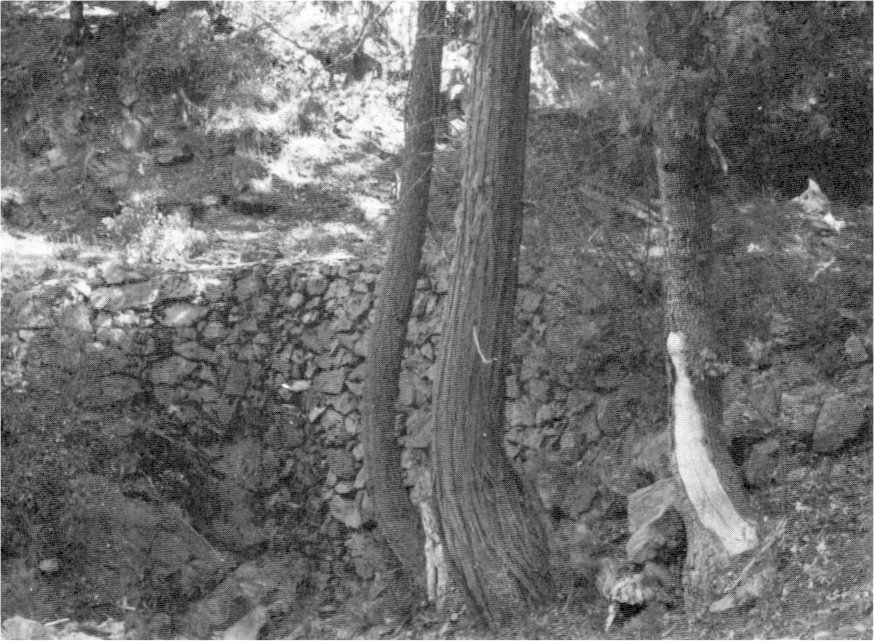
[click to enlarge] |
Most importantly, the completion of the Big Oak Flat Road meant great and immediate financial loss for the pioneer Coulterville Road company, which, because of its agreement for an exclusive privilege, had expended thousands of dollars in the construction of its road, fully expecting to be repaid by the increased volume of stage travel coming to it alone and paying the liberal tolls allowed by the commissioners. The company had confidently expected to receive a reasonable interest on the cost of the road plus a large annual surplus over the interest to help pay off the original cost of construction. The Big Oak Flat Road eventually became the more popular of the two routes.
A further aggravation to the Coulterville company was its earlier expectation that all tourists to Yosemite, wanting maximum pleasure from the trip, would enter the valley by one route and leave by another. Because its road was expected to be the only one into the valley on the north side, every tourist either entering or leaving by it, the builders of the Coulterville Road had agreed at the behest of the commissioners to collect tolls on the road only where it crossed the boundary of the grant or outside the grant in order to comply with the “public use” condition under which the grant had been made by Congress.
The construction of another road from Gentry’s to the valley meant that from 1874 to 1886, when the state purchased it, the extremely scenic portion of the Coulterville Road extending from the level of the valley to The Cascades constantly carried tourists who entered and returned from the valley by the Mariposa or Gentry routes, and who thus enjoyed the canyon scenery without paying any toll to the Coulterville company.
h) The Wawona Road Reaches the Valley Floor
Galen Clark, from his vantage point at the South Fork of the Merced, had early seen the need to develop better access routes into Yosemite Valley. By 1866 he had pushed a stage road to a point about twelve miles west of his hotel. In 1869 he organized the “Mariposa Big Trees and Yo Semite Turnpike Company” mentioned earlier, and construction on the road from Mariposa to the South Fork took place during 1870-71. The California state legislature, however, refused to buy the road as had been anticipated by the company, somewhat dampening enthusiasm for pursuing it to completion. In 1870, however, Galen Clark opened the Chowchilla Mountain wagon road from Mariposa. Two years earlier the Mariposa County Board of Supervisors had given Clark money from the county road fund to build a bridge across Big Creek on that trail.55
[55. Mariposa (Calif.) Gazette, 7 March 1868. The Chowchilla Mountain road still receives limited use.]
The later completion of the Coulterville and Big Oak Flat roads to Yosemite Valley east from Coulterville and Stockton attracted many visitors away from Clark’s southern endeavors. Because of increased debts, Clark and Moore’s, as Clark’s ranch was then known, was forced to sell to the firm of Washburn, Coffman & Chapman in 1874. Henry Washburn also believed that a completed road between the South Fork and Yosemite Valley would be advantageous to business, and the completion of such a toll road became a top priority.56
[56. Anthony Crosby and Nick Scrattish, Historic Structure Report, Design and Installation of a Fire Detection and Suppression System, Wawona Hotel, Yosemite National Park, California (Denver: National Park Service, 1983), 11, 14.]
In November 1874 Mariposa County granted a permit for a toll road to the southern boundary of the Yosemite Grant. John Conway and Joseph Ridgeway were appointed commissioners to locate and survey the route. That same fall the Yosemite commissioners granted A. H. Washburn, E. W. Chapman, and W. F. Coffman and Company of Mariposa the right to extend their toll road on the south side of the Merced from the boundary of the grant into the valley on the same terms as those given the Coulterville and Yosemite Turnpike Company. A company of Chinese obtained the contract for building the road. James Ridgeway of Mariposa oversaw the work, which started in December at Alder Creek, to which point the road had already been completed. The initial force of 50 Chinese was soon increased to 300 workers, divided into two camps.
One group of laborers worked ‘under James Ridgeway from the valley south, while the other worked under Joe Ridgeway toward the valley north from Alder Creek. Despite severe snow and ice conditions that winter, the South Fork and Yosemite Turnpike Road, except for about 300 yards near Inspiration Point, was completed by 18 April 1875 at a cost of about $76,750. The first stageload of tourists arrived at the end of the road from Wawona on that day. The Ridgeway brothers and their helpers took the stage apart and the Chinese laborers carried the pieces over the still-rough section. They then reassembled the stage, and the passengers continued on their way. Other stages proceeded in the same manner, their passengers enjoying the novelty of walking over the short section of unfinished road.
Access to Yosemite from the south, then, began at Raymond in Madera County, the terminus of the branch line of the Southern Pacific Railroad from Berenda, and proceeded north to the south boundary of the park at Wawona, then on to the valley, a total of seventy-three miles, twenty-six being within the park boundaries. A branch line from Mariposa, over the Chowchilla Mountain, joined the main line at a point one mile south of Wawona. Another branch left the main road at Four-Mile Station, four miles south of Wawona, and ran easterly to the Mariposa Big Tree Grove. (The Yosemite Valley commissioners authorized the survey of the original road through the Mariposa Grove in 1878. Construction began immediately, with the road completed the next year.) Another branch, completed in 1882, left the main road at Chinquapin Station and ran northeast to Glacier Point. On the main branch from Raymond to Yosemite, from a point eight miles north of Ahwahnee to a point on the boundary line between Madera and Mariposa counties, the owner of the Miami sawmill maintained the road and collected tolls. At the boundary line the main Wawona toll road began, owned and controlled by the Yosemite Stage and Turnpike Company. Points on the latter road were Four Mile Station, Wawona, Eight Mile Station, Grouse Creek, and Fort Monroe, from where the descent to the valley floor was made.
The width of all the sections averaged sixteen feet, with grades varying from four percent to eight percent. The cost of construction of the portion of road extending from the bridge across the South Fork of the Merced to the Yosemite Valley Grant line (20 miles), including bridge, was $35,000. Cost of construction from Chinquapin Junction to Glacier Point (14 miles), $8,000; from the Madera County line to the bridge across the Merced (11 miles), $17,000; from Four Mile Junction to the Big Tree grant line (2 miles), $1,250; from Cold Springs to the bridge over the Merced (13 miles), $15,500. After the state purchased the section of the Wawona Road within the Yosemite Grant in 1886, the Washburns collected toll over the balance of the road until 1917, when the section south of Wawona and the road to Glacier Point were turned over to the federal government.
The road proved to be very popular because of the access it provided to the Big Tree Grove and other views of interest, such as Inspiration and Glacier points. No one could dispute the spectacular view of Yosemite Valley upon entering from the south.57 Until 1933, when the present road circumvented it, visitors first saw the valley from present Old Inspiration Point. Today its place has been taken by Tunnel View, another magnificent overlook at the east end of the Wawona tunnel. A 1 1/4 mile trail leads to Old Inspiration Point from the upper parking area at the tunnel.
[57. A. H. Washburn, Superintendent of the Yosemite Stage and Turnpike Company, to Col. S. M. Mansfield, 31 October 1899, Letters Received by the Office of the Secretary of the Interior Relating to National Parks, 1872-1907 (Yosemite), RG 79, NA.]
Those three roads—the Coulterville, Big Oak Flat, and South Fork routes—commanded all possible approaches and accommodated all the travel to Yosemite for several years. The easier travel conditions and attendant increased publicity about the trip substantially increased the number of visitors to Yosemite.
i) Roads Within the Reservation Boundary
Road building in Yosemite Valley itself always proceeded slowly because of lack of funds, differences of opinion as to proper location, and problems with dust. John Conway constructed a stage road along the north side of the valley in 1872, and two years later built a road for hauling wood from Hutchings’s property along the south side of the valley. As late as 1880 no satisfactory carriage road around the valley existed.
As one of its first acts, the board of commissioners appointed in 1880 by Gov. George C. Perkins unanimously passed a resolution declaring that the state should immediately purchase all toll roads and trails built by individuals or corporations within the limits of the Yosemite Grant and make them free to the public. Guardian Hutchings also favored that policy, stating that the collection of tolls on roads and trails in and to the valley greatly annoyed visitors and that in his opinion the state could ill afford to bear censure over the omission of CO such a relatively small action as the purchase of those enterprises.58
[58. Report of the Commissioners to the Legislature, 20 December 1880, and Report of the Guardian of the Valley to the Yosemite Commissioners, December 1880, in McLean, “A Statement,” 45.]
The legislative session of 1880 appropriated $25,000 to purchase trails and to build roads and bridges within the grant. With part of that money, the Yosemite commissioners initiated construction of a Grand Carriage Drive around the valley floor, on which they continued work until the money was exhausted. During the course of that project, the commissioners realized that the section of the Coulterville and Yosemite Turnpike Company’s road extending from the Lower Iron Bridge down the Merced canyon to The Cascades constituted an essential part of the new drive. In accordance with their policy that roads and trails in the grant should be free, they recommended in their biennial report to the legislature in December 1882 that the state purchase that section.
In response, the state legislature in 1883 passed an act appropriating $25,000 for the purchase and construction of roads, trails, and bridges within the grant. Governor George Stoneman, however, for certain fiscal reasons, vetoed it. The 1885 legislature subsequently passed an act on 3 March more compatible with Stoneman’s wishes for tighter control over the commission’s expenditures and again appropriated $25,000 to purchase, construct, and complete avenues, roads, trails, walks, and bridges in Yosemite Valley. The act allocated ten thousand dollars of that appropriation for purchasing the four-mile section of the Coulterville and Yosemite Turnpike Company’s road within the grant extending from the blacksmith shop near The Cascades to Hutchings’s Hotel, and $1,500 for the purchase of the Eagle Peak Trail. Thirty-five hundred dollars of the 1885 appropriation was earmarked for the purchase of the three-mile section of the Big Oak Flat Road from Gentry’s to the valley floor, which had cost more than $12,000 to construct. The state purchase of the Coulterville Road section on 2 April 1885 ended the injustice without making up the losses suffered by the road company as a result of the act of the 1873-74 state legislature authorizing the construction of a competing road into the valley on the same side of the river and the policy of the commissioners forbidding the collection of tolls within the grant for the use of that part of the road lying within the grant boundaries. The commissioners did not complete their road around the valley until 1882. In 1886 the state also purchased the seven-mile section of road within the Yosemite Grant from Fort Monroe to the valley floor.
During the season of 1888, Mariposa County, angered by the perceived monopoly of Yosemite travel business by the Washburn
|
Illustration 7.
Map of Yosemite Valley. Capt. George M. Wheeler, Corps of Engineers, U. S. A., Expeditions of 1878-79. |
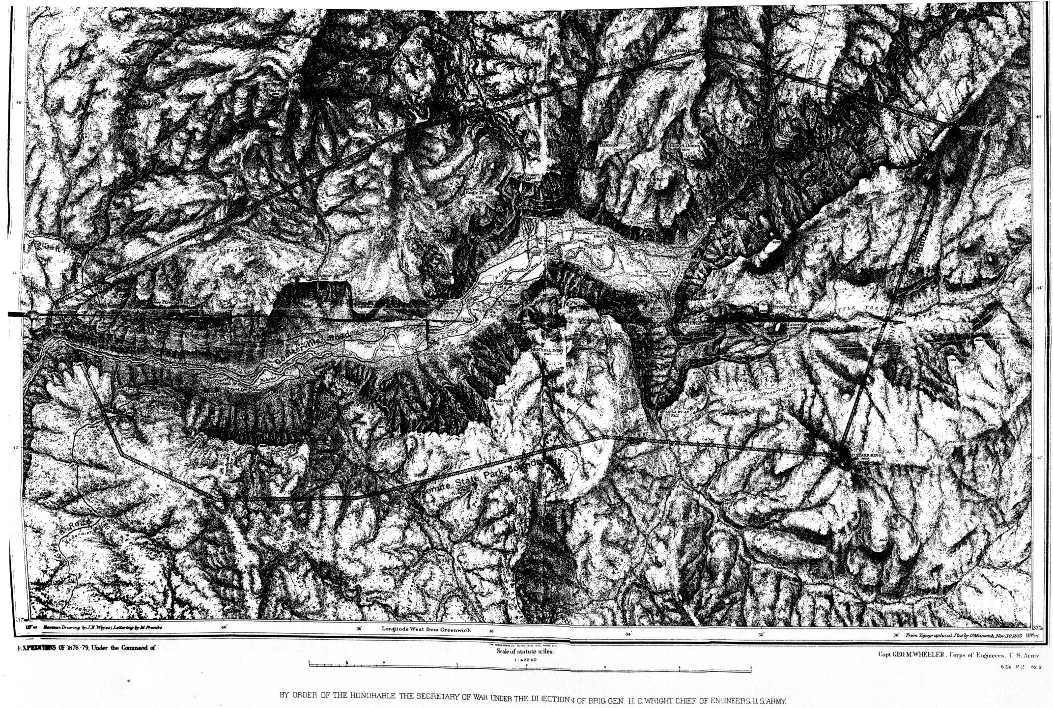
[click to enlarge] |
At a special election, Mariposa County voted bonds to the amount of $75,000 to build a road from Mariposa to Yosemite Valley and to Coulterville. The Washburn faction reportedly placed obstacles in the way of the surveyors and ultimately brought influence to bear to keep the county from floating the bonds. Despite these problems, the road measure grew in popularity and the Washburn interests grew more uneasy and desperate.
As grading and bridge contracts were let, the Washburns argued that the Mariposa County election was illegal and the state supreme court put a restraining injunction against the further operations contemplated on the new road pending an official inquiry. Eventually the court, pressured by the Southern Pacific Railroad/Yosemite Stage and Turnpike Company coalition, sustained the Washburn allegations and declared the county election illegal. Thus failed Mariposa County’s attempt to rid itself of the Washburn’s Yosemite business monopoly.59
[59. Charles D. Robinson to Hon. John W. Noble, Secretary of the Interior, 26 January 1891, in Letters Received by the Office of the Secretary of the Interior Relating to National Parks, 1872-1907 (Yosemite), RG 79, NA.]
6. Development of Concession Operations
a) Hotels and Recreational Establishments
As stated previously, the Yosemite Grant contained the stipulation that leases not exceeding ten years could be granted for portions of the premises. In 1866 the Yosemite commissioners disallowed private land claims in the Yosemite Valley and those that had been made were purchased in 1874. Although private individuals had been able to establish the earliest commercial enterprises in the valley without restrictions, after 1874 business concessions were allowed only in accordance with the regulations of the commissioners and through state contracts.
A visitor in July 1876 noted that
In the valley were three hotels, two stores, a billiard hall, two or three drinking saloons, a laundry building and several barns. These were so grouped in the upper part of the valley as to form a little village. The population was perhaps a hundred social and honest people. Their charges for board, livery and washing were reasonable. The stores furnish the common groceries and dry goods, likewise barley for horses.60
[60. Lewis, Gypsies, 179. This small settlement south of the Merced near Sentinel Bridge is referred to in this study as the Old Village, while the present administrative and commercial area is referred to as New Village or Yosemite Village.]
The commissioners ultimately authorized a variety of commercial ventures, including hotels, photographic and art studios, bakeries, dry goods and grocery stores, saddle horse rentals, and livery service. They acted as superintendent for the state, determining who could lease lands and what rents would be charged and who could operate roads and trails. The state bought the structures to be used as hotels and determined the charges made to the public. This was intended to avoid contention among competitors and prevent public extortion.
(1) Upper Hotel
Buck Beardsley and Gustavus Hite had erected the original canvas-covered Upper Hotel in 1857 near Sentinel Bridge. A wooden building replaced it in 1859. J. M. Hutchings, who had revisited Yosemite several times after his initial trip in 1855, became convinced that he wanted to reside there. In the spring of 1864 he came to the Upper Hotel as proprietor, only a few months before Yosemite Valley was removed from the public domain. The Upper Hotel property had by that
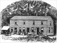
THE OLD HUTCHINGS HOUSE |
The hotel was then a twenty by sixty-foot, two-story frame structure consisting of two large rooms, one upstairs and one down. The upstairs room had become a women’s dormitory, the one downstairs housed the men and boys. That arrangement was not only inconvenient, but often separated families. Hutchings replaced the cotton cloth doors and windows and the muslin partitions between rooms, which had previously evoked expressions of amusement from some guests and of outrage from others, with wooden ones. He also added lean-tos and porches to rejuvenate the structure. Hutchings constructed all those improvements with lumber from a water-powered sawmill John Muir built in 1868 near the foot of Yosemite Fall. A ditch carried water from Yosemite Creek to the sawmill, which cut boards from a large number of trees throughout the valley that had toppled during windstorms. A small lawn with scattered shade trees, some large boulders, and hitching posts and rails dominated the area between “Hutchings House” and the Merced River. Meadowland producing hay for winter feed lay just across the river.61
[61. Olmsted, A Trip to California, 75.]
In 1866 Hutchings added the large, dirt-floored, combination kitchen and sitting room back of the hotel that encompassed a 175-foot-high incense cedar tree that he could not bring himself to fell, giving the addition its name of “Big Tree Room.” Nails driven into the tree’s trunk held culinary utensils. (The structure was later renamed Cedar Cottage.) There is some question as to dates of construction, but possibly Hutchings built the River Cottage and Rock Cottage in 1870 to provide more accommodations. After wintering one season under the shade of the south wall of the valley, the Hutchings family built a cabin on the north side of the Merced River near the foot of Lower Yosemite Fall. By 1866 improvements there consisted of a small log house and a large barn and shed, with a garden and orchard. Hutchings’s claim embraced 118.63 acres of the best meadowland in the valley.
Helen Hunt (Jackson) visited Yosemite Valley in 1872 and described with delight Hutchings’s hotel:
There are no such rooms in Ah-wah-ne as the rooms on the river-side of this little house. This is the back side; and those who wish to see the coming and going of people, the setting-off of saddle-trains, the driving up and down of the laundry wagon, would better take rooms on the front. But he who would like to open his eyes every morning on the full shining of the great Yosemite Fall; to lie in bed, and from his very pillow watch it sway to right and left under moonlight beams, which seem like wands arresting or hastening the motion; to look down into the amber and green Merced, which caresses his very door-sill; to listen at all hours to the grand violoncello tones of the mysterious waters,—let him ask, as we did, for back bedrooms in the Cottage by the River.
But if he is disconcerted by the fact that his bedroom floor is of rough pine boards, and his bedroom walls of thin laths, covered with unbleached cotton; that he has neither chair, nor table, nor pitcher; that his washbowl is a shallow tin pan, and that all the water he wants he must dip in a tin pint from a barrel out in the hall; that his bed is a sack stuffed with ferns, his one window has no curtain and his door no key,—let him leave Ah-wah-ne the next day.62
[62. Helen Hunt [Jackson], Ah-wah-ne Days: A Visit to the Yosemite Valley in 1872 (San Francisco: The Book Club of California, 1971), 34.]
|
Illustration 8.
Barnard’s Hotel and cottages, 1890. |
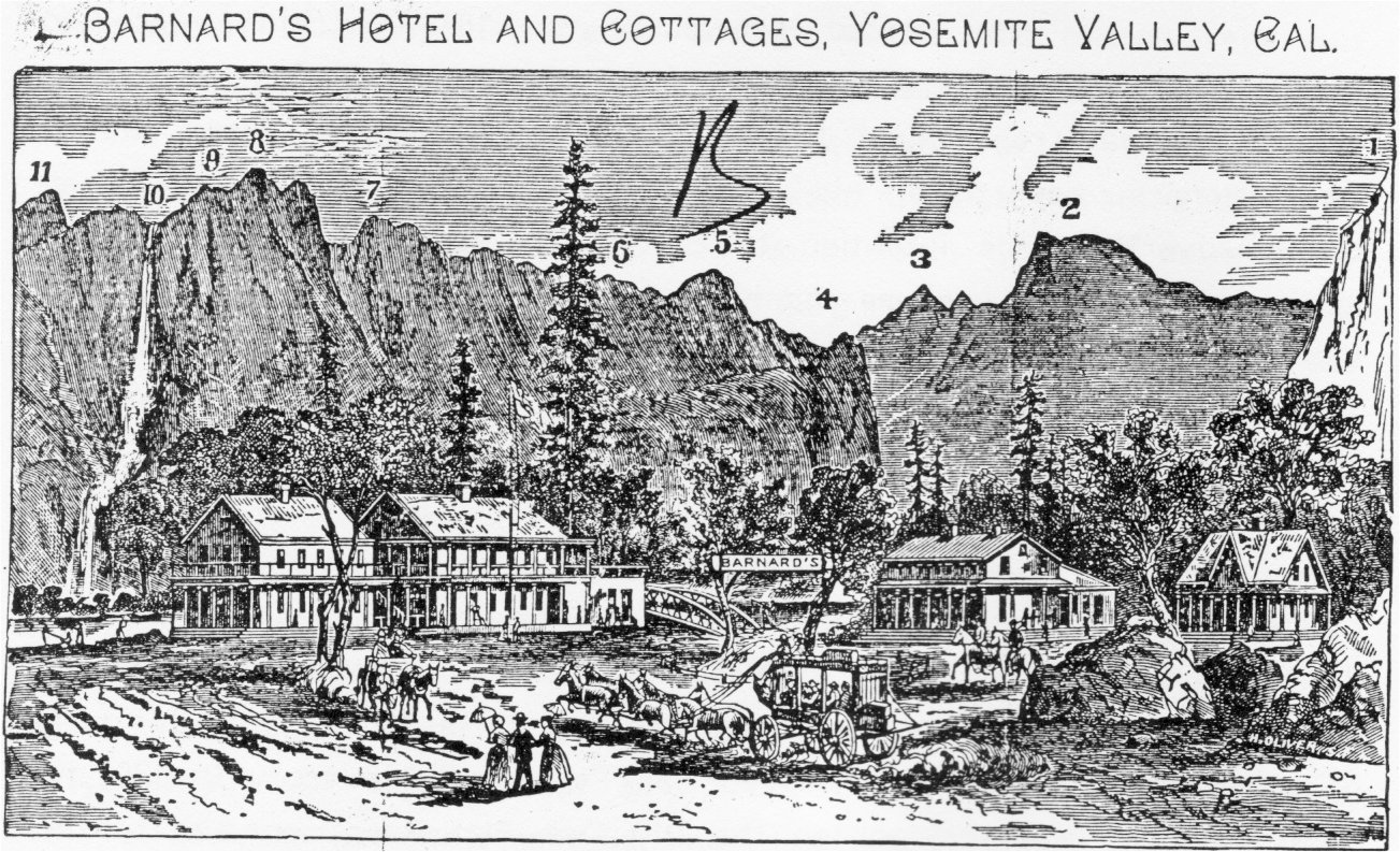
[click to enlarge] 1. Glacier Point 2. South Dome 3. Clouds’ Rest 4. Washington Column. 5. North Dome. 6. Royal Arches. 7. Indian Cañon 8. Yosemite Point 9. Lost Arrow. 10. Yosemite Falls. 11. Eagle Point |
|
Illustration 9.
Sentinel Hotel, late 1890s. Postcard published by Flying Spur Press, Yosemite, California. |
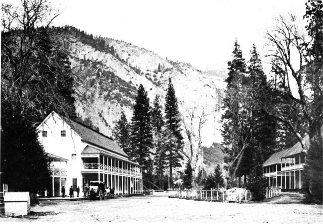
[click to enlarge] |
As stated previously, in 1874 Hutchings received $24,000 for his holdings from the state. He subsequently, however, refused to pay rent equal to the fair interest on that sum, so the commissioners advertised his property for lease. Hutchings then counteradvertised his intention to contest the legality of the proposed leasing by the commissioners and his own intention to acquire a lease from the state and continue to conduct business himself. George W. Coulter, the only other bidder for the lease, went into partnership with A. J. Murphy.
After lengthy and bitter lawsuits, Hutchings was evicted from his Yosemite land claim in 1875 and moved to San Francisco. James Hutchings returned to Yosemite Valley, strangely enough, as Guardian of the grant, succeeding Galen Clark, in 1880. After his term of office ended in 1884, he moved back to San Francisco. In 1902 he died in a carriage accident on the Big Oak Flat Road, enroute to the valley. In 1876 Coulter and Murphy took over management of the Hutchings hotel group and added a large two-story building across the road from Cedar Cottage, part of which overhung the river, which became the main building of the Sentinel Hotel group. Coulter and Murphy ultimately surrendered their lease to John K. Barnard. He ran the complex, which included Hutchings’s early buildings and Coulter’s and Murphy’s additions and was variously known as Barnard’s Hotel and the Yosemite Falls Hotel, from 1877 until his forcible eviction by the sheriff of Mariposa County in 1893. Barnard installed a windmill and elevated tank in April 1886, but the windmill was dismantled about 1891 when water from the spring at the foot of Glacier Point was piped to the village. During Barnard’s tenure he floored the Big Tree Room, which became a dining room for hotel guests. Barnard also added a lower porch to Cedar Cottage.
A. B. Glasscock took over the premises after Barnard. By 1894 porches, stairs, and a new roof connected the main hotel building and the adjoining River Cottage, which were referred to as the Sentinel Hotel and Annex. In 1897 Jack Leidig worked for a contractor from Madera in remodelling Cedar Cottage, which had become very run down. Most of the guests in the valley had been housed up to that time either at the several units of the Sentinel Hotel or at the Stoneman House, which had just burned. The Cedar Cottage remained much as Hutchings had remodeled it. It had no sleeping quarters downstairs. The east end held a large kitchen, the dining room occupied the middle of the structure, and the sitting room (Big Tree Room) and offices filled the west end. Reconstruction work in 1897 involved removing the hallway and creating bedrooms; installing new doors and windows; replacing the old clapboard with new rustic siding; replacing the old porch with a new two-story one; and razing the laundry, containing four rooms for hired CO help, built by Hutchings at the east end of the building.63
[63. C. A. Harwell, Park Naturalist, Memorandum for the Superintendent, 19 July 1940, in Separates File, Yosemite-Concessions, Y-16a, Yosemite Research Library and Records Center.]
After Glasscock’s death in 1897, Jay Bruce Cook took over management of the large group of structures that now included several cottages near the main Sentinel Hotel, each taking its name from its surroundings, which accommodated guests during emergencies in the busiest months. By the turn of the century, the Sentinel Hotel group consisted of the Sentinel Hotel proper, Cedar Cottage (Upper Hotel), Rock Cottage, Oak Cottage, River Cottage, Ivy Cottage, and Locust Cottage (old Cosmopolitan Saloon).64 A four-room bathhouse stood adjacent to the Chinese laundry. Down by the river, beyond the laundry, an open air pavilion featured dances on Wednesday and Saturday nights and church services on Sunday.
[64. The exact construction dates of these structures are unclear. Various sources indicated the Sentinel Hotel proper was built in either 1873 or 1876; Rock Cottage in either 1870, 1873, or 1875; Oak Cottage, 1882, 1890, or 1898; River Cottage, 1870, 1875, or 1882; and Ivy Cottage, 1896 or 1901.]
(2) Lower Hotel/Black’s Hotel
Alex Gordon Black was a pioneer of the Coulterville region and in the late 1850s lived at Bull Creek on the Coulterville Trail where he kept a hostelry for travelers. In 1861 the Blacks moved down into Yosemite Valley when Mrs. Black purchased the five-year-old Lower Hotel built by Beardsley and Cunningham near the foot of Four-Mile Trail, in the area referred to as Lower Yosemite Village. Anticipating more tourists to the grant upon completion of the transcontinental railroad, the Blacks tore down part of that structure in 1869 and erected a long, narrow building with a two-story wing and a porch along the front—Black’s Hotel—in its place. It stood on the south side of the south valley road, about one city block northeast of Leidig’s Hotel and across the road from the Coffman and Kenney stables. The state purchased the structure in 1874 for $1,300. The Blacks continued to operate the hotel until 1880, when the state leased it to Wright and Cook. From 1882 until its demolition in 1888, Jay J. Cook was manager.
(3) Leidig’s Hotel
George Fredrick Leidig, a short, stout German, arrived in Yosemite Valley in 1866 to help James C. Lamon develop his valley homestead. For a while he leased the Lower Hotel, but when owner Black assumed its management, the Leidigs decided to go into business for themselves. Upon receiving a lease from the Yosemite commissioners, Leidig built a two-story hotel about one-quarter mile west of Black’s in 1869. Rivalry between the Leidigs and the Blacks was strong. Although Mrs. Leidig was an excellent cook and attracted many patrons, stage drivers tended to favor the latter’s place.
An early traveler to Yosemite Valley, Caroline Churchill considered Leidig’s Hotel the best hostelry in the valley. It offered good food and clean beds, consisting of mattresses on slat bedsteads. The hotel, surrounded with porches, faced the Yosemite falls and provided a nice place to admire the valley’s views.65 The Leidig Hotel had twelve sleeping rooms upstairs, two sleeping rooms downstairs, and a parlor, sitting room, and dining room. An annex in the rear housed the kitchen. The Leidigs stayed in a separate building back of the kitchen. Handsawed logs from the property went into the structure. The state tore down the hotel after construction of the Stoneman House in 1887. A group of black locust trees mark the site.66
[65. Churchill, Over the Purple Hills, 138-39.]
[66. Much of this information on early sites and structures came from “Other early-day buildings,” by Jack Leidig, 21 November 1941, in Yosemite Research Library and Records Center.]
(4) Mountain View House
In the 1860s Charles E. Peregoy, a California ’49er, began cattle ranching at present Peregoy Meadow, which lies on either side of the Glacier Point road. Because travelers on the way into the valley from Mariposa frequently stopped to rest at his place, in 1869 he and his wife Mary felled, hewed, and whipsawed fir and yellow pine trees and started construction on the Mountain View House, just south of the present road and on the horse trail from Clark’s Station to Yosemite Valley. That small building contained a kitchen, dining room, office, and bedrooms to accommodate about sixteen guests. Later the owners added another building with a living room and more bedrooms.
Mules brought in all the furniture, bedding, and food for Peregoy’s inn from Mariposa. Tourists stayed overnight and traveled the next day out to Glacier Point, this trail being originally the only access to that majestic view. The later completion of the Four-Mile Trail by James McCauley took some of the overnight trade from the Mountain View House, because tourists could go to the point and then continue on to the valley floor for the night. At that time Peregoy began construction of a building at Glacier Point for tourist accommodation, but before completion he disposed of it to McCauley, who later ran the first hotel at Glacier Point. In the late 1870s, business at the Mountain View House began to decline. A notice of bankruptcy and of the sale of the
|
Illustration 10.
Wawona Hotel. From Hutchings, Tourists’ Edition. In the Heart of the Sierras, 1886. |
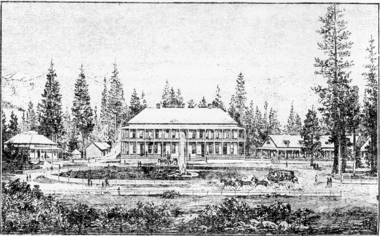
[click to enlarge] |
|
Illustration 11.
Hill’s Studio. Photo by Gary Higgins, 1984. |
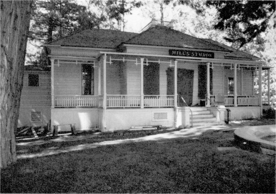
[click to enlarge] |
(5) Wawona Hotel
This hotel complex dates to the 1850s when an earlier hostelry on the site served travelers coming to the Mariposa Grove from the valley or coming in to the valley from Mariposa. A visitor in 1868 described Galen Clark’s ranch, the first hostel on the site, saying it was
built more for use than show, and is capable of indefinite extension without hurting its proportions. It is a long, narrow building of one story, facing south and west, about twenty by one hundred and twenty feet, with covered stoops front and rear, and doors opening on to them from each room. The west room is used as an office, and a receptacle for certain compounds for the inner man; on the outside hangs the antlers of an elk . . . The east end of the house is cut up into bedrooms. . . .67
[67. Olmsted, A Trip to California, 91-92.]
In 1869 Galen Clark, facing financial difficulties due to road construction expenses incurred on his Mariposa-South Fork road, accepted Edwin Moore as a full partner in his hotel enterprise. The next year, however, Clark had to mortgage the ranch to pay for a new sawmill and to further defray expenses of the Chowchilla Mountains stage road between his station and Mariposa, which opened in 1870. The Clark and Moore partnership did not last, however, and the firm of Washburn, Chapman & Coffman purchased the South Fork hostelry in December 1874. The Washburn brothers—Henry, John, and Edward—had arrived in California from New England after the Gold Rush and had been running a livery business and transporting visitors to Clark & Moore’s on their way into Yosemite Valley.
Although Clark’s connection with Wawona ended in 1874, he served Yosemite for forty more years as Guardian, author, and guide before dying of pneumonia in 1910 at age 96. He first became Guardian of the grant in 1866 and served difficult years trying to appease bitter homesteaders, control fires, and oversee the building of bridges, trails, and roads, usually with insufficient appropriations for such work or for his salary. In 1880 a new state constitution limiting tenure of office removed the entire Board of Yosemite Commissioners and Clark. He subsequently became a Yosemite tourist guide and performed other odd jobs in the valley. Summoned back as Guardian in 1889, he resigned in 1896 and spent the rest of his life guiding and writing. He personally prepared the grave in which he lies in the Yosemite Valley cemetery.
Included in the 1874 Washburn purchase were the hotel, various lodging houses, a blacksmith shop, the open bridge across the South Fork of the Merced, and all other improvements, such as the sawmill and barn. It seemed obvious to the new owners that aggressive management and new buildings were needed to make the Big Tree Station, as it became known, a going concern. A single-story building of sixteen rooms, called “Long White,” became the first addition to the complex, in 1876. The Washburn partnership with William F. Coffman and E. W. Chapman proved short-lived, with Chapman and Coffman selling their half-interest in the firm to Henry Washburn in March 1877. Washburn then entered into partnership with John B. Bruce.
The original South Fork lodge building burned in 1878, but Long White survived and became the nucleus of the new Wawona Hotel Victorian gingerbread complex. Undaunted by the fire, Henry Washburn and John Bruce rebuilt. They commenced work on the main two-story hotel building north of Long White, on the site of Clark’s early home and rude hotel, in 1878, and it opened a year later. It contained a
|
Illustrations 12-14.
Wawona Hotel, Annex Building, and Little Brown (Moore Cottage). Photos by Gary Higgins, 1984. |
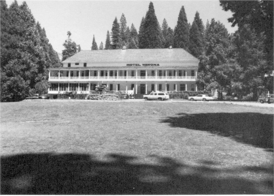
[click to enlarge] |
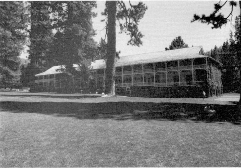
[click to enlarge] |
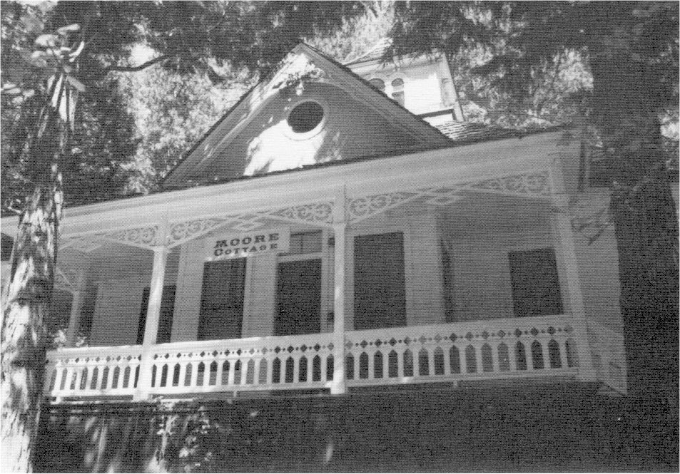
[click to enlarge] |
John Bruce died in March 1882, and the Washburn brothers took over management of the hotel. At this time the name Big Tree Station gave way to “Wawona,” the Nutchu Indian word for Big Tree. Edward spent most of his time at the hotel, while Henry and John ran the associated stage line. The Wawona Hotel remained a two-building group until about 1884 when the owners added “Little White” south of Long White. Wood for that building, renamed the Manager’s Cottage in 1952, as for Long White, probably came from the water-powered sawmill Clark and Moore had built in 1869-70 north of the hotel. The South Fork complex became largely self sufficient. The river and a long irrigation ditch supplied water for cattle, hogs, sheep, and horses that grazed in the nearby meadow as well as for crops that grew there, such as hay and timothy, barley, and potatoes. South of the hotel lay an orchard, garden, and chicken coops; other enterprises included a slaughterhouse and dairy. The system that provided water for irrigation and power generation, known as the Washburn Ditch or Brook Walk, diverted water from the South Fork and channeled the flow for five miles.
The Washburn brothers built another sawmill south of the Wawona store in 1878 that operated until the fall of 1883. It was powered by an undershot waterwheel, with water from the South Fork. Lumber processed there was used for a hotel at Coarse Gold and a house at Fresno Flats, but most of it went into buildings at Wawona and Yosemite Valley. About forty acres near Wawona were logged by means of oxen.68
[68. U. S. Forest Service, A Sawmill History of the Sierra National Forest: 1852-1940, comp. by Bert Hurt (Fresno: U. S. Forest Service, 1941), in Yosemite Research Library and Records Center, 3.]
The Washburn brothers managed to develop the Wawona Basin into a highly respected and well-known resort area. The increasing number of visitors to the valley and grove sometimes taxed the resources of the complex and required new measures to solve new problems. By the mid-1880s a source other than the river edges was required to furnish ice for hotel guests during the summer months. In 1886 the Washburns excavated a pond about 200 feet wide by 1,000 feet long, dammed at its lower end and fed through a diversion ditch from the South Fork of the Merced at its upper end. An earthen dike separated it from the adjacent river. ‘The lake was named for landscape artist Thomas Hill’s daughter Estella Louise, who had married John Washburn in 1885.
Ice formed on this pond to a depth of several inches by the first of each year. Local residents then spent several days sawing the ice into long strips that they poled to a dock, where a conveyor belt driven by a horse-powered Persian wheel on the southwest end of the dam lifted them out of the lake and over the dam to the west into a sawdust-insulated icehouse with a 300-ton capacity. The lake also provided recreational opportunities for ice-skating, fishing, swimming, boating, and picnicking by Wawona’s guests and other Yosemite visitors. The auto era, beginning in 1913, necessitated expansion of recreational facilities. In August 1916 the Washburns constructed a boathouse at the lake, and later a bathhouse on the southwest end of the lake near the icehouse.
This ice reservoir functioned as the Wawona Hotel’s source of refrigeration between 1886 and the 1940s. The isolation of the Wawona settlement and the fact that electric power lines did not reach there until 1948 prolonged the use of that operation well past the time that modern refrigeration equipment was available. Floods in 1950 and 1955 damaged the lake’s dikes and the National Park Service removed the icehouse in 1956.69
[69. The cutting and storing of the ice blocks was an activity of major importance to the comfort and convenience of guests of the hotel. The reservoir itself is especially interesting because the Washburns constructed it specifically for ice production on a local level, whereas in other places in the park, notably on the Merced River and at Mirror and Merced lakes, ice cutting operations exploited a natural feature of the landscape. The Stella Lake ice reservoir is part of the Wawona Archeological District. It was an important factor in the success of the hotel and restaurant business there and is a tangible reminder of an important industry of a bygone era. Remains at the site are those of the dam, an earthen dike parallel to the river, the inflow channels that, diverted water from the Merced River, and the reservoir basin itself. The ice industry in Yosemite began apparently in the early 1890s, with construction of an icehouse at Mirror Lake in 1890 by the Yosemite Stage and Turnpike Company. Cold storage rooms were added to the Stoneman House in 1891 and to Hutchings’s hotel in 1897. Another icehouse was erected at Mirror Lake in 1895. An icehouse was later built at El Portal sometime after 1907. The Yosemite Valley Railroad added a refrigerator car to its line around 1913. The new Yosemite Valley powerplant of 1917-18 finally provided adequate electricity for modern refrigeration equipment. By 1927 the valley’s hotels and camps all possessed electric cold storage facilities. Ice houses also were built at the High Sierra camps in 1916 for snow storage during the summer. See Robert C. Pavlik, “Like a Mirror Hung in the Sky: The Story of Stella Lake, Wawona, Yosemite National Park, California,” typescript, 39 pages, 1986.]
In the mid-1880s, the resort turned into a complex of wide-porched, New England-style buildings and supporting shops. Stables, a blacksmith shop, a carriage and paint shop, and a laundry were present, as were spouting fountains and lily ponds. The hotel area had by that time become a central stage station, the biggest stage stop in Yosemite—the meeting point of the Berenda, Madera, and Mariposa routes. Hay and grain wagons, freight teams, and tourist coaches and carriages were constantly coming and going. The hotel became famous for its sylvan setting, hospitable accommodations, and good meals. Thomas Hill, noted landscape painter and authority on Yosemite and Sierran painting, who had established the first artist’s studio in Yosemite Valley, became closely associated with the hotel beginning in 1885, when his daughter married John Washburn, until his death in 1908. His studio, a three-room pink cottage with a fountain in front, called The Pavilion, was built in 1886 northwest of the main building. Hill moved his summer operations from Yosemite Valley to Wawona and lived off and on in the hotel. His studio functioned as both a workshop and display gallery, giving prestige to the Wawona Hotel and also increasing the audience for his works. Living north of the hotel and across the South Fork of the Merced, settlers in Chilnualna Park supplied the hotel with lumber, produce, and labor. No further buildings were added to the resort until the early 1890s.70
[70. For additional details on the Wawona Hotel history and operations, see Crosby and Scrattish, Historic Structure Report . . . Wawona Hotel, passim. One of the more enduring controversies concerning Wawona Hotel buildings has centered around the original color of the Thomas Hill Studio. Paint analysis of the original exterior siding, however, has conclusively proved that the original color was pink, with gray overlaid at a later date.]
(6) La Casa Nevada
In the early years of the Yosemite Grant, visitors could reach Vernal and Nevada falls only via a crude trail. As mentioned previously, Albert Snow completed a horse trail from the valley floor, up the south side of the Merced River, crossing to the north side between Emerald Pool and Nevada Fall, and continuing on to the flat between Vernal and Nevada falls during 1869-70. There he opened a sort of mountain chalet, La Casa Nevada, in April 1870, situated so close to Nevada Fall that spray often reached its porches. The ride to the hotel for lunch proved immensely popular with visitors, which undoubtedly encouraged Conway’s extension of the trail to Little Yosemite Valley—where Snow pastured cattle and sheep—for use by hardier souls who wished to hike or ride farther. Trails also were built to Half Dome and Clouds Rest, popular destinations from the hotel. La Casa Nevada burned in 1897. It was rumored that Snow and his friends intentionally set the fire after removing everything of value, after being compensated for the value of the property by the Yosemite commissioners.71 The site of this two-story frame building is marked by broken bottles and other debris.
[71. M. Hall McAllister to Carl P. Russell, 31 January 1927, in files, Yosemite Research Library and Records Center. D. J. Foley stated in his Yosemite Souvenir and Guide (Yosemite, Calif.: “Tourist” Studio, 1903) for 1903 that the Casa Nevada Hotel was accidently destroyed by fire “during the season of last year [1902]. It had not been used as a hotel for nearly ten years.” P. 29.]
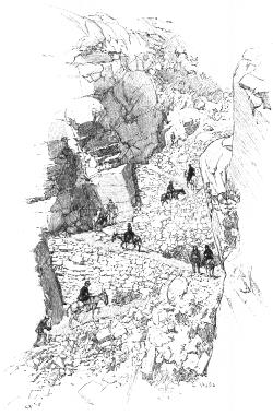
[click to enlarge] STAIRWAY ON CLOUD’S REST TRAIL. |
(7) Cosmopolitan Bathhouse and Saloon
One of the most interesting buildings in Yosemite Valley was the Cosmopolitan bathhouse and saloon, established by John C. Smith and J. R. Townsend, and standing on the north side of the road in the Old Village just east of the Pavilion. Smith, born in Ohio, came to San Francisco in 1850 and pursued mining and saloon-keeping at various places. He came to Yosemite from Sonora in Tuolumne County; later a newspaper of that town lavishly described his new business enterprise:
One of the great necessities of Yo Semite Valley during the past ten years has been a saloon such as will be owned and conducted there by Mr. John C. Smith and opened on or before the 1st of May next for the reception of visitors. Each year we hear of the complaints of travellers with regard to the accommodations and the absence of those refinements which are inseparable to celebrated watering places. . . . The main building is 80 feet by 25 with a porch 10 feet wide extending entirely around it. Connected with the saloon will be bath rooms furnished in the most approved and comfortable style with hot and cold baths for ladies and gentlemen, also a Gent’s Reading Room where files of the latest papers can always be seen. Lounges, hammocks, and easy chairs will be scattered around the porch and saloon. A ladies parlor will also be attached. The bar will be furnished with the latest and finest styles of glass and silver ware, and the bar room will contain two superb billiard tables manufactured of California Laurel.
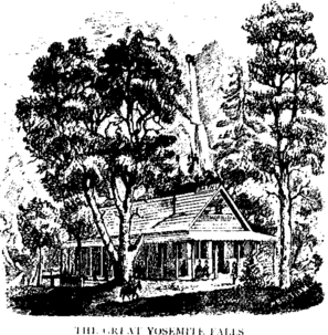
[click to enlarge] |
Swings, shuffle boards, quoits and a shooting gallery will afford amusement for those whose time hangs heavily on their hands. The entire appointments and finish of the saloon will be unsurpassed by any saloon in the State. The cigars, liquors and wines will be of the first quality, and no pains or expense will be spared to rendering one of the most attractive places outside of San Francisco.72
[72. Union Democrat (Sonora, Calif.), 5 November 1870, quoted by Laurence V. Degnan, in “Hersog’s Cosmopolitan Saloon,” typescript, 9 pages., 30 November 1954, in Separates File, Yosemite-Concessions, Y-16a, #8, Yosemite Research Library and Records Center, 3-4.]
The Cosmopolitan, a simple one-story, gable-roofed structure surrounded by a covered porch, began operations in 1871 and evidently fulfilled the newspaper’s expectations, at least as far as most travelers were concerned. Helen Hunt described the building with wonder in 1872:
This long, low, dark-brown house . . . consists of nine rooms, a billiard-room . . . a reading-room . . . a small sitting-room . . . and five small bath-rooms. . . . A small store-room at the end completes the list of rooms.
The bath-tubs shine; the floors of the bath-rooms are carpeted; turkish towels hang on the racks; soaps, bottles of cologne, and bay rum are kept in each room; a pincushion stands under each glass, and on the pincushions are not only pins, but scissors, needles, thread, and buttons of several ^kinds. Has anybody ever seen public bath-rooms of this order73
[73. Hunt [Jackson], Bits of Travel at Home, 138-39.]
Mules carried in all of the equipment, supplies, and luxurious furnishings for the establishment, including full-length mirrors, three pairs of large glass doors that decorated the front of the building, glassware, handsome furniture, and the latest in bath fixtures, astounding travelers who tried to visualize such an undertaking. Helen Hunt remarked that
To have seen the slates of those billiard tables coming down the wall of Ah-wah-ne on the backs of mules must have been an amazing spectacle. As we looked at their great mahogany frames, it seemed more and more impossible every moment. But to all our exclamations Mr. Smith replied, with great quietness, that there was no difficulty in bringing any thing whatever into Ah-wah-ne, and that he intended to bring a piano next year. A mule can carry 600 pounds weight of any thing which can be strapped on his back; and, once strapped firmly on his back, the coach will be carried with far less jolt and jar than on wheels.74
[74. Ibid.]
The Cosmopolitan’s unexpected comforts awaiting travelers after their long, dusty ride into the valley, received many comments. Ladies, especially, were impressed by the clean bathtubs, fine towels, delicate soaps and lotions, and latest papers. The men seemed to enjoy the comforts of the well-stocked bar with its billiard tables even more. The “Grand Register” of valley visitors betweeen 1873 and 1887 was kept in the Cosmopolitan. Two feet long, 1 1/2 feet wide, and 8 inches thick, it held 800 pages and 18,000 names. Signed by Presidents Ulysses S. Grant, James A. Garfield, Rutherford B. Hayes, and Theodore Roosevelt, it also contains the names of many governors. It is now in the possession of the National Park Service. For his visitors’ further benefits—to raise them above occasional high watei—Smith built a walkway of five-foot-long planks, at his own expense, stretching from Leidig’s and Black’s hotels to the Sentinel Hotel area. Mrs. John Degnan remembered that the boardwalk was four feet off the ground with seats along the way to accommodate weary pedestrians.75
[75. Ralph Anderson, Park Information Clerk, interview with Mr. and Mrs. John Degnan, 13 December 1934.]
Smith and his brother-in-law, Ben Hayes, operated the Cosmopolitan Saloon under the name of Smith & Hayes. After Smith married and left Yosemite with his ill wife, Hayes continued to conduct the business by himself. It subsequently passed into other hands until operations ceased in the mid-1880s. By 1890 the saloon’s auxiliary structures had vanished. In 1886 J. K. Barnard acquired a windmill and the bathhouse equipment and installed them at his hotel. He evidently hoped to emulate the Cosmopolitan’s success by establishing a bathhouse with wooden water tanks in a separate building immediately east of Cedar Cottage. Water for baths was heated by circulation in iron pipes through a firebox stoked with wood.76
[76. Laurence V. Degnan to Donald E. McHenry, Park Naturalist, 17 November 1954, in Separates File, Yosemite-Concessions, Y-16a, #8, Yosemite Research Library and Records Center.]
(8) Mountain House
After construction of Conway’s trail to Little Yosemite Valley in 1871, a few stalwart mountaineers made the hike to Glacier Point from there via the Illilouette basin. In addition, Hutchings continued to guide parties to the point over his Ledge Trail. Visitation increased dramatically, however, after 1878, when James McCauley, recognizing that visitor facilities were needed at Glacier Point, acquired Charles Peregoy’s property there and built a two-story hotel known as the Mountain House. It is not hard to understand the popularity of the new hotel, with its superlative views of the Yosemite Valley and its tributary canyons, Half Dome, and the rest of the High Sierra country. Sometime in 1872, McCauley, by accident or design, pushed some burning embers over Glacier Point, unknowingly establishing a tradition that would last for almost 100 years.77
[77. Stories on the origin of the firefall differ. It is generally accepted that McCauley was the first to push a fire over the cliff, about 1871 or 1872. The event was so successful that people began to request it, and McCauley decided to charge for the entertainment. McCauley also is said to have soaked gunny sacks in kerosene, lit them, and, after waving them around, thrown them over the cliff. Fred W. Zimmerman also claimed the distinction of originating the firefall, reporting that in 1883, while camped on Glacier Point, he had built a small fire of pine cones and amused himself by knocking its embers over the edge. J. K. Barnard of the Sentinel Hotel saw the coals cascading down and offered to pay Zimmerman to repeat the act each evening for his guests. However it began, the custom continued irregularly until David Curry revived it on a daily basis for the benefit of vacationers at Camp Curry. M. E. Beatty, “History of the Firefall,” Yosemite Nature Notes 13, no. 6 (June 1934): 41-43. A variation on the firefall consisted of sending a bomb salute from the point, which involved setting a piece of dynamite with a fuse attached on an anvil, placing another anvil on top, and lighting the fuse. The sound of the explosion reportedly echoed between the valley walls as many as fifteen or more times. Sometimes rags soaked in coal oil were ignited and waved back and forth for dramatic effect.]
Visitation at the small resort further increased when the Glacier Point wagon road was built in 1882. McCauley ran the Mountain House in the summer and wintered on his ranch outside the park. While Park Supervisor Gabriel Sovulewski was in the Phillipines during the Spanish-American War in 1898, the state commissioners ousted McCauley when his lease expired in favor of John F. Stevens, in charge of transportation for the Washburns at Wawona. Although Stevens’s name was on the lease, the Washburns actually operated the Mountain House. Stevens operated the hotel for one year, until he became Guardian of the valley, at which time the Washburns took over the Mountain House. They operated it until the Desmond Park Service Company took over in 1916, building a new hotel on the point a year later. The Mountain House survived as a cafeteria until 1969. The oldest building in the park still in use, it burned that year along with the nearby Glacier Point Hotel in the worst structural fire in Yosemite’s history.
(9) Stoneman House
Because leaseholds could not be granted for more than a ten-year period, many Yosemite Valley hotelkeepers were loathe to invest much money in needed repairs or improvements. The possibility always existed that, after such work was done, their lease would not be renewed and their successor would be the only one to benefit. Due to the inability in the 1880s of the existing hotels to accommodate visitors in the more pretentious style desired by its legislators, the state decided to appropriate funds for a new four-story hotel to house 150 guests. The state would lease the new facility to someone under the commissioners’ control and subject to removal if
|
Illustration 15.
Stoneman House, Yosemite Valley. Built 1886, burned 1896. Yosemite National Park Collection. |
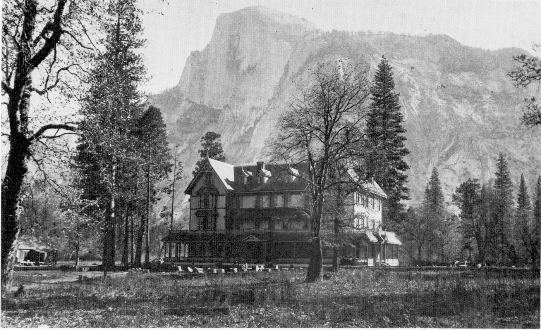
[click to enlarge] |
|
Illustration 16.
Area of Yosemite Valley in front of Stoneman House. Information from Laurence Degnan, 1956. Drawing by Erwin N. Thompson. |
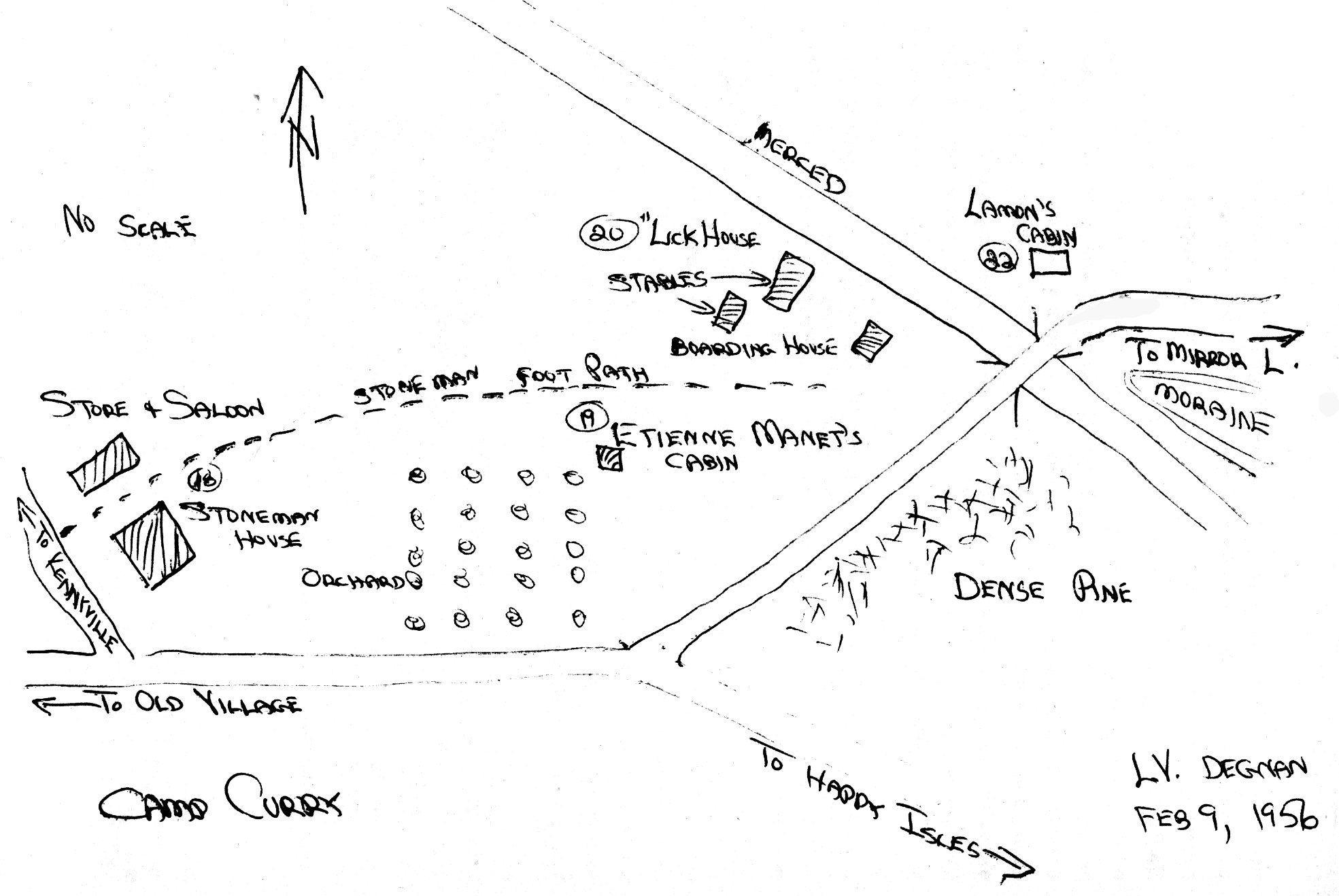
[click to enlarge] |
According to Lafayette Bunnell, the Stoneman House, erected at Boling’s Point and Spring, occupied the earlier site of Capt. John Boling’s race course and exercising grounds. While that second expedition of the Mariposa Battalion sojourned in the valley and explored the Sierra, the soldiers exploited various avenues of recreation, among them exercising the animals:
There was then but little undergrowth in the park-like valley, and a half day’s work in lopping off branches along the course enabled us to speed our horses uninterrupted through the groves.78
[78. Lafayette H. Bunnell, MS, in Biennial Report of the Commissioners to _Manage Yosemite Valley and the Mariposa Big Tree Grove, For the Years 1889-90 (Sacramento: State Printing Office, 1890), 12.]
Upon the hotel’s completion in 1888, Jay J. Cook, manager of Black’s Hotel, assumed charge. The Stoneman House, located near the later Curry Village garage, was a 3V story frame structure with a covered porch around the ground floor and gabled windows on the half-story. A store, bath, and billiard room were separate. The Yosemite commissioners felt that
while the amount expended would not admit of any enchanting architectural display, it was quite enough to rear an exceedingly pretty structure, of slightly modern gothic suspicion, three and one half stories in height, with eighty rooms, dining room accommodations for two hundred, large vestibuled parlor, capacious office, reading and writing rooms, and all modern improvements, such as bath rooms and toilet rooms, for both sexes, on the different floors. It is handsomely furnished throughout, mostly oak, with nice new mattresses, art tapestry and part body Brussels carpets (all new). . . .79
[79. “Report of the Commissioners to Manage the Yosemite Valley and the Mariposa Big Tree Grove,” in Biennial Report of the Commissioners . . . For the Years 1887-88, 14.]
The hotel proved a continual headache and constant source of expense resulting from a multitude of plumbing and construction defects. One of the major assets of the hotel was its excellent water supply, piped from a spring. In those days the valley did not have a central piped water supply, and each establishment, or group of two or three, had its own well or drew water from the Merced River or a nearby creek. After the Stoneman Hotel opened, the Yosemite commissioners decided that some of the older, more unsightly hotels were no longer necessary and should be torn down. Among those were Black’s and Leidig’s hotels, removed in 1888. Only two hotels were then left on the valley floor—the Stoneman House and Barnard’s Hotel, which was described as being “patched and patched until it quite resembles an architectural crazy quilt.”80 The Stoneman House, rather ugly architecturally itself, as well as poorly designed, burned in August 1896.
[80. Ibid., 13.]
b) Stores, Studios, and Other Services
(1) Harris Campground
Yosemite Valley had always been a popular camping place. The tradition began in the earliest days when travelers had to camp out because of the lack of facilities. As time passed, the practice continued, because many visitors were loathe to pay what they thought were exorbitant prices for accommodations, and because others simply enjoyed the closer relationship with nature. Early campers brought all their supplies with them and simply staked their tents or threw their bedrolls wherever they found a likely spot. Because conservation of resources was not yet a concern among the great portion of the visitors, hunting and fishing provided meals, and horses were allowed to graze wherever they could find forage. Any forgotten necessity had to be done without, because there was no way to replenish supplies except when hotels might be able to provide them.
In 1876 Aaron Harris, a storekeeper who had come to Yosemite in 1874, leased J. C. Lamon’s homestead, the Royal Arch Farm, at the eastern end of the valley, for the purpose of catering to campers. He established a more formal campground and began growing animal fodder (clover, timothy, wheat, hay) and selling groceries, such as vegetables, butter, eggs, and milk, to campers. A special inclosure designated “Campers’ Pasture,” adjacent to the campground on the west, was provided for the horses of the campers. Harris established not only the first store in Yosemite Valley, but also the first camping business, originating an idea that later evolved into housekeeping camps that rented equipment to campers. When Harris’s buildings burned in 1887, the commissioners would not replace them, and Harris did not wish to undertake the project because his lease had expired. He therefore left the valley, and William F. Coffman and George W. Kenney obtained a lease on the property in 1888. The state erected new buildings in 1889, including a barn, carriage shed, quarters, an office, a residence, and a corral, using lumber salvaged from the demolished Leidig and Black hotels. The new stable complex housing the Coffman and Kenney saddle horse business became known as Kenneyville.
(2) Degnan Bakery
About 1884 Irish-born John Degnan and his wife Bridget arrived in Yosemite Valley, Degnan having obtained a job as a laborer on the roads and trails in the Yosemite Grant. Their earliest residence consisted of the west end of an abandoned barn on the flat where Yosemite Lodge stands. The barn had been built by Bill (William J.) Howard, former district attorney of Mariposa County who lived on and off in the valley in the 1870s and 1880s. While John maintained a small dairy herd to supply the valley’s increasing demand for milk, Bridget baked homemade bread and cooked occasional meals for tourists in a Dutch oven over an open fire. Before long, the Degnans began to accept boarders and sell a few groceries. Little by little the business grew, as did the Degnan family.
In the fall of 1888, the family moved to Kenneyville, where John served as caretaker of the stables and other buildings during the winter while livery operations were suspended. When operations started up the next season, the Degnans moved into the Kenneys’ former dwelling in the Old Village. The Yosemite commissioners granted them permission to occupy that house at a meeting in December 1888.81
[81. Laurence V. Degnan to Douglas H. Hubbard, 24 February 1956, in master plan files for Yosemite National Park, Western Team, Denver Service Center, National Park Service, Denver, Colorado.]
(3) Fiske Studio
George Fiske, pioneer Yosemite photographer who concentrated on portraying the valley in winter, was born in New Hampshire in 1833. He came west in the early 1850s and for several years drove a stage between Sacramento and Marysville. He first came to Yosemite Valley in 1872, while working for a prominent San Francisco photographer, and travelled about taking landscape pictures, transporting his large camera, plates, and other supplies by pack train. For many years Fiske spent the summer in Yosemite and winters in San Francisco. In 1880 he established a photography studio in the Lower Village, southwest of the Old (or Upper) Village, and stayed through the year, occupying what was known as the “Sierra Cottage.”
(4) Bolton and Westfall Butcher Shop
This shop stood on the south side of the valley road, opposite Galen Clark’s cabin, in the Lower Village. It appears Westfall later had a meat market in the Old Village. The old slaughterhouse, Jack Leidig said, was owned by a Spaniard named Juan Jerona (?), and later operated by Joseph J. Westfall to supply meat to the hotels and public. Located south of the Northside Road and west of the bear pits, the site was once identifiable by limbs cut off a large oak tree in which a windlass was anchored. According to Leidig, C O. Drew furnished the meat for the valley market. Drew pastured eight to twenty cattle, depending on demand. After slaughtering, the cattle would be hoisted by a rope between two trees. The slaughterhouse operated around 1878 or 1879 and was run for five years by the Spaniard and six or eight years more by Op Westfall before being torn down. A large corral stood nearby.82
[82. “Interview with Jack Leidig,” 15 July 1952, by Ralph H. Anderson, in Separates File, Y-4b, #38, Yosemite Research Library and Records Center.]
(5) Flores Laundry
The Flores laundry stood just west of Galen Clark’s cabin and across the road from the meat shop.
(6) Cavagnaro Store This long, narrow structure in the Upper Village stood between the relocated chapel and Degnan’s residence. Aaron Harris first operated the store, which Angelo Cavagnaro purchased from him.
(7) Stables
Stables were first located near the foot of Four-Mile Trail and later at Kenneyville in 1888. The old Coffman and Kenney stables used until 1886 stood 200 feet east of Folsom’s Hall in the Lower Village. A big corral stood to the west.
(8) Sinning Woodworking Shop
On the south side of the Old Village road stood the cottage of Adolph Sinning, a skillful wood worker. Probably built prior to 1875, Sinning acquired it in 1877 and operated a woodworking and curio shop. Julius Starke took over Sinning’s woodworking and curio business after the latter’s death on 20 June 1889. A notice in the Bodie (Calif.) Daily Free Press of 18 January 1883 stated that the Yosemite Valley cabinetmaker’s shop, located opposite Barnard’s Hotel, had burned. As far as is known, however, the building that became the Sierra Club’s headquarters in 1898 was the original Sinning cottage. Possibly Sinning’s work area was not in the cottage, but farther west where Starke’s shop was later located, and that burned.
(9) Stegman Seed Store
Next door to Sinning, Henry Stegman ran a seed store where he sold seeds of the Big Trees along with other kinds of seeds found in the valley. By 1890 the German government had been buying sequoia seeds for many years, but the trade was languishing because Stegman, who had been doing the collecting, had been accused of doing harm. Trees had been planted in forests near Heidelberg since 1864, the seeds of which had come from California.83
[83. Hans Huth to Russell K. Grater, Actg. Reg. Chief of Interpretation, Region Four, NPS, 6 June 1961, in History Files, Yosemite, Denver Service Center, National Park Service.]
(10) Reilly Picture Gallery
J. J. Reilly, a stereograph photographer, became the first to open a photographic studio in Yosemite, in 1875. He operated with a succession of partners, one of whom, Gustav Fagersteen, took over Reilly’s studio in 1880 upon Reilly’s departure from the valley.84 According to Laurence Degnan, after Fagersteen’s death his personal property was sold at auction. Only a stack of glass negatives remained, which were thrown in a heap on the floor in the abandoned studio and gradually crushed under the feet of playing children.
[84. Churchill, Over the Purple Hills, 142-43; Ted Orland, Man & Yosemite: A Photographer’s View of the Early Years (Santa Cruz, Calif.: The Image Continuum Press, 1985), 66, 70. Laurence V. Degnan to Ralph H. Anderson, 3 February 1952, Y-4b, #1, in Separates File, Yosemite Research Library and Records Center.]
(11) Wells Fargo Office
Charles D. Robinson, an artist who spent some of each year in Yosemite Valley from 1880 to 1890, acquired the right in 1885 to build and lease a small studio next to the Guardian’s office. After he began complaining loudly about the injustices and narrow-minded policies of the Board of Yosemite Commissioners, however, Guardian Walter Dennison invaded his studio and removed his furniture and prints. Dennison then moved the studio and refitted it for use as a post office and Wells Fargo express agency. (This might be the old transportation building mentioned in Appendix F as built around 1882.)85 “’ From that time on, Robinson became a stalwart adversary of the Yosemite commissioners, ultimately filing a public petition of charges against them.
[85. Petition to the Senators and Representatives of the Congress of the United States Against the Extension of the Yosemite Grant, p. 8, from Printed Rules and Regulations and By-Laws of Board of Yosemite Commissioners, 1885. See more on Robinson in Holway R. Jones, John Muir and the Sierra Club: The Battle for Yosemite (San Francisco: Sierra Club, 1965), 36-37.]
The original Wells Fargo and Company began banking and express operations in California in 1852. In later years, its gold, treasure boxes, and stagecoaches became a legend in Western folklore. The firm’s first recorded agent in Yosemite was Henry Stegman, who was appointed in 1879 and relinquished the job in 1886. He ran a post office and express office in the old Folsom Hall. After that, a series of agents held the post until 1898 and the appointment of J. B. Cook, last agent of record, who served twelve years. In 1910 the Yosemite Valley Railroad Company built the Yosemite Transportation Company office (Wells Fargo office also) in the Old Village near the Sentinel Hotel. It is among several restored early-day Yosemite structures on permanent exhibit at86 Wawona.
[86. “Ribbon Cutting Ceremonies Friday In Park Dedicated New Wells Fargo Bank,” Mariposa (Calif.) Gazette, 29 April 1971, in Separates File, Yosemite-Concessions, Y-16c, Yosemite Research Library and Records Center.]
(12) Folsom Bridge and FerryIn 1871 Ira B. Folsom operated a cable ferry across the Merced River for the use of visitors coming into the valley in 1874 on the Big Oak Flat or Coulterville roads. This ferry stood about one-half mile west of the foot of Four-Mile Trail on a curve in the river marked on old maps as Ferry Bend. Later he built a toll bridge below the junction of Eagle Creek and the Merced River, three-fourths of a mile below the Lower Hotel.
Folsom ran what were apparently the first store and saloon in Yosemite Valley. His cabin/store structure, about sixteen by thirty feet, faced north near the west end of Folsom Bridge. He built a large hall just east of Galen Clark’s cabin in the Lower Village with the intention of having a saloon, shows, dances, and a front room for activities similar to Locust Cottage or the Cosmopolitan House. The building was torn down in the late 1880s along with other early structures in the area after the center of valley activities moved farther up the valley with construction of the Stoneman House.
(13) Chapel
This New England-style, 250-seat structure was built under the sponsorship of the California State Sunday School Association in the summer of 1879, partly by subscription from children, but mainly by voluntary contributions from prominent members of the association. Charles Geddes, a leading San Francisco architect, made and presented the plans for the building. E. Thomson of the same city erected it. H. D. Bacon of Oakland gave the bell, and Mary Porter of Philadelphia donated the organ in memory of Florence Hutchings, first white child born in Yosemite.
A dark-colored structure with light trim, the chapel opened for the free use of Christians of every denomination. It originally stood on the south side of the road, on a rise of ground near the base of Four-Mile Trail, a mile or so down the valley from its present site. It was moved from there to its present site in September or October 1901
|
Illustration 17.
Yosemite Valley chapel. Photo by George Fiske, Yosemite National Park Collection. |
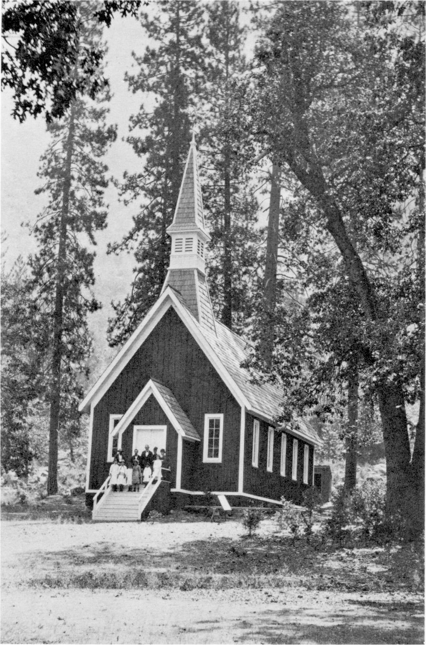
[click to enlarge] |
The original structure consisted of a single room, twenty-six feet three inches wide by fifty feet three inches long, with a stone foundation and a bell tower and a steeple on the roof. The interior and original furnishings consisted of pews, an altar, coal oil lamp fixtures, and exposed stud walls and rafters.
c) Transportation in the Valley
J. M. Hutchings started the first saddle train business in Yosemite in 1866. Fred Brightman, who had come to Yosemite in 1867 or 1868 and worked for Hutchings, started a competitive business in 1870. By 1875 Brightman had formed a partnership with George W. Kenney and applied for a lease of the old Lamon ranch. Because they were short of money, they took Aaron Harris in as a partner. Brightman pulled out the next year and went to work for Washburn’s stage lines while Kenney continued in the saddle business. Harris was evidently supposed to continue running the Lamon ranch until he was repaid for money that Brightman and Kenney had borrowed from him.
William F. Coffman had bought an interest in the Yosemite stage line with Washburn and E. W. Chapman in 1874, but sold it in 1877. In 1878 he purchased Hutchings’s stables and stock in Yosemite Valley and entered into the saddle train business. George Kenney and William Coffman combined their saddle horse businesses in 1885 and as Coffman and Kenney took over the Royal Arch farm lease from Harris in 1888. They later operated stables at Kenneyville, on the site of the present Ahwahnee Hotel. There they supplied horses, guides, and carriages for trips over the Yosemite trails and around the valley floor. In winter the proprietors suspended operations, locked up the vehicles, saddles, harness, and other equipment, and moved their families and livestock to the foothills or the San Joaquin Valley. The business continued until sold to the D. J. Desmond Company in May 1916.
d) Staging and Hauling to Yosemite Valley
Even before the completion of the first wagon roads into Yosemite Valley in the 1870s, tourists by the hundreds made their way into the area via stages to the termini of the public roads and then by saddle train on down into Yosemite Valley. Often commented upon were the accommodations offered to travelers at the various stage stops along the roads, which varied from simple but adequate to simple and unbearable. As travel to Yosemite increased, people who had only occasionally offered meals and lodging to needy travelers began to realize the profitability of such enterprises. As they slowly upgraded their services, actual tourist inns came into existence along the early stage routes.
A number of stage lines served the Yosemite visitor. At first, travelers from Stockton journeyed to Chinese Camp by stage, where they transferred to Simon Shoup’s line and continued on via either the Big Oak Flat or Coulterville route. From the terminus of each of those roads, saddle trains carried travelers down to the valley floor. As soon as the Big Oak Flat Road reached his place, Jeremiah Hodgdon not only opened a tourist hotel but also began a stage line, running a small wagon from Hardin’s Mill east to his ranch.
As mentioned earlier, the completion of the Central Pacific Railroad’s Copperopolis Short Line in 1871 enabled tourists to journey by train to Milton, from which stop a stage took them to Chinese Camp. At the same time Hodgdon extended his stage route farther east to Tamarack, Flat, from which place Hutchings’s saddle mules carried passengers to the valley floor. In 1872 Hodgdon formed a partnership with Shoup in the Yo Semite Stage Line. Shoup delivered passengers from Chinese Camp to Hardin’s Mill, where they transferred to Hodgdon’s line and continued on to Gentry’s where Hutchings’s saddle train met them. Hodgdon built a large barn on a tributary of North Crane Creek near his station to accommodate his horses and stages. Ultimately James Hardin acquired an interest in the line and also established a small rest stop on his property. Hodgdon sold out in 1879, although he kept an interest in the business.
In the 1870s the Nevada Stage Company had some equipment that ran as late as the early 1880s into Yosemite Valley over the Big Oak Flat Road, from Milton via Chinese Camp. It was the manager of the Nevada Stage Line, in fact, who, feeling that Hodgdon’s “hotel” was too primitive, asked Henry Crocker to build a better stage station and hospice (discussed later) for the accommodation of travelers, only a few miles below Hodgdon Meadow. In 1886 the Great Sierra Stage Company was incorporated, after its owners purchased the Yosemite run of the Nevada Stage Company. William C. Priest, Colwell O. Drew, Charles Kassabaum, Henry R. Crocker, and Thomas H. Beals directed the new line that ran from Milton to Yosemite Valley via Copperopolis, O’Byrne’s Ferry, and Chinese Camp. By 1902, after some changes of ownership, the line became the Big Oak Flat-Yosemite Stage Company. In the early 1900s, the peak of staging to Yosemite, that company owned thirty stages and had several hundred horses and thirty drivers in addition to hostelers, blacksmiths, and other essential personnel. The construction of the Sierra Railroad in 1897 attracted most of the Yosemite-bound passengers away from the Copperopolis Short Line. As branch rail lines spread to different points throughout the San Joaquin Valley, travelers could transfer from train to stage wherever it was most convenient.87
[87. Paden and Schlichtmann, Big Oak Flat Road, Appendix I, 316-19.]
Henry Washburn incorporated the Yosemite Stage & Turnpike Company on 16 November 1877 to carry passengers and freight from Merced to Big Tree Station, the Yosemite Valley, Glacier Point, Nevada Fall, Mariposa Grove, the Fresno Grove of Big Trees, Fresno Flats, and Madera, and to acquire, build, and maintain a wagon and turnpike road on those routes. The company also intended to carry on a livery business and supply conveyances and outfits to tourists. The total length of the stage route was 165 miles and of toll road 73 miles, of which twenty to twenty-five miles lay within the park. This stage line played a prominent role in the development of the Wawona area until about 1914.
A. H. Washburn and John B. Bruce, finding the management of the turnpike road and its associated properties burdensome, decided to convey the South Fork and Yosemite Turnpike Road to the Yosemite Stage and Turnpike Company in December 1877. That company then became entitled to control and conduct tourists over the turnpike road extending from the north bank of the South Fork of the Merced to the southerly boundary of the Yosemite Valley Grant, near Old - Inspiration Point.88
[88. A. H. Washburn, Supt., Yosemite Stage & Turnpike Co., to John S. Stidger, Special Agent, General Land Office, 13 November 1892, in Letters Received by the Office of the Secretary of the Interior Relating to National Parks, 1872-1907 (Yosemite), RG 79, NA.]
Many tourists considered the wagon road from Wawona to be the most scenic approach to the valley. Because of the influx of people over that route, Wawona became a bustling stage center supporting stables, hay barns, granaries, blacksmith shops, and carriage repair works. The Yosemite Stage & Turnpike Company employed between twenty and forty drivers and owned some forty stages and buggies. During the summer, as many as eleven stages a day ran from the Raymond train station to Wawona, Yosemite Valley, Glacier Point, and the Mariposa Grove. The forty-four mile trip from Raymond to Wawona took ten hours, while the twenty-seven miles on into Yosemite Valley from Wawona took six more. Old-timers recalled the “Cannonball” stage from Raymond that, for extra fare, made the run to the Sentinel Hotel in twelve hours. It used six horses rather than four, changed every ten to fifteen miles. Regular stages were more leisurely in their approach to the valley.
Excitement characterized stagecoach rides into Yosemite Valley, as coaches and buggies carefully wound their way down steep, narrow grades covered with several inches of thick dust. Blind curves, fallen trees and rocks, and the unguarded road edges with their sheer drop to the valley floor imbued trips into Yosemite with a thrill not soon forgotten. Yielding to vehicles that had the right-of-way often meant passing precariously close to the road’s edge; so close, in fact, that often stagedrivers unloaded their passengers to walk up ahead and be picked up after the safe passage of the coach. Both his employer and visitors relied upon the stage driver’s skill in managing his horses and being able to discern obstacles through clouds of swirling dust. Delivery of his passengers safely at the hotel entrance endeared him forever to his charges. The names associated with this era of Yosemite transportation are legion and a multitude of anecdotes are connected with each of them. Some of the drivers became famous for their stories about the park and its inhabitants, some of which were true and some of which were sprinkled with more than a dash of exaggeration. But those storytellers were much sought after by Yosemite tourists, the partisans of one driver sometimes arguing with the fans of another whose story differed slightly.
Representative of that worthy brotherhood was George F. Monroe, a well-liked and highly respected Black driver of the 1880s. Time after time the same visitors requested his coach runs between Madera, Wawona, and Yosemite Valley in appreciation of his masterly but kind handling of the horses and his steady hand on the reins. Fort Monroe was named in his honor, as was Monroe Meadows (former Round Meadows), the present site of the Badger Pass ski area. Fort Monroe was a stage station on the old Wawona Road, above the east end of the Wawona tunnel, where the Pohono Trail changes direction from the southwest to the east. Alfred, a mulatto driver who piloted a daily stage between Wawona and the valley, drove dozens of famous passengers, including presidents, actresses, and royalty. Once he even permitted former President Ulysses S. Grant to take the reins.
Occasionally a holdup enlivened the trip to Yosemite, the jewelry and cash of tourists offering lucrative bait for the highwayman. The Mariposa Gazette noted that between 1883 and 1906 six stage robberies occurred on the Yosemite run. Two were more famous than the rest. One, in the summer of 1905, resulted in perhaps the only authentic photograph of a stage robbery in progress. For sheer audacity, however, the multi-stage holdup on a Yosemite road on 7 July 1906 takes the honors. In that instance the robber, who was never apprehended, stopped five successive stages and one private conveyance, waiting for each to come around a turn in the road and then politely motioning it with a shotgun to stop and fall into place behind the others. The San Bernardino (Calif.) Daily Sun reported on 21 June 1907 that “Black Kid,” the famous lone bandit of Yosemite, had held up two stages from Raymond bound for Wawona and robbed sixteen passengers. The “Black Kid” was not as much of a gentleman as the 1906 bandit nor as confident of his abilities, however, because he compelled a woman passenger to stand behind him as a shield to prevent an attack from the rear.
Stagecoaches and buggies were not the only wheeled conveyances coming into Yosemite Valley. Before the construction of wagon roads, a thirty- to forty-muie packtrain delivered supplies to the Fred Leidigs from a store in San Francisco. With the advent of wagon access, in addition to the coming and going of numerous stages, the arrival of freight wagons bringing supplies to the various business establishments and residents provided a high degree of excitement. Heavy hauling of staples, fruit, hay, and other goods to valley residents was accomplished by two wagons hooked together, tandem style, drawn by ten-mule teams. The completion of the Yosemite Valley Railroad in 1907 cut markedly into the wagon freight business on the upper roads, although the road from El Portal echoed continually with the thunder of wagons plying passengers and goods between the railroad terminus and Yosemite Valley.
7. Schools
The rapid settlement of Yosemite Valley by entrepreneurs eager to serve the visiting public brought families and, of course, children. Although for awhile those youngsters were able to escape the constraints of a formalized school system, it was not long before their parents felt that lack. In the spring of 1875 several Yosemite families, including the Leidigs, Blacks, Hutchingses, and Howards, petitioned the Mariposa County Board of Supervisors to establish a school district in Yosemite Valley. The district was granted in May and the school was operating by July. At first, the children attended classes held outside under a large oak tree about one mile from Lower Yosemite Fall, probably at the foot of Indian Canyon near Indian Creek:
dry goods box was used by the teacher for a blackboard, on which he printed small words, there being no books in a class of seven beginners.89
[89. “Yosemite Valley School,” in Stockton (Calif.) Daily Independent, 2 August 1876. Confusion exists concerning early school sites. See discussion in footnote 99.]
During the first week they moved into a tent, twelve by sixteen feet, erected by the pioneer trail builder George Anderson near Royal Arches. Some confusion exists as to the location of temporary schools used prior to the permanent structure at the foot of Glacier Point. Although some early valley residents such as Cosie Hutchings Mills remembered the earliest school being on the north side of the valley, Paden and Schlichtmann relate that the first school (1872) operated a few yards from the Leidig Hotel. Unbleached muslin covered the frame structure. The chapel first stood next to that school.90
[90. Paden and Schlichtmann, Big Oak Flat Road, 294.]
Jack Leidig states also that the first wooden schoolhouse, about fourteen by twenty-four feet; with a lean-to on the back, stood near the site of the village chapel, near the foot of Four-Mile Trail. It formerly served as a boardinghouse for Washburn, McCready, and Chapman, called the “Lick House,” a tongue-in-cheek allusion to the famous San Francisco hotel of that name. The old saddle corral of Washburn, McCready, and Chapman stood east of the chapel site.91
[91. “Interview with Jack Leidig,” 15 July 1952, by Ralph H. Anderson, Administrative Assistant, in Separates File, Y-4b, #38, Yosemite Research Library and Records Center.]
A permanent school building soon followed, probably in the summer of 1875, when a structure was built about 250 yards above Sentinel Bridge close to the south wall of the valley in the shadow of Glacier Point. Laurence Degnan described it as
a rough unpainted one-room frame shack, 24 feet long by 16 feet wide. The walls were a single thickness of vertical boards and battens, which directly supported the wall plate and shake roof, there being no studding. There was no ceiling or interior lining, not even the white cloth ceiling, so common in other buildings in those days. . . . the structure withstood the winds and storms of almost a quarter of a century, until it was abandoned for school purposes. . . . As might be inferred from the type of construction, the walls of the schoolhouse contained many knotholes and cracks; through these openings friendly green lizards used to crawl and visit the school, clinging to the walls as we chanted the multiplication table. . . . Yet notwithstanding its generous air-conditioning, the schoolhouse was not uncomfortable. The sessions were held in the warmer part of the year, and a large pot-bellied stove took care of the occasional rainy days in summer and the cooler days of spring and autumn. Our front yard, partly flooded in some seasons by high water, was a breeding ground for mosquitoes. . . . sprigs of pungent laurel, or pennyroyal, or both, were placed around the school room, and on the desks and persons of the pupils. But the uninformed mosquitoes did not seem to know that these plants repelled them, and they found that the plump little Yosemite school children . . . were “mighty good eatin’.”92
[92. Laurence V. Degnan, “The Yosemite Valley School,” typescript, 33 pages, 6 December 1955, in Separates File, Yosemite-Schools, Y-26, #15, Yosemite Research Library and Records Center, 12-13.]
Water for the children to drink came from the Merced River 100 yards away. Furnishings in the school consisted of maps and globes, an abacus, a dictionary, a blackboard along the southwest end of the room, and a small library. The children worked on their slates while sitting on rough benches at homemade tables, which were later replaced with factory-made school desks. Instructional devices included a mannequin showing the human body in a series of superimposed colored plates. Recess took place in the glade in front of the school crossed by the narrow, gravel stage road that ran between the Old Village and the Stoneman House.
The inadequacy of that small schoolhouse increased as the attendance grew, and at a meeting of the Yosemite Commission in July 1896, a motion was made to petition the state legislature for $2,000 to construct a stone schoolhouse. A strange chain of events indirectly provided a new building. After Black’s and Leidig’s hotels had been torn down, competition for customers became fierce between the Stoneman House and Barnard’s, each accusing the other of soliciting business to the detriment of the other. Finally the Yosemite commissioners ordered in 1896 that no stage company could maintain an office or an agent at either hotel. That order resulted in construction that summer of a stage and telegraph office next to the road near the site of the present Le Conte Memorial Lodge, halfway between the two hotels.
With the destruction of the Stoneman House by fire, however, the new office closed. At Guardian Galen Clark’s suggestion in 1897 that the structure would be suitable for a new schoolhouse, the Yosemite commissioners turned it over for that purpose.93
[93. Ibid., 14-15, 18, 30-31.]
For some students, school was especially difficult to reach. The twin McCauley boys had to get up early to ride donkeys down the Four-Mile Trail from the Mountain House to the valley floor. Late in the evening they usually had to walk back up because their mounts would be carrying supplies for the hotel and firewood to fuel their father’s firefall. The school sessions were limited to the summer and parts of spring and fall, about six months to one term. As time went on and the number of permanent residents in the valley grew, especially after completion of the Yosemite Valley Railroad in 1907, the school terms were lengthened to 7-1/2 to 8 months. In 1916 the regular full school term was adopted.94
[94. Some confusion exists surrounding the first school building in Yosemite Valley. Mrs. Esther Harris Nathan, who lived in the valley as a child, reported that the first schoolhouse was the “Lick House,” the building that had been a boardinghouse for the Washburn and McCready stables, between Black’s and Leidig’s hotels. The second schoolhouse, she said, was a frame building with a canvas top and wood benches and desks near Indian Canyon. The third was near LeConte Lodge in the upper end of the valley. Ralph H. Anderson, “Interview with Mrs. Esther Harris Nathan,” 8 September 1952, in Separates File, Yosemite-History, #39, Yosemite Research Library and Records Center.
Degnan stated that about 1909 the schoolhouse building was moved to a spot across the river about 300 yards southwest of the present Park Service headquarters building. His brother and sister later recalled that the schoolhouse at the road fork on the north side of the valley was actually the house at the Lamon orchard that the Degnan family occupied in 1894 that was moved to the new spot to serve as a school. Degnan later agreed that the Lamon dwelling and the stage office were of the same type of construction and that possibly it was not the office that was moved. Laurence V. Degnan to Douglass H. Hubbard, 3 March 1956, in Separates File, Yosemite-Schools, #27. A former student’s father, Sterling Crammer, however, stated that the first canvas and frame school was established in 1872-73, but was not formally incorporated into the Mariposa County school system until 1875. Mr. Crammer said that the school near the Le Conte Memorial was moved in 1909 to a site about 400 yards north of the Sentinel Hotel. “Early Day Schools of Yosemite: Extract from Talk Given by Sterling Crammer at Commencement Exercises, Yosemite Grammar School, June 1943,” in Separates File, Yosemite-Schools, #4, Yosemite Research Library and Records Center. The schoolhouse that was moved across the river about 1909, according to Chief Park Naturalist Donald E. McHenry, became park employees’ residence no. 15. The Park Service demolished it 21 February 1956:
Reminiscences by Cosie Hutchings Mills also relate that the first school, in a tent with frame at the foot of Indian Canyon, was started about 1873. The teacher boarded with the Hutchings family. Noted by Bab Godfrey, 25 January 1943, in Separates File, Yosemite-Schools, #14. It might be that a school was carried on informally for a couple of years in the canvas structure and that the more permanent school building upstream from Sentinel Bridge was not built until after the school was incorporated, in July 1875. The Stockton (Calif.) Daily Independent, however, states the school was organized on 6 July 1875, followed by construction of the tent school. The Mariposa Gazette of 17 July 1875, on the other hand, stated the new school was completed as early as 7 July 1875.]
In the summer of 1891 the Washburns set up a schoolroom at Wawona and the banks of the South Fork of the Merced.
8. Private Lands
From the time of earliest penetration of the Yosemite area, the entire region was open to settlement and development under various land laws. It was only natural that the best meadow and timber lands and those along the routes of the first roads and trails into the area — sites that were best adapted for commercial use—should be quickly appropriated. Settlers acquired those private holdings in various ways —under laws relating to homesteads, pre-emption, timber and mineral lands, reservoir sites, and state school lands. Upon establishment of the national park in 1890, private individuals held some 60,000 acres. During the process of establishing boundaries, the federal government was compelled to recognize those prior rights.
Numerous cabins were built in the valleys and high country of Yosemite in connection with homesteading, stock grazing, lumbering and mining activities. Many of those structures and additional related sites and features in the high country remain unrecorded. A backcountry survey, impossible within the budget and time schedule established for this report, is urgently needed to locate additional resources and fill in data gaps on use of the Yosemite wilderness.
The effects of Indian and Anglo occupation of the backcountry uplands has never been documented in detail. The general ‘lack of published information on land use in those areas does not mean that they escaped exploitation or that such records do not exist. A number of government documents record and discuss early homestead, mining, and lumber claims and several early reminiscences shed light on activities in the area, but these have not yet been sorted out, crosschecked, and organized. This will be a complex task but is sorely needed to complete documentation of Yosemite’s early history. The long-term impact of homesteaders, trappers, and miners on park lands has been minimal. Fortunately no rich mineral values were found in the highlands, and none at all in the valley, but mining activity did open up the backcountry by means of Mono Trail traffic through Bloody Canyon to the east. The Tioga Road, constructed to facilitate mine shipping, directly facilitated later tourism. The effects of stock grazers and lumbermen were pronounced for awhile, resulting in heavy damage to the Yosemite ecosystem. Fortunately administrators managed to arrest those activities before irreparable damage occurred. Actually those landholders exerted a great influence on the park because it was their type of land use that led to the campaign for establishment of the national park.
The federal government finally managed to absorb many private holdings through strict army regulations, the implementation of which eventually drove out some early families, and changing park conditions that exerted pressure on individual landholders and enabled the Park Service to purchase many of their properties. Evidence of early land use in the backcountry exists today in the form of place-names, cabins, activity sites, and other scant remains. The few ramshackle structures that exist around mining operations and on homestead patents are slowly disintegrating and will eventually be gone. It is essential that a backcountry survey ensure that they are not forgotten. In terms of private holdings today, continuing settlement activity at Wawona, Foresta, and Aspen Valley is having the longest-lasting effect on the park and continues to compromise its scenic integrity and values.
In 1951 Robert F. Uhte, a Yosemite National Park ranger, began gathering information on Yosemite’s pioneer cabins. In writing his report, he utilized the field notes, rough sketches, and photographs supplied by several park rangers who had investigated historical structures in the backcountry during the summers of 1949 and 1950. Uhte was primarily interested in the architecture of Yosemite’s log cabins, noting that most of them were simple, crude affairs that were nonetheless interesting because of their history and architectural qualities. Round logs with saddle-notched corners—an easy and quick construction method—characterized most of the cabins investigated at that time. A V-notch cut, easier to form than a U, was sometimes used with round logs, although the saddle notch produced a more finished appearance. A more difficult but more successful method of corner joining was the dovetail or box corner, usually used with hewn logs but sometimes with round ones. Dovetailing made for a tighter fit and often eliminated the need for chinking. Various types of chinking were used when necessary: Split shakes laid flat or on edge between logs; small poles cut to fit into crevices; wedge-shaped slabs laid between logs; or a complete covering of split shakes, laid vertically against the side walls. This latter type of chinking was common in Yosemite because of the proximity of sugar pine for shakes.95
[95. This information and much of the following comes from Robert F. Uhte, “Yosemite’s Pioneer Cabins,” Yosemite Nature Notes 35, no. 9 (September 1956): 135-43, and 35, no. 10 (October 1956): 144-55.]
Uhte’s informers did not, however, particularly note the surroundings of each cabin or the manner in which the landscape had been affected by human occupation. Most backcountry cabins have some relation to other nearby historical features, such as blazes or corrals, that help indicate the extent and type of activity undertaken by the cabin owners. Those corollary resources also need to be recorded and analyzed to complete the picture of homesteading, mining, ranching, herding, and logging activities in Yosemite’s backcountry.
The early history of some of the more important private land- and leaseholdings within Yosemite National Park is presented below. Structures described are - connected with settlement, stockraising, hostelry, and mining activities. The continued existence of many of these pioneer log cabins is uncertain. Those mentioned in Uhte’s report were inventoried in the early 1950s, but a check of their present status would be another necessary function of a backcountry survey.
a) Bronson Meadows (Hodgdon Meadow) Area
(1) Crocker Station
Henry Robinson Crocker came from Massachusetts to California in 1853 and built a cabin in what was then known as Bronson Meadows. Bronson had operated an early camp there catering to saddle travelers to Yosemite Valley. The superintendent of the Chinese Camp to Yosemite stage company, which used the Big Oak Flat wagon road, requested that Crocker build and run a stage stop that would be superior in accommodations to the hotels of Hodgdon and others. Crocker agreed and in 1880 erected fifteen buildings referred to as “Crocker’s Sierra Resort,” composed of an inn, barns, storehouses, and guest cottages.
Crocker’s became a well-known and important stage stop, providing good food and clean rooms to all travelers along the road. The station served as construction headquarters during the building of the Great Sierra Wagon Road. Crocker died in 1904 and his widow sold the property in 1910. Eventually it came into the hands of the Yosemite National Park Company and for several years lay within the park, four miles from the western boundary. When the boundary changed and excluded it, the property fell into other hands. It took guests as late as 1920, but then began to decay. Some of the smaller buildings were moved to Carl Inn.96
[96. Paden and Schlichtmann, Big Oak Flat Road, 207-8, 210.]
(2) Hodgdon Ranch
About two miles within the park on the Big Oak Flat Road is the site of the former Thomas J. Hodgdon ranch. The site of the ranch was first called Moore and Bowen Camp, then Bronson Meadows, and eventually Hodgdon Meadow. Hodgdon, from Vermont, purchased the land in 1865 by squatter’s title. He raised cattle there and built two shake-roofed log cabins, tightly constructed of square, hewn logs on a loose rock foundation. The National Park Service removed the Hodgdon Meadow cabins when it acquired the property.
|
Illustration 18.
Notching and chinking types. From Uhte, “Yosemite’s Pioneer Cabins,” Yosemite Nature Notes 35, no. 10 (October 1956). |
[click to enlarge] |
Before the Big Oak Flat Road reached this meadow in June 1870, Hodgdon’s served as headquarters for a summer cow camp. The hospitable Mr. Hodgdon often housed and fed Yosemite tourists. Because the number of passersby steadily increased after Hodgdon’s became the terminus of the Big Oak Flat wagon road, Hodgdon decided to build a regular hotel to accommodate more people. He finished it by 1871 and began housing travelers connecting with J. M. Hutchings’s saddle train to Yosemite Valley.
Helen Hunt graphically described the “delights” of a night at “Hogdin’s” in 1872:
Three, four, five in a room; some on floors, without even a blanket. A few pampered ones, women, with tin pans for washbowls and one towel for six hands. The rest, men, with one tin basin in an open shed, and if they had any towel or not I do not know. That was a night at Hogdin’s.
Food? Yes. Junks [sic] of beef floating in bowls of fat, junks of ham ditto, beans ditto, potatoes as hard as bullets, corn-bread steaming with saleratus, doughnuts ditto, hot biscuits ditto; the whole set out in indescribable confusion and dirt, in a narrow, unventilated room, dimly lit by two reeking kerosene lamps. Even brave and travelled souls could not help being appalled at the situation. Not in the wildest and most poverty-stricken little town in Italy could such discomfort be encountered.97
[97. Hunt [Jackson], Ah-wah-ne Days, 25.]
The Hodgdons accommodated stage passengers and travelers along the Big Oak Flat Road until the late 1890s.
The site of Hodgdon’s stage station, a little over a mile beyond the park’s Big Oak Flat entrance, is marked by a cottage set in the lower corner of a green pasture now known as Cuneo Meadows and facing on the highway. This used to be the site of Hodgdon’s two cabins and a barn for the stage horses.98
[98. Paden and Schlichtmann, Big Oak Flat Road, 213-16.]
b) Ackerson MeadowJames T. Ackerson came west during the 1849 California gold rush. He settled on land known as Buckley and/or Wade meadows and began supplying hay to Yosemite Valley. T. C. Carlon later purchased the property and pastured cattle there in the summer.
c) Carlon or Carl Inn
Dan and Donna Carlon built their rustic Carl Inn about 1918-19 in a meadow near the old Big Oak Flat Road from the South Fork of the Tuolumne bridge, just inside Yosemite National Park. It consisted of a main building and several bungalows. Four years later it burned, was rebuilt, and burned again. The National Park Serivce took over the land in 1932 and razed the structures in 1940.99
[99. According to Ditton and McHenry, the inn was built about 1919, was twice destroyed by floodwaters, once by fire, and again by snow until finally razed by the Park Service in 1940. Yosemite Road Guide, 19.]
d) Hazel Green
Hazel Green, supporting a number of hazel bushes in its meadow, acquired its name when Dr. Lafayette Bunnell, George W. Coulter, and others were constructing the Coulterville Free Trail in 1856. It became the lunch stop on the second day of the stage trip from Merced to Yosemite over the Coulterville and Yosemite Turnpike Road. James Halstead collected the tolls at Hazel Green from the spring of 1874 until 1884. About 1877 the Halsteads began supplying food to travelers and a camping place for parties with their own teams. From Hazel Green it was said to be an exhilarating ride through the forests to the Merced Grove of Big Trees and then past Little Nellie Falls to the quiet of Big Meadow (another toll station), and then to drop steeply to the valley floor just below the Cascade Falls. In October 1888 Halstead patented 120 acres at Hazel Green, which passed to his widow after his death in 1901.100
[100. Mary Curry Tresidder, “Reminiscences of Hazel Green,” typescript, 10 pages, in Mary Curry Tresidder Papers, Drawer 13, Yosemite Research Library and Records Center.]
|
Illustration 19.
Cuneo residence, Carl Inn, to northwest (Hodgdon Meadow on old Big Oak Flat Road). |
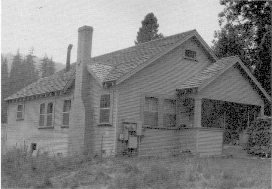
[click to enlarge] |
|
Illustration 20.
Hazel Green ranch on old Coulterville Road (private property outside park boundary), to west. Photos by Robert C. Pavlik, 1984. |
[click to enlarge] |
e) Crane Flat
Coulter and Bunnell also named this area in 1856 as they worked their way from Black’s hotel on Bull Creek blazing a saddle trail to join Coulterville to the Big Oak Flat Trail so that they could use its descent into Yosemite Valley. The shrill cry of some sandhill cranes (possibly great blue herons) surprised by the explorers suggested the name to them. The two trails joined on the near edge of Crane Flat and continued together toward Gin Flat.
The earliest known habitation at Crane Flat was a cabin mentioned by Josiah Whitney in 1868, which probably belonged to Hugh Mundy, who owned property west of the park and ran sheep in the vicinity. It is also possible that Louis D. Gobin built a structure there as early as the 1860s. By the 1870s, at least, Gobin’s cattle and sheep grazed at Crane Flat during the summer. At first he took in travelers simply as a kindly gesture, serving them meals in his small log cabin. The meadow became a lively place as a stage station and an important stop for food and shelter as more people began to trek to Yosemite Valley. The Gobins even had a dairy house in which they churned their own butter. The buildings burned in 1886 but were rebuilt two years later. The hotel finally closed its doors in 1895. Across from Gobin’s, on the south side of the old road, stood Billy Hurst’s saloon, which served as a supply center for sheepherders and as a saloon for anyone in the area with a thirst for liquor and companionship. A lively place, it functioned until Hurst’s death in the winter of 1889-90. Early cattleman R. A. Curtin once mentioned that James (“Johnny”) Hardin settled at Crane Flat, building a water-powered sawmill and logging with oxen. Ultimately he fell on hard times and lost his ranch at the flat.101
[101. Paden and Schlichtmann, Big Oak Flat Road, 219-23; R. A. Curtin to Carl Russell, 6 June 1951, in Separates File, Yosemite-History, Yosemite Research Library and Records Center. Curtin may be confused, because Hardin had a ranch and sawmill at Harden Flat on the Big Oak Flat Road.]
f) Gin Flat
In 1879 the Irishman John Curtin bought a ranch in Tuolumne County and for the next twenty-three years worked as a freighter between Stockton and the southern California mines. The Curtins switched gradually from freighting to the cattle business, grazing stock in the foothills during the winter and pasturing them on the high Sierra Nevada ranges in the summer. Ultimately the Curtins decided to use Gin Flat as summer grazing land, and in 1882 the elder Curtin filed upon it and obtained a government patent. Gin Flat acquired its name from an incident involving a barrel of gin that fell off a freight wagon coming up the grade from Crane Flat and that provided refreshment for a group of roadworkers, cowboys, and sheepherders. In the early days, Hugh Mundy also grazed his sheep on Gin Flat, where he had a camp and stored provisions for his herders. His was only one of many bands of sheep grazing on the elevated plateaus every summer, where the plentiful water and grassy meadows provided welcome relief from the parched plains and foothills.
John B. Curtin, Jr., went to Gin Flat as a boy of fifteen after the family took over the property. He and Henry Bancroft lived in the Mundy cabin while felling tamarack logs for their own one-room abode that stood about 150 feet east of the old Big Oak Flat Road in the south end of the meadow.102 Pine log walls hewn on the two exposed sides and secured at their box notch joints by large oak dowels contained wedge-shaped chinking. Curtin used granite for the foundation and for a dry masonry fireplace in a corner of the larger unit. A sugar pine shake roof covered the structure. Curtin’s cow camp also included a barn between the cabin and the present road. The old road passed between that structure and the cabin. They used that cabin, completed about 1883, as a cow camp while cattle grazed on the meadow. The younger Curtin took over Tamarack Flat sometime after the railroad reached El Portal. He moved the larger cabin from the Tamarack Flat Lodge (see below) alongside his Gin Flat cabin in 1914 so that the two appeared as one long structure with a common porch. The larger cabin measured 16 by 24 1/2 feet, the smaller 14 by 18 1/2 feet. A common porch six feet deep spanned both structures. The remains of only one cabin exist today. The National Park Service stabilized its walls in 1961 by adding vertical log posts to keep the walls from collapsing.
[102. Curtin to Russell, 6 June 1951.]
g) Tamarack Flat
Coulter and Bunnell also named Tamarack Flat in 1856. Starting in 1870, before completion of the Big Oak Flat Road to the floor of Yosemite Valley, Alva Hamilton maintained a rude hotel there, the Tamarack House, where tourists and pack train handlers obtained meals. He is the first identified settler on the flat, although in 1869 John Muir had found a white man and Indian woman living there in a log house. Business at Tamarack House fell off drastically in the mid-1870s as soon as stages could go through to the floor of Yosemite Valley. When fire destroyed Hamilton’s buildings, he moved to present Buck Meadows, where he ran a stage stop, continuing to cater to traffic on the Big Oak Flat Road.
David Woods rebuilt Tamarack House, as the Tamarack Flat Lodge, erecting a large stage barn and later a store and saloon. The hostelry possessed several features not found on other cabins in the park. At each of the four corners, hewn, squared logs rested on tall piles of granite rocks. Other design features included box corner joints and a shake roof and chinking. Two large stone steps led up to the doorway. The structure is no longer extant. Wood’s family continued the business after his death in 1884. The difficult winter of 1889-90 probably wreaked havoc on the buildings, or possibly it was the new U. S. Army administration that caused the family to leave in 1891. As noted, in 1914 John Curtin, Jr., moved a Tamarack Flat structure up the mountain to Gin Flat and placed it next to his cabin. It ultimately weathered away.103
[103. Paden and Schlichtmann, Big Oak Flat Road, 194-95, 235-36.]
h) Foresta/Big Meadow
Miwok Indians inhabited Big Meadow and the surrounding area, and probably after the 1850s packers, miners, and hunters occasionally passed through. An abundance of water, grass, game, and foodstuffs made Big Meadow particularly attractive for long-term habitation. The Indians called Big Meadow “O'pim” and frequently journeyed there from Hog Ranch for acorns and rest until cold weather drove them to lower elevations in El Portal.
The meadows attracted white settlement also. About 1873 John D. Meyer, a German who had traveled to the goldfields in 1850 and become a prominent rancher and businessman around Groveland, and a fellow countryman, Peter van der Miesen decided to graze cattle and raise hay and grain in Big Meadow. They paid an Indian who lived there a few dollars for his squatter’s rights.
Within a few years Gerhardt (George) Meyer, who had come to California later than his brother, in 1870, acquired his brother’s interest at Big Meadow and became Mieson’s partner. They acquired land near Merced Falls as winter headquarters and filed for adjoining 160-acre homesteads around Big Meadow. In addition to maintaining a toll gate, they operated a lunch stop for the stages carrying mail and tourists over the Coulterville Road and stabled horses for the Washburn and McCready stage line. They also produced alfalfa, barley, potatoes, and berries; raised cattle and hogs; and cultivated a vegetable garden, selling their products to hotels and stores in Yosemite Valley.
In exchange for his help in building barns and a ranch house, the partners allowed George Anderson to build a log cabin on the southern border of their property. Anderson had arrived in Yosemite around 1870. One of the first settlers to locate on the present western boundary of the park, he built his cabin about 1876. The single-room log structure, measuring twenty by twelve or thirteen feet, originally abutted a boulder, into which Anderson cut a fireplace. Professor W. A. Setchell of the University of California bought it from George Meyer and paid James McCauley to move it 200 to 300 yards onto his lots in Foresta in 1909. Professor Setchell finally donated the structure to the National Park Service. With the appropriation of funds to restore the abandoned structure for interpretive use, the Park Service disassembled it and moved it to the Pioneer Yosemite History Center at Wawona in 1961, where it was reassembled.
The present cabin is a single-story, one-room structure, ten by fourteen feet, with a dirt floor. It is notch and saddle log construction with hand-split shakes covering the steeply pitched gable roof and with a large fieldstone fireplace at one end. The hewn squared logs lie in alternating tiers, joined at the corners with a V-notch joint. After the cabin was moved, laborers added chinking in the form of split log wedges. They also transported the masonry fireplace to the new site and rejoined it to the structure. An exterior chimney was placed on the north end of the cabin.
Thomas A. Rutherford, a New Yorker who ran the Cranberry Mine in the Merced River canyon, around 1878 homesteaded the 160 acres that now comprise Foresta, adjoining Meyer and Mieson’s southern boundary. He set up a blacksmith shop and water-powered sawmill on the east bank of Crane Creek. George Meyer worked for him, and, after his death, continued to run the blacksmith shop. Meyer and Mieson’s house probably incorporated lumber from the Opim Mill, run by Rutherford and his partner George L. Rich, although they freighted most of the milled lumber to Yosemite Valley businessmen. Remains of the long ditch that brought water by gravity flow from Crane Creek to the sawmill are visible above the creek and northwest of the Big Meadow bridge. Rutherford’s one-room, board-and-batten cabin stood on a rise overlooking the creek.
A post office, Opim Station, was established in 1882 and lasted a little over a year. Rutherford’s death in 1884 occasioned establishment of the Big Meadow cemetery. James McCauley, who had settled a mile south of Meyer, became administrator of Rutherford’s estate and entered in competition with Meyer for Rutherford’s land. Rutherford’s mill burned the next year, and in 1887 McCauley’s hired hand bought Rutherford’s 160 acres. Later McCauley registered the title in his own name. Bitterness between the two men increased when Meyer removed the shake roof of George Anderson’s abandoned cabin, which McCauley claimed was on his new property. Meyer was forced to pay for the shakes, and eventually McCauley added a new roof.
McCauley had come to Yosemite in 1883, when he purchased the John Hamilton holdings on the flank of the mountain above the Merced River canyon. An early guide in Yosemite before his death in 1882, Hamilton had a house, barn, and some goats on his property. James McCauley acquired that land as winter quarters for his family. He grazed a few cattle at El Portal in the winter and drove them up the Four-Mile Trail to Glacier Point in the summer, where they grazed in nearby meadows while the family stayed in the Mountain House.104 Around 1886-87 McCauley added Rutherford’s 200 acres to the original ranch, which later became the Foresta subdivision. Evicted from Glacier Point about 1898, McCauley and his twin sons, John and Fred, raised cattle, hogs, and horses on their property. McCauley died in an accident on 24 June 1911 while driving a team with a loaded wagon down the steep descent of the Coulterville Road into Yosemite Valley.
[104. Shirley Sargent, Yosemite’s Rustic Outpost: Foresta, Big, Meadow (Yosemite, Calif.: Flying Spur Press, 1983), 8-10.]
Several important historical resources exist in the Big Meadow/Foresta area.
(1) McCauley Barn
Part of the old McCauley ranch lies along Foresta Road, approximately two miles northwest of Foresta. Abandoned now, it comprises an open sloping meadowland. All that remain are some ruined buildings, peach trees, Bob Rutherford’s old sawmill, and a derelict barn. Historically Crane Creek supplied water by flume. An apple orchard lies one-half mile north of the barn. The land on which the barn stands was a 160-acre parcel of public domain patented to Thomas A. Rutherford. After his death in 1884, the land was conveyed to Philippe Provuveur, McCauley’s hired hand as recorded on 11 January 1887. James M. McCauley acquired it about 1888.
It is assumed McCauley built the barn on the property sometime soon afterwards. McCauley moved here permanently in 1897 and supplied beef to the valley until his death in 1911. In 1913 his son Fred, who had been growing apples, sold part of the acreage to C. P. Snell for $5,500. In 1923 Fred sold the rest of the ranch to Horace Meyer, who raised hogs until 1955 and cattle until 1974. The property had been unoccupied since 1355. The National Park Service condemned the land in 1974 and grazed horses there.
The McCauley barn is basically an open log cribwork barn or unchinked log building enclosed within later additions of concrete and sawn lumber. The log crib core was used for hay storage, with surrounding stalls. The crib is of peeled, large-diameter logs laid in alternating tiers with V-notch joints. The forty by eighty-foot structure has a gable roof and is built into the hillside. The uphill side has a low concrete retaining wall its full length. Peeled log rafters support the roof that is now corrugated sheet metal but was originally shingled. The barn is sheathed with vertical board siding. The log portion was probably constructed soon after 1887, while most of the additions appear to date from at least the 1940s.105
[105. Historic Resources Inventory form, McCauley Ranch, State of California, Department of Parks and Recreation, prepared by Shirley Sargent, 1981; Gordon S. Chappell, Roger E. Kelly, and Robert M. Cox to Assoc. Reg. Dir., Prof. Services, Western Region, 25 July 1974, “Evaluation of McCauley-Meyer Barn, Yosemite National Park, July 16-17, 1974,” in Box 74, LCS (List of Classified Structures) Data File, Yosemite Research Library and Records Center.]
(2) Meyer Barn No. 1 (Saltbox)
Located in Big Meadow, this hewn timber framework barn on the George Meyer property has a gable roof and lean-to shed addition. The barn measures thirty by twenty feet, the lean-to thirty by sixteen feet. The wood-shingled roof is supported by peeled log rafters. Meyer Barn No. 1 was probably built in the early 1880s.
(3) Meyer Barn No. 2 (Cribwork Interior)
Also located in Big Meadow, this fifty-foot-square structure has a steeply pitched, overhanging gable on a hip roof. The twenty-five-foot-high, rectangular log crib on the interior, used for hay storage, is made of unchinked peeled logs laid on alternating tiers and joined with saddle notch joints. There are stalls on three sides of the crib. Peeled log rafters support the originally wood-shingled roof that is now covered with corrugated metal. The barn is sheathed with vertical boards. Meyer Barn No. 2 probably was built in the late 1870s.
(4) Big Meadow Cemetery
Near Meyer’s ranch at Big Meadow is a small graveyard in which five Yosemite pioneers are buried. It was restored and fenced in 1957 when native granite headstones were placed on the grave mounds and identifying markers affixed. The five graves are those of:
|
Illustration 21.
Shed ruins, McCauley ranch, view to southeast. |
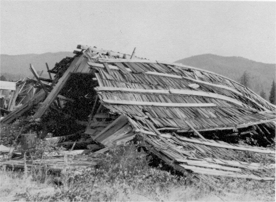
[click to enlarge] |
|
Illustration 22.
Cabin ruins, McCauley ranch, view to southeast. Photos by Robert C. Pavlik, 1984. |
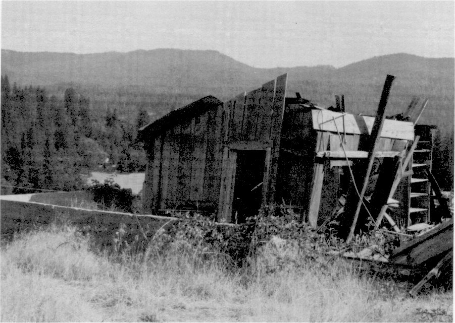
[click to enlarge] |
|
Illustration 23.
Barn, McCauley ranch. Photo by Gary Higgins, 1984. |
[click to enlarge] |
|
Illustration 24.
Sawmill, McCauley ranch. Photo by Robert C. Pavlik, 1984. |
[click to enlarge] |
|
Illustration 25.
Meyer saltbox and crib barns, Big Meadow Photo by Gary Higgins, 1984. |
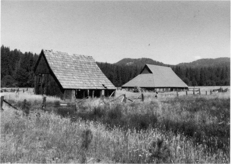
[click to enlarge] |
(a) Thomas Rutherford—Rutherford was the first man buried here, dying of pneumonia at Big Meadow in 1884.
(b) John Henry “Jack” Allen—Allen was a laborer killed in a rockslide above Arch Rock. Surveyors found his body and took it to Big Meadow for burial in 1886.
(c) John “Sawmill” Johnson—Johnson also died in 1886, after working periodically for J. M. Hutchings at his timber mill in the valley. He was once worked for Meyer at Big Meadow. He froze to death while walking home inebriated from Yosemite Valley along the Coulterville Road. James McCauley discovered the body.
(d) Philippe (Philip) Provuveui—Provuveur was a Belgian who immigrated to South America and arrived in San Francisco during the gold rush. He worked as sharecropper on the McCauley ranch. He was also a carpenter and probably helped build some of the structures at the McCauley place. He died sometime after 1901 at the McCauley ranch.
(e) George Washington Drake—Drake was a ranchhand who worked for Meyer most of his life. He died in 1918. His burial was the last in the Big Meadow graveyard.106
[106. Shirley Sargent, “Little Known of Old Graveyard at Big Meadow,” Mariposa (Calif.) Gazette, 22 August 1957, in Separates File, Y-4, Yosemite Research Library and Records Center; Sargent, Yosemite’s Rustic Outpost, 18-19.]
(i) Gentry Station
Gentry’s served as the last station on the Big Oak Flat Road on the brink of the cliffs overlooking the Merced River canyon. Colonel E. S. Gentry settled there and constructed buildings of logs and split shakes. The two-story main house was porchless with a steep roof and stood on a tiny flat to the right of the road. It served travelers when it was necessary to disembark from stages and enter the valley on horse- and muleback. The completion of wagon roads to the valley floor enabled passengers to continue on into the valley without stopping at Gentry’s place.
Gentry ultimately moved out and Joseph Hutchins took over the location in 1885, building a sawmill south of the old Gentry house, which housed some of the mill workers. Additional small cabins were built across the road. Hutchins had contracted to supply lumber for the Stoneman Hotel in Yosemite Valley. Oxen soon began dragging the logs in from the woods, while horse teams carefully hauled the lumber down the Zigzag to the valley floor. Gentry’s became known as a lively place during all this activity, but upon completion of the new valley hotel and exhaustion of the nearby timber supply, Hutchins dismantled the sawmill and the workers’ families eventually moved away.107
[107. Paden and Schlichtmann, Big Oak Flat Road, 239-41.]
j) Aspen Valley
(1) Hodgdon Cabin
At the southeast end of the Aspen Valley meadow, Jeremiah (Jerry) Hodgdon, T. J. Hodgdon’s son, built a two-story log cabin. Hodgdon began work on the structure in 1879, assisted by an old Chinese gentlemen named Ah Hoy and a neighbor called Babcock. Originally constructed as living quarters on the Hodgdon homestead, it was occupied until construction of a larger home. (Although the structure has been termed the only two-story log cabin in Yosemite, James Lamon had built a two-story log house in Yosemite Valley ten years earlier.) The cabin later housed laborers on the Great Sierra Wagon Road and provided summer billeting for detachments of cavalry patrolling Yosemite National Park.
|
Illustration 26.
Hodgdon Aspen Valley homestead cabin after relocation at Yosemite Pioneer History Center. |
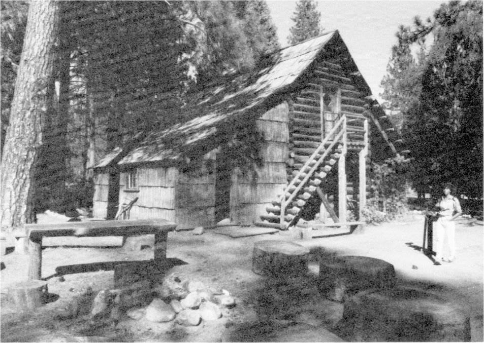
[click to enlarge] |
|
Illustration 27.
Anderson cabin after relocation at Yosemite Pioneer History Center. |
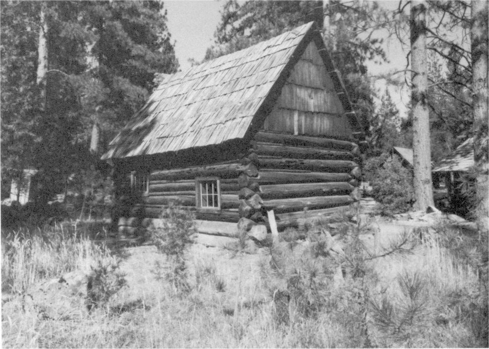
[click to enlarge] |
Several additions altered the Hodgdon structure in later years: a large front porch, a lean-to kitchen on the west side, and exterior stairs to the second floor on the south end. The main portion of the cabin was built of peeled logs laid in alternating tiers and interlocked at the corners with saddle-notched joints. A shake roof covered the purlins, which were parallel to the sides and extended about two feet on each end of the cabin. The base log served as the cabin’s foundation. The building timbers were carefully notched on both upper and lower sides and had wedge-shaped chinking.
Descendants of the Hodgdon family who still owned and resided upon the Aspen Valley property in 1951 planned to tear down the old, empty homestead structure. In order to preserve the only extant two-story pioneer log cabin in the Yosemite region, the National Park Service purchased it. In 1960 park employees dismantled it and moved it from its original site in Aspen Valley to the Pioneer Yosemite History Center, where they re-erected it and accomplished considerable interior restoration. After furnishing it with furniture and personal items of the late 1800s, the Park Service has since used the building to interpret pioneer life of early California.
(2) East Meadow Cache
This small trapper’s shelter was built in the East Meadow portion of the Hodgdon Estate near Aspen Valley. Its features were still distinguishable in 1951, although it had rotted almost to the ground. Used as a cache on Babcock’s trap line, it measured only eight feet long and six feet high. It lacked windows and was entered through a trapdoor in the roof. It did contain a small stone fireplace and chimney.
k) Hetch Hetchy Valley/Lake Eleanor Area
Some controversy surrounds the identity of the first white man to enter Hetch Hetchy Valley, although historians believe it was undoubtedly one of three brothers—Joseph, Nathan, or William Screech. Joseph is the one most often credited with the first exploration of this beautiful area northwest of Yosemite Valley in 1850, but other sources claim that without a doubt Nathan made the discovery. The latter recorded in 1935 that during an early hunting trip in the mountains he climbed a high peak, from which vantage point he could see the Tuolumne River flowing out of the Sierra Nevada through a deep cut. He also saw beyond what appeared to be a wider cut in the mountains resembling a deep, wide valley.
Although he did not pursue his discovery at that time, he returned -two years later and succeeded in entering the valley and speaking with its Indian inhabitants. Observing that they cooked some sort of grass covered with seeds, he inquired its name, and received the answer “hatch hatchy.” James Ackerson, who homesteaded near Hetch Hetchy Valley, however, said that Joe Screech and two others made the first trip into the valley and that he accompanied them on their second one. Possibly all three Screech brothers composed that first party and that was when Nate finally reached the valley he had seen earlier. Because by 1868 Joe had cleared a trail that was used to bring in sheep and cattle, he became most closely identified with Hetch Hetchy Valley.108 Sheepherders and cattlemen also once occupied a level spot in the Tuolumne River canyon referred to as Poopenaut Valley.
[108. See a discussion of the discovery of the Hetch Hetchy Valley in ibid., 188-92.]
(1) Miguel Meadow Cabin
Seven miles from the present Hetch Hetchy Reservoir on the Lake Eleanor Road is a meadow once owned by Miguel Errera and his partner Jonas Rush, who owned the Rush and McGill ranch near Keystone in Tuolumne County. There they pastured large herds of cattle and horses during the summer. In a 1906 deposition, Rush and Errera stated they had been co-partners in raising horses, cattle, and mules in Stanislaus and Tuolumne counties for twenty years under the name Rush & Errera. Their lands included the Lake Vernon area and McGill Meadow.
|
Illustration 28.
Kibbe cabin, 1896. From Uhte, “Yosemite’s Pioneer Cabins,” Yosemite Nature Notes 35, no. 10 (October 1956). |
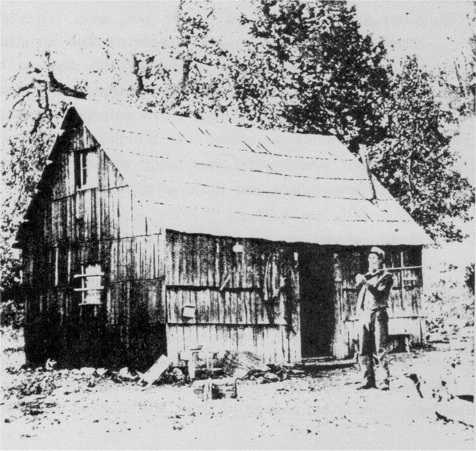
Mr. Kibby at his Lake Eleanor cabin in 1896. This photo was taken by Lukens. [click to enlarge] |
(2) Kibbe Cabin
Homesteader Horace J. Kibbe erected this structure on the shores of natural Lake Eleanor. He recorded the deed to his property in 1890, but the one-room cabin of overlapping shakes dates from an earlier time. It was abandoned by 1914. The enlarged waters of Lake Eleanor reservoir have since inundated the building. Kibbe was referred to as a “squaw man” whose wives reportedly packed trout from lake to lake to ensure both the Indians and Kibbe of good fishing.
(3) Elwell Cabins
Two cabins stood seven miles north of Hetch Hetchy Reservoir, along the Jack Main Trail, in “The Beehive” area—a fenced meadow west of Lake Vernon. Lewis and Eugene Elwell built both structures. The Elwells lived near Groveland, California, and each summer drove cattle up into the high country, where they established line camps. About 1889 Lewis Elwell filed on Mount Gibson and Eugene Elwell filed on The Beehive. The latter packed in trout and stocked streams in the area.
The brothers built at least one and possibly both cabins in 1888. Situated on a loose rock foundation, the walls of one comprised five horizontal round logs on one side and six on the other, joined by V notches. Short stumps or uprights placed between the logs at various intervals kept them from sagging—an expedient not found in other Yosemite cabins. The structure measured fifteen by twenty-four feet. Shakes covered the roof and sides. There was no flooring. A 1986 field inventory found no traces of this structure. Large, round logs joined with a box notch, the first one half buried in the ground as foundation, formed the walls of the second, shake-roofed structure, which the Elwell family also used as a summer headquarters during the grazing season. They also built a cabin on Tiltill Mountain and one near Lake Vernon, the latter known to be no longer standing.
(4) Tiltill Mountain
The Elwell brothers built this stockman’s cabin in 1888, the same year they erected those at The Beehive. Probably only seasonally occupied while Elwell cattle grazed in the area, it measured ten by twelve feet. V-notched corners joined walls five logs high. Split shakes functioned as roofing and served for chinking. By 1951 two large trees had fallen over the structure.
(5) Lake Vernon Cabin
Thomas R. Reid pioneered as a homesteader at Lake Vernon in the late 1870s. He and his wife filed on Lake Vernon by preemption and built a cabin on its shores in 1889. A miner from Groveland, Reid also fattened cattle for owners of ranches near Modesto. He regularly took more than 100 animals to summer range via the Big Oak Flat Road, through Hog Ranch (Mather), to the Hetch Hetchy Valley. A saddle trail provided access to Miguel Meadow and Reid’s homestead at Lake Vernon from the Hetch Hetchy Valley. Reid also guided tourists entering Yosemite Valley on horseback from Hodgdon’s ranch around 1869-70.
The Reid log cabin had whipsawed plank floors and roof boards.109
[109. “Interview by Carl P. Russell with Mrs. Thomas Rathbone Reid, Sept. 26, 1951,” in Separates File, Yosemite-Cabins, Y-36, Yosemite Research Library and Records Center.]
(6) Rancheria Mountain Cabin
An unknown builder located this structure above Hetch Hetchy Valley on Hat Creek.
(7) Smith Meadow Cabin
The Smith Meadow cabin lay one mile southeast of Smith Peak and Hetch Hetchy Reservoir. Cyril C. Smith, an early settler from Maine, who had holdings in Merced and pastured stock in the summer in the area of Mather, Hetch Hetchy Valley, and Smith Meadow, built the cabin in 1885. Although primarily a sheep man, Smith raised hogs on the Mather site.110 He was the father of Elmer Smith of Merced, who eventually sold parts of those lands to the city of San Francisco for its Mather recreation camp.
[110. Hog Ranch derived its name from a sheepherder’s painting of a sheep on a boulder in the area in the early 1880s that looked more like a hog. Michael O’Shaughnessy, San Francisco city engineer, changed the name in October 1919 to Mather, in honor of the first director of the National Park Service.]
The twelve by sixteen-foot cabin with shake roof consisted of hewn logs whose box corners were secured with hardwood dowels. The rear wall supported a small dry masonry stone fireplace. Double chinking filled the spaces between the squared timbers. Its continued existence is uncertain.
l) White Wolf
The three Meyer brothers—Diedrich, Heinrich, and John— left Germany in the 1850s for the California goldfields. Having no luck in that endeavor, they turned their efforts to cattle raising and acquired holdings in Tuolumne County. While in summer pasturage in Smith Meadow sometime prior to 1882, some Indians stole their horses and John Meyer took off in hot pursuit. He found not the thieves but another Indian band camped in a beautiful alpine meadow, which he named “White Wolf” in honor of their headman. The name stuck.
By 1882 the land had been surveyed and the Great Sierra Wagon Road, discussed later in this chapter, had reached White Wolf Meadow. One of the teamsters employed in building that road, Johnson Ridley, acquired title to the lush meadow area in 1883. He later conveyed it on 6 November 1884 to John D. Meyer, who received 120 acres including the meadow. Meyer drove his cattle to summer pasture there over the Great Sierra Wagon Road after it fell into disuse.111
[111. George H. Harlan, An Island in Yosemite: The Story of White Wolf Lodge (Greenbrae, Calif.: Published by the Author, 1981), 1-2. Ridley later worked for Henry Washburn at Wawona. After Washburn fired him, Ridley took a potshot at him during a 4th of July celebration. Convicted of attempted murder, Ridley went to San Quentin Prison. Interview with George Harlan by the author, 1984.]
m) Soda Springs and Tuolumne Meadows
The Tuolumne Meadows area is one of the most beautiful in the park and has been frequented from the earliest days. As mentioned earlier in this report, the ancient Mono Trail traversed the High Sierra from west to east, through Tuolumne Meadows, over Mono Pass, and down Bloody Canyon to the east side of the Sierra Nevada. Mono Lake Paiutes traded pinon nuts, dried fly pupae, pandora moth larvae, baskets, rabbit and buffalo robes, salt, tobacco, and obsidian for acorns, berries, beads, paint pigments, arrows, baskets, and abalone shell ornaments from the Miwoks who traded with peoples along the West Coast. That trade continued into the 1880s, and was carried on during summer rendezvous when the Yosemite and Mono Indians encamped in Tuolumne Meadows.
Several parties of whites penetrated the area in the early days, in search of either Indians, wealth, or scientific knowledge. Lieutenant Tredwell Moore passed through with a small command of troops in pursuit of Chief Tenaya in 1852, pausing only long enough to explore briefly for rich mineral ore in the vicinity of Bloody Canyon. By the 1850s a few miners from the western foothills struggled over the slightly improved Mono Trail to the mining settlements near Mono Lake. In 1863 an expedition of the California Geological Survey reached Tuolumne Meadows while studying the watershed between the Merced and Tuolumne rivers and their headwaters and named the Soda Springs.
Sheepherders with immense flocks had been annual visitors to the Yosemite high country meadows since the 1860s. Sheep husbandry in California had boomed since the gold rush days, and the introduction of hardier breeds, such as the Merino, had resulted in excellent wool as well as good meat. Increased agricultural use of the Central Valley, however, began to crowd the flocks, and the extreme heat and dryness of the summer season inflicted great hardship and casualties upon them. During the summers, Basque, Portuguese, Scottish, and French sheepherders escorted the animals through the hills, into the high mountain meadows of the Sierra Nevada, and back again. Along the way the animals feasted on the lush grasses and green plants of meadows such as Tuolumne, uprooting flowers, destroying the soil cover, and fouling water sources as they passed.
In 1869 a California sheep rancher hired a young drifter named John Muir to take charge of a flock of several thousand sheep headed for grazing grounds in the High Sierra. The party reached Soda Springs in late summer and the sheep were deposited in a high pasture north of Tuolumne Meadows. While the sheep fattened, Muir spent much of his time exploring the surrounding high country.
Meanwhile, prospectors remained active in the mountains east of Tuolumne Meadows, and miners and packers frequently plodded along the trail from Big Oak Flat to Bloody Canyon. When the Tioga Mining District blossomed about 1878, a flurry of tunneling and building ensued, culminating in construction of the Great Sierra Wagon Road through Tuolumne Meadows in 1883.
During all those years Tuolumne Meadows was government land, open to homesteading as well as grazing. The army took advantage of its central location in the eastern portion of the park as a starting point for patrols in that area. Its beautiful scenery and convenience as a starting point for hikes into the backcountry also attracted the attention of the Outing Committee of the Sierra Club. Its first annual Outing in 1901 visited Soda Springs, which served as a base of operations during subsequent annual excursions.
(1) Lembert Cabin
The only resident of Tuolumne Meadows who left much of a mark, however, was a New Yorker by birth, John (Jean) Baptiste Lembert. He had worked in and around Yosemite Valley for several years, and, regarded somewhat as a recluse, had built a winter cabin among the Indians on the north side of the Merced River canyon below present El Portal. Lembert established a homestead claim at Tuolumne Meadows that included the Soda Springs in 1885, to which he acquired title 28 June 1895. A few feet in front of, and a little toward Soda Springs from the present Parsons Memorial Lodge, Lembert built a crude, one-room cabin of large, round timbers laid on a granite stone foundation. The shake-chinked and shake-roofed structure had a crude fireplace and a chimney of granite rocks and was adequate for summer occupancy only. On the east side, Lembert added a shed for his donkey.
Around 1889 Lembert erected a small log enclosure over three of the larger soda springs to protect them from contamination by flocks of roving sheep and cattle. The structure measured nine by eleven feet and had no windows. Its peeled logs interlocked at the corners with V-notch joints. Lembert also fenced in his land, making it available for grazing for a fee to parties passing through with stock. Although a loner by desire, he welcomed passersby and was especially friendly with many of the sheepherders frequenting the area. He also had friends among the Indians who came to the meadows to trade in late summer.
Lembert brought in a flock of angora goats that he later lost during a blinding snowstorm in the winter of 1889-90. He also pursued mining in a desultory fashion, sinking a small shaft a short distance into his property, and bottled and sold the water from the soda springs to people in Yosemite Valley. An avid student of nature, with special interests in entomology and botany, Lembert assisted a government scientific expedition that came through the meadows in the 1890s in collecting Sierran plant and insect specimens. Afterwards, he continued sending specimens for payment to museums and scientific societies. In
|
Illustration 29.
Soda Springs enclosure. Photo by Robert C. Pavlik, 1984. |
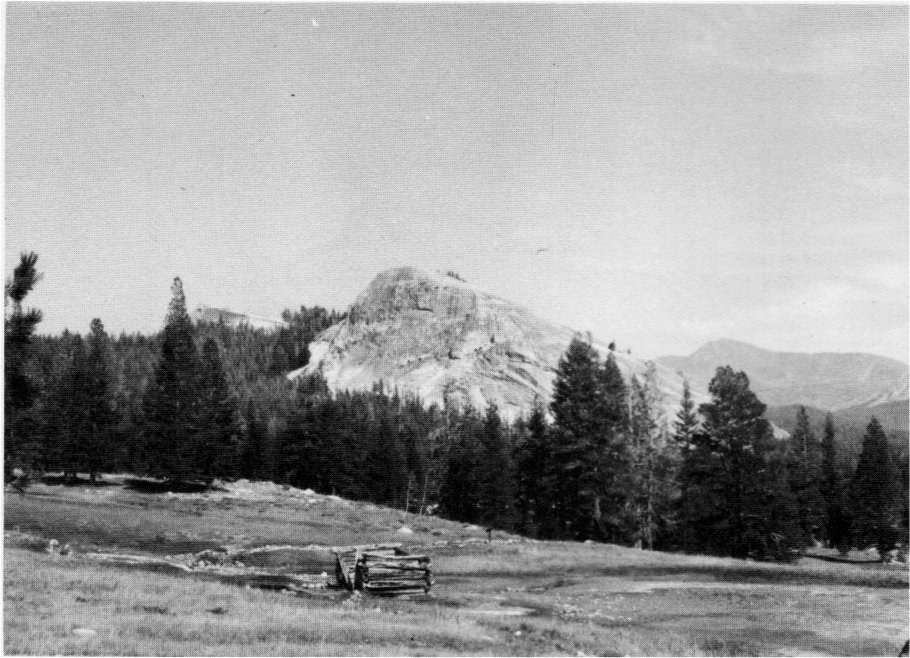
[click to enlarge] |
|
Illustration 30.
Tuolumne Meadows cabin, 1950s. From Uhte, “Yosemite’s Pioneer Cabins,” Yosemite Nature Notes 35, no. 10 (October 1956). |
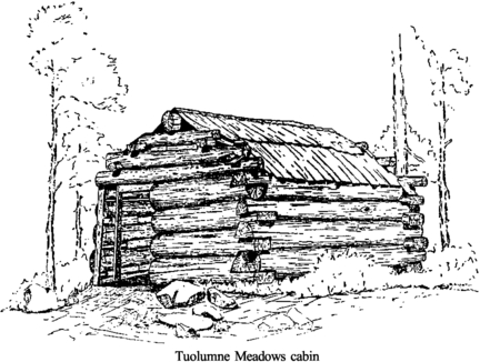
[click to enlarge] |
[112. Elizabeth Stone O’Neill, Meadow jin the Sky: A History of Yosemite’s Tuolumne Meadows Region (Fresno: Panorama West Books, 1983), 6-7, 12-17, 22-24, 34-37, 43-47; William E. Colby, “Jean (John) Baptiste Lembert—Personal Memories,” Yosemite Nature Notes 28, no. 9 (September 1949): 113-17.]
(2) Tuolumne Meadows Cabin
This small house stood on the Elizabeth Lake Trail in Tuolumne Meadows. Crudely constructed of large lodgepole timbers, it contained chinking in the form of small wedges placed parallel between the round logs whose corner joints were secured with box corners. Two courses of long shakes covered the roof. The cabin reportedly existed in 1894, built by sheepherders who drove their flocks into the meadows prior to establishment of the park.
(3) Murphy Cabin
In 1878 a Yosemite guide, John L. Murphy, homesteaded the meadows bordering Tenaya Lake, eventually planting a number of brook trout from the Tuolumne River in its waters. In 1881 Archie Leonard, later one of the park’s first civilian rangers, initiated a ten-horse pack train operation between Yosemite Valley and the mining town of Lundy to the east. Travelers over that trail and the later Tioga Road, and hikers on the Eagle Peak Trail from Yosemite Valley, found satisfactory accommodations at the primitive Lake Tenaya stopping place where Murphy and a Mr. (Johnny?) Brown dispensed refreshments.
The hospice was a long, rectangular structure that Murphy initially built as his home. He occupied it during the summer season, when he employed a cook and catered to travelers and campers. In the winter he lived in Mariposa. Exposed logs chinked with large horizontal boards composed about one-third of the structure—evidently the basic cabin, containing a dry masonry rock fireplace and a chimney. The other two-thirds, a later addition, comprised a frame structure covered by horizontal shakes. A shake roof covered the entire cabin, which no longer exists.
Few details of Murphy’s business are known. In 1916 the Desmond Park Service Company established a tourist camp on the site of Murphy’s “inn.” The Yosemite Park and Curry Company closed the operations at Lake Tenaya in 1938 to build in a more isolated location at May Lake.
(4) Snow Flat Cabin
Once visible along the trail leading to May Lake, the remains of two deteriorated cabins at Snow Flat lay about one hundred yards off the Tioga Road. Their history is unknown. The only trace of one of them in 1951 was a pile of large granite boulders, presumably the remains of a dry masonry fireplace and chimney. The other cabin a short distance away had been reduced to a small square enclosure four logs high resembling a corral. The cabin consisted of rough round logs with wedge-shaped chinking laid on a stone foundation, a large boulder having been placed at each of the four corners. Saddle-notched above and below, the logs joined closely at the corners. Piles of ore samples lay around the cabin sites.
n) Tioga Pass
(1) Dana Fork Cabin
This old sheep camp cabin lies on Dana Fork, about one and one-half miles from the Tioga Road along the Mono Pass trail. There an unknown builder erected a one-story, one-room log structure. Measuring about ten feet square, it consisted of large, peeled round white bark pine logs laid in alternating tiers eight logs high. V-notches at the corners allowed tight-fitting chinking. The roofing material consisted of small poles laid parallel to the end of the building and bound together by split shakes. The structure is in ruins with a collapsed roof and deteriorated walls. Because of its proximity to both Dana Meadows
|
Illustration 31.
Leonard cabin, Little Yosemite Valley, view to north. Photo by Robert C. Pavlik, 1984. |
|
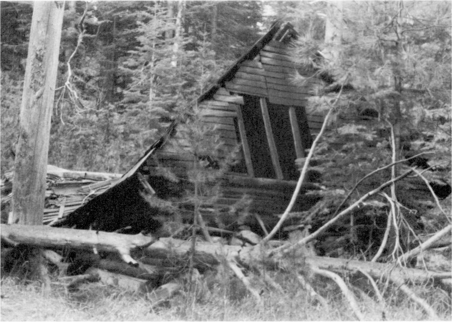
[click to enlarge] |
(2) Mono Pass Cabins
The Mono Pass miners’ cabins are a series of shelters at the head of Bloody Canyon just off the Mono Pass trail on the eastern boundary of Yosemite National Park. They consist of five log structures erected about 1879 for employee housing by the Great Sierra Consolidated Silver Mining Company, which owned the Golden Crown and Ella Bloss claims in the area. Constructed of white bark pine logs, they exhibited V-shaped corner notching and wedge-shaped chinking. Sod from a nearby meadow once covered their log roofs.
A one-story, one-room structure, ten by twelve feet, surrounds a shaft lined with vertical logs that is now filled with water. The four cabins stand about 100 feet away, strung in a row across the crest of the rise. Three are small, one-story, one-room buildings, each with door and adjacent window. One larger cabin has a log annex. At least three other shafts exist in the area, one below the cabins and near the lake that is open and log lined, and two others that are filled in. Their sturdy construction and isolation have helped preserve them.
Another small, deteriorated cabin exists near Mono Pass, measuring about ten feet square. The one-story, one-room log structure contained only one opening, a doorway. It was made with round, peeled logs laid in alternating tiers and joined with a V-notch joint at the ends. The log roof has fallen in and parts of the walls have toppled. Its early history is unknown, although a picture of the cabin appears in a 1909 photograph. It was probably built by a miner working at the Golden Crown or Ella Bloss mines.
o) Little Yosemite Valley
(1) Washburn/Leonard Cabin
In Little Yosemite Valley stands a structure referred to variously as both the Washburn Cabin and the Leonard Cabin. Possibly the Washburns built the structure at the upper end of the valley after filing on the area, because they often pastured horses there. Archie Leonard in 1894, and Nathan (“Old Pike”) Phillips, an early Wawona settler, also filed on the area and supposedly built the fence one-half mile from the cabin. The structure may have served as a shelter for travelers on the trails leading from Yosemite Valley to the backcountry and Leonard may even have later used it as a patrol cabin for the Little Yosemite Valley-Washburn Lake area.113
[113. Ralph H. Anderson, “Additional Notes from Jack Leidig,” 15 July 1952, typescript, 4 pages, in Separates File, Yosemite-History, #38, Yosemite Research Library and Records Center, 1.]
The cabin stands two miles east of the Little Yosemite ranger station on the south side of the trail, just east of an aspen grove. The one-story, one-room log structure is of peeled round logs laid on alternating tiers and joined at the corners with saddle-notch joints. It measured about fifteen by twenty feet and had a wood-shingled gable roof. In October 1964 an allotment of $4,100 enabled the Park Service to rehabilitate three historic cabins in the park with day labor. The work involved repairs to log walls and rafters and new shake roofs for the Little Yosemite, McGurk, and Galen Clark (Mariposa Grove) cabins. Restoration of the Little Yosemite Valley structure took place in 1971, but afterward it was partially crushed by a falling tree. It has further deteriorated since that time.
p) Yosemite Valley
(1) Pioneer Cemetery
It is unclear when this plot was laid aside for burial purposes, but it was probably sometime in the late 1860s, when Agnes, the small daughter of the Frederick Leidigs, died after a short illness. Hers was probably the first natural death of a white person in the valley. She was first buried near the present Ahwahnee Hotel site and later reinterred in the present cemetery area. In 1906-7 Gabriel Sovulewski and John Degnan planted rows of incense cedar trees on the south and west sides of the cemetery, and in 1918 they placed the present fence around part of the area. The cemetery is now closed to further entry, the last burials having been made in 1956.
There are probably some graves that still lie outside the limits of the present cemetery, especially of some of the earlier Indian inhabitants of the valley. The cemetery includes several occupants who played important roles in the growth and development of Yosemite National Park. Others were visitors; some were old, some young. There are also several Indian graves. The graves described below are keyed to Illustration 32.
(a) White Graves
i) Henry Eddy, died 10 October 1910. He was a road laborer for the government and also a carpenter who worked on the Yosemite barns. He lived in a tent at the rear of Mr. Sovulewski’s home. His death was due to natural causes.
ii) Frank Beckerman, died 9 July 1910. He was from Coulterville, looking for work in the park, when he fell sick and died in the army hospital.
iii) William Bonney Atkinson, born in 1898 in Yosemite, died in 1902. His father was an employee of the state.
iv-v) James Mason Hutchings, his second wife Augusta L. Hutchings, and his daughter Florence (first white child born in Yosemite Valley). Marked by a large piece of granite and a stone cross. Augusta and Florence died in 1881 and James in 1902.
vi) Effie Crippen, died 1881, youngest daughter of Joshua D. Crippen, sheriff of Mariposa County from 1857 to 1870. His widow married John K. Barnard, operator of the former Hutchings Hotel from 1877 to 1892.
vii) Mrs. Laura Cannon, a visitor to Yosemite, who died in 1895.
viii) Thomas Glynn, a Mexican War veteran and currier by trade, who died in the valley in 1881. His wife for a time operated the hotel at Glacier Point and was a neighbor of the Degnans in the Old Village.
Between the graves of Glynn and Albert May are the remains of an old well Clark dug to provide water to keep the graves green. It had a hand pump. The site is hardly visible today.
ix) Agnes Leidig, infant daughter of the Frederick Leidigs, pioneer hotel keepers. She died in 1868.
x) Albert May, died 1881. May was a carpenter and caretaker for A. G. Black.
xi) James Lamon, whose grave is marked by a tall granite spire. The rock of the monument is white granite taken from one of the “Three Graces.” John Conway worked on the monument, which was erected in 1875 by Lamon’s heirs.
xii) Galen Clark, died 1910. Clark carved his own name on the rough granite stone for his grave; he also dug the hole and planted six sequoias around it about 1886.
xiii-xiv) George Fiske, pioneer photographer in Yosemite in the late 1800s and early 1900s, and his wife Carrie. Mr. Fiske died in 1918 and his wife a year earlier.
xv) Hazel Meyer, infant daughter of George and Lizzie Meyer, pioneer settlers in Mariposa County, of the Big Meadow ranch. When. she died of scarlet fever in 1905, the cemetery was without definite outline, merely a dusty corner on a portion of the valley floor.
|
Illustration 32.
Yosemite Valley cemetery plan. From Brubaker, Degnan, and Jackson, Guide to the Pioneer Cemetery. |
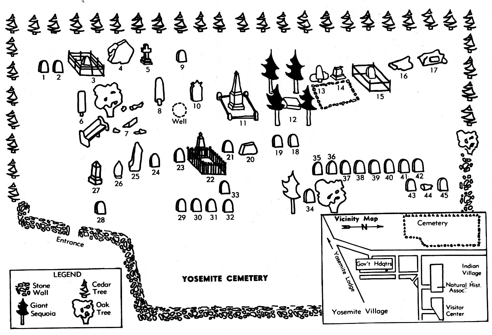
[click to enlarge] |
xvi) Gabriel Sovulewski, died 1938. He served in the army in Yosemite in 1895-97, in Troop K, 4th Cavalry. He continued as the civilian year-round administrator after the army left. He was extremely interested in trails and planned and laid out many of the trails in the park.
xvii) Rose Sovulewski, Gabriel’s wife, died in 1928. xviii) Leonidas (Dick) Whorton, shot and killed at his Cascades home by Abel Mann in April 1887. He served as justice of the peace of Yosemite Valley and was partners with Peter Gordon in 1870 in the “Lake House” at Mirror Lake. He owned eighty acres at The Cascades.
xix) John Hamilton, died 1882. Hamilton was a guide with a cabin and stockade in El Capitan Meadow near the bridge. He also lived in back of Folsom Hall on the south bank of the Merced near Swinging Bridge. This is the same man who owned land near the McCauley ranch in Big Meadow.
xx) George Anderson, died 1884. A small, simple stone marks the grave of the first man to scale Half Dome, in 1875.
xxi) J. W. Wood. Wood was watching cattle for J. B. Curtin when he died at Tamarack Flat. Whether this is the same man who resided near Wawona is not known.
xxii) A. B. Cavagnaro, died 1885. He was a storekeeper in the Old Village.
xxiii) John Anderson, died 1867. Anderson was a stage driver who was violently kicked and instantly killed while breaking a young horse. He was first buried at the base of Four-Mile Trail near the Fiske residence.
xxiv) Walter Coyle baby. The father of this infant worked in the valley.
xxv) Albert Glasscock, died 1897. He took over Barnard’s Hotel, naming it the Sentinel Hotel.
xxvi) James Morgan, died 1901.
xxvii) Sadie Schaeffer, died 1901. Sadie was a waitress for J. B. Cook at the Sentinel Hotel and drowned in the Merced River.
xxviii) Forest S. Townsley, a Yosemite Chief Ranger, died of a heart attack in August 1943. He was a taxidermist who gave the Yosemite Museum its beginning by displaying his work in his office in the Old Village.
xxix) “A Boy.” Identity unknown. Possibly John Bennett, son of Capt. R. H. Bennett, who died by drowning.
xxx) “Frenchman,” probably Etienne Manet, who sold vegetables that he grew in the upper Lamon orchard. He lived in a cabin at the northeast corner of the lower Lamon orchard (now Camp Curry parking area).
xxxi) ________ Woolcock. A miner who fell off a log and broke his neck while working on the Coulterville and Yosemite wagon road.
xxxii) George E. Boston, died 1874. Boston ran the Coulterville Road toll house at Cascades below Yosemite Valley that was burned by Indians.
xxxiii) ________ McKenzie. He was a member of a camping party to the valley in 1896.
xxxiv) A. W. B. Madden, died 1883. He was a tourist who died at the Sentinel Hotel.
(b) Indian Graves
The Ahwahneechees practiced cremation in pre-discovery Yosemite. Their last known cremation ceremony took place in 1873 at cremating grounds directly across the road from the Leidig Hotel, near the base of Sentinel Rock. The earliest recorded Indian burial took place about 1875, immediately south of a large rock near the southeast corner of the present museum. The Yosemite Indians had adopted the burial custom by the turn of the century.114 Sites in El Portal have also provided unburned skeletal remains. Ten of the Indian grave markers in the cemetery are redwood boards placed in recent times. The eleventh is a granite boulder.115
[114. J. W. Bingaman, The Ahwahneechees: A Story of the Yosemite Indians (Lodi, Calif.: End-Kian Publ. Co., 1966), 17-18, and Galen Clark, Indians of Yosemite Valley and Vicinity: Their History, Customs and Traditions (Yosemite Valley: Galen Clark, 1904), 63, quoted in Napton, Archeological Overview, 97-98.]
[115. Jay Johnson, a Native American park maintenance worker claimed the wooden “Miwok” markers were rearranged by park interpreters years ago for aesthetic reasons without regard to actual grave locations. Discussion with DSC comprehensive design team, January 1986.]
xxxv) Sally Ann Dick Castagnetto, died 1932. She was a full-blooded Yosemite Indian married to Henry Stegman and later to Johnny Brown who either at one time operated the Hennessey ranch below El Portal and sold vegetables to people in the valley or ran a pack train that brought the fruits and vegetables to the valley, or both. (The Superintendent’s Monthly Report for April 1932 refers to the death of Sarah Jane Castagnetto.)
xxxvi) Mother of Indian Lucy Brown.
xxxvii) May Tom, age fourteen, a Paiute, killed by a falling tree about 1905.
xxxviii) May Dick, mother of Sally Ann. A full-blooded Yosemite Indian whose husband, Indian Dick, provided wood for the early settlers.
xxxix) Suzie Sam, Lucy Telles’s grandmother, died about 1904. She was a Yosemite Indian, born in the valley. Her husband, Captain Sam, was employed by Camp Curry and the Sentinel Hotel to supply fish.
xl) Lucy Brown, died 1924, said to have been nearly 120 years old. She was one of the last of the original Indians found in the valley at the time of its discovery by white men in 1851.
xli) Bill Brown, died 1899. He was the husband of Indian Lucy and one of the first Indians buried in this cemetery.
xlii) Lancisco Wilson, died 1885. The father of Johnny Wilson, he was one of the old chiefs of the Yosemites. He was approximately 115 years old when he died.
xliii) Johnny Brown, died 1934.
xliv) Pete Hilliard, died 1934. He was part Yosemite Indian and worked for the federal government in the valley.
xlv) Louisa Tom, died 1956. Hers was the last burial in this cemetery.116
[116. Lloyd W. Brubaker, Laurence V. Degnan, and Richard R. Jackson, Guide to the Pioneer Cemetery (Yosemite National Park: Yosemite Natural History Association, 1972), 1-13.]
|
Illustration 33.
Lamon cabin. From Uhte, “Yosemite’s Pioneer Cabins,” Yosemite Nature Notes 35, no. 10 (October 1956). |
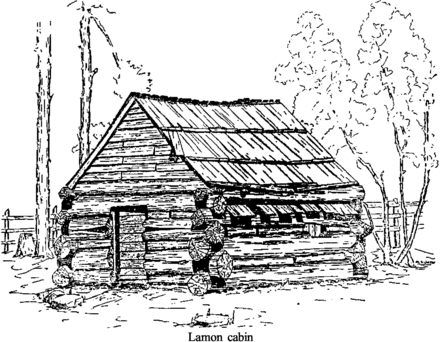
[click to enlarge] |
(2) Lamon Cabin
James C. Lamon built the first log cabin in Yosemite Valley, measuring about eight by ten feet, on his preemption claim at the upper end of the valley in 1859. He used very large logs, skillfully notched on the upper and lower sides and joined tightly at the corners. The logs were graduated in size from the base log up to a small gable filled in with horizontal split shakes.
James Hutchings wrote that Lamon erected a small house on the sunny side of the valley; and, as a precaution against Indian treachery, lived in its basement. This, however, being flooded during a heavy and continuous rain, he afterwards built a commodious log-cabin, that, upon emergency, might be to him both a fortress and a home.117
[117. Hutchings, In the Heart of the Sierras, 137.]
Lamon recorded his claim to 160 acres in Yosemite Valley on 17 May 1861. Later he built his other, larger cabin, a visitor to the valley in 1869 stating that
Mr. Lamon has been getting out material for a two story hewed log house, and making a line fence on his lower boundary. He is now pruning his fruit trees, and showing the young buds which way to “shoot.”118
[118. “Trip to Yo Semite Valley,” by G. C., Mariposa (Calif.) Gazette, 16 April 1869.]
No remains of either of these two cabins exist today.
(3) Hutchings Cabin
James Mason Hutchings, as mentioned previously, served as proprietor of the Upper Hotel or Hutchings House in the valley after widely publicizing Yosemite in his California Magazine and in several books on the Sierra. Famed as a guide and hotel keeper, he also served as Guardian of Yosemite Valley and the Mariposa Grove from 1880 to 1883.
The permanent home he built for his wife and three children stood on the sunnier north side of the valley near the Yosemite falls on the most easterly branch of Yosemite Creek. James C. Lamon assisted in its construction. Round logs joined with a V notch rested on a stone foundation. Shakes formed the roof of the cabin and the chinking between logs. A covered open porch or lean-to occupied one side of the building and a later frame addition on the opposite end provided additional living space. The cabin had a large stone fireplace and chimney.
Back of the cabin Hutchings planted an apple orchard, and Muir’s small cabin rested farther back on the creek. Hutchings’s sawmill operated even farther up the creek. Hutchings connected his cabin to his hotel by an elm-bordered plank boardwalk to a log bridge crossing the Merced River about where Sentinel Bridge is now.119 At least two of those trees are still alive.
[119. Jack Leidig to Douglass Hubbard, October 1958.]
After Hutchings’s court battles with the state over retention of his property in Yosemite Valley, the board of commissioners refused to lease him the homestead he and his family had built. Instead it passed along with his commercial developments south of the river to Coulter and Murphy, and ultimately to John Barnard, who moved into Hutchings’s cabin. After Hutchings became grant Guardian in 1880, Barnard vacated the cabin and the Hutchings family reoccupied it. Hutchings lived there until his death in 1902.120 A traveler to the valley in 1868 described the winter residence of the Hutchings family:
a large cabin made of hewn logs, warm and snug, a huge stone fireplace in one end; hanging shelves, containing some two hundred and fifty volumes, in the corners; fishing rods, guns, and rifles along the walls; and, a pair of snow shoes, indispensable to that snowy. region. . . . Near the house are sheds and hay racks. . . .121
[121. Olmsted, A Trip to California, 75.]
[120. Robert C. Pavlik, “The Hutchings - Sovulewski Homesite, Yosemite Valley,” typescript, 13 pages, n.d. (1986), 4-5.]
Originally of very small construction, the cabin gradually acquired additions through the years, such as an upper story and lean-tos.122 In the early 1900s the structure stored hay. In 1906 the hay and other debris were removed and the Gabriel Sovulewski family occupied the cabin until its removal in 1909.
[122. Anderson, interview with Degnans, 13 December 1934,]
(4) Muir Cabin
John Muir came to Yosemite in 1868 and made Yosemite Valley his headquarters for about five years. During that time he worked at Hutchings’s sawmill cutting lumber for the hotels and cottages of the Sentinel group. He boarded with the Hutchings family and occupied a cabin he built in 1869 back of Hutchings’s winter home along Yosemite Creek near the foot of Lower Yosemite Fall. The one-room cabin consisted of sugar pine shakes with a floor of round tree slabs. Proudly Muir exclaimed that
This cabin . . . was the handsomest building in the Valley, and the most useful and convenient for a mountaineer. . . . I dug a small ditch [from Yosemite Creek] and brought a stream into the cabin, entering at one end and flowing out the other with just current enough to allow it to sing and warble in low, sweet tones, delightful at night while I lay in bed. . . . My bed was suspended from the rafters and lined with libocedrus (Incense cedar) plumes. . . .123
[123. Sargent, John Muir in Yosemite, 15.]
Hutchings later appropriated the cabin, causing Muir to move to Black’s Hotel. No trace of the structure remained by 1901.
In 1871 Muir built a small box-like home or garret beneath the gable of Hutchings’s sawmill, facing west down the valley. A hole in the roof provided a view of Half Dome, while a skylight on the side of the roof permitted a view of Upper Yosemite Fall. An end window faced down the valley. A series of sloping planks roughed by slats, similar to a hen ladder, provided access to the room. No remains of the sawmill structure exist.
In 1872 Muir built another cabin, fourteen by sixteen feet, just opposite Royal Arches and hidden in a growth of trees and shrubs. The cabin construction consisted of round logs joined with a V notch. Purlins parallel to the ridgepole extended two to three feet beyond the cabin. A steeply pitched, sugar pine shake roof covered the structure and overlapped the ridgepole on one side. This structure has been referred to as Muir’s “lost cabin,” and he reveled in its seclusion.
Although Muir bragged that no one could find this structure, photographer George Fiske did, and his resulting photo of it greatly surprised Muir. In later years the Leidig brothers located the site of this “lost cabin” on Tenaya Creek in Camp 9, about 200 feet west of the footbridge and approximately 150 feet south of the creek. The Civilian Conservation Corps removed the last evidence of the structure in 1933.124
[124. “Early Yosemite History Told by Pioneers at ‘Old-Timer’s Campfire,’” 30 May 1943, in Separates File, Y-4, Yosemite Research Library and Records Center; “Other early-day buildings,” information furnished by Jack Leidig, 21 November 1941, typescript, 11 pages, in Separates File, Yosemite-Buildings, Yosemite Research Library and Records Center.]
(5) Leidig Cabin and Barn
Fred and Isabel Leidig came to Yosemite from Coulterville in 1866. Leidig and James Lamon farmed 160 acres on both sides of the Merced River. Leidig built a hotel in 1869.
He erected a cabin north of the Merced River in the woods at the edge of present Leidig Meadow. The family used the structure as winter headquarters during its first few years in the valley. The site of the cabin is about 100 yards west of where the Eagle Peak Trail leaves the highway, on the south side of the road, near where the road turned into the Indian Village. That log cabin, measuring about fourteen by twenty-two feet and facing west, burned about 1883.
The later cabin where the children were born was on the present Ahwahnee Hotel grounds, and appears to have been Lamon’s second cabin. A two-story log house possibly 150 feet south of the present Ahwahnee Hotel, it had breastworks around it and a spring in the cellar.
(6) Howard Cabin
William J. Howard built his cabin in late 1874 or early 1875 on Mirror Lake, between the later footbridge and the small peninsula on which the minister stood for Easter services. At one time remains included four hitching hooks in a rock and one in a tree. Howard built the first road up Tenaya Canyon to Mirror Lake, crossing Sentinel Bridge to the Ahwahnee grounds, and charged $1.00 toll. The state purchased the road in 1886.
Peter Gordon and Leonidas G. Wharton established the Lake House (Mirror Lake House, Howard House) about 1870. A newspaper advertisement of that year mentioned
Mirror Lake House
Yosemite Valley
By Gordon & Wharton
Recently stocked with choice wines, fine
liquors and Havana cigars.
Boats furnished for the Lake.
P. Gordon L. G. Wharton125
[125. Mariposa (Calif.) Free Press, 3 June 1870.]
Another item, in the delinquent tax list for 1875, mentioned:
Whorton, L[eonidas]. G. Frame building
at Mirror Lake, in Yo Semite Valley, known
as the Lake House, valued at $200.126
[126. Mariposa (Calif.) Gazette, 6 February 1875. This is the same Whorton who lived at The Cascades.]
Evidently W. J. Howard leased the premises from the commissioners that year and operated a saloon. A platform built out over the water provided dance space for visitors, and several rowboats were also available.
The Guardian of the grant, by order of the Yosemite commissioners, burned the Howard cabin, described as a shake shanty, about 1880 or 1881, evidently in an effort to improve the lake’s appearance. Howard’s property had already been removed and he received $200.00 in compensation. About 1890 the Yosemite Stage and Turnpike Company built a frame ice house at the lake.
(7) Happy Isles Cabin
George Anderson occupied a cabin in the Happy Isles area while constructing the trail to Vernal Fall.
(8) Clark Cabin
This structure stood on the north side of the road leading west from the Old Village, approximately 300 yards east of the road leading into the base of Four-Mile Trail. A Spanish family ran a laundry 150 feet west of his cabin. Manual Flora (Manuel Floris) [Editor’s note: Manuel Flores—dea] served as a guide for Hutchings. Hutchings and his daughter Cosie utilized Floris’s cabin after he left the valley.
9) Four-Mile Trail Cabin
This structure at the foot of Four-Mile Trail served as a toll house for those visitors climbing or riding to the Mountain House at Glacier Point.
10) Mail Carrier Shelter Cabins
Louie Ferretti carried the mail from Groveland to Yosemite over the Big Oak Flat Road by snowshoe during the winter months. He shared the task with several other individuals. According to Laurence Degnan, mail was delivered three times a week by a carrier on horseback who picked it up at Jerseydale. Stopover cabins stood at The Cascades and on the north side of the Merced River below the present Pohono Bridge. During the worst of the winter, the mail carrier could ride only as far as one of those small cabins before having to change to skis to get to the post office, which then occupied space in the Stoneman House.127 Nothing remains today of the mail carrier cabins.
[127. Dorothy Holmes, “Early Resident Recalls His School Days in Yosemite,” Fresno (Calif.) Bee, 6 July 1952, in Separates File, Yosemite-Schools, Y-26, #13, Yosemite Research Library and Records Center.]
(11) Stegman Cabin
Jack Leidig stated that the Henry Stegman cabin, a two-room structure about twelve by twenty-two feet stood a short distance west of Folsom Bridge. It lay on the right-hand side of the road near the later powerline leading across the road from the old sewage tanks.
(12) Hamilton Cabin
Jack Leidig recalled the John Hamilton cabin, measuring about sixteen by twenty-two feet, stood just west of the El Capitan Bridge intersection on the north side of Yosemite Valley. Hamilton was the Yosemite guide also associated with the Big Meadow area. He harvested fine crops of wheat and barley on El Capitan Meadow.
(13) Shepperd Cabin
According to Leidig, Shepperd’s cabin, later occupied by George Fiske, lay north of the road leading in to Four-Mile Trail. Fiske used the cellar as a darkroom.
(14) Manette Cabin
According to Leidig, in the northwest corner of the Curry orchard a Frenchman, Nicholas Manette, lived in a ten by twelve-foot shack.128
[128. Memo, Information Specialist (Anderson?) to Superintendent, Yosemite National Park, 30 June 1950.]
(15) Whorton Cabin
Leonidas G. Whorton, who came from Georgia, dabbled in saloon-keeping at Hite’s Cove, then settled at El Portal, where he established a ranch. He served as justice of the peace for the Yosemite area from 1876 to 1882, was a partner in the Mirror Lake House, and owned mining interests on the Merced. He eventually moved into Yosemite Valley to The Cascades and built a cabin in the approximate location of the present park employee housing (former housing for powerhouse maintenance employees). Abel Mann shot Whorton in 1887. Whorton is buried in the valley cemetery.
(16) Boston Cabin
George Ezra Boston’s cabin leaned against the face of a rock behind the present Park Service employee houses. The tollkeeper for the Coulterville Road, he was killed by the Indian “Piute George,” who was later tried for the crime and incarcerated in San Quentin Prison.
|
Illustration 34.
McGurk Meadow cabin, to southeast. Photo by Robert C. Pavlik, 1984. |
[click to enlarge] |
q) Glacier Point
(1) McGurk Cabin
A stockman’s cabin similar in appearance and construction to one in Mono Meadow once stood one mile west of Bridalveil Creek and about one mile north of the Glacier Point road. Thomas M. Again filed for 160 acres in 1884, intending to claim what is now known as McGurk Meadow. The description entered into the county records, however, placed the claim well up Illilouette Creek. He received a patent for the property in 1890.
Hugh Davanay acquired the mistaken title from Again and sold it to John J. McGurk in 1895, who continued in possession until August 1897 when U. S. troops removed him to protect the integrity of the park on the basis of the error in the original description of the claim patented by Again. The land McGurk occupied lay in Range 21 East, while the land covered by the patent lay in Range 22 East, a rough area six miles east of the intended homestead and considered basically worthless. After his removal, McGurk forced Davanay to reimburse him for the loss, and Davanay then tried unsuccessfully to effect a trade with the General Land Office for the desired piece of land. Thus McGurk Meadow has always been in government ownership, although occupied by several persons over a considerable period of time.
McGurk, for whom the meadow was named, was born in Calaveras County in 1856. He worked as a hogman for several years around Oakdale (then Fresno Flats) before turning to cattle raising. In 1896 he settled in Madera County, serving as a deputy sheriff. He purchased the cabin from Davany in 1895 and ran cattle in the high country, during which time he used the cabin, probably built either by Davaney or McGurk, as a seasonal residence. Not designed with sturdy, durable construction in mind, the cabin constituted a summer shelter for workers watching over grazing cattle.
The McGurk cabin is a one-story, one-room log structure about fourteen feet square. Saddle-notched joints formed the corners of the round, peeled lodgepole pine logs laid on alternate tiers. The gable roof had wood shake shingles. It contained no fireplace, windows, or flooring. Split-log, wedge-shaped chinking originally filled the gap between logs. Sierra Club volunteers under the direction of Chief Park Naturalist Douglass Hubbard stabilized the partially collapsed cabin in 1958. Park management then believed that as camping facilities in Yosemite expanded, the Bridalveil Creek Campground would become more important and more hikers would pass through McGurk Meadow, making it a good interpretive site.
(2) Mono Meadow Cabin
This cabin, on the Mono Meadow trail, about one mile east of the Glacier Point road, had walls of small, unchinked lodgepole pine logs. Constructed by Milt Egan, the shelter received seasonal use as a summer line cabin. Later it probably housed sheepherders or cowboys grazing stock in the adjacent meadow. The one-story, one-room cabin measured fourteen feet square and lacked a foundation, window, or floor. Its construction simulated that of the McGurk cabin except that the logs used averaged only six inches in diameter.
(3) Ostrander Cabin
This structure stood near the present Bridalveil Creek Campground. Little is known of its construction. In 1864 a newspaper article mentioned that a grizzly bear had entered and ransacked the cabin.129 Four years later a visitor recounted that after
arriving at the Summit meadows, I found the snow from eight to ten feet deep, and so soft as to make it very tiresome walking. I concluded to go to Ostrander’s sheep ranch, and stop over night in his cabin; which is three fourths of a mile off the direct route. As I approached the cabin I saw signs of wild animals which had been prowling around after offal and carcasses of dead sheep. I found the cabin completely covered with snow, except a little of the chimney top and gable at the south end. There was an opening down beside the chimney, into the interior of the cabin; as I approached this, with the intention of trying to effect an intrance [sic], a wolf rushed out through the opening and passed me. . . . I then enlarged the opening and entered the cabin. I found plenty of indications that wolves and coyotes had frequented the place during the Winter. I soon cleared the snow from the fire place, found an axe and procured plenty of wood and had quite a comfortable night.130
[129. Mariposa (Calif.) Gazette, 14 May 1864.]
[130. “A Trip to the Yo Semite Valley on Snow-Shoes,” Mariposa (Calif.) Gazette, by G. C., 17 April 1868.]
(4) Westfall Meadows Cabin
J. J. Westfall erected this log cabin on Bridalveil Creek, south of the present Glacier Point road, in the early 1860s to shelter men herding cattle driven up from the plains to feed during times of drought.131
[131. “Yo Semite Valley,” by Gollek, in Mariposa (Calif.) Gazette, 29 June 1867.]
r) Wawona
(1) Pioneer Cemetery
The cemetery near Wawona, probably used from about 1878 to 1905, is on a hill one-tenth of a mile north of the Pioneer Yosemite History Center. It consists of two small, separate plots, each surrounded by a brown fence. The larger one encloses a granite headstone marking the grave of Nathan B. Phillips (Old Pike), a pioneer in the Wawona area who died in 1896, and a wooden marker for the grave of John L. Yates, an army private stationed at Camp Wood who drowned in August 1905 in the Merced River. A third wooden marker for the grave of H. R. Sargent, either a carpenter or stage driver, is missing.
Recent archeological excavations by park personnel found that an unmarked slab of granite had been placed in the smaller plot and a wood marker dated 1876 had been placed north of the large enclosure. As many as ten people are reportedly buried here. Possibly there are unmarked graves outside the boundaries of the two plots.132
[132. Richard G. Ervin, Test Excavations in the Wawona Valley, Publications in Anthropology No. 26 (Tucson: National Park Service, Western Archeological and Conservation Center, 1984), 119-20.]
(2) Crescent Meadows Cabin
The Crescent Meadows cabin near Wawona consisted of lodgepole logs about nine inches in diameter, joined by a V notch. Wedge-shaped strips chinked the walls and flat shakes covered the crevices. Large rocks placed beneath the base logs served as foundation. It had a dry masonry fireplace and chimney. According to Bob McGregor, a government packer, Robert Wellman built the cabin for use by the livestock partnership of Stockton and Buffman. Some residents of Wawona believed it dated from about 1887.
(3) Turner Meadow Cabin
Stockmen built this cabin four miles below Crescent Lake, east of Wawona.
(4) Buck Camp
The area known as Buck Camp, about sixteen miles east of Wawona and high above the South Fork of the Merced River, provided summer grazing for horses and cattle for a number of years before establishment of the national park. Comprising log houses, corrals, and fenced pastures, it became the starting point for trails leading into the High Sierra. One of the people associated with the camp was Robert S. Wellman.133
[133. Joseph Grinnell, Joseph S. Dixon, and Jean M. Linsdale, Fur-Bearing Mammals of California (Berkeley: University of California Press, 1937), 2 vols., quoting the circumstances surrounding the killing of one of the last grizzly bears in the Yosemite region, in 1887, as recounted in a letter by one of the participants, Robert S. Wellman, 20 April 1918, in 1:83.]
(5) Mariposa Grove Cabins
It is possible Galen Clark built the first log hut in Mariposa Grove as early as 1858 or at least by the early 1860s. That early cabin had shake chinking and an uncovered triangular stockade at one end, possibly used as a kitchen. The Yosemite Valley commissioners’ biennial report for 1885-86 reported that “a comfortable and artistic log cabin has been erected at a central point in the grove for the shelter and convenience of visitors, ornamented by a shapely massive chimney of stone, with commodious fireplace graced by traditional crane and pendent kettle. “134
[134. Biennial Report of the Commissioners to Manage the Yosemite Valley and the Mariposa Big Tree Grove, 1885-86 (Sacramento: State Printing Office, 1886), 10.]
Probably the 1885 cabin was an extension of the earlier cabin created by tearing down the open triangle used as a kitchen and replacing it with an enclosed area with a chimney. In 1902 the state lengthened the cabin by adding another room to serve as an office for the Guardian. Known as the Galen Clark Cabin, it stood for the next forty-five years. The Park Service replaced it in 1930, as will be discussed, because it appeared on the verge of collapse.
Galen Clark, appointed as one of the first eight commissioners of the Yosemite Grant in 1864, became Guardian of the grove and valley in 1866. Possibly Clark did not build the earliest, rough, one-room cabin in the Upper Grove until 1864, to function as an office and information center to assist visitors and to facilitate keeping track of activities in the grove. Dr. Henry Bellows is credited with attaching the name “Galen’s Hospice” to the cabin in June 1864 after his party took shelter there during a storm.135
[135. National Register of Historic Places, Inventory—Nomination Form, “Mariposa Grove Museum,” prepared by Leslie Starr Hart, 1975. It was reported in the Mariposa (Calif.) Gazette, 18 June 1864, that Bellows and his party had passed through Mariposa the week before on their way from Yosemite Valley and the Big Trees.]
An early visitor related that, during a trip to the Mariposa Big Tree Grove: At noon we halted in the forest at a comfortable log cabin, built by Mr. Clark for the accommodation of visitors, which was [illeg.] by the Rev. Dr. Bellows, of New York, as “Galen’s Hospice.” It stands near a spring of iceficold water, and here we took our lunch and rested ourselves.136
[136. “Yo Semite Valley,” Mariposa (Calif.) Gazette, 29 June 1867, by Gollek, appears to be reprint of his journal of 1865.]
The 1930 cabin, a reconstruction of the 1885 structure as enlarged in 1902, stands on the original site, and, although not an exact duplicate, resembles the original enough to carry on the tradition of style and workmanship. It has undergone major rehabilitation since its construction. The forty-five by twenty-foot log structure contains one large interior room; a ten-foot-wide porch runs the length of the structure at the rear. It has a rubble masonry foundation and a reinforced chimney and is constructed of peeled, saddle-notched sugar pine logs tied with steel dowel pins and chinked with split log strips over oakum packing. The shake roof lies on roofing paper and solid sheathing. It houses a small museum exhibit devoted to the sequoias.
(6) Chilnualna Fall
Prior to 1885 John Washburn held a preemption claim on the lower falls. It became a stop for stage visitors, where he provided picnic facilities. After the Albert Bruces homesteaded the area, they excluded visitors. Albert Bruce and John Washburn, with two Chinese helpers, built a short foot trail to the base of the fall in 1870, while John Conway built the upper trail to the fall in 1895.137
[137. Sargent, Wawona’s Yesterdays, 38.]
(7) Galen Clark Homestead Historic Site
The 2.25-acre Galen Clark homestead site is located near Wawona, about twenty-five yards southeast of the hotel golf course
|
Illustration 35.
Trail to Chilnualna Fall. Photo by Robert C. Pavlik, 1985. |
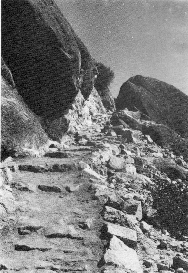
[click to enlarge] |
(8) Cunningham Cabin
Stephen Cunningham homesteaded at the mouth of Rush Creek near Wawona and built a log cabin on the flat below later Camp A. E. Wood, approximately eighty-five yards from the South Fork of the Merced River. He filed on the land in 1861, although the date of construction of the cabin is not known. The eighteen by twenty-one-foot structure fronted on the river and was considered luxurious for its time and place. Its walls were of saddle-notched eight-to-twelve-inch yellow pine logs. In the 1870s Cunningham filed mining and grazing claims in Yosemite Valley, in Little Yosemite Valley, and above Bridalveil Fall. Assisting Galen Clark as keeper of the Big Tree Grove, Cunningham supplemented his income as a state employee by making curios for sale to visitors to the Mariposa Grove. The Washburns bought Cunningham’s land after his death and held it until 1932. The carriage road providing access to the cabin from Clark’s Station was obliterated with construction of the modern road into the new Cunningham Flat Campground in 1951. The decaying cabin still stood in 1950, but only a pile of granite from the fireplace and chimney remained when the area was cleared for campground construction the next year.
(9) West Woods (Eleven-Mile Station)
John Wesley Wood, known as “West Woods,” lived at Eleven-Mile Station, about 10.76 miles north of Wawona and 2.20 miles south of Chinquapin. Woods lived near the stage station year-round, running a roadside stopping place where campers could stay and also buy horse feed. He eventually moved to Yosemite Valley and at one time operated a meat market there for George Meyer of Big Meadow. A delinquent tax list published in the Mariposa (Calif.) Gazette of 28 January 1882 mentions:
Wood, J. Wesley—Frame house, situated on the road between Big Tree Station and Yo Semite Valley at the 11-mile Station nearly opposite Yo Semite Stage & Turnpike Co’s. stable. Value $50. Personal property $70. Total $120.138
[138. Laurence V. Degnan to Douglass H. Hubbard, 3 September 1957, in Separates File, Yosemite-Trails, Yosemite Research Library and Records Center.]
(10) Other Homesteaders
Although Galen Clark, who had claimed his 160 acres in March 1856, was the first homesteader in the Wawona Basin to have his land patented, William H. Leeper, Davis Potts, James C. May, and Hiram Cartwright had each filed land claims earlier in the month. John T. Banton claimed a quarter section in 1862 and Jarvis Kiel filed for one near Clark’s house in 1868. During the 1880s and 1890s other homesteaders who filed and received patents included the Van Campens and Washburns, Roscoe Greeley, John E. Hammond, Archibald C. Stoddart, John Green, and others. Emily V. Dodge patented 480 acres in 1891, while Thomas Hill and his wife each homesteaded 160 acres and received patents that same year.139
[139. Sargent, Wawona’s Yesterdays, 13.]
During 1986, a question arose over the age of some structures on the Edward Vagim property in Section 35 at Wawona. Research showed that Catharine Leitch had filed on the property in 1888 under the provisions of the Homestead Act of 1862. She was the sister of Albert Bruce, another Wawona pioneer who received patents to land adjacent to hers in 1889 and 1892. Between them, they owned three-quarters of all the land in Section 35 by 1895. Catharine Leitch’s son, Bruce, served as mail carrier between Mariposa and Big Tree Station (Wawona) and also filed on his own land in the area. In 1905 he was a licensee operating a curio and gift shop in the Mariposa Grove, a job he continued until his death in 1910. He served also as a justice of the peace in Mariposa. Acting Superintendent Harry C. Benson described Leitch in 1906 as the only person in the Mariposa Grove, whose presence helped secure the place and who was able to answer tourist questions and add greatly to visitor pleasure. The Leitch property passed through a series of transactions until sold to Edward and Blanche Vagim in 1945. The oldest structure on the property probably dates from the late 1880s or early 1890s.140
[140. Bob Pavlik to Gordon Chappell, Western Regional Historian, National Park Service, 19 August 1986, re: Vagim property, Section 35, Wawona, Yosemite National Park.]
s) El Portal Area
(1) Hennessey Ranch
The Vigilance Committee of San Francisco reportedly forced James A. Hennessey, a native of Ireland, out of town in the 1850s.141 He came to the Hite’s Cove area and briefly worked for John R. Hite before starting his own extensive garden and orchard at present El Portal beginning in the early 1870s. Hennessey peddled his vegetables, fruits, and berries as far east as Bodie as well as to Wawona, the Yosemite Valley hotels, and nearby Hite’s Cove. He also constructed a two-story frame building on his property to accommodate Yosemite-bound travelers. In 1887 the mortgage on the ranch, located at the present site of the government trailer park, was foreclosed, and John Hite acquired the house, corral, barn, orchard, and outbuildings. By 1891 the Hennessey ranch belonged to Augustus H. Ward, who had extensive mining and real estate interests in and around El Portal. These were eventually acquired by the Yosemite Valley Railroad. Hennessey committed suicide in San Francisco in 1908. The original condition of the area has changed because of the installation of a government trailer park. Some fruit trees mark the spot of Hennessey’s former farm, while some drylaid masonry wall remnants in the trailer village might be remains of ranch structures.
[141. Ralph Rene Mendershausen, Treasures of the South Fork (Fresno: Panorama West Books, 1983), 54.]
(2) Rutherford Mine
The Rutherford Mine lay north of the Merced River. The Rutherford brothers discovered it about 1863 and patented it in 1874. According to a 27 April 1867 Mariposa Gazette article, the Rutherford brothers formerly owned the Yosemite quartz mill. By 1867 the Rutherford vein, owned by J. Tannabill of Garrote, and the Cranberry vein, owned by A. C. Bradford of Mariposa and by Tannabill, lay idle, as did the mill. The Rutherford vein had been yielding seventy dollars a ton and the Cranberry from twelve to thirty dollars a ton. The properties changed hands in 1868 and 1875. The Rutherford Mine remained intermittently active until the summer of 1889, when it closed. In 1885 the discovery of a rich vein in the Cranberry Mine gave further impetus to mining activities until 1896. Augustus H. Ward owned the property in the early 1920s. F. E. Bass of San Francisco then took over the Rutherford and Cranberry mines, leasing the Rutherford property to R. A. Frederick of El Portal about 1927. The property was later disposed of and used for home sites. Practically nothing remains of the old mine workings.142
[142. Historic Resources Inventory form, Rutherford Mine, State of California, Department of Parks and Recreation, prepared by James Law, 1981.]
9. The Tioga Mine and Great Sierra Wagon Road
a) Early Activity in the Tuolumne Meadows Area
Tuolumne Meadows remained largely undisturbed into the 1880s, although, as mentioned earlier, it was a focal point for summer gatherings of Mono and Miwok Indians who engaged for many years in a trans-Sierra trade, beginning possibly as early as 2500 B. C. Indians mainly used the meadows for social contacts, as a source of food, and, after initial hostile encounters with whites, as a place of refuge as well.
The first white men to visit the Tuolumne region were probably members of Joseph Walker’s 1833 expedition. Not until 1852, when 1st Lt. Tredwell Moore and members of the 2d Infantry pursued Chief Tenaya and members of his band over the mountains toward Mono Lake, was the country explored at all. Moore and his troops cursorily examined the region north and south of Bloody Canyon before returning to Fort Miller on the San Joaquin River with a few gold ore samples. In 1852 Leroy (Lee) Vining and some fellow prospectors crossed west over the mountains via Bloody Canyon, exploring the region east of Tuolumne Meadows. Vining eventually homesteaded in present Lee Vining Canyon and established a sawmill.143
[143. According to one author, at least, Vining did not actually cross the mountains and settle in Mono County until sometime after 1857, when placer mining in Mariposa began to decline. Mendershausen, Treasures of the South Fork, 34-35.]
Moore’s expedition reports and the publicity given Yosemite Valley by early visitors prompted public interest not only in Yosemite Valley, but in the rich mining properties east of the Sierra Nevada. As a consequence, Tom McGee, who owned a liquor store in Big Oak Flat in the 1850s and a store in the Mono Diggings and operated a pack outfit between them over the Mono Trail, cleared and blazed the old route about 1857. Along it passed miners and packers from the mines of the Mother Lode to the settlements of Dogtown and Monoville near Mono Lake, where they had established mines along the eastern base of the Sierra Nevada and in several of their rugged canyons. The trail was also occasionally traveled simply for pleasure by Yosemite tourists beginning in the late 1850s. b) Formation of the Tioga Mining District In 1860 a member of a prospecting party near Bloody Canyon staked a silver claim, “The Sheepherder,” on Tioga Hill, a high ridge about one mile northwest of Tioga Pass, although he never pursued development. This original discovery of the Tioga Mine deposit fell into mythological oblivion as one of the numerous “lost mines” of the West. Also in 1860 the state legislature established the California Geological Survey, which, as mentioned earlier, requested a group headed by Josiah Dwight Whitney to map the state of California and categorize its resources. During its detailed survey of the High Sierra adjacent to Yosemite Valley, the party established a camp at Soda Springs in the summer of 1863 and reconnoitered the area, climbing peaks and surveying valleys.
During the 1860s and 1870s, sheepherders utilized much of the area for summer grazing for their flocks. In 1874 one of those men, William Brusky, stumbled across the old Sheepherder location notice and, recalling stories of the earlier discovery, prospected the site until he found rich silver ore in 1877. In 1878 Brusky located four claims along the Sheepherder Lode on Tioga Hill—the Tiptop, Lake, Sonora, and Summit, all of which the Great Sierra Consolidated Silver Company eventually purchased. The Great Sierra ledge, including the Bevan, Ah Waga, Hancock, Atherton, and High Rock claims, paralleled the Sheepherder Lode on the south. W. W. Rockfellow originally located the High Rock in 1878; it later became the Mount Dana and finally the Great Sierra Mine. The mining camp of Dana sprang up on that claim, acquiring a post office by 1880.
Also in 1878 E. B. Burdick, Samuel Baker, and W. J. Bevan organized the Tioga Mining District extending eight miles north-south from the foot of Bloody Canyon, over the Sierra Nevada summit, and down the Tuolumne River to Soda Springs. More than 350 mining claims comprised the Tioga Mining District. Sonora, California, businessmen owned most of the properties, although some Eastern capital was invested. A few Yosemite Valley residents, such as Albert Snow and A. G. Black, also became involved in mining efforts there. One claim, the May Lundy, ten miles north of Tioga, was unusual for the area in that it actually produced great wealth—three million dollars. It and neighboring mines were originally included in the Tioga Mining District, but because of their distance from the books of the Tioga recorder, they were later made a part of the new Homer Mining District.
Between 1878 and 1884 the area around Upper Gaylor Lake bustled with the activity of miners, engineers, and merchants. Shortly before committing suicide in 1881, Brusky and the owners of the adjoining claims on the Sheepherder Lode attempted to incorporate as “The Consolidated Lake, Summit and Sonora Claims,” while the High Rock passed to the Mount Dana Mining Company and then to the Great Sierra Mining Company, both California corporations. The latter company, predecessor of the Great Sierra Consolidated Silver Company, began winter-long operations at Dana on Tioga Hill in 1881-82 with substantial buildings and sufficient supplies. Very little is known of the mining operations of the company, but evidently it retrieved no silver and finally collapsed.
c) The Great Sierra Consolidated Silver Company Commences Operations
In 1881 Franklin H. Watriss, Warren B. Wilson, and Charles H. Forward, incorporated the Great Sierra Consolidated Silver Company in the state of Illinois. Proposing to engage in mining, working, and smelting silver and gold and other ores, the company purchased the major claims of both the Sheepherder and Great Sierra lodes on Tioga Hill.144 The new owners of the Tioga Mine decided to drill a tunnel into the base of Tioga Hill in hopes of intercepting the Sheepherder vein at depth. That procedure would also facilitate water drainage and removal of ore and waste rock.
[144. Photostatic copy of Statement of Incorporation in the State of Illinois, Cook County, for Franklin H. Watriss, Warren B. Wilson, Charles H. Forward to Form a Corporation—“The Great Sierra Consolidated Silver Company,” capital stock $8,000,000, location of principal office in city of Chicago, filed 10 November 1881, in Box 86, Tioga Mine, Yosemite Research Library and Records Center.]
On 25 February 1882, hand drilling began on the Great Sierra tunnel. It soon became evident that drilling machinery was required, and the company bought the necessary equipment and shipped it to Lundy. It was fortunate that the company was well financed, because it cost an enormous sum to bring in men and supplies as well as tons of mining equipment. Initially the trail through Bloody Canyon provided the only access from the east, but eventually miners blazed another route from the mining camp of Lundy, via Mill Creek Canyon to Lake Canyon and then up Lee Vining Canyon to Tioga. Over that route in mid-winter passed 16,000 pounds of machinery, including an engine, boiler, air-compressor, drills, and iron pipe, transported on six heavy hardwood sleds. A crew of ten men and two mules with rope and block and tackle hauled the load up and over the mountains for a distance of about nine miles. Upon its arrival at the mine more than two months later, the owners quickly installed the machinery and started work.
The Great Sierra Consolidated Silver Company established its headquarters at Bennettville, stretching along Slate Creek a few hundred yards from the mouth of the mine tunnel. It acquired a post office on 13 March 1882, first called Bennett City and later Tioga. In time Bennettville, named for the company president, Thomas Bennett, Jr., became headquarters for the Tioga Mining District. A sawmill brought up from Lundy provided mine timbers and materials for camp buildings, including a boardinghouse, utility buildings, a company office, an assay office, and a stable.
At Mono Pass stand the log cabins of the Golden Crown and Ella Bloss mines, owned by the Great Sierra Company and worked on as late as 1890. Reportedly two men, Fuller and Hayt (or Hoyt), found large ledges of antimonial silver at the site in 1879. The Golden Crown, Mt. Hoffmann, and Mt. Gibbs (in Mono Pass) groups never produced pay dirt, but there are mining remains associated with them.
|
Illustrations 36 and 37.
Great Sierra Mine cabin ruins. Photos by Robert C. Pavlik, 1985. |
[click to enlarge] |
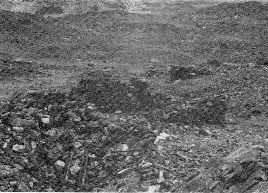
[click to enlarge] |
d) Construction of the Great Sierra Wagon Road The bustling activity in the Tioga Mining District and expectations of great success suggested to the board of directors of the Great Sierra Consolidated Silver Company that pack trains would not be adequate for shipping ore to market or bringing in supplies and equipment to Bennettville. Trails had been established, as previously stated, to the eastern railheads via Lundy and Bloody Canyon. The company now decided, however, that a less precipitous route across to the western flank of the Sierra Nevada would facilitate bringing machinery and supplies to the mines from the railhead at Copperopolis, near Angel’s Camp, via the Big Oak Flat Road. Access already existed, after all, as far as Crocker’s Station.
The projected route would serve as both a wagon road and railroad. In 1882 personnel of the Great Sierra Consolidated Silver Company incorporated the California and Yosemite Short Line Railroad to run from Modesto to Mono Valley via Lee Vining Creek Canyon, with its principal place of buisiness being “Bennettsville” in the Tioga Mining District. Capital subscribed for the new railroad company funded supplies for the road survey crew.145
[145. Bloody Canyon, or Tuolumne Pass as it was sometimes called, and the Sonora Pass, twenty-four miles farther north, were the only passes in the Sierra range south of Reno available for a railroad to cross to make the shortest route from the East to San Francisco. These were the two passes considered by the Union Pacific Railroad for its direct route from Ogden, Utah, to San Francisco. It was expected that the Tuolumne Pass would be chosen in order to secure the Yosemite Valley travel as well as take advantage of the timber supply and mineral lands in that area. “The Great Sierra Mining Properties Situated in Tioga Mining District, Mono County, California,” by Thos. Bennett, Jr., New Bedford, Mass., 15 February 1890, carbon copy of typescript, in Box 86, Tioga Mine, Yosemite Research Library and Records Center, 4.
In the fall of 1882 survey work began on the Great Sierra wagon road, starting at Crocker’s Station and continuing east to White Wolf, where efforts ended with the coming of winter. A crew started road construction that same fall and built a little way beyond the later Carl Inn. Work resumed the following spring with a force of about 250 men and the road reached White Wolf about 1 June. The survey through Tioga Pass to the Sheepherder Mine ended in July 1883, and construction of the entire 56-1/4-mile stretch finished 4 September 1883, at a cost of $61,095.22. A crew consisting of both Chinese and white laborers accomplished the job using graders, picks and shovels, and blasting powder.
Upon completion of the new thirteen-foot-wide road, carriage and wagon transportation could pass from Crocker’s Station to Bennettville. Travelers left the Big Oak Flat Road near Crocker’s Station, continued east across the South Fork of the Tuolumne River, ascended to Aspen Valley, passing over the low divide between the South and Middle Forks of the Tuolumne, and on to White Wolf and the summit. From there the road ran down the western watershed of Yosemite Creek, which it crossed by a substantial bridge about seven miles from Yosemite Valley. It then continued up the eastern watershed of Yosemite Creek to Porcupine Flat, which it followed to Indian and Snow creeks. Following Snow Creek to its headwaters under Mount Hoffman, the road continued east to Lake Tenaya, along its north shore, and up Tenaya Canyon to Tenaya Summit. It then proceeded along the south side of Tuolumne Meadows to the junction of the Main and Lyell Forks of the Tuolumne River, along the Main Fork of the Tuolumne to Pilot Knob (the south end of Tioga Hill), and finally along the east slope of Tioga Hill to Bennettville.
The most direct route for teamsters crossing the Sierra, the new road was considered an easy haul for freight teams because of its low and uniform grades (three to ten percent) and its substantial bridges built with stone abutments and heavy timber sills, stringers, and flooring. The road was well built from an engineering standpoint, with several culverts and bridges and rock walls along much of its route. The retaining wall along the edge of Lake Tenaya, buried or removed during rebuilding of the road in 1959-60, was a striking example of its excellent
|
Illustration 38.
Lifting winch, Great Sierra Mine. |
[click to enlarge] |
|
Illustration 39.
Old Tioga Road through Tuolumne Meadows. Photos by Robert C. Pavlik, 1984, 1985. |
[click to enlarge] |
Heavy use of the road in the future seemed assured with the anticipated completion of the additional four miles needed to connect it with the Lake Canyon toll road to Lundy and Bodie, making it a through route across the mountains. The road was little used after the Tioga mines closed, however, because of the continuing lack of a wagon road on to the east. Toll collection ceased, as did repairs, and the road fell into a state of neglect.
for sheepmen, hunters, and trespassers, and the army began advocating the federal government’s acquisition of the route. The estabishment of Yosemite National Park included within its boundaries the entire Tioga Road except for about four miles of the extreme eastern portion. Establishment of the park also withdrew land on either side of the road from entry and occupation for business purposes and thereby diminished use of the road. Its owners stated that it would have been more valuable as an income-producing property if the Tioga mines had continued to operate, if the federal government had not established the national park, and if a wagon road had been built east from Tioga Pass to the public highways of Mono or Inyo counties so that the Tioga Road could have become a connecting link over the Sierra.146
[146. Wilson & Wilson, atts. for Capt. Rodolphus W. Swift, owner of Tioga R d., to Col. S. M. Mansfield, Pres. of the Yosemite National Park Commission, 31 October 1899, Letters Received by the Office of the Secretary of the Interior Relating to National Parks, 1872-1907 (Yosemite), RG 79, NA.]
The Tioga Road did not become a trans-Sierra route until the state completed the present road down Lee Vining Canyon in 1911. In 1915 Stephen Mather bought the road and deeded it to the government. In July of that year, the highway opened to motor cars. In 1937 the section of road from Crane Flat, near the western boundary, to McSwain Meadow, near White Wolf Lodge, and the section from Cathedral Creek to Tioga Pass, were realigned, bypassing Aspen Valley with a two-lane paved road via Crane Flat on the new section of the Big Oak Flat Road.
Prior to 1961, when the modern Tioga Road was dedicated, a twenty-one-mile section of the old road was the only route across Yosemite National Park and one of the few across the Sierra Nevada. In several places in the park the old road is still used to reach remote streams and camps. The last unimproved portion of the modern Tioga Road, the Lee Vining grade east of Tioga Pass and outside the park, was rebuilt beginning in 1963.
The original Great Sierra Wagon Road comes generally northeast for 17-3/4 miles from the western boundary of the park to near White Wolf Campground. The westernmost 3-3/4 miles of road are paved. Two and one-quarter miles beyond where the pavement ends, the road passes along the southern edge of Aspen Valley. It then enters a dense forest, following a tributary of the South Fork of the Tuolumne, up to the Harden Lake Campground spur. This section of road is narrow in places and required drywall masonry retaining walls.
There the forest opens up for a short distance to White Wolf Campground. Part of the old road then leaves the main route of the present Tioga Road and leads four miles to Yosemite Creek and a small primitive campground. At May Lake Junction an interpretive sign sketches the history of the old Tioga Road and a second sign tells about the machinery used by the Great Sierra Consolidated Silver Company. Total length of the old road section there is 1.8 miles, ending at the start of the trail to the May Lake High Sierra camp.
The section of road from Aspen Valley to White Wolf Campground is no longer passable by vehicle. Maintenance stopped after a tree fell across the roadbed. The section between the western boundary and Aspen Valley is open during the summer season as an access route for property owners in the area.
e) The Tioga Mine Plays Out
By 1884 the Great Sierra Consolidated Silver Company’s mine tunnel had been blasted 1,784 feet into the mountain without producing one ounce of millable ore. The company had already been experiencing acute financial troubles, and at that point lacked money or resources to pursue the work. On 3 July 1884 its executive committee telegraphed orders to suspend all operations. The primary backers of the company, such as Thomas Bennett, J r., one of the founders of the Wamsutta Mills; William Swift, of the firm of Swift and Perry, owners and outfitters of whaling ships; and his brother Rhodolphus Swift, a whaling captain, thought at first that the mine could resume operations if the company underwent a reorganization. The Mariposa Gazette reported in 1885 that
It looks as though the Swift Brothers, of the Tioga Mining property, after last year’s vacation, were about to go ahead again. The time was lost in a little game of freeze out; at any rate, that is the general supposition, that some of the smaller fish, stockholders, were played out. Already about three-quarters of a million of dollars have been spent, and those representing the company seje/n to be in good spirits and appear satisfied to push the work.147
[147. Mariposa (Calif.) Gazette, 15 August 1885, in Degnan to Hubbard, 3 September 1957.]
As time passed and no progress was made in resolving the situation, the Eastern stockholders became edgy and, in an attempt to learn the true value of the property, sent William Swift to Bennettville with an English mining engineer. The latter assigned a value of more than twelve million dollars to the holdings of the stockholders, who, in early 1887, assigned the claims to William Swift as trustee.
The state mineralogist’s report for 1887-88 contained some information on the Great Sierra, Sheepherder, and Golden Crown mines in the Tioga Mining District. Although their ore averaged twenty-five dollars per ton in gold and silver, and the immediate vicinity offered a ready supply of both timber and water power, the comparative inaccessibility of the mines, in addition to high freight rates and a harsh climate, made mining unprofitable.148
[148. California State Mining Bureau, Eighth Annual Report of the State Mineralogist. For the Year Ending October 1, 1888 (Sacramento: State Printing Office, 1888), 675.]
During the summer of 1887, Swift sued the Great Sierra Consolidated Silver Company and obtained a judgment of more than two hundred seventy-seven thousand dollars. Ultimately he bought the entire property, including the road and the mines, in 1888 at public auction. The state mineralogist’s report for 1889-90 stated that after a lengthy suspension, work on the mine tunnel had resumed the previous year with the driving of a double tunnel, six feet wide and seven feet high.149
[149. California State Mining Bureau, Tenth Annual Report of the State Mineralogist. For the Year Ending October 1, 1890 (Sacramento: State Printing Office, 1890), 342-43.]
By then, however, nearly everyone realized that the suspension presaged a shutdown, and disgusted miners had already begun drifting off to find new employment. Although more than three hundred thousand dollars had been spent in mine development to date, none of the new owners, mostly residents of New Bedford, Massachusetts, had enough interest, or perhaps optimism, to complete the tunnel project. William Swift died in 1892 and Thomas Bennett in 1898. In settlement of a debt William owed his brother Rhodolphus, the Tioga property passed to the latter in 1895 and, upon his death in 1901, to his heirs.
10. Management of the Grant by the Yosemite Commissioners
a) Replacement of the Board of Commissioners, 1880
Almost ten years after establishment of the grant, Charles Nordhoff suggested that the commissioners still had much to do to “improve” the valley:
I saw a notice, signed “Galen Clark, guardian,” that no more buildings should be put up; and as the houses so far erected are little better than shanties, this seemed to me judicious. . . . It [Yosemite Valley] needs one good carriage road from one end to the other on the level plain, and a little judicious and skillful combing down of the wildness, with plantings of indigenous shrubs and flowers, and a little drainage and embankment, so that the Merced River may be kept within its bounds at all seasons. . . . Under the present management it is easy to see that as travel increases more leases will be granted to hotel-keepers, and these build temporary, tasteless structures which form blots on the landscape. They hold for only ten years, and therefore make shabby and temporary buildings. . . . In its present condition the Valley will not remain. It must either be made more beautiful, as I have suggested, or it will become a wreck, denuded of fine trees, cumbered with enterprising toll-takers, and made nauseous by the taint of selfish and sordid speculation.150
[150. Charles Nordhoff, California: for Health, Pleasure, and Residence (New York: Harper & Brothers, Publ., 1873), 77, 80. Nordoff, sailor, author, and journalist, worked for Harper & Brothers (1857-61). The New York Evening Post (1861-71), and served as editor of the New York Herald (1872-87).]
The California state legislative act of 1866 had entrusted the Board of Yosemite Commissioners with full power to administer the Yosemite Grant. In an effort to supply needed services to visitors and gain additional improvements to the park, the board had leased land and buildings to private individuals. In their manner of distributing those leases, however, they left themselves open to charges of corruption, favoritism, and graft. By 1880 the various concessioners, the commissioners, and the state legislature were at such odds, and public opinion so unfavorable to the system of management of the grant, that the legislature attempted to dissolve the original board and appoint another.
Although members of the first board resisted dissolution, the state filed suit and forced them to vacate their offices. At the same time, James Hutchings replaced Galen Clark as Guardian. The new board jumped off to a good start, maintaining, after some study, that the previous commissioners had been grossly negligent in the administration of the grant. Before long, however, the new board began incurring the antagonism of a variety of groups and individuals.
b) Report of the State Engineer, 1881
State Engineer William Hammond Hall visited Yosemite Valley in 1881 and subsequently made some observations and recommendations on its condition. His rather lengthy treatise addressed “improvement” of Yosemite Valley in terms of works necessary for its preservation or promotion of its use, actions that were not by any means actually improvements to the valley’s appearance, but necessary evils prompted by man’s occupation and use of the area:
Seriously to speak of its “improvement” would be presumptuous; but, if it is to be occupied and enjoyed, there arises a duty, because it becomes a necessity, to preserve this property from defacement; for the influence of man’s presence in such regions is destructive of their charms, and productive of effects which pain rather than please the beholder.151
[151. William Hammond Hall, “To Preserve from Defacement and Promote the Use of the Yosemite Valley,” Report of State Engineer, appendix to Report of the Commissioners to Manage the Yosemite Valley and the Mariposa Big Tree Grove, 1885-86, 13.]
(1) Protecting Yosemite Valley from Defacement
Hall recommended three actions to preserve Yosemite Valley from deterioration. First it would be necessary to control the mountain watershed tributary to the valley streams to prevent the destruction of timber and vegetation thereon. Second, the board needed to regulate the use of the valley floor and its surroundings to prevent the valley covering from being trampled out of existence and useful vegetation being supplanted by some that was less desirable but better able to withstand sustained use. Third, the natural deteriorative action of the valley streams needed to be counteracted.
(a) Preservation of the Watershed
The Yosemite Grant of 1864 did not include the valley watershed, but extended to a line drawn around the valley at an average distance of only one mile from its edge. The mountain canyons and higher valleys from which the waters drained into the valley’s waterfalls and streams lay outside the grant area. Unless the state acquired those almost 200,000 acres draining into the valley, Hall feared they would nearly all pass into the hands of private individuals for sheep and cattle grazing and logging purposes. Hall’s argument that the watershed should be included within the limits of the grant was a precursor of the later idea of ecosystem preservation.
By controlling the watershed, the commissioners could prevent grazing and sow the seeds of native trees over a considerable area not presently forested, thereby laying the foundation for protection of the valley below. In future years, under wise management, that area could be used for limited logging and grazing without detriment to the land. Then the state would posses a magnificent huge mountain holding, with a scenic wonder in its midst, that might yield an income sufficient to repay the cost of maintenance and “improvement” of Yosemite Valley.
Hall argued that the watershed could also irrigate the dry plains of Merced County, enabling a great number of people to benefit from the mountain resources rather than only a small number of lumber- or sheepmen. Continued logging would cause the supply of water to fail much earlier in the season, while if the area of timber growth increased, the falls would contain water to a later date each year. If the timber were stripped and the country overrun with sheep, the water entering the valley in the early part of the season would be muddy. The sand and gravel banks formed by silt deposition would obstruct the main river channel through the valley, forcing erosion of the banks and flooding of the beautiful meadows, which, permitting unobstructed views of the waterfalls and cliffs, formed an essential feature of the landscape.
(b) Regulation of Use of the Valley Floor
Hall pointed out that the constant travel over the valley floor and the grazing of animals affected the character and extent of its growth. The finer forage grasses were being thinned out and more robust grasses and weeds were taking their place. The area of meadow was decreasing due to the spread of young thickets of forest and shrub growth. The cessation of the old Indian practice of burning off thickets, which created new clearings almost every year for grass growth, may have been partly responsible. This observation by Hall appears to be an early recognition of the value of “prescribed burns.” The continued cropping of the finer grasses and trampling of the ground by grazing horses that avoided the coarser growths, allowing them to flourish, remained the primary cause, however.
The soil and subsoil of the meadows were becoming compacted, inhibiting percolation of water therein. Meadows therefore tended to dry out earlier each year, resulting in a change in character of their forage vegetation and the encroachment of thicket growths. The preservation and extension of grass meadows could perhaps be accomplished by regulating the use of natural meadows and grazing lands to prevent overcropping; by clearing, perhaps plowing, and resowing the land; and by clearing and bringing under cultivation by irrigation other suitable lands as grass meadows to supply the deficiency in the forage supply.
(c) Treatment of the Valley Streams
Hall deemed it necessary to clear out and regulate the streams in the valley to check the influence of natural processes, to mitigate the effects of occupation and use of the valley and its watershed, and to add to the enjoyment of the use of the valley. He acknowledged that rivers constantly eroded their banks in some places and built them up in others. When undisturbed, nature healed those wounds, covering deposits of silt with shrubbery and rapidly forming new banks. But in Yosemite Valley, man and his domestic animals facilitated the destructive process and prevented the buildup of new banks. In Yosemite Valley the Merced River, flowing for a considerable portion of its course through a light alluvial deposit, continually cut away the banks in a number of places, widening its channel, dividing its waters, and leaving sand and gravel bars where meadowland formerly existed. Regulatory measures again seemed necessary.
In summing up the condition of the grant property, Hall ventured a remark that has proven an accurate assessment of the problems that would plague Yosemite National Park management to the present day:
The occupation and use of the water-shed above the valley, the visiting and enjoyment of the valley itself, and the operations designed to prepare for these, are all calculated to destroy its attractions. The immediate interest of every land owner in the water-shed, of every visitor to the valley, are inimical to the preservation of the property, and consequently at war with the object of your trust.152
[152. Ibid., 17.]
(2) Promoting Tourism
Hall also approached the subject of how better to promote the use of Yosemite Valley and concluded that in order for a greater number of people to more generally enjoy the valley, they had to be able to reach it more quickly and cheaply, view its scenery with less fatigue and outlay of money, and find accommodations there more comfortable and less expensive.
(a) Improving Approaches to the Valley
Hall pointed out that the varied and beautiful sights of Yosemite could not be seen in a day, or even in two or three. To have adequate time to reflect upon and properly appreciate Yosemite’s sights, visitors needed to stay about a month. In reality, however, the average visit lasted less than a week, because the trip in proved so grueling that travelers thought of nothing else once they got there but getting the return trip over with as quickly as possible. Construction of a series of easy drives in the valley, providing periodic scenic viewpoints, would be a great attraction, as would less expensive and more comfortable hotel accommodations.
But basic problems still existed: lack of adequate forage for animals and lack of suitable roads over which supplies from outside could be delivered cheaply, over which private teams with reasonable loads could be driven, or over which stages could be driven with some comfort. Hall considered a first-class wagon road to the valley, with light grades and a smooth surface, of paramount importance. Although the portions of the three roads entering the valley that were built especially for Yosemite travel—that is, from the ends of the county roads to the valley—were tolerable, the county roads used in reaching the roads to Yosemite Valley were less so.
(b) Improvements to Travel In and About Yosemite Valley
Hall’s suggestions for valley roads included one main drive following generally along the edge of the rocky talus lying between the plain and the valley walls, a few cross-valley connecting drives between certain points on the main road, some side drives from the main road up the talus slopes, and branch roads up principal canyons to points near their lower falls. In plotting roads across the valley, efforts needed to be made not to disturb the open meadows, but to follow the edges or margins of the open grounds and even of the smaller glades as much as possible.
In road construction, Hall suggested trying to avoid bare macadamized surfaces and artificial lines. Those improvements, Hall thought, that would increase the pleasure of carriage rides, would turn Yosemite into a resort where families would spend several months. That would put the valley’s management on a better basis financially, enable the public to be accommodated at reasonable rates, and relieve maintenance costs to a great extent.
(c) Trails
Hall noted that the existing trails to Eagle Peak, Glacier Point, and Snow’s hotel provided adequate access to the surrounding heights, but saw the necessity for a connecting trail from Glacier Point to Snow’s, around the rim of the valley, via Illilouette Fall, and also for a trail up Illilouette Canyon to the foot of the fall. Because of the pressing need for better roads, he did not believe that more extended work on trails was necessary at that time. In pondering the proposed location of a trail on the north side of the Merced River to the summit of Vernal Fall and then on to Snow’s, Hall rejected it as unnecessary because it would involve a heavy outlay of money and effort when the object had already been accomplished by the existing trail and because its construction would mar the face of a picturesque cliff.
(d) Footpaths
One of the greatest needs in Yosemite Valley was of firm, clean footpaths to special attractions or fine viewpoints and even between the various hotels. People tired of riding and driving every day and also of remaining inside or sitting on hotel porches. They enjoyed moving about, but preferred doing it without encountering the dust of the roads and trails. In locating rural park paths, Hall suggested, straight lines should be avoided as well as long formal curves. Every change of direction needed a purpose, either to follow the topography, to circumvent an obstruction, or to provide a special view. Hall urgently recommended abolishing all plank walks in the valley when possible, and in the meantime camouflaging them as much as possible.
(e) Bridges
Hall pointed out that cheap, flimsily built structures looked out of character in Yosemite Valley. All architectural works, he said, should be solid and massive in character, especially the bridges. Stone offered a preferable fabric, especially if the crossing passed over a stream with a rocky bed and banks. Rough, massive timber would be suitable if the crossing lay in a forest and spanned a quiet-flowing stream with sandy banks and bed. Ironwork could be appropriate where the crossing stood in open ground, distant from heavy timber growth or rock formations, and where the bridge needed to be less conspicuous. In retrospect, at this early date Hall was pioneering “rustic” design of bridges to harmonize with their particular natural surroundings.
Hall then presented a critique of existing valley bridges. The iron bridge at the Upper Hotel was not out of place, according to Hall, but the lower iron bridge should be of stone because it was the first large artificial construction encountered on entering the valley and needed to be imposing and impart a sense of security. He suggested that the existing lower iron bridge be moved to the lower crossing of Yosemite Creek or to a crossing on the main river between the Upper Iron Bridge and Tenaya Creek, and that a stone arch be built in its place at the lower main crossing.
(f) Drainage and Guard Walls
Culverts, necessary for drainage under roads and walks, should be of stone rather than wood, Hall stated. Large and solid stone walls, one and a half or two feet high, should be erected along the edge of narrow or high roads.
(g) Hotels, Stores, Houses
Because dwellings, although necessary to provide shelter and other material comforts, constituted an intrusion on the landscape, they had to be tolerated but should be as inconspicuous as possible. Ideally, Yosemite Valley houses would be of massive stone construction, near the base of the valley walls, surrounded by trees, with a fine view in front. Buildings should not be placed in meadows or glades, near any of the falls, or between the falls and the valley. A development plan was necessary before new structures were built. Hall recommended that the proposition to locate cottages between the Upper Hotel and Yosemite Fall be dropped, and that they be located instead on the south side of the Merced River between the hotels. In this area, also, Hall pioneered in calling for “rustic” design of buildings and other structures to harmonize with the landscape.
(3) Landscaping
Hall had several general suggestions for improving the landscape:
(a) Around houses—Residents should not attempt any city-type gardens or imitations of fountains or waterfalls. There should be no fences, and front yards should maintain an open view, although they could be edged by native trees, shrubs, and flowers. If fences were absolutely necessary, they should be of wire or else unpainted rough timber, never whitewashed.
(b) Plantings—Hedges or rows of trees were out of character for the valley and should be avoided. Only native trees and shrubs should be planted.
(c) Timber clearing—The many large and heavy growths of young trees (pines, willows, etc.) in the valley did not add to the landscape, but actually detracted from it by obstructing views. They needed thinning out and gradual clearing. Clumps of willows, alders, and other softwood trees were to be left in disconnected, irregular lines to divide the meadowland into the several tracts that appeared to be natural divisions. Most of the valley lowlands were to be returned to grass. Judicial thinning out was also needed in the higher timber areas of the valley where the growth obstructed views and actually formed woods.
(4) Agricultural Development
The land surface of the valley, Hall remarked, fell into three general categories: meadows, fern lands, and rocky slopes. Although timber covered much of the higher fern lands, large tracts of open ground remained that Hall felt were valueless as well as unsightly. He had already determined that a good supply of hay available at low cost would increase visitation to the valley. Hay would continue to be at a premium, however, because of increased demand for the small supply available as a result of overgrazing of existing meadows. The solution to the problem seemed to be cultivation of additional natural meadowland through irrigation and conversion of much of the fern land to grass meadows. Such an action would not only improve the landscape, but would augment state revenues and enhance visitor pleasure by furnishing abundant forage at low rates. Hall estimated that 1,000 acres in the valley could be cultivated in that manner.
(5) River Overflow
One of the major problems in the valley, previously introduced, was river overflow and the subsequent destruction of meadowlands. Hall found the Merced River channel above the Upper Iron Bridge to be in bad condition: divided, spread out, obstructed, and tortuous in its course. That resulted in an unregulated annual overflow of the valley meadows and the potential for a disastrous flood each season. To remedy the situation, Hall recommended clearing the channel in the lower part of the valley of obstructions; farther up, it would be necessary to divert the waters into one channel, which would be deepened and straightened, by building training walls of stone and brush, spurs, and cross dykes, systematically and judiciously located. The channel clearing operations might well involve blasting of rocks and sunken tree logs and the use of a small flatboat for a hand dredge and rake.
Hall ended his discussion by noting that, contrary to what he had once thought, the problems at Yosemite were so great, covering such a wide range, topographically and technically, and necessitating such exact treatment, that a detailed plan was necessary to develop the valley resources. It appeared absolutely essential to conduct a topographical survey and draw up a systematic development plan.153
[153. Ibid., 18-31.]
c) Remarks on Hall’s Report
Hall’s report highlights several natural resource problems in Yosemite Valley whose resolution has been a major source of concern for park administrators and natural resource managers through the years. Because most of them will not be discussed elsewhere in detail, an indication is presented here of the continuing problems involving stream control, including drainage, erosion, and overflow and vegetative changes due to fire suppression, vista clearing, meadow drainage, and the introduction of exotic species. Attempts to combat these problems resulted in a number of man-made structures that exist today and whose significance is related to changing resource management policies through the years.
The white man’s discovery of Yosemite Valley and its environs and subsequent often contradictory efforts to preserve resources and enhance aesthetic values while increasing recreational use have resulted in many changes to the environment. Plowing, seeding of crops and pastures, irrigation, mowing, livestock grazing, clearing of trees and brush, changing drainage patterns, fencing meadows, building roads and trails, and constructing hotels, campgrounds, and utility systems have drastically impacted the park’s vegetation, soil, and stream conditions, especially in Yosemite Valley.154 The valley’s riverscape has been completely altered by efforts to control flooding and bank erosion. The forests of the Yosemite region, originally parklike with little undergrowth and wide expanses of meadows, took on a completely different character under state and federal management. The involvement of modern man in natural processes has resulted in alterations such as an unnatural accumulation of fuels, proliferation of a dense understory in forest communities, reduction in the number and size of meadows, lack of regeneration in giant sequoia and black oak forests, and introduction of exotic species.
[154. Harold F. Heady and Paul J. Zinke, Vegetational Changes In Yosemite Valley, National Park Service Occasional Paper Number Five (Washington: Government Printing Office, 1978), 1-2.]
(1) Yosemite Valley River Drainage and Erosion Control
A major question since establishment of the grant has concerned control of the valley river and stream system. Little description of the pre-1880s condition of the system exists except for an occasional mention of swampy oxbows and meandering river channels. State Geologist Josiah Whitney provided a more detailed description in his Yosemite Guide-Book in 1870, noting the river’s sharp bends and the swampy meadows. The latter condition resulted from natural rock dams that impeded the drainage of surface water: terminal moraines occurred near the mouth of the valley and lateral moraines existed between Tenaya Creek and the Merced River. Numerous log jams in the valley also reduced stream velocity and drainage and aided meandering and the undercutting of streambanks.
These conditions caused little concern until the rapid expansion of tourist facilities in the early years of the grant resulted in placement of a variety of hotels and roads within the valley’s floodplain. Visitors also established campgrounds along the banks of the river and small streams, which became traditional campsites. Additionally, the state commissioners started to view the meadows as potential farming areas. Before long, state administrators noticed that the uncontrolled meadering of the Merced constantly washed away sections of the meadows and many of their trees. The state commissioners seemed unaware of, or simply chose to ignore, the fact that heavily eroded streambanks had long been a natural part of the Yosemite Valley scene, as evidenced by the earliest photos of the area. Actually stream erosion had been a natural process since the last glacial retreat, playing a principal part in creation of the valley floor by building up new meadows.
The Yosemite commissioners, however, faced pragmatic considerations. They only saw the erosion process as destructive of meadowlands. If allowed to continue, they feared it would turn the entire valley into a wasteland and dispel all possibilities of state profit. Despite the edict of the grant specifying preservation of the valley’s natural conditions (which would seem to entail preservation of its natural processes) for future enjoyment, the commission pondered ways to alter and thereby control the stream system to prevent the destruction of meadows and the loss of real estate through periodic flooding and erosion. Foremost in its mind was protection of the valley from change and encouragement of public use, the latter necessitating removal of any threat to visitor access and facilities.
From 1864 to 1879, therefore, the commission endeavored to control lateral erosion to prevent tree destruction and drain meadows for agricultural use and construction purposes. In 1879 Guardian Galen Clark attempted to remedy the situation by blasting the El Capitan terminal moraine, thus lowering the water table. By so doing he hoped to open more land for grazing and also eliminate mosquito breeding areas. He then leveled the fragments of boulders left after the blasting. By lowering the base level of the stream system several feet, Clark stimulated vertical erosion in the riverbed and also changed the valley ecology. Removal of the El Capitan moraine has been called the most influential single act affecting the valley river system.155
[155. James F. Milestone, “The Influence of Modern Man on the Stream System of Yosemite Valley,” M. A. thesis, San Francisco State University, 1978, 40. This document presents a detailed history of stream control in Yosemite Valley and is the source for most of this information on that subject.]
From 1864 to 1965, administrators attacked lateral shifting of the Merced River into its banks, believing it to be, after 1 re periodic flooding, the foremost threat to valley defacement.156 Even during the twentieth century, most management activity concerned prevention of bank erosion rather than analysis of river channel behavior and its relationship to other natural processes. Unfortunately this problem was exacerbated by large-scale costly development in the valley that required protection. The campaign to halt natural lateral erosion finally ended in the mid-1960s after all critical meanders threatening development had been riprapped. Application of this riprap has drastically changed the valley riverscape by altering the configuration of riverbanks and paving them with granite boulders. The resultant decrease in sediment load in the river has resulted in the disappearance of vast stretches of braided stream channels that originally characterized the valley floor.
[156. Ibid., 67.]
The state grant period proved exceedingly destructive of the natural riverscape of Yosemite Valley, resulting in the removal of natural rock dams, the initiation of bank revetment projects, the commencement of dredging operations to acquire gravel for development projects, the construction of wing dams, and the removal of log jams and other obstructions from stream channels. If the commissioners had chosen to acknowledge stream erosion as a natural process and planned development around that process, perhaps the later elaborate and expensive stream control projects that have continued into modern times would not have been necessary. Perhaps, as Olmsted suggested, the board of commissioners should have included some natural scientists who could have advised on such matters. Unfortunately, the policies developed under state management became so entrenched that they continued into the National Park Service era. Park Service efforts to manage the Merced River stream system in the valley will be discussed in a later chapter as they relate to historical resources.
Despite man’s efforts to limit their impacts, the processes of nature continue, often with dramatic effect. Normal winter and spring floods still leave behind layers of fine sand and silt that fill in low areas, while rain-swollen floodwaters in the late 1930s and in the 1950s wreaked havoc and destruction in their wake. Most efforts to confine the river to its channel and prevent bank cutting have ultimately proven unsuccessful. This continual pattern of flooding, deposition, and erosion, in conjunction with a low water table during the dry summer months, affects soil development and vegetation to a great degree.157
[157. Heady and Zinke, Vegetational Changes in Yosemite Valley, 3.]
Galen Clark, in his Early Days in Yosemite Valley, cogently described an unfortunate result of heavy tourist visitation and freighting activities that was mentioned by most travelers to the valley and directly related to the periodic silting process. He noted that the topsoil over which the stage roads ran consisted of a very fine disintegrated granitic sand. The heavy traffic, including freight wagons, stagecoaches, campers’ wagons, private carriages, and horseback riders, cut deeply into the soft soil, pulverizing it
until the roadbed has become a deep channel of volatile earth dust, which rises in great clouds, enveloping stage coaches and Passengers, obscuring vision, penetrating ears, eyes, nose and mouth if not kept closely shut, and covering the whole body with a dusty pall so that as the stages arrive at the Hotel they appear to be loaded with human images carved in brown stone.158
[158. Galen Clark, Early Days in Yosemite Valley (Los Angeles: The Docter Press, 1964), 4.]
The vegetative cover of the valley has also undergone dramatic changes as a result of state and federal intervention in natural and aboriginal processes.
(2) Yosemite Valley Vegetative Changes
(a) Fire Suppression
The areas within Yosemite Valley most disturbed by human activity through the years have recovered well. They are, however, quite different from the meadows of 1851 and earlier. In the early years, three-fourths of the valley was open ground, with meadows covered by waist-high grasses and flowering plants. The dryer parts of the valley supported scatterings of forest trees—pines, cedars, and oaks—widely separated and clear of underbrush. One could see clearly up, down, and across the valley. The original open conditions of the valley floor and other forested areas within the present national park were attributable to two factors: low intensity surface fires set by Indians and lightning-caused fires that were a natural element of the mixed-conifer ecosystems of the Sierra Nevada. Indians used the controlled burning of vegetation, sometimes followed by hand-eradication, to clear brushy areas and grasslands. Systematic burning was an important environmental modification made by the California Indians probably over hundreds of years to increase the yield of edible seeds, to encourage the growth of desirable plants, to drive game, to provide forage for deer and elk, to facilitate nut harvesting, and to provide an easy passage through the valley.
Natural and aboriginal fires created an environment in the valley favorable to the establishment and maintenance of black oak woodlands. By the late 1880s, the annual Indian practice of burning off dried grass and leaves had been discontinued, actually forbidden by law, enabling a growth of young pines to spring up all over the valley and encroach on the meadowlands.159 Attempts to suppress fires began before establishment of the national park and by 1910 an effective suppression program was in effect. As with stream control, the need for fire control was a direct outgrowth of construction and development and protection of investments. The most significant influence of man on park vegetation has been the suppression of naturally occurring fires. The cessation of Indian burning and the initiation of a park management philosophy of “preservation” caused many changes by altering a biotic complex dependent on the periodic occurrence of fire. As with stream control management, which attempted to preserve an existing situation without allowing the processes that led to that situation to continue, the commissioners and later Park Service managers tried to preserve the aboriginal landscape without continuing the aboriginal activities that created it. This early management decision to suppress natural fires led to an unnatural ecological succession and conditions threatening to destroy park values.
[159. Biennial Report of the Commissioners . . . For the Years 1887-88, 18.]
As a result of the discontinuance of controlled burning, a tangle of understory thickets and accumulated bushy debris took over the forest floor and posed a serious fire hazard. Once fires started, they became almost impossible to stop. In contrast, in areas where fires are frequent, their intensity is much less. Effective fire suppression resulted in several other adverse impacts, also, such as the replacement of meadows by mixed-conifer forests, the slowing down of nutrient recycling, a decrease in wildlife habitat, and more trees suspectible to insects and disease. The commissioners realized the implications of letting these processes continue and constantly worried about the necessity to open up the meadows. Attempts to restore natural conditions, however, were limited to the mechanical removal of small trees encroaching on the meadows and black oak woodlands. Limited vista clearing was carried out by early settlers in the valley prior to 1880 and much of the valley floor was cleared of underbrush in the 1890s. It became a regular activity during the Civilian Conservation Corps period and continued in a limited fashion until 1961.
One of the chief duties of the army administration of Yosemite National Park concerned the suppression of fire. Man-made fires resulted from careless hunters, sheepherders, or tourists, whose abandoned campfires often flared out of control. The army made no distinction between natural and man-made fires, and in its zeal to protect the park contributed its part in prolonging an undesirable management practice:
The suppression of fires was thus intimately connected with the establishment of Army administration: fire suppression was a visible, material, and symbolic expression of Army determination to rid the park of destruction and vandalism of all sorts, to regulate tourism, and to confront and remove the lawless class of poachers.160
[160. Stephen J. Pyne, Fire In America: A Cultural History of Wildland and Rural Fire (Princeton, N. J.: Princton University Press, 1982), 228. See, however, footnote 55, p. 403, which notes that several army administrators disagreed with the government’s policy of fire suppression and prevention.]
Finally, in the 1960s, changes in Park Service policy directed that each park be restored as nearly as possible to the conditions existing when the park was first visited by Anglos. This new management philosophy of perpetuating natural processes resulted in the introduction of prescribed fire into Yosemite’s mixed conifer forests. Since 1967, the Park Service, by simulating the natural fire process, has hoped to recreate and then perpetuate what are thought to be pristine conditions, thereby reducing fire hazards also. Prescribed fire was introduced in the park in 1970, and burning commenced at Foresta, Yosemite Valley, and along the Wawona Road. Prescriptions have since been developed and refined to meet burning objectives for larger and more vegetationally diverse areas. Until 1972, the Park Service suppressed all naturally occurring fires. In that year four natural fire management units were established in which all natural fires could run their course. In 1975 conditional fire management was initiated. In those units fires were promply suppressed only during the normal fire season. The long-range objective is the reestablishment of conditions in which natural fires can again be allowed to burn throughout all the natural areas of the park.161
[161. Jan W. van Wagtendonk, Refined Burning Prescriptions for Yosemite National Park, National Park Service Occasional Paper Number Two (Washington: Government Printing Office, n.d.), 1-2, 19; Yosemite National Park, Natural Resources Management Plan and Environmental Assessment (Denver: National Park Service, 1977), 4-5, 14; Yosemite National Park, Management Program: An Addendum to the Natural Resources Management Plan for Yosemite National Park (Denver: National Park Service, 1977), 1-2, 14, 26.]
(b) Drainage of Meadows
As mentioned above, Guardian Clark’s removal of the El Capitan moraine deepened the Merced River channel through the valley. This resulted in less marshland, which of course comprised one of the major purposes for that action. The valley meadows thus opened up for cultivation were quickly appropriated. Leidig Meadow, extending from Swinging Bridge to Rocky Point, was put under cultivation early after being surrounded by a rail fence. Two-thirds of Stoneman Meadow was plowed and seeded in timothy, while Washburn and McCready built a log barn at El Capitan Meadow in which they stored their hay. A stone drift fence was built there prior to 1881. A wire fence encircled the meadow in 1884, though by 1886 the commissioners began taking down such structures.162 The Lamon orchard underneath Half Dome, east of the present location of the concession stables, produced fruit and garden goods that Lamon sold to innkeepers and campers. It comprised approximately four acres and originally contained about 500 trees twenty feet apart. Lamon planted a second orchard around 1861, whose remains have been severely impacted by the Curry Village parking area. James Hutchings had an orchard near the present Yosemite Village. Reduced in size, it has a road running through its southern boundary and has been severely impacted by trails and construction of the nearby housing area. ‘The Wawona Meadow served many purposes over the years, including the growing of hay and pasturing of cattle, hogs, sheep, and horses, and as an airplane landing field. The Park Service eliminated pasturing of stock there in 1976. Man maintained the valley meadows by burning previous to 1850 and after that by cultivation, grazing, and tree and brush pulling. In the 1950s the Park Service cleared two acres of black oak woodland of coniferous understory. Other than that, only insignificant amounts of such work have been carried out in the valley.
[162. Anderson interview with Degnans, 13 December 1934.]
(c) Introduction of Exotics
Another problem on the valley floor concerned exotics. Early settlers in the valley planted exotic trees, shrubs, flowers, and grasses for aesthetic purposes and to insure self-sufficiency. Exotics degrade the natural integrity of park ecosystems and constitute an undesirable alteration of the natural scene. These often displaced native species and became so naturalized that it was doubtful if they could ever be eradicated. The Park Service pursued their eradiction, however, and annually from 1963 to 1972 removed approximately 50,000 exotic plants by digging and pulling individual specimens from meadows and road edges.163
[163. Yosemite National Park, Management Program, 38.]
(3) Mariposa Grove Management Problems
Areas other than Yosemite Valley provided concern for the Board of Yosemite Commissioners early on. The Mariposa Grove seemed constantly under threat of fire damage, it being especially suspectible to fires started outside the grant boundaries. As stated earlier, in 1865 Olmsted noted that the commissioners proposed laying a road to and around the grove to act as a fire barrier. The Guardians of the grant, concerned over accumulations of combustible debris, repeatedly pressured the legislature for funds to reduce fire hazards in the grove. Not until an 1889 wildfire surrounded and invaded the trees, penetrating deeply into the Upper Grove, was some clearing of grove debris accomplished. The legislature approved funds to clean up the area, and by 1892 extensive clearing of organic debris and removal of forest litter had been accomplished. The Guardian justified road building that year as a safeguard against fire. Army administrators also worried about the potential seriousness of accumulations of combustible debris. An extensive cleanup campaign from 1911 to 1915 near visitor use areas alleviated some of those concerns.
Concern for grove vegetation usually centered around specific trees in the grove, such as the Grizzly Giant. In 1911 soil was hauled in and spread over its roots that had been exposed to the trampling of horse hoofs due to the location of the main stage road from Yosemite Valley just to the east. In 1912 a high wire fence was erected around the base of the tree. A CCC program in 1933 undertook an extensive and vigorous cleanup campaign that rid the grove of much combustible debris and snags. Workers cleared the roadsides of hazardous trees and shrubs and sloped the steep road banks. Heavy foot erosion worried park administrators also, and in 1954 they built a rock wall along the upper road bank next to the Tunnel Tree to reduce destruction. That year a committee was established composed of Yosemite personnel, including the park forester and naturalist, to study sequoia problems. Its final report was an important contribution to the preservation of sequoias. The Park Service eliminated the Mariposa Grove Campground in 1955 and laid wood mulch around the base of certain trees. Vandalism has played only a minor role in human impact on the grove, far exceeded by the construction of roads, trails, and buildings over the root system of the giant sequoias.
In the grove, too, fire is a natural ecological factor in the control of tree species. It controls groundcover and understory vegetation to provide room for the germination of sequoia seeds, which are released from the cones by hot fires. Larger sequoias are insulated from the effects of fire by their thick, relatively fire-resistant bark. In 1932 the Park Service decided to allow debris to accumulate on the ground in the grove. The only deviation from this policy involved vista clearing from 1934 to 1935. The last specific effort to reduce the quantity of combustible debris had been the army effort between 1911 and 1915.164
[164. Richard John Hartesveldt, “The Effects of Human Impact upon Sequoia Gigantea and its Environment in the Mariposa Grove, Yosemite National Park, California,” Ph. D. diss., University of Michigan, 1962, 38, 40-41, 45, 50-51, 56, 59-60, 63-64, 66-67, 70, 74, 140-43.]
d) Report of the Commissioners, 1885-86
In 1885-86 the commissioners for Yosemite Valley submitted their biennial report to the state legislature. In it they pointed out that during the first five years after acceptance of the grant by the state, only 456 people, on the average, visited it annually. After the completion of the transcontinental railway, that number swelled to 1,122. The board stressed that with improved facilities, more people would come, and stay longer, substantially augmenting the state coffers.
The commissioners felt that a big step toward accommodating the increased visitation was being taken with construction of the Stoneman Hotel. The next major necessity was suitable provision for pedestrian traffic. Promenades radiating from the new hotel as well as from the older ones would provide inviting and secluded walks to points of interest or restfulness. They would complement the fine carriage road that had already been constructed encircling the entire valley along the line of talus at the foot of the valley walls.
The report warned that pasturage in the valley was exhausted and that increased demand necessitated an increase in meadowland area. Overuse of the best meadowlands was resulting in encroachment by brambles and thickets of young trees. Indeed, some pastures had already become woodlands. The commissioners appealed for restoration of the valley to its earlier, natural condition. The fast-growing underbrush also crowded upon the carriage drives and trails, restricting views and emphasizing the need for some sort of forestry program. Ungoverned watercourses also caused serious damage in the valley and required engineering advice on a proper remedy.
Improvements made since the 1884 report included:
(1) A new trail to La Casa Nevada—The construction of a massive bridge over the Merced River at Register Rock connected the Vernal and Nevada falls trails, thereby completing the work Anderson had begun and bringing his trail into profitable use.
(2) A new bridge at Diamond Cascade—The previous bridge had become unsafe as a result of storm damage and heavy use.
(3) A trail from Nevada Fall to Glacier Point—The board had constructed a trail from La Casa Nevada to Glacier Point, referred to as the Echo Wall Trail. It crossed the Merced River over a bridge a few yards above Nevada Fall, skirted the edge of Echo Wall, and crossed Illilouette Creek over a bridge at the brink of its fall, and then passed upward to Glacier Point. Its construction enabled the entire circuit from the valley to Glacier Point, Sentinel Dome, Too-lool-a-we-ack (Illilouette) Fall, Nevada Fall, La Casa Nevada, and Vernal Fall to be made in one day.
(4) A dam above Mirror Lake—Over the previous several years, granite debris brought down in the waters of Tenaya Creek had been filling in Mirror Lake. A dam had been constructed across the lake outlet in an attempt to submerge the deposit, but that provided no permanent solution. The board had initiated a survey of the Tenaya Creek channel above the lake, and, as a result, had constructed a retaining dam in a narrow, rocky gorge, which appeared to alleviate the silt deposition.
Projected improvements in the grant included:
(5) Construction of a bridge across Yosemite Creek above the brink of the Upper Fall—The project had already begun in anticipation of the commission’s being financially able to lay a trail from there to Yosemite Point, returning by way of Indian Canyon.
(6) Rehabilitation of the disused (Pohono) trail from Glacier Point to Old Inspiration Point that reached Yosemite Valley near Bridalveil Fall by way of The Fissures.
(7) Construction of a trail opening up the scenery of the South Fork of the Merced and enabling tourists to visit the foot of Too-lool-a-we-ack Fall.
The report also noted that, during the tourist season, constant vigilance was necessary in the Mariposa Big Tree Grove to guard against destruction of the trees by souvenir hunters and by forest fires started accidentally by sheepherders, hunters, prospectors, and campers. A comfortable log cabin had been erected at a central point in the grove as shelter for the convenience of visitors. Five hundred dollars had been spent in constructing new roads in the grove and in improving those already built.
The board closed its regular report by calling attention to the need for enlargement of the grant. Because it felt that the beauty of the valley rested largely with its waterfalls, which in turn depended upon the Sierra Nevada for their water supply, the board stated that the control and preservation of the watershed discharging into Yosemite Valley appeared vital to the valley’s future appeal. In retrospect, this recommendation for watershed protection comprised an initial step in protection of the larger Yosemite ecosystem.
e) Report of the Commissioners, 1887-88 In this report, the commissioners detailed expenditures made thus far for improvements in the valley, which entailed:
$60,000 for the purchase of settlers’ claims;
$15,000 for the purchase of the Eagle Point, Mirror Lake, and Glacier Point trails and of the Coulterville Road;
$6,000 for the construction of the Upper and Lower iron bridges;
$18,000 for the construction of the Tissaack, Pohono, and Bridalveil bridges, and of the Yosemite, Echo Wall, and Register Rock trails; and
$45,000 for the construction of the Stoneman House.165
[165. Biennial Report of the Commissioners . . . For the Years 1887-88, 15.]
The last appropriation of $15,000 from the state legislature, plus about $8,000 from rents for the period 1887-88, had been used in repairing new trails, constructing new roads and bridges, erecting new stables and other buildings, demolishing old structures, graveling roads, removing rocks, clearing out underbrush, and purchasing lumber for new construction. At their last annual meeting, the commissioners had decided to remove the old “shanties” that had been serving as hotels and stables and replace them with more pretentious structures. Improvements over the previous four months had included an addition to Bernard’s Hotel and extension of the wings of the south abutment of the Upper Iron Bridge adjacent to that building. Other work accomplished under the immediate supervision of Commissioner E. W. Chapman, from August to September 1888, included:
(1) a broad footpath from the Stoneman House along the north side of the south Lamon orchard to the Moraine or Georgie Avenue bridge, beyond the stable of the Yosemite Stage and Turnpike Company, on Georgie Avenue;
(2) a road from the southeast corner of the south Lamon orchard to the Merced River at the lower end of the Tissaack Moraine; thence, from the opposite side of the river to Tissaack Avenue, at a point east of the north Lamon orchard. A branch of that new road extended to the new stable of the Yosemite Stage and Turnpike Company. The new road and bridge afforded a short and direct route from the Stoneman House to Mirror Lake and the stage stables;
(3) a new barn and coachhouse for the Yosemite Stage and Turnpike Company near the new road on the north side and about halfway between the south Lamon orchard and Moraine bridge. The barn measured forty-eight by sixty feet and accommodated thirty horses as well as hay and grain storage. The coachhouse, sixteen by forty feet, could shelter four coaches and contained a sleeping room for the stable man. A five-board corral, eighty-four by one hundred twenty-eight feet, was attached to the stable;
(4) a truss bridge across the Merced at the Tissaack Moraine connected the two portions of the new Georgie Avenue. The Moraine bridge consisted of heavy hewn timbers and had a span of sixty-one feet;
(5) a two-inch and one-inch pipeline to convey water from the Glacier Spring main at the southeast corner of south Lamon orchard to the new stable;
Illustration 40.
Yosemite Valley roads and structures.
Frontispiece, Biennial Report of the Commissioners, 1887-88.

[click to enlarge](6) a sub-branch of the Glacier Spring main laid around the Stoneman House with four hydrants for fire protection;
(7) a two-inch water pipe laid from the store at Stoneman House to the Royal Arch bridge, and across it to the new buildings on the Royal Arch farm;
(8) a broad roadway (Royal Arch Avenue) from the Stoneman House to the nearest point on the Merced, where crews constructed the seventy-six-foot-span Royal Arch truss bridge of heavy hewn timbers on massive granite abutments. In the planning of the Moraine and Royal Arch bridges, engineers avoided the annoying defect of the other wooden bridges in the valley—i.e., the obstruction of the view of persons sitting in carriages by the truss timbers;
(9) an extension of Royal Arch Avenue along the north bank of the Merced from Royal Arch bridge to the Grand Round drive under the Royal Arches;
(10) the Royal Arch farm buildings near the site of the old Lamon farmhouse, consisting of a fifty-two by one hundred-foot barn for fifty-two horses; a sixteen by sixty-foot carriage shed; a sixteen by sixty-foot men’s quarters and office; a twenty-four by sixty-foot residence with veranda on the south and east sides; and a five-board corral. Ninety percent of the lumber for those structures came from the old Folsom building and from the Black and Leidig hotel buildings, all of which, except for the two-room Leidig cabin in the rear of the latter hotel, had been removed;
(11) a roadway branching from Glacier Avenue, under Moran’s Point, and extending along the south bank of the Merced to the Royal Arch bridge;
(12) a three-board fence from a point above Royal Arch bridge to the southwest corner of south Lamon orchard, defining the Stoneman Meadow; and
(13) pruning of forest trees in front of the Stoneman House and clearing out of the undergrowth east of a line from the Royal Arch bridge northeast to the Royal Arch farm.166
[166. E. W. Chapman, Commissioner, Report “To the Executive Committee of the Board of Commissioners to Manage Yosemite Valley and the Mariposa Big Tree Grove,” 25 September 1888, in ibid., 16-17.]
Commissioner Chapman pointed out, as had others before him, that vegetable matter accumulating undisturbed beneath the trees of the valley and the resultant growth of young pines were destroying much meadowland as well as creating a fire hazard. He pleaded that the state vigorously pursue meadow reclamation as the only way to combat the situation. That would involve removing young pines from the fern lands, removing the unsightly undergrowth in all areas, and seeding the valley to grasses to suppress the undergrowth and restore the landscape to its original beauty. Along other lines, Chapman suggested that the campgrounds should remain below the Royal Arch farm and Iron Spring on the north side of the Merced River and noted the immediate need of restoring Mirror Lake to its former beauty and of raising a wall to create a large and permanent reservoir for irrigation of the valley lands. The Yosemite commissioners also requested money in the next legislative appropriation for work in the Mariposa Grove. That area had been neglected for many years, with only a little work accomplished in creating footpaths to some of the larger trees and in clearing away underbrush.167
[167. Ibid., 18; Biennial Report of the Commissioners . . . For the Years 1887-88, 19.]
During this time, visitors could enter Yosemite via several different means. The Yosemite branch of the Southern Pacific Railroad diverged from the main line at Berenda and proceeded twenty-two miles to its terminus at Raymond. From there stages left daily during the travel season, with hotel accommodations available at Raymond, Grant’s Springs, and Wawona. Another stage route began at Milton, the terminus of the Stockton and Copperopolis Railway, which connected with the Central Pacific line at Stockton. That route ran through the Tuolumne Big Tree Grove and offered accommodations at Priest’s Hotel and Chinese Camp. Another feeder stage route ran from Madera, a town on the Southern Pacific Railroad, to Fresno Flats. Other tourist came from Merced on the Southern Pacific line via the Merced Grove of Big Trees or from Modesto on the Southern Pacific to Coulterville.
f) Report of the Commissioners, 1889-90
During 1889-90 the Yosemite commissioners were involved with several important items of business. Again the restoration of Mirror Lake on Tenaya Creek took precedence. A popular stop on valley tours, the lake had become so covered with aquatic plants and shrubs due to shoaling of the basin that it no longer reflected. Previous repair work had consisted of renovating the basin and erecting a permanent granite dam across its outlet to raise the water level. Dredge work was a continuing process. A dreadful fire in the forest surrounding the Big Tree Grove had posed a serious threat to the giant sequoias and most of the annual appropriation for the grove had been consumed in fire defense. In addition to the usual repairs on roads and trails, the commissioners had constructed a shorter and better trail to Cloud’s Rest from the floor of Little Yosemite Valley.
The commissioners also at that time issued some important policy statements. Their aim was to preserve the valley floor as nearly as possible in its natural state by avoiding the grouping of buildings in a “village” effect, by reducing the number of permanent residents in the valley to the lowest number required for guarding public property in the winter, by expelling from, the valley all “tradesmen, trinket and curiosity peddlers, hawkers, solicitors, and similar nuisances who prey upon visitors,” and by restoring the park-like character of the valley according to forestery principles. The board also reported that Congress was already acting on its request to add the Yosemite watershed to the reservation in order to safeguard its forests and prevent diversion of its streams.
11. Establishment of Yosemite National Park
a) Accusations of Mismanagement of the State Grant
A lengthy petition presented to the U. S. Congress around 1888 opposed the extension of the Yosemite Grant and requested an investigation into its management. The document outlined a host of infractions of the trust that the state had accepted, beginning with what it termed the series of “unhappy and coercive measures” against the settlers of the valley, which had generated a bitter antagonism that continued to that day. The document accused the Board of Yosemite Commissioners of regarding the early settlers as obstacles in the way of development, even though they had made all the original improvements to the valley, for which they had been poorly paid by the state.
The petitioners continued their criticism by stating that Guardian James Hutchings, from 1881 to 1884, had implemented a systematic plan for improving the valley. With his removal and the installation of Walter E. Dennison in that position, who the complainants perceived as being totally unfamiliar with the region and its history, the situation had deteriorated rapidly. The new system that Dennison inaugurated appeared to foster gross favoritism and injustice, often degenerating into personal persecution. He reportedly granted exclusive privileges and leases to those persons that remained pliable and friendly to the board, an act of favoritism that other prospective businessmen deeply resented. One of the most blatant acts of partiality related to the dominant position accorded the Yosemite Stage and Turnpike Company, whose interests were promoted over those of various other businesses. The lessee of the state-built Stoneman Hotel, for instance, happened to be a principal stockholder in that stage line. At the time of the hotel’s construction, the board of commissioners had ordered two earlier hotels destroyed, an action others perceived as achieving a monopoly for the state hotel. Another favored business appeared to be the saddle train and livery company of Coffman and Kenney, which had been allowed to lease and farm nearly the entire valley floor by 1888 and was charging outrageous and extortionate rates to campers.
Other changes instituted during that time that the petioners considered intolerable included:
(1) a changeover to yearly permits from ten-year leases and the transfer of private real property to the board on behalf of the state;
(2) the board’s continual violation of individual contracts;
(3) the encouragement of “pools” among hotel proprietors to maintain exorbitant rates;
(4) the cutting of vast quantities of young timber and entire virgin groves on the valley floor, beginning in June 1884, and the conversion of most of the cleared land to hayfields and private pastures;
(5) the arbitrary cutting of magnificent trees to obtain satisfactory vistas from certain viewpoints;
(6) the fencing in of nearly all the valley floor with barbed wire;
(7) the holding of board meetings behind closed doors, despite an act by the state legislature expressly requiring that all such meetings be open to the public;
(8) the lack of representation of Mariposa and Tuolumne counties on the Board of Yosemite Commissioners, and its monopolization by southern California and San Francisco interests; and
(9) the acceptance of gifts and presents from valley tenants by certain commissioners.
The petition went on to explain that the widespread criticism circulating about the one-sided and narrow policies of the Yosemite commissioners had prompted the San Francisco Daily Examiner to publish a series of articles upon the management of the valley during 1888. These first formally published charges of mismanagement on the part of the Yosemite commissioners appeared in the June, July, and August issues of the Examiner. They alleged many depredations upon the environment, including: devastation of timber in the valley in a wanton and grossly disfiguring manner; unsatisfactory travel conditions in the valley resulting from the liberal quantities of dust and the lack of good walks and pathways for pedestrians; lack of places of amusement; neglect of mountain trails and state livestock; fencing in nearly all the meadowland of the valley; and granting exclusive franchises that discouraged competition and resulted in high prices for hay, grain, livery services, supplies, and accommodations.
The Examiner articles led to an official inquiry by the California State Legislature during its 1888-89 session. That investigation exposed abuses in the management of the trust and resulted in a recommendation to dissolve the Board of Yosemite Commissioners and form a commission upon entirely different lines. The legislature then, however, in a complete turnabout, voted a large sum of money for the use of the original commission over the next two years.
The petitioners were objecting to the request by the Yosemite commissioners remaining in power that Congress repeal the terms of the original Yosemite Grant and pass new laws for its government. Other changes the commissioners desired included reduction of the number of Yosemite commissioners from eight to three, conversion of that office to an elective rather than appointive position, and enlargement of the domain within the Yosemite Grant to include the watershed of the Sierra Nevada and country a certain number of miles north, south, and west deemed necessary to protect that watershed from the depredations of sheepmen.
|
Illustration 41.
“Cultivated fields, fences, and areas of excessive landscape management, Yosemite Valley, 1883-1890.” From Jones, John Muir and the Sierra Club. |
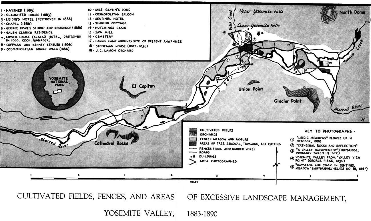
[click to enlarge] |
The purpose of the opposing petition was to request that Congress not acquiesce in those demands, for the following reasons: First, if the office of Yosemite commissioner were an elective, and therefore a salaried, position, it would degenerate into a political gift at the whim of whichever political party happened to be in power at the time. Second, if the Yosemite Grant were enlarged as requested to include the Sierra Nevada watershed, it would unjustly deprive preemptionists of their property and improvements. The fear existed also that the commissioners would destroy much of the magnificent forest in the new area for economic gain as they had done in Yosemite Valley.
According to the petitioners, the depredations by sheepherders and logging interests had been greatly exaggerated. Their remoteness from markets and the difficulty of transporting their lumber to market would forever check wholesale destruction of the Sierran forests, “especially in the heart of a practically inexhaustible supply of timber.” If the government acquired the balance of the timber in that locality, it would increase the value of those timber sections owned by private parties and possibly lead to the formation of a giant timber trust. It would also discourage railroads attempting to enter California over either of its central passes by removing from availability an item necessary in their construction and operation.
The petitioners contended that by granting those requests, Congress would actually be securing water, timber, and railroad pass monopolies for the Board of Yosemite Commissioners. Healthy competition would be sacrificed in favor of a few individuals. How long would it be, they asked, before some water corporation interested the board in a scheme for building storage dams to retain surplus waters in the mountains, which would later be offered for sale at high cost to the farming community of central California? And what if a single railway line managed to exert enough influence over the board to gain control of the two most important remaining railroad passes over the central Sierra Nevada—through Lee Vining and Bloody canyons?
In summation, the petitioners feared that enlarging the park area would invest the board of commissioners with control over all future water sources for central California; over one of the finest timber belts in the world when, it was argued, it had already proven incapable of properly preserving the small forest area of Yosemite Valley; and over the landed interests of many settlers and owners of mountain property, when its management policy relating to individuals holding interests within Yosemite Valley had already proven unfair, unjust, and discriminatory. They hoped, instead, that Congress would retract the Yosemite Grant and place it under military administration, with direct supervision by a body of civilian experts in the fields of engineering, landscape gardening, and art. They also pleaded for a thorough investigation of the Yosemite matter, in the best interest of all American park reservations, to determine whether in the future such splendid wonders as Yosemite Valley should be entrusted to such precarious management.168
[168. Petition to the Senators and Representatives of the Congress of the United States. Against the Extension of the Yosemite Grant and Praying for an Investigation into the Management of the Present Grant, Letters Received by the Office of the Secretary of the Interior Relating to National Parks, 1872-1907 (Yosemite), RG 79, NA, 1-26. Specific “Charges against the Board of Yosemite Commissioners preferred by Chas. D. Robinson at the Cal. State Legislature of 1889” included:
1. squandering and misapplying public moneys
2. forcible breaking and entering of private property
3. wanton destruction of public and private property
4. cutting and destroying timber in the valley
5. burning shrubbery, clearing and plowing up meadows, and allowing persons to do the same for private gain, thereby doing irreparable damage to the natural beauties of the valley
6. fencing and farming out public lands for the benefit of private individuals
7. refusing to investigate or consider charges of gross neglect and incompetence and of destruction of property alleged against Guardian Dennison
8. connivance with persons endeavoring to secure all business privileges in Yosemite Valley and to remove residents and debar the general public from joint and legal use of the valley
9. neglect to prosecute persons disfiguring and destroying natural features of the valley in defiance of the law
10. holding annual meetings with closed doors in defiance of the law
11. allowing contractors for the Stoneman House to cut and mill timber within the limits of the grant
12. open defiance of laws prohibiting the granting of exclusive privileges
13. reduction of rentals to the prejudice of the state income
14. making illegal and arbitrary contracts with laborers and withholding their wages
15. refusing to recognize their own contracts and to pay balance due on the same
16. suppressing and withholding facts from citizens concerning the acceptance of the Stoneman House by the board and illegally leasing the same
17. cutting wood on the grant and selling it to residents of the valley, thereby destroying the natural park timber, in defiance of their own rules and regulations and in violation of the law
18. official sanction and approval of a return to the vicious toll system of former years abolished with great difficulty and at considerable expense by the legislature
19. eviction of law-abiding and useful families in aid of monopoly enterprises, thereby destroying the District School of Yosemite
20. gross neglect of public roads and trails within the grant
21. employment of state labor upon work for private parties
22. general failure and incompetency of the board system to properly manage the Yosemite Valley for the interests of the state of California, in accordance with the conditions imposed by the United States for the comfort and convenience of visitors from abroad or for the welfare of the residents of the valley.
Charles D. Robinson instigated the first investigation of the Yosemite charges by the California State Legislature. Letters Received by the Office of the Secretary of the Interior Relating to National Parks, 1872-1907 (Yosemite), RG 79, NA.]
b) Arrival of John Muir in California
Others would soon join in the movement for recession of the Yosemite Grant to the United States. In March 1868 a ship’s passenger disembarked at San Francisco Bay, destined not only to play a strong role in the realization of that objective, but who would also have a profound, long-term effect on the philosophical development and the implementation of wildland conservation in America. John Muir, a young Scotsman possessed of a wide range of interests, including invention, science, and botany, had read about Yosemite Valley and had traveled a circuitous route from Wisconsin to see it firsthand. With a companion, Muir set out on a walking trip across the Central Valley to Yosemite. That short excursion whetted his appetite for further exploration of the Sierra Nevada at some future date.
Muir worked on the West Coast during the winter of 1868-69 at a variety of jobs, finally finding employment with a sheepman. In the spring ‘of 1869 the owner sent him toward Tuolumne Meadows to oversee a sheepherder with a band of more than 2,000 animals. From June to September, snatching bits of time between his duties as supervisor, Muir managed to explore much of the Yosemite high country, observing, sketching, and recording his adventures in a journal. His almost spiritual experience among the majestic peaks and flowery meadows, akin to a rebirth, transformed him into an avid conservationist and foe of all people and activities that might despoil “the most spacious and delightful high pleasure-ground” he had ever seen. During that summer Muir studied the animals and weather of Yosemite, formulated theories on glaciation, and began molding his gospel of wilderness—the basic tenets of a philosophy of ecology and conservation that perceived wildness as a necessity for the sustenance of human existence.
Muir’s experiences in the Sierra high country spoiled him for any other lifestyle, and he soon quit his flatland work to return to Yosemite Valley. There he first worked at the sawmill run by James Hutchings, cutting up trees damaged by storms on the floor of Yosemite Valley. Nights he spent in the perusal of scientific books and further study of the flora and fauna of the region.
Before long Muir acquired a reputation in the scientific and literary world that blossomed as time went on. Important figures sought his company for long discussions on life and nature and the interdependency of the two. Muir’s strong arguments for glaciation as the origin of Yosemite Valley gained him a worthy antagonist also, in the person of Josiah Dwight Whitney, California state geologist. Whitney, a distinguished scientist with a national reputation, had written The Yosemite Guide-Book, a widely read and much-used work acclaimed for its clear explanation of the origin of the valley. Whitney was fully convinced that subsidence had formed Yosemite Valley and never hesitated to declare his disagreement with Muir’s theories. Undaunted and unintimidated, Muir spent much of his time in painstaking observation of the valley walls and floor and in careful documentation of his findings. In later years Muir would achieve recognition as one of the first scientists to perceive the importance of glacial erosion in the Sierra Nevada.169
[169. Although Muir was definitely on the right track in his glacial studies, he erred in some of his conclusions regarding the extent of glaciation in the Sierra. William R. Jones, former chief naturalist at Yosemite National Park, pointed out that glaciation in Yosemite Valley was responsible for probably only one-third of its visible depth. Originally the Merced River gouged out a V-shaped valley, which was later modified by three ice invasions. The present U-shaped valley, while typical of glacial sculpture, has a floor that is wide, flat, and alluviated, rather than rounded. This results from having subsequently been covered by a lake formed when a terminal moraine at the west end of the valley blocked drainage of the melting glacier. “The Sheepherder Versus the Geologist,” Audubon (January-February 1967): 48.]
Muir’s time in Yosemite and the Sierra high country furnished the grist for brilliant, voluminous articles on the origin, beauty, and use of America’s wilderness treasures. He spent the remainder of his life alerting people through books and lectures to the wonder and fragility of nature and the necessity of preserving it. His subjects included not just Yosemite but all wild areas.
c) John Muir and Robert Underwood Johnson Join Forces
Much of Muir’s writing focused on the damage to the environment by sheepmen and lumbermen. After his marriage in 1880, Muir spent the next few years managing the family’s ranch in Martinez. But his concern for the future of Yosemite Valley and its surrounding high country rekindled in the late 1880s, and his conservation crusade demanding legislative interference to end the spoliation attracted a strong ally in Robert Underwood Johnson, editor of Century Magazine.
On visiting Yosemite Valley together in 1889, Muir and Johnson were appalled to find the valley despoiled by commercialism and exploitation in the form of fenced pastures, plowed hayfields, and unsightly development. Even Tuolumne Meadows, remote from the sordid moneymaking projects they perceived going on below, had not been spared the ravages of man’s unregulated occupation. Fires set to improve pasturage and unrestricted grazing had resulted in charred tree stumps; dusty, bare meadows; and “trampled, muddy streams. Upon leaving the high country where their flocks had consumed nearly all the vegetation, sheepmen habitually set fires to give the grass an opportunity for renewed growth the next season. That practice not only destroyed many fine trees and shrubs, but left nothing to retain the snow, whose rapid melting resulted in dry waterfalls during the height of the tourist season.
To Muir and Johnson it was obvious that state management had proven inadequate and would ultimately ruin forever the precious landscape of the Sierra. Neither the valley nor the surrounding forests, mountains, and meadows received adequate attention, enabling businessmen, cattlemen, sheepmen, and timber interests to rape the resources unopposed.
The discussions between Muir and Johnson ultimately touched upon the possibility of incorporating the peaks, meadows, and lakes of the high country into a national park, and Muir’s future writings focused on achievement of that goal. In two articles written for Century Magazine, “The Treasures of the Yosemite” (August 1890) and “Features of the Proposed Yosemite National Park” (September 1890), Muir eloquently described the beauties of the region and the forces at work on their destruction, finally urging adoption of the proposal for their preservation as a national park. Muir and Johnson sought to protect as much as possible of the Yosemite ecosystem, noting the interdependence of the valley and the high country surrounding it. Those Century articles, an effort to sidestep the pettiness and intrigue of local politics and appeal to the nation as a whole, adequately fulfilled their purpose.
d) Response of the Commissioners to Charges of Mismanagement
In their report of 1889-90, the Yosemite commissioners responded to “the shameful and shameless attacks” upon their management of the valley. Referring particularly to Muir’s articles in Century Magazine, the commission pointed out that it had been trying to restore the valley floor to its condition as first noted by white men. At that time the valley was park-like in its lack of underbrush and small tree growth. By the late 1880s, the commissioners noted, at least one hundred trees were growing where only one had stood when whites entered the valley. Obviously, they maintained, charges of wholesale destruction of resources were nonsense.
The commissioners also argued that Nature was responsible for many of the changes on the valley floor. Whenever the Merced River flooded and cut a new channel, it created a new meadow by overflowing and killing the timber that lay in its floodplain. Meanwhile, young pines and other conifers sprang up in the old meadows in the angles from which the river retreated. This concurrent destruction and renewal was an ever-changing and continual process. The commission charged that pictures showing a large area of tree stumps that were published in the Century and as described indicative of the condition of the entire valley floor actually depicted only one area of pine thicket that had been killed by floodwaters and was being cleared. Rebutting criticism of widespread agricultural activity on the valley floor, the commission stated that the results of such experiments had never been encouraging. The sterile soil and short growing season lessened the chances for success of that particular enterprise.
In a final attempt to dispel any questions about their management of the Yosemite, the commissioners published in their report to the legislature a number of letters written by recent visitors to the valley giving their impressions of its condition and management. Secretary of the Interior John W. Noble had requested the letters in the course of an investigation of the charges of mismanagement ordered by the U. S. Senate. All the letters published were complimentary of the job being done by the commissioners under trying circumstances and with limited appropriations.
e) Comments on the Controversy
Debate over the success of state management of the Yosemite Grant raged for several years. The prolonged litigation over settlers’ claims in the valley initiated immediately after federal cession of the grant set the tone for the commissioners’ continuing tumultuous relationship with valley residents. Such actions as the later failure of the state legislature to back up the ruling of the Yosemite commissioners relative to the granting of exclusive road rights on the north side of the valley generated further ill feeling between the state and the general public. Throughout the early years of state management, well-publicized outbursts of public anger over commission decisions alternated with almost complete indifference to commission activities. Lack of funds and of a well-defined management policy ultimately handicapped the state administration so severely that in 1880 the state legislature replaced the first board of commissioners. Not until the next decade did public awareness mature to the point that closer attention was paid to state administrative procedures and the area’s future. It needs to be remembered also that conservation per se was in a nascent stage at this time and that issues such as scenic preservation and natural resource management were thoroughly unexplored. The problems that overdevelopment, lack of architectural planning, and overuse would bring had to be learned by experience. Also, the valley’s isolation from supply points made it seem logical and economically intelligent to grow food and provide a variety of commercial services on-site.
Because the purpose of ceding the Yosemite Valley to the state of California had been to preserve great natural wonders in their original condition, the allegations by 1890 of spoliation of the valley became particularly serious. Most Congressional members firmly believed that proof of the permission of such injuries would demand forfeiture of the state’s title to the grant. It is difficult to doubt the sincerity of concerned individuals such as John Muir, who claimed that destruction of Yosemite Valley accelerated every year. On the other hand, there must be some appreciation of the trying conditions under which the Board of Yosemite Commissioners was attempting to manage the valley and of the apparent sincerity and concern of at least some of the commissioners through the years.
Without question, trees were felled in certain places on the valley floor and other areas were cultivated. The extent of those activities and their impact on the beauty and grandeur of the valley remained open to question. Some of the state projects that precipitated criticism, such as the destruction of trees and shrubs surrounding the new Stoneman House and the erection of a dam at the lower end of Mirror Lake, were undertaken to improve the visitor experience. Those particular actions were designed to alleviate the mosquito problem, avoid the danger of falling branches around the hotel, and preserve the mirrorlike surface of a popular tourist attraction. Critics argued that such activity ran counter to the obligation undertaken by the state to preserve the natural landscape. Obviously, the aim of “pure” conservationists to preserve resources unimpaired, and the need of the state to encourage tourist-oriented development and the spending of money in order to support maintenance costs, were at odds, a dilemma that would continue to plague management efforts in the valley to the present day. On the other hand, the commissioners were nearly always applauded for judicious tree cutting to repair fire, storm, and flood damage; for restoring meadows by clearing trees and brush; and for reopening scenic vistas obscured by intrusive growth. The desirability, extent, and methods of natural resource management were then, as now, subject to controversy.
One of the more detailed letters concerning alleged spoliation of the valley published in the 1889-90 commission report came from George Davidson of the U. S. Coast and Geodetic Survey in San Francisco. Davidson suggested that in debating the character of “improvements” to the valley, no two engineers or commissions would agree. He also recognized that a restricted budget made it difficult to decide what should be done first or how to do it best. Furthermore, valley residents would alway disagree with visitors as to what “improvements” were needed, and personal feelings would always cloud professional opinions. These same problems have continued to the present day. Davidson perceived, as others had and would continue to note, that the principal defect in management of the valley, in addition to an insufficient budget, was the lack of agreement on future direction, resulting in a scarcity of any type of comprehensive planning. This absence of a plan for “improvement” meant a lack of organization not only in ‘the implementation of natural resource management objectives but also in engineering work, such as the building of better roads and paths, the improvement of trails, and the building of bridges. Davidson, as Hall had done, suggested the need for a thorough topographical survey of the valley and a study of the Merced River to enable the commission to propose a systematic and broad plan of development.170
[170. George Davidson to Secretary of the Interior, 8 November 1890, in Biennial Report of the Commissioners to Manage Yosemite Valley and the Mariposa Big Tree Grove, For the Years 1889-90 (Sacramento: State Printing Office, 1890), 20-22.]
The burden imposed upon the Yosemite Board of Commissioners was startling when viewed in relation to the yearly appropriations received. One of the commission’s complaints in the 1890 report involved the recent decision of the state legislature to purchase the turnpike roads within the Yosemite Grant. Although commendable from the standpoint of reducing private claims in the valley, the act had added significantly to the cost of valley maintenance. Every year required a constant and considerable outlay of money for labor and material for the repair of roads, trails, and buildings damaged by floods, rockslides, and storms; constant fire protection for the valley and Big Tree Grove; the preservation of old trails and the construction of new trails, roads, and footpaths; and increases in guest accommodations and services.
It could be argued that the state of California met its obligations as well as could be expected under the stringent limitations of a low budget, increased visitation, changing land use, inadequate policing powers, and differing theories of land conservation. This does not preclude the obvious existence of corruption of a type that often pervades state politics and the probable truth of many of the charges of favoritism and ineptitude. The Southern Pacific Railroad, for instance, exerted a powerful influence on the state legislature and consequently on the Board of Yosemite Commissioners. Through the Washburn interests, it effectively controlled the transportation monopoly in Yosemite and kept a tight rein on valley affairs. On the whole, however, the Board of Yosemite Commissioners appears to have made an effort, with little professional direction, to preserve the integrity of the valley as a scenic wonder as much as consistent with the state’s intention of turning the valley into a source of revenue. The continuing diversity of opinion on the future level of development of the grant, further charges of corruption and inefficiency, and the state’s seeming inability to protect and maintain the Yosemite Grant in an appropriate manner would eventually lead to the inclusion of Yosemite Valley and the Mariposa Big Tree Grove within a national park under federal control.
f) The Yosemite National Park Bill Passes Congress
Muir’s moving and influential articles in Century Magazine appeared just as Congress been debating legislation to establish a Yosemite National Park. The previous March, Representative William Vandever of Ventura County, California, had introduced a bill in the House of Representatives for protection of the Sierran forests. Political pressure had resulted in omission from the proposed Yosemite Reservation of some important areas of the High Sierra—most of the Tuolumne River watershed, Tuolumne Meadows, Tenaya Lake, and the Ritter Range.
Much public support for the original proposal had surfaced, however, varying from interests as powerful as the Southern Pacific Railroad, which envisioned a profitable tourist transportation business, to the President of the United States, Benjamin Harrison. When Muir’s articles appeared, they were widely quoted and circulated, and preservation of the entire Yosemite high country and indeed of all Sierran forests and meadows became of nationwide concern.
Renewed pressure resulted in submission of a second bill in place of the original, extending the Yosemite Reservation to again include all the vital high country areas. Backed by Secretary of the Interior Noble and President Harrison, the bill cleared both houses of Congress on 30 September and was signed into law by President Harrison on 1 October 1890, a legislative feat rarely accomplished in this day of lengthy debate and partisanship. The establishment of Sequoia National Park on 25 September and of Yosemite and General Grant (now Kings Canyon) national parks on 1 October saved much of the finest scenery and some of the noblest forests of the Sierra Nevada for the enjoyment of future generations.171
[171. On 30 September 1890, Representative Lewis E. Payson of Rhode Island [Illinois?] reported the substitute bill (H. R. 12187) from the Committee on Public Lands. Entitled “A bill to set apart a certain tract of land in the State of California as a forest reservation,” it granted exclusive control over the area to the Secretary of the Interior. In recommending passage of the bill, the committee report stated:
The preservation by the Government in all its original beauty of a region like this seems to the committee to be a duty to the present and to future generations. The rapid increase of population and the resulting destruction of natural objects make it incumbent on the Government in so far as may be to preserve the wonders and beauties of our country from injury and destruction, in order that they may afford pleasure as well as instruction to the people.
Congressional Record—House, 30 September 1890, 10752.]
g) Comments on the Preservation Movement and Establishment of Yosemite National Park
The law enacted in 1890 set aside an area larger than the present national park as “reserved forest lands”—1,400 square miles surrounding and connecting the Yosemite Valley and Mariposa Big Tree
|
Illustration 42.
Map of Yosemite Valley, August 1890. From Muir, “The Proposed Yosemite National Park—Treasures & Features,” 1890. |
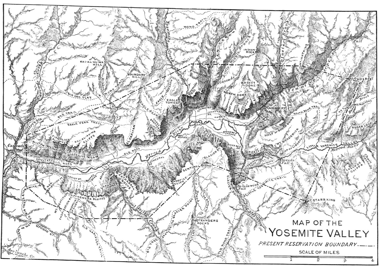
[click to enlarge] |
The successful attempt by John Muir and R. U. Johnson to establish a national park in the Yosemite high country had collided with a variety of well-entrenched private and commercial interests. The Yosemite Stage and Turnpike Company, which had a monopoly on valley transportation services and exerted great influence over the Board of Yosemite Commissioners; various cattlemen, sheepmen, homesteaders, and lumbermen with patented property in the Yosemite high country; and the politically minded state commissioners—all feared a strong government presence exerting undue control over their lives and activities.
On the other hand, some groups, such as the Southern Pacific Railroad, however, aided the preservation cause on behalf of their interests in boosting tourism. California farmers were concerned with the protection of watersheds for agricultural purposes. In addition, the two men found support among a small constituency interested in protection and preservation of the environment. Before the heyday of utilitarian conservation and scientific management of resources, the preservation movement consisted primarily of idealists, enthusiasts with a love of the outdoors but lacking the training and knowledge that would enable them to better understand the complexities of nature. Only gradually had those people begun to comprehend the arguments of Muir and Olmsted that entire related environments needed protection, including the commonplace features of an area as well as the spectacular and unique. It would be years before the concept of interdependent ecosystems and of wilderness preservation as a justification for the establishment of parks would take hold.
At this time, despite the use being made of the high country by several groups, it still appeared to be relatively useless because of its isolation and ruggedness. There was no way of knowing that before long the arrival of railroads would make the Yosemite high country’s resources extremely valuable and lead to a variety of political maneuvering to reduce the size of the new national park to exclude rich timber and mineral lands.
It will be interesting to note as the Yosemite story continues that despite their seemingly disparate interests at times today, conservationists and park managers succeeded in working alongside each other with little friction in the early years. Indeed parks flourished under their combined patronage. Both groups, in their zeal to find support for a national park system, recognized the advantages of developing tourism and commercial recreation. As long as crowds remained small and impact on the resources minimal, conservationist aims remained compatible with park use. Not until the twentieth century would preservationists become dismayed by the seeming impossibility of promoting park use without an adverse impact on natural resources and consequent physical deterioration of park facilities and the environment. Even worse, growing commercialism would threaten to overshadow the basic purpose of parks as areas of relaxation and contemplation.
In 1890, however, such concerns loomed far in the future. Preservationists only hoped that establishment of the larger national park around Yosemite Valley would ensure the survival of the valley’s resources by protecting the high mountain meadow drainage basins and forests from the ravages of overgrazing and indiscriminate logging. Additionally, and by no means of lesser importance in their eyes, the act created a new mountain preserve of unparalleled natural beauty for the enjoyment of all people.
Next: 3: Cavalry 1890-1905 • Contents • Previous: 1: Early History
| Online Library: | Title | Author | California | Geology | History | Indians | Muir | Mountaineering | Nature | Management |
http://www.yosemite.ca.us/library/yosemite_resources/state_grant.html