historic resource study
VOLUME 2 OF 3
historical narrative
|
YOSEMITE
NATIONAL PARK / CALIFORNIA
| Online Library: | Title | Author | California | Geology | History | Indians | Muir | Mountaineering | Nature | Management |
Yosemite > Library > Yosemite Resources > Chapter V: National Park Service Administration of Yosemite National Park, 1916-1930: The Mather Years >
Next: 6: NPS 1931 to 1960 • Contents • Previous: 4: Cavalry 1905-1915
|
historic resource study
YOSEMITE NATIONAL PARK / CALIFORNIA |
by
Linda Wedel Greene
September 1987
U. S. Department of the Interior / National Park Service
A. Overview 523
B. Roads, Trails, and bridges 531
1. Season of 1916 531C. Construction and Development 568a) Existing Roads and Trails 5312. Season of 1917 542(1) Government-Owned Roads 532b) Anticipated Visitation Requires New Construction 537
(2) Non-Government-Owned Roads 533
(3) Government-Owned Trails 533
c) John Muir Trail 541
3. Seasons of 1918-19 547
4. The 1920s Period 548a) Improvement of Roads and Trails Continues 5485. Some Valley Naturalization Begins 565
b) Hetch Hetchy area 550
c) Auxiliary Valley Roads 551
d) The Park Service Initiates a Road-building Program 552
e) Improvement of Wawona Road and Relocation of Big Oak Flat Road Contemplated 554
f) Reconstruction of Wawona Road Begins 555
g) Valley Stone bridges Constructed 560
h) Trail Work Continues 560
1. The Park Service Slowly Builds Needed structures 568D. Educational and interpretive Programs 595
2. A New Village site is Considered 577
3. The 1920s Period involves a Variety of Construction Jobs 581
4. The New Hospital and Superintendent‘s residence 585
5. The Indian Village in Yosemite Valley 590
6. More Construction and Removal of Some older structures 591
1. Nature Guide Service 595E. Concession Operations 612
2. LeConte Lectures 597
3. Yosemite Museum Association 597
4. Zoo 603
5. Indian Field Days 605
6. Interpretive Publications 606
7. Yosemite School of Field Natural History 606
8. Research Preserves 607
9. Development and Importance of Educational Work at Yosemite 607
1. The Desmond Park Service Company (Yosemite National Park Company) 612F. Patented Lands 677a) The Desmond Company Receives a Concession Permit 6122. The Curry Camping Company 652
b) Desmond Constructs forerunners of High Sierra Camps 615
c) Yosemite National Park Company formed 618
d) Bear Feeding Expands 624
e) High Sierra Camps Reestablished 626
f) Yosemite National Park Company Holdings, 1924 630a) The Company Continues to Grow 6523. The Wawona Hotel Company 671
b) Mrs. Curry Has the LeConte Lodge Moved 652
c) New Construction activity 653
d) Yosemite Park and Curry Company formed 658
e) The Company initiates a Winter Sports Program 663
f) Concession Atmosphere Changes with Increased Tourism 671
4. Best Studio 675
5. Pillsbury Studio 676
6. Fiske Studio 676
7. Baxter Studio 676
1. Yosemite Lumber Company 677G. Hetch Hetchy 695
2. Foresta Subdivision 684
3. Big Meadow 687
4. Aspen Valley Homesites 687
5. Cascade Tract 688
6. Gin Flat and Crane Flat 688
7. The Cascades (Gentry Tract) 688
8. Hazel Green 688
9. White Wolf Lodge 689
1. Stream Control 715K. Fish Hatcheries 721
2. Meadows 717
3. Fire Control 718
4. grazing 720
Stephen T. Mather, having accepted the challenge of his old college friend Secretary of the Interior Franklin K. Lane to take over the direction and unification of the national park system, devoted his next fourteen years to America’s national parks. Closely linked with Mather’s name during this period was that of Horace Albright, the young Interior Department lawyer who became Mather’s assistant. Mather served as Assistant Secretary of the Interior for two years, beginning in 1915, and as Director of the National Park Service from 1917 until 1929. Albright then served in that capacity until his resignation in 1933 to become president of the American Potash Company. During the crucial early years of the Park Service, Mather and Albright proved phenomenally successful in acquiring increased appropriations and the public support necessary to develop more and better park facilities:
Indeed the effectiveness of their promotion was not due to new ideas per se; John Muir, J. Horace McFarland, R. B. Marshall, Mark Daniels, and others had long since laid the rhetorical basis for justifying the national parks in an urban, industrial society. Mather’s and Albright’s original contribution was the institutionalization of the national park idea within the political and legal framework of the federal government. Henceforth an attack on a reserve would not be an affront to it alone, but to the very fabric of American society.1
[1. Runte, National Parks, 102.]
From the beginning, Mather determined to closely link in the public mind the relationship between national parks and the American economy. He believed it imperative to fully and efficiently develop park resources for the pleasure of the public, which would in turn result in profits for the public through increased tourist dollars. In view of the strong influence of utilitarian-minded preservationists, it seemed necessary in order to strengthen the position of the national parks to associate scenic protection with economic growth. Aesthetic conservationists still hoped to find ways to use scenic areas without destroying their basic values. They realized, however, that some concession had to be made to provide for the comforts and convenience of tourists in order to get them into the parks for longer periods of time so that they would come to appreciate them and rally to their defense.2
[2. See discussion of preservationist thinking after the Hetch Hetchy defeat and establishment of the National Park Service in ibid., 84-103.]
In his endeavors to popularize the national park idea, Mather’s practical business experience proved invaluable. He was, once again, selling a product to the American public, although scenic beauty would prove a somewhat harder commodity to sell than borax. Based on the argument that national parks would ultimately stimulate the economy if properly managed, Mather’s first steps involved streamlining his organization, handling estimates and appropriations in a businesslike manner, installing trained park personnel and nonpolitical superintendents, and improving the visitor experience by eliminating toll roads, admitting autos, improving accommodations, and inaugurating educational facilities and opportunities. His educational program became a direct outgrowth of this need to help people better understand the phenomena represented in the various national parks. The auto camps and housekeeping camps in the national parks resulted from his desire to provide accommodations for all classes of visitors. In Yosemite, ultimately, accommodations included the plush Ahwahnee Hotel, the medium-class Yosemite Lodge, the permanent tent camp at Curry, which also offered housekeeping facilities, and the seasonal camps of the High Sierra—ensuring something for everyone’s tastes.
One of the most important accomplishments of Mather’s tenure involved recognizing problem areas and organizational deficiencies and establishing divisions in his new bureau to address and correct them. Both Mather and Albright recognized the need for broader and sounder policies based on serious study of the issues and current data. One of the more important of these new divisions was that of landscape architecture, established to ensure the harmonization of park structures with their environment.3 That unique advisory group concerned itself with devising ways of constructing buildings, campgrounds, roads, and the like with minimal sacrifice of natural scenery. Their advice on engineering projects and other scenic questions, such as vista-cutting, would prove invaluable. The various chiefs of that division in Mather’s time—Charles D. Punchard, Daniel R. Hull, and Thomas C. Vint, all trained architects—accomplished designs of maximum harmony with the landscape using native stone and timber.4
[3. Horace M. Albright, “Stephen T. Mather—The Organizer of Parks,” 1932, typescript, 4 pages, in Central Files, RG 79, NA.]
[4. Shankland, Steve Mather, 254-56.]
The changes in Yosemite during Mather’s administration of the Park Service proved to be dramatic and beneficial to the visitor, many of them being precedent setting in terms of policy and programs. The purchase of the Tioga Road has been mentioned to improve access and sightseeing opportunities, as well as the establishment of the D. J. Desmond Company in an attempt to remove concession haggling and put Yosemite’s visitor services on a stable footing. Other significant actions from 1916 until his death included the improvement of roads, the relocation of Yosemite Village, construction of the Rangers’ Club—an architectural prototype for future park structures, and initiation of an interpretive and educational program that would be emulated by all other parks. Mather’s approach to the national parks is best described as visitor oriented. His attempts to increase the attractions of Yosemite resulted in the encouragement of
|
Illustration 66.
Automobile map of Yosemite National Park, 1917. From Report of the Director of the National Park Service, 1917 |
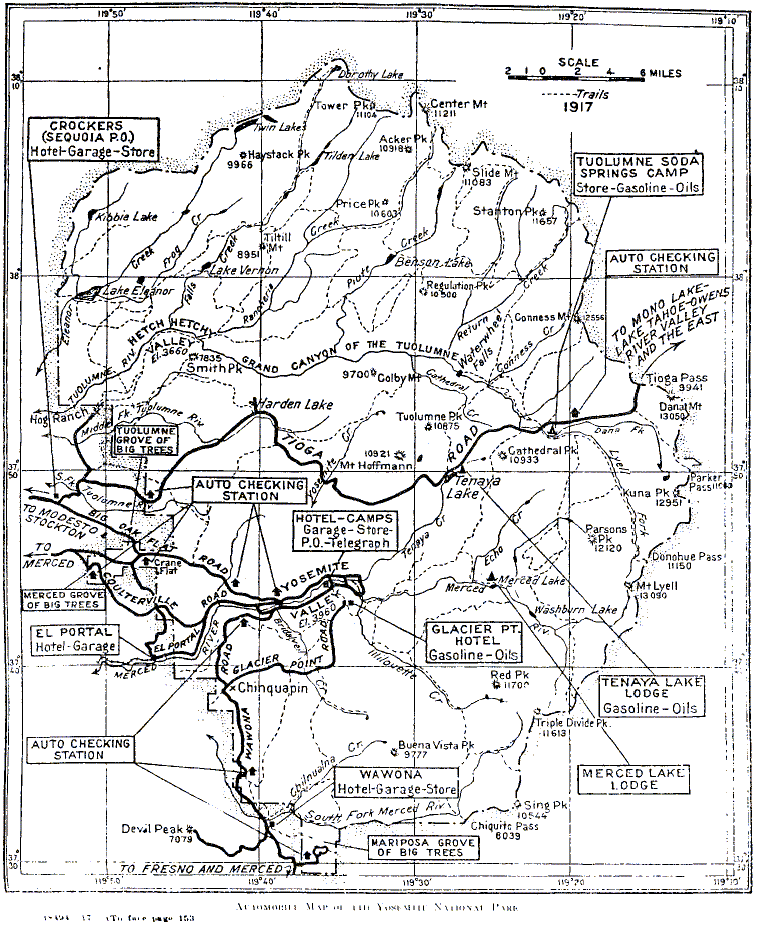
[click to enlarge] |
|
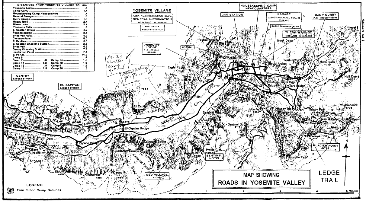
Illustration 67.
Automobile guide map of roads in Yosemite Valley, 1917. From Department of the Interior pamphlet, “Automobile Guide Map Showing Roads in the Yosemite Valley,” 1917. |
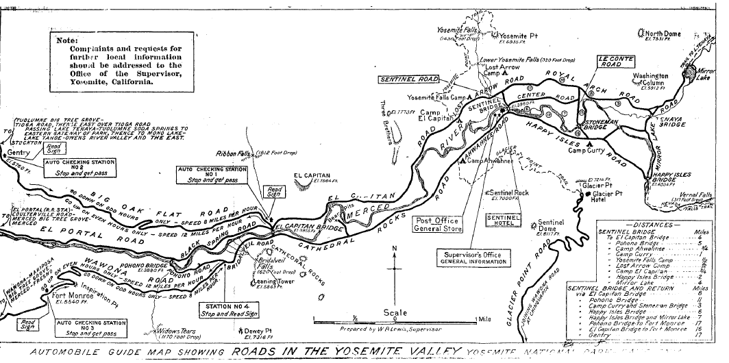
[click to enlarge] |
In 1916 Washington B. “Dusty” Lewis became the first administrator of Yosemite under the new National Park Service bureau. Originally with the U. S. Geological Survey, he became
one of the most popular superintendents in national-park history. A good engineer . . . handsome and personable and blessed with a handsome and personable wife, he was exactly what Mather wanted for Yosemite . . .5
[5. Ibid., 246.]
Lewis stayed in Yosemite for eleven years and guided into place many of the elements of today’s modern park system as conceived of by Stephen Mather.
1. Season of 1916
a) Existing Roads and Trails
In the fall of 1916 Washington B. Lewis, Supervisor of Yosemite National Park, sent the Superintendent of National Parks a list of all the existing roads and trails within the limits of the park:
[6. W. B. Lewis, Supervisor, Yosemite National Park, to Superintendent of National Parks, Department of the Interior, 28 October 1916, in Separates File, Yosemite-Roads, Y-20, #8, Yosemite Research Library and Records Center. (Lewis did not yet serve as superintendent of Yosemite National Park. Because Congress did not fund the National Park Service until 1917, a new organization could not be formed until that time, even though President Woodrow Wilson had signed the act creating the Park Service in August 1916.)]
b) Anticipated Visitation Requires New Construction
Both Assistant Secretary of the Interior Mather and Secretary of the Interior Lane determined early in 1916 that tourists should be induced to visit the nation’s parks, not only during but after the war. Mather, especially, recognized early the automobile’s potential to increase use of the national parks and thereby strengthen their position in American society. The Park Service eventually followed the policy that the minimum number of roads needed in a park would be built, but of as good a class as could be obtained. This would be, of course, dependent on government appropriations. To give the parks higher visibility, Mather conducted an educational campaign with the help of Robert Sterling Yard, former editor of The Century Magazine, and the Sunday New York Herald, and newly appointed publicity director for the parks. Until 1911, the Interior Department had only published park regulations and superintendents’ annual reports. Yard’s National Park Portfolio and a stream of enthusiastic articles dramatically increased travel to the parks during 1916.7 Mather and Lane believed that travel could be further encouraged by providing accommodations for tourists of all economic levels and perfecting means of travel to and through park areas.
[7. Mather and Yard later split over several issues concerned with park management. Yard criticized both Mather’s predator extermination program and the “honky-tonk” atmosphere of Yosemite’s concession operations. Fox, John Muir and the American Conservation Movement, 203-4.]
Road conditions in Yosemite at this time posed a major problem. Of the approximately 103 miles of road that the government controlled in 1916, only about one mile had a good hard surface. The two miles of “water-bound” macadam road on the valley floor contained bad ruts, while the approximately five miles of road surfaced with river gravel, which pulverized quickly under wear, required heavy sprinkling to keep down the dust. The remainder of the park road system consisted of narrow, dirt tracks with sharp curves and steep grades. Reconstruction of the El Portal road continued during this time. The one-way travel restriction on valley roads rigidly adhered to at the beginning of the 1916 season was gradually phased out as workers eliminated dangerous curves and widened narrow stretches. (One-way traffic continued to be enforced on the Big Oak Flat and Wawona grades because of their steepness.) Although speed limits remained in effect, every relaxation of restraints brought in more motorists who stayed longer. Park officials began suggesting at this time that the increasing travel required dignified gateways at the several entrances to the park, particularly where the Wawona, El Portal, and Tioga roads entered the boundaries. These would not appear, however, for several more years.
After improved roads brought them into the national parks and improved accommodations persuaded them to stay awhile, visitors would begin looking around for the best way to see the area’s sights. One of the primary emphases of the National Park Service in its early years in Yosemite concerned continuation of the backcountry trail-building program initiated earlier by Major Benson and carried out by Gabriel Sovulewski in an effort to introduce tourists to the backcountry. It differed from earlier army efforts in that trails were designed less for access and patrol purposes than for recreational use by tourists. Laborers placed trails in more scenic places, such as river canyons, and built them to higher standards, so that they often resembled roads in terms of width and method of construction. Explosives reduced labor costs and solved topographical problems. Modern machinery gradually facilitated trail construction and maintenance, and the earlier work in native stone and timber gradually gave way to steel, cement, and prefabricated wooden construction.
As workers dispensed with the old methods, however, characterized by skilled labor, hand tools, and draft animals, backcountry trail work became more environmentally incompatible. The new trails not only changed the character of backcountry use, but also severely impacted the ecology of the region. Little consideration existed for the effects of that type of trail building on the wilderness, and over the next several years, a variety of trails — relocations or newly built ones—began to impact the wilderness along with backcountry patrol cabins and High Sierra camps. Although occasional individuals raised questions about trail width and drainage and the long-term effects of construction activity in the backcountry, conservation of a pristine wilderness was not then the critical issue it is today, and attitudes changed slowly. Not until a new period of trail reconstruction and restoration began in the early 1970s, using a blend of old methods and tools and new ideas, did Yosemite backcountry trail work become flexible enough to adapt to the difficult problems posed by the rough Sierra terrain and inexpensive enough to be used under severe budget restrictions, while at the same time managing o to please wilderness lovers concerned with environmental compatibility.8
[8. See James B. Snyder and Walter C. Castle, Jr., “Draft Mules on the Trail in Yosemite National Park,” The Draft Horse Journal (Summer 1978): 10-13, for a detailed description of backcountry trail construction and maintenance techniques.]
In 1916 only about 175 of the 650 miles of park trail were considered in good condition, requiring only minor improvements. In fact some of the trails, such as those to Yosemite Fall, Nevada Fall, and up Tenaya Canyon, were considered of first-class construction. One hundred forty-five miles of park trail were judged only fair, while the remaining 280 miles needed reconstruction. Those were principally in the northern part of the park, north of the Grand Canyon of the Tuolumne, an area just beginning to show measurable visitation. The park recommended three new trail projects: an extension of the Washburn Lake trail to join the Isberg Pass trail near Harriet Lake; a trail from the McClure Fork of the Merced, three-fourths of a mile above its junction with the latter, to Tuolumne Pass, via Babcock and Emeric lakes; and replacement of the trail from that same point of origin to Tuolumne Pass via Vogelsang Pass.9
[9. The former McClure Fork of the Merced River appeared as Lewis Creek on USGS maps in 1944. Named for W. B. Lewis, former park superintendent, it had been called Maclure Fork, the name also of a tributary of the Lyell Fork flowing from Maclure Glacier about one mile southeast. The new name eliminated some of the confusion engendered by the duplication. Decisions of the United States Geographic Board, No. 30—June 1932, Yosemite National Park, California (Washington: Government Printing Office, 1934), 14; Browning, Place Names, 134. The Board of Geographic Names ratified the name Vogelsang Pass in 1932, although it does not appear on maps. It is one-half mile south of Vogelsang Lake. Ibid., 228.]
During the 1916 season, laborers constructed about five miles of footpaths on the valley floor, primarily paralleling the existing roads but also closely following the contour of the land, so that they often possessed steep grades and sharp curves. As time passed and the roads were improved, sprinkled, and later paved, foot traffic became disinclined to use the paths and switched to the smoother roads. That did not pose a serious problem in the early days of light traffic, but as autos increased, the combination of hikers and motor cars on the roads began to cause problems. It ultimately became essential to provide paved walks alongside the roads in the valley.
During the 1916 and 1917 seasons, workers also laid out several miles of bridle paths on the valley floor. Those narrow trails again followed the contour of the country. Because they were dusty and only accommodated single-file traffic, horseback riders also began leaving the bridle paths and following the sprinkled, and later paved, roads, creating dangerous situations. At the same time, reconstruction of valley roads often wiped out many stretches of path. It became obvious the park needed a more modern system of horse routes.
Bridges in the valley posed another problem. In 1916 only the El Capitan Bridge, a combined steel and wood truss structure, had a safe loading capacity of more than six tons. Sentinel Bridge, on the other hand, over which most valley traffic passed, had been condemned three years earlier for loads over three tons. This caused great inconvenience to the park maintenance staff, because heavy road building and sprinkling equipment could only pass from one side of the valley to the other over the El Capitan Bridge. That resulted in excessive cost to transportation companies in the park as well, who had to send all freight trucks and heavy passenger vehicles bound for destinations on the north side of the valley via the LeConte Road and Stoneman Bridge—an extra two-mile haul.
c) John Muir Trail
Work on the John Muir Trail continued in 1916, during which time crews began working up the Middle Fork of the Kings River to a point just south of Muir Pass. In 1917 a $10,000 appropriation enabled construction of two bridges across the San Joaquin River and more work south of Muir Pass. Although the 1919 and 1921 legislatures voted additional appropriations, Governor Stephens vetoed both measures and work stopped. No more funds came until 1926, which subsidized seventeen more miles of trail north from the Selden Pass area. In 1927 and 1929 crews accomplished trail work across Silver Pass, Fish Creek, and past Virginia and Purple lakes to Devils Postpile National Monument. The stretch of trail from Crabtree Meadows to the summit of Mt. Whitney was completed during 1930. Work also began that year on a new, more direct crossing of the Kings-Kern Divide at Foresta Pass, boundary between Sequoia National Forest and Sequoia National Park. The original route selected by McClure had been followed closely, with only minor relocations.10
[10. Roth, Pathway in the Sky, 44; Huber, “The John Muir Trail, “41-5]
2. Season of 1917
The year 1917 proved important in Yosemite history, producing general improvements parkwide relative to roads and trails, visitor accommodations, travel facilities and transportation services, campgrounds, and utilities and sanitation. Those accomplishments had been made possible by an increase in tourism, resulting in greater revenues, and by larger congressional appropriations as that body responded to the mounting popular interest in national parks. Officials expended the bulk of the funds available in 1917 in construction, maintenance, and improvement of the park road and trail systems, both on the valley floor and in outlying areas. Several thousand dollars enabled continuing work on the El Portal road, which would connect at El Portal with a road constructed by the state and cooperating counties as part of the state highway system. In connection with that work, in 1917 the lower wooden timber truss bridge over Cascade Creek, built in 1907-1908, was replaced by a concrete structure. The upper bridge, built at the same time, was also in process of replacement.
Another benefit accrued to Yosemite travel in the summer of 1917. At that time the Yosemite Stage and Turnpike Company turned over to the Department of the Interior, in return for certain transportation privileges in the park, title to the Wawona toll road system connecting Wawona with Fort Monroe, including its lateral to Glacier Point from the old Chinquapin stage station. The department then eliminated travel charges, except for the automobile fee.11 The Mariposa County Board of Supervisors declared the Coulterville Road free to the public about 1917, and performed a small amount of improvement work on it over the next two years. Later the former owners won back title to the road, but subsequently did not make repairs or collect tolls. Ultimately the portion of that road inside the park became abandoned. Mariposa County continued to maintain the road outside the park, from Coulterville to Hazel Green and Crane Flat.
[11. Report of the Director of the National Park Service, in Reports of the Department of the Interior for the Fiscal Year Ended June 30, 1917. Volume 2. Secretary of the Interior, Etc. ‘(Washington: Government Printing Office, 1918), 841-49.]
During this 1916 to 1930 period, California’s highway system was undergoing rapid development and improvement for automobile traffic. When the federal government took over the Big Oak Flat and Tioga roads in 1915 and the Wawona Road in 1917, it made only such improvements as seemed necessary to make them passable. As fast as money could be obtained from Congress, those mountain roads, which obviously were not suitable for the increased auto travel using them, were improved. As stated earlier, prior to the late 1920s, roadwork consisted only of repair, maintenance, and minor improvement because of the expense of paving and lack of sufficient appropriations. The improvements were undertaken in connection with maintenance work only and primarily involved widening the roadway to provide turnouts so that two cars could pass, reduction of some of the sharpest curves and steepest grades, and replacement of old cutouts and bridges. No funds existed to relocate or rebuild roads.
Tourist visitation to Yosemite had always occurred on a seasonal basis. By long tradition, Yosemite’s waterfalls had been a major spring
|
Illustration 68.
Map of Yosemite Valley and adjacent region. Note the Carlin Trail, used by cattlemen, from Aspen Valley to Ackerson Meadow. Hall also mentions a seldom-used “Packers’ Trail” beginning about one mile north of Aspen Valley and bearing north to Hetch Hetchy. From Hall, Guide to Yosemite, 1920. |
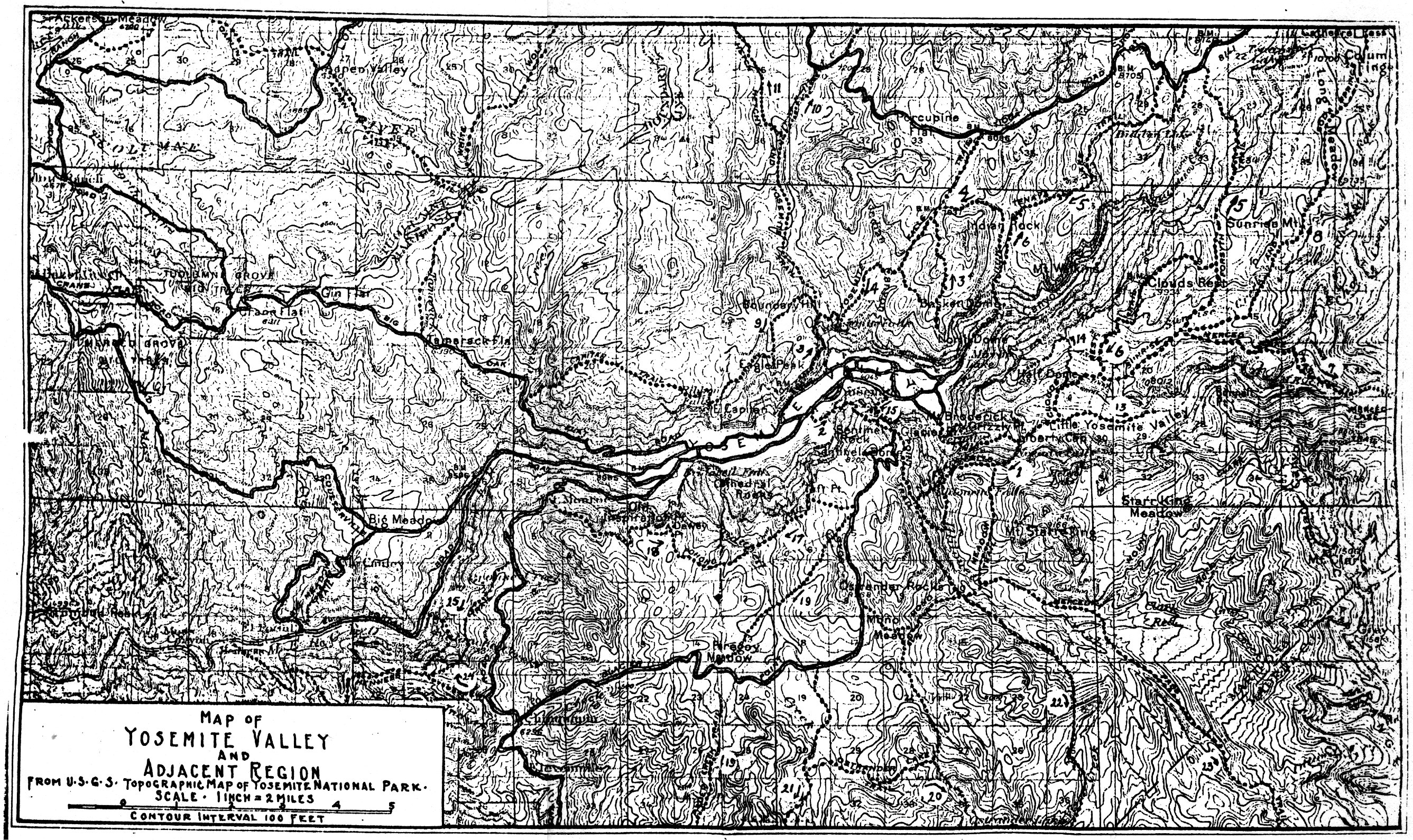
[click to enlarge] |
3. Seasons of 1918-19
By 1918 practically all the primary park roads had been gravel covered and widening and straightening of routes had begun. During the 1918 season, construction began on three new trails: because snow often covered Vogelsang Pass, crews constructed an alternate route between Merced Lake and Tuolumne Meadows via Babcock and Emeric lakes to the divide at Tuolumne Pass; another new trail left the Tioga Road at the Yosemite Creek bridge and proceeded eight miles to Ten Lakes Basin on the south rim of Tuolumne Canyon; the last, the Ledge Trail, climbed Glacier Point behind Camp Curry, an improvement of the earlier, exceedingly steep trail that nevertheless cut the distance between the valley and Glacier Point to less than two miles. Finally in 1918 workers built a new Sentinel Bridge across the Merced River just east of Yosemite Village. Of reinforced concrete beams and native granite, the three-span, two-lane bridge measured ninety-seven feet long and twenty-three feet wide. The superintendent noted during that season increased visitor appreciation of the high country north of the valley, as evidenced by extensive camping throughout the higher mountains.
In the 1919 season the Sierra Club enabled climbers to more easily scale Half Dome by providing a stairway to the summit. It consisted of two sections, the first a 600-foot stretch of zigzag trail and stone steps on the small dome. On the second, 800-foot section up the incline on the large dome, a double handrail of steel cables set into a double line of steel posts set in turn into sockets drilled in the granite every ten feet assisted the ascent. Experts from the Sierra Club accomplished the work with the park meeting part of the expense.
4. The 1920s Period
a) Improvement of Roads and Trails Continues
Trail marking has always been a difficult task. The state of California had used painted signs, white on blue and green on white, to mark trails. Many of these continued in use into the late 1920s. Possibly because of the loss of several of them, the civilian rangers began tacking shakes to trees at each trail junction displaying directions printed on them with lumberman crayons. The Sierra Club marked trail junctions with painted coffee can lids in the mid-1920s to make them easier to find. In the 1920s trail measuring involved attaching an odometer to a bicycle wheel. A long handle attached to the spokes reached to the saddle. Subsequent marking involved nailing small round tin tags with numbers and letters on them identifying specific trails. In 1927 the Park Service made green signs of porcelain-covered metal. A few of these still mark restrooms and maintenance roads. In 1930 the old signs at the Mariposa Grove were removed and replaced with wooden slabs bearing the names of important trees and necessary statistics.
During the 1920-21 season, work crews completed trails from Harden Lake on the Tioga Road to Pate Valley in the bottom of the Grand Canyon of the Tuolumne River and down that canyon from Glen Aulin to the lower of the Waterwheel Falls. In addition to constructing trails in the Tuolumne Canyon, laborers completed two bridges for saddle and pack animals: a fifty-foot double-span one at Glen Aulin seven feet wide and a fifty-five-foot single-span one at Pate Valley also seven feet wide. A masonry-faced arch bridge over Yosemite Creek in Yosemite Valley and a reinforced concrete beam bridge over the Merced River near Happy Isles were among the improvements of the 1921 fiscal year. The North Road across El Capitan Meadow was raised in 1922 to prevent its flooding and the road from Camp Curry over Clark’s Bridge to Mirror Lake was widened in 1923.12
By 1923 the highway from Merced to the gateway of Yosemite National Park had been paved through Merced County and graded and graveled in Mariposa County to its termination at Briceburg.
[12. Fitzsimmons, “Effect of the Automobile,” 54. See Hall, Guide to Yosemite, for a description of roads and trails at that time.]
In 1924 the California State Highway Commission installed a convict camp at Briceburg on the Merced River, whose residents began construction on the last seventeen-mile section of the Ail-Year Highway to El Portal. Also that year the park reopened the section of the Pohono Trail between Fort Monroe and the Pohono Bridge that had been abandoned for many years. This action enabled visitors from the valley to make the trip to Glacier Point on foot or horseback without using the Wawona Road. A new bridge on the trail was erected over Bridalveil Creek. This same year workers cut a stone stairway out of the rock wall to replace the wooden stairs on the Vernal Fall Mist Trail. Laborers also finished most of the trail from Pate Valley to Waterwheel Falls through the Tuolumne Canyon that year. In addition they built a new two-span bridge over the Tuolumne River on the trail to Soda Springs, a single-span structure over Rodgers Canyon Creek on the Tuolumne Canyon trail, and a bridge over Return Creek. The park also reconstructed approximately three miles of the Mariposa Grove road system, while the remaining three miles remained essentially as when constructed in the 1870s. In 1925 trail crews completed two miles of new trail from the junction of the Pohono Trail at Bridalveil Creek on the south rim of the valley to the junction of the Glacier Point-Wawona trail via Alder Creek. A branch extended to Bridalveil Meadow and the Glacier Point road. By April workers had almost completed the trail through Muir Gorge so that hikers could pass from Waterwheel Falls down the Grand Canyon of the Tuolumne to Pate Valley. (The Sierra Club had regularly used this canyon trail for years and had marked their own route and installed a register at Muir Gorge.) An improved trail through there had been one of John Muir’s greatest wishes, and through the urging of the Sierra Club, Director Mather had become interested in the project, construction of which had been directed by Gabriel Sovulewski. The Tuolumne Canyon trail was finally completed in September. New bridges included one on the Snow Creek Trail, one for saddle and pack animals over a branch of the Tuolumne River at Pate Valley, and another one over Rancheria Creek on the trail to Tiltill and Hetch Hetchy valleys.
b) Hetch Hetchy Area
Another problem that Mather faced near the start of his parks administration revolved around the city of San Francisco’s road and trail responsibilities under the Raker Act, which city and county representatives had in 1913 declared their willingness to perform. After the war Mather began insisting that the city meet its obligation by constructing good concrete roads. He and City Engineer O’Shaughnessy talked considerably of the matter but had not resolved the impasse by the time of Mather’s death in 1930.
During the summer of 1925 the board of supervisors of the city and county of San Francisco passed a resolution directing the city Board of Public Works to remove the Hetch Hetchy Railroad tracks and related apparatus between Mather and Damsite and to resurface the roadway to make it available for vehicular traffic. The park deemed this an important action from an administrative standpoint and also to open up the northern part of the park to tourist travel. Since June 1923, according to park superintendent W. B. Lewis, the railroad had only been used for propoganda purposes, bringing in people who used the city’s services to impress them with the importance of the reservoir as a water supply and to build up public opinion against utilizing the Tuolumne watershed for tourist purposes. The Park Service then wanted the city to construct a scenic road around the north side of the reservoir (never constructed) to provide access to the trail system leading up the Grand Canyon of the Tuolumne and into the northern part of the park.13 The Park Service and the city decided not to allow tourist travel over the steep and narrow roadbed from Hetch Hetchy to Lake Eleanor, which contained dangerous switchbacks. On 19 September 1925 the new nine-mile auto road between Mather Station and the Hetch Hetchy dam officially opened to the public, an event regarded as heralding a new era of development for the Hetch Hetchy region.
[13. W. B. Lewis, Superintendent, Yosemite National Park, to the Director, National Park Service, 18 May 1925, including “History of Hetch Hetchy Project,” typescript, 14 pages, in Box 84, Hetch Hetchy “Gen’l 1923-24-25,” Yosemite Research Library and Records Center, 13.]
c) Auxiliary Valley Roads
The auxiliary valley roads received little attention prior to 1920 when the park constructed a new road behind the present New Village to the government barns and storehouse. Also that year a new road was completed west of Yosemite Lodge and in 1921 an access road was provided for new employee cottages.14 In 1919 the Mirror Lake road had been realigned. The road through Camp 7 was built in 1921, dissecting the camp, and another ran across Cook’s Meadow by 1924.15 The New Village construction of the mid-1920s resulted in additional road building in that area, including auxiliary roads to the government barns, shops, and housing. Roadways in the campgrounds were also extended in the mid 1920s. The alternate route to the Old Village—the south branch of the South Road—became an auxiliary route as traffic to the Old Village decreased. The most significant era in increasing total miles of auxiliary roads occurred from 1929 to 1938. Final construction of auxiliary roads in the lower valley included a new route to the river from the North Road at the east end of El Capitan, a new road into Bridalveil Meadow, and an access road to the new sewage plant opposite Bridalveil Fall. The alternate route to the Old Village site was finally eliminated.16
[14. Fitzsimmons, “Effect of the Automobile,” 57.]
[15. Ibid., 51.]
[16. Ibid., 58-59.]
One of the main objectives of the development program initiated by construction of the New Village was to move facilities off the main valley highways. ‘The present main circuit roads on both sides of the valley and crossing the valley resulted from this planning. The new Ahwahnee Hotel would be placed on a spur road. The new South Side Road was built at a distance from Camp Curry with a spur road into the camp. In the same way, the New Village was built on a loop road so that only those desiring services there had to enter the area. The main road bypassed that village.17
[17. Frank A. Kittredge, Superintendent, Yosemite National Park, Memorandum for the Regional Director, Region Four, Re: Development in Yosemite Valley, 25 June 1947, in Box 78, “Box A-NPS Files,” “Development - Part IX,” Yosemite Research Library and Records Center, 2.]
d) The Park Service Initiates a Road-Building Program
By 1924 Yosemite auto travelers still suffered over 138 miles of rutted wagon road, as did visitors to all of the national parks. Puny Congressional appropriations over the past several years did not begin to cover the costs of maintaining or building roads in rugged mountain terrain, during short working seasons, and under the extreme care that had to be taken to preserve scenic values. By 1924, however, need for better roads had become acute. Finally, after some astute lobbying, the 1924 Congress voted the Park Service its first real road-building authorization — seven and a half million dollars for a three-year program. Although this appropriation would not begin to cover the cost of roads of the standard needed in the future, Mather intended to use the money as far as it went to improve current roads by widening, reducing grades, and eliminating curves, and to build roads in parks where none existed.
All national park road planning since 1917 had emanated from the office of George E. Goodwin, Chief Engineer of the National Park Service in Portland, Oregon. Around 1925, however, the Park Service and the Bureau of Public Roads made an agreement under which major park roads would be built and maintained. The Bureau’s Senior Highway Engineer Frank A. Kittredge, who ultimately became Chief Engineer of the Park Service after Goodwin’s departure, and also liaison with the Bureau of Public Roads, drew up in 1926 a road program for the entire National Park System.18 Because of the great increase in travel to national parks and because the State Highway Commission was building roads leading to Yosemite to a higher standard than those the park had originally contemplated, the construction program had to be revised and a policy adopted of building within the parks roads of the same standards as those leading into them.
[18. Shankland, Steve Mather, 152-59. Herb Evison pointed out the type of relationship that existed between the Bureau of Public Roads and the National Park Service:
. . . almost from the beginning, the maintenance of close relations with the Bureau [of Public Roads] has been a function of landscape architecture rather than engineering. The competence of Bureau engineers has seldom been subject to question; on the other hand, Service concern in road design and in road construction practices has been with fitting these “necessary evils” into the landscape with the least damage, unobtrusively, softening the lines of demarcation between road construction and the bordering undisturbed landscape.
This has called for the special skills of the landscape architect. Thus the flattening and rounding of cut slopes, the provision of natural-looking vista clearing, and the wedding of the road margins with the adjacent land through carefully planned planting of native vegetation have given a special and widely copied character to park and parkway roads.
S. Herbert Evision, “The National Park Service: Conservation of America’s Scenic and Historic Heritage,” 1964, typed draft, 663 pages, in Library and Archives, Division of Reference Services, Harpers Ferry Center, Harpers Ferry, West Virginia, 454.]
In 1925 then, Director Mather announced a radical change in the Yosemite road building program, including immediate steps to relocate both the Wawona and Big Oak Flat roadbeds to provide a gentler grade and to realign and reconstruct the Tioga Road. Mather stated that the Park Service intended to build the best mountain roads that money and the science of highway engineering could devise. This was obviously in response to the imminent completion of the All-Year Highway, which park officials realized would cause an immense influx of new visitors and severely impact the substandard park roads. Beginning in 1925, work began on widening, improving, and paving the El Portal road while park crews prepared a site for a ranger station/residence and checking stations at Arch Rock to serve the expected flood of visitors upon the opening of the All-Year Highway. The road below the checking stations had to be widened to accommodate four lanes of traffic in 1928. Two roads connecting the North and Middle (Ahwahnee) roads in the valley were built in 1925. Other accomplishments around that time included completion of the Camp Curry bypass road and relocation eastward of the El Capitan Bridge and its approaches.19
[19. Fitzsimmons, “Effect of the Automobile,” 51.]
e) Improvement of Wawona Road and Relocation of Big Oak Flat Road Contemplated
In 1926 the National Park Service and the Bureau of Public Roads signed a Memorandum of Agreement for the construction of major roads within the national parks. In California, the district engineer of the bureau in San Francisco assigned an engineer to do reconnaissance work in Yosemite and lay out an integrated road system enabling future work to be planned properly and undertaken systematically. The Bureau of Public Roads representative, Harry S. Tolen, first surveyed the Wawona Road, the most heavily travelled route in the park prior to completion of the Ail-Year Highway. Except for widening of the grade between the valley floor and Inspiration Point in 1924, and occasional drainage work, the road had never been improved.
Tolen found that the section of the Wawona Road between Yosemite Valley and Grouse Creek, which passed over the mountain at Inspiration Point, would never be a satisfactory grade. The point’s height above the valley floor and the short distance from there to Bridalveil Creek necessitated a very steep grade that would be hazardous during the winter months. After detailed study of that portion of the Wawona Road, Tolen determined that a satisfactory grade could be obtained only by running the road along the bluffs. Because of their steepness, it would be necessary to drive a tunnel through them, an innovation in highway construction in the parks. It would take two years to reach a decision on the location of this portion of the Wawona Road.
The Park Service determined to relocate the Big Oak Flat Road between Crane Flat and Yosemite Valley farther to the south, shortening the distance between the valley floor and Crane Flat and enabling it to be opened earlier in the spring. It proposed to abandon the Tioga Road from Crane Flat to Carl Inn and from Carl Inn to White Wolf and substitute a new alignment directly from Crane Flat to White Wolf via the upper reaches of the South Fork of the Tuolumne River. That would shorten the route to Tuolumne Meadows, save elevation, and provide a high-standard road.
f) Reconstruction of Wawona Road Begins
An event destined to have a major impact on tourist visitation to Yosemite took place on 31 July 1926—the official opening of the new Yosemite Ail-Year Highway to motor travel—a celebration coinciding with the seventy-fifth anniversary of the Mariposa Battalion’s discovery of Yosemite Valley in 1851. The most important roadwork achieved during that time involved paving of the valley roads by the Bureau of Public Roads from 1927 through the early 1930s. The new roads greatly facilitated the park maintenance schedule by requiring less repair, less gravel to be dredged from the Merced River, and less sprinkling. This in turn released park crews and equipment for other necessary jobs. The rebuilding of the road system in the 1920s and the paving revolutionized travel conditions in the valley. It not only brought in increasing numbers of visitors, but made traveling safer and more pleasant, and improved scenery and vegetation along the roadside that was no longer obscured by the dust of passing autos. “The one act of rebuilding and paving the roads probably did more to return the Valley to its natural appearing condition than anything since the stagecoaches first churned up the dust many decades before.”20
[20. Kittredge memo to Regional Director, 25 June 1947, 3.]
In the summer of 1927 the Park Service assumed maintenance of the road between Mather Station and Hetch Hetchy and began to issue auto permits and collect fees. The good condition in which the park maintained the Wawona, All-Year, Big Oak Flat, and Tioga roads during this time resulted in a remarkable increase in travel to the park. On the valley floor road crews made good progress toward completing paving of another thirteen miles of roads, resulting in a total of twenty-nine miles of paved major roadways in the valley. The park opened four miles of oil macadam surfaced road between Yosemite Village and El Capitan Bridge.
Also that year the Park Service started planning for five new bridges in the valley. Two would replace the Pohono and Clark’s bridges, two would cross the Merced River near Kenneyville, and one would be a new bridge over Tenaya Creek. In accordance with President Wilson’s executive order of 28 November 1913 requiring that, whenever artistic questions arose on federal projects, proposed plans be submitted to the National Commission of Fine Arts in Washington, D. C., for comment, a committee of that commission considered the Yosemite bridge designs. Director Mather believed that the design of bridges in national parks was one of the Park Service’s most important architectural problems. Because some existing structures in parks had drawn considerable criticism from architects, landscape engineers, and others, Mather determined to achieve in the future the best possible structures in terms of both design and execution for particular location.
Trail and associated bridge work continued in 1927. Crews constructed two bridle bridges over the lower and upper crossing of McClure Fork on the trail to Washburn, Babcock, and Boothe lakes. They also rebuilt the bridge over Illilouette Creek on the Vernal and Nevada falls-Glacier Point Trail at a new location upstream. Yosemite National Park’s first nature trail was laid out in Yosemite Valley in 1927, succeeded by a permanent trail in 1929. Clifford Presnall developed this “Lost Arrow Nature Trail, “which was used until 1933. Presnall also developed nature trails along the Sierra Point and Ledge trails, the latter abandoned after two seasons due to vandalism.21
[21. Richard R. Wason, “Yosemite Nature Trails,” Yosemite Nature Notes (September 1953).]
In 1928 Director Mather and the Bureau of Public Roads decided to begin reconstruction of the Wawona Road, postponing relocation of the Big Oak Flat Road at least one year. They made that decision for several reasons: first, the state had no immediate plans to construct the Buck Meadows-Crane Flat link that would insure that the entire Big Oak Flat Road could be used within a reasonable period of time after the park had completed its section; second, the road work around Hetch Hetchy required of the city of San Francisco under the Raker Act had to be coordinated with the Big Oak Flat Road work, and so far the city had given no indication as to when it would carry out the requirements; and third, more time was needed to work out landscape details on the Big Oak Flat Road where it ascended the north wall of the valley to prevent marring of the cliffs. The Park Service believed that a timely reconstruction of the Wawona Road would result in some immediate benefits to the park. The improved road would make the Mariposa Grove an all-year attraction, add to the winter sports lure of the park, and open up camping areas along the Glacier Point road that would relieve the crowded conditions in the valley. 22
[22. Stephen T. Mather, Memorandum Re Wawona and Big Oak Flat Roads, 19 April 1928, in Central Files, RG 79, NA.]
|
Illustration 69.
Happy Isles Bridge, built 1929. Note tunnel for bridle path Photo by Linda W. Greene, 1984. |
[click to enlarge] |
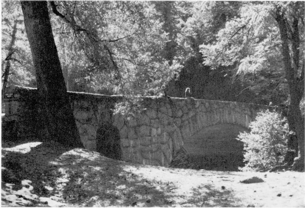
g) Valley Stone Bridges Constructed
By the end of 1928 a system of hard-surfaced roads extended over the valley floor, necessitated by the increased travel due particularly to the opening of the Ail-Year Highway into the park. Road work at this time included the five bridges mentioned earlier. A total of eight granite-faced, concrete arch bridges were constructed on the floor of Yosemite Valley between 1921 and 1933. All were of similar design, with variations in size and configuration. Built of reinforced concrete veneered with native granite, they each had either one or three arches with finely cut keystones. The structures include the Yosemite Creek Bridge built in 1922; the Ahwahnee Bridge (Kenneyville #1), crossing the Merced on the Mirror Lake Road; Clark’s Bridge, crossing the Merced on the Curry stables road; the Pohono Bridge, crossing the Merced at the beginning of the road to El Portal; the Sugar Pine Bridge (Kenneyville #2), crossing the Merced on the Mirror Lake road; and the Tenaya Creek Bridge, all built in 1928; the Happy Isles Bridge built in 1929, which had underpasses on each side of the river for bridle paths; and the Stoneman Bridge, built in 1933. Designed by the senior highway bridge engineer of the U. S. Bureau of Public Roads in collaboration with the Landscape Division of the Park Service to accommodate all classes of traffic and to harmonize with their natural surroundings, they had been endorsed by the National Commission of Fine Arts. In 1928 workers also replaced two bridges on the Tioga Road, one at the Yosemite Creek crossing and the other at the lower crossing on the Middle Fork of the Tuolumne River, and constructed a bridge across Cascade Creek on the Big Oak Flat Road.
h) Trail Work Continues
Because of a lack of funds and as a matter of general policy, the Park Service during the mid- to late 1920s did not feel justified in building separate trails for hikers and riders, but followed the practice of building trails suitable for both classes of travel. The bulk of trail construction at that time concentrated on dust-proof paths. During 1928-29 workers built three or four miles of dust-proof trails to points of interest along the valley walls, reaching elevations sufficient to enable extensive views of the valley. One such path extended through the Lost Arrow section to the foot of Yosemite Fall, another led to the Royal Arches, and another climbed to a lookout point above and west of Camp Curry. During 1928 the Park Service reconstructed the Four-Mile Trail some distance from the old one as well as several sections of bridle path in the valley. Other work included reconstruction of the Mist Trail, mostly along its old route. Steps had been installed in the steep areas, and a pipe rail was to be placed along the most dangerous portions of the trail by 1929.
During the 1928-29 travel season in Yosemite, the Park Service noted a year-round movement of people rather than just summer visitation. Winter sports played a large part in attracting visitors during what had once been considered a dull season in Yosemite. The improvements made to roads entering and in the valley also increased the popularity of valley travel. The Big Oak Flat Road from Gentry to Gin Flat was being widened, surfaced, and dustproofed. Some curves and grades were reduced at the same time. At the same time, the Park Service and the concessioner slowed their building programs, both organizations believing that development on the valley floor had reached its peak. By 1929 the valley contained twenty-nine miles of paved road; ten miles of bridle paths; fifteen miles of paved walks; fifteen miles of oiled roads; six new road bridges; two large, paved parking areas (at Happy Isles and Mirror Lake); and several small footbridges across the Merced River (between camps #12 and #14, camps #7 and #16, camps #6 and #16, and between old Camp Ahwahnee and Yosemite Lodge).
In addition to continuing work on the Four-Mile Trail in 1929, crews rebuilt and shortened the Merced Lake trail between the valley floor and the lake. They also improved the Vogelsang Pass trail from Merced Lake to Tuolumne Meadows, which had been abandoned a few years previously because of its dangerous condition. Laborers then relocated the Firefall Point foot trail near Glacier Point and built a masonry wall at Firefall Point. Four new trail bridges were built in 1928-29, and workers replaced the old Vernal Fall bridge of the Glacier
|
Illustration 70.
Map showing roads in Yosemite Valley, ca. 1929. Central Files, RG 79, NA. |
[click to enlarge] |
5. Some Valley Naturalization Begins
During the 1930 season, a crew began obliterating old roads across the meadows on the south side of the valley floor, changing them whenever possible into bridle paths, and then landscaping the area. The digging of ditches to prevent autos from driving across meadows in the valley helped improve the park’s appearance. In April 1930 the collapse of the upper member of its western truss destroyed the El Capitan Bridge, constructed in 1915. Park officials immediately condemned the structure and barricaded the road. They proposed installation of a new structure one-half mile east of the old site. Workers restored the site of the old bridge to as natural a condition as possible as part of an ongoing program to obliterate the most unsightly spots on the valley floor.
Bridge construction in the 1930 season included replacement of the Silver Apron Bridge below Nevada Fall with a new log structure, repair and reconditioning of the Swinging Bridge in the valley, and replacement of one span on the footbridge to Yosemite Village. Laborers also installed a bridge on Tenaya Creek above Mirror Lake in connection with a new trail there.
|
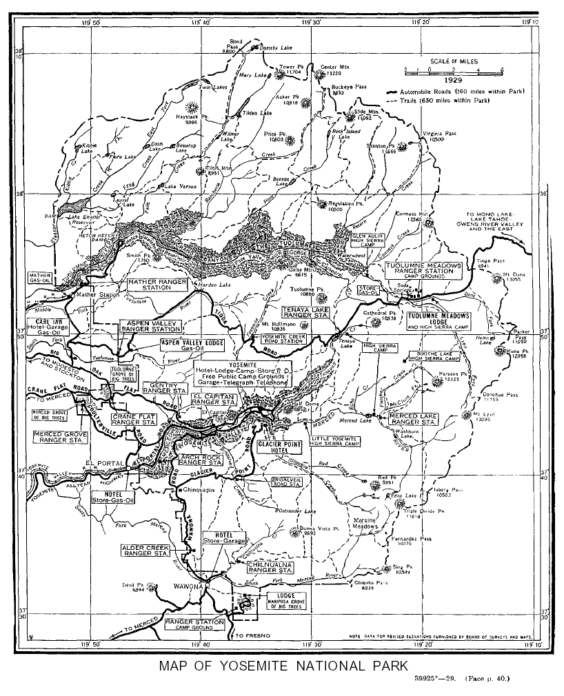
Illustration 71.
Map of Yosemite National Park, 1929. From Circular of General Information Regarding Yosemite National Park, California (Washington: Government Printing Office, 1929). |
[click to enlarge] |
The new Four-Mile Trail (actually 4.62 miles long) was completed in June 1930. The trail crew then moved to Nevada Fall to begin work on that section of the Merced Lake Trail. That work involved relocating and reconstructing the old trail from Happy Isles, past Vernal and Nevada falls, through Little Yosemite and Lost valleys, to Merced Lake. In places where workers had to cut into the granite ledge, they treated the walls chemically to restore the color. A trail change also took place near Boothe Lake after the Curry Company moved its hiker’s camp east to a point near Upper Fletcher Lake for sanitary reasons. Secretary of the Interior Ray Lyman Wilbur authorized the city of San Francisco to begin construction work on the scenic trail around the north side of Hetch Hetchy reservoir from O’Shaughnessy Dam to Tiltill Valley and Lake Vernon in 1930. In connection with that project, bridges were constructed across Tiltill and Falls creeks.
1. The Park Service Slowly Builds Needed Structures
Building construction progressed slowly in Yosemite during the first few years of Park Service administration. Immediate reasons for the lack of development included division of the nation’s attention and resources to the World War I effort and the multitude of organizational and funding questions confronting the new bureau’s leadership. At the same time, the Park Service needed to formulate a clear, long-term development policy before expending vast sums of money on construction. During the winter of 1915-16, the wagon shed used by the Yosemite Stage and Turnpike Company in Yosemite Valley collapsed under the weight of heavy snows and was damaged beyond repair. In the spring of 1916 the company gained permission to erect a portable office building in the valley.23 Up until 1917 the area between the later New Village and the north valley walls and between Yosemite and Indian creeks held few permanent structures. Beginning in 1917 the government constructed a complex of service buildings north of the cemetery, including barns, shops, and storage sheds.
[23. Gabriel Sovulewski to Yosemite Stage & Turnpike Co., 14 March 1916; W. B. Lewis, Supervisor, to S. G. Owens, Manager, Yosemite Stage & Turnpike Co., 18 April 1916, in Box 63, Yosemite Stage & Turnpike Co., Yosemite Research Library and Records Center.]
The first housing for government employees in Yosemite consisted of the cottages formerly used by the War Department at Camp Yosemite—renamed the Yosemite Falls Camp, which had been sealed to make them usable during the winter season. Government barns and a wagon shed, frame with shakes, were built in 1916. A new schoolhouse built in 1917-18 accommodated fifteen to twenty pupils, mostly children of government personnel, although the children of park concessioners and their employees attended it in the early fall and late spring. It stood near the northeast corner of Hutchings’s old farm. Laborers also erected a machine shop near the other government shops and barns during the 1917-18 season. In June 1917 the park established a government mess. After one summer in the inadequate tent quarters, however, the operation moved into the old Jorgensen cabin near Sentinel Bridge, which the artist had vacated after relinquishing his concession. A committee of three men appointed by Superintendent W. B. Lewis made the studio into a clubhouse for members of the mess by converting it into a kitchen and dining room.
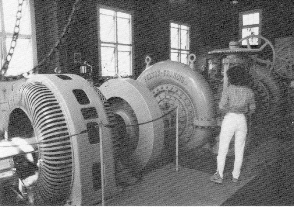
The Sundry Civil Act of 1 July 1916 contained $150,000 for the erection of a new power plant in the park. Park officials considered the plant an absolute necessity because of increasing demands for power, light, and heat by the park concessioners. The sale of electric current would also provide substantial revenue for the park. In general, the Interior Department believed that the federal government should own and control power plants, water and sanitation systems, and telephone lines in national parks so that concessioners could invest all their money in further development of their own enterprises and because, as public
|
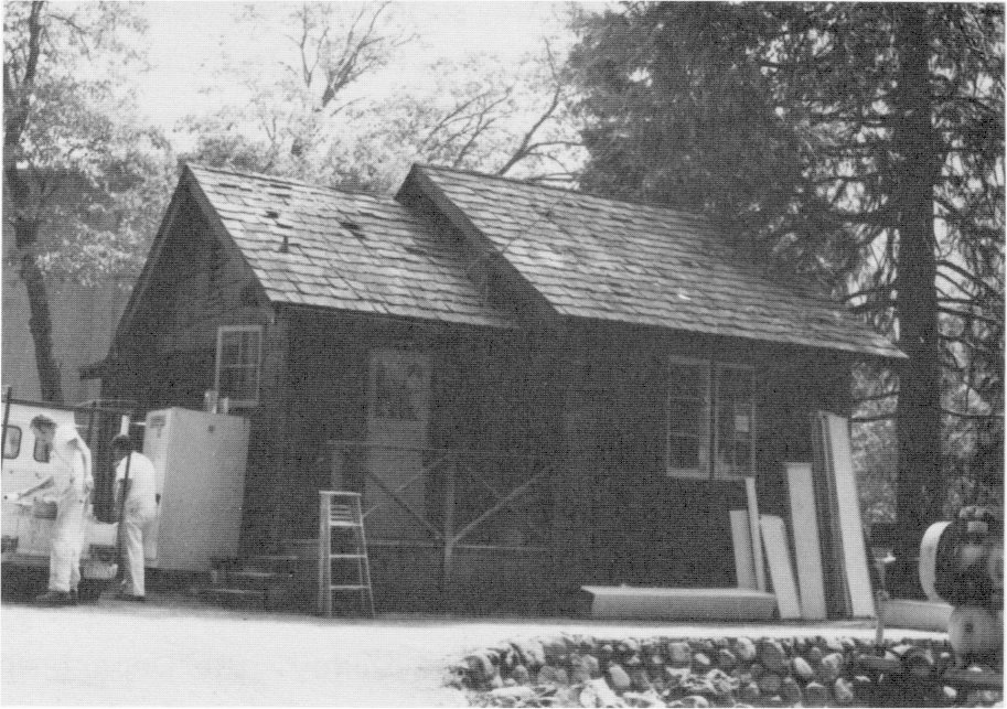
Illustrations 72-73.
Examples of early structures in Yosemite Valley maintenance yard. Photos by Robert C. Pavlik, 1984. |
[click to enlarge] |
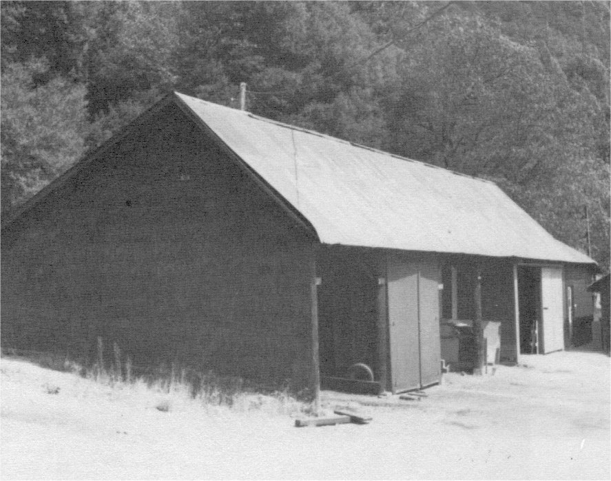
[click to enlarge] |
|
Illustrations 74-76.
Water intake and penstock of Yosemite Valley power plant. Photos by Gary Higgins, 1984. |
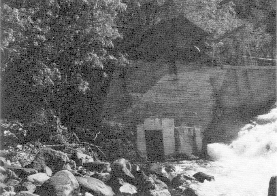
[click to enlarge] |
[click to enlarge] |
[click to enlarge] |
|
Illustrations 77-79.
Interior of powerhouse and Cascade residence #101 and garage #333. Photos by Gary Higgins and Robert C. Pavlik, 1984. |
[click to enlarge] |
[click to enlarge] |
[click to enlarge] |
[24. Information on 1916 NPS activities is found in “Report of the Superintendent of National Parks” and “Excerpts from reports of supervisors of national parks” in Reports of the Department of the Interior for the Fiscal Year Ended June 30, 1916. Volume I. Secretary of the Interior, Etc. (Washington: Government Printing Office, 1917), 762-63, 789-94.]
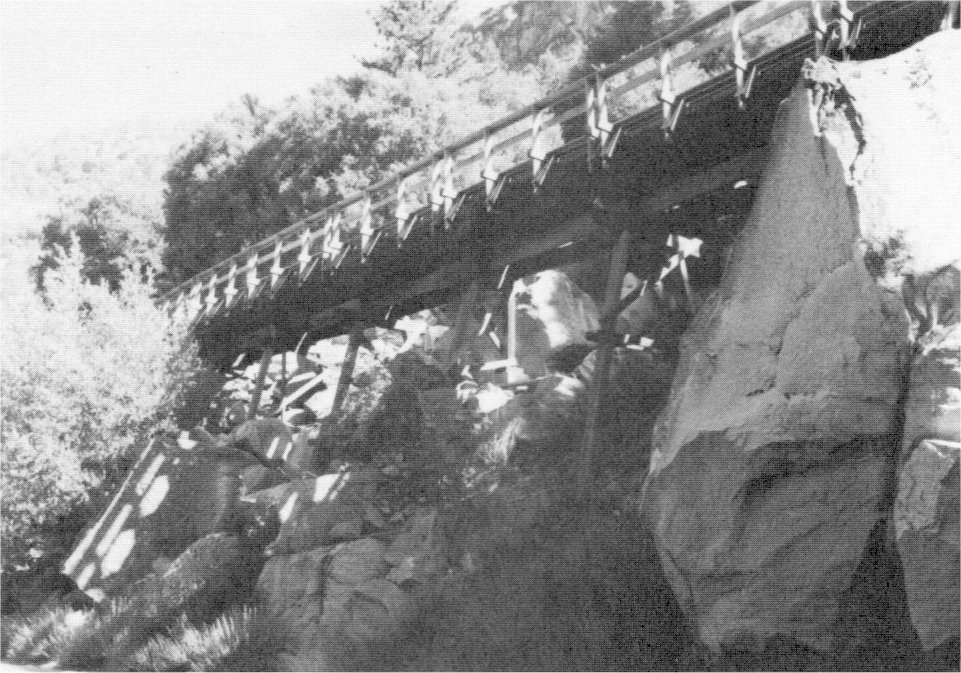
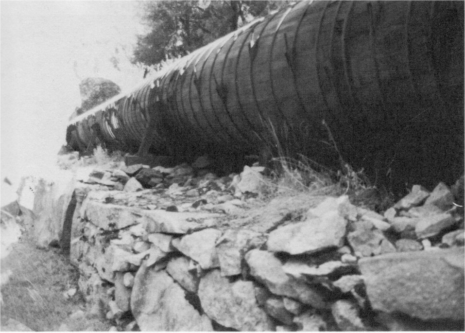
The park located the small diversion intake dam for the plant at the head of the rapids in the Merced River near the Pohono Bridge and the powerhouse near Cascade Creek, the latter designed to be as inconspicuous as possible. When completed, the plant would generate enough power to light all Park Service buildings, all camps, the new hotel, and all the main roads and footpaths in the valley. It would also provide for heating and cooking at the hotel and permanent camps. The Interior Department carried out the work under the supervision of the Superintendent of National Parks, through Galloway and Markwart, supervising electrical engineers in San Francisco.
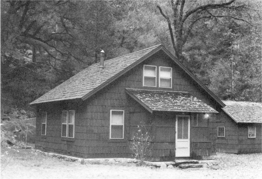
Because of unexpected difficulties during excavation of the division dam—the first component of the plant built—the cost of the structure increased. Congress made an additional $60,000 available in 1917 to complete the plant; its generating capacity was also increased from 1,000 to 2,000 kilowatts. Beginning operations on 28 May 1918, the plant included the timber crib diversion dam spanning the Merced River about one mile below the Pohono Bridge at the intersection of State Highway 140 and the Big Oak Flat Road. The penstock, or conduit, that transports the water under pressure to the power plant, begins just past the intake and screens in the north abutment of the diversion dam. It consists of concrete, redwood stave, and riveted steel sections. The wooden portion, supported on wooden trestles, runs along the hillside north of the Merced, from the dam west to the powerhouse. Within the powerhouse, located about one mile west of the dam on the north bank of the Merced alongside Highway 140, two General Electric 1,000-kilowatt dynamos connected to two Pelton turbines. The Park Service dedicated the plant to Henry Floy, the New York electrical engineer whose voluntary study of the power problem and subsequent report and presentation of the project before the Congressional House Appropriations Committee resulted in the project’s successful conclusion. Sequoia National Park received the old electric plant above Happy Isles, which the park removed in 1919. During 1917-18 workers constructed three cottages to house operators at the new power plant. These still stand in The Cascades area and are used for employee housing.
Crews constructed the one-story frame ranger station at Aspen Valley on the Tioga Road in 1918, as well as the Gentry Ranger Station on the Big Oak Flat Road, and the Mariposa Grove and Chinquapin ranger stations. The park eliminated four of its early campgrounds between 1919 and 1925. The Mirror Lake road realignment. of 1919 resulted in abandonment of Camp 10; the Church Bowl took over the site of Camp 20 in 1920; the New Village post office rose on the site of Camp 18, which was eliminated in 1923; and the Ahwahnee Hotel was constructed on Camp 8 grounds in 1925-26.25
[25. Fitzsimmons, “Effect of the Automobile,” 106.]
2. A New Village Site Is Considered
Director Mather and other Park Service officials considered it essential to build a new administrative area in Yosemite Valley because of the rapidly growing volume of traffic in the summer. Commercial and service activities of the park still centered in the early village at this time. The increased tourist volume, however, was rapidly making that area obsolete. The necessity for all campers to register and receive camp assignments at park headquarters in the village resulted in heavy congestion on the main street. In addition, the administration building was too small to handle the large crowds and the village site as
|
Illustration 80.
Map of Yosemite Village. From Hall, Guide to Yosemite, 1920. |
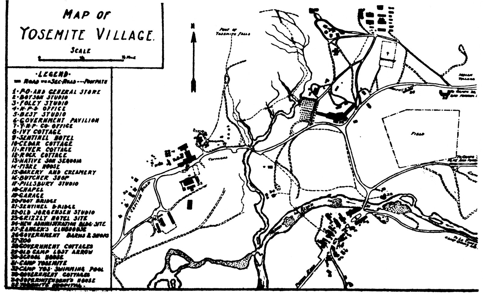
[click to enlarge] |
| “At the U. S. National Park Service Administration Building are the offices of the Park Superintendent, Chief Ranger and other executive officers. In front of the building is a free information bureau with a park ranger in charge. Government maps and bulletins may here be obtained free or at a very nominal cost. Adjacent is a motorists’ information bureau maintained by the California State Automobile Association. At the left entrance is the telegraph and telephone office maintained by the government. The Yosemite Museum, which contains many excellent exhibits of the flora and fauna of the region is temporarily housed in this building.” |
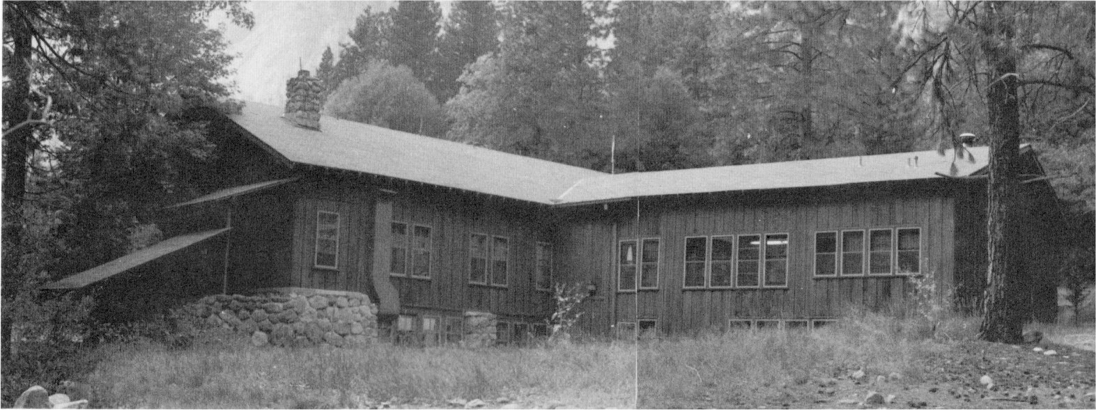
Landscape Engineer Charles Punchard spent 7-1/2 months during 1918-19 in Yosemite, which Director Mather had chosen to be his showplace of the national park system. One of Punchard’s primary tasks involved locating a new village site, in addition to rearranging campgrounds and landscaping existing facilities. At the same time he studied landscape problems in other western parks. Punchard also began working on one of Mather’s pet projects, which involved providing a dormitory for the Yosemite rangers. The design of the completed Rangers’ Club pleased the director so much that he announced it would serve as a model for new construction in the park.
During this period Yosemite Valley became headquarters for the Park Service landscape program. Buildings erected beginning in 1921 to plans devised by this Landscape Engineering Division were the first examples of a new Park Service rustic style involving natural materials that harmonized with their particular environment. By late 1922 Landscape Engineer Daniel Hull, who had taken over after Punchard’s death, recommended to Mather that architect Gilbert Stanley Underwood be hired to develop ideas for the -new Yosemite administration and post office buildings. The Fine Arts Commission, however, rejected his designs as being inappropriate and too complex. Mather brought in another architect, Myron Hunt of Los Angeles, who developed an acceptable design for the administration building and also helped Hull and Mather complete a final plan for the valley redevelopment.26 The unified architectural design of the new administration center would feature battered stone veneers, shake siding and roofs, exposed logs, and hip roofs, long, horizontal lines would blend into the rock cliffs behind the village.
[26. William C. Tweed, “‘Parkitecture’: Rustic Architecture in the National Parks,” November 1978, draft, 133 pages, 29-32, 34, 39-40.]
The new Yosemite Village residential district was located among the trees and brush against the north valley cliffs. It consisted of curved streets and residences built to be environmentally harmonious with their environment. Punchard performed much of this early planning work. Part of the development called for moving three of the early army structures into the new group of residences and out of their intrusive locations in the meadow. An appropriation of $35,000 for construction of the new administration building and approval by the Post Office Department of plans for the construction, under a lease arrangement, of the new post office building started the relocation process.
3. The 1920s Period Involves a Variety of Construction Jobs
During the 1920-21 season, construction projects included four employees’ cottages, two auto sheds in the shops and barn group on the valley floor, a roadhouse and barn at Bridalveil Creek on the Glacier Point road, and a checking station at Gentry’s at the top of the grade on the Big Oak Flat Road. Activity during the 1921 fiscal year also produced a modern sewer system, preliminary improvements to the water system, additional sanitary provisions in the public camping grounds in the valley, and initial improvement of sanitary conditions in the camp in Tuolumne Meadows. In that same year Park Service Director Stephen Mather donated money for the Rangers’ Clubhouse—a personal gift to the officers and rangers of Yosemite—containing a large kitchen, dining room, lounge, and dormitory. To personalize the structure, each ranger with a record of two years of continuous service in Yosemite could nail a shoe from the hoof of his favorite horse on the lounge wall.
In 1923 the park erected ten comfort stations in the public campgrounds in a further effort to improve the sanitary situation. Similar work projected for fiscal years 1924 and 1925 would eliminate the serious sanitary situation that had prevailed in the public camps for the past several years. Additional structures built at this time included four more employees’ cottages in the valley and a frame bunkhouse at Chinquapin on the Wawona Road. After dam construction ended at Hetch Hetchy in 1923, the Park Service hoped to secure a barn, bunkhouse, mess house, and office located in the city of San Francisco’s construction camp. The city decided to retain its caretaker’s building and guest cottage, but turned the rest of the buildings over to the Park Service for their salvage value. Although the Yosemite Park and Curry Company proposed establishing a lunchroom and boat service at the dam, the city and Park Service ultimately agreed that the government would not encourage developments near the dam that might become a menace to the purity of the water supply. People would only be encouraged to visit and view the dam.
During the 1924 travel season crews began installing a ranger station, checking kiosk, and public comfort station at the foot of the Wawona grade in the Bridalveil area and started work on similar units at the Alder Creek station on the Wawona Road and at the El Capitan station at the foot of the Big Oak Flat grade. (Workers moved the old ranger residence at the El Capitan checking station to a new location and reconstructed i t.) Additional work included a ranger station and a small administrative headquarters—consisting of a comfort station, a house for the road maintenance crew, a mess house, a barn, and ranger living quarters—at Tuolumne Meadows on the Tioga Road. The ranger station was built to serve also as a contact station and entrance station into the park from Tioga Pass. It ceased to function as an entrance station with the construction in 1931 of a new one at the Tioga Pass summit several miles east, and its visitor contact function moved to a new building in 1936. It continued to serve as a ranger residence and office. Nine more comfort stations were added in 1924 in the public campgrounds. That same year construction began on a rough stone lookout station at Glacier Point, housing field glasses, to serve during the summer months as headquarters for a nature guide. This structure was an important aspect of the park’s new interpretive program and is discussed later in this chapter.
In November 1924 Director Mather presided over the dedication of the new administration building and the laying of cornerstones for the new museum, post office, and Pillsbury’s Pictures, Inc., Studio in the new Yosemite Village. This occasion marked the first step in the abandonment of the old village. The administrative, post office, and museum buildings, plus the Rangers’ Clubhouse would form the nucleus of the civic center, which would eventually include other studios and stores. After moving various units of the old village to the new site, the old buildings no longer needed, including the Sentinel Hotel, would be razed and the landscape restored.
In 1925 work crews completed a kiosk at Grouse Creek as part of a new checking station, and finished similar structures at Alder Creek and El Capitan. On 30 May 1925, the California Conference of Social Workers unveiled a tablet in memory of John Muir, marking the site of his sawmill and cabin. Earlier, on 19 May, a memorial plaque honoring Dr. Bunnell, member of the party that discovered the Yosemite Valley, had been placed on a large boulder in Bridalveil Meadow, a gift of the California Medical Association. Superintendent Lewis noted that this was the first time that any of the points of historic interest in the park had been permanently marked.27 Other work that year included relocation of the old ranger station at Tuolumne Meadows, constructing steps over the granite rock to the new Glacier Point lookout station, moving the ranger station structure from the Bridalveil checking station to a new location in the Lost Arrow residential group, and constructing a new four-room cottage from the material obtained from the wrecking of the old administration building. Also that year Director Mather decided to locate the ranger station on the El Portal road at Arch Rock, necessitating construction of a by-pass road on the north side of Arch Rock to accommodate outgoing traffic. J. W. Boysen started construction on a new studio in the New Village in 1925. [Editor’s note: the correct spelling is J. T. Boysen (Julius T. Boysen)—dea]
[27. W. B. Lewis, “General Statement,” in “Superintendent’s Annual Report,” 1925, n.p. (22?), in Yosemite Research Library and Records Center.]
Workers completed the new Arch Rock ranger station/residence in 1926. Construction during 1927 included moving the checking station at Arch Rock to the righthand side of the road for incoming cars, building an entrance gate at the park line on the Hetch Hetchy road, putting finishing touches on two new employee cottages in the valley, building the form work for a new detention building in the valley, establishing a ranger station and barn on the South Fork of the Merced River near Wawona, and constructing the Merced Lake patrol cabin to aid in snow surveys. In November of that year a fire in the stock room of Pillsbury’s auditorium destroyed the workrooms and theatre portion of the building along with two darkrooms and developing rooms.
In 1928 a change in the Arch Rock station general plan due to unexpectedly heavy traffic necessitated moving the two checking buildings from their location above the rangers’ living quarters to a site a short distance below the residence. A small building architecturally similar to them was moved from the El Capitan station and placed in the center of the Arch Rock group to facilitate the traffic flow.28 The park addressed the need for better housing for Yosemite schoolteachers by beginning construction of a suitable building on the school grounds at the end of 1928.
[28. John B. Wosky, Jr., Landscape Architect, to Thomas C. Vint, Chief Landscape Architect, 27 June 1928, in Box 28, YP&CCo. Architectural Reports, 1927-1939, Yosemite Research Library and Records Center.]
Further development during the 1929 season involved a comfort station in the Glacier Point campground. One of the oldest Indians in Yosemite Valley, John Brown, had accomplished most of the stone masonry work on that structure. In Yosemite Valley, construction consisted of a new hospital building; an employee cottage; a women’s dormitory; two frost-proof toilet buildings in the newly established winter campground in the area now known as Sunnyside, or Camp 4; and remodeling of the superintendent’s residence, garage, and laundry. At the same time, a stone wall creating a pool at the outlet of a spring adjacent to the Merced Lake trail near Happy Isles, about where the Sierra Point trail intersected it, was nearing completion.
4. The New Hospital and Superintendent’s Residence
The building used as a hospital in Yosemite during the early Park Service years was the same facility that the War Department had used, slightly remodeled. It contained three rooms for patients, a small operating room, a nurse’s area, and a reception/consultation facility. The physician’s family used three other rooms as living quarters. Heavy tourist travel and the park’s distance from major hospital facilities increased the need for first-class service in the park. During the 1920-21 season a small addition to the hospital had made it possible to furnish better dental service.
By 1923 the park considered new hospital facilities absolutely essential because of increased visitation from all parts of the country, leading to the rapid spread of contagious diseases, and the unfamiliarity of most visitors with the rugged terrain of the park, resulting in many accidents. During the summer tents often had to be utilized for patient care, while other individuals ended up on the hospital porch. Many needy people often had to be turned away for lack of space.
In the 1928 Interior Department Appropriation Act, Congress granted money for the construction of a new hospital. The structure, dedicated in 1930 and later named for former park superintendent Washington B. Lewis, filled the long-felt need for modern medical, surgical, and dental facilities in the park. Located on the north side of the valley, halfway between the New Village and the Ahwahnee Hotel, the frame building, stone veneered below the first floor, had both a ward and
|
Illustration 81.
Lewis Memorial Hospital, Yosemite Valley. Photo by Robert C. Pavlik, 1984. |
[click to enlarge] |
|
Illustration 82.
Paint shop in Yosemite Valley maintenance yard (former Indian Village residence). Photo by Robert C. Pavlik, 1984. |
[click to enlarge] |
The new superintendent’s residence, a two-story frame structure, was erected on the same site as the previous one. Workers basically tore down the earlier army structure, leaving only the framework of the dining room, kitchen, pantry, breakfast nook, one bedroom, and a bath, which were incorporated in the new house. The garage and laundry building had burned in the early summer and also had to be replaced. The new laundry unit was attached to the house. Work on this modern six-room structure ended in October 1929. The convertible women’s dormitory completed during the year was a four-room cottage.29
[29. Edward A. Nickel, Assoc. Structural Engineer, “Report on Building Construction, Season of 1929,” 8 February 1930, in Central Files, RG 79, NA.]
5. The Indian Village in Yosemite Valley
During 1929 Superintendent Charles G. Thomson took a census of the inhabitants of the old Indian village, located in the area now occupied by the Yosemite Medical Group (former Lewis Memorial Hospital). He found sixty-seven Indians living there in makeshift dwellings formed from ragged tents, old boxes, and other cast-off materials. Although these residents possessed no formal rights to a reservation and had no legal rights entitling them to reside in the valley, the Department of the Interior and the superintendent agreed that those who had been born in the valley and could trace their ancestry to either the Miwok or Mono Paiute Indians had a moral right to continue living there. The village had to be moved to another location, however, because of the impending construction of the new hospital on that site. Superintendent Thomson also considered the old village too unsightly and unhealthy to remain.
Accordingly Thomson selected a new village site about one-half mile west of Yosemite Lodge. The superintendent assigned the small, three-room cabins to selected Indians, under special use permits, who rented them at a nominal monthly fee. Only those Indians living in Yosemite in 1929 who could trace their ancestry to early inhabitants of the area were considered for housing. Furthermore, government policy dictated that quarters be assigned only to the man as head of the family or to a woman whose husband had died or left her. If a woman remarried, she lost the right to live in the new village and was obligated to move unless her new husband had a moral right to reside there. The moral right was passed on to the first male child in each family. Relatives and other Indians from outside the valley could not reside in the new village for long periods. The Park Service considered supervision of the community life of the Indians one of its administrative responsibilities.30
[30. Harold E. Perry, “The Yosemite Indian Story: A Drama of Chief Tenaya’s People,” 1949, typescript, Yosemite Research Library and Records Center, 6-8.]
6. More Construction and Removal of Some Older Structures
Building construction, repair, and relocation during the 1930 season included, in Yosemite Valley, erection of a four-family employees’ residence and a staff residence as well as replacement of the wooden trestles on the hydroelectric pipeline. A new raised platform in Camp 15 provided a stage for the public entertainment presented each weeknight during the summer.
Crews also accomplished repair work, reshaking, and painting on the Yosemite chapel in the Old Village. New entrance signs for campgrounds 7, 14, and 15, electrically illuminated to show up at night, were constructed and erected. The park then set aside several areas of the valley floor as picnic sites: Indian Cave, Happy Isles, beaches in the vicinity of the Giant Yellow Pine, a spot adjacent to the old bear pits
|
Illustration 83.
El Portal entrance boundary marker. Photo by Robert C. Pavlik, 1984. |
[click to enlarge] |
Outside the valley, the park completed erection of a boundary marker at the El Portal entrance, subsidized with funds donated by James H. Schwabacher of San Francisco, and accomplished landscaping around its base. The park had dismantled the earlier stone entrance pillars in 1926. Workers also tore down the old barn and corral downhill from the Glacier Point Hotel and began establishing three new patrol stations, at Benson Lake in the northern section of the park, at the South Fork of the Merced near Wawona, and at Buck Camp near the southern boundary of the park. Because of the location of the new Wawona Road at a considerable distance from the former one, it became necessary in 1930 to move the checking station or kiosk about sixty-five feet from the center of the old road to the center of the new one.
The removal of buildings in the Old Village proceeded slowly. Galen Clark’s home west of the village came down in 1921. By 1926 the old Boysen, Best, and Foley studios had been slated for destruction pending removal of those services to the New Village, but they managed to hang on a while longer. Destruction of the Old Village began accidentally with the Pillsbury movie house fire of 1927, followed by the Cosmopolitan Bathhouse fire in 1932. Planned removal began later in the 1930s, when from 1938 to 1941, the park removed the Rock, River, Oak, Ivy, and Cedar cottages and the Sentinel Hotel. The loss of its visitor accommodations resulted in a lessening of importance of the Old Village, which had already experienced a reduction in business as a result of the continuing growth of Yosemite Lodge and Camp Curry. The opening of the Ahwahnee Hotel in 1927 further increased visitor activity in other areas.
The New Village became the administrative center of the park, initially lacking commercial activity except for the studios. It has never offered visitor accommodations, but began providing food in the 1950s. Both the Park Service and concessioner had recognized the importance of abandoning the Old Village structures and the old Yosemite Lodge in order to relieve congestion. To that effect they had even signed an agreement in 1925 calling for the removal of the Old Village store and construction of a new one in the New Village within one year and removal of the old army barracks/Yosemite Lodge and construction of a new facility in a different location within five years.31 As it turned out, however, as late as the 1950s the Old Village still contained a studio, the pavilion (movie house), chapel, and the store, in addition to a few employee residences.32
[31. Kittredge memo to Regional Director, 25 June 1947, 3.]
[32. Fitzsimmons, “Effect of the Automobile,” 70-72, 74.]
1. Nature Guide Service
When Stephen Mather assumed the directorship of the National Park Service in 1916, he determined to provide park visitors with information on natural and historical features. Educational programs were part of his agenda from the beginning. Interpretation, an attempt to broaden human understanding of the physical, natural, and historical processes exemplified by varied Park Service properties, has been undertaken by that agency for many years. As early as 1904, Acting Superintendent James Bigelow, Jr., was attempting to educate people on the flora of the park and envisioned a much broader program. Director Mather also perceived that this type of education would give added dimension to the park experience and help gain support for Park Service programs.
Yosemite was not the first park to begin interpretive programs nor did the Park Service invent most of the fundamental interpretive techniques it adopted, such as the campfire program or guided nature walks. By 1919, interpretive activities were well underway within the National Park System. They included the newly instituted LeConte memorial lectures at Yosemite as well as campfire talks long offered by the Sierra Club; talks by Milton P. Shinner at Yellowstone National Park on its flora and fauna; campfire talks at Mesa Verde National Park by Dr. J. Walter Fewkes, Chief of the Bureau of Ethnology, who was undertaking archeological work there; and nature guide work in Mount Rainier and Rocky Mountain national parks.33
[33. Evison, “The National Park Service,” 397-98.]
The organized interpretive programs of the National Park Service, however, began in 1920 with initiation of Nature Guide services at Yosemite. The idea originated with Charles M. Goethe of Sacramento, who, with his wife, observed nature guides in Switzerland prior to World War I. Upon further investigation they found that several European countries successfully used trained guides to instill in their citizens a knowledge of nature studies.
The Goethes made intensive field studies of each country’s program, and, after the war, personally funded a nature guide program at Lake Tahoe to serve resort guests. That experimental program, designed to test the reaction of vacationists to nature talks and trips, became highly successful. Naturalists participating in the program were Harold C. Bryant, with the California Fish and Game Commission, and Loye Holmes Miller, of the University of California at Los Angeles. In the summer of 1919 Director Mather observed the guides and, impressed by their program, decided to introduce the concept at Yosemite. Mather hoped to prevent over-commercialization of the park by emphasizing its natural beauties. By promoting a deeper understanding and appreciation of the park’s values, Mather expected to inspire its visitors to contemplate the wonders of nature and how best to preserve them. In 1920 Bryant and Miller arrived in the park to organize a nature program.
Appointed as temporary rangers assigned to special duty as naturalists, they offered the first public interpretive services of the National Park Service. Their field trips and evening campfire talks proved highly popular. Dr. Carl P. Russell, who diligently researched the Park Service’s initial interpretive activities, wrote:
I think it is not necessary to go back further than the Goethe-Mather invention to recognize the first organized interpretive work in the parks. I believe that the Yosemite programs headed by Bryant, Miller, and Ansel Hall constitute the beginnings of coordinated and continuous interpretive work in the parks. The pioneer programs in Mesa Verde, Rocky Mountain, Yellowstone and Mount Rainier are to be recognized as contemporary with (or even earlier than) the Yosemite program but at first they were seasonal and not set up under a year-around National Park Service employee. M. P. Skinner [Yellowstone] did precede Hall in attaining park naturalist status . . . but Skinner seems to have functioned without the aid of ranger naturalists, while Hall had a small staff of seasonal employees and thus established a continuing tradition. . . . I feel that the Yosemite program of 1920-22 set the pattern, generally, and led the way for park naturalist programs throughout the Service.34
[34. Carl P. Russell to Daniel B. Beard, Chief of Interpretation, NPS, 1961, cited in Evison, “The National Park Service,” 396-97.]
2. LeConte Lectures
The establishment of the LeConte Memorial Lecture series at Yosemite by the University of California in 1919 slightly preceded installation of the Nature Guide Service. In memory of Professor Joseph LeConte, every year the Extension Division of that university sent eminent western scholars to Yosemite during the summer months to lecture on the natural history, geology, art, ethnology, and history of the region. In 1920 the Sierra Club and the National Park Service jointly erected an outdoor log auditorium 400 feet east of the LeConte Lodge.
3. Yosemite Museum Association
The success of the Nature Guide program inspired other educational work. The next task involved establishing a formal museum where natural, scientific, and historical specimens of the Yosemite and High Sierra region could be exhibited for study by the visiting public. The museum would serve as a public contact point and headquarters for the park interpretive program. The movement to establish a museum in every national park gained its momentum from Yosemite’s success in that area.
As stated earlier, in 1915 the acting superintendent at Yosemite had established a small museum in the administration building in Yosemite Valley where Chief Ranger Forrest S. Townsley’s taxidermy specimens formed the nucleus of the bird and mammal exhibits. The growing popularity with the public of the displays of natural history specimens, enthnographic materials, and other items of interest finally necessitated a larger building and a change of location. Ranger Ansel F. Hall was detailed from the park ranger force to begin the new museum project.35
[35. Ansel Hall, the first naturalist in Yosemite National Park, had graduated in forestry from the University of California. After engineering and forestry work in France for the army, Hall became Information Ranger at Yosemite in 1919 and Acting Park Naturalist in 1920. Hall, basically on his own initiative, began the Yosemite Museum, constructing geological models, assembling native crafts, and mounting natural history specimens. Shankland, Steve Mather, 259-60. Evison, “The National Park Service,” has stated that Hall “established a record as probably the greatest innovator of interpretive activities in Service history,” 395.]
In the summer of 1920 the old Chris Jorgensen art studio, abandoned by the artist in 1917 and acquired by the Park Service in 1919 and used as a rangers’ clubhouse, was designated the Yosemite Museum, and in 1922 the much-expanded park collection moved into six exhibit rooms in the 1899 bungalow. At the same time, the superintendent established a Park Naturalist Department, supervised by Hall, to operate the museum, conduct the Nature Guide Service, and supervise all educational activities. Similar educational and museum programs soon got underway in all major scenic parks and archeological areas. The American Association of Museums even sent Hall to study museums in Europe, North Africa, and the Near East. In 1923 Hall became the first Chief Naturalist of the Park Service, with offices in Berkeley, to coordinate and direct the interpretive work in all parks. At Yosemite, meanwhile, the museum collection grew quickly. Chris Jorgensen donated his extensive Native American basket collection to this interpretive effort in 1923. The collections had been further augmented by beadwork and other archeological materials from other sections of the country, by objects of historical value, and by additional natural history and geological specimens.
Realizing the impossibility of acquiring an appropriation for a proper museum building at that time, Chief Naturalist Hall in 1922 had suggested to Acting Director Arno B. Cammerer that an association be created to work toward that end while at the same time disseminating information on the park’s natural history and fostering the arts, customs, and legends of the remaining Indians of the Yosemite region. On 4 August 1923, the Yosemite Museum Association was organized under the auspices of the American Association of Museums with the goal of securing funds for the erection of a fireproof museum building in the park and promoting among the visiting public a better knowledge of the natural history of the region. The Yosemite Museum Association, predecessor of the Yosemite Natural History Association, became the first cooperating association established in the National Park System to further a park museum program.
In August 1924, in line with the director’s recommendation to establish small branch museums at points where special features of natural history could best be demonstrated, plans were made for the erection of a small trailside museum at Glacier Point that would be a branch of the Yosemite Museum and also serve as a lookout station. Designed by Park Service Architect Herbert Maier and Ansel Hall, and undertaken with the cooperation of the Yosemite Park and Curry Company, the Park Service, and the American Association of Museums, the building was completed in September and planned as a Nature Guide station. The small observation
|
Illustration 84.
Glacier Point overlook. Photo by Gary Higgins, 1984. |
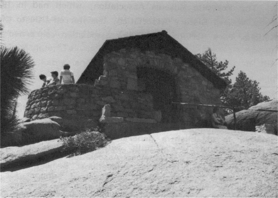
[click to enlarge] |
[36. Private funds, especially Mather’s, financed the Yosemite naturalist program for the first few years until its success became apparent. The effectiveness of the Yosemite Museum as headquarters for the park educational staff convinced the American Association of Museums to make further efforts to establish a general museum program in the national parks. New museums were built with additional funds from the Rockefeller foundation. The American Association of Museums lent strong support to the fledgling Yosemite educational project in the form of recognition of work well done and in financial support for continued development. The steady growth of educational services, centering around new museums in Yosemite, Yellowstone, and the Grand Canyon and other interpretive facilities, developed a public conscience of the good resulting from such activities in the national parks. These programs became. models for future work. Their success resulted in approval of plans for future services and, most importantly, in regular appropriations to implement those plans. The American Associaton of Museums continued to foster interpretive facilities throughout the National Park System. Public Works Administration funds in the 1930s further aided development of the museum program. A Museum Division of the Park Service was established in 1935. C. P. Russell, “A ‘Good-Bye’ and a ‘Hello,’” Yosemite Nature Notes. Carl Russell succeeded Hall as Yosemite park naturalist and as the Service’s Chief Naturalist. Also see Shankland, Steve Mather, 257-62, for a discussion of the beginnings of park interpretation and education, and Russell, 100 Years in Yosemite, 129-45.]
At the recommendation of the American Association of Museums and the Park Service, the Laura Spelman Rockefeller Memorial Foundation made a substantial donation to aid in the construction of a new Yosemite Museum in 1925, with exhibit rooms opening to the public in May 1926. Also designed by Maier, it was one of the first permanent national park museums. The Yosemite Museum Association, which had in 1925 become the Yosemite Natural History Association, transferred title to the building to the National Park Service. The new association concerned itself with developing the new museum; establishing subsidiary units, such as the Glacier Point lookout; aiding the development of the Nature Guide Service; and maintaining a library in the valley of volumes of historical, scientific, and popular interest to the public; promoting scientific investigations; and gathering and disseminating information on the cultural and natural history of the area. The group has continued to this day to make an influential contribution to the educational projects of the National Park Service in Yosemite. The native stone museum building, with its large wooden beams and shakes, harmonized well with its environment and became a model for other Park Service areas. The two-story structure contained exhibits, a library, storage facilities, a classroom, offices, and caretaker’s quarters.
An important part of the museum’s early educational program was the demonstration of Native American lifeways by local Indians. In the late 1920s Maggie “Tabuce” Howard, a Mono Lake Paiute woman, began demonstrating basketry and food processing techniques of the native peoples in a re-created Indian village behind the museum. In addition, a Southern Sierra Miwok man was hired to do traditional dances and demonstrate fire making and arrow manufacturing.
4. Zoo
Another more questionable attempt at public education began in 1918 with the display of three orphaned mountain lion cubs, whose mother had been killed, in an enclosure in Yosemite Valley. A brown bear cub captured during that season was added to this exhibit of Yosemite wildlife. By the late 1920s the park questioned the legitimacy of exhibiting live animals in captivity, except in exceptional cases in accordance with a well-considered educational policy and as an adjunct of the museum. In addition, the zoo’s location between the government residential and utility areas attracted visitors to a location that should have been closed to the public.37
[37. During Mather’s administration, predators, including mountain lions, coyotes, and wolves, were ruthlessly hunted down in many of the western national parks with the help of the Bureau of Biological Survey (later Fish and Wildlife Service). Mather believed in strong reductions of numbers but not complete elimination of native species. Shankland, Steve Mather, 269-70.]
Although not part of the zoo, an elk herd once grazed in Yosemite Valley. About 1921 it was feared that Tule elk, once numerous in the San Joaquin and Sacramento valleys, stood in danger of extinction due to reduction of their grazing areas. When only one wild herd remained, in Kern County, wildlife groups became greatly concerned over the animals’ future. In an effort to save them, interested parties captured a few individuals and shipped them to various parks in California.
The California Academy of Sciences, through the efforts of M. Hall McAllister, chairman of conservation, obtained permission to place twelve elk in Yosemite, between the New and Old Villages, in a wire fence paddock eight feet high enclosing twenty-eight acres of meadowland. This effort to reestablish a species native to the region at first seemed in accord with the park policy of maintaining original wildlife conditions. Here scientists hoped the elk would increase in number as well as provide pleasure and an educational experience for visitors. By 1933 the herd had increased to twenty-seven animals. Because the elk were actually exotic to the high country and National Park Service policy prohibited the introduction of non-native species, because of the unsightliness of the high fence, and because the animals’ grazing had detrimentally affected the meadow, the park transferred the elk to the Owens Valley in Inyo County that same year.
5. Indian Field Days
From 1917 to 1924, the National Park Service held Indian Field Days in Yosemite Valley in mid-summer, featuring a parade, horse races, Indian baby beauty contests, and prizes for the best Indian regalia. Miwok, Paiute, and other Indians attended to display their basketry, participate in rodeos, prepare Indian foods, and perform ceremonial dances. The Park Service even erected fake wigwams painted with pseudo-Indian designs to provide the “proper” atmosphere. It created an oval race track for the horse races in the middle of Leidig Meadow, which became an eyesore for several years. Many activities were obviously designed to cater to the visitors’ preconceived notions of Indian life and were of questionable authenticity. The Committee of Expert Advisers for Yosemite saw it as
essentially a white man’s race-meet or rodeo, in which some part is taken by Indians to whose Yosemite forebears such things were wholly unknown. In so far as the “Indian Field Day” is useful in maintaining the interest and morale of the Government and company employees some other device not disregardful of the landscape of the Valley could presumably be found. In so far as it is regarded as one of the “attractions” for visitors to the Valley it seems to us to have little more excuse than the introduction of a county fair or a full blown commercial circus.38
[38. “Draft of Report: Meeting of the Committee of Expert Advisers, Yosemite National Park, at Yosemite Valley, April 24th and 25th, 1930,” in Central Files, RG 79, NA, 18.]
The festivities did, however, provide some recognition of the Indian contribution to the development of the area, probably fostered some feeling of unity among the Indian population, and aided the Park Service cause by promoting a healthy tourist traffic during the off-season. The field days ended during the 1930s depression.39
[39. Craig D. Bates, “Ethnographic Collections at Yosemite National Park,” American Indian Art Magazine 7, no. 3 (Summer 1982): 28-30.]6. Interpretive Publications
In 1921 G. P. Putnam’s sons published Handbook of Yosemite National Park, compiled and edited by Ansel F. Hall. The park produced a popularized mimeographed booklet entitled “Yosemite Nature Notes” in 1922 to correlate the educational activities of the park and to cater to the needs of a public becoming increasingly interested in nature and history studies. The “Notes” appeared in 1926 as a printed journal and was published monthly until 1961. In 1924 the University of California Press published Animal Life in the Yosemite, by Joseph Bird Grinnell and Tracy Irwin Storer, a major inventory of park resources and an important contribution to the park’s nature study program.
7. Yosemite School of Field Natural History
Nature trails also became an important part of the park interpretive program. By 1925, however, it was evident that field-trained naturalists for park positions were at a premium and that most university-trained botanists and zoologists lacked field experience. Much knowledge had to be gained first-hand before it could be interpreted to the public. To fill the need for better-trained park naturalists—a direct outgrowth of the Nature Guide program—Dr. Bryant established the summer-long Yosemite School of Field Natural History. Its emphasis lay on field experience, involving observation and identification of living things in their natural environment, rather than on lectures and books. Started under the joint auspices of the Park Service and the California Fish and Game Commission, its staff consisted of park naturalists and other specialists in the field of natural history. Daily trail trips enabled students to study geology, plant and animal life, and ecology first hand. The school also studied park resource management efforts. For many years it furnished candidates for Civil Service naturalist positions, nature study teachers, and scout camp positions. The school continued until World War II. It resumed after the war for five years, finally closing in 1954. It provided valuable training in interpretation and in teaching of the natural sciences.
8. Research Preserves
In 1926 an area of seven square miles in the high country, along the Sierra crest and north of Tuolumne Meadows, was set aside as a reservation within which the flora and fauna would be left in their primitive state. All domestic animals, camping, and fishing were excluded for the purpose of making scientific studies of plants, animals, and geologic and other natural features under primitive conditions. The only reserve of its kind in the United States at the time, it became the subject of keen scientific interest. Yosemite became the first national park to establish an absolute nature reserve to be open only to naturalists and scientific students.
9. Development and Importance of Educational Work at Yosemite
Interpretive efforts in Yosemite developed slowly but steadily. In 1928 the park undertook interpretation at the Mariposa Grove, culminating in construction of the present museum there in 1930. The third structure to stand on that site in the grove, it continues the use of Galen Clark’s original cabin as a shelter and information center for visitors. The present structure is a reconstruction, or replica, of its predecessor, built by the state of California in 1881 but deteriorated by the 1920s.40 When the building had to be replaced, the superintendent ordered its reconstruction with special emphasis on a faithful exterior duplication because the structure was of great historic interest and familiar to a multitude of visitors. The resulting building was more substantial and durable than the old one, but still retained the historic atmosphere of that location.
[40. For further information on the Mariposa Grove Museum, see National Register of Historic Places Inventory—Nomination Form prepared by Leslie Starr Hart, NPS Cultural Resources Specialist, in 1975.]
A Junior Nature School began in 1930 to enhance children’s nature study experiences in the park. That same year, for the first time, the Educational Department of the National Park Service directed the
|
Illustration 85.
Old log cabin at Mariposa Grove. Photographer and date unknown. |
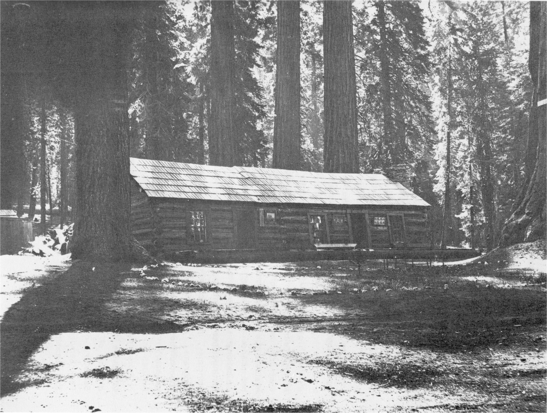
[click to enlarge] |
In 1928 the Secretary of the Interior, Hubert Work, aided by another Laura Spelman Rockefeller foundation grant, appointed a six-man Committee on Study of Educational Problems in the National Parks to evaluate the accomplishments of the Park Service’s educational programs, recommend improvements, and determine further opportunities for educational service to the public in the national parks. This group of distinguished scientists and educators outlined basic Nature Guide principles, made recommendations on the organization and development of programs, and pointed out the Park Service’s responsibilities and opportunities for education and research in the fields of history and science.
The committee recommended establishment of an advisory body to advise the director on educational matters and establishment of a division of education in the Washington office. In response, the next Secretary of the Interior, Ray Lyman Wilbur, established the National Park Service Educational Advisory Board to which he appointed most of the committee members, although the committee also continued to function.41 Also upon their recommendation, Park Service Director Horace Albright established a Branch of Research and Education in the Washington office to administer educational programs in the parks. He appointed Dr. Harold C. Bryant Assistant Director of the National Park Service in charge of the Educational Department in 1930.
[41. Evison, “The National Park Service,” 404-405.]
Albright had a strong interest in educational and interpretive programs. He spent much of his time trying to convince park superintendents to organize museums and interpretive programs. In 1930 and 1931 he secured increases in the Park Service appropriations for interpretive activities, including historical and scientific research projects. Under Bryant and Albright, the Park Service’s educational program thrived and became a major function of the bureau.42
[42. Swain, Wilderness Defender, 201.]
The educational advisory committee finally disbanded in early 1931. The Educational Advisory Board eventually merged into a permanent Advisory Board on National Parks, Historic Sites, Buildings, and Monuments. Congress authorized that board in 1935 through the Historic Sites Act to assist the Secretary of the Interior and the Park Service in formulating administrative policies and a broad program of study and preservation for the nation’s outstanding scenic, scientific, and historic areas. The board consisted of eleven members distinguished in specialized fields such as natural history, history, architecture, conservation, and planning.
The pioneer interpretive program inspired by the Goethes and launched at Yosemite became a highly significant conservation force by helping visitors understand and appreciate the chief features of national parks. It served as an example for all future educational development in this country’s parks. Through the years, as the benefits of educating the public became clear, similar interpretive programs expanded into state and municipal parks and organized education programs were instituted in every major national park and monument. The educational program of the Park Service became an official and major function of the organization and gave new importance to the professions of historian, archeologist, and naturalist.
At Yosemite, further efforts to not only display the resources of the park but also interpret them for greater understanding and enjoyment through the years have resulted in establishment of a central museum and visitor center, a major research facility, a nature center at Happy Isles, and the Pioneer Yosemite History Center at Wawona. The support to the park’s interpretive program from the Yosemite National History Association has furthered research efforts, expanded museum collections, and disseminated wider knowledge of Yosemite. Campfire circles, trailside museums and exhibits, and nature trails further inform park visitors about their surroundings and instill in them a stronger desire to protect our country’s natural, historical, and archeological resources.43
[43. Carl Russell, “A 40th Anniversary,” in Yosemite Nature Notes 39, no. 7 (July 1960): 153-55; C. M. Goethe, “Nature Study in National Parks Interpretive Movement,” in Yosemite Nature Notes 39, no. 7 (July 1960): 156-58; Loye H. Miller, “The Nature Guide Movement in National Parks,” in Yosemite Nature Notes 39, no. 7 (July 1960): 159-60; Harold C. Bryant, “The Beginning of Yosemite’s Educational Program,” in Yosemite Nature Notes, 39, no. 7 (July 1960): 161-65.]
1. The Desmond Park Service Company (Yosemite National Park Company)
a) The Desmond Company Receives a Concession Permit
As stated previously, Stephen Mather disliked the competitive nature of park concessions up to this time. He believed strongly that the ruthless competition and resultant pressure exerted on tourists, and the shoddiness of most of the park business operations, detracted from the visitor’s park experience in addition to being totally uneconomical. One licensed operator carefully supervised by the government, on the other hand, would result in less duplication, reduce the amount of park land tied up in business operations, and result in a stronger concession system. New capital could only be attracted to the parks, where normal business risks were compounded by short seasons, adverse weather, and peak-load problems if there were a guarantee of profit, such as could be ensured under a strictly regulated monopoly.44 The monopoly franchises Mather developed for the parks extracted either a fixed sum or one based on the number of customers or the amount of gross income as the fee for operating rights. Yosemite’s contract contained an alternative profit-sharing plan.45
[44. Shankland, Steve Mather, 120-21.]
[45. Ibid., 126. Mather made every effort to keep his chosen concessioner operating in the black. As the Yosemite National Park Company began to falter economically, Mather personally loaned it $200,000 to try to keep it going. He retrieved the loan after formation of the Yosemite Park and Curry Company and never suffered particular criticism for what some considered an unwise political move. Ibid., 133.]
In 1916 the Interior Department granted the newly organized Desmond Park Service Company a twenty-year concession to operate camps, stores, a dairy and garage, a saddle horse service, and transportation facilities in Yosemite National Park. Other provisions of the 1916 permit included construction of a hotel in Yosemite Valley and one at Glacier Point, maintenance and operation of at least three mountain “chalets” outside the valley, and construction of a new store and dairy, all to be ready for use no later than the beginning of the 1917 travel season. The destruction of the Black and Leidig hotels in 1888 and of the Stoneman House in 1896 had drastically depleted the number of visitor accommodations in the valley. For that reason, the old Sentinel Hotel had continued in use despite its decrepit condition.
The Desmond Company agreed to operate the old Sentinel Hotel until completion of its modern facility on the valley floor. That new structure would inaugurate General Superintendent Mark Daniels’s plan for a new Yosemite Village that would have more unity of design and compatibility with its environment than the old one. The Tenaya Lake and Tuolumne Meadows chalets, a new class of visitor service, would provide accommodations for travelers on the Tioga Road, which the Department of the Interior planned to fully develop over the next year. This entailed the first step towards consolidation of a hodge-podge of individual permits into an organized concession operation controlled by one company.
The Desmond Company immediately purchased Camps Lost Arrow and Ahwahnee, the Yosemite Transportation Company (1 September 1916), J. W. Coffman’s saddle horse business (9 May 1916), W. D. Thornton’s store in the Old Village (1 August 1916) and S. Cummings’s meat market (1 August 1916), and the assets of the Sentinel and Glacier Point (Mountain View House) hotels. Desmond discontinued camps Lost Arrow and Ahwanhee and established the new Yosemite Lodge, on the site of the old army camp, as a center of valley activity. Some of the buildings in the Yosemite Lodge area were moved from the Los Angeles aqueduct camps in Owens Valley around 1916 and used as rental units (the U-shaped and L-shaped units now used for employee housing). In April 1916 the Gutleben Brothers Construction Company converted an old army building at the former Camp Yosemite into lounge and dining facilities, constructed a laundry building and steam plant, a bathhouse, a swimming pool, temporary garage facilities, tennis courts and dance facilities, employee housing in Camp Tecoya east of the new lodge, and converted another old government building into the company’s valley storehouse. That same year the firm erected the foundation and substructure for the Grizzly Hotel, the company’s new valley accommodations, just south of the present government residential area.46 (The company never pursued the hotel’s completion. In February 1924 park laborers recovered the stone in the old hotel foundation and filled in the basement excavation.) Also in 1916 Desmond established the new El Capitan Camp, although its dining room and lobby burned down the next season. Thereafter the tents in that camp were rented through Yosemite Lodge.47
[46. “Outline of Work Performed in Yosemite National Park By Gutleben Brothers of San Francisco, April 1916-1952,” typescript, 6 pages, Yosemite Research Library and Records Center.]
[47. Frank A. Kittredge to Einar Wismer, 26 November 1941, in Separates file, Yosemite-Concessions, Y-16c, Yosemite Research Library and Records Center. According to A. B. C. Dohrmann, a financial backer of Desmond, the 1917 fire destroyed all the main buildings of the El Capitan Camp, necessitating providing for all its guests and employees in the dining room and other buildings of Yosemite Lodge. Because it happened at the height of the tourist season and in the midst of Desmond’s financial difficulties, it resulted in a second breakdown of Desmond’s health and his consequent replacement by T. E. Farrow. A. B. C. Dohrmann, Chairman, Reorganization Committee, “History of the Yosemite National Park Co. and it’s [sic] predecessor the Desmond Park Service Company. From the time of their financial embarrassment in 1916 up to the re-organization and re-financing as of January 1, 1920,” in Report of Yosemite National Park Company—Successor to Desmond Park Service Company for years of 1917-1918-1919, in Yosemite Research Library and Records Center, 3.]
b) Desmond Constructs Forerunners of High Sierra Camps
Desmond also began construction of his mountain chalets, forerunners of the present High Sierra camps, in 1916. Until establishment of those facilities, the few tourists who ventured into the backcountry had to rely on a packtrain and packer or carry their equipment on their backs. The first method was costly and the second tiring. Mather’s publicity trips into the high country to gain support for the parks had always been characterized by good food and various other creature comforts. It was this ability to view the beauties of nature without the attendant hardships of setting up camp and cooking that Mather wished to provide for all tourists. Heretofore, however, concessioners had been loathe to establish extensive camping accommodations in isolated sections of the park because of the expense and uncertainty of patronage. The newly created National Park Service, however, requested the camps in an attempt to draw visitors to the
|
Illustration 86.
Barracks moved from Owens Valley to Yosemite Lodge. Photo by Robert C. Pavlik, 1984. |
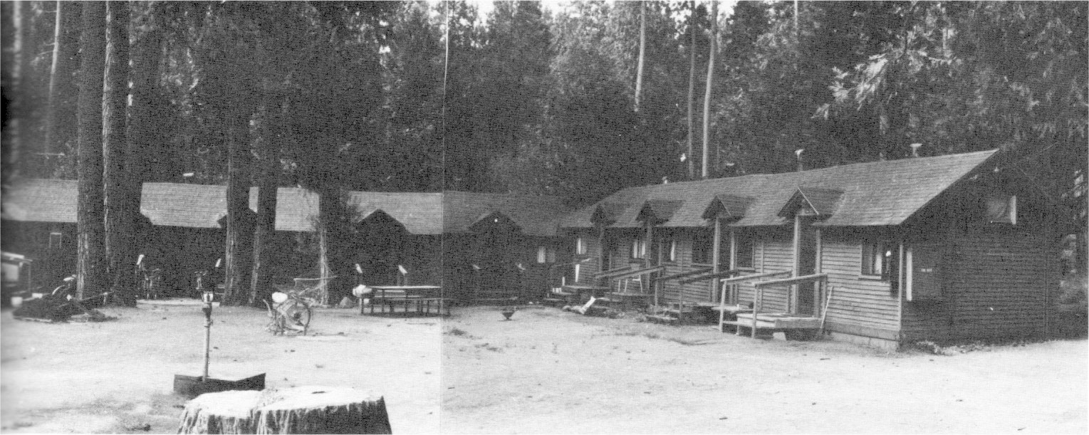
[click to enlarge] |
|
Illustration 87.
Glacier Point Hotel, constructed in 1917. |
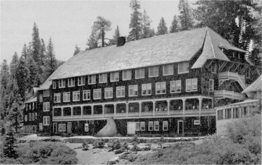
[click to enlarge] |
Each “chalet” consisted of an eighteen by eighty-four-foot combination lounge, dining room, and kitchen building, largely frame roofed with canvas. Guest tents surrounded the main building. Staff at each camp consisted of a manager, cook, and fisherman.48 Although the first two lodges were well patronized during the 1916-17 season, few visited the Tuolumne Meadows Lodge, which Desmond closed early with the intent of removing it to a better site.
[48. Lloyd B. Dennis, “The High Sierra Camps,” Bay Views (July/August 1980): 65.]
c) Yosemite National Park Company Formed
Desmond’s financial difficulties began in the fall of 1916, as a result of building beyond the money available, and the company attempted recovery through formation of a reorganization committee. After Desmond went to pieces mentally and physically in July 1917, the reorganization committee designated Thomas E. Farrow to manage operations for the balance of the 1917 season. The Gutleben Brothers Construction Company constructed the Glacier Point Hotel on the rim of Yosemite Valley between 1916 and 1917. They accomplished the difficult task of transporting building materials to the site with the cooperation of the manager of the Yosemite Lumber Company. He ensured that materials arriving at El Portal over the Yosemite Valley Railroad were transferred to the special flatcars and pulled up the cable tramway to the top of the ridge above the Merced River. From there a shay locomotive took them over the logging railroad to Chinquapin, where a receiving and reloading station was established. There men loaded the material into wagons for the fourteen-mile haul by mule team to the hotel site.49 Early in July 1917, the Desmond Company opened the hotel, which proved very popular because of its panoramic view of the Yosemite gorge, its tributary canyons, Vernal and Nevada falls, and the high, rugged Sierra peaks. The valley power plant transmitted electrical energy for lighting. The shingle-covered structure resembled a Swiss chalet in design, possessing a steeply pitched roof, several gables, and balconies. Because of the unfavorable reputation acquired by the Desmond Park Service Company due to its inferior service in 1917, the company changed its name to the Yosemite National Park Company on 12 December 1917. At that time Desmond resigned and severed all connection with the company.
[49. C. T. Gutleben to John C. Preston, 8 June 1964, in Separates File, Yosemite—Concessions, Y-16c, Yosemite Research Library and Records Center.]
Early in 1918 insufficient capital remained to carry on the business. The High Sierra camps closed in that year.50 A Receiver took charge of the company on 26 February 1918 and operated the property until January 1920. Because there were insufficient funds to operate in the 1918 season, the Receiver contracted with the Shaffer brothers, who leased the properties from the Receiver to operate for the season of 1918 with an option to purchase at the end of that time. Dick Shaffer and his brother Hal put up $50,000 to enter the business, which involved running the El Portal stage line; sightseeing buses; an auto garage and shop; the Sentinel Hotel; Yosemite Lodge; the village store; pack trains and stables; the Merced Lake, Tenaya, and Tuolumne Meadows lodges; a barber shop; and a bake shop. The Shaffers ran them from 1 April to 1 October 1918. The Shaffers offered the company $400,000 for the Yosemite business, but Dohrmann and the other directors wanted
[50. The Tuolumne Meadows camp on the Dana Fork of the Tuolumne River reopened in 1922. The largest and most popular High Sierra camp, it offers a store, a post office, a gas station, stables, and a public campground. The Merced Lake camp also reopened in 1922 as a sports-oriented boys camp with two tennis courts, two basketball courts, and a baseball diamond. The Curry Company rebuilt and expanded it in 1928. The Tenaya Lake camp closed in 1922. Some question exists as to whether each of the camps originally had stone kitchen structures. The Glen Aulin stone lodge was not built until 1935, while a 1923 inventory states Tuolumne Meadows had a frame and canvas lodge.]
|
Illustration 88.
Map of Big Trees Lodge site, 17 July 1920, revised 1923. NPS, Denver Service Center files. |
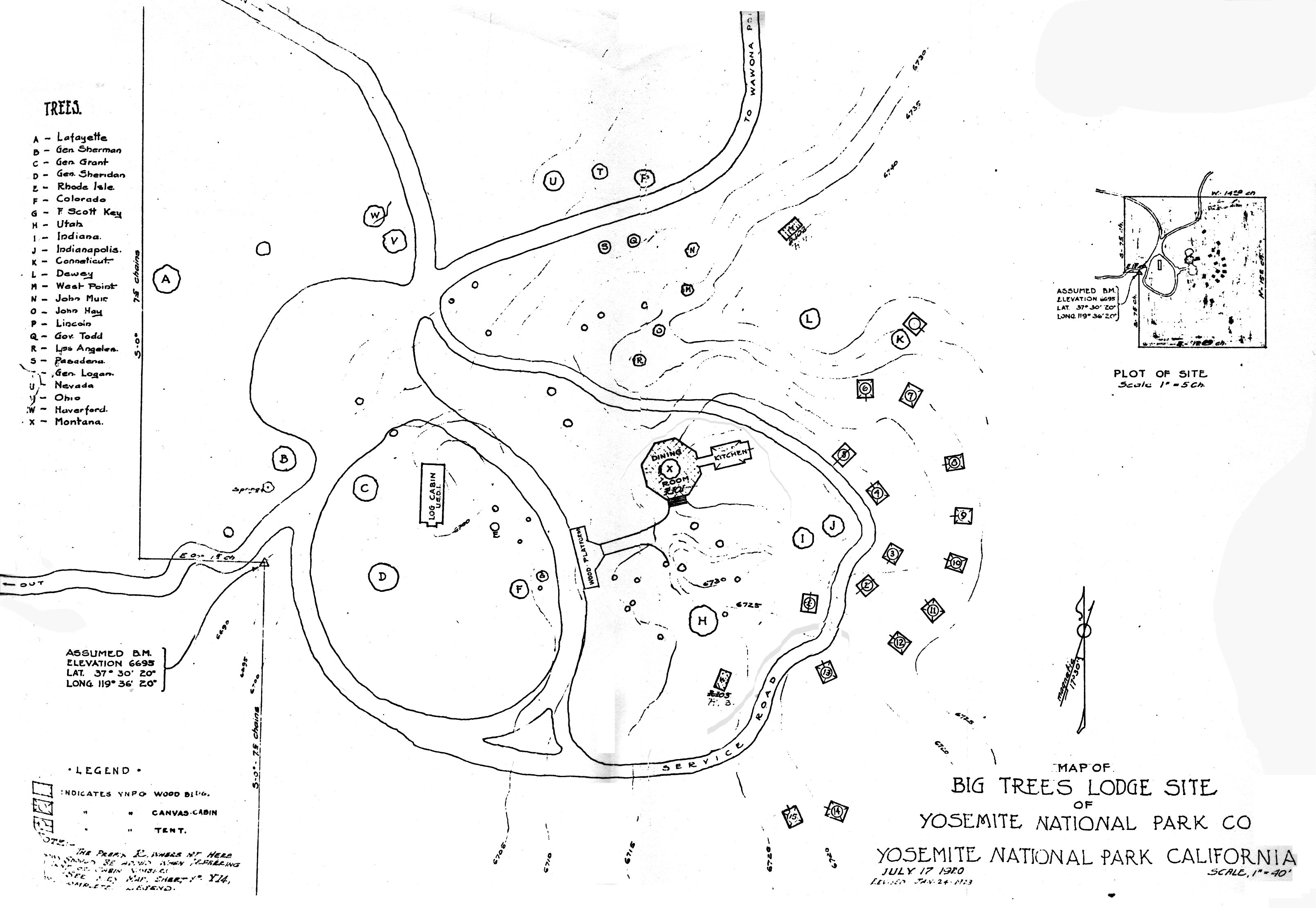
[click to enlarge] |
[51. “Some Historical Facts Regarding the Desmond Company,” C. P. Russell interview with Dick Shaffer, 2 July 1951.]
During the 1919-20 season, the Yosemite National Park Company erected a large garage and automobile repair shop and an attractive unit of wooden bungalows with bath facilities at Yosemite Lodge. It also erected Hetch Hetchy Lodge at Mather, which later became part of the Mather Recreation Camp, and a tent camp in the upper section of the Mariposa Grove (Big Trees Lodge), consisting of a rustic central cafeteria building around the base of the Montana tree and a group of portable wooden cabins and tents.
After much reorganization effort, including a new contract with the Department of the Interior and help with financial support from a group of men in San Francisco and Los Angeles, the receivership was lifted and a new board of directors elected, the reorganized company taking active charge on 1 January 1920.52
[52. Homer Robinson, “Desmond Park Service Co.,” April 1951, in Box 60, Museums, Yosemite Research Library and Records Center; Dohrmann, “History of the Yosemite National Park Co. and it’s [s\£] predecessor the Desmond Park Service Company,” 1-7; and Memorandum for the Press: New Hotels for the Yosemite, Department of the Interior, 22 November 1915, in Box 3, Washburn Papers, “File of Misc. Army Correspondence,” Yosemite Research Library and Records Center.]
During August 1920 the company closed the Sentinel Hotel and made extensive improvements in the form of additional baths and electrical heating and cooking installations in an effort to attract winter travel to Yosemite Valley. In 1921 the Yosemite National Park Company owned the Glacier Point Hotel, the Sentinel Hotel, Yosemite Lodge, a print shop, a garage, a general office building, Hetch Hetchy Lodge, a store, a photo studio, a meat market, the village post office, an equipment warehouse, and a main warehouse. In 1922 the Yosemite Lodge complex included the main building, 35 double redwood cabins with bath, 30 single redwood cabins with bath, 116 redwood cabins without bath, and 198 canvas cabins, as well as 50 tents and one dormitory. The Big Trees Lodge had 14 wooden cabins.53
[53. Robinson, “History of Business Concessions,” “Yosemite National Park Co.,” n.p.]
d) Bear Feeding Expands
The increased visitation to Yosemite caused a variety of natural-resource related problems, not all of which concerned fire protection, meadow degradation, or river control. Attracted by campers’ foodstuffs and the ever-expanding park garbage pits, bears began to make nightly camp raids. A barrage of visitor complaints prompted the National Park Service to begin a bear scrap feeding program in an effort to lure them away from visitor use areas. This basically comprised government institutionalization of a practice already followed by some of the early hotel owners as a popular form of visitor entertainment.
Knowing that they would be fed later in the day, bears began hanging around near the garbage pits during the day, begging from cars along the. main park highways to fill the time between feedings. In 1923 the Yosemite National Park Company built a special feeding place for bears near the Merced River bank a mile below Old Yosemite Village. Hundreds of visitors collected there very night to watch the bears eat and play on an electrically-lighted platform. Park Service rangers even began putting on interpretive programs there in the evenings before the bears ate. By the early 1930s, bear feeding had become one of the summer’s prime attractions.
The large number of bears and the large numbers of people were bound to start getting on each other’s nerves. Careless visitors began to resent being scratched or clawed as they tried to feed the furry beggars and the valley hospital staff kept busy each season binding the wounds resulting from this interplay. Bears became less a “cute” attraction and more of a pest to the visiting public. In an attempt to reduce the accident rate and reintroduce the bears to wild food gathering, the Park Service prohibited feeding, teasing, or molesting the animals. The valley, however, simply did not contain enough natural resources to feed the number of bears living there. Also, as long as the pits and camp foodstuffs were available, the bears had no intention of moving on, and visitor-bear contact continued to pose problems.
Eventually the Park Service perceived the bears, which had lost their fear of man, as a significant threat to visitor safety. Coupled with an increased awareness of Park Service responsibilities for the preservation of wildlife in its natural state, this resulted in a phasing out of the scheduled, interpreted feeding of bears in the fall of 1940. At that time rangers also began trapping bears and moving them out of the valley.54
[54. Ferris H. Scott, The Yosemite Story, (Santa Ana, Calif.: Ferris H. Scott, Publ., 1954), 54. The trapping of bears was largely an incidental assignment for park rangers and lacked proper organization and expertise for several years. An Addendum to the Natural Resources Management Plan, 1977, 63.]
The Park Service’s practice of dumping garbage in open pits and the later inadequate solid waste collection program resulted in an increase in black bear population numbers, wider distribution, and in continuing alterations of their natural wild habits. Even after bear feeding stopped, camp foodstuffs continued to attract bears, leading to property damage and personal injuries, resulting in turn in destruction of some bears and constant relocation of others. Efforts to prevent man-bear conflicts have consisted of public education, removal of artificial food sources, enforcement of bear feeding regulations and proper food storage; control of problem bears, and continuing research on black bear population dynamics and their interrelationship with humans.55
[55. Natural Resources Management Plan, 1977, 24, 26.]
e) High Sierra Camps Reestablished
Also in 1923 Superintendent Lewis advocated reestablishment of the High Sierra camping service providing simple, cheap accommodations at minimum operating expense. T. E. Farrow of the Yosemite National Park Company accordingly projected plans for a series of “Hikers’ Camps” Lewis sent his new park naturalist, Carl P. Russell, into the backcountry to locate appropriate campsites. Because of the beauty of their surroundings, the availability of water, and the fact that they were within a day’s walk of each other, he selected campsites for the project at Little Yosemite Valley, Merced Lake, Boothe Lake (later Vogelsang, in a different location), the Lyell Fork of the Tuolumne, Tuolumne Meadows, Glen Aulin, and Tenaya Lake.
The Yosemite National Park Company proceeded to build the camps, and, by 1924, all of them except Lyell Fork and Glen Aulin consisted of a mess and cook tent and dormitory tents for men and women. Attendants and cooks worked at each place, and mules brought in equipment and supplies. Because the company offered these facilities at a low price, they became very popular. In 1925, after the merger of the Yosemite National Park Company with the Curry Camping Company, the camps were retitled High Sierra camps because of their growing popularity with saddle parties as well as hikers. A new camp beside White Cascade at Glen Aulin began operating in 1927. Because of a mosquito problem, the camp later moved to a valley to the east. The camps were not money-making ventures, but profits in overall concession activity covered the losses, which the company deemed acceptable because of the convenience and service such facilities afforded the public.
The High Sierra camps have been significant as an innovative concept luring more people into the backcountry and represent a successful joint effort by the National Park Service and the concessioner to encourage travel beyond the roads and thus enhance visitor appreciation of the wilderness areas of the park. Their establishment also helped implement the Interior Department’s policy of making remote areas of the park more accessible. Another aspect of the 1923 reopening of the camps involved Steven Mather’s strong desire to implement the Park Service’s interpretive responsibilities in the high country. The park established a pattern of interpretive service there by initiating backcountry Nature Guide trips to the camps. Despite the initially small number of visitors exposed to this service, Mather and park officials believed that a naturalist talking to the same people day after day, amidst the superlative peaks and meadows of the backcountry, could probably exert a strong and long-lasting influence on the formation of positive visitor attitudes toward national parks and conservation in general.
There are today seven camp locations, two of them—at White Wolf and Tuolumne Meadows—accessible by auto. The other five camps—May Lake, Glen Aulin, Sunrise, Vogelsang, and Merced Lake—comprise the highly popular High Sierra Loop. Each of the camps is located in a beautiful setting, usually near water or on the edge of a mountain or meadow, and each one provides comfortable accommodations in the form of permanent beds in cement-floored tents, a dining tent, and hot showers and flush toilets. Since 1925 the the Yosemite Park and Curry Company has owned and operated the camps. They have been criticized in recent years because of the sanitation problems they pose, the impact on backcountry trails of large numbers of campers, the resulting erosion, and their generally negative impact on the area’s ecology.56
[56. The camps have accomplished the purpose of enticing visitors out of the valley, but many environmentalists now believe attempts should be made to remove these areas of intense concentration and disperse people more throughout the backcountry. They question whether this is legitimate backcountry use or even a genuine backcountry experience. Interestingly enough, Chief Naturalist Car! Russell once stated:
It is unthinkable that any camp shall become so popular as to render it a saturated center overrun by people. Heavy use, of course, would ruin the atmosphere which distinguishes the favored spots and actually would destroy some of the natural attributes which make the High Sierra Camp experience delectable.
Carl P. Russell, “High Sierra Camps and Their Place in the Yosemite Interpretive Scheme,” 1961, typescript, 6 pages, in Separates File, Yosemite-High Sierra Camps, Y-43, Yosemite Research Library and Records Center, 4.
Initially the lack of “entertainment” such as visitors experienced at Camp Curry, the rather primitive accommodations, and the sometimes arduous trip to reach the camps kept down the number of visitors. With the initiation of interpretive work in the camps and on the trails between them, however, it became inevitable that ever-increasing numbers would come. This has created new demands on the facilities, such as expanded sewage treatment, that would eventually compromise their existence.]
|
Illustration 89.
May Lake High Sierra camp, showing stone cookhouse and dining room. Photo by Paul Cloyd, 1986. |

[click to enlarge] |
|
Illustration 90.
Merced Lake High Sierra camp barn, still in use. Photo by Robert C. Pavlik, 1984. |
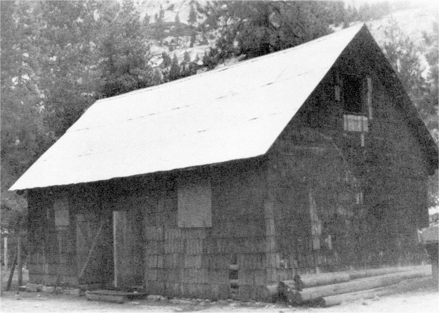
[click to enlarge] |
|
Illustration 91.
Merced Lake High Sierra camp ice house. Photo by Robert C. Pavlik, 1984. |
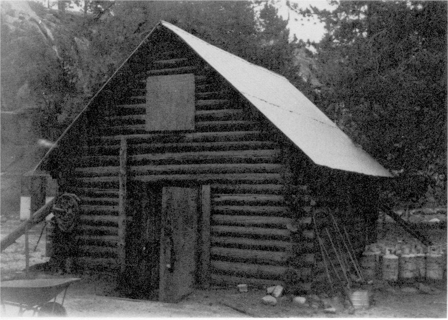
[click to enlarge] |
f) Yosemite National Park Company Holdings, 1924
In 1924 an appraisal inventoried the Yosemite National Park Company holdings. In the Old Village these consisted of the Sentinel Hotel; River, Ivy, Locust, Cedar, Oak, Bluebird, Oriental, Fox, Rock, and Hope cottages (see Appendix F); plus various employee quarters, a general office, an architect’s office, a general store and warehouse, a print shop, an ice house, an employee laundry, a store manager’s residence, a meat market, Wiggle Inn, an employee dormitory, and a toboggan slide.
The Yosemite Lodge wood section consisted of the administration building, auto shelters, a bathhouse and dressing rooms, a laundry and boiler house, a laundry office and tailor shop, a linen room, a barber shop, a public bath and employee quarters, a motion picture booth, a stage, a linen supply room, toilets, a storehouse, a dance pavilion and music stand, and a swimming tank. The lodge canvas section contained men’s and women’s bathhouses, linen rooms, toilets, a telephone and ticket office, and a tennis court.
Camp Tecoya had a cafeteria and kitchen, an employee laundry, toilets, employee quarters, an office, a linen room, a women’s recreation room, a storeroom, a pump house, and a covered walk. The Glacier Point Hotel group consisted of the hotel, an annex, a gas and oil house, a barn, and outhouses. At that time the company’s Warehouse Group included an office and warehouse, two other warehouses, a warehouse and print shop, a lumber shed, a paint shop, a storage shed, employees’ quarters, and an electric, plumbing, and carpenter shop. Its Garage Group consisted of a garage, a gas and oil station, car sheds, a paint shop, and toilet buildings. Housekeeping Camp 17 contained the main housekeeping building, a curio and cigar stand, and two warehouses. The Stable Group contained an office, a blacksmith shop, employees’ quarters, various sheds, stables, storerooms, and saddle houses, along with a gas station and stalls and feed racks.57
[57. The American Appraisal Co. (Milwaukee, Wisconsin), “Appraisal Inventory of the Yosemite National Park Co.: Group A: Yosemite Village (vol. 2); Group B: Yosemite Lodge Wood Section (vol. 4); Group C: Yosemite Lodge Canvas Section (vol. 5); Group D: Camp Tecoya, and Group E: Tecoya Annex (vol. 6); Group F: Warehouse Group, Group G: Garage, Group H: Housekeeping Camp 17, Group J: Stables (vol. 7); and Group Q: Glacier Point Hotel (vol. 8), 30 June 1924, in Yosemite Research Library and Records Center.]
The Ahwahnee row houses built during the 1922 to 1924 period in Housekeeping Camp 17 are a series of six houses originally built with the same interior plan but different exterior fabrics — hollow tile, boards and rails, stone, processed metal, stucco, and rustic logs and boards. They were built by the Yosemite National Park Company as employees’ quarters, although the reason for the different exterior coverings is uncertain. Possibly they were a test of weathering action on different surfaces or of methods of insulation.
Illustration 92.
Plat of Group A, Yosemite Village, showing operations of Yosemite
National Park Company, 30 June 1924. This and the following plats are
from the appraisal inventory of the Yosemite National Park Company by
the American Appraisal Company of Milwaukee, Wisconsin, in Yosemite
Research Library and Records Center.
SCHEDULE
Showing
Building Designation and Occupancy
| Buildings | Occupancy | |
|
GROUP A
Yosemite Village Building Designation and Occupancy |
||
| Building | A/1 | Sentinel Hotel |
| A/2 | Toilet Room | |
| A/3 | River Cottage | |
| A/4 | Employees Quarters | |
| Rear Building |
A/4 | |
| Building | A/5 | Ivy Cottage |
| A/6 | Locust Cottage | |
| A/7 | General Office | |
| A/8 | Architects Office | |
| A/9 | Employees Quarters | |
| A/10 | General Store and Warehouse | |
| A/11 | Cedar Cottage | |
| A/12 | Oak Cottage | |
| Rear Building |
A/12 | |
| Building | A/13 | Bluebird Cottage |
| A/14 | Print Shop | |
| A/15 | Oriental Cottage | |
| A/16 | Old Ice House | |
| A/17 | Fox Cottage | |
| A/18 | Employees Laundry | |
| A/19 | Rock Cottage | |
| A/20 | Store Managers Residence | |
| A/21 | Hope Cottage | |
| A/22 | Meat Market | |
| A/23 | Wiggle Inn | |
| A/24 | Employees Dormitory | |
| A/25 | Toilet | |
| A/26 | Vault | |
| A/27 | Toboggan Slide | |
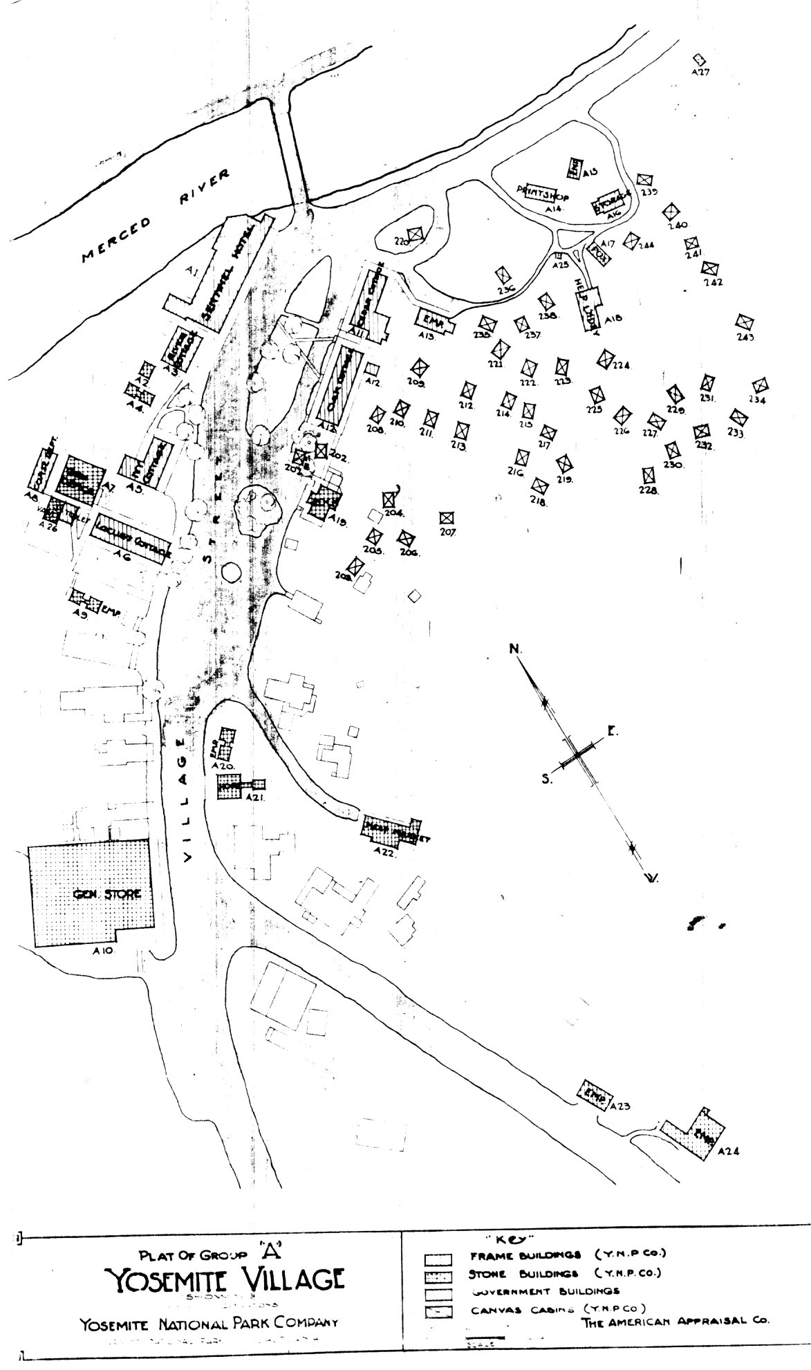
[click to enlarge] |
Illustration 93.
Plat of Group B, Yosemite Lodge wood section, Yosemite National Park
Company, 1924.
SCHEDULE
Showing
Building Designation and Occupancy
| Buildings | Occupancy | |
|
GROUP B
Yosemite Lodge Wood Section |
||
| Building | B/1 | Yosemite Lodge Administration Building |
| B/2 | Auto Shelter | |
| B/3 | Auto Shelter | |
| B/4 | Bath House and Dressing Rooms | |
| B/5 | Laundry and Boiler House | |
| B/6 | Laundry Office and Tailor Shop | |
| B/7 | Linen Room | |
| B/8 | Barber Shop, Public Bath and Employee Quarters | |
| B/9 | Motion Picture Booth | |
| B/10 | Stage | |
| B/11 | Linen Supply Room | |
| B/12 | Toilet Building | |
| B/13 | Toilet Building | |
| B/14 | Toilet Building | |
| B/15 | Store House | |
| B/16 | Dance Pavilion and Music Stand | |
| B/17 | Swimming Tank | |
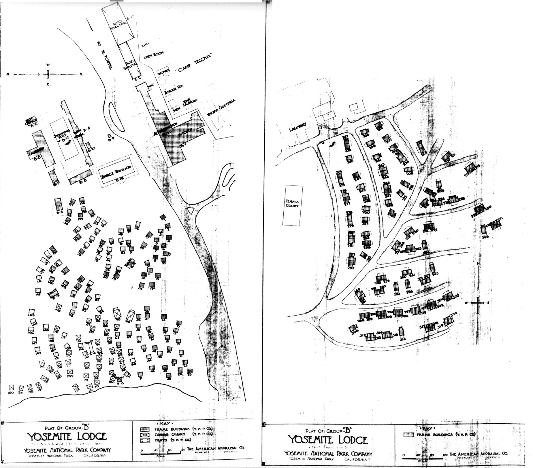
[click to enlarge] |
Illustration 94.
Plat of Group C, Yosemite Lodge annex, Yosemite National Park Company,
1924.
SCHEDULE
Showing
Building Designation and Occupancy
| Buildings | Occupancy | |
|
GROUP C
Yosemite Lodge Canvas Section |
||
| Building | C/1 | Mens Bath House |
| C/2 | Linen Room | |
| C/3 | Womens Bath House | |
| C/4 | Linen Room | |
| C/5 | Linen Room | |
| C/6 | Linen Room | |
| C/7 | Linen Room | |
| C/8 | Linen Room | |
| C/9 | Womens Toilet | |
| C/10 | Mens Toilet | |
| C/11 | Telephone and Ticket Office | |
| C/12 | Tennis Court | |
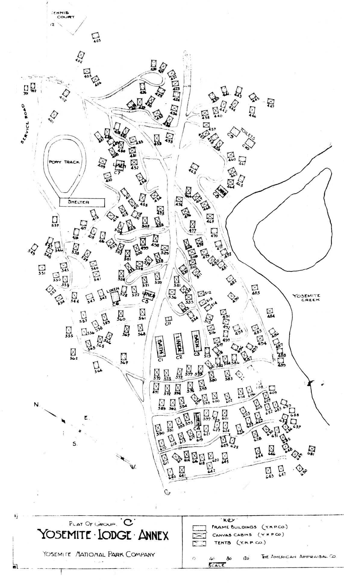
[click to enlarge] |
Illustration 95.
Plat of Group D and E, Camp Tecoya and Camp Tecoya Annex, Yosemite
National Park Company, 1924.
SCHEDULE
Showing
Building Designation and Occupancy
| Buildings | Occupancy | |
|
GROUP D
Camp Tecoya |
||
| Building | D/1 | Cafeteria and Kitchen |
| D/2 | Employees Laundry | |
| D/3 | Mens Toilet | |
| D/4 | Boiler Room and Ladies Toilet Building | |
| D/5 | Womens Toilets | |
| D/6 | Employees Quarters | |
| D/7 | Employees Quarters | |
| D/8 | Tecoya Office | |
| D/9 | Linen Room | |
| D/10 | Womens Recreation Room | |
| D/11 | Ladies Toilet Building | |
| D/12 | Storeroom | |
| D/13 | Toilet Building | |
| D/14 | Employees Quarters | |
| D/15 | Employees Quarters | |
| D/16 | Employees Quarters | |
| D/17 | Pump House | |
| D/19 | Covered Walk | |
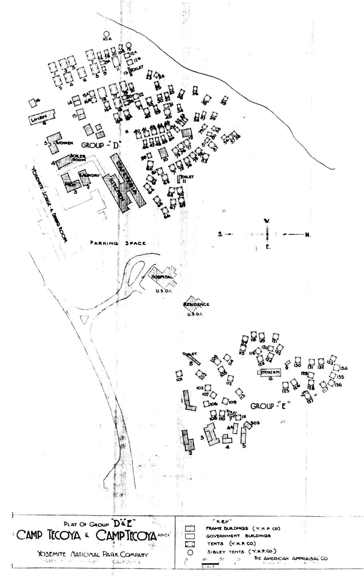
[click to enlarge] |
Illustration 96.
Plat of Group F, Construction and Equipment Warehouses, Yosemite National
Park Company, 1924.
SCHEDULE
Showing
Building Designation and Occupancy
| Buildings | Occupancy | |
|
GROUP F
Warehouse Group |
||
| Building | F/1 | |
| F/2 | Warehouse | |
| F/3 | Warehouse and Print Shop | |
| F/4 | Warehouse | |
| F/5 | Lumber Shed | |
| F/6 | Paint Shop | |
| F/7 | Storage Shed | |
| F/8 | Employees Quarters | |
| F/9 | Electric, Plumbing and Carpenter Shop | |
[click to enlarge] |
Illustration 97.
Plat of Group G, Garage Group, Yosemite National Park Company, 1924.
SCHEDULE
Showing
Building Designation and Occupancy
| Buildings | Occupancy | |
|
GROUP G
Garage |
||
| Building | G/1 | |
| G/2 | Gas and Oil Station #1 | |
| G/3 | Car Shed | |
| G/4 | Car Shed | |
| G/5 | Car Shed and Paint Shop | |
| G/6 | Toilet Buildings | |
[click to enlarge] |
Illustration 98.
Company, 1924.
SCHEDULE
Showing
Building Designation and Occupancy
| Buildings | Occupancy | |
|
GROUP H
Housekeeping Camp 17 |
||
| Building | H/1 Housekeeping and Main Building | |
| H/2 | Curio and Cigar Stand | |
| H/3 | Warehouse | |
| H/4 | Warehouse | |
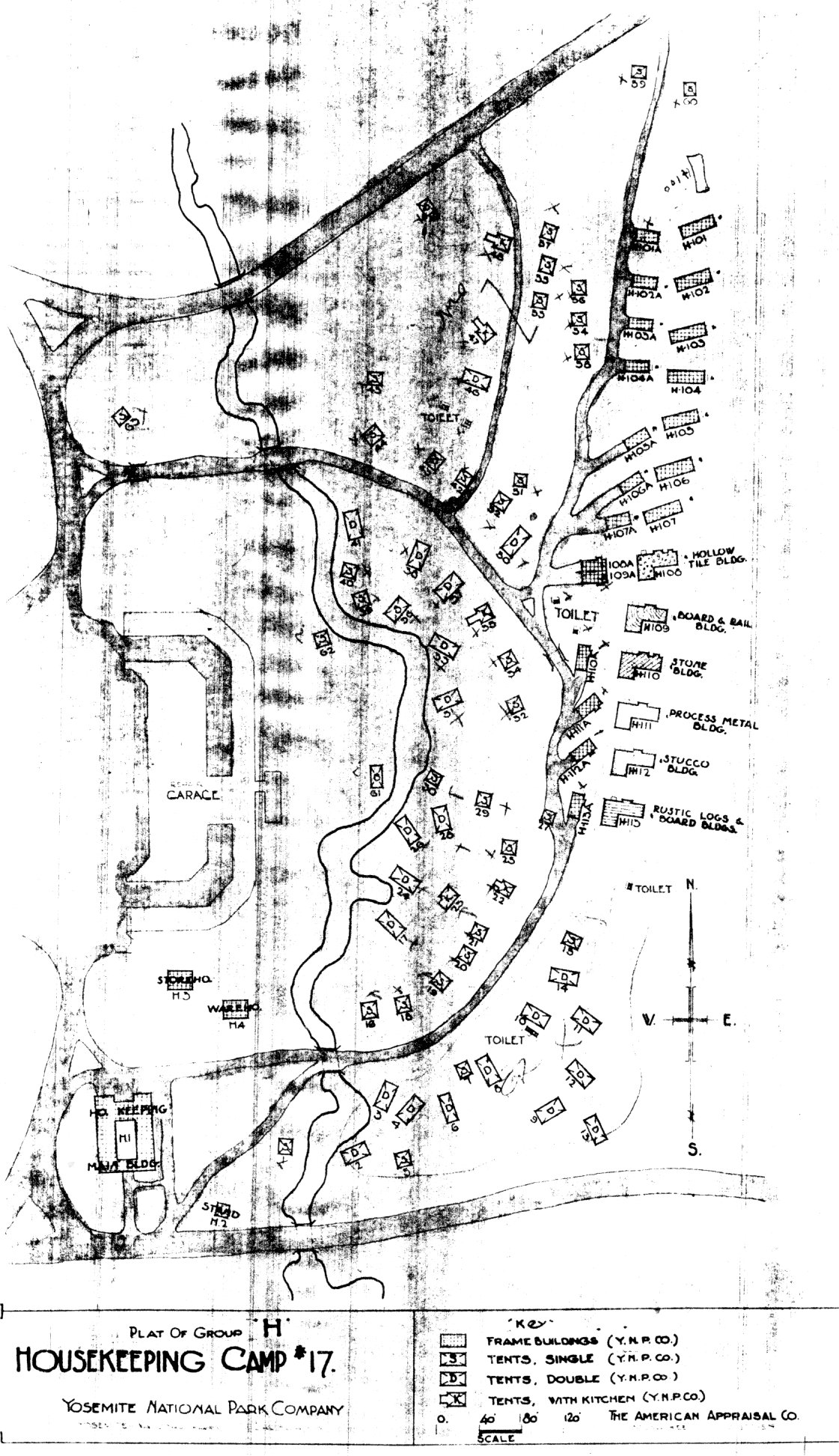
[click to enlarge] |
Illustration 99.
Plat of Group J, Stables, Yosemite National Park Company, 1924
SCHEDULE
Showing
Building Designation and Occupancy
| Buildings | Occupancy | |
|
GROUP J
Stables |
||
| Building | J/1 | |
| J/2 | Employees Quarters | |
| J/3 | Employees Quarters | |
| J/4 | Shed | |
| J/5 | Office | |
| J/6 | Stable | |
| J/7 | Stable | |
| J/8 | Shed | |
| J/9 | Storeroom | |
| J/10 | ||
| J/11 | Stable | |
| J/12 | Employees Quarters | |
| J/13 | Employees Quarters | |
| J/14 | Saddle House | |
| J/15 | Saddle House | |
| J/16 | Gas and Oil Station | |
| J/17 | Toilet | |
| J/18 | Outside Stalls and Feed Racks | |
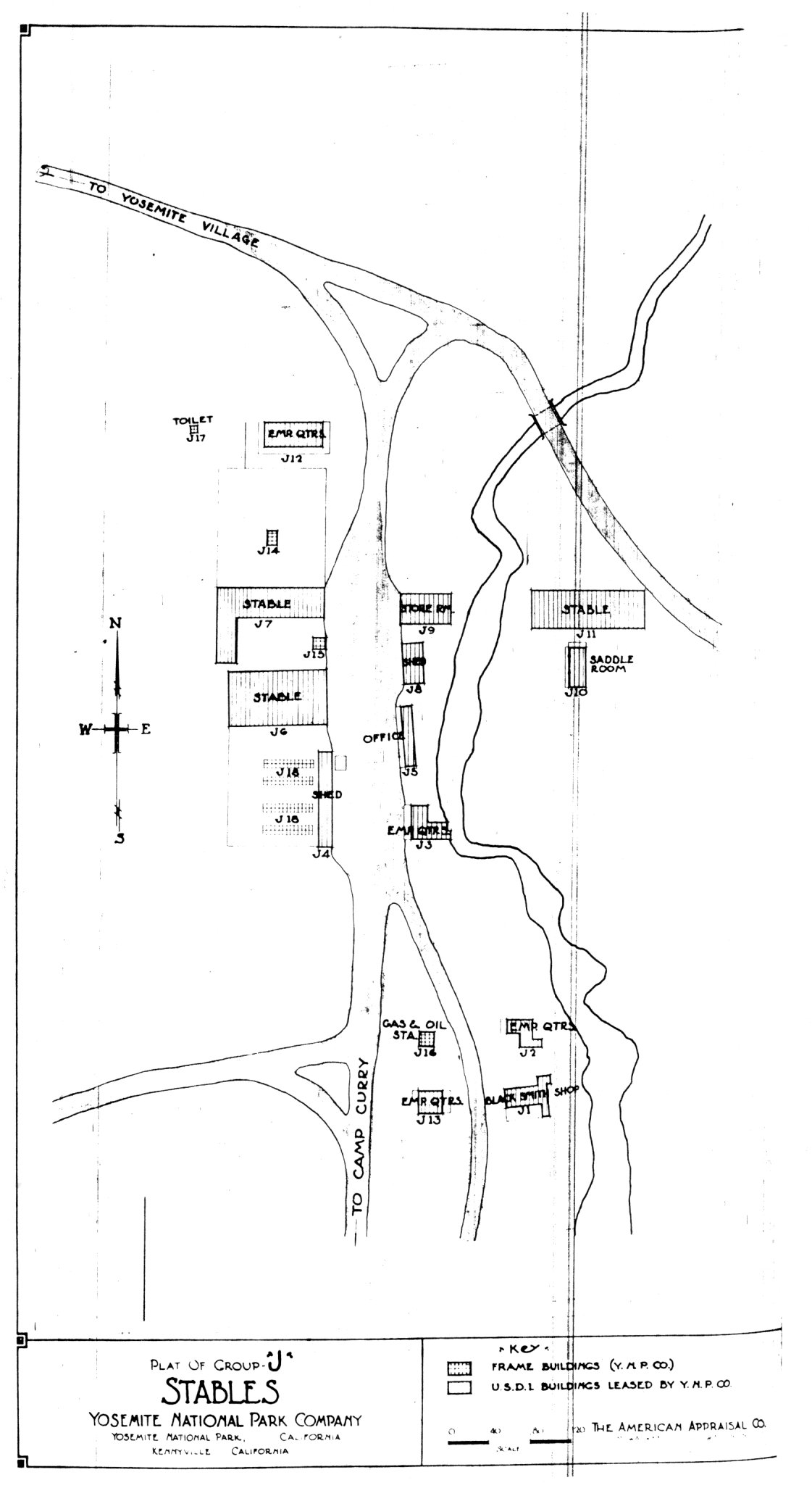
[click to enlarge] |
Illustration 100.
Plat of Group Q, Glacier Point Hotel site, Yosemite National Park
Company, 1924.
SCHEDULE
Showing
Building Designation and Occupancy
| Buildings | Occupancy | |
|
GROUP Q
Glacier Point Hotel |
||
| Building | Q/1 | |
| Q/2 | Hotel Annex | |
| Q/3 | ||
| Q/4 | Gas and Oil House | |
| Q/7 | Barn | |
| Q/8 | Outhouse | |
| Q/9 | Outhouse | |
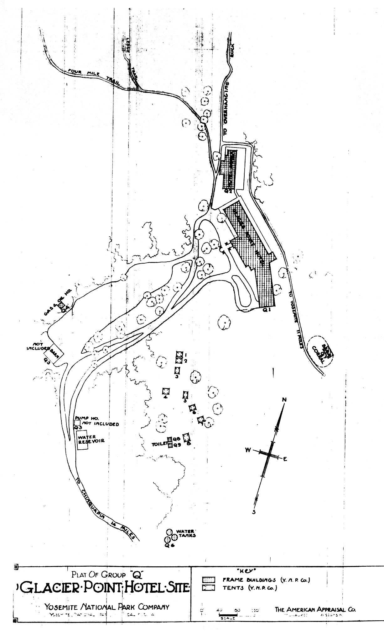
[click to enlarge] |
|
Illustrations 101-4.
Ahwahnee row houses. Stone structure and residences #1 and #6. Photos by Jo Wabeh, 1986. |
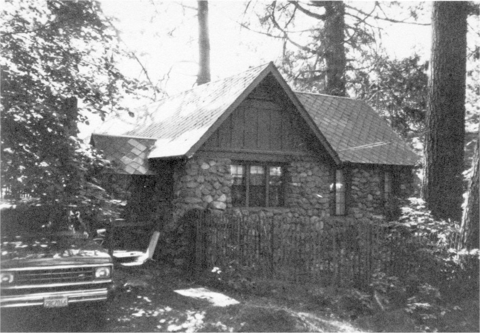
[click to enlarge] |
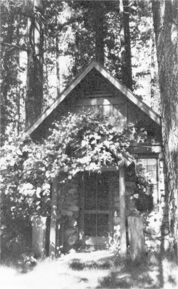
[click to enlarge] |
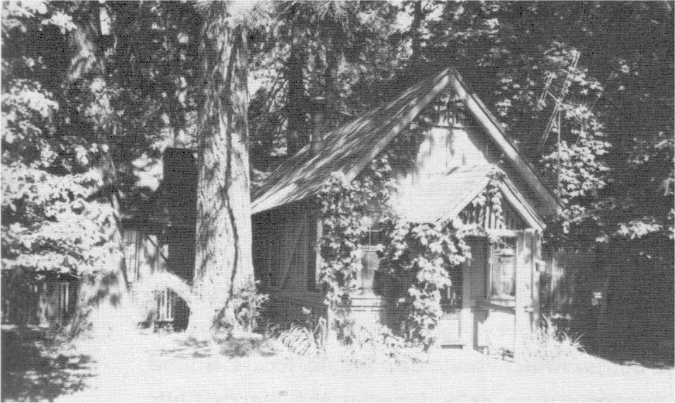
[click to enlarge] |
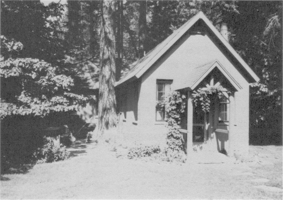
[click to enlarge] |
2. The Curry Camping Company
a) The Company Continues to Grow
By 1916 Camp Curry’s capacity had grown to 1,000 guests, with a total guest count of more than 10,000 for the season. Two significant structures—the Foster Curry cabin (1916) and Mother Curry’s Bungalow (1917)—were constructed at that time. Jennie F. Curry managed and operated Camp Curry after the death of her husband David in 1917. Her son, Foster Curry, aided her in that task, although not always beneficially. Horace Albright, acting director in 1917, sympathized with Mrs. Curry’s desire for a five-year contract and the restoration of the popular firefall, and persuaded Secretary Lane to grant both wishes. After that, relations between the Curry operation and the federal government remained fairly stable.
b) Mrs. Curry Has the LeConte Lodge Moved
By 1918 the Curry Company was growing increasingly at odds with the Sierra Club, whose members often camped behind the LeConte Memorial Lodge to hear the nature programs, many of them Curry-sponsored. The problems began when Sierra Club members began using some of the Camp Curry facilities without paying, and the situation became even more strained when the Currys acquired the privilege of building canvas bungalows with baths, which they decided to locate in the area near the lodge. In the face of strong objections by the Sierra Club that such a project would be intrusive on the LeConte lodge area, Mrs. Curry paid the Gutleben Brothers Construction Company to move the memorial to a new site across from the Curry housekeeping unit, which it did in 1919.
Because the entire granite structure could not be moved, only the roof and some of the building stones went to the new location, where the Gutlebens erected a structure that was half original and half replica. Today it has walls faced with coursed ashlar granite and a steeply pitched hip roof of hand-split cedar shingles. The smaller wings at each side, centered on a walled, stone-paved entrance terrace, each contain a small room. Also in 1919 the University of California instituted free LeConte Memorial Lectures to be given during the summers at the lodge.
The original walls, floor, steps, and fireplace left behind at Camp Curry became the scene of Mary Curry’s wedding to Donald Tresidder in June 1920. The walls ultimately fell, but the steps remained visible for a while, south of the “Kiddie Kamp.” Today only crumbling vestiges of them remain.
The northern terminus of the John Muir Trail, the LeConte Lodge is the oldest of the Sierra Club lodges, housing a small mountaineering library, historical and educational photos, Galen Clark’s personal library, and general information on conservation, national parks, and the High Sierra. David A. Curry and Francois Matthes arranged another memorial by collecting rocks from various glacial moraines and placing them in a cairn marking the spot where LeConte died. Years later the rocks were moved near Mrs. Curry’s bungalow, where they remain.58
[58. “Lodges and Lands,” Sierra Club Bulletin 52, no. 11, Handbook Edition (December 1967): 30; Sargent to Kuhn, 1 July 1974.]
c) New Construction Activity
In 1918 new construction at Camp Curry consisted of the bungalow cottages, a studio, a storehouse, a repair shop, an office addition, and a bowling alley and social hall. Actually the company built forty-eight bungalow units with baths between 1918 and 1922, designed in the rustic style as smaller versions of the Mother Curry bungalow and the Foster Curry cabin. The 1919 season brochure also mentioned such amenities as the modern bathhouse, the swimming pool, a barber shop, manicure and hair dressing parlors, and a modern steam laundry.59 As mentioned, after repeated applications for a longer concession term and additional privileges, the Curry Company finally acquired from the
|
Illustration 105.
Sites occupied by permittees in Yosemite Village, May 1924. |
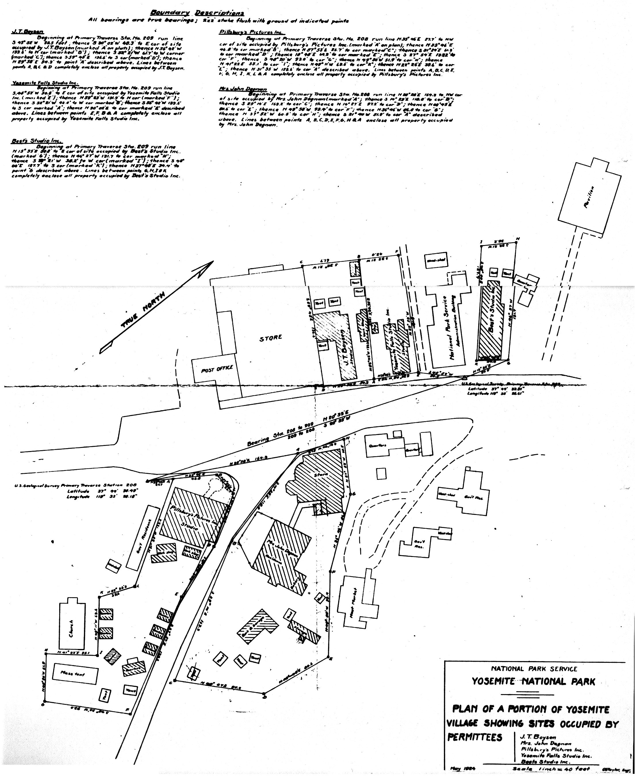
[click to enlarge] |
[59. “Yosemite National Park—Camp Curry,” pamphlet, 1919 season, Bancroft Library, University of California, Berkeley.]
[60. Robinson, “History of Business Concessions,” “Curry Camping Company,” 3-4. The original post office was a log structure with a shingle roof overhanging a veranda that encircled the building. It has been altered several times, and in the mid-1950s a space was added on the north side to house the registration office. The post office function has since moved to the lounge. USDI, NPS, Western Regional Office, “Design Criteria for the Camp Curry Historic District, Yosemite Valley, Yosemite National Park, California,” 1980, typescript, 13 pages, 2.]
[61. Robinson, “History of Business Concessions,” “Curry Camping Company,” 50.]
When the Interior Department gave the Desmond Park Service Company its comprehensive contract in Yosemite, it also allowed the small businesses operating in the park to continue during the lives of their owners. Those businesses included Degnan’s bakery and the Pillsbury, Foley, Boysen, and Best studios. The department also allowed Camp Curry to continue independently because it was a family operation, although unlike the others it was large in size and extremely competitive. Originally the department thought that Desmond would absorb Camp Curry, but that never came to pass. Allowing two large, independent concessioners to compete for tourist dollars did not lead to a stable concession situation. It undoubtedly led to the failure of the Desmond Company and created many problems for the Park Service.
d) Yosemite Park and Curry Company Formed
During 1924 discord between the Yosemite National Park Company and the Curry Camping Company rose to the surface, taking the form of constant bickering, numerous petty complaints, and unpleasant accusations. Irritated by this constant turmoil, Superintendent Lewis, Park Service Director Mather, Assistant Director Albright, and the new Secretary of the Interior, Hubert Work, in accordance with Interior Department policy to establish soundly financed companies in the parks, decided that the rival companies should merge. In fact, Work gave Mather an ultimatum—either the companies merge or be replaced. Albright carried out the final negotiations.62
[62. Sargent, Yosemite & Its Innkeepers, 82.]
In 1925 the Yosemite National Park Company and the Curry Camping Company combined to form the Yosemite Park and Curry Company (YP&CC). Don Tresidder became president and general manager. The Interior Department authorized the company, on a preferential right basis, to handle transportation, saddle and pack horses, meals, hotels and camps, photographic supplies, stores, garages, a laundry, and all other services needed or prescribed by the Secretary of the Interior. (Although today the Yosemite Park and Curry Company conducts practically all the Yosemite business enterprises, the Secretary of the Interior regulates and controls its business, by limiting its commercial activities, specifying the location of facilities, defining the standards of service, and approving rates.) Tressider immediately put the business on a corporation basis and made efforts to standardize services for the sake of economy. The permits of smaller concessioners were still tolerated, by permission of the new company, on the understanding that those smaller operations would not be enlarged and would lapse upon the death of their holders. The new company purchased the assets of Pillsbury upon his retirement and of Boysen upon his death. The Foley operations gradually discontinued after Mr. Foley’s death, while Degnan’s and Best’s continued to operate.
In 1925 the newly organized Yosemite Park and Curry Company kept busy planning construction of a new hotel on the site of the Kenneyville stables. After the consolidation of the two companies, the laundry equipment at Camp Curry was moved to Yosemite Lodge, where the company built extensions on the building. It also constructed a new stable in Camp 12. A 1925 appraisal of the Camp Curry operation inventoried the following structures in the complex: a studio, store, and soda fountain; a dining room and kitchen; a vegetable room; a main office; a laundry and bathhouses; a swimming pool; a transportation building; an auditorium; a pool hall; a dormitory; a repair shop; residences for Mrs. Curry, Mr. Tresidder, Mr. Charles H. Petersen (company auditor), and a Mr. Carrol; toilets; a clubhouse; a sawmill; a co cabinet shop; and bungalows.63
[63. The American Appraisal Company (Milwaukee, Wisconsin), “Appraisal Summaries of the Camp Curry. Yosemite National Park, Yosemite, California,” vol. 1, 30 July 1925, in Yosemite Research Library and Records Center.]
In 1926 fire partially destroyed the dining room wing of Yosemite Lodge. In that same year the Yosemite Park and Curry Company bought out the Yosemite Stage and Turnpike Company interests. The six-story, all-year Ahwahnee Hotel opened in 1927 on the former site of Kenneyville, near Royal Arches. Scheduled to provide an additional 300 bungalows in the surrounding grove, it became an important asset to the newly formed company, finally meeting visitor demands for the finest
Illustration 106.
Plat, Camp Curry. From appraisal summary by the American Appraisal
Company of Milwaukee, Wisconsin, 30 July 1925, in Yosemite Research Library
and Records Center.
SCHEDULE
Showing
Building Designation and Occupancy
| Buildings | Occupancy | |
| Building | A/1 | Studio, Store and Soda Fountain |
| A/3 | Dining Room and Kitchen | |
| A/3-A | Vegetable Room | |
| A/4 | Main Office | |
| A/5 | Laundry and Bath House | |
| A/6 | Swimming Pool | |
| A/7 | Transportation Building | |
| A/8 | Auditorium | |
| A/9 | Pool Hall | |
| A/10 | Dormitory | |
| A/11 | Repair Shop | |
| A/12 | Mrs. Curry’s Residence | |
| A/13 | Toilet and Bath House | |
| A/14 | Toilet | |
| A/15 | Toilet Building | |
| A/16 | Club House | |
| A/17 | Mr. Tresiddor’s [sic] Residence | |
| A/18 | Toilet | |
| A/19 | Sub-station | |
| A/20 | Garage | |
| A/21 | Mr. Peterson’s Residence | |
| A/22 | Saw Mill | |
| A/23 | Lumber Storage | |
| A/24 | Cabinet Shop | |
| A/25 | Mr. Carrol’s Residence | |
| A/26 | Shake Storage | |
| A/27 | Housekeeping Toilet | |
| A/28 | Toilet | |
| Bungalows | ||
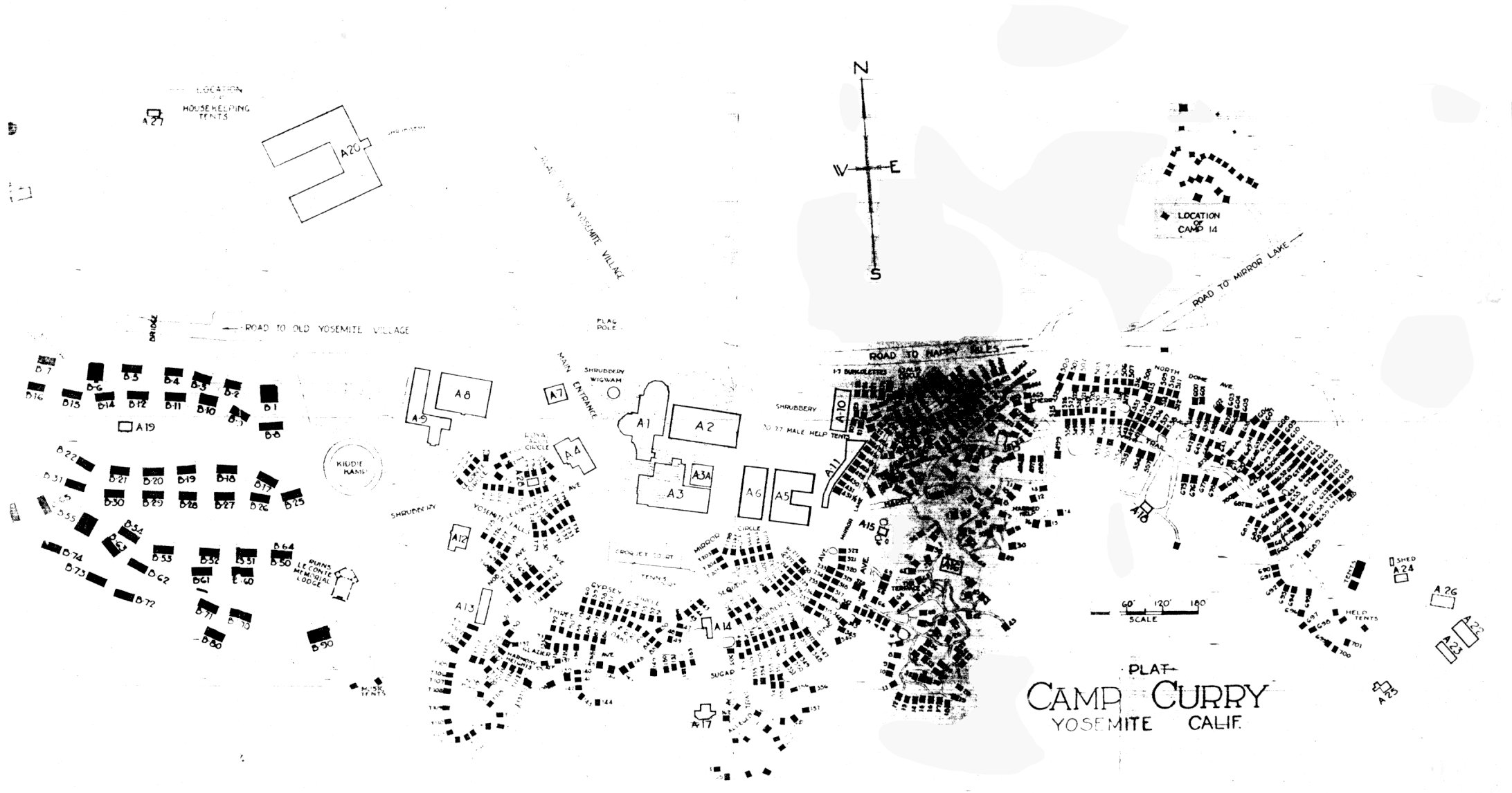
[click to enlarge] |
In 1928 the Interior Department approved plans for four dormitories, a heating plant, and a laundry in the Tecoya area, designated for Curry employee housing, and for seventeen bungalows at the Ahwahnee. Construction also started on six-room cottages in Camp 17, a reinforced concrete bridge over Indian Canyon Creek, and four garages. The department approved plans for a new Curry dining room, kitchen, and cafeteria that same year. The structures were finished a year later.64 In early 1928, A. C. Pillsbury decided to sell his Yosemite interests rather than rebuild his theatre after the heavy loss he sustained by fire. The Yosemite Park and Curry Company agreed to purchase his holdings. The open-air dance floor in the Old Village, which had been enclosed as a meeting place, subsequently served as the valley movie theater.
[64. Robinson, “History of Business Concessions,” “Yosemite Park & Curry Co.,” n.p.]
e) The Company Initiates a Winter Sports Program
The problem of how to sustain winter operations became a serious one for the new company with the completion of the Ail-Year Highway to Yosemite in 1926 and the opening of the Ahwahnee Hotel. Its directors decided to undertake winter sports development to promote more travel and make it possible to keep the new hotel functioning year round. In 1920 Tressider had hired a Swiss, Ernst des Baillets, who had been successful promoting winter development at Lake Pladd in New York State, to organize skiing, skating, ice hockey, and other winter sports.
|
Illustration 107.
Tecoya employee housing area, 1930. NPS, Denver Service Center files. |
[click to enlarge] |
|
Illustration 108.
Plat, Camp Curry, 1930. NPS, Denver Service Center files. |
[click to enlarge] |
|
Illustration 109.
Snow Creek cabin, view to southwest. |
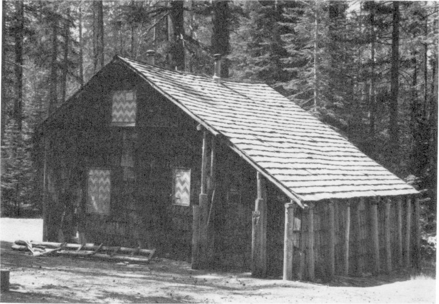
[click to enlarge] |
|
Illustration 110.
Snow Creek cabin, view to northeast. Photos by Robert C. Pavlik, 1984. |
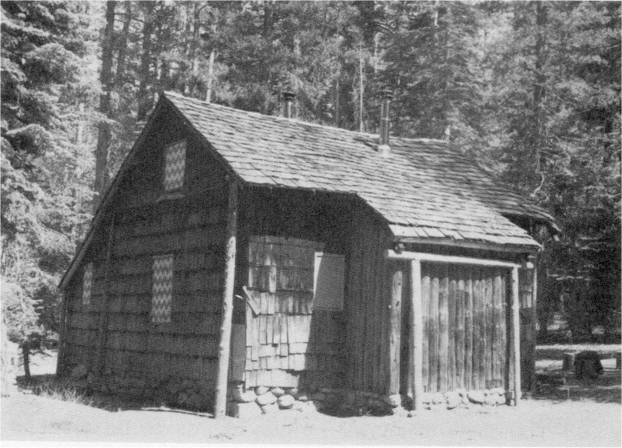
[click to enlarge] |
The YP&CC formed the Yosemite Winter Club in 1928, the pioneer California winter sports organization. Its objects were the general development of winter sports, the promotion of amateur competition, and continued improvement of Yosemite’s winter facilities. Other improvements included an ice rink formed by sprinkling the Camp Curry parking area and a new toboggan slide built in 1927 west of the camp. The older slide became the enjoyable ride referred to as “Ash-Can Alley.” During the late 1920s and early 1930s, the company kept horses in the valley for sleighing and ski-joring in Stoneman Meadow, which also provided a field for dog teams. Figure skating contests and ice carnivals were held frequently. Tresidder developed the moraine near Tenaya Creek Bridge into a temporary ski hill and later installed a jump. Areas along the Big Oak Flat and Tioga roads catered to skiers when the valley had insufficient snowfall.
The Yosemite Park and Curry Company believed that High Sierra ski tours would greatly increase the scope of winter sports in Yosemite, and, in entering that pioneer field, devised crosscountry ski tours of two to six days, the first time such tours were attempted in the United States. It remodeled the little Glacier Point Mountain House for winter use and, in 1929 built an experimental ski cabin on the shoulder of Mount Watkins above Snow Creek, initiating the first hut system for ski-mountaineering in the Sierra. The cabin was enlarged in 1930. The hut would function as a starting place for tours of the High Sierra camps, which would also be developed with a series of ski huts similar to those used in the European Alps. Eldridge T. Spencer of San Francisco drew the cabin plans, with Dr. Tresidder making suggestions drawn from a book of pictures and plans of Swiss mountain huts. Visitors arrived at the cabin on horseback, snowshoes, foot, and skis for the start of ski tours, which ran from Mount Watkins to Snow Flat and from the cabin to Tenaya Lake and Tuolumne Meadows. The Park Service allowed the Tenaya Lake and Tuolumne Meadows ranger cabins to be stocked and used in the winter as bases for those skiing expeditions. A ski school started at Yosemite in 1928, with professional instructors and ski guides providing competent ski instruction. As it turned out, ski touring did not catch on as expected, while downhill skiing on packed slopes became ever more popular. The park even made a bid in 1929 to host the 1932 Olympics, but was turned down in favor of Lake Placid.
f) Concession Atmosphere Changes with Increased Tourism
Some critics found the developments at Camp Curry during the 1920s disturbing. The consolidation of companies in 1925 resulted in an increase in size and activity that changed the former homey, wholesome, and delightful camp atmosphere. The area next to the valley’s south wall that had gracefully accommodated the original small tent camp had trouble accepting increased numbers of tents and other structures. Many of those structures, such as the new dining room and cafeteria, were intended to attract not only Camp Curry customers but guests from other units and the campgrounds. The early evening campfire programs that gained their traditional appeal from guest performances, singing, and storytelling, were soon invaded by paid entertainers. The increased number of people seemed to call for more amusements and a carnival atmosphere developed with the addition of exotic types of entertainment such as dancing to draw and hold crowds.65
[65. Kittredge, Memo to Regional Director, 25 June 1947, 4.]
3. The Wawona Hotel Company
The directors of the Wawona Hotel Company met in San Francisco in the summer of 1917 and agreed on the need for more improvements to the complex. That decision resulted in the addition of a nine-hole golf course, of a swimming pool, and construction of the, Annex, completed in the spring of 1918. A tennis court had also been built by 1917. The improvement program of 1917-18 comprised an attempt by the hotel’s owners to attract the patronage of automobile travelers, a new class of visitor demanding more modern amenities than earlier tourists.
|
Illustration 111.
Wawona slaughterhouse. Photo by Robert C. Pavlik, 1985. |
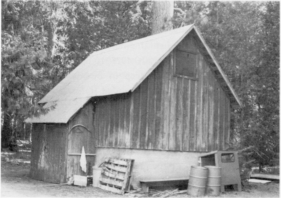
[click to enlarge] |
Also in 1917, the Hill Studio became a clubhouse, with the section facing the tennis court becoming a soda fountain and the middle section serving as a dance hall. Clarence Washburn noted that the Big [Tree?] Creek Bridge was finished in October 1917 and the Indian Bridge in July 1921. The latter might have been the new bridge over to the fish hatchery, although Washburn later wrote that that particular structure had not been completed until August 1921. The old Wawona laundry also came down, in 1919.66
[66. Wawona Washburn Hartwig, comp., “Clarence A. Washburn Diaries—Repairs-lmprovements (Buildings and Grounds, 1914-1934),” in Yosemite Research Library and Records Center. This document states that the company was erecting a new slaughterhouse and tearing down the old one in the summer of 1927, although other sources state the new slaughterhouse did not go up until 1929.]
In March 1920 the hotel’s directors decided on further improvements to the Wawona group, including demolition of the old store and construction of three new buildings, none of which is extant. The company began work on the men’s bunkhouse and a refrigerator plant in April 1920. It also started the Girl’s House, later known as the Sequoia Building, that month, northeast of the main hotel, and finished it two months later. Designed to house the hotel’s female employees, it served as a dormitory during 1920-25. In 1926 it opened to the public, along with a coffee shop, but due to a drop in business, in 1931 again began housing seasonal employees. Fire destroyed it in November 1977.
A second store, begun in March 1920 on the approximate location of the first one, contained a butcher shop and smokehouse, it burned about 1943-44. Another tennis court, constructed in 1922, along with a.. croquet court added in 1914, provided additional recreational opportunities for guests. The tennis court was probably demolished in 1937 when a new one was built.67
[67. Crosby and Scrattish, Historic Structure Report, Wawona Hotel, 31, 40, 197, 203, 206-207, 220.]
A nearby competitor for the Wawona Hotel—the Sierra Lodge—was established by Jack Menniceni in 1920 in Section 35. Most of the improvements on that tract had been constructed by Ed Quigg about 1912, who used the premises for dining, dancing, and saloon purposes. Menniceni bought the property in 1920 and built an addition to the dance hall. He then established a camp for summer visitors. The venture proved unprofitable. A bank took over the property and in 1929 sold it to Sara Scroggs as a summer youth camp. The Park Service acquired the property in the late 1940s and razed the buildings.68
[68. Information from Sara Scroggs file, Wawona, Drawer 14, Yosemite Research Library and Records Center; Whittaker, Archeology in Yosemite National Park, 28. The Park Service had considered installing a housekeeping camp on the property.]
In 1923 the Shell Oil Company established a service station at Wawona, which, along with a garage and repair shop, enabled the complex to better serve the touring public. The first aviation field in the High Sierra was established on the Wawona meadow in 1925, to be used as an emergency landing field for army aviators and as a regular landing field for government forest patrol flyers. In 1926 daily airplane service from San Francisco commenced. A new slaughterhouse, later turned into a tool shed at the end of the golf course, built in 1929 processed the hotel’s cattle, sheep, and hogs. It evidently replaced one built in 1920 that in turn had replaced an older structure.69
[69. Whittaker, Archeology in Yosemite National Park, 27-28.]
4. Best Studio
Snow destroyed the Best Studio in 1921, but the Bests rebuilt it. In 1923 Best incorporated the business. The New Yosemite Village plan of 1923, which would place administrative and commercial activities on the north side of the valley, incorporated H. C. Best’s Studio. Construction on the three studios in the New Village began the end of 1925, with the studios in the Old Village razed in early 1926. Structures in the Best Studio complex included a darkroom, two duplex residences, and a garage. The couple’s daughter, Virginia, married Ansel Adams, destined to become a renowned photographer, in 1928. After Best’s death in 1936, the Adamses returned to the valley to run the studio. It still operates today as the Ansel Adams Gallery, offering photographs by Adams, books on the Yosemite area, and Indian goods.
5. Pillsbury Studio
In 1907 Arther C. Pillsbury bought out the interests of the Hallett-Taylor Company and changed the name to “Pillsbury’s.” After a fire destroyed his theater, Pillsbury sold his photo studio to the Yosemite Park and Curry Company in early 1928. It became the Lost Arrow Studio at the New Village.
[Editor’s note: the correct spelling is Arthur C. Pillsbury (Arthur Clarence Pillsbury, 1870-1946)—dea]
6. Fiske Studio
In November 1918 George Fiske committed suicide at his studio on the Merced River north of the foot of the Four-Mile trailhead. Fiske was the last great Yosemite photographer of the nineteenth century, for by the late 1800s, the introduction of Eastman Kodak cameras was making tourist-oriented photo studios obsolete.70 ’ 0 By special permission of the National Park Service, Fiske was buried in the Yosemite Valley cemetery, between his wife and Galen Clark. Later the Curry Camping Company purchased all Fiske’s personal property, including the stock on hand in his studio and his negatives and cameras. Fiske was a well-known figure in Yosemite for thirty years and highly respected for his mountain pictures.
[70. Orland, Man & Yosemite, 78.]
7. Baxter Studio
In the 1920s, Ed Baxter ran a studio and photo shop in the old Galen Clark cabin near Big Trees Lodge.
1. Yosemite Lumber Company
During 1916-17 the federal government, continuing the exchange of timber it owned in remote park areas for land and timber owned by the Yosemite Lumber Company and the city and county of San Francisco along park highways and in other scenic spots, acquired nearly 7,000 acres, or more than thirty percent of the privately owned lands in the park. Through these congressionally authorized exchanges, the government tried to protect the scenic beauty of Yosemite’s roads. It also attempted to protect Yosemite’s forests by specifying that timber traded to the lumber companies be logged under strict supervision and in ways that insured an immediate second-crop growth. The time was rapidly approaching, however, when there would no longer be sufficient government land available to effect such exchanges. Furthermore, the first public pressure for the elimination of logging operations in the park began to be felt.
During the 1923 season the government acquired a 160-acre tract in Little Yosemite Valley, owned by the Yosemite Stage and Turnpike Company, through an exchange agreement with the Yosemite Lumber Company by which the government transferred title to timber in the western portion of the park in the Cottonwood Creek section. The government had long wanted to acquire the Little Yosemite Valley land for administrative purposes—to serve as a Happy Isles-Vernal Fall-Little Yosemite Valley-Tioga Road connecting link. Civilian Ranger Archie Leonard had deeded this land, also known as the Washburn quarter-section, to the stage company in October 1891.
By the fall of 1923, Yosemite Lumber Company logging crews had exhausted the timber supply on the south side of the Merced River, and the company made plans to move operations to the north side of the canyon. A new incline, less steep than that on the south side but still about 8,300 feet long, finished in 1924, extended from a point across from Indian Flat almost to the top of Trumbull Peak. Because of the difficult construction and resulting high cost—nearly one million dollars—
|
Illustration 112.
Yosemite Lumber Company holdings, 1923. Box 88, Yosemite Research Library and Records Center. |
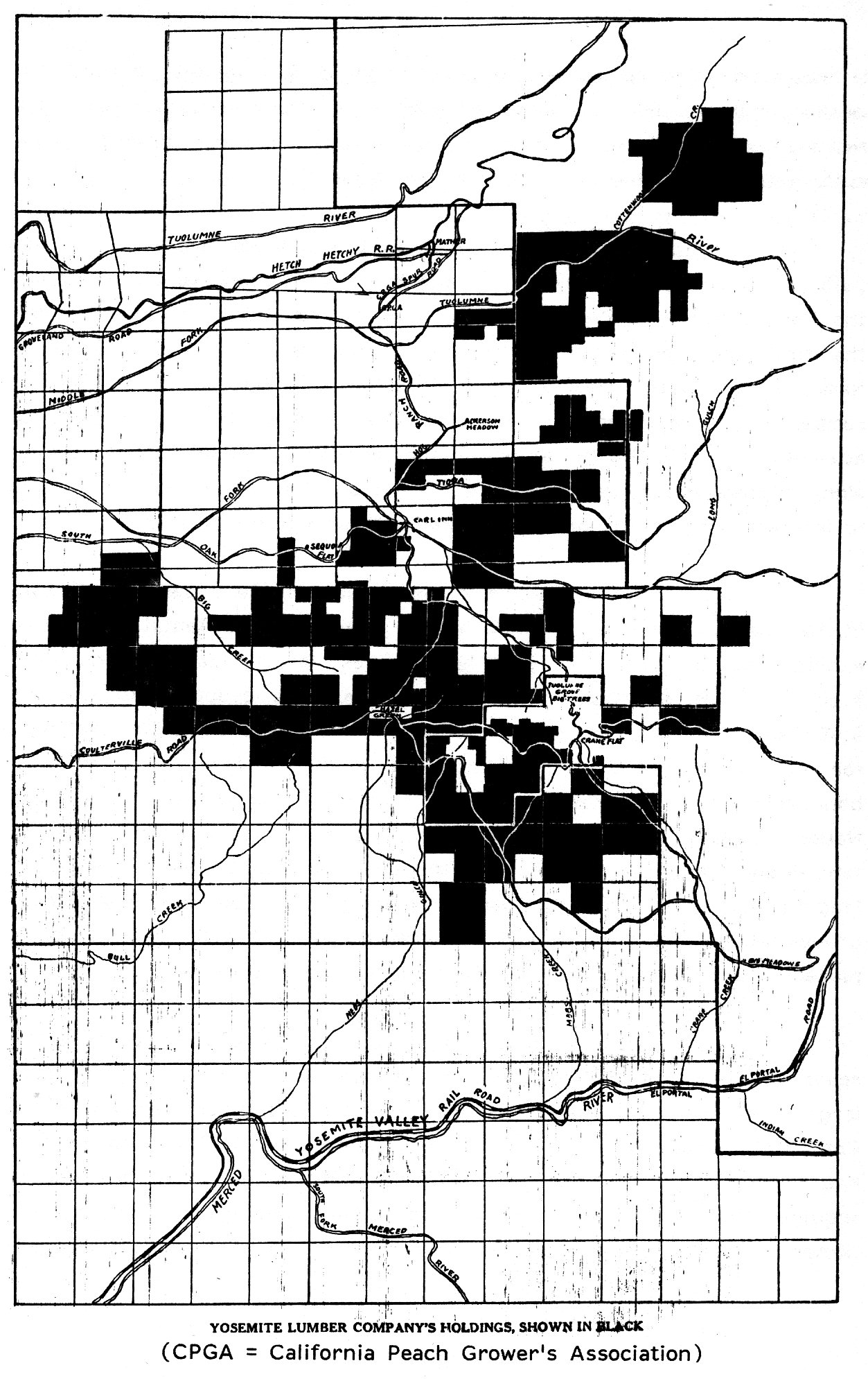
[click to enlarge] |
| (CPGA = California Peach Grower’s Association) |
The company’s modern equipment wiped out everything in its path, threatening to destroy the magnificent sugar pine forest encircling the Merced Grove of Big Trees. In 1926 Willard Biggs Van Name voiced the first major opposition to logging in the park. In a circular, Van Name, a conservation advocate, criticized the Park Service and the lumber company for denuding the forests. He accused the government of attempting to hide the full extent of the ravages by trading timber stands along highways for less conspicuous forests. Van Name did not manage to interest many in the problem, however, and logging continued.
Also fearful of wholesale destruction of the sugar pine forests in the park, however, Director Mather worked out a tentative plan to exclude from the park more than 12,000 acres, largely timbered, including 5,500 acres of privately owned timberlands. He proposed to use the 6,700 acres of government land to be excluded as a basis for exchange for more important timber holdings within the proposed modified park boundaries. In 1926 the President’s Commission on the Coordination of National Parks and Forests, after studying the situation on the ground, tentatively agreed to the plan as the only feasible method of excluding logging operations from the park. Although the Tuolumne and Merced groves would be removed, the commission expected that they would be protected under the jurisdiction of the U. S. Forest Service.
The proposed modification of the boundary would throw about seventy percent of the privately owned lands out of the park, the only large block left being that owned by the Yosemite Lumber Company in the Cottonwood Creek area north of Aspen Valley. By 1927 the government had proposed a timber exchange with the company by which it hoped to acquire the Cottonwood Creek and other holdings in return for timberlands along the western boundary of the park that would eventually be eliminated under the proposed boundary exchange and become part of Stanislaus National Forest. The plan later, however, appeared disadvantageous to the government, because the timberland received from the lumber company would not be equal in value to the timber conveyed by the government. The latter rejected the plan with the recommendation that further effort to effect an exchange be undertaken.
At that point the general public finally became interested in the situation, and Nicholas Roosevelt, editorial writer and special correspondent of the New York Times, visited the park. After studying the problem on site, he wrote that the timber exchange plan should be discouraged. After conferring with Park Service officials, however, Roosevelt advocated in the paper outright purchase of the timberlands in question, opposing any plan to delimit the park for exchange purposes. The Times became instrumental in developing public opinion in favor of the preservation of the Yosemite forests.
The Yosemite Lumber Company, meanwhile, had suddenly ceased operations in 1927, when the White & Friant Company, which owned timber intermingled with that of the Yosemite Lumber Company, refused to let the latter use White & Friant land to reach its timber unless it purchased the land. The Yosemite Lumber Company refused. The company’s Merced Falls mill lay idle until May 1929 when the Sugar Pine Lumber Company of Pinedale reopened it, having purchased the assets of the Yosemite Lumber Company a few months earlier.
John D. Rockefeller, Jr., became interested in the Yosemite situation and sent a representative to the park to investigate. When the Sugar Pine Lumber Company bought the holdings of the Yosemite Lumber Company and of White and Friant with the intention of logging them, the situation became critical, and Rockefeller immediately pledged one million dollars to help save the forests. Louis C. Cramton, chairman of the Subcommittee on Appropriations for the Interior Department, then included in the bill appropriating money for the fiscal year ending 30 June 1930 an authorization of funds for the purchase of all privately
|
Illustration 113.
Map of timber stands acquired in 1930 through Rockefeller purchase. Separates File, Yosemite-Boundaries, Y-37, Yosemite Research Library and Records Center. |
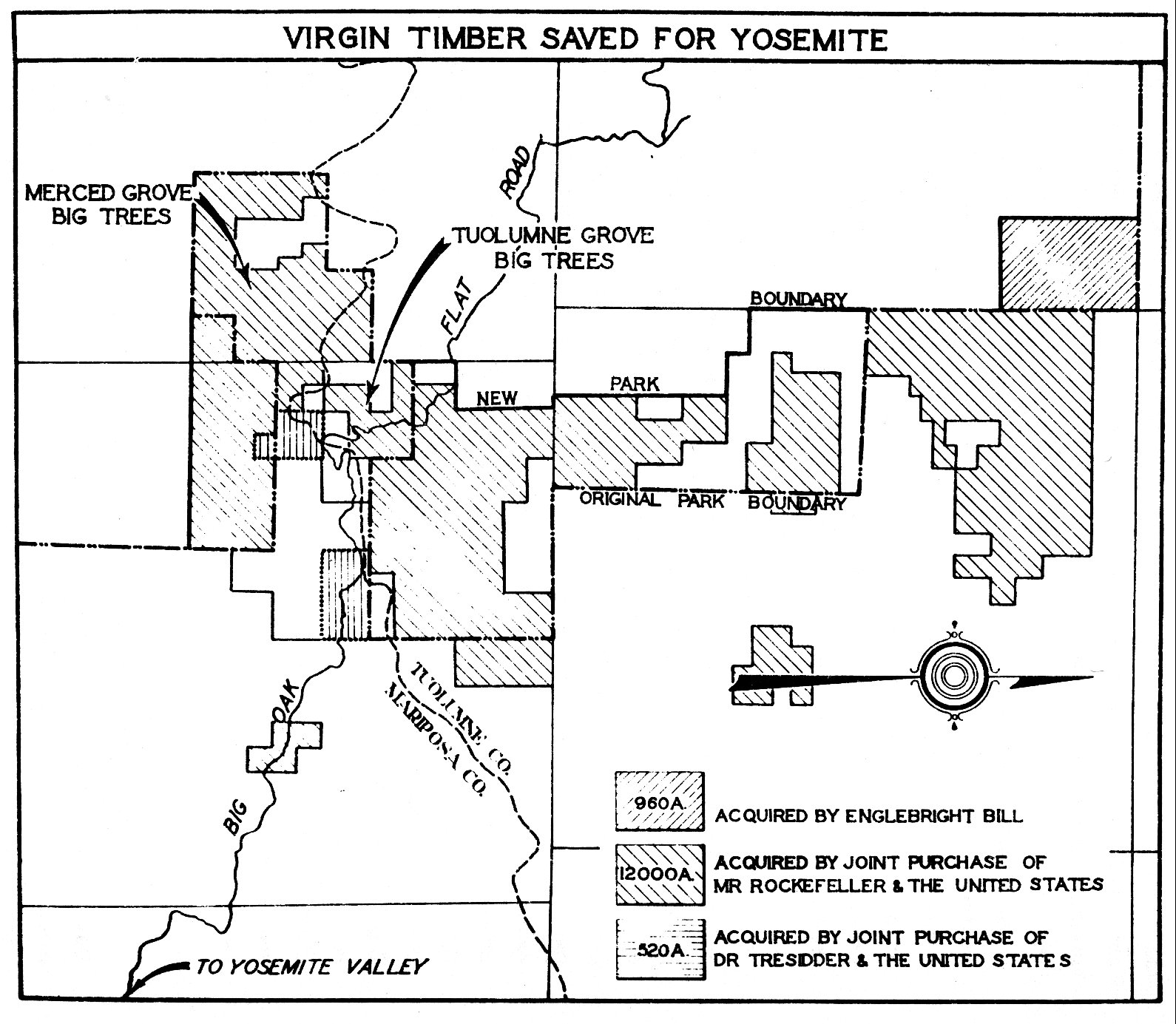
[click to enlarge] |
That purchase was important as the first substantial accomplishment under the plan approved by Congress to eliminate private landholdings in the national parks. It brought the finest remaining stand of sugar pine trees into government ownership and marked the discontinuation in the park of the logging operations that had plagued park administration and protection for the past twenty years; it greatly reduced the total area of private holdings in the park; and it provided protection to the Tuolumne and Merced groves of giant sequoia that lay in the heart of the newly acquired forest. Park Service administration of that area had become critical in light of the projected relocation of the Big Oak Flat Road and construction of the new Crane Flat-Hetch Hetchy road. The Sugar Pine Lumber Company ultimately gave up the Yosemite Lumber Company subsidiary when the depression ruined the lumber market at the start of 1931. The company finally went out of business two years later.
2. Foresta Subdivision
About 1917 the cookhouse at Foresta burned and Alfred B. Davis, proprietor of Foresta and manager of the Foresta Land Company, moved camp operations to another location. A new spring became the chosen site for the Foresta Assembly grounds and a community center. In the spring of 1917 workers dug a deep reservoir around the spring and constructed an all-purpose building containing a kitchen and screened dining room. A powerhouse, containing an electric light plant and boilers, supported a large wooden water tank on its roof. Two bath and toilet houses, storage sheds, and one or two cabins, along with thirty-seven floored tents, completed the complex. Investors continued to buy lots on installment plans, but, when payments ceased, many properties either reverted to the original owners or were sold for taxes. The economics of World War I undoubtedly affected sales and buyer interest.
In mid-August 1918, fire destroyed the new Foresta dining room. Horace and George Meyer and the park’s civilian rangers managed to contain the blaze. Davis, beginning to run out of development money by the fall of 1918, dropped his association with Foresta in the summer of 1919. Simoneau & Company of Los Angeles took over from the Foresta Land Company. It stressed the idea of mutual interests and exclusivity for the area, noting that several professors on the faculty of the University of California owned Foresta property as well as such notable members of the Foresta Assembly as John Muir, Jack London, and George Wharton James. Despite these efforts, this company’s selling campaign also lacked success. Davis sold his remaining holdings to his daughters shortly before his death in 1922, and they organized the Yosemite Valley Land Company to continue property sales.
The completion of the Ail-Year Highway from Merced to Yosemite Valley in 1926 and proposed construction of a new Big Oak Flat Road from Yosemite Valley to Crane Flat revived interest in Foresta, and publicity resumed. John J. Michaelsen, a San Francisco real estate agent, who had become president of the Yosemite Valley Land Company, began selling Foresta lots in November 1926 under the title of the new Foresta Land Company, and invoked the ire of the park superintendent because of his misleading sales literature. Superintendent Lewis took exception, for instance, to advertising statements made in company literature to the effect that owners of Foresta property were entitled to unrestricted park privileges and were exempt from the restrictions placed on general park patrons. Lewis had been receiving inquiries for some time about the soundness of such an investment from prospective buyers and people who had already purchased. To each individual Lewis stated his belief that the development proposition for the area remained unsound and that Foresta could never be turned into a successful resort operation.
Lewis believed at the time that no development of the tract had occurred since 1918 when the former owners had gone into bankruptcy. To substantiate this, he sent E. C. Solinsky to the Foresta townsite to scout out the situation. Solinsky found that the property contained five permanent buildings and one portable structure similar to those used at Yosemite Lodge as sleeping quarters for guests. Of the five buildings, two functioned as bathhouses and one as a boiler house. Additionally the area contained thirty-seven tent platforms and a concrete reservoir for storing water from a spring on the property. Solinsky could see remains of the 1918 fire that had destroyed the dining room and kitchen on the townsite. Those buildings had not been rebuilt and all the extant buildings appeared unused, indicating a lack of activity since the fire. No work toward grading of streets or roads had yet been accomplished and weather and vandalism had taken a toll.71
[71. E. C. Solinsky, Forester, to W. B. Lewis, Superintendent, 2 June 1922, and W. B. Lewis to the Director, National Park Service, 7 June 1922, in Central Files, RG 79, NA.]
Ultimately Michaelsen, after selling about 200 lots and running into the problem of delinquent payments, sold W. S. Wright, the land company’s general manager, the remaining lots, roads, and right-of-way in January 1929. Wright then took over as president of the Foresta Land Company. The stock market crash of 1929 and the Great Depression resulted in a decline of sales and installment and tax payments. In 1929, William Setchell donated his Foresta lots and the historic George Anderson cabin to the Park Service—the first act of a volunteer program to help the government acquire property in the Big Meadow area. Foresta’s rejuvenation during the 1920s had been short-lived. By 1931 the Foresta Land Company was finished.72
[72. Sargent, Yosemite’s Rustic Outpost, 26-27, 33-34, 38-40, 42-44, 50.]
3. Big Meadow
The McCauley sawmill operated steadily until 1922 and sporadically after that. The Meyers bought the McCauley property in 1924 and continued to operate the mill. They hauled logs by horse team from their cutting site to the mill, where they dumped them onto skids and rolled them along onto a movable carriage that held the log, carrying it back and forth past the saw blade. The Jast lumber sawed in that mill served in rebuilding the McCauley house at Big Meadow in 1937-38.
4. Aspen Valley Homesites
In the fall of 1922, Robert Bright, a son-in-law of T. G. Hodgdon, began erecting buildings at Aspen Valley on the Tioga Road, on land owned by Hodgdon. Bright intended ultimately to erect an eating establishment, a small store, and a gas station. This became the first development work of that kind actively underway on private park land during that time. 73 During the 1920s Aspen Valley became a busy tourist stop on the Tioga Road. In 1927 the Tuolumne County engineer subdivided part of the original Hodgdon homestead. The Park Service perceived the cabin sites to be more an effort by T. J. Hodgdon, who owned the Aspen Valley Lodge, to bring in summer residents to bolster his lodge business than to develop a prosperous and dignified summer community. Neighbors and friends of the original owners appeared to comprise the subdivision’s clientele. The design of the community was poor, with most of the cedar to be used for the buildings—acquired from a mill a few miles away—subject to dry rot. No sanitary facilities existed, so most of the garbage had to be buried. The front of all the lots sold faced the meadow on which the Hodgdon cows grazed. Hodgdon also intended to subdivide the East Meadow area if the government did not purchase it.
[73. W. B. Lewis, Superintendent, to the Director, National Park Service, 7 September 1922, in Central Files, RG 79, NA.]
5. Cascade Tract
The east line of this property stood at the west end of the Wildcat Creek Bridge on the El Portal highway. During the 1920s the San Joaquin Light and Power Corporation held a permit from the Federal Power Commission for water power development on the South Fork of the Merced River. In the summer of 1928 an agreement was reached under which the National Park Service would attempt to get an extension of the power company’s permit in return for that company’s purchasing the private Cascade holding and deeding it to the government. The government, in turn, would grant the company forty acres on the southeast boundary of the park that it needed for a reservoir site on the South Fork. The deal never materialized because too many problems prevented the company from exercising the rights of its South Fork permit. First, the dam project required a portion of the park to be flooded, as well as large tracts of private land, such as that owned by the Wawona Hotel. In addition, the company began to think that oil power would probably be cheaper than water development.
6. Gin Flat and Crane Flat
In 1928 the Yosemite Park and Curry Company purchased the 520 acres of private land at Gin and Crane flats along the Big Oak Flat Road and turned them over to the National Park Service upon reimbursement of half the cost. Park Service officials considered those areas of vital importance to the administration and enjoyment of the park.
7. The Cascades (Gentry Tract)
By 1930 this tract, although laid out in blocks and with some actual grading of streets, had turned out to be a wildcat scheme similar to the Foresta subdivision.
8. Hazel Green
In the 1920s Mrs. David Curry owned about 120 acres at Hazel Green, along the Coulterville Road, on which the old Hazel Green stage station stood. From about 1925 to 1927 she operated a small sawmill on the property.
9. White Wolf Lodge
With the purchase of the Tioga Road by Stephen Mather and its ensuing rehabilitation by the National Park Service under Sovulewski’s supervision, traffic over the route increased to such an extent by 1926 that John D. Meyer, who now owned the White Wolf property, and his wife, Alice, decided to convert their home into a lodge. They had previously operated a hotel in Groveland during the course of the Hetch Hetchy project. Certainly the operation of a resort at White Wolf would be difficult due to its isolation, but that did not stop the Meyers from converting their home into a dining room, sitting room, and kitchen, and erecting two duplex cabins and twelve wood-floored, wood-framed tents. A small electric light plant completed the complex. Across the road from the lodge stood a soda fountain with a single gasoline pump. (That building was later enclosed and moved behind the lodge where it is now used for linen storage.)
Accommodations at White Wolf were primitive. A commercial laundry service from Sonora visited three times a week. Grocery shopping had to be done two or three times a week because of the lack of refrigeration. The Meyers stored meats and other perishables in a screened cooler. The lodge attracted only small numbers of travelers at first, generally because of a lack of information regarding the Tioga Road route and its facilities. Those who did stop at the lodge undoubtedly found it a welcome respite from the dust and long, hard grades of the road. As California motorists became more familiar with the route, it would become increasingly popular and be used considerably by eastern traffic driving over the Lincoln Highway to Lake Tahoe and on to Yosemite.
By 1930 the lodge with its improvements consisted of a building containing the main dining room, lobby, and kitchen; two cabins, each with two rooms and bath; a service station with a pump; a small store; and nine tent platforms with tents. It could accommodate about thirty guests.
|
Illustration 114-16.
White Wolf Lodge, guest cabin, and storage shed (former soda fountain) Photos by Robert C. Pavlik, 1984. |
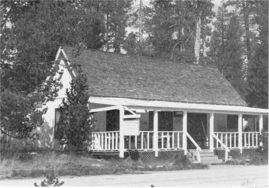
[click to enlarge] |
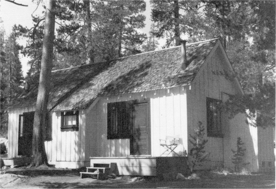
[click to enlarge] |
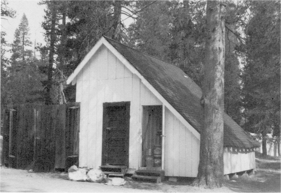
[click to enlarge] |
|
Illustration 117.
Map of Hetch Hetchy water supply, 1925. From Wurm, Hetch Hetchy and Its Dam Railroad. |
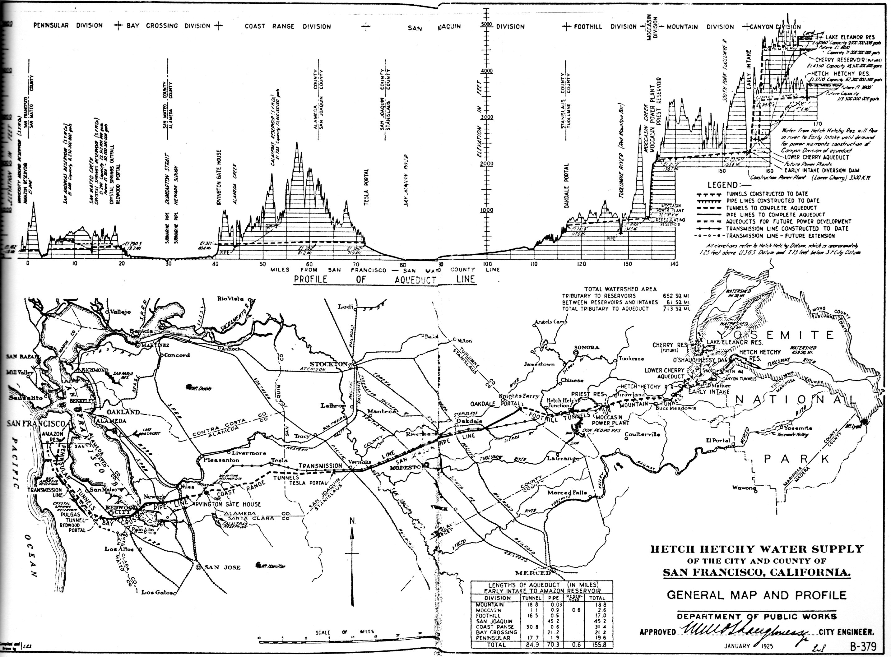
[click to enlarge] |
Construction of the Hetch Hetchy dam took nearly four years and was viewed by large groups of Yosemite Valley campers who took buses over the Big Oak Flat Road to Mather Station on the Hetch Hetchy Railroad. From there special railroad cars carried them to Damsite, and an inclined cableway dropped them to the floor of the valley. The narrow-gauge Valley Railroad then took them to view the various phases of construction. Sometimes those tourists stayed overnight at the park’s Hetch Hetchy Lodge at Mather; others returned directly to the valley. The Yosemite excursions lasted until the summer of 1925. Two years later San Francisco bought Hetch Hetchy Lodge and opened it as part of a new summer resort.
Problems presented by the dam construction were many. To divert the Tuolumne River around the dam site, workers drove a 900-foot-long tunnel through the solid granite of the south canyon wall. A timber-crib diversion dam forty feet high turned the water into the tunnel. Excavation on the dam could then be carried out with little difficulty.
Derricks on the dam site handled the material from the deep excavations. Operating in conjunction with them, a railroad line on the south abutment connected with the valley railroad system north of the river by crossing on the diversion dam. Another track lay at the same elevation on the north abutment.
A cableway with a span of 903 feet, supported on tall towers, extended over the dam site to transfer machinery, industrial locomotives, and other heavy equipment, lumber, and timbers from cars on the Hetch Hetchy Railroad to the narrow-gauge cars of the contractor’s construction railroad on the valley floor. The industrial Valley Railroad extended from the dam site to the head of the valley, about four miles, terminating at the Rancheria Creek sand pit, serving along the way the Falls Creek gravel pit, the Wapama Falls rock quarry, the crusher, and the sand-screening plants. It served to haul excavated material from the dam foundation to the valley dump, to bring sand and rock from natural
|
Illustration 118.
Plat of O’Shaughnessy Dam camp site, showing roads and buildings, 1925. Yosemite Research Library and Records Center. |
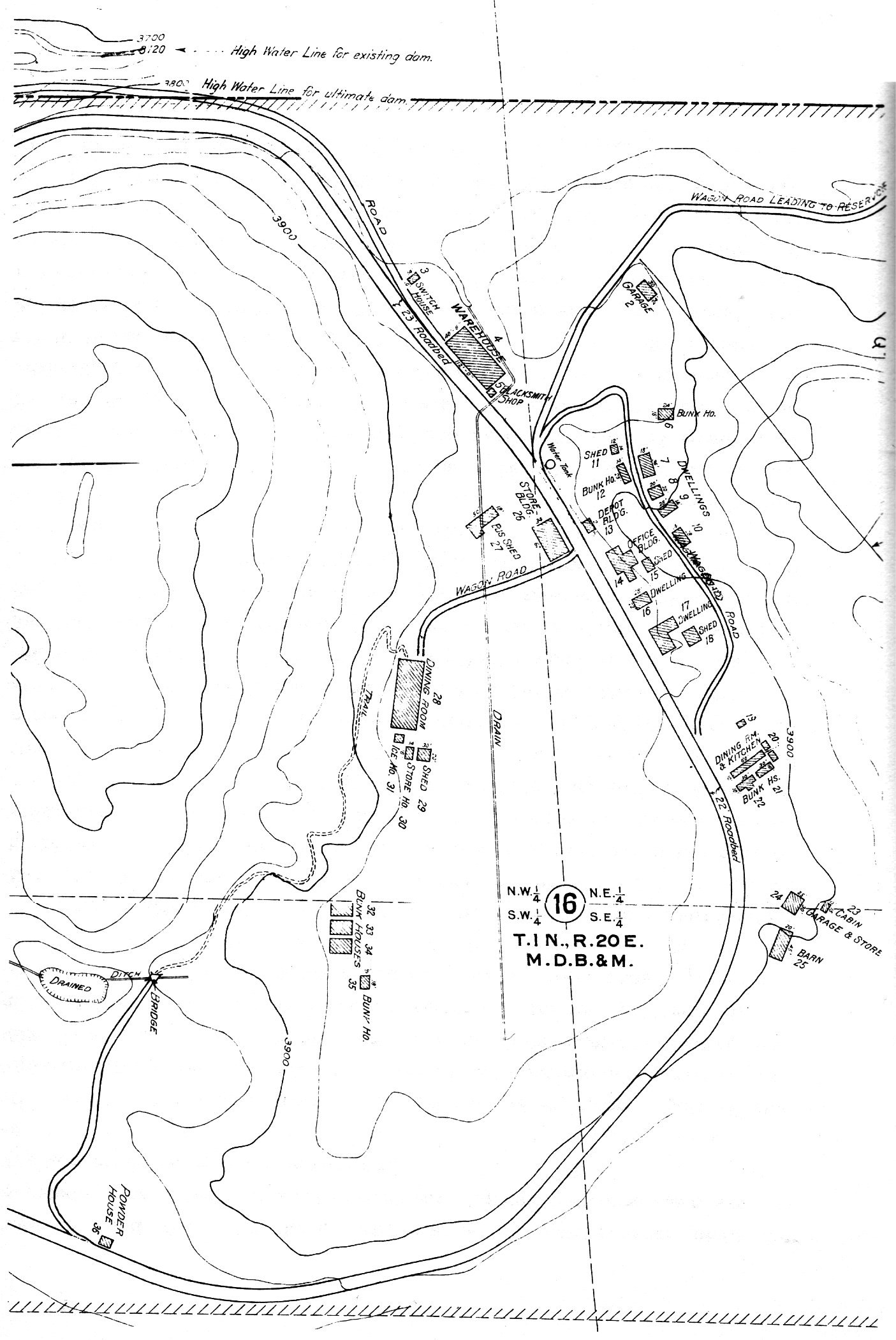
[click to enlarge] |
The rock-crushing plant stood on the valley floor, one-half mile upstream from the dam, with the sand plant for screening sand nearby. Sand and rock brought to the dam site by train from the washing and crushing plant were fed into cement mixers. A four-compartment, timber elevating tower distributed the mixed concrete into the forms.
Mayor James Rolph, Jr., and a group of distinguished visitors dedicated the O’Shaughnessy Dam, named in honor of San Francisco’s chief engineer, on 7 July 1923. It loomed 226-1/2 feet above the original streambed and measured 298 feet thick at its base and 15 feet thick at the top. It became the largest single structure on the West Coast and the second highest dam in the United States, impounding 206,000 acre-feet of water. As the Utah Construction Company began clean-up efforts, Superintendent Lewis requested that he be allowed to look over the buildings in the vicinity of the dam site for possible use by the Park Service. He anticipated that increased travel to Hetch Hetchy would require a ranger station and a small administrative unit there. The city of San Francisco intended keeping three of its cottages for the dam caretakers.
In 1926 the city engineer gave the government permission to tear down a cabin, garage and storeroom, and barn at the dam site—buildings 23 to 25 (see Illustration 116). He also gave permission for an administrative unit on the land across the main roadway southwest of the city’s headquarters buildings. The city would then tear down buildings 27 (bus shed) and 29 to 35 (shed, storehouse, ice house, and bunkhouses). The city did, however, need sleeping quarters for its road construction and maintenance crews at the dam site. Therefore, it decided to retain the bunkhouses on the hill back of its headquarters. It also needed mess halls 19 to 20 as well as warehouse building 4, store building 26, and powder house building 36.
The city gave the Park Service permission in May to use buildings 2 and 6 temporarily for administrative purposes. Park authorities originally intended to raze buildings 23 to 25 to permit erection of a feeding unit by the Yosemite Park and Curry Company, but later decided not to, as explained earlier. In August the Park Service, in an effort to make the dam site more presentable to the public, requested the removal of store building 26, depot building 13, warehouse building 4, bunkhouse 12, and dining room building 28 (the only building left south of the road in the meadow). It also stated that it would tear down the public toilets then in use and provide more suitable facilities as soon as possible.74 In May 1929 the Department of the Interior accepted a deed from the city and county of San Francisco to certain lands at Canyon Ranch; at the Hetch Hetchy reservoir and dam sites; adjacent to the Lake Eleanor reservoir site; and in and adjacent to Tiltill Valley in compliance with certain provisions of the Raker Act.
[74. Robert M. Searls to W. B. Lewis, 19 January 1926; M. M. O’Shaughnessy to W. B. Lewis, 19 May 1926; O. G. Taylor to M. M. O’Shaughnessy, 3 August 1926; in Box 84, Hetch Hetchy, “General, 1926-1927,” Yosemite Research Library and Records Center.]
Barite was discovered near El Portal in the 1880s on the north side of the Merced River. In 1915 the El Portal Mining Company worked the deposits about one mile downriver from El Portal. Ore cars trammed the ore downhill to a bin at the railroad tracks and to one at the quarry. By 1928 the Yosemite Barium Company operated the deposit, which had been worked at different periods by both the El Portal Mining Company and the Western Rock Products Company of San Francisco. The deposit on the north side of the river was the first and, for a long period, the only barite mined commercially in California. The ore was shipped to oil fields where it helped prevent blowouts in the oil wells. Drillers used the heavy metal to “weight” drilling muds to prevent the drills from blowing out of the well casings. This was also the only deposit in the U. S. producing commercial shipments of the carbonate called witherite.
|
Illustration 119.
O’Shaughnessy Dam, Hetch Hetchy. |
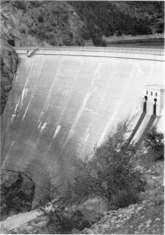
[click to enlarge] |
|
Illustration 120.
Mess hall and dormitory, Hetch Hetchy Photos by Robert C. Pavlik, 1984. |
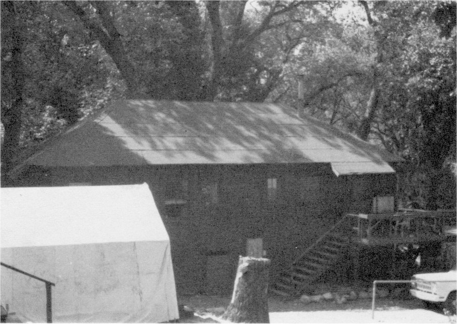
[click to enlarge] |
|
Illustration 121.
Damkeeper’s residence, Hetch Hetchy. |
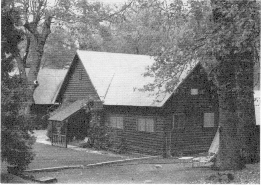
[click to enlarge] |
|
Illustration 122.
Assistant damkeeper’s residence, Hetch Hetchy. Photos by Robert C. Pavlik, 1984. |
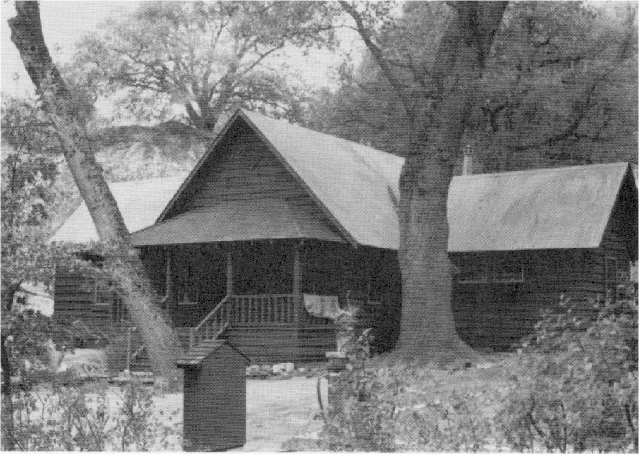
[click to enlarge] |
|
Illustrations 123-24.
Residences, Hetch Hetchy. Photos by Robert C. Pavlik, 1984. |
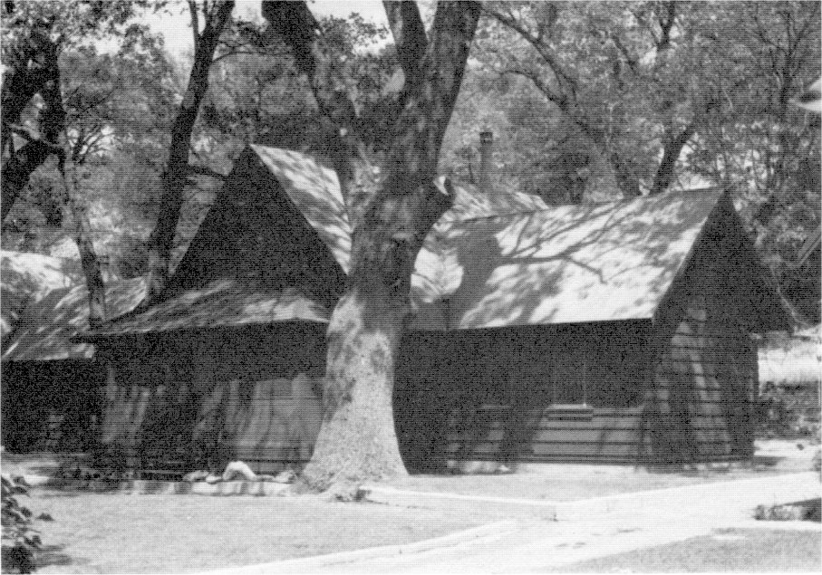
[click to enlarge] |
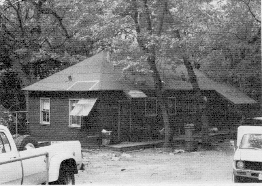
[click to enlarge] |
|
Illustration 125.
Ranger station/residence, built by City of San Francisco, Lake Eleanor. |
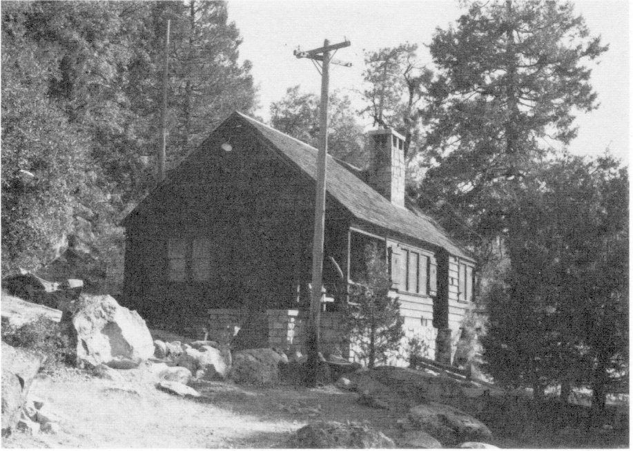
[click to enlarge] |
|
Illustration 126.
Storage building west of above residence, Lake Eleanor. Photos by Robert C. Pavlik, 1984. |
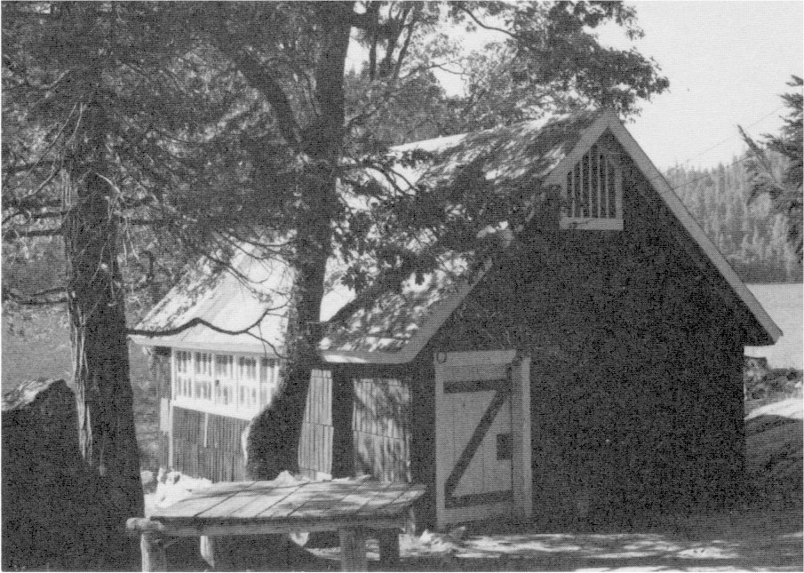
[click to enlarge] |
|
Illustrations 127-28.
Rancheria Flat houses built by National Lead Company. Photos by Robert C. Pavlik, 1985. |
[click to enlarge] |
[click to enlarge] |
|
Illustrations 129-30.
Murchison house (Yosemite Research Center) and assay office (laboratory), El Portal. Photos by Robert C. Pavlik, 1984. |
[click to enlarge] |
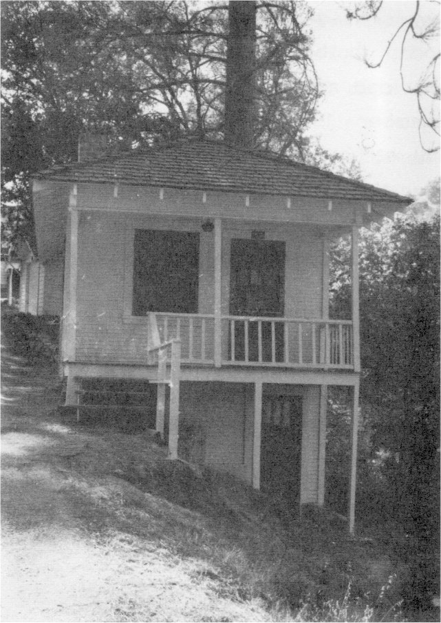
[click to enlarge] |
In 1927 development of a barite deposit south of the river began, by drifting and stoping. The National Pigments Company, Inc., purchased the deposit between 1928 and 1930. The Merced River canyon, the Yosemite Valley Railroad, and the new Yosemite Ail-Year Highway all cut directly across the barite lode. The National Lead Company started operating in December 1928 after purchasing the mill site and barium mine on the south side of the Merced. An aerial tramway carried ore buckets across the highway and river to the mill for processing and loading into railroad cars. After the Yosemite Valley Railroad discontinued service, the mine shipped its product by truck. That proved too expensive, and the company folded in 1951.
One of the more interesting structures in the area is the Murchison house, which now harbors the Yosemite Research Center. It was built in 1929 as a residence for Earl H. Murchison, who superintended the El Portal barium mine for the National Lead Company. Fire destroyed an assay office on the flat below the house, near the present sand pit. The company built a second one to the right of the entrance road to the house, which today is used as an archeological and biological research laboratory. A wooden footbridge built in 1929 across the Merced River below the house provided access to the company’s mill on the other side. The flood of December 1937 destroyed the bridge, and the large galvanized steel mill structure, open on all four sides, was torn down about 1959-60. After the Park Service acquired the land and buildings in 1959, it used the Murchison house briefly as offices for Park Service and General Services Administration employees.
According to Jack Murchison, Earl’s son, barium sulfate was mined on the south side of the river, and barium carbonate on the north side. The mine was considered a godsend during the depression because it utilized many men during a time of widespread unemployment. Murchison also stated that the El Portal Mining Company used convict labor in the mine, secured from San Quentin for a minimal fee.75
[75. Robert C. Pavlik, phone conversation with Jack Murchison, 25 June 1984. For further information on houses in El Portal, see the El Portal Historical Survey completed in 1981.]
On 1 October 1917, after its operations in the park had closed for the winter, the Desmond Park Service Company moved its general office staff and records to the Hotel Del Portal. Although the hotel was owned by the railroad company, the Desmond Company operated it, and the stage line between El Portal and Yosemite Valley, under a lease arrangement. On 27 October a fire, starting from a defective attic flue, completely destroyed the hotel and its contents, including the Desmond Company’s records. (The site of the hotel is now covered by residences on Cedar Lane and Buckeye Road.)76 Adding to the Yosemite Valley Railroad’s problems, restrictions during World War I prevented any expansion of equipment or service. In April 1918 the twenty-room, two-story, less elaborate El Portal Inn replaced the Hotel Del Portal. Located opposite the present library and near the location of the first tent hotel, it was operated by the Yosemite Terminal Company, a subsidiary of the Yosemite Valley Railroad, the Desmond Company having failed in early 1918. During the war years, train travel declined as people had less money to spend on trips and expensive accommodations. Automobile use continued to affect the line’s tourist business. The advent of the auto stage in 1914 had already lessened the hotel’s trade, enabling tourists to go directly from the train to Yosemite Valley for the night. The line still, however, carried a particularly heavy passenger load up until 1926, and carried on a lucrative auto-ferry business.
[76. Dohrmann, “History of the Yosemite National Park Co. and it’s [sic] predecessor the Desmond Park Service Company”; Jim Law, Historic Resources Inventory, State of California—The Resources Agency, Department of Parks and Recreation, Hotel Del Portal (Site), 24 June 1981.]
Between 1923 and 1926, the building of the Exchequer Dam by the Merced Irrigation District and the completion of the All-Year Highway between Merced and the park drastically affected the line. The former structure harnessed the waters of the Merced River and rerouted them in the canals of the irrigation system, necessitating the relocation of about seventeen miles of main line of the Yosemite Valley Railroad. Convict labor completed the final section of the Merced-El Portal road from Briceburg east in 1926, which cut drastically into the business of the railroad as the Yosemite Transportation Company began offering bus trips beginning at Merced at lower rates than the rail fare. In terms of passenger service, the railroad would ultimately be defeated by both auto and bus competition.
The Yosemite Portland Cement Company, incorporated in 1925, opened a lime rock (cement) quarry at Emory in 1927, and the Yosemite Valley Railroad began hauling the rock from there to the company’s Merced mill. Railroad traffic further diminished in November 1927 when the Yosemite Lumber Company, which had provided a major portion of the railroad’s revenue, closed its mill because of a decreasing market. In December 1928 the Sugar Pine Lumber Company of Pinedale purchased the Yosemite Lumber Company’s assets and briefly resumed operations. The railroad also began hauling for several smaller mines and quarries and transported mail and freight for the park. The National Lead Company began mining barites in El Portal in 1929, its deposits providing ninety-six percent of all barites used in California drilling operations. It became an important shipper on the Yosemite Valley Railroad. When the depression hit full force in late 1930, however, the Merced Falls lumber mill closed for a five-year period, and in the early 1930s, the Portland Cement Company drastically curtailed production, bringing on some lean years for the railroad company.77
[77. Hank Johnston, Short Line to Paradise: “The Story of the Yosemite Valley Railroad” (Yosemite, Calif.: Flying Spur Press, 1962), 19-22, 26-30, 37. Also see The Western Railroader, Issue No. 257, vol. 24, no. 5 (May 1961): 3-4, 8-9, 11-12, and Issue No. 310, vol. 38, no. 11 (November 1965), and Johnston, Railroads of the Yosemite Valley, 21-77.]
1. Stream Control
According to James Milestone, during the years of Park Service administration, stream control has passed through three intense periods of construction. Two of them are mentioned in this chapter. During the years 1916 to 1927, the “Sovulewski Years,” Gabriel Sovulewski was general foreman of maintenance in charge of the construction and planning of front-and backcountry trails. He also continued the Yosemite commission’s efforts to halt the lateral erosion of the Merced River banks by constructing bridges, clearing channels, and installing riprap. Future Park Service policies on stream control became well entrenched during this time.
A second distinct period of Park Service stream control, that of the “Landscape Architect,” lasting from 1928 to 1938, emphasized landscape architecture. Landscape architects became more concerned with making the river aesthetically pleasing than continuing natural processes. To accomplish that objective, the Park Service performed more bank revetment, channel clearing, dam building, pipe laying, and bridge construction. During most of that period, the Civilian Conservation Corps performed the majority of the stream control actions, removing log jams, sloping and revegetating undercut river banks, excavating river gravel, and dredging Mirror Lake. Many of the projects Hall had recommended in 1882 were finally carried out, including the construction of five large stone bridges, all of which unintentionally restricted the size of the channel and acted as dams during floods. The last phase of Park Service stream control, the “Preventative Nature Design Years,” from 1955 to 1967, developed after the devastating 1955 flood and will be discussed in the final chapter.
A selected chronology of Park Service construction centering around the Merced River, including stream control measures, from 1916 to 1930, follows:
1916 - placement of water-stage recorders near Happy Isles and Pohono Bridge
1917 - collapse of Clark’s Bridge and its rebuilding in concrete; construction of Indian Canyon Creek Bridge
1918 - construction of Sentinel Bridge; automatic water-stage recorder installed on Tenaya Creek
1919 - erection of dry rock wall on south side of Merced between valley footbridge and village road; construction of small bridge at Stoneman Meadow
1921 - installation of riprap near Stoneman Bridge
1922 - riprap along Yosemite Creek installed; Yosemite Creek road built; Yosemite Creek Bridge finished
1923 - removal of small bridge on Indian Creek and replacement with iron culvert; construction of dam and intake pipeline on Illilouette Creek
1927 - riprapping near Happy Isles; thirteen-plus miles of valley roads asphalted; two miles of roads paved with river gravel; Ahwahnee Hotel completed with gravel from Merced River used in concrete
1928 - construction of Ahwahnee, Sugar Pine, Clark’s, Tenaya Creek, and Pohono bridges with gravel from Merced River and valley-quarried granite; construction of Illilouette Creek Bridge
1930 - El Capitan Bridge falls78
[78. Milestone, “Influence of Modern Man on the Stream System of Yosemite Valley,” 85-94. Milestone’s chronology is more detailed, although the writer’s information sometimes differs from the dates presented by Milestone and those changes are reflected here.]
In 1930 H. E. Williams, Special Agent, wrote a memorandum on Merced River erosion. Williams stated that although “the Merced River has been flowing through Yosemite Valley for a million years and may continue to flow for millions of years without destroying the Valley or all of the trees,” that fact “does not in any way lessen our opportunity to prevent further damage, provided such work can be done at a reasonable cost and . . . that it does not too greatly detract from the natural beauty of the Valley.”79 Williams’s primary concern centered around the number of trees lying in the river that had formed a foundation for river deposits, thus changing the current so that it undercut the banks on the opposite side. As a result of those natural dams, in some places the river had cut new channels, leaving unsightly exposures of trees, roots, and rocks covered with mud during parts of the year. Williams did not particularly approve of riprapping because of its cost and aesthetic objections, but admitted it would be better than letting these conditions continue. His main suggestions involved using a steam or gas shovel to open up the objectionable river deposits and using the excavated material for fill for parking places and campgrounds and in other construction work. Such action would not only open the Merced channel, change the currents, prevent erosion, and prevent much of the overflow into campgrounds, but also provide much needed material for development.80
[79. H. E. Williams, A Memorandum on Merced River Erosion, Yosemite National Park, 11 January 1930, 1.]
[80. Ibid., 1-3.]
2. Meadows
During the 1920s, valley meadow conditions gradually improved. Forest encroachment remained a continuing problem. In 1919 some portions of the meadows by camps 6, 17, and 18 were cleared of growth and three years later workers removed small evergreens from El Capitan Meadow. Clearing of trees would continue in an attempt to preserve remaining meadowlands. Up to that time, as mentioned earlier, the meadows had been severely impacted by cultivation, grazing, picnicking, parking, and various forms of recreation. The advent of the auto had resulted in a decline in the use of horses and horse-drawn conveyances and consequently in a decreased demand for hay and pasture, leading to a general decline in livestock and barn and feed facilities. This enabled the meadows to gradually begin reverting to a more natural state. The increased visitation, however, with its intensified land use, began forcing the Park Service to more clearly assess the use of the limited valley acreage.
The tule elk herd penned in Yosemite Valley beginning in the early 1920s resulted in much overgrazing of the area between the old and new villages. In 1924 more of El Capitan Meadow was fenced for stock grazing, the old pasture having become barren. By the mid-1920s, however, the Park Service began imposing limitations on meadow utilization. In 1924 fences around Leidig and Bridalveil meadows came down and the gradual phasing out of grazing began. By 1930 the valley dairy herds had been removed and the number of work stock much reduced. Beginning in 1929, park crews began digging ditches around the meadows and placing rock curbs to prevent cars driving onto the meadows.81 The ditches also, however, changed the valley drainage patterns by interrupting their flow.
[81. Fitzsimmons, “Effect of the Automobile,” 107, 110, 119.]
3. Fire Control
Until the 1920s, the Park Service had no central fire control organization. Fire control expertise primarily came from park rangers who had graduated from forestry school or who had transferred from the Forest Service and who propagated Forest Service beliefs about fire and control techniques. Many early parks, formed out of national forests, inherited the remains of the previous Forest Service fire organization, such as lookout towers, roads, trails, and the like. General Park Service fire policy has been discussed earlier, and only its specific applications during 1916 to 1930 will be discussed here.
The Park Service considered fire a threat to the scenic and recreational values of the parks, as had the commissioners and, with some notable exceptions, the army. The Service’s major fire control thrust was suppression, although no money specifically for that purpose had ever been appropriated. In 1922 the Park Service finally received a special fire control appropriation—an emergency account to be used only in case of fire. Four years later it was combined with other moneys into a general disaster fund to cope with emergencies and repair damage. No presuppression activities were allowed, however.
In 1926, while the forest fire danger continued to grow, Chief Naturalist Ansel Hall became head of a Park Service Division of Education and Forestry, headquartered in Berkeley. The position primarily was to be concerned with interpreting forest resources to visitors, but it soon included fire planning duties. In 1928 the actions of Park Service crews in fighting a large fire near Sequoia National Park brought much criticism and led to the creation of the post of fire control expert under the chief forester. A veteran Forest Service supervisor, John D. Coffman, was named to the new position. Under Coffman the Park Service and other members of the Forest Protection Board prepared a comprehensive fire prevention plan detailing the facilities and other requirements adequate for fire control within the National Park System. This laid the foundation for later Civilian Conservation Corps fire programs in the parks. Congress then made its first national appropriation of $10,000 for park fire protection and also stressed the need for presuppression capabilities, an activity which was actively carried out by the CCC. Fire lookouts op were not authorized until 1931.82
[82. Pyne, Fire In America, 296-98. Interagency experimentation with resource management on a national scale during the 1920s resulted in formation of the Forest Protection Board, which existed from 1927 to 1933. It functioned as an advisory body to ensure coordination of effort among federal agencies in examining all aspects of forest destruction, especially fire. Ibid., 317-18.]
4. Grazing
The question of park grazing arose at the beginning of America’s involvement in World War I on 6 April 1917 and prompted some heated disagreements between Secretary of the Interior Lane and Acting Park Service Director Horace Albright. The latter tried to persuade his supervisor, whose patriotism was clouding his conservation convictions, to keep park resources intact unless the war situation took a drastic turn for the worse. The crisis arose when western ranchers began agitating for the right to graze sheep and cattle on park lands. They would, they said, conform to the government’s request for conservation of food supplies. Although the possibility existed that the cattlemen hoped to use this argument as a means of gaining a foothold on park lands, in view of their strong demands, the Park Service opened certain areas of the parks to grazing, but only by cattle, which were thought to be less destructive in their grazing habits. In Yosemite, Secretary Lane wanted all the park lands above the valley opened to sheep. Albright reached a compromise with him, permitting cattle to graze on lands primarily in the western and northwestern portions of the park, north and south of the Tuolumne River, plus a small section in the southeast corner. Albright managed to forestall the department issuing large numbers of grazing permits for most of 1917.
The Park Service and California grazing interests discussed the continuation of grazing on park lands as war conditions continued during 1918. As a result of strong lobbying efforts by the California Cattlemen’s Association for increased grazing privileges over those granted at the beginning of the war, the Park Service opened about seventy percent of Yosemite to grazing during the period of emergency. The cattle grazing had immediate detrimental effects on the deer population, which began to suffer from lack of food.
In 1919 the Park Service decided to again close Yosemite to grazing because of the termination of the war and the ending of drought conditions. It restated that no reason existed for permitting commercial uses of the park during peacetime and also pointed out that the expected heavy tourist visitation that year made it desirable to keep the reservation as free as possible of activities inconsistent with the primary purposes of the park. Altogether, the national parks received little damage from grazing during World War I thanks to the efforts of Acting Director Albright, supported by various conservation groups.83
[83. Swain, Wilderness Defender, 73-75.]
During the 1916 season, the park more stringently enforced its fishing regulations and pursued with continued vigor the work of stocking lakes and streams. Fish conservation had become an important activity because fishing, particularly in the backcountry, had evolved into one of the main park attractions.
In the fall of 1917 the Galifornia Fish and Game Commission conducted a survey to determine a suitable site for a trout hatchery to serve Yosemite Valley and outlying areas. The commission reached an agreement with the Interior Department allowing the state to lease a site of approximately three acres at Happy Isles in Yosemite Valley for a twenty-year period. The agreement provided that the state erect a building at its own expense, on the condition that if the federal government wanted to take it over after three years, it would reimburse the state for the original cost. The project appeared very advantageous to the state in that its interests were fully protected, the park would furnish water free from its distributing mains, and park personnel would distribute the fry without cost to the state. In addition, the hatchery offered an excellent opportunity to demonstrate to visitors the type of work the commission performed.
Subsequently the Fish and Game Commission established an experimental hatchery operation in the fall of 1918. Early the next year it acquired lumber for a building, and in the spring of 1919 it installed a temporary hatchery building on the site of the proposed permanent one. That same spring 400,000 rainbow, lahontan cutthroat, and steelhead trout eggs hatched. Although the site proved successful for breeding purposes, opposition to continuing the project arose because the erection of permanent buildings on leased land contravened state policy. The state therefore decided to abandon the project, and in the fall of 1919 the governor of California ordered the hatchery dismantled and removed. The equipment was transferred to Wawona and used to equip that station for more extensive operations.
Over the next few years the park continued to think that because of the rapidly increasing use of the park by the public and the accompanying increase in the use of fishing waters, more extensive stocking of park waters was necessary than was possible by shipping fry to the park from outside hatcheries. Finally, after the Federal Bureau of Fisheries, which operated hatcheries in Yellowstone and Glacier national parks, began showing an interest in extending its activities to Yosemite, the state and the Park Service reached an agreement in 1926 for a permanent hatchery at Happy Isles. The hatchery building and two residences were subsequently built in 1927. The new hatchery played an important role in connection with the educational and nature study work being carried on in the park; in 1927 the park instituted Nature Guide services there.
The hatchery building, of local rock and heavy timber, contained 52 troughs for hatching and rearing the trout, and a smaller room held four 250-gallon aquariums where visitors could see rainbow, golden, and brown trout. The structure also held displays explaining the fishery program in Yosemite. A large show pond outside contained prize specimens of trout, while six circular concrete tanks raised “catchable” trout. Two family dwellings stood south of the hatchery, and a bachelor quarters was attached to the side of the building.84
[84. Robert C. Pavlik, “A History of Yosemite’s Fish Hatcheries,” 1984, typescript, 3 pages, in Yosemite Research Library and Records Center, 2-3; E. C. Finney, First Asst. Secretary, Department of the Interior, to California State Fish and Game Commission, 10 February 1923, Central Files, RG 79, NA. The Addendum to the Natural Resources Management Plan 1977, 89, points out that the waterfalls formed during the Pleistocene glaciation acted as fish barriers, preventing fish from reaching streams and lakes in the high country. Man’s introduction of exotic fish has been contrary to a “natural area” concept and the park fishery, enabling fish planting in waters to which trout are not indigenous, basically served an alien function by prohibiting the restoration of aquatic ecosystems to their original condition. In addition, fish stocking in Yosemite has mostly involved genetically altered, hatchery strains of the native rainbow trout and other species alien to the park. Natural Resources Management Plan, 1977, 33.]
During 1915 the Park Service established temporary gauging stations on the Merced River, one above Illilouette Creek and the other on the Illilouette near its confluence with the Merced. In August 1915 laborers placed a staff gauge at the Happy Isles Bridge, downstream from the power plant and near the fish hatchery. It eventually appeared that the powerhouse regulated the river’s flow and that the one or two daily staff readings were insufficient reflections of the daily mean flow with that regulation and did not accurately portray the often extreme fluctuation caused by melt-off from April through June. To remedy the situation, an automatic water-stage recorder replaced the Happy Isles staff gauge in November 1916. An attractive fourteen-foot-square enclosure with vertical log pillars and a high hip shake roof sheltered the new equipment. (After a falling tree destroyed it in April 1975, a smaller, less distinctive structure replaced it.)
|
Illustrations 131-34.
Water gauging station, Pohono Bridge, and gauge at Happy Isles with interpretive information. It states that this spot was selected as a national hydrologic benchmark because of its location in a national park on a stream largely unaffected by man. Recordings are made of water stages and temperatures and samples collected for analysis of dissolved minerals and gases, trace metals, bacteria, and suspended sediment. Photos by Robert C. Pavlik, 1985, and Linda W. Greene, 1984. |
|
[click to enlarge] |
[click to enlarge] |
[click to enlarge] |
[click to enlarge] |
At the same time workers installed a similar automatic Friel eight-day water-stage recorder on the Merced just upstream from the Pohono Bridge. The housing for that recorder, on the south side of the river, is still visible today from the El Portal road. A third water-stage recorder installed on Tenaya Creek in 1918 replaced the staff gauge that Chandler and Currie had erected there in 1904. The National Park Service provided materials and labor for the construction of the stilling wells and instrument shelters for the three recording stations, while the Geological Survey and the state of California provided the instruments, plans, and supervision. Continuous recorders replaced all the eight-day oc recorders in 1925.85
[85. Robert C. Pavlik, “Water Gaging Stations in the Merced River Drainage, 1904-1984,” 6 December 1984, typescript, in Yosemite Research Library and Records Center.]
Stream-flow records have been obtained in two areas of the park other than the valley floor, but not directly in cooperation with the National Park Service. A station operated on the South Fork of the Merced at Wawona from 1910 until 1922. Also, in accordance with provisions of the Raker Act, the city and county of San Francisco, under the direction of the Geological Survey, operated gauging stations for several years on the Tuolumne River, Falls Creek, and Eleanor Creek.
The cooperation over many years between Yosemite National Park and the Geological Survey resulted in useful and valuable records of stream flow from Sierra Nevada streams in their natural state. A list of the stream-flow gauges established in Yosemite National Park follows:
Yosemite Creek—stream-flow recordation began here on 9 July 1904. The staff gauge was fastened to an alder tree on the right bank, fifty feet upstream from the bridge on the road between the Yosemite post office and Yosemite Fall and half a mile upstream from the confluence of the creek and the Merced River. Readings were taken from 1904 to 1909 and 1912 to 1926.
Merced River at Yosemite Creek—a staff gauge was established on 11 July 1904 at the bridge across the Merced River at the Sentinel Hotel, about one-half mile upstream from Yosemite Creek. It was fastened to the masonry of the left abutment on the downstream side. Readings were made irregularly to 1909 and from 1912 to 1918.
Tenaya Creek—a staff gauge was established 11 July 1904 at the highway bridge over Tenaya Creek about .7 mile upstream from its mouth. Early records describe the gauging station as at Tissaack Avenue bridge crossing Tenaya Creek on the road between the Yosemite post office and Mirror Lake. The stilling well and shelter for the automatic water-stage recorder installed in 1918 were built in the left bank about fifty feet upstream from the bridge. Readings were made from 1904 to 1909 and from 1912 on.
Merced River at Happy Isles Bridge—a staff gauge was established here on 20 August 1915, close to the powerhouse at the structure now used as a trail bridge. The gauge was bolted to a large boulder on the downstream side of the right bank pier. One of the first two automatic water-stage recorders used in Yosemite Valley replaced it on 2 November 1916. The well and shelter for the recorder stood on the right bank about twenty feet downstream from the bridge. Readings continued from 1915 on.
Merced River above Illilouette Creek—a staff gauge was established 20 August 1915 to determine the low flow for the season. The gauge was attached to a large boulder on the left bank about 1,000 feet upstream from the mouth of Illilouette Creek and one-fourth mile upstream from the point of diversion for the powerhouse. Readings were made from August through December 1915 and some in 1916. Illilouette Creek—a staff gauge was established 20 August 1915 at a point about 800 feet upstream from its mouth and one-half mile from the powerhouse, just downstream from Happy Isles. It was a temporary station established to ascertain the low water flow for the season. Readings were made from August through December 1915 and some in 1916.
Merced River at Pohono Bridge—an automatic Friel eight-day water-stage recorder was installed here on 2 November 1916 in a concrete well with a wooden shelter, built with the help of park personnel on the left bank of the river about 150 feet upstream from or the Pohono Bridge. Readings were made from 1916 on.86
[86. Revoe C. Briggs, District Engineer, Geological Survey, to Carl P. Russell, Superintendent, Yosemite National Park, 20 May 1952, in Yosemite Research Library and Records Center.]
Beginning in the mid-19205, rangers conducted snow surveys on a limited basis in Yosemite National Park. Although snow surveys were usually made to provide data needed to forecast runoff, which was important to storage operations connected with power production, irrigation, and domestic water supply, and to facilitate flood control, recreation, and avalanche forecasting, those made in the park at this time helped determine the opening date for high country roads and trails and predict the condition of the valley waterfalls during the tourist season.
The Park Service did, however, enter into an agreement with the Merced Irrigation District, which was interested in runoff because the Merced River fed directly into the district’s reservoir on the eastern side of the San Joaquin Valley. In 1926 a snow course was installed at Dana Meadow. In 1927 the district donated money to build a patrol cabin at Merced Lake to aid in snow surveys. The Park Service building could be used by the irrigation district in the course of snow survey travels. That cabin is used today as a ranger patrol cabin.
The state legislature appropriated funds in 1929 to be used by the Department of Water Resources in organizing a California Cooperative Snow Surveys Program to begin in January 1930. That program would coordinate snow surveys throughout the Sierra. The department provided funds for equipment, building construction, and occasionally for personnel to conduct the surveys. Agencies to be involved in the snow surveys included irrigation districts, municipalities, and public utility companies, as well as other state and federal agencies.87 The Park Service agreed to assist in the program. Once a month, from January through April, rangers traveled over the designated snow courses measuring the depth of snow and the water content.
[87. Robert C. Pavlik, “A History of Snow Survey in Yosemite National Park,” 30 November 1984, typescript, 2 pages, in Yosemite Research Library and Records Center, 1.]
An important event with significance for future planning efforts in Yosemite National Park took place in 1927 with the formation of a Yosemite Advisory Board. The action related to a comprehensive study of the problems related to the use and enjoyment of the park and the preservation of its natural features that Congress authorized in the Interior Department Appropriation Act for fiscal year 1929. The first three men suggested for appointment as Expert Advisors were Fredrick Law Olmsted, Jr., the nationally known landscape architect and planner; Duncan McDuffie of San Francisco, a member of the Coordinating Committee on National Parks and Forests; and John P. Buwalda, professor of geology at the California Institute of Technology in Pasadena, all of whom were considered outstanding in their interest, knowledge, and judgment regarding national parks and conservation matters.
Ordinarily Park Service areas did not have advisory boards, but the Interior Department believed that Yosemite Valley, because of its extremely heavy visitor impact, had need of such a planning body to aid in questions of broad policy. The group’s task involved formulating a basic plan for the valley floor, including all of its administrative and service needs, taking into consideration the park’s fundamental values. Hopefully, after studying the unique features of Yosemite Valley and the surrounding country, the board could design a plan not only for the development of the valley floor but for the larger use of the park as a whole. The department considered this a good time to reclarify the educational and inspirational features of the area.
Coincidentally, Colonel Charles Goff Thomson came from Crater Lake National Park in 1929 to serve as Yosemite superintendent, succeeding W. B. Lewis. This period of park development, beginning with a reformulation of objectives and a restatement of ideals, required a dynamic, experienced, but visionary leader at the helm. Thomson fitted the requirements perfectly. Frank A. Kittredge later stated that Thomson’s
keen sense of the fitness and desire for the harmony of things in the national parks has made itself felt in the design of every road, every structure, and every physical development in the Park. He recognized the importance and practicability of restricting and harmonizing roads and structures into a natural blending of the surroundings. He has set a standard of beauty and symmetry in construction which has been carried beyond the limits of Yosemite into the entire National Park system. The harmony of the necessary man-made developments and the unspoiled beauty of Yosemite Valley attest to the Colonel’s injection of his refinement of thought and forceful personality, into even, n the everlasting granite itself of the Yosemite he loved so well.88
[88. Scott, The Yosemite Story, 50. Thomson served as superintendent until 1937.]
Next: 6: NPS 1931 to 1960 • Contents • Previous: 4: Cavalry 1905-1915
| Online Library: | Title | Author | California | Geology | History | Indians | Muir | Mountaineering | Nature | Management |
http://www.yosemite.ca.us/library/yosemite_resources/mather_years.html