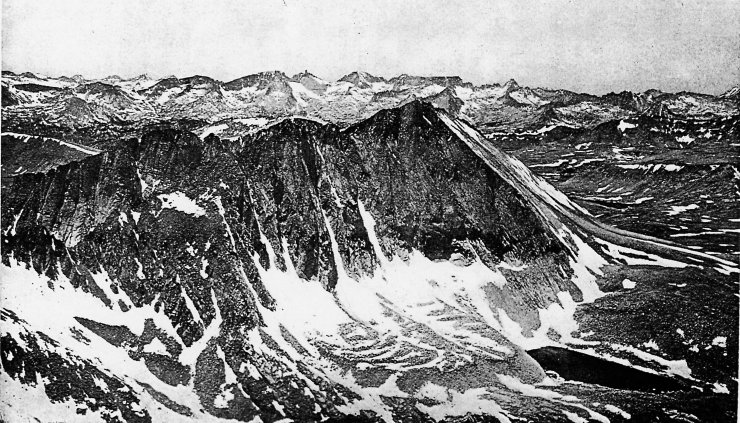
MOUNT TYNDALL FROM MOUNT WILLIAMSON
Showing the Great Western Divide in the distance, with Milestone Mountain
and Table Mountain.
Photograph by J. N. LeConte.
| Online Library: | Title | Author | California | Geology | History | Indians | Muir | Mountaineering | Nature | Management |
Yosemite > Library > Exploration of the Sierra Nevada > The Whitney Survey and Clarence King >
Next: Yosemite Valley • Contents • Previous: Big Trees
A new period in the history of the Sierra Nevada opens with the establishment, in 1860, of the California State Geological Survey. In the next few years the remote canyons and the highest mountain peaks were to become known and placed upon the map. Professor Josiah Dwight Whitney of Harvard University received the appointment of State Geologist and proceeded to organize a staff of remarkable young men, several of whom became national leaders in the fields of geology and topography. William H. Brewer, later professor of agriculture at Yale, was Whitney’s principal assistant; and William Ashburner and Chester Averill were also among the first members of the staff. In the following year Charles F. Hoffmann was added as topographical assistant and Dr. J. G. Cooper as zoologist.
During the first two years of its existence, the Survey devoted most of its attention to preliminary surveys and to organization, and it was not until 1863 that work was begun in the Sierra Nevada., Meanwhile the staff had been increased by the addition of William More Gabb as palaeontologist, and by two young men who had recently graduated from the Scientific School at Yale, Clarence King and James Terry Gardner. King volunteered to go an an expedition with the Survey to Lassen’s Peak and Mount Shasta, and after serving as volunteers for a while, both young men became permanently attached to the Survey.
For the next few years, this staff, under direction of Professor Whitney, was exceedingly active and produced a great quantity of information which Whitney proceeded to prepare for publication. The legislature, however, while generous at first, soon became antagonistic to Whitney, whom ideas of scientific research diverged more and more from the demands of politicians and “practical” men. His employers were man concerned with metals and other minerals than with mountain tops and glaciers and, especially, old bones and shells. Whitney strove valiantly to impress upon the legislature and the people of the State the importance of palaeontology and the other accompaniments of a geological survey. Support was more and more withdrawn, and by 1870 the work of the Survey was practically closed, although it was not officially discontinued until 1874. 42
The results were published in a series of volumes, brought out largely at Whitney’s own expense and for which he received only partial reimbursement from the State. The series was never completed. There were also produced several editions of a Yosemite Guide Book, 43 which for many years was the principal source of reliable information about the Yosemite region and almost the only one about the High Sierra. A perusal of them volumes, particularly the Yosemite Guide Book and the publication on geology, 44 brings to light the vivid personalities of the members of the Survey and affords many a delight in the picturesque descriptions of the rugged High Sierra scenery. Here we read the official record of the explorations that was immortalized in popular form by Clarence King in “Mountaineering in the Sierra Nevada.” 45
In June 1863, Whitney, Brewer and Hoffmann made a thorough reconnaissance of the region beyond Yosemite Valley in the upper basin of the Tuolumne. It was on this occasion that they climbed and named Mount Dana, June 28, 1863. The name was given in honor of James Dwight Dana, then the most eminent American geologist and Vice-President of the National Academy of Sciences.
In 1864 them was undertaken the first extensive exploration of the hitherto vaguely known regions of the High Sierra. Inasmuch as the route followed during them explorations has never to my knowledge been traced in detail since the publication of accurate topographical maps, it will perhaps not be out of place to follow its course as far as it can be ascertained from the reports of the Survey and the writings of Clarence King.
The party under the leadership of Brewer, included Hoffmann, Gardner, and King. They entered the mountains from Thomas’ Mill and kept along the main divide between the North Fork of Kaweah River and Boulder Creek nearly to Mount Silliman, probably crossing what is now known as J. O. Pass. Mount Silliman was ascended by some members of the party and a clearly recognizable sketch by Hoffmann is shown in the report. They observed the dome structure in this vicinity and may have visited Twin Lakes before turning northward. From Rowell Meadow, or vicinity, they followed Sugarloaf Creek as far as the Sugarloaf. Guided by observations from Silliman and Sugarloaf, the party proceeded toward the western crest of the Sierra and crossed “King’s River, a stream twenty feet broad, and travelled up the valley of the south branch of the south fork of that river, camping at the western base of Mount Brewer.” 46
The identification of the route is materially assisted by Hoffmann’s map, published about 1873, on which the route is traced by a faint dotted line. 47 From this it is clear that the party ascended the eastern bank of Roaring River and ascended Brewer Creek. It is interesting to observe that Clarence King, with characteristic freedom, in his description stretches the width of the stream to thirty feet. Both King’s description and that of the official report agree, however, in describing the remarkable system of moraines that flank Roaring River; in fact the official report shows so much talent in description that one is inclined to believe that King wrote many of the best passages and afterwards dressed them up a little for his own purposes in the articles that he wrote for the Atlantic Monthly, which were ultimately brought out in his book. 48
From the camp at the base of Mount Brewer, the peak was twice ascended; first on the 2nd of July and again on the 4th. This statement is found in the Whitney report and is corroborated by the discovery of the original record on the summit by Miss Estelle Miller of Joseph N. Le Conte’s party in 1896. 49 Two excellent drawings of Mount Brewer, one by Hoffmann and one by Gardner, appear in the 1865 report. An estimate was made of the height of Mount Brewer by barometrical measurement, and was given as 13,986 feet. This was not far from the height determined many years later by the United States Geological Survey, 13,577 feet.
It was from the upper slopes of Mount Brewer that Brewer and King and their companions first beheld the lofty peak which they then and there hailed as the highest of the Sierra and named in honor of their chief, Mount Whitney. The view of Whitney from this point is most inspiring and it is little wonder that Clarence King became excited and insisted upon attempting to reach it. He received permission from Brewer, and with Richard Cotter, “an indomitable mountain-climber whose Services were of great value in more than one branch of the work,” 50 left the others on Mount Brewer on the 4th of July, and set out upon that adventurous scramble which, as described in “Mountaineering in the Sierra Nevada,” is one of the classics of mountaineering literature. It would be vain to endeavor to trace the precise course of their arduous climb, but a glance at the maze of granite walls and dizzy pinnacles is sufficient to win acknowledgment of King’s extraordinary perserverance. If King had only known, he could have crossed the divide to the headwaters of the Kern by an easier route but he seemed to have a special aptitude for discovering only the most difficult ones. This after all is not an uncommon failing of mountaineers in attempting to go where no one has been before. I know from personal experience how easy it is to become trapped upon a climb that presents at first a reasonably safe course, but which develops unexpected difficulties. If one has a fixed purpose to attain the objective,
|
MOUNT TYNDALL FROM MOUNT WILLIAMSON
Photograph by J. N. LeConte. |
Once over the divide, King and Cotter made rapid progress toward Mount Tyndall, but there again they became involved in difficulties that seem almost incredible to anyone who has been on the summit of that mountain. I have been up one side of Mount Tyndall and down the other, and nowhere did I see any slope that seemed so hazardous as that described by King. Yet there is hardly a doubt that the mountain of his exploit is the same as the one that now bears the time. James D. Hague once intimated to Clarence King that his story of the slopes of Mount Tyndall might well seem pretty steep to an unimaginative reader, whereupon King offered to throw off five degrees for a flat acceptance or, otherwise, to conduct him personally to the scene of the adventure. 51
From the summit of Mount Tyndall observations were taken of Mount Whitney, Mount Williamson, and other points. Mount Whitney proved too far away to be reached on this hasty trip and King and Cotter were obliged to turn back from Mount Tyndall and return to the camp near Mount Brewer. The account of the return is given at great length in “Mountaineering in the Sierra Nevada” but in the official report is confined to the following few words: “We were obliged to take a new route home, but made the whole successfully, reaching the camp near Mount Brewer with our bones and the barometer whole, although twice on the way back Cotter came within a hair’s breadth of losing his life, and once I almost gave myself up.” 52
After King’s return, the whole party went back to Big Meadows, being out of provisions. From this camp, King and Brewer made a hasty trip to Visalia, whence Brewer returned to the party and King made another effort to reach the summit of Mount Whitney. He followed The trail recently constructed across the Kern River to the Owens Lake region and passed by what is termed Sheep Rock, about eight miles south of Mount Whitney, the point subsequently to come into fame as false Mount Whitney, later called Mount Corcoran and now known as Mount Langley. After some difficulty in crossing the plateau, King reached the base of Mount Whitney but once more he chose an unfortunate route for climbing and, after reaching a point within a few hundred feet of the summit, was forced to abandon the attempt. The customary label of those days was therefore placed upon Mount Whitney by declaring it “utterly inaccessible.” This is qualified by the remark that “Mr. King thinks it possible, however, that some route may yet be found by which the summit can be reached.” This was, indeed, true as King himself learned nine years later. 53
While King was attempting to reach Mount Whitney, Brewer and the others descended into the great canyon of the South Fork of Kings River. They remarked its resemblance to the Yosemite and were impressed by the enormous height of its cliffs. Attempting to ascend the main South Fork towards Paradise Valley, they were forced to give up as they could not take their animals over the Indian foot trail. They did, nevertheless, succeed in scaling the north wall, probably by Copper Creek, and camped in Granite Basin. From there they made a series of unsuccessful attempts to reach Mount Goddard which they had seen and named from Mount Brewer a few weeks before. They observed that the canyon of the Middle Fork of Kings River was even deeper than that of the South Fork. From this point they also observed and named Mount King and Mount Gardner. At the head of what is here termed “the north fork” they observed a very high range of peaks which they called the Palisades. 54 By “north fork” they probably meant the northerly branch entering Kings River Canyon, shown on present-day maps as the Upper South Fork of Kings River. They undoubtedly had a fairly correct conception of the main topographical features of the Kings River basin, as is shown by Hoffmann’s map; and at the time of writing the report they were familiar with the true North Fork of Kings River, which is shown in its proper location on the map as taking its source west of Mount Goddard.
After abandoning the attempt to take their animals into the Middle Fork, Brewer and his party returned to Kings River Canyon, ascended Bubbs Creek and Charlotte Creek, and crossed Kearsarge Pass. It is remarked that “the labor of crossing was much facilitated by the fact that a party of prospectors had crossed here not long before, and had done a good deal towards making a passable trail.” 55 This was the party of Thomas Keough and others, including John Bubbs for whom the main tributary of the South Fork of Kings River was named. 56
The Brewer party went north through Owens Valley and reentered the mountains by way of Rock Creek and Mono Pass at the bead of Mono Creek, a tributary of the South Fork of the San Joaquin. To a peak just south of the pass on the main crest, they gave the name Mount Abbot. The report mentions that this pass had been used in the preceding year (1863) by a party of seventy cavalrymen with pack train.
The members of Brewer’s party were much impressed by the grand scenery of the Mono Creek region and were particularly interested in a group of dark, crimson colored peaks towards the north. Gardner visited this group, but it is not recorded that he reached the summit of my of the peaks. I judge from the route shown on Hoffmann’s map and from the character of the country itself, that Gardner went up one of the side canyons of Mono Creek and perhaps ascended the slopes of Red and White Mountain. Continuing down Mono Creek, the mingling of slate and volcanic formations with the granite was observed. One of the slate peaks, which may be the one now called Volcanic Knob, was called Mount Gabb after the palaeontologist member of the Survey. The name has been transposed to one of the higher granite peaks.
Crossing the South Fork of the San Joaquin, the plateau between that basin and the North Fork of Kings River was ascended, and another attempt was made to reach Mount Goddard. Cotter and one of the soldiers who had been detailed as an escort to the Survey party, managed to get within a few hundred feet of the summit and took a reading of the barometer. From this, the height of the mountain was calculated to be about 14,000 feet. The United States Geological Survey has since determined the height to be 13,555 feet.
The Survey party now turned towards the northwest and made their way to what they call the north fork of the San Joaquin. They evidently reached the vicinity of the junction of the two forks now known as the South and Middle forks, and the remarkable canyon and dome scenery of that locality is unmistakable described. Brewer likened one of the domes to “the top of a gigantic balloon struggling to get up through the rock.[”] 57 The Middle Fork was crossed at a point north of this dome, probably in the vicinity of the later Miller and Lux bridge. Ascending Granite Creek, they made camp in Jackass Meadow. A high peak east of Mount Lyell was observed and named Mammoth Mountain. Subsequently, when they saw it from the other side, they gave it the name Mount Ritter. The peak named Black Mountain on Hoffmann’s map was climbed and Mount Clark was beheld only eight miles to the north. A pass about eighteen miles to the northeast appeared to them to be the lowest across the Sierra between Carson and Walker passes, which is in fact the case. It was remarked that cattle had been driven across to Owens Valley by this route, using a crossing of the San Joaquin above the one they had just used—doubtless at the point known as Sheep Crossing. Turning southwest to the head of Chiquito San Joaquin, they found trails indicating a return to the regions of civilization. From the head of Fresno River they reached Clark’s Ranch at Wawona on the 23rd of August, “pretty nearly at the end of their resources, as well as their strength.” 58
Thus ended one of the greatest exploring trips in the history of the Sierra Nevada. It was the only attempt of the Whitney Survey to examine the region of the High Sierra at the head-waters of the San Joaquin and Kings Rivers, excepting a visit to Mount Ritter. Subsequent efforts of the Survey in the High Sierra were in the region about the head-waters of the Merced and Tuolumne, which had already been reconnoitered in June and July 1863. In October and November 1864, King and Gardner were engaged in making a survey and map of Yosemite Valley for the commissioners appointed by the Governor to manage the Yosemite Valley and the Mariposa Grove of Big Trees. They climbed many of the points around the Valley, and ascended Mounts Hoffmann and Conness. 59
The results of the publicity given to Yosemite and the High Sierra were already beginning to be shown, and the Whitney Survey report states that Mount Dana had received a number of visitors during the season of 1864. King, with Cotter—the comparion of his climb of Mount Tyndall, attempted to climb the Obelisk (Mount Clark), but they were driven from the mountains by a severe snow storm. Their experiences are vividly described in a chapter in King’s “Mountaineering in the Sierra Nevada.” An attempt was made by Brewer and Hoffmann to climb Mount Lyell but they did not reach the very summit, “which was found to be a sharp and inaccessible pinnacle of granite rising above a field of snow. 60 What would they have said if they could have seen some seventy-five members of the Sierra Club, many of them novices, grouped on this pinnacle fifty years later!
Names were given at this time to a number of the peaks including Lyell, Dana, Conness, Ritter, Warren, and Maclure (erroneously spelled McClure on later maps). 61
Further explorations of the Sierra were carried on in the seasons of 1866 and 1867. In the former year, King and Gardner made a survey east and southeast of Yosemite, and it may have been on this occasion that King attempted unsuccessfully to climb Mount Ritter. 62 He did succeed, however, in reaching the summit of the Obelisk (Mount Clark), with Gardner, after a perilous leap that provides one of the greatest thrills in King’s vivid writings. The fact that subsequent climbers have had little difficulty in reaching this summit and have never been able to discover the “location” of this famous episode, should in no way detract from the enjoyment of the reader, for King’s faculty for finding the worst possible route should always be borne in mind. 63
The principal exploration of 1867 was conducted by Hoffmann, who made a thorough study of the region just north of Yosemite Valley, including the canyon of the Tuolumne. A photographer, W. Harris, accompanied the expedition and four of his photographs were included, with a number of Yosemite views by C. E. Watkins, in the first edition of Whitney’s Yosemite Guide Book, published in a limited edition in 1868. Notable among these is a photograph taken near the summit of Mount Hoffmann, showing Charles F. Hoffmann himself with big transit on the mountain that had been named for him.
The Whitney Survey was the first great contribution to an accurate knowledge of the High Sierra, and the series of publications and maps made this knowledge generally available, yet perhaps the greatest achievement of the Survey was the initiation of the young men, whom Whitney had gathered together, into the splendors of the mountain scenery and their training in the sciences of geology and geography. The fruit of these experiences was borne almost immediately in the delightful literary products that came from Clarence King in the early days of his enthusiasm; and later, in Hoffmann’s professional career, in the achievements of King and Gardner in the Survey of the Fortieth Parallel, and the organization under King of the United States Geological Survey.
————
42
Brewster: Life and Letters of Josiah Dwight Whitney, 1909.
43 The Yosemite Book, 1868; the Yosemite Guide-Book, 1870; The Yosemite Guide-Book, pocket edition, 1871; same, revised, 1874.
44 Geology, Volume 1, 1865.
45 Boston, 1972; revised edition, 1874,
46 Whitney Survey; Geology, 1865, p. 378.
47 Reproduced in part in King’s Mountaineering in the Sierra Nevada, edition of 1874.
48 Atlantic Monthly, May, June, July, August, 1871.
49 Sierra Club Bulletin, 1897, II, 2, p. 88; 1922, XI, 3, p. 252, and plate LXXII.
50 Whitney Survey: Geology, 1965, p. 366.
51 Clarence King Memoirs, 1904, p. 410.
52 Whitney Survey: Geology, 1865, p. 397.
53 Whitney Survey: Geology, 1865, p. 301,
54 Whitney Survey: Geology. 1865, p, 301.
55 Whitney Survey: Geology, 1865, p. 394.
56 Sierra Club Bulletin, 1918, X, 3, p. 340.
57 Whitney Survey; Geology, 1865, p. 401; Yosemite Guide-Book, 1970, p. 137.
58 Whitney Survey: Geology, 1865, p. 403.
59 King: Mountaineering, 1872, p. 144; Whitney Survey: Yosemite Guide-Book, 1870, p. 103.
60 Whitney Survey; Yosemite Guide-Book, 1870, p. 104.
61 Whitney Survey: Yosemite Guide-Book, 1870, pp. 94, 100, 101.
62 Whitney Survey; Yosemite Guide-Book, 1870, p. 109.
63 King: Mountaineering, 1872, pp. 198-205.
Next: Yosemite Valley • Contents • Previous: Big Trees
| Online Library: | Title | Author | California | Geology | History | Indians | Muir | Mountaineering | Nature | Management |
http://www.yosemite.ca.us/library/exploration_of_the_sierra_nevada/whitney.html