Yosemite > Library >
Maps >
![[Yosemite]](/images/yosemiteicon.png)
Yosemite Library: Yosemite Historic Maps
The map is not the territory.
—Alfred Korzybski, 1931
Maps are
arranged by date from earliest to present-day.
Use of these maps is subject to the
disclaimer below.
Some maps are large, so may take some time to download if you have a slow connection.
-
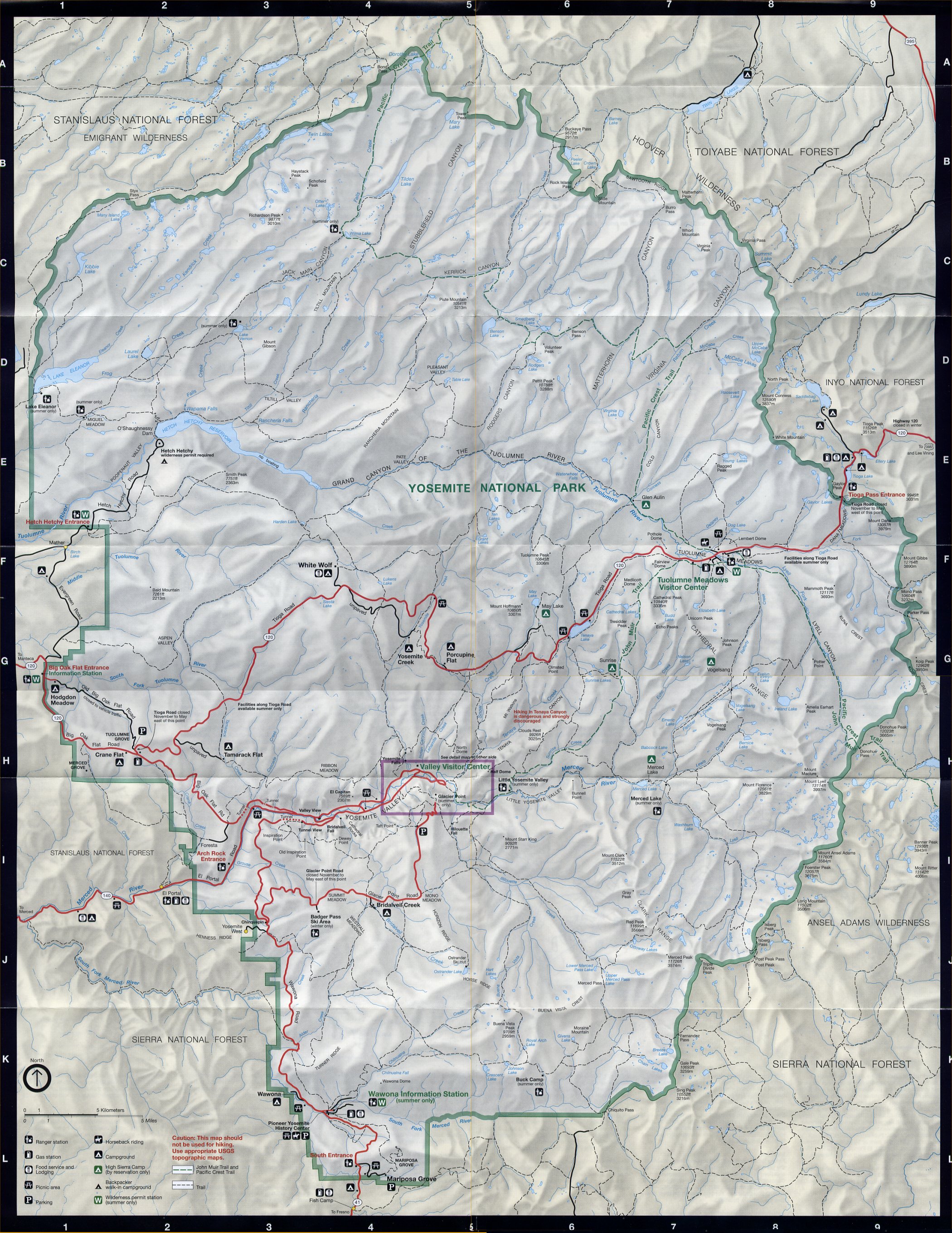
Separately listed are present-day (modern) Yosemite maps:
General Yosemite Maps,
Yosemite Valley Maps,
Wawona & Mariposa Grove Maps,
Tioga Road, Tuolumne Meadows, & High Sierra Maps,
Hotel Maps,
Campground Maps,
&
Winter Maps
[ prehistory
| 1777
| 1833-1883
| 1849-1850
| 1851
| 1852
| 1850-1915
| 1857-2011
| 1859-1959
| 1868
| 1869
| 1870
| 1871
| 1872
| 1873
| 1874-1955
| 1879
| 1880
| 1884
| 1883-1990
| 1886
| 1888
| 1889
| 1890
| 1890-1961
| 1891
| 1892
| 1886-1896
| 1864-1979
| 1894
| 1896
| 1897
| 1900
| 1902
| 1906
| 1907-1945
| 1908
| 1909
| 1909-1912
| 1911
| 1912
| 1914
| 1917
| 1919
| 1920
| 1921
| 1923
| 1924
| 1926
| 1925-1941
| 1929
| 1930
| 1931
| 1932
| 1933
| 1934
| 1935
| 1937
| 1938
| 1939
| 1941
| 1945
| 1946
| 1947
| 1948
| 1949
| 1951
| 1952
| 1955
| mid-1950s
| 1956
| 1958
| 1959
| 1962
| 1963
| 1964
| 1965
| 1966
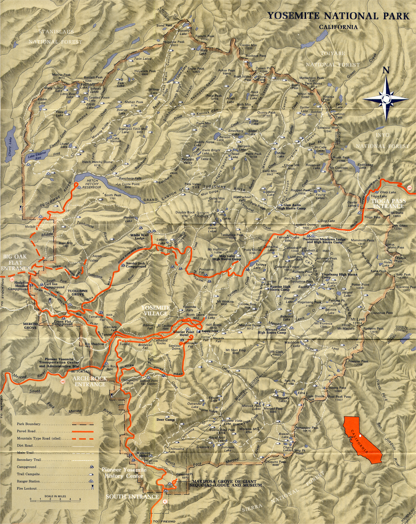
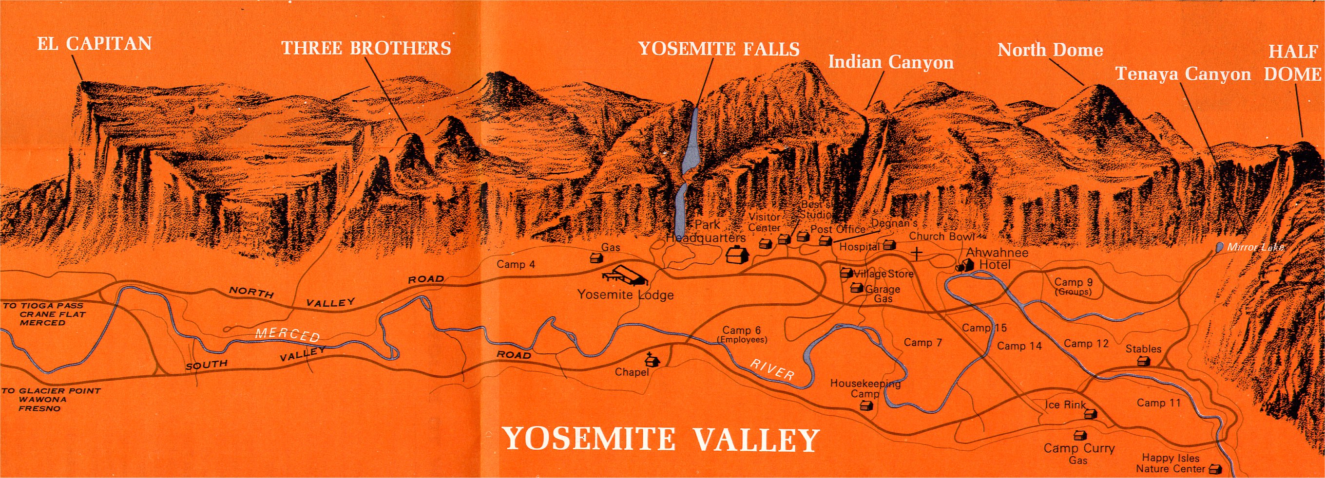
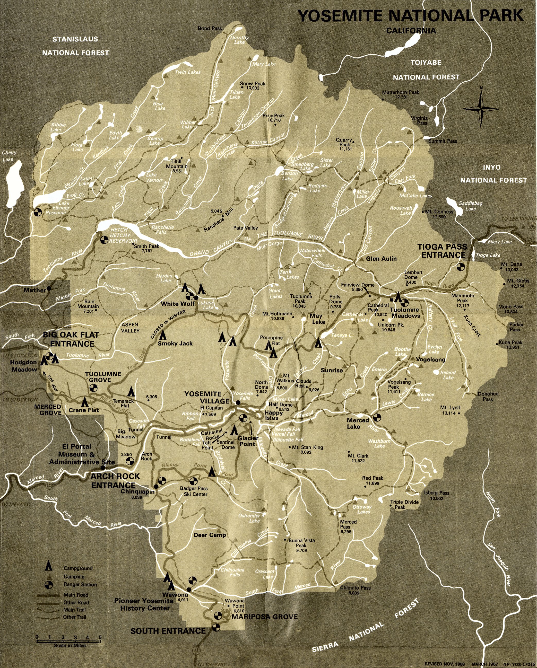
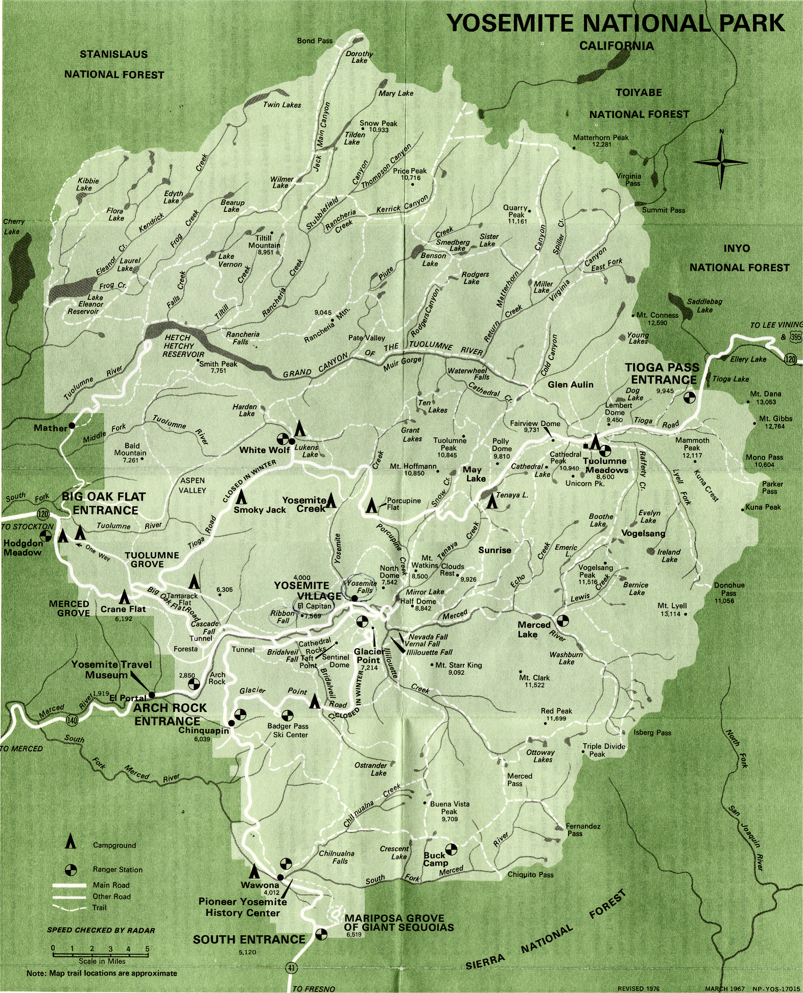
| 1967
| 1969
| 1970
| 1970-2011
| 1972
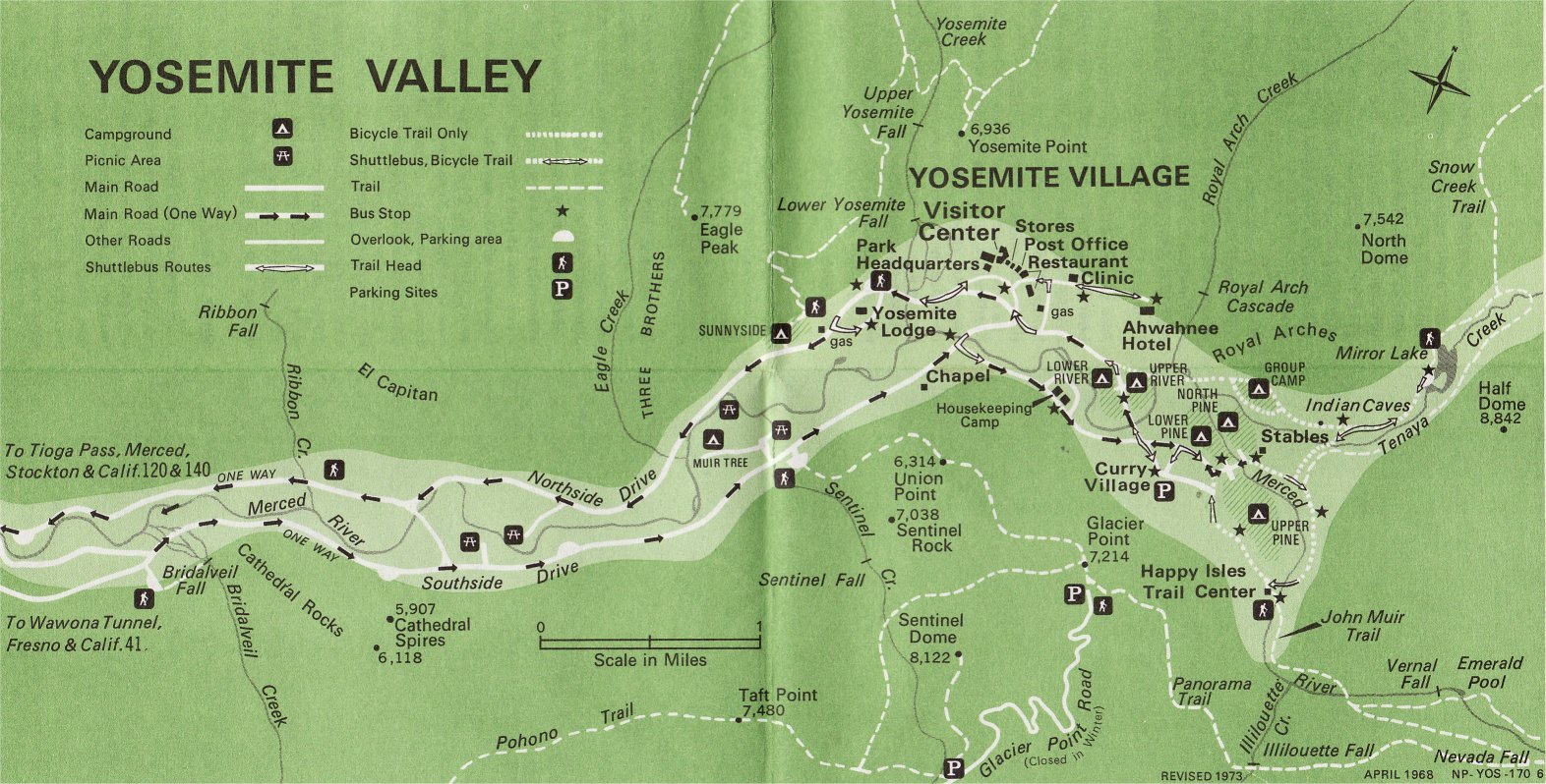
| 1973
| 1975
| 1978
| 1983
| 1985
| 1987
| 1990
| 1994
| 1998
| 1999
| 2001
| 2003
| 2008
| today
| disclaimer
]
- Prehistory
-
“Map of ancient glaciers of Yosemite region,”
from plate 39 of
Geologic History of the Yosemite Valley (USGS: Geological Survey Professional Paper 160, 1930) by François E. Matthes
[NPS website]
-
“Territory and Villages of the Maidu and Miwok.”
From Handbook of Indians of California by A. L. Kroeber (1919).
- “Location of Indian tribes in the vicinity of Yosemite National Park” (1956)
from Yosemite: the Park and its Resources (1987) by Linda W. Greene
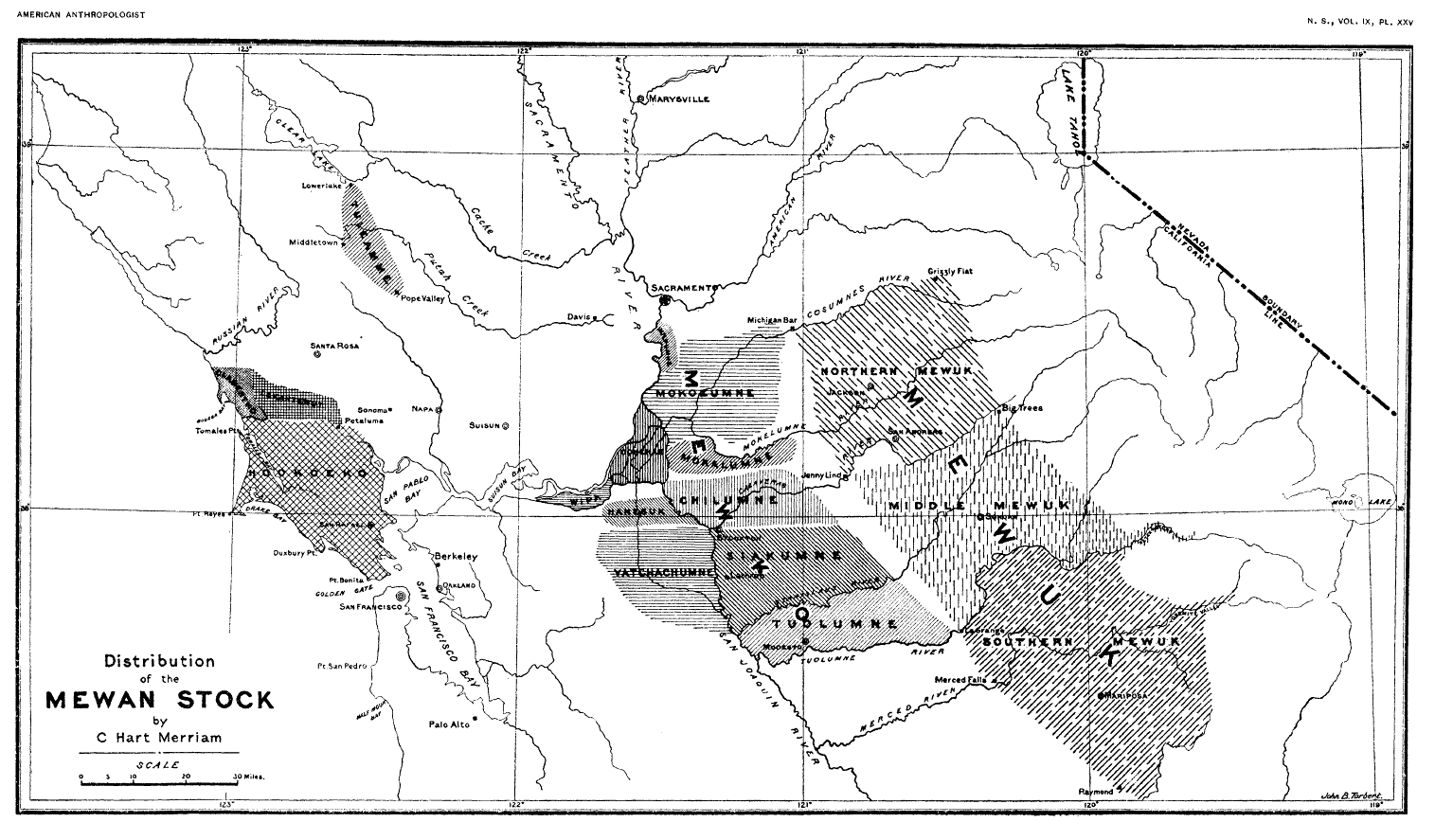
- “Distribution of the Mewan Stock by C. Hart Merriam,“ map of Miwok boundaries from
C. Hart Merriam,
“Distribution and Classification of the Mewan Stock of California,”
American Anthropologist 9(2):338-357 (April/June 1907)
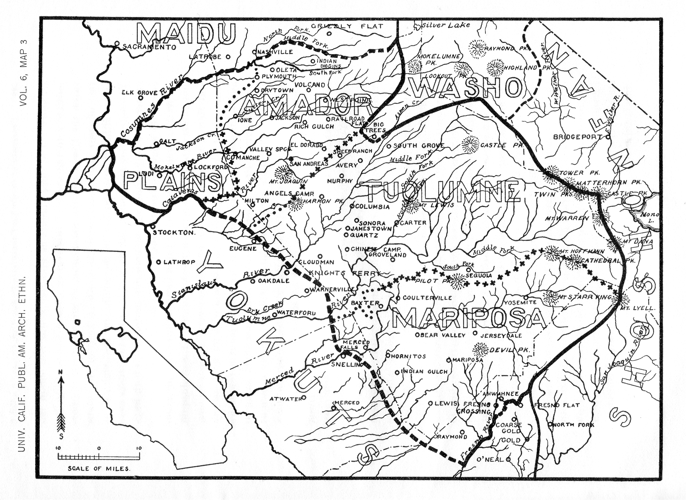
- Map of Miwok territory
from
S. A. Barrett
“The Geography and Dialects of the Miwok Indians,”
UCPAAE 6(2):333-368 (February 1908) [PDF]
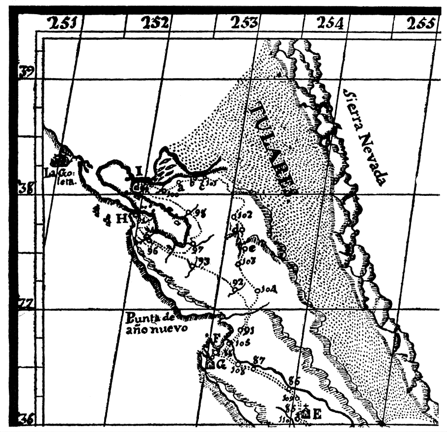
- 1777
-
Mapa del viage que hizo el P. F. Pedro Font a Monterey, y Puerto de San Francisco; y del viage que hizo el P. F. Francisco Garcés por el Rio Colorado hasta su desemboque, y para arriba hasta el Moqui.
In the archives at Seville, Spain; sketch-copy from Coues, On the Trail of a Spanish Pioneer 1 (1900). This map shows the name “Sierra Nevada” for the first time in its present location and indicates rivers entering the Tulares from the Sierra.
- 1833-1883
- Sketch Map of Yosemite Region [1833-1883]
from
One Hundred Years in Yosemite
2d. ed. (1947)
by Carl P. Russell
[1890x1341, 175KB]
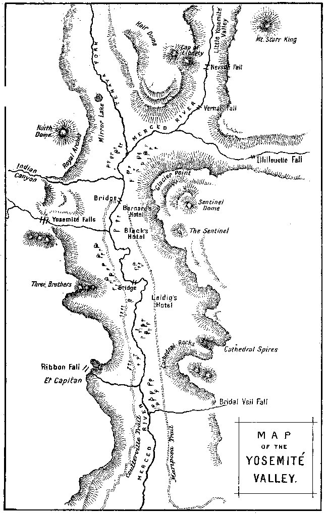
- “Early Trails Yosemite National Park”
from Yosemite: the Park and its Resources (1987) by Linda W. Greene
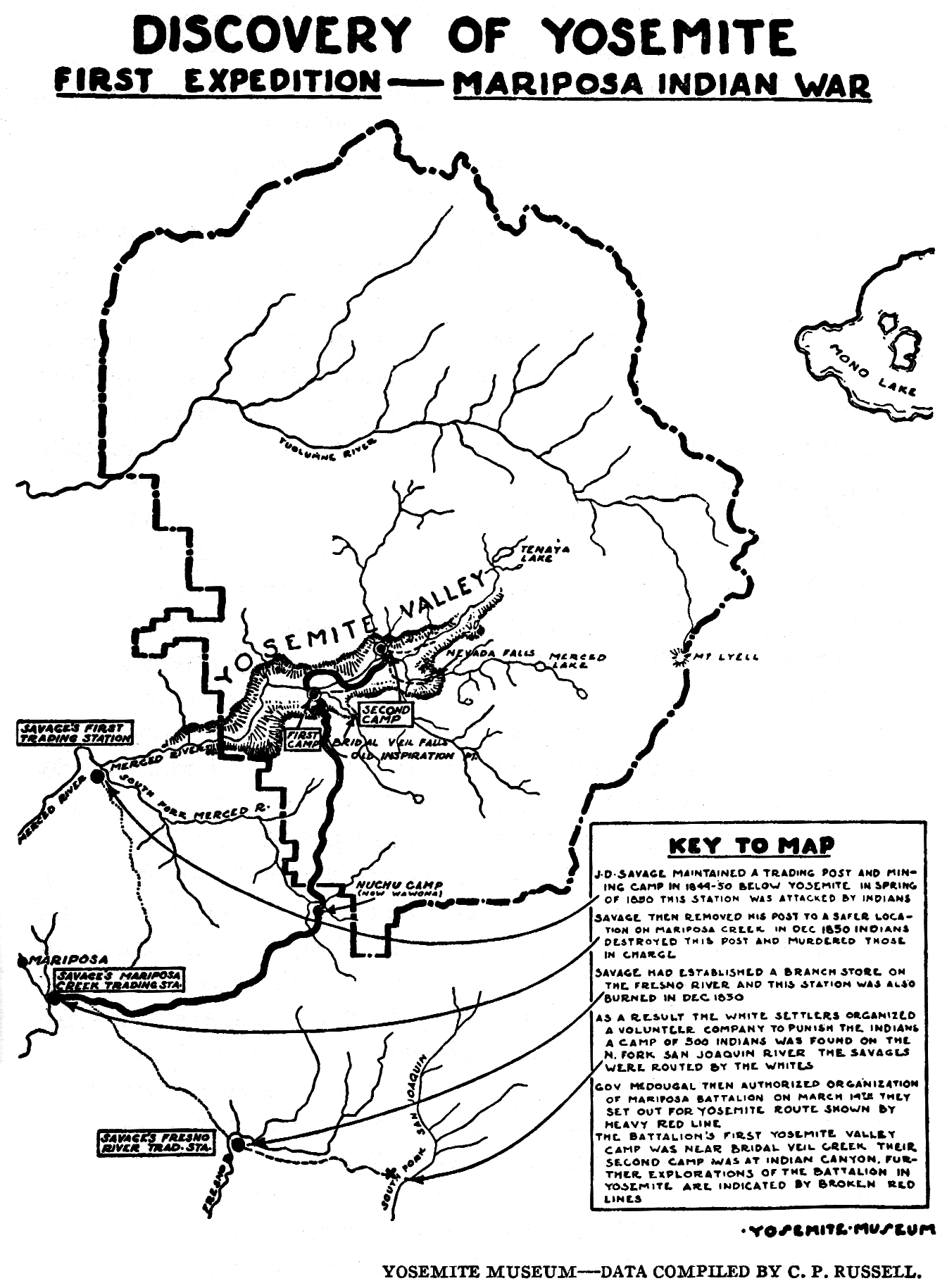
- 1849-1850
-
Discovery of Yosemite: First Expedition— Mariposa War by Carl P. Russell. From
“Early Years in Yosemite” (1926)
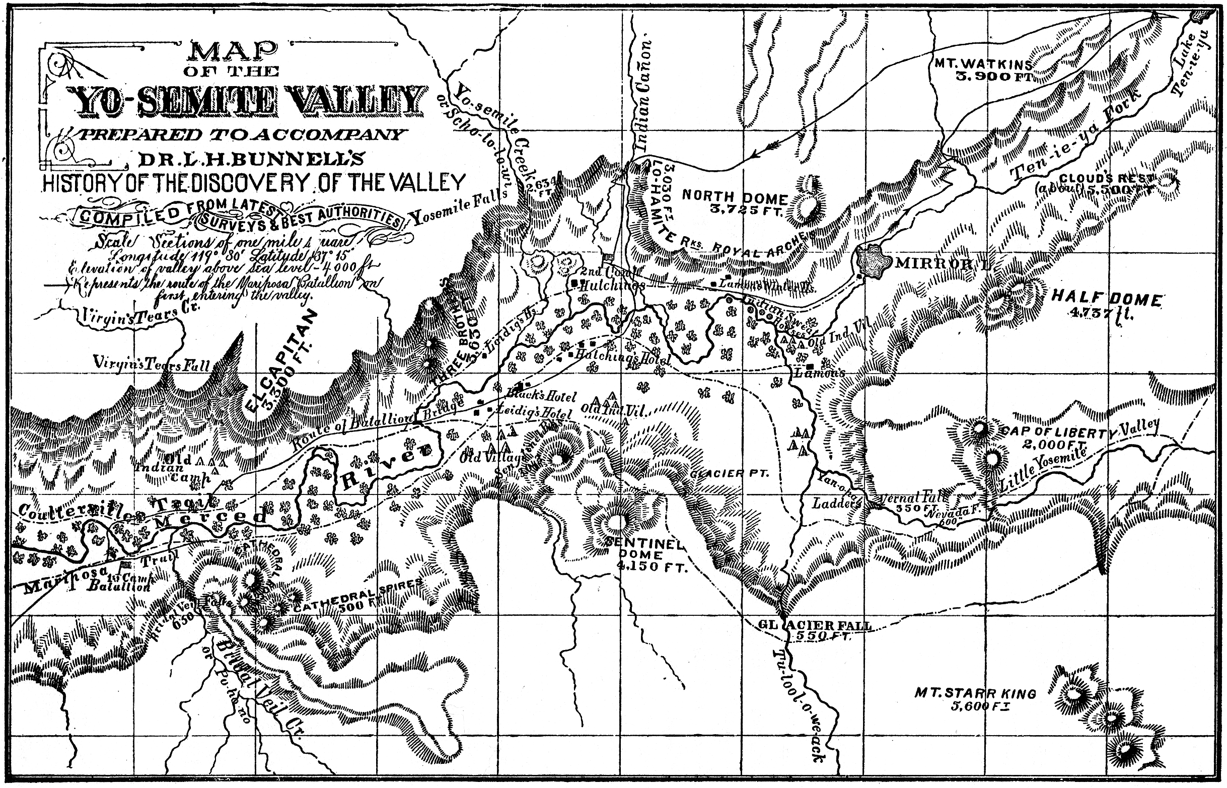
- 1851
-
Map of the Yo-semite Valley
notes Indian villages and sweathouses in Yosemite Valley in 1851
from
L. H. Bunnell’s
Discovery of the Yosemite
(1st. ed., c. 1880)
- “Route of Mariposa Battalion First Expedition—March, 1851”
from Yosemite Indians Yeserday and Today (1941) by Elizabeth H. Godfrey
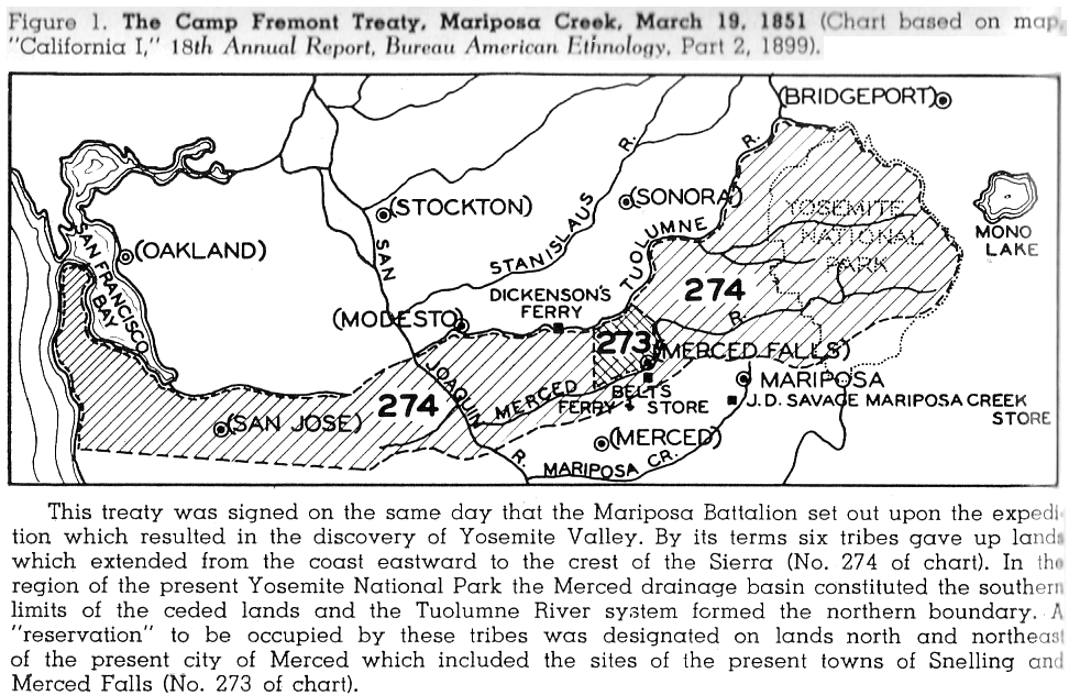
- Map of Mercedes Indian Reservation, created from the Camp Fremont Treaty of March 19, 1851. Congress never ratified the treaty and the reservation reverted to public land after a few years.
From
Carl P. Russell,
“Geography of the Mariposa Indian War,”
Yosemite Nature Notes 30(7):62 (July 1951) [PDF]
- 1852
- Map of Merced River area gold mining country, including Mariposa, 1851-1852, from Sam Ward in the Gold Rush (1861, 1949)
- Map of San Joaquin River area Indian Reservations, 1852, by Indian Agent Col. Adam Johnson, from Sam Ward in the Gold Rush (1861, 1949)
- 1850-1915
- Historical Maps of Yosemite National Park and Yosemite Valley 1850 to 1915
(mostly of outlying cabins)
from Yosemite: the Park and its Resources (1987) by Linda W. Greene
- 1857-2011
- “Yosemite Valley Historic Rockfall Map 1857-2011” (NPS, 2011).
From Rockfall (NPS).
- 1859-1959
- Old Yosemite Village Area, Development from 1859 to 1959
from Yosemite: the Park and its Resources (1987) by Linda W. Greene
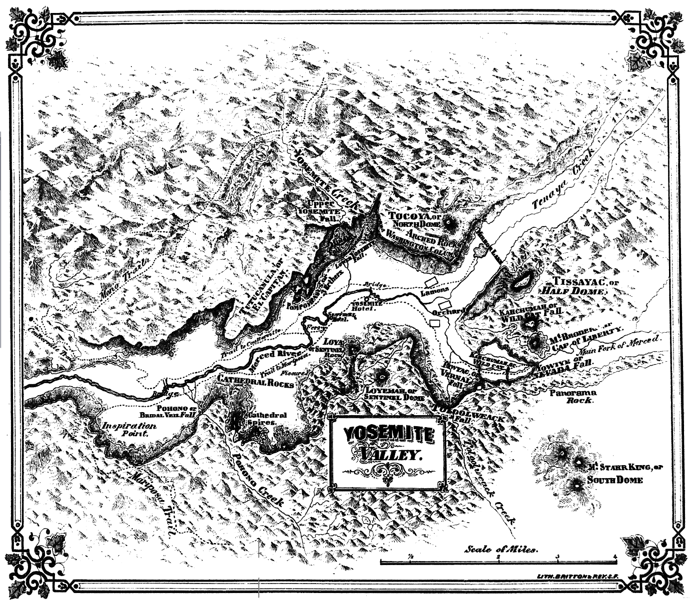
- 1868
- “Yosemite Valley”
from
Yosemite: Its Wonders and Its Beauties (1868) by John S. Hittell
[1383 x 1213, 610KB]
- 1869
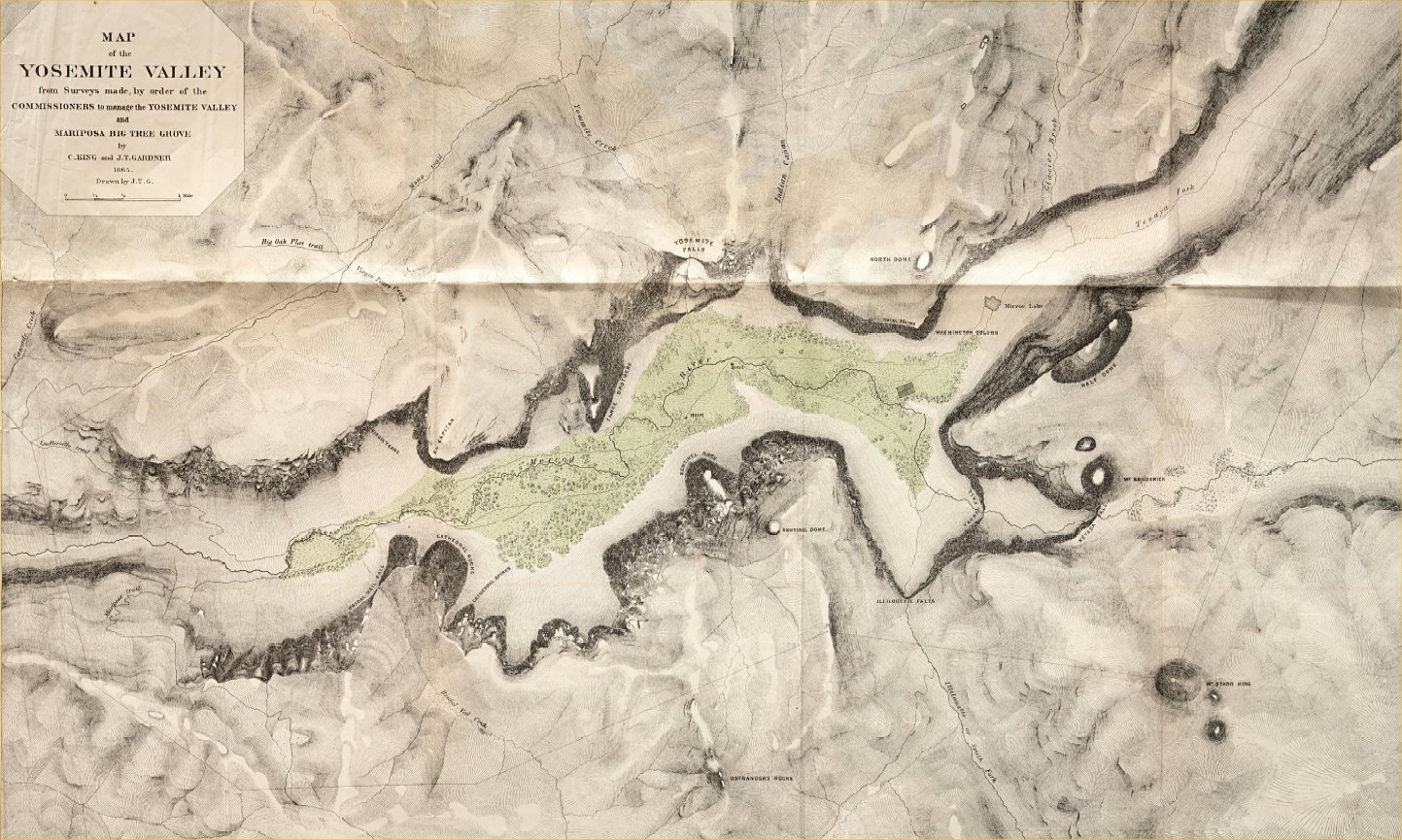
-
“Map of the Yosemite Valley prepared to accompany
the pocket edition of the Yosemite Guide Book”
by Clarence King and James T. Gardner,
from
The Yosemite Book
by Josiah D. Whitney (1869 ed.) [1443 x 865, 360KB]
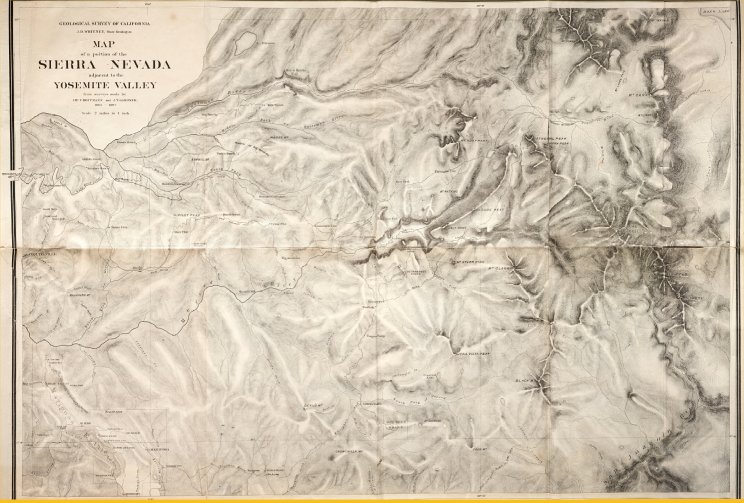
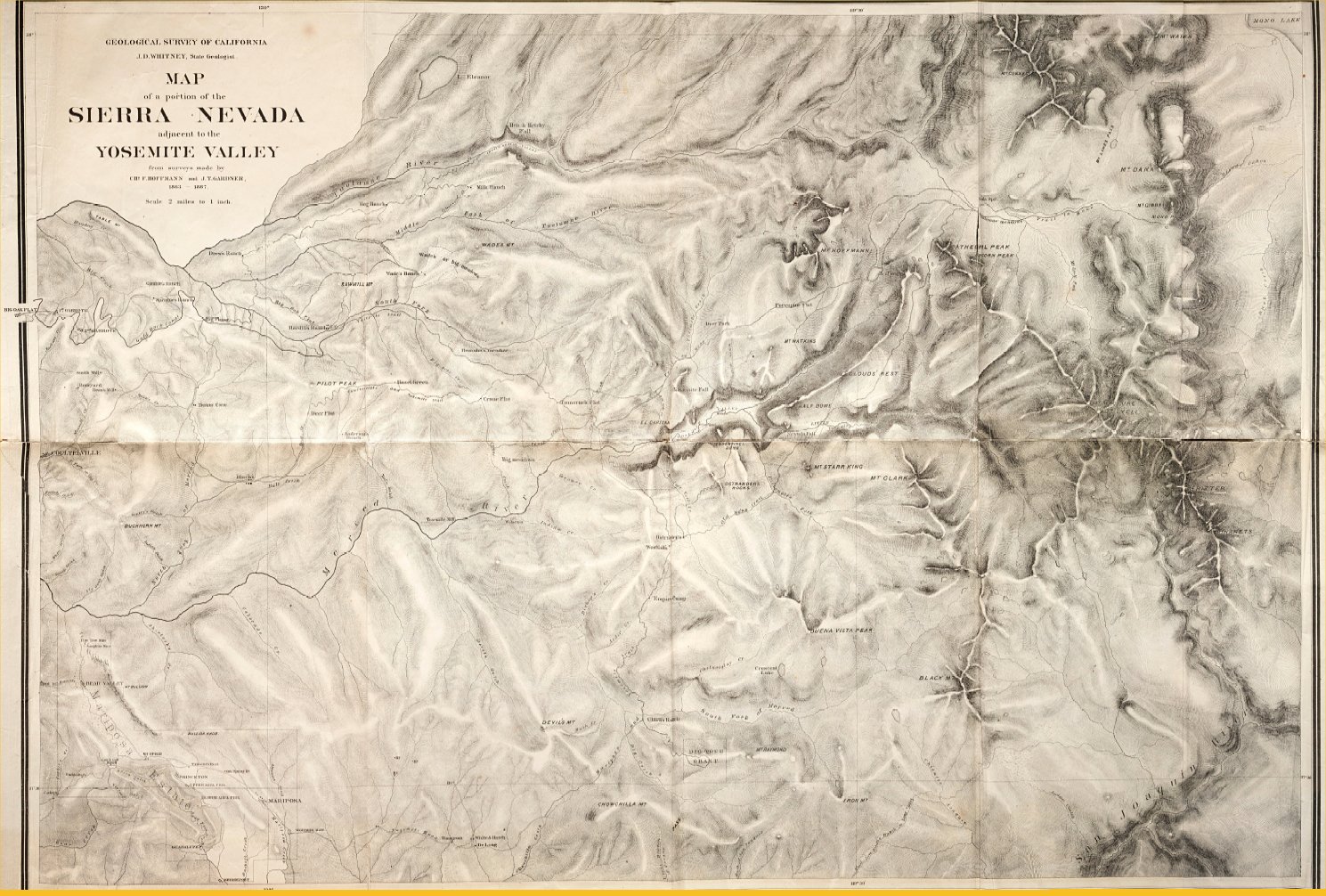
-
“Map of a portion of the Sierra Nevada adjacent
to the Yosemite Valley
from surveys made by Chs. F. Hoffmann and J.T. Gardner, 1863-1867”
from
The Yosemite Book
by Josiah D. Whitney (1869 ed.)
- 1870
-
Outline Map of Routes to Yosemite and the Mammoth Tree Groves
from
The Yosemite Valley, and the Mammoth Trees and Geysers of California (c1870)
- 1871
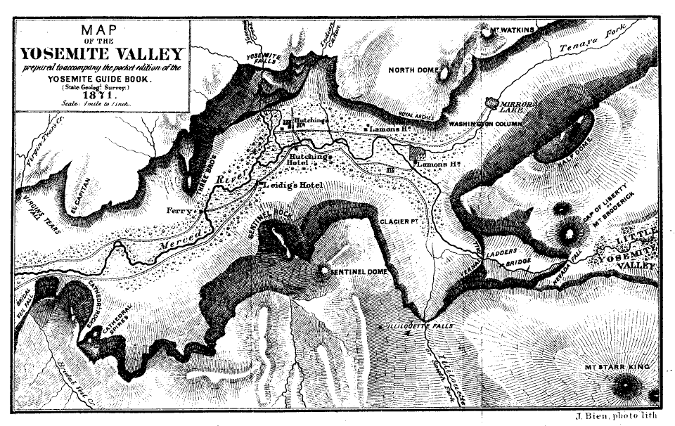
-
“Map of the Yosemite Valley prepared to accompany
the pocket edition of the Yosemite Guide Book.”
by Charles Hoffman,
from
The Yosemite Guide-book
by Josiah D. Whitney (1871 ed.) [960 x 606, 90KB]
- 1872
- Map of the Yosemite Valley 1872
(80KB, 936x573)
from Samuel Kneeland’s Wonders of Yosemite (1872).
- Map of Rail & Stage Route to Big Tree Groves and Yosemite
from Samuel Kneeland’s Wonders of Yosemite (1872).
(50KB, 744x416)
- 1873
-
“Map of the Yo-Semite Valley”
from
John Erastus Lester,
The Atlantic to the Pacific (1873)
-
“Map Showing the Lines of Rail between the Atlantic and the Pacific”
from
John Erastus Lester,
The Atlantic to the Pacific (1873)
- 1874-1955
- Big Oak Flat Road, 1874 - 1955
from Irene D. Paden & Margaret E. Schlichtmann
The Big Oak Flat Road (1955)
[2700x1850, 680KB].
Shows current and old road and trail routes for Western Yosemite.
- 1879
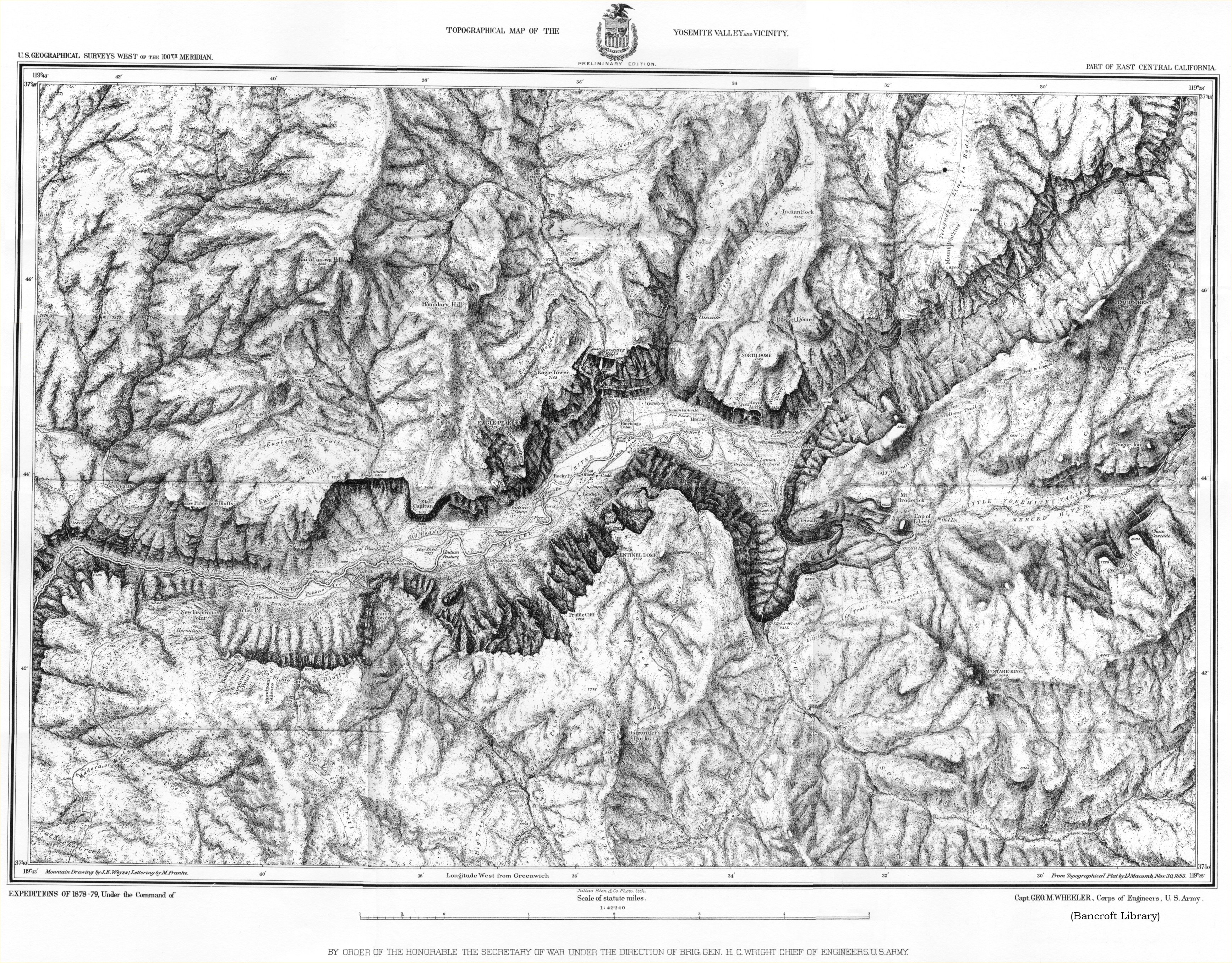
- Map of Yo Semite Valley (Wheeler Survey, 1879) (3.5MB)
from Hutchings’ In the Heart of the Sierras, (1886)
- 1880
-
Map of the Yo-semite Valley
from
L. H. Bunnell’s
Discovery of the Yosemite
(1st. ed., c. 1880)
- 1884
-
Map of the Yosemité Valley.
from
Granite Crags
(1884)
by Lady Constance F. Gordon-Cumming
- 1883-1990
- Cultivated Fields, Fences, and Areas of Excessive Landscape Management, Yosemite Valley, 1883-1890
from
Holway R. Jones
John Muir and the Sierra Club; the Battle for Yosemite
(Sierra Club, 1965)
[200KB, 1168x693]
- 1886
- Map of Routes to the Yo Semite Valley
(from Hutchings’ In the Heart of the Sierras, 1886)
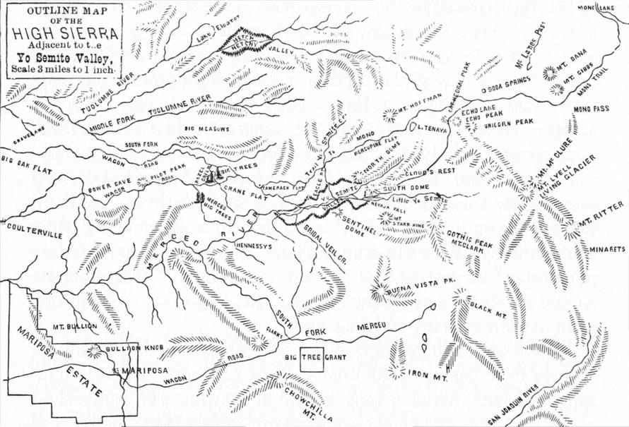
- Map of the High Sierra
(from Hutchings’ In the Heart of the Sierras, 1886)
- 1888
-
Yosemite Valley map
from Biennial Report of the Commissioners, 1887-88
- Yosemite Valley Map
from
George G. MacKenzie Yosemite: Where to Go and What To Do
(Murdock, 1888)
- Yosemite Valley
by John Bartholomew & Co., Edinburgh
from
Chambers's Encyclopaedia
(London: William & Robert Chambers, Ltd., and Philadelphia: J. B. Lippincott, 1888)
- 1889
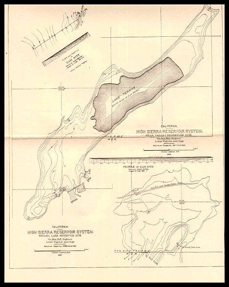
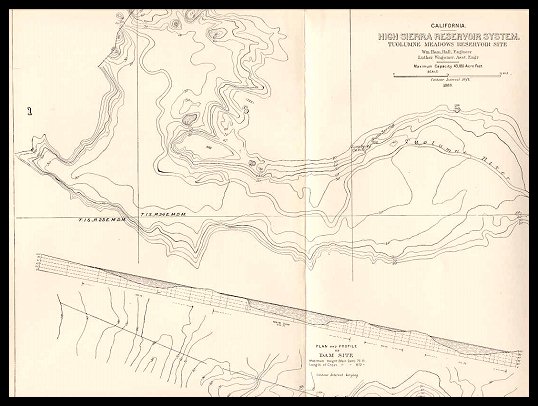
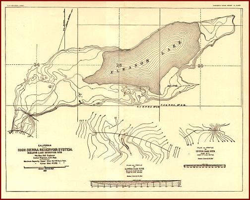
- Proposed 1889 dam site surveys,
“High Sierra Reservoir System,”
published by U.S. Geological Survey, 1892,
as part of its Irrigation Survey.
- 1890
-
“Map of the Yosemite Valley”
[450KB, 1560x1100]
from
“Features of the Proposed Yosemite National Park”
(The Century Magazine 40(4) (Aug. 1890)
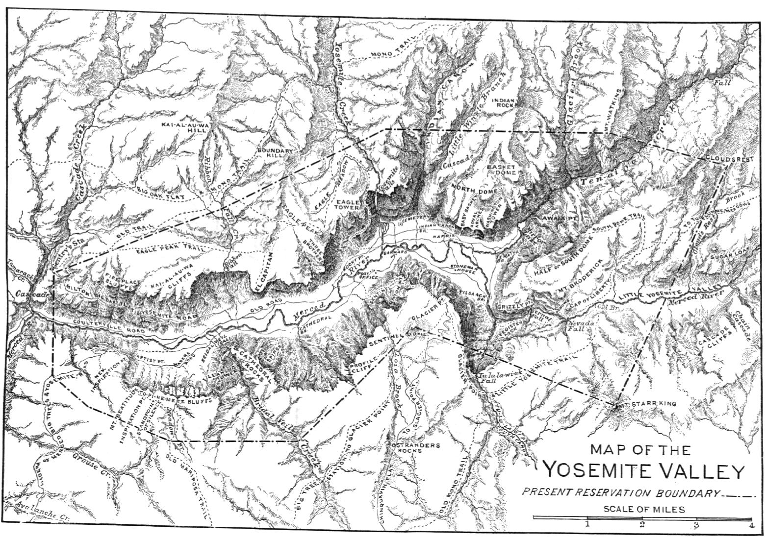
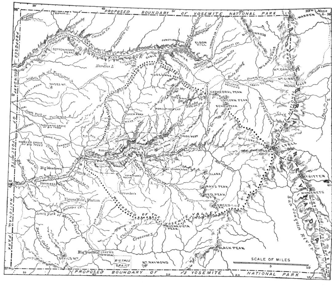
-
“Map of the Yosemite region, showing present reservation, water-shed of the
valley, and approximate limits of the proposed national park”
[230KB, 1080x940]
from
“Features of the Proposed Yosemite National Park”
(The Century Magazine 40(5) (Sept. 1890)
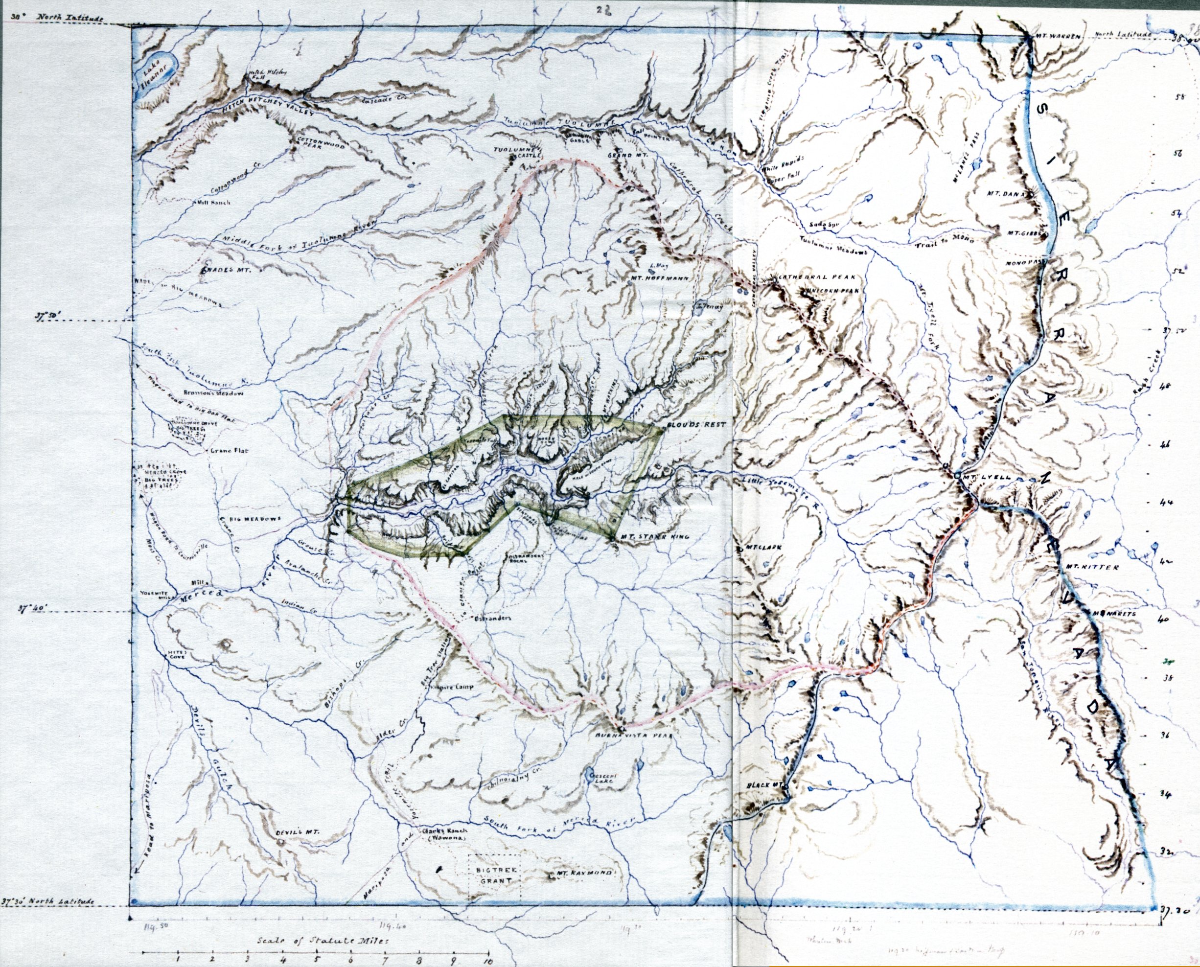
-
Map of Proposed Yosemite National Park Region
by John Muir
(1890)
from
Holway R. Jones
John Muir and the Sierra Club; the Battle for Yosemite
(Sierra Club, 1965).
Green is the original 1864 Yosemite Grant,
pink shows the watershed of the Yosemite streams, and
blue shows the proposed boundary of the Yosemite National Park.
(original in Bancroft Library)
[1MB, 2452x1976]
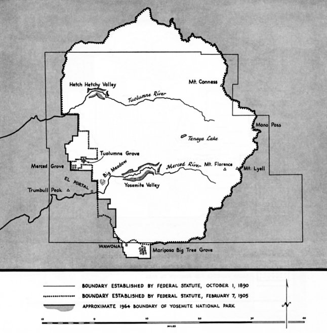
-
Boundary Proposals and Changes, Yosemite National Park, 1890-1964
from
Holway R. Jones
John Muir and the Sierra Club; the Battle for Yosemite
(Sierra Club, 1965)
[70KB, 646x657]
- circa 1890-1961
-
Map of Wawona and Vicinity
from
Shirley Sargent
Wawona’s Yesterdays (1961)
- 1891
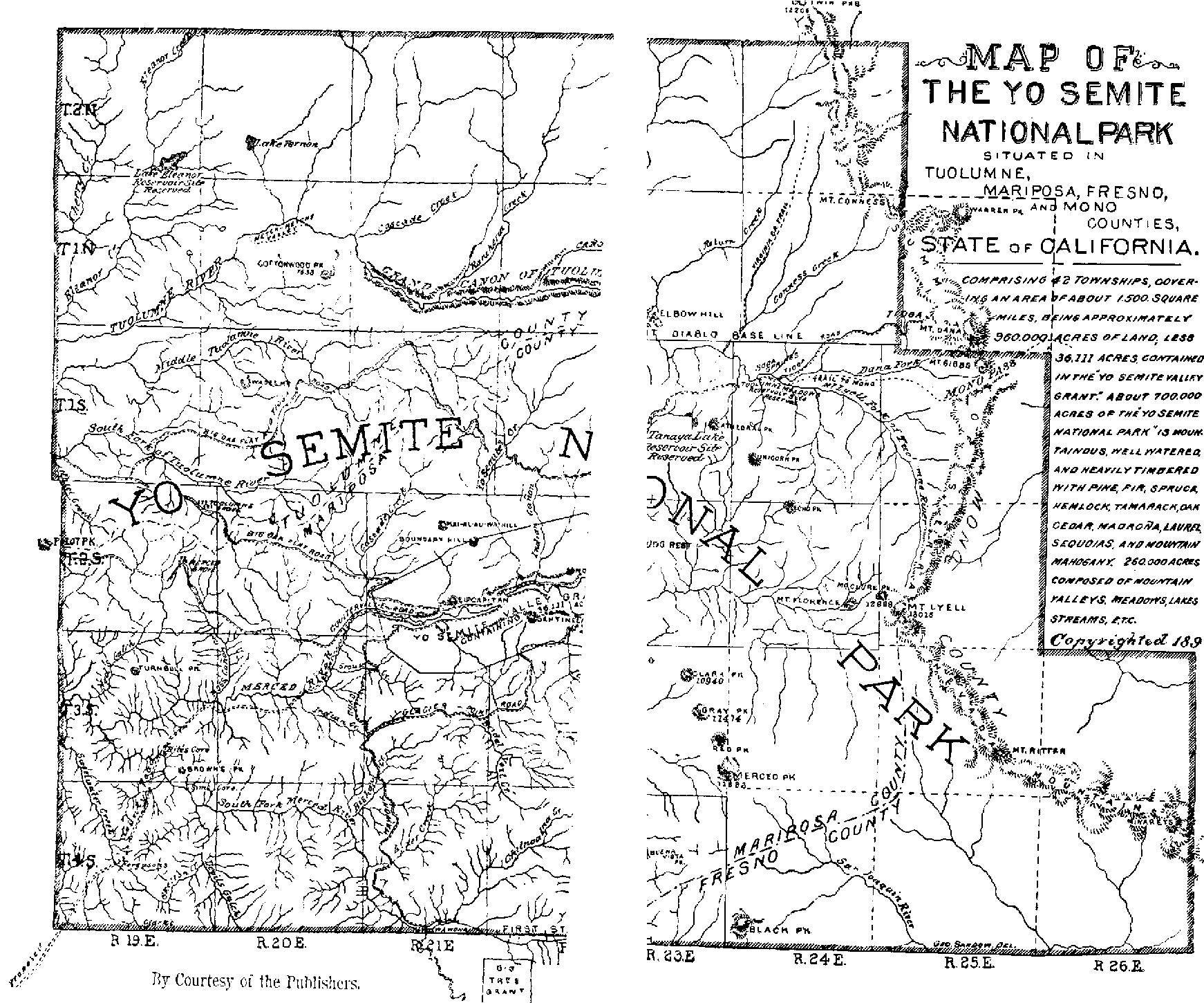
“Map of the Yo Semite National Park” (San Francisco: Dewey & Co., 1891).
Contains annotations from John Muir and others protesting a bill to reduce the size of Yosemite National Park in 1893. US National Archives ARC ID 306674.
- 1892
-
Map of the Yosemite National Park
from
L. H. Bunnell’s
Discovery of the Yosemite
(3d ed., 1892)
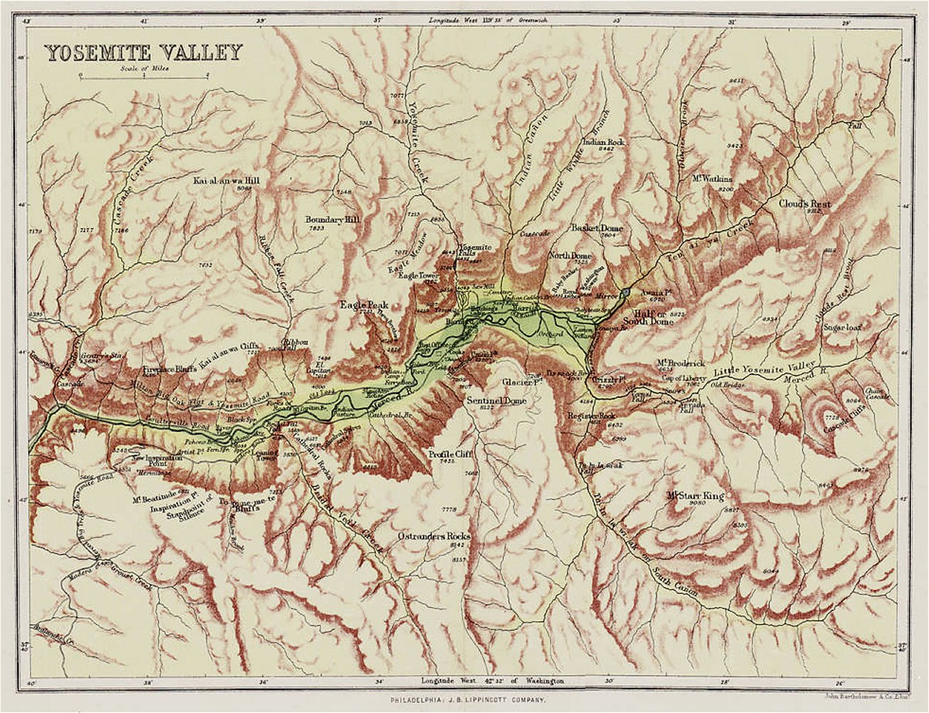
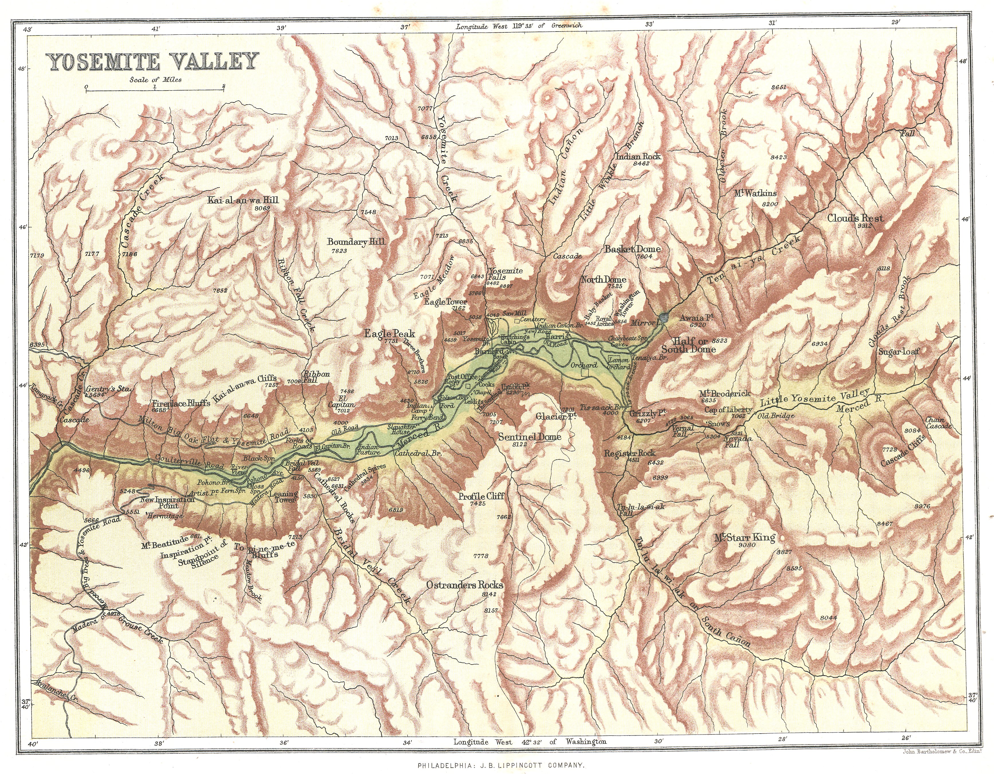
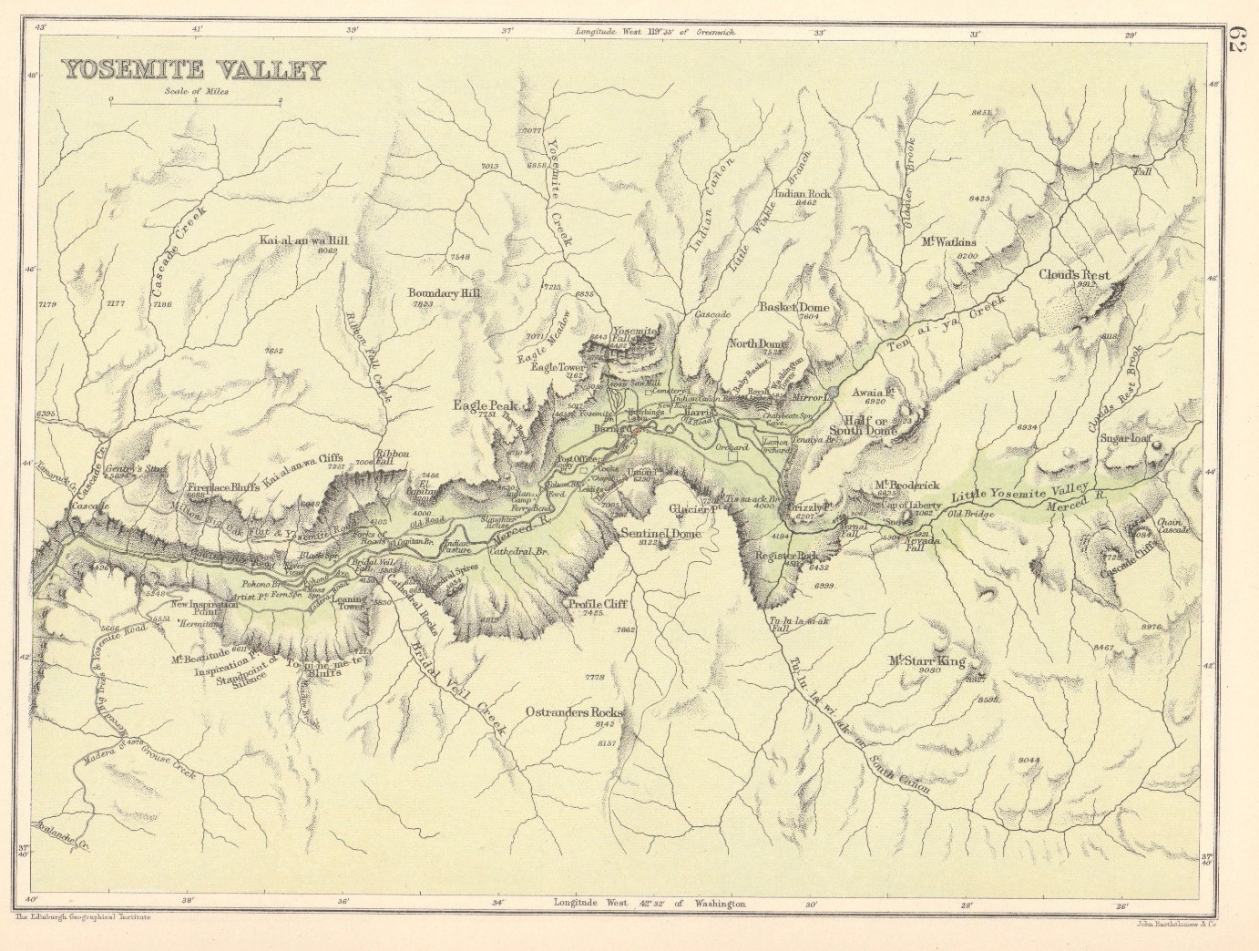
- Yosemite Valley (Edinburgh Geographical Institute, 1892. Originally printed by John Barththolomew & Co., Edinburough; reprinted by J. B. Lippincott Company, Philadelphia)
- circa 1886-1896
- Area in Yosemite Valley in front of Stoneman House [north of present Camp Curry]
from Yosemite: the Park and its Resources (1987) by Linda W. Greene
- circa 1864-1979
- “Major Changes to Boundaries Yosemite National Park 1864 - 1979”
from Yosemite Draft Land Acquisition Plan (1979)
- 1894
- Outline map of Yosemite Valley
from Hutchings Yo Semite Valley and the Big Trees (1894)
- 1896
- Map of the Yosemite National Park Prepared for Use of U.S. Troops by N. F. McClure, 1st Lieut, 5th Cavalry (March 1895)
from Yosemite: the Park and its Resources (1987) by Linda W. Greene
- 1897
- “Yosemite Sheet” (PDF, USGS, 1897).
First USGS topographic map of Yosemite.
Scale 1:100000.
From US Historical Topographic Map Collection.
- 1900
- “Yosemite Valley” map from The Graphic Atlas and Gazetteer of the World (London and Edinburgh: Thomas Nelson & Sons, 1900). Edited by J. G. Bartholomew
- 1902
- map by F. M. Day & Co. from
Foley’s Yosemite Souvenir and Guide, by D. J. Foley (1902). Map appears to pre-date 1897, before Stoneman House burned down.
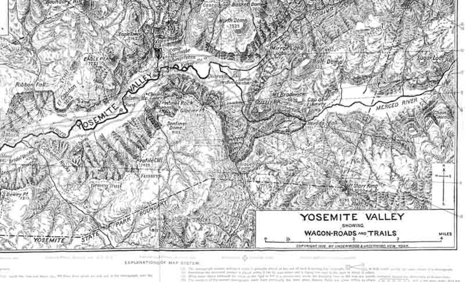
- Yosemite Valley Showing Wagon-roads and Trails (Madera Co. Library, 20x33cm). Blurred copy.
- 1906
- Plat of land leased to J. B. Cook, Chris Jorgensen, and Coffman and Kenney, 1906
from Yosemite: the Park and its Resources (1987) by Linda W. Greene
- 1907-1945
-
“Portion of the Yosemite Valley Railroad showing the Yosemite Lumber Co. R. R. and the Yosemite Sugar Pine Lumber Co. R. R. since 1907,”
drawn by Robert L. La Plaine,
from Johnston, Railroads of the Yosemite Valley.
- 1908
- Sketch map of the High Mountain Route, Yosemite to the King’s River Cañon, 1908
from LeConte, “The High Mountain Route Between Yosemite and the King’s River Cañon,” Sierra Club Bulletin 7, no. 1 (January 1909)
- 1909
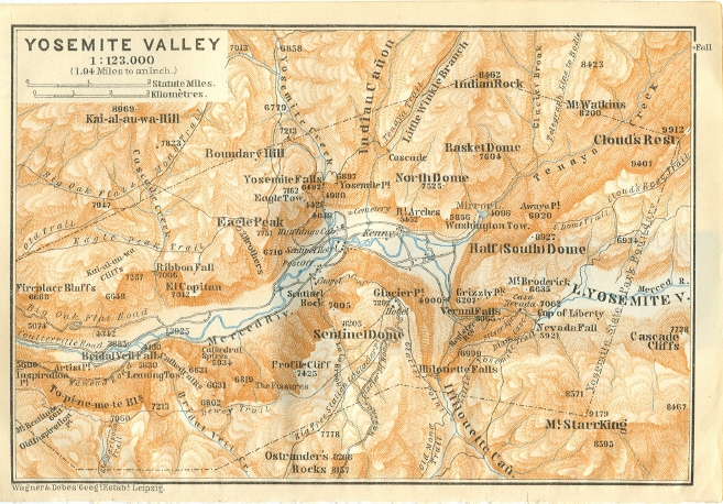
- Yosemite Valley
from Handbook for Travellers
(Liepzig, Germany: Wagner & Diebes, 1909)
by Karl Baedeker
(10x15cm)
- ca. 1909-1912
- Map of Wawona Hotel and points of interest in vicinity, ca. 1909-1912
from Yosemite: the Park and its Resources (1987) by Linda W. Greene
- 1911
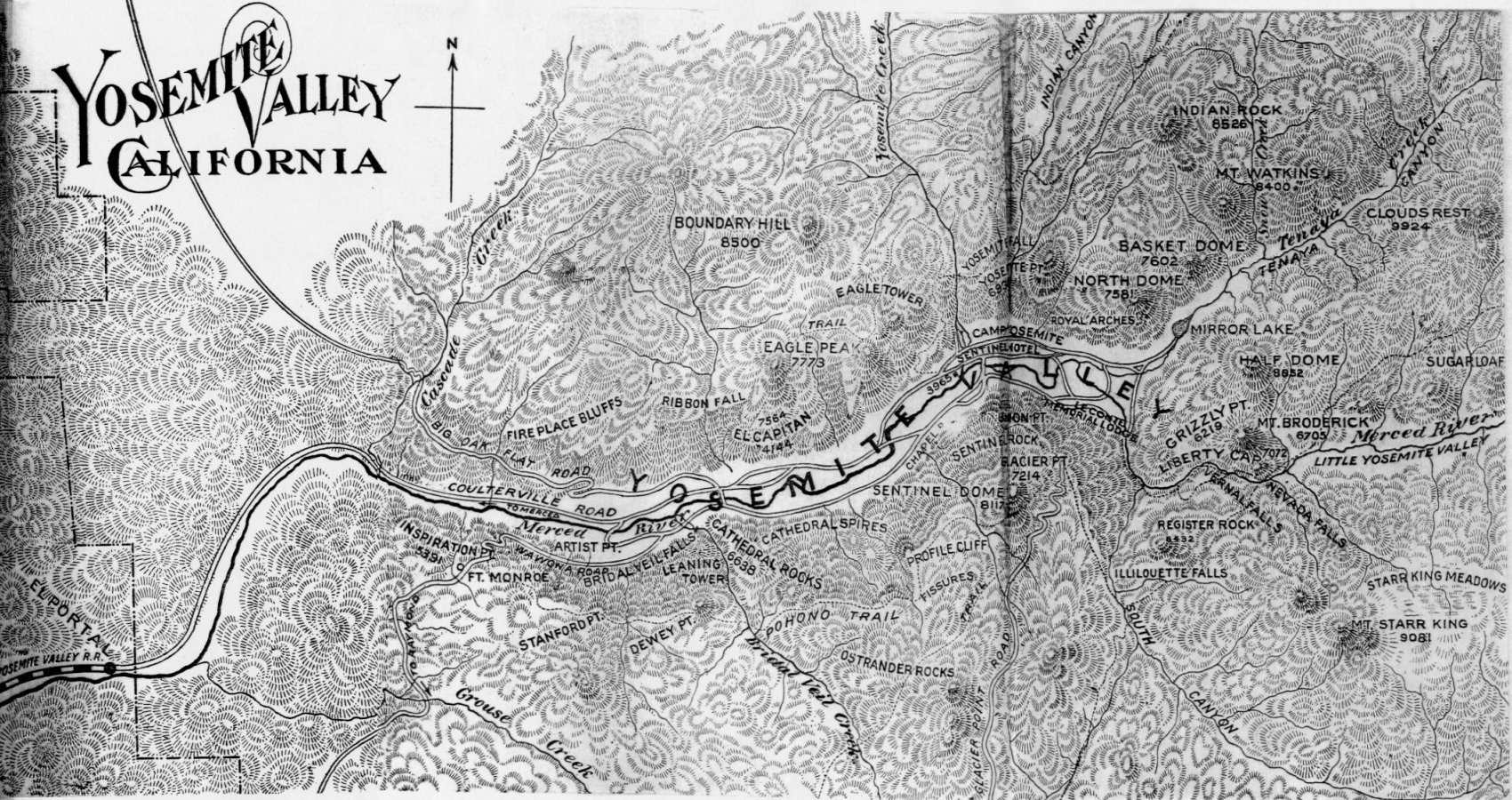
-
Yosemite Valley California
from
L. H. Bunnell,
Discovery of the Yosemite
(4th ed., 1911)
[1700x900, 607K]
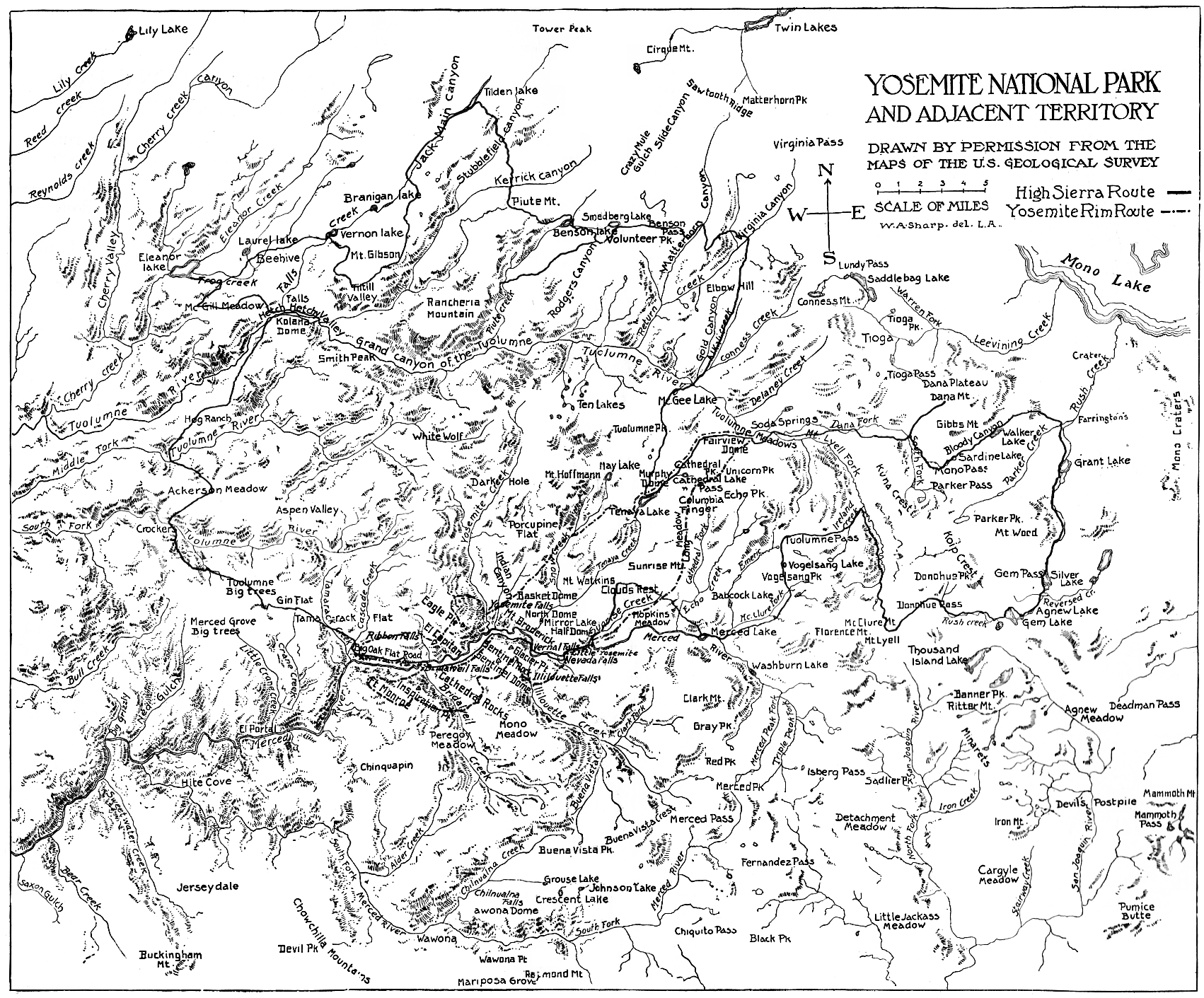
-
“Yosemite National Park and Adjacent Territory”
from
J. Smeaton Chase,
Yosemite Trails (1911).
- 1912
- Maps from
The Yosemite
by John Muir (1912)
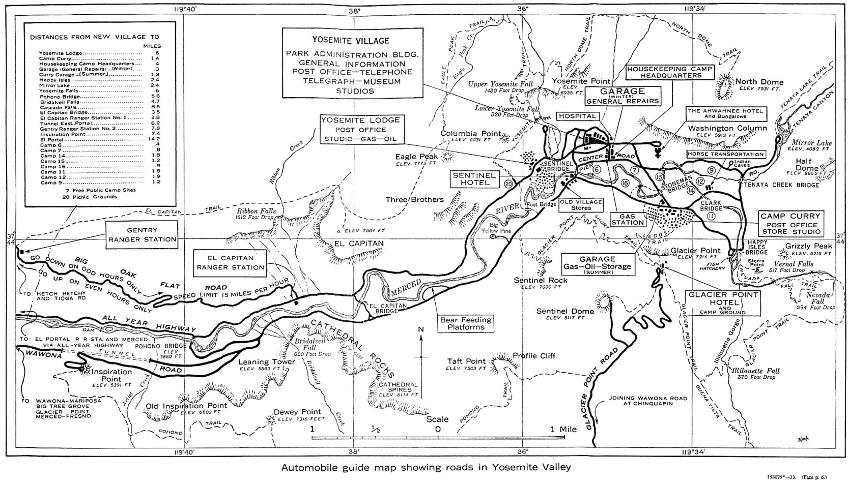
- Map of Yosemite Valley showing roads and projected revisions, 1912-13
from Automobile Club of Southern California Road Department Report on Condition of Roads into Yosemite Valley (1912)
- Map of portion of Yosemite Valley showing location of ca. 1909 schoolhouse and 1912 Army residence
from Yosemite: the Park and its Resources (1987) by Linda W. Greene
- 1914
- Maps from Yosemite and its High Sierra (1914)
by John H. Williams
- 1917
- Automobile map of Yosemite National Park (NPS, 1917) [100KB, 758x936]
from Yosemite: the Park and its Resources (1987) by Linda W. Greene
- Automobile map of Yosemite Valley (NPS, 1917) [140KB, 1064x530]
from Yosemite: the Park and its Resources (1987) by Linda W. Greene
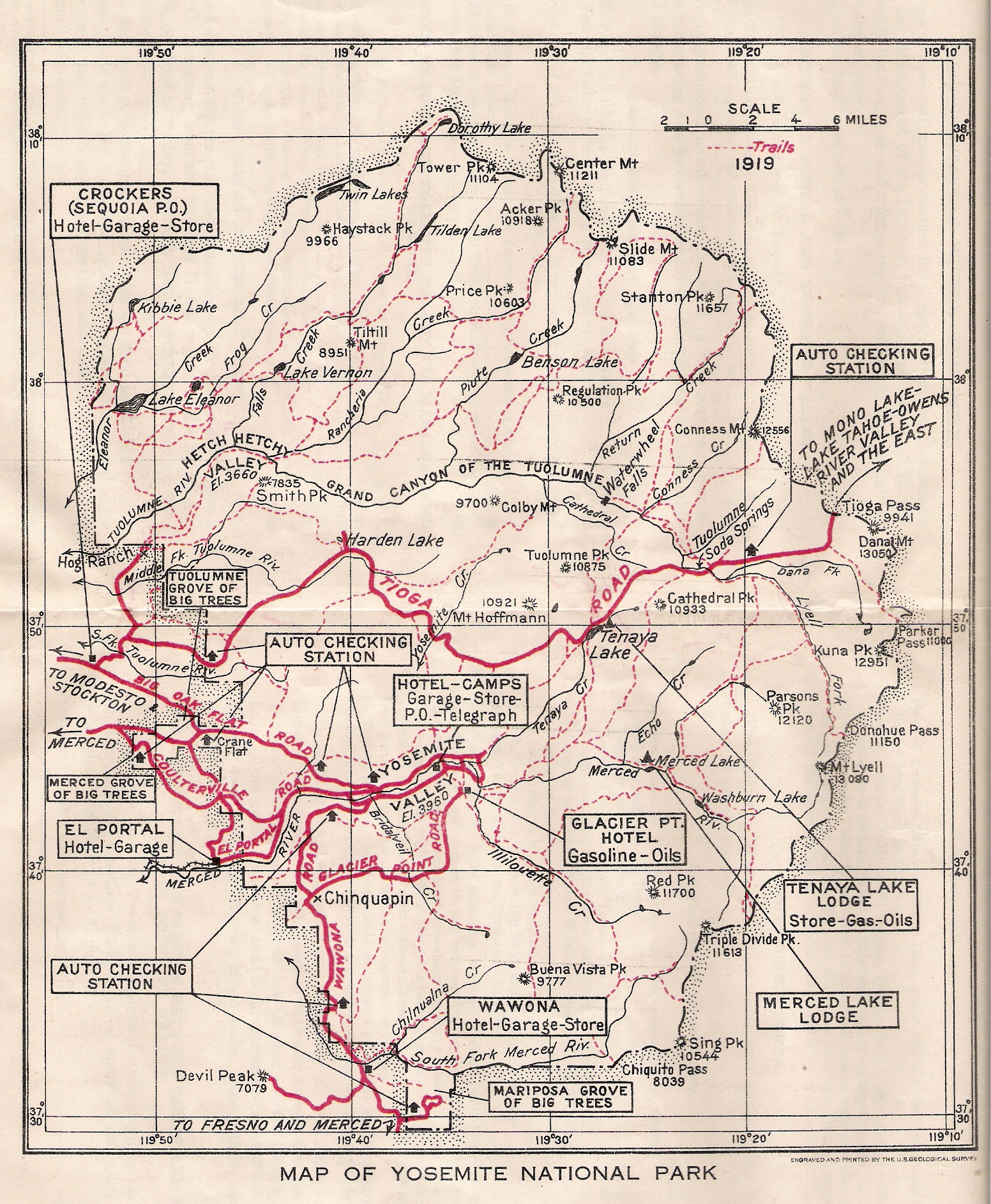
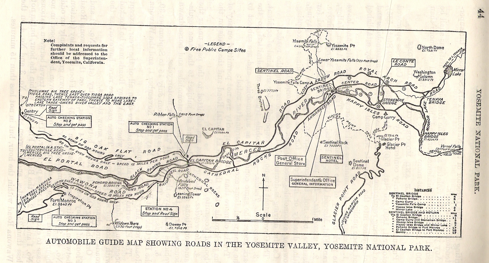
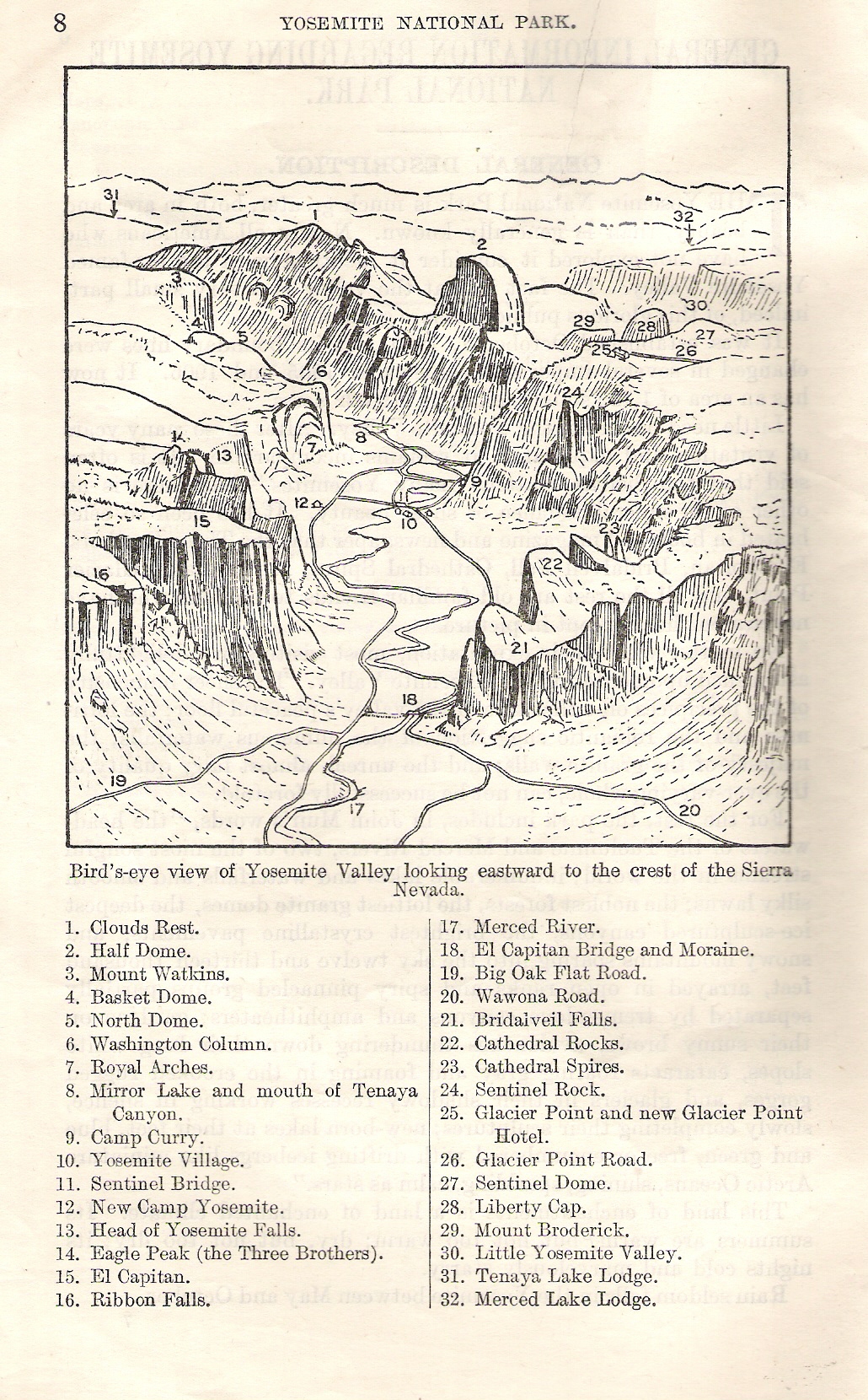
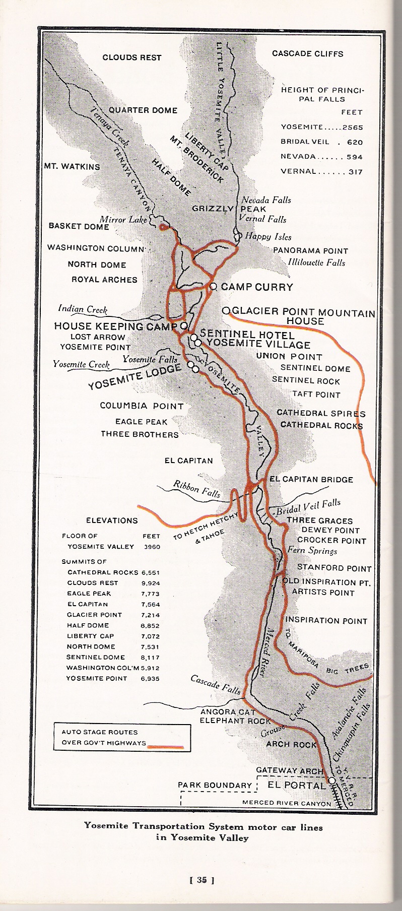
- 1919
- Maps from General Information Regarding Yosemite National Park (Washington: GPO, 1919) (courtesy of Scott Tipton)
- 1920
- Maps from Ansel F. Hall
Guide to Yosemite (1920)
- 1921
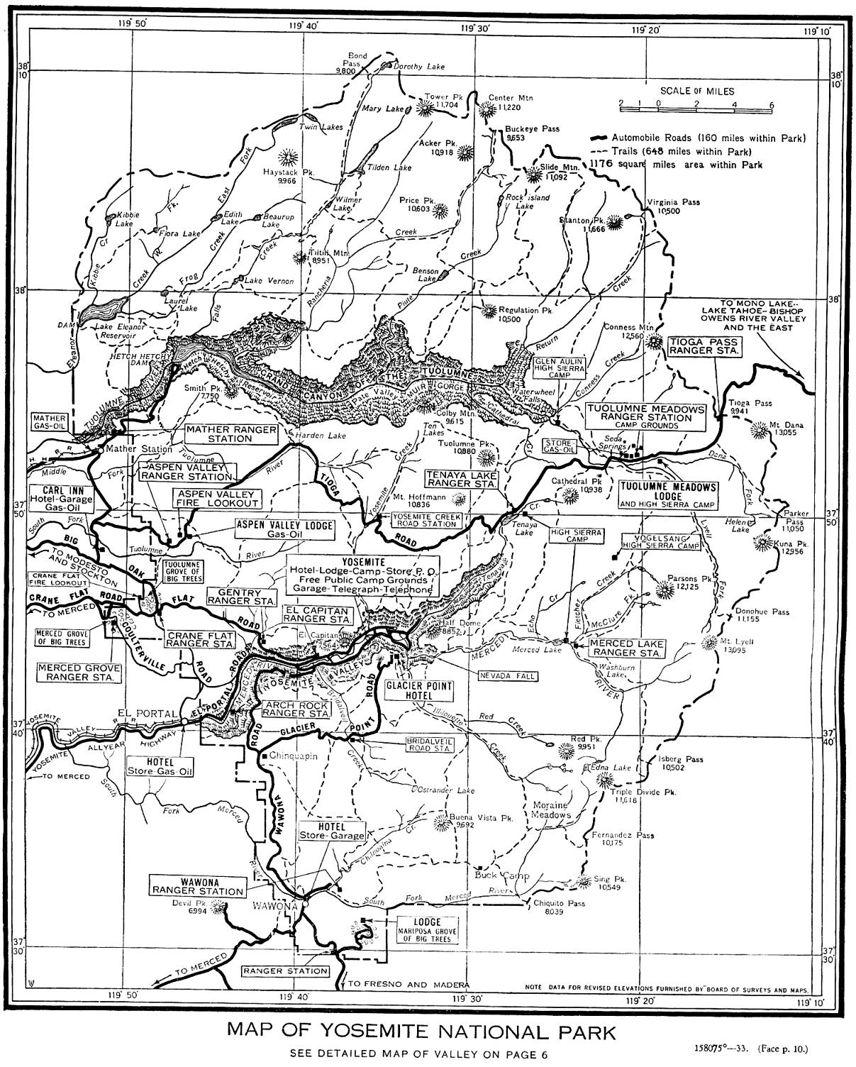
- Map of Yosemite National Park
(1921) [1.2MB, 1984x1948]
from
Handbook of Yosemite National Park
by Ansel F. Hall
(1922)
- 1923
- Yosemite Valley Map
from Yosemite Transportation System brochure
(courtesy of Scott Tipton)
- Map of Big Trees Lodge in Mariposa Grove (1920, 1923)
”
from Yosemite: the Park and its Resources (1987) by Linda W. Greene
- 1924
- “Map showing life-zones of Yosemite section” (pl. 62)
[1.2MB, 914x217]
Also a
cross-section (pl. 61)
[153KB, 914x324].
From
Animal Life in the Yosemite
(1924)
by Joseph Grinnell and Tracy Irwin Storer
(NPS website)
- Maps created by Yosemite National Park Company for appraisal purposes
from Yosemite: the Park and its Resources (1987) by Linda W. Greene
- Sites occupied by permittees in Old Yosemite Village (May 1924)
from Yosemite: the Park and its Resources (1987) by Linda W. Greene
- 1925
- Plat of Camp Curry (created for appraisal purposes)
from Yosemite: the Park and its Resources (1987) by Linda W. Greene
- Map of Hetch Hetchy water supply, 1925
from Wurm Hetch Hetchy and Its Dam Railroad
- Plat of O’Shaughnessy Dam camp site, 1925
from Yosemite: the Park and its Resources (1987) by Linda W. Greene
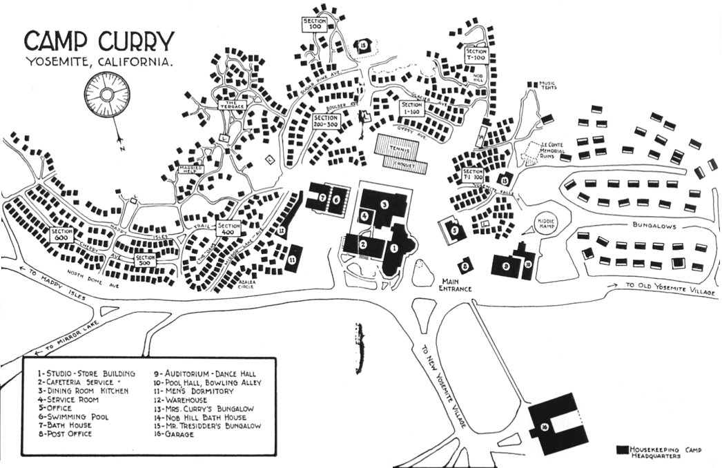
- circa 1925-1941
- Camp Curry
circa 1925-1941
[150KB, 1046x678]
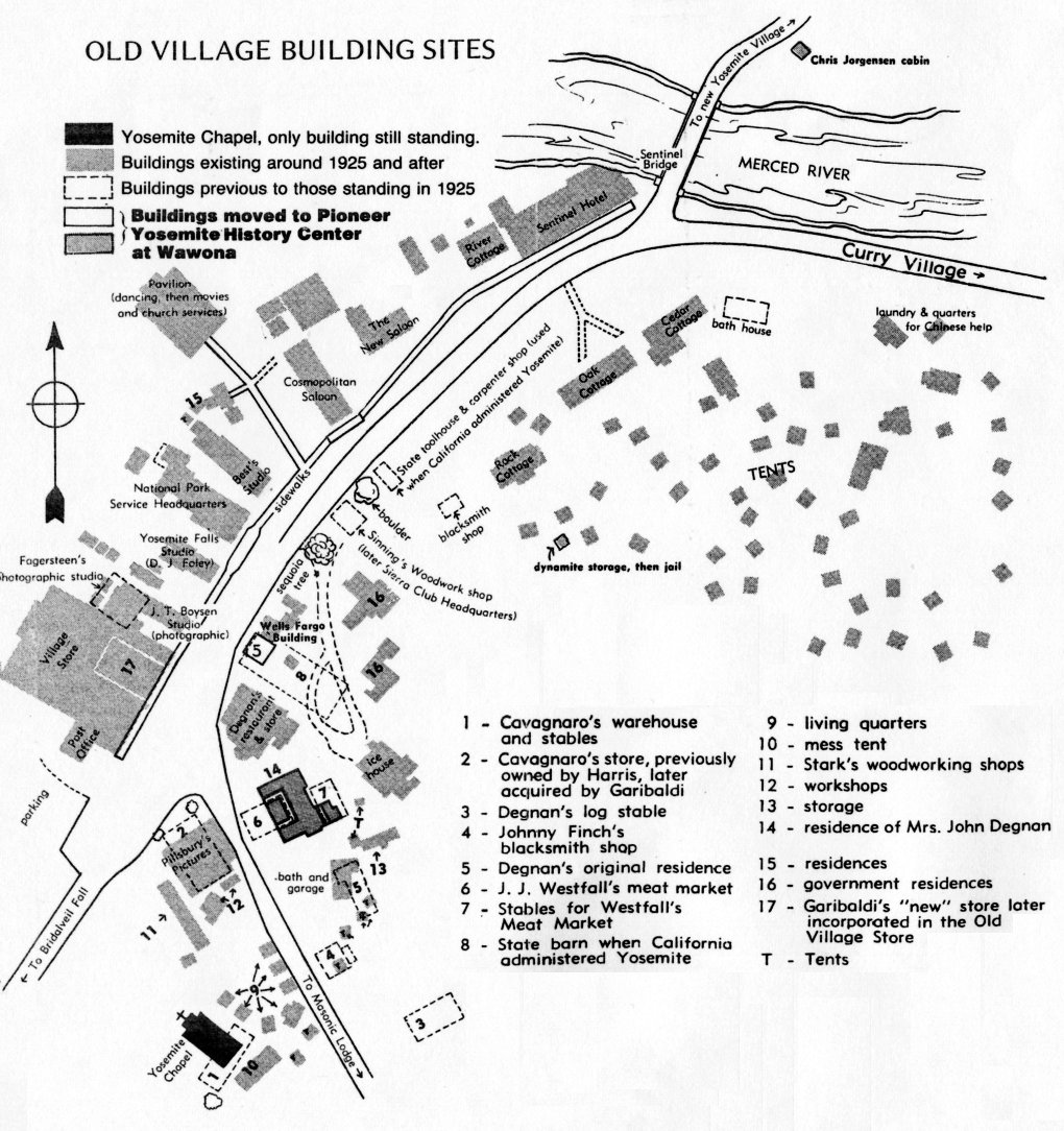
- “Old” Yosemite Village (Upper Village) building sites, circa 1925-40
[260KB, 1020x1084]
- 1929
- Maps from Circular of General Information Regarding Yosemite National Park, California (NPS, 1929)
- 1930
- Tecoya employee housing area
from Yosemite: the Park and its Resources (1987) by Linda W. Greene
- Map of virgin timber stands acquired in 1930 through purchase by Rockefeller, Tresidder, and the U.S.
from Yosemite: the Park and its Resources (1987) by Linda W. Greene
- 1931
- Maps from Circular of General Information Regarding Yosemite National Park, California (NPS, 1931)
- Pictorial Map of Yosemite Valley by Jo Mora (1931)
- 1932
- Map of Boundary Changes at Wawona, 1864-1932
from Yosemite Draft Land Acquisition Plan (1979)
- 1933
- Maps from General Information Regarding Yosemite National Park California visitor’s leaflet (NPS, 1933)
- 1934
- Map of CCC camp #1, Wawona
from Yosemite: the Park and its Resources (1987) by Linda W. Greene
- Map of CCC camp #2, Wawona
from Yosemite: the Park and its Resources (1987) by Linda W. Greene
- Map of Merced Grove CCC camp
from Yosemite: the Park and its Resources (1987) by Linda W. Greene
- 1935
- Map of the Yosemite Valley, 1935
from Yosemite: the Park and its Resources (1987) by Linda W. Greene
- Map of Hetch Hetchy dam construction Village
from Yosemite: the Park and its Resources (1987) by Linda W. Greene
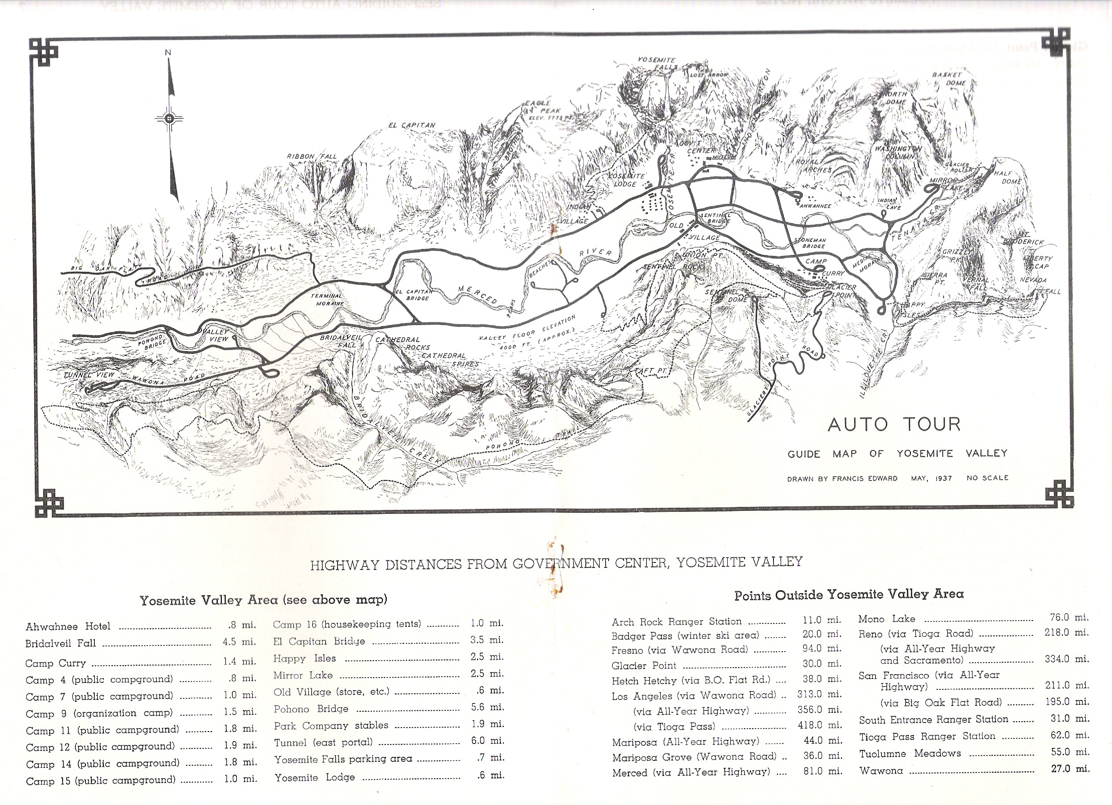
- 1937
- “Auto Tour Guide Map of Yosemite Valley,” drawn by Francis Edward from “Self-guiding Auto Tour of Yosemite Valley,” Yosemite Nature Notes (1937) by M. E. Beatty.
(courtesy of Scott Tipton).
Map reprinted unchanged in 1942 “Self-guiding Auto Tour,”
Yosemite Nature Notes.
- 1938
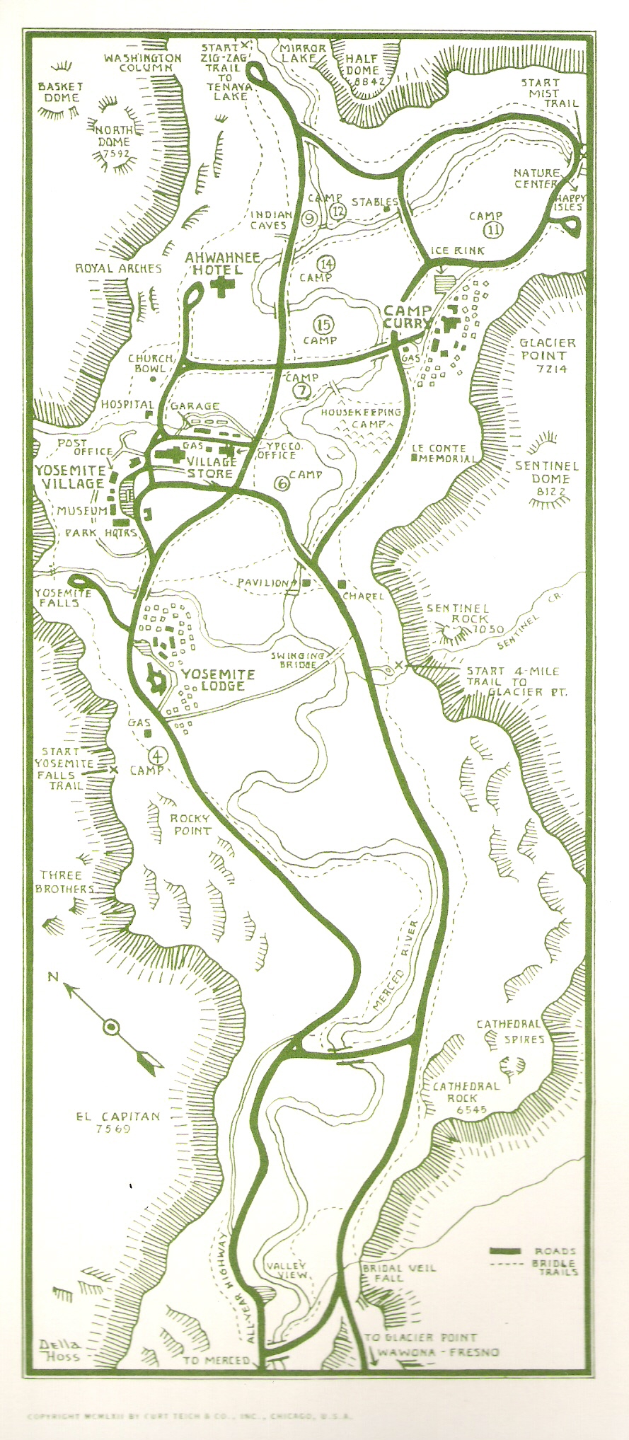
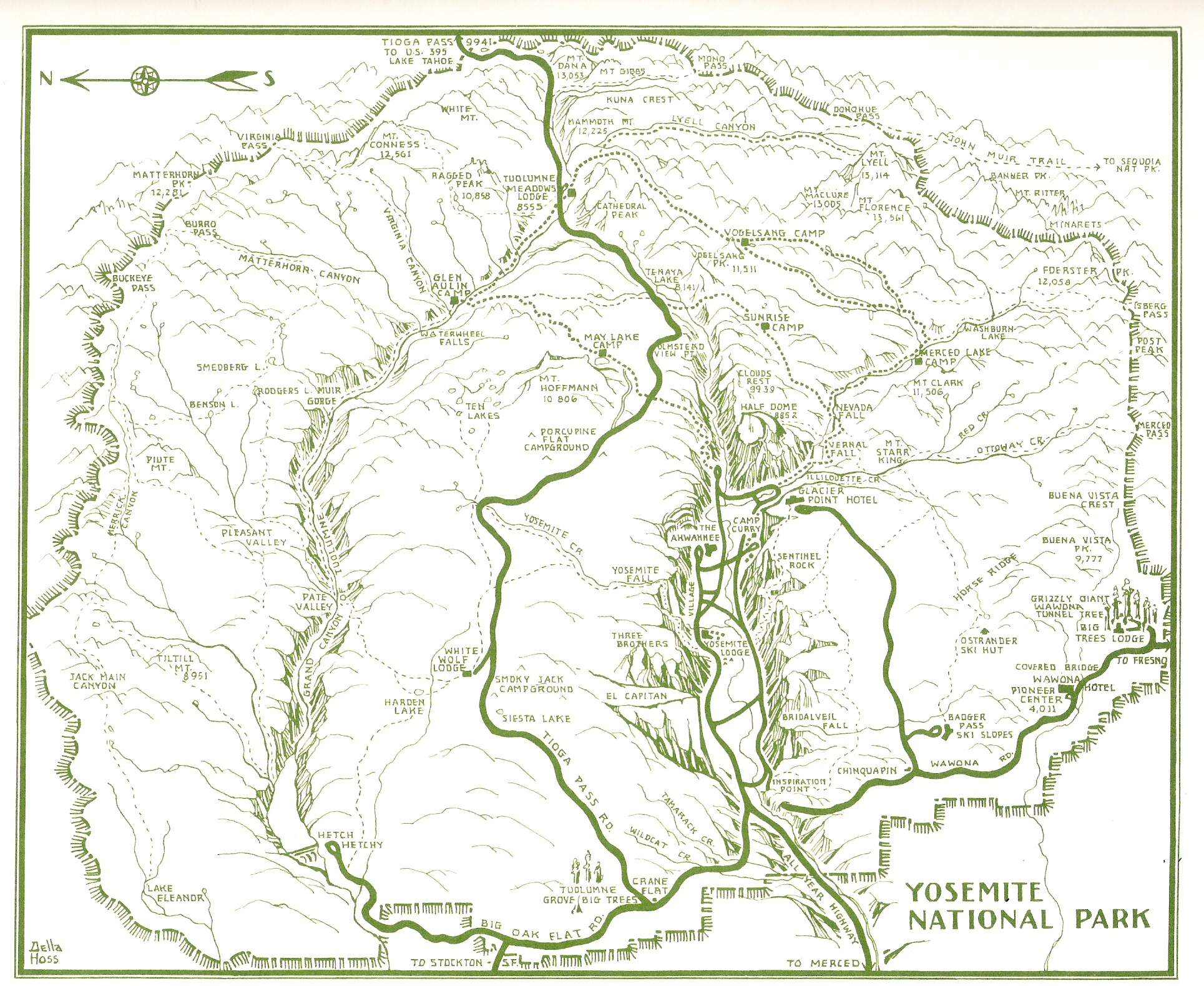
- Yosemite National Park map by Della Taylor Hoss.
From The Four Seasons in Yosemite National Park (1938) by Ansel Adams
- 1939
- Guide Map, Yosemite National Park
(1939) [260KB, 872x1056]
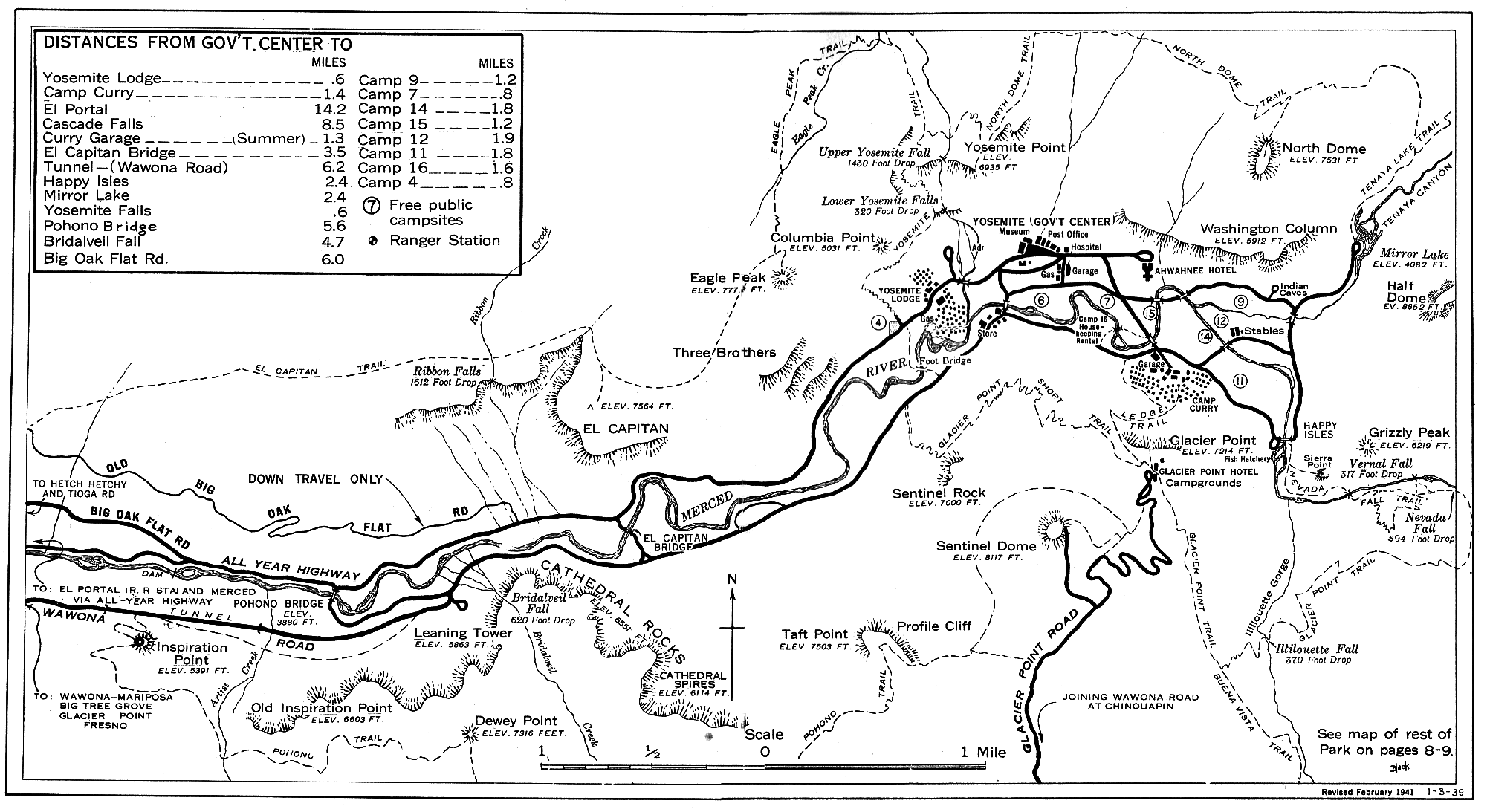
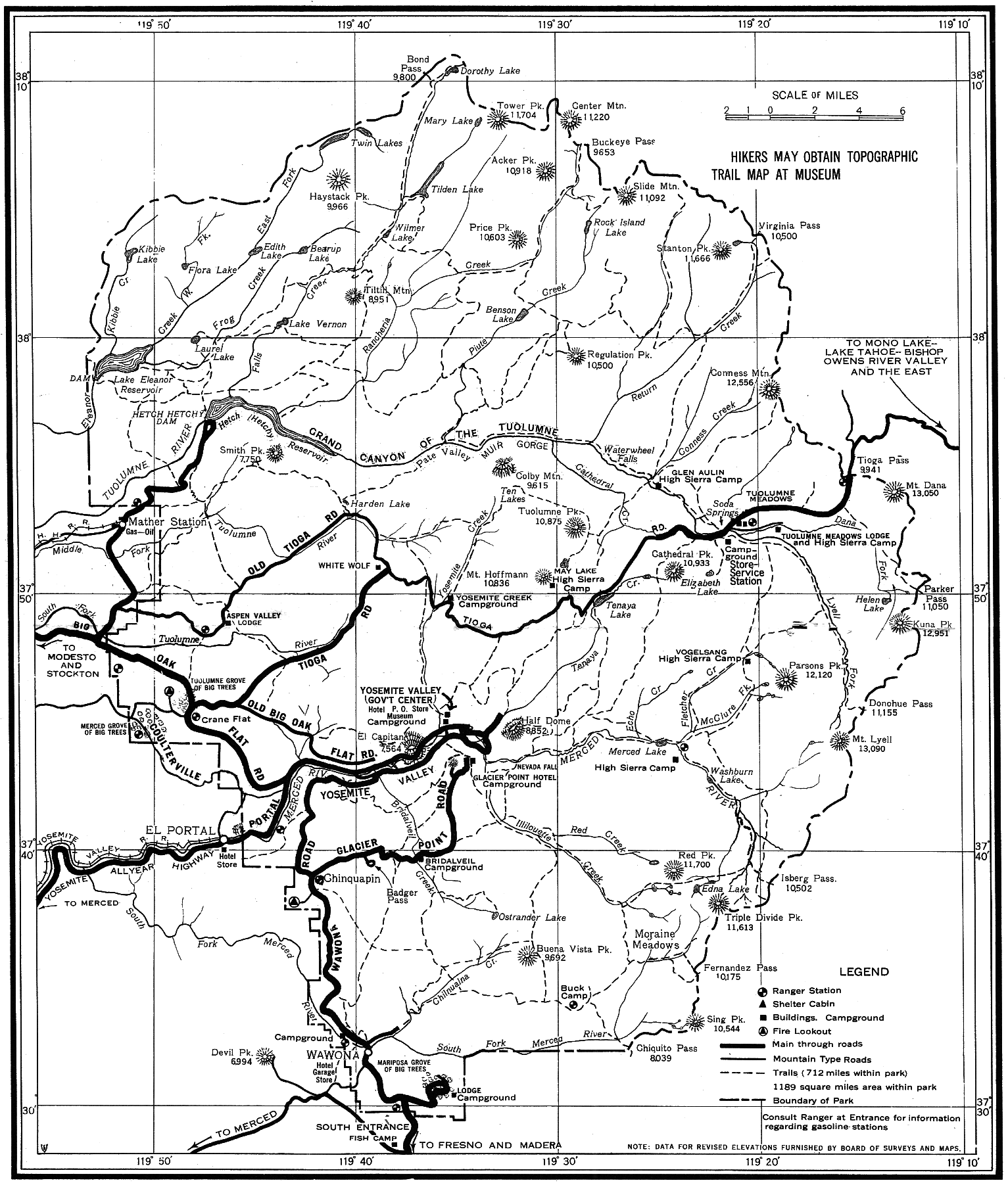
- 1941
- Maps from Yosemite National Park California visitor’s leaflet (NPS, 1941)
- 1945
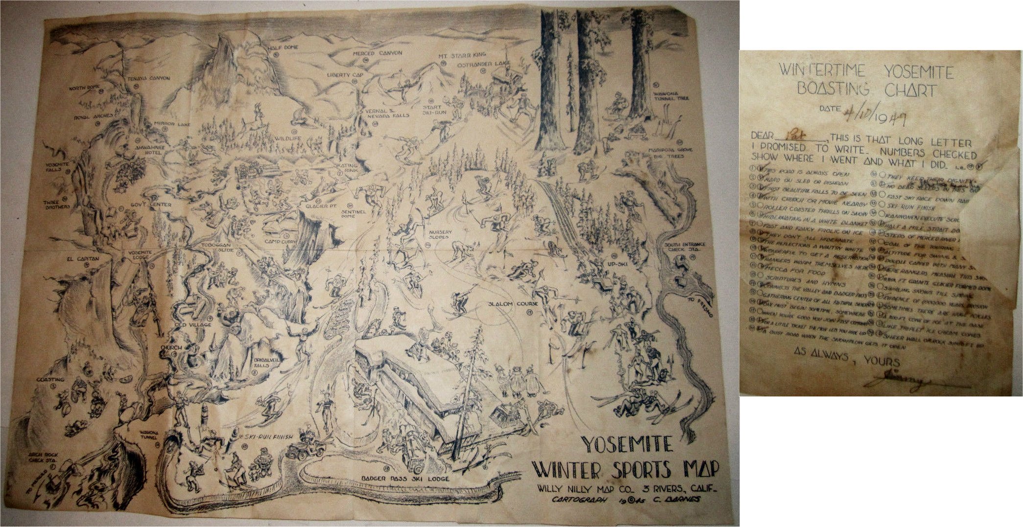
- Yosemite Winter Sports Map
by C. Barnes (Three Rivers, California: Willy Nilly Map Co., 1945)
- 1946
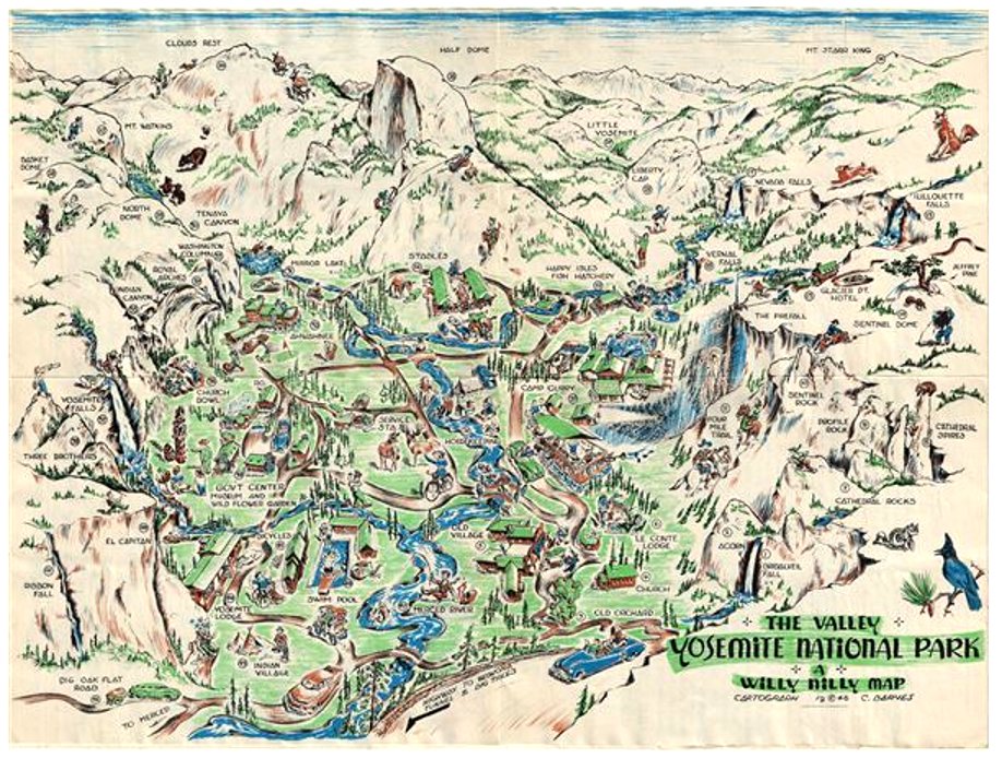
- The Valley Yosemite National Park; A Willy Nilly Map by C. Barnes (San Francisco: Crown Print. and Lithographing Co., 1946)
- 1947
- Map of Hetch Hetchy Railroad, 1947
from “History of the Hetch Hetchy Railroad,” in The Western Railroader, 24, no. 10 (October 1961)
- 1948
- Yosemite Valley panorama map
by Della Taylor Hoss (1948) [1MB]
(courtesy of Scott Tipton)
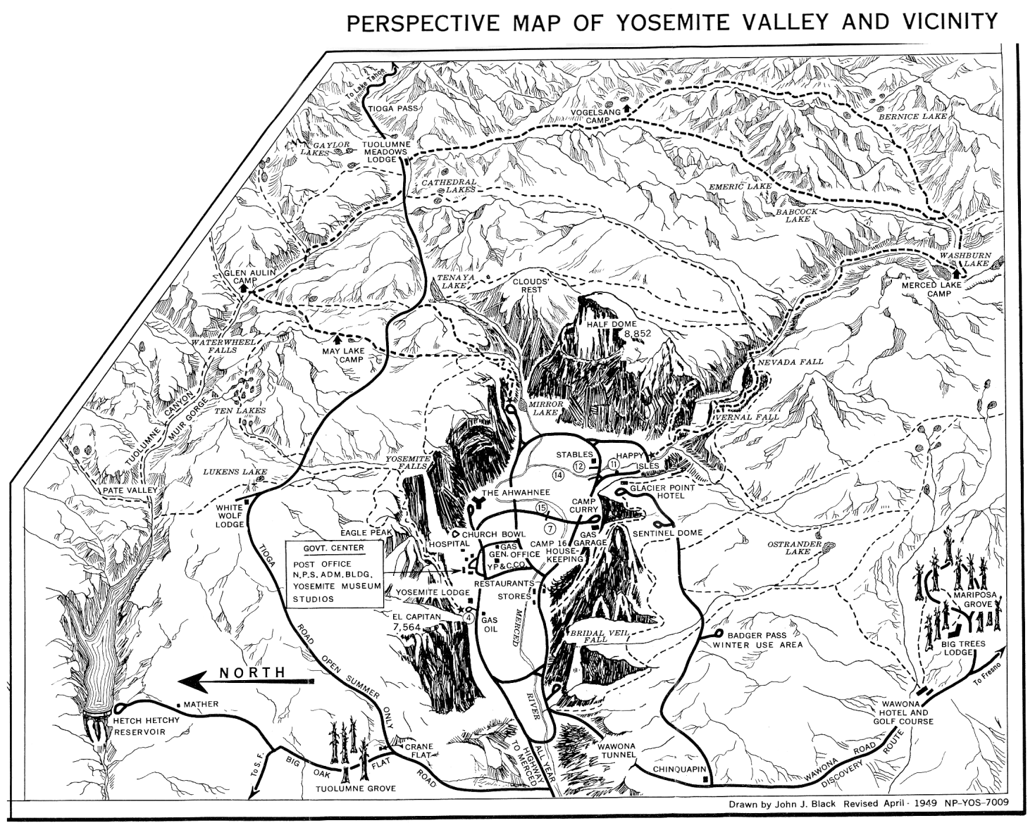
- 1949
- Maps from Yosemite National Park visitor’s leaflet. Drawn by John J. Black April 1949) (NPS, reprinted 1950)
- Map of the Mariposa Grove
from
James W. McFarland
A Guide to the Giant Sequoias of Yosemite National Park (1949)
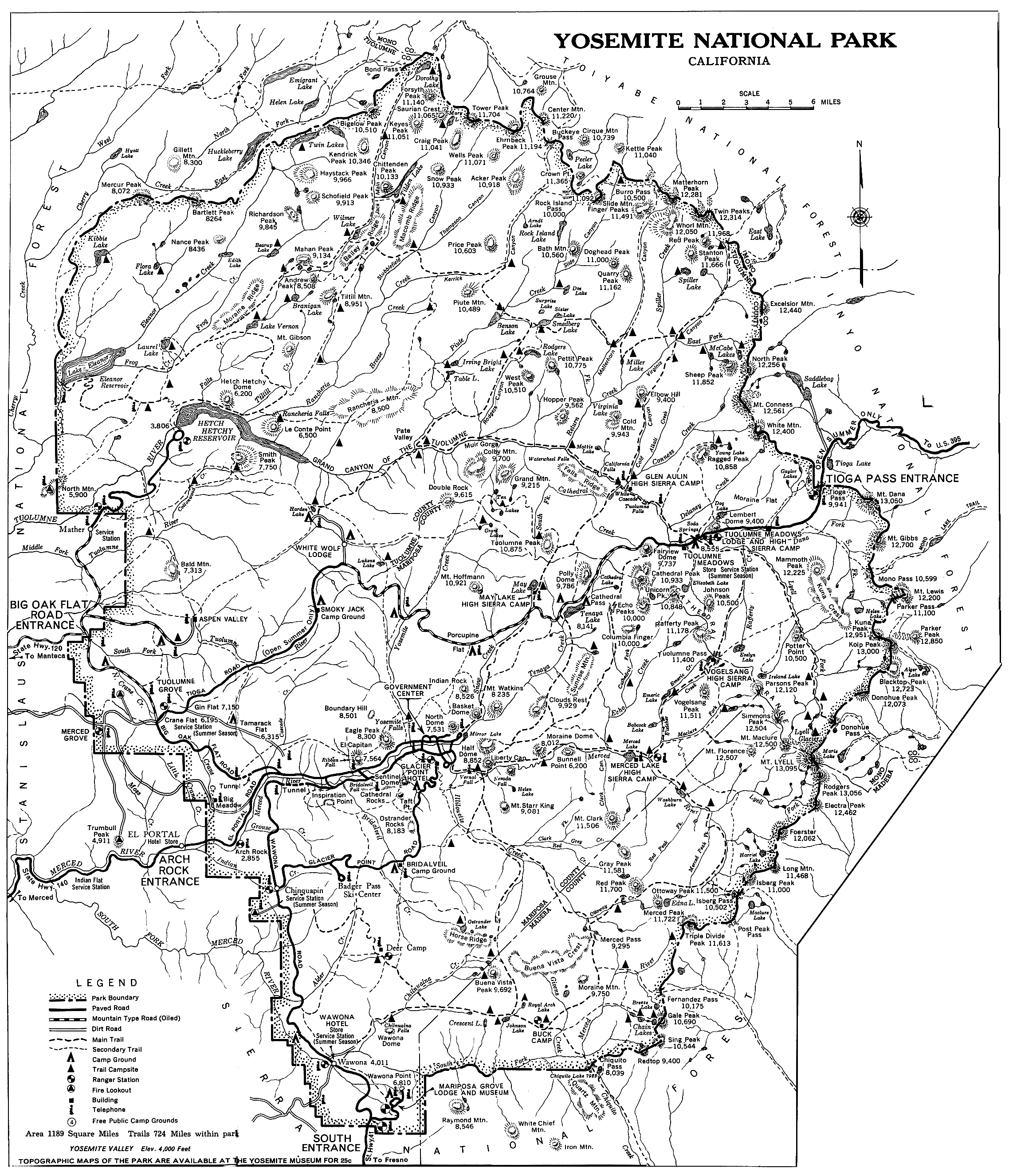
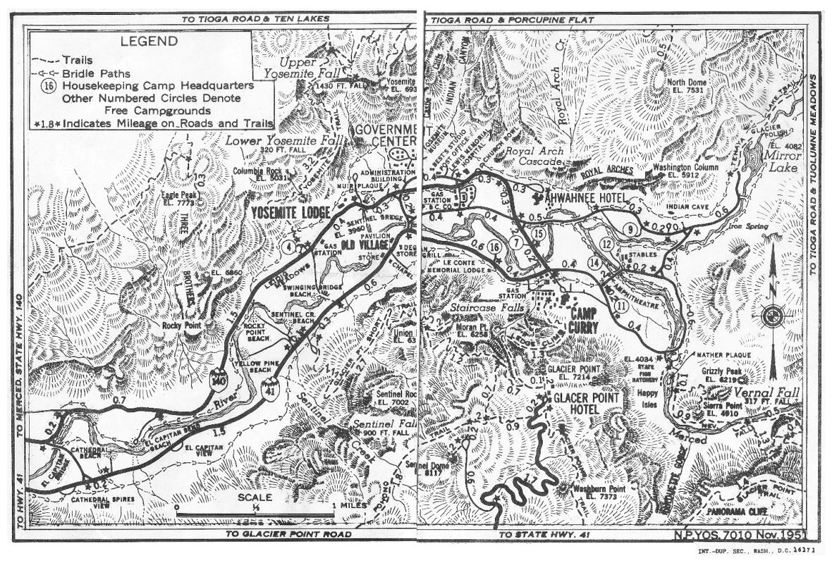
- 1951
- Yosemite Valley map
(NPS, Nov. 1951)
- 1952
- Map of Arch Rock Entrance Station
from Yosemite: the Park and its Resources (1987) by Linda W. Greene
- Map of Indian Village in Yosemite Valley
from Yosemite: the Park and its Resources (1987) by Linda W. Greene
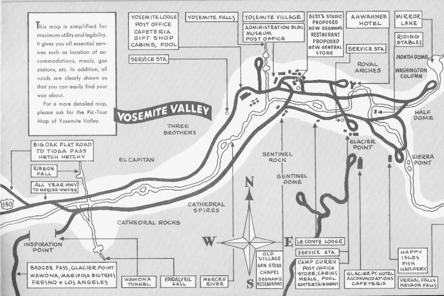
- 1955
- Simple map of Yosemite Valley, 1955
from Yosemite Souvenir Book (San Francisco: 5 Associates, 1955)
[courtesy of Scott Tipton]
- Yosemite Valley Map showing outline of 1955 flood damage
(1955) [180KB, 1182x732]
- mid-1950s
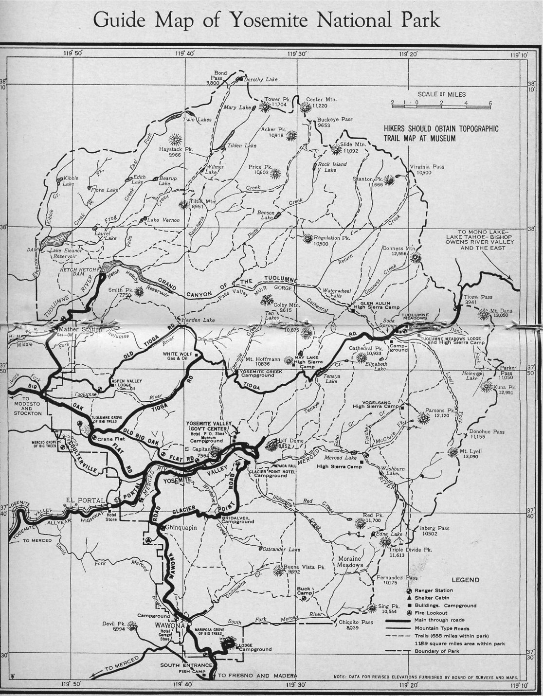
- Guide Map of Yosemite National Park
[440KB, 1116x1431]
from John W. Bingaman Guardians of the Yosemite (c. 1961)
Not dated. Map appears to be in the mid-1950’s.
Exact map also reprinted in
John W. Bingaman Pathways (1968)
- 1956
- Maps from
Self-Guiding Auto Tour of Yosemite National Park
by Ditton and McHenry (1956)
- Camp Curry, 1956
from Yosemite: the Park and its Resources (1987) by Linda W. Greene
- 1958
- Maps from Yosemite National Park, California visitor’s leaflet (1958).
- 1959
- Yosemite Valley cemetery plan
from
Brubaker, Degnan, and Jackson, Guide to the Pioneer Cemetery
(1959)
- 1962
- Maps drawn by Della Taylor Hoss in Yosemite National Park “Jewel of the Sierra” (Chicago: Curt Teich & Co., 1962)
(courtesy of Scott Tipton)
- 1963
-
“Yosemite National Park, California” visitor’s leaflet (NPS, 1963)
- 1964
- Maps from This is Yosemite by Douglass Hubbard (San Francisco: 5 Associates, 1962)
(courtesy of Scott Tipton)
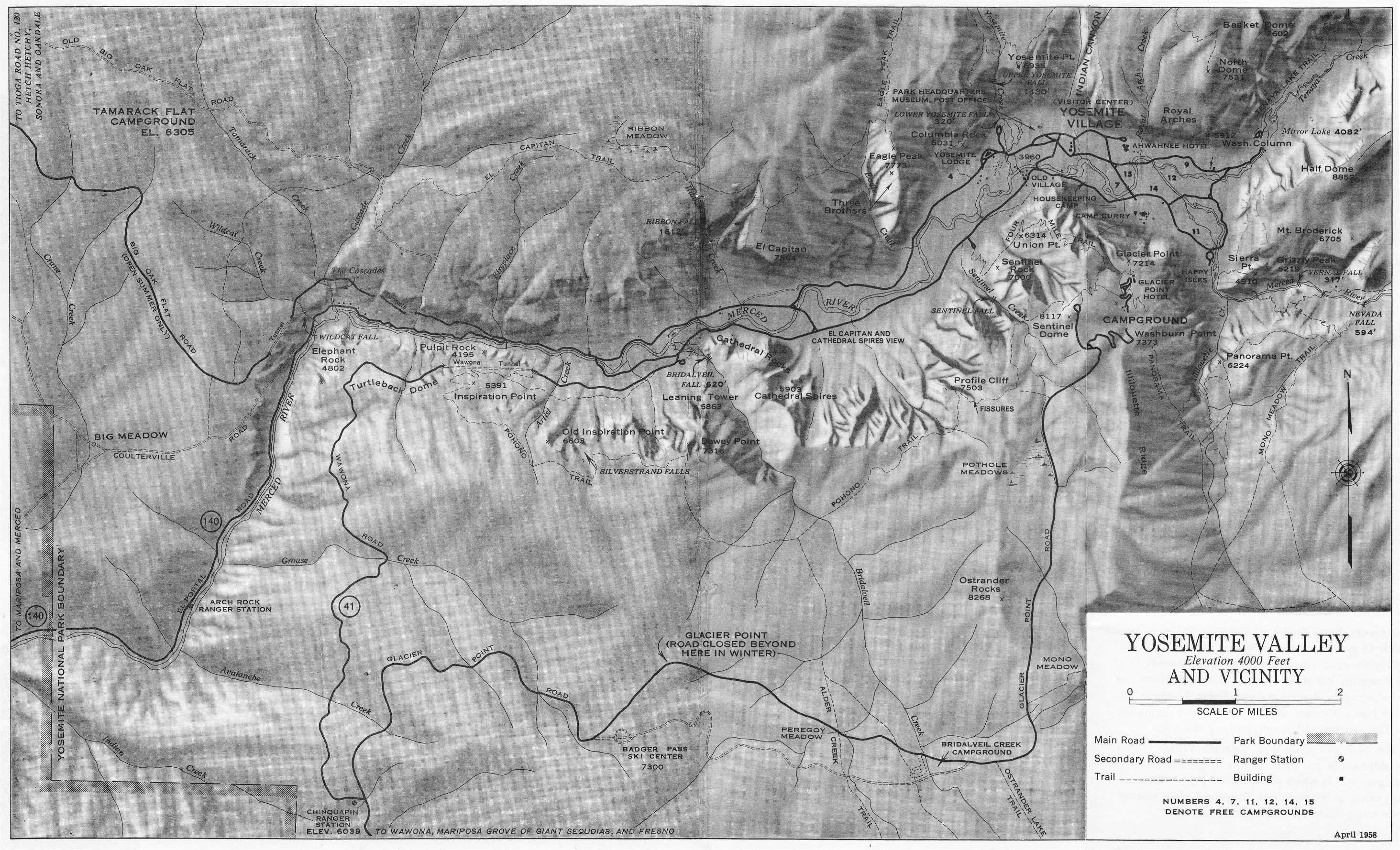
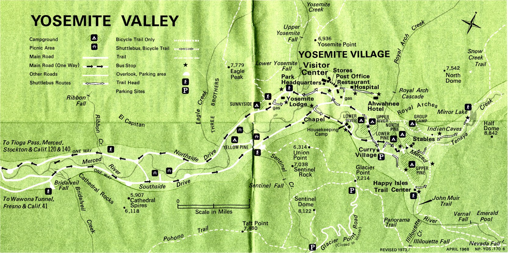
- 1965
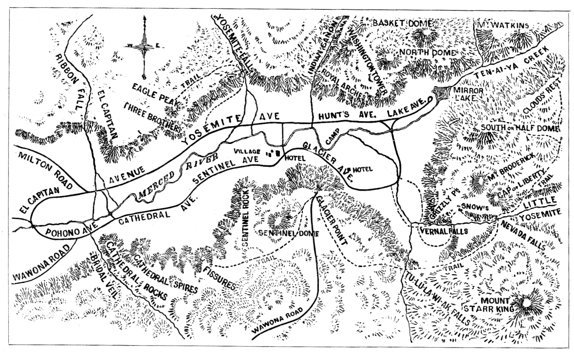
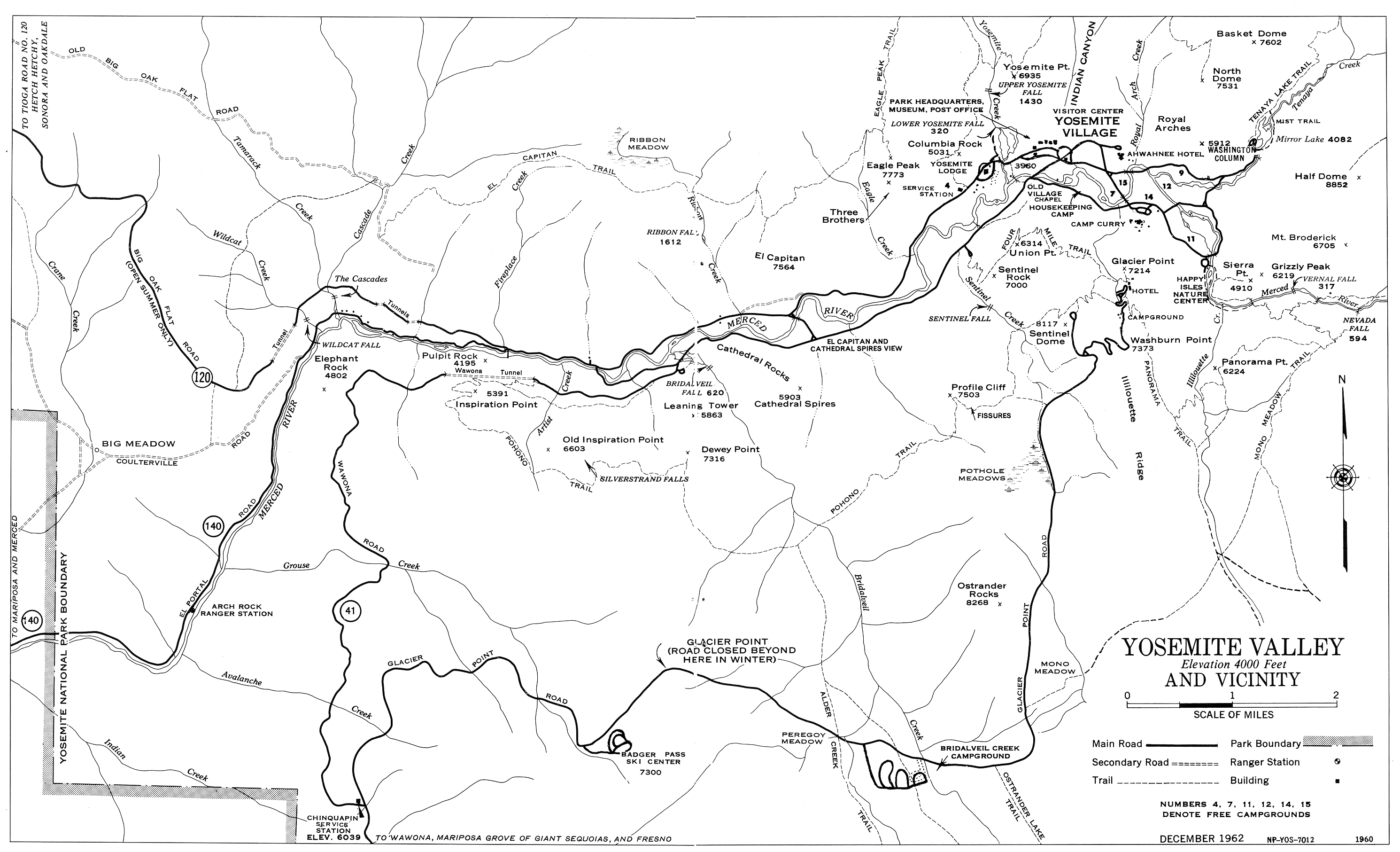
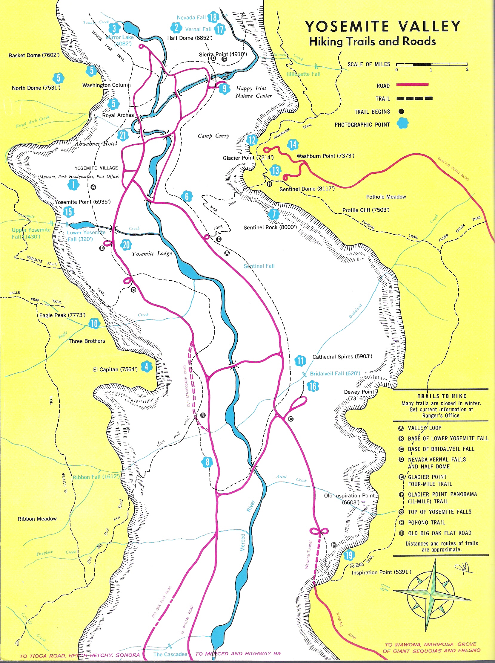
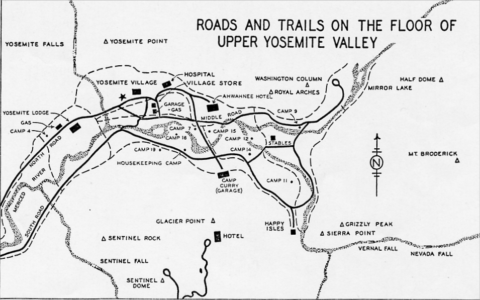
- Roads and Trails on the Floor of Upper Yosemite Valley
from Virginia and Ansel Adams Illustrated Guide to Yosemite
(Sierra Club, 1965)
[260KB, 955x597]
- 1966
- “Yosemite National Park” visitor’s leaflet (NPS, 1966)
- 1967
- Wawona area, including Section 35 land ownership
from Yosemite: the Park and its Resources (1987) by Linda W. Greene
- 1969
- Yosemite National Park visitor’s leaflet (NPS, 1969)
- 1970
- Ahwahnee Hotel grounds, 1970
from Yosemite: the Park and its Resources (1987) by Linda W. Greene
- 1970-2011
- “[Yosemite] Prescribed Fire History 1970 to Present” by Katy W. Warner (NPS, June 2011)
- 1972
- Tecoya and warehouse area map, Yosemite Village
from Yosemite: the Park and its Resources (1987) by Linda W. Greene
- Yosemite Lodge area, 1972
from Yosemite: the Park and its Resources (1987) by Linda W. Greene
- 1973
- Yosemite National Park visitor’s leaflet (NPS, 1973)
- Map of Wawona area showing concesion and park facilities
from Yosemite: the Park and its Resources (1987) by Linda W. Greene
- 1975
- Map of High Sierra Camps, 1975
from Yosemite: the Park and its Resources (1987) by Linda W. Greene
- 1978
- Maps from “Yosemite National Park California” visitor’s leaflet (NPS, 1978, reprint 1979)
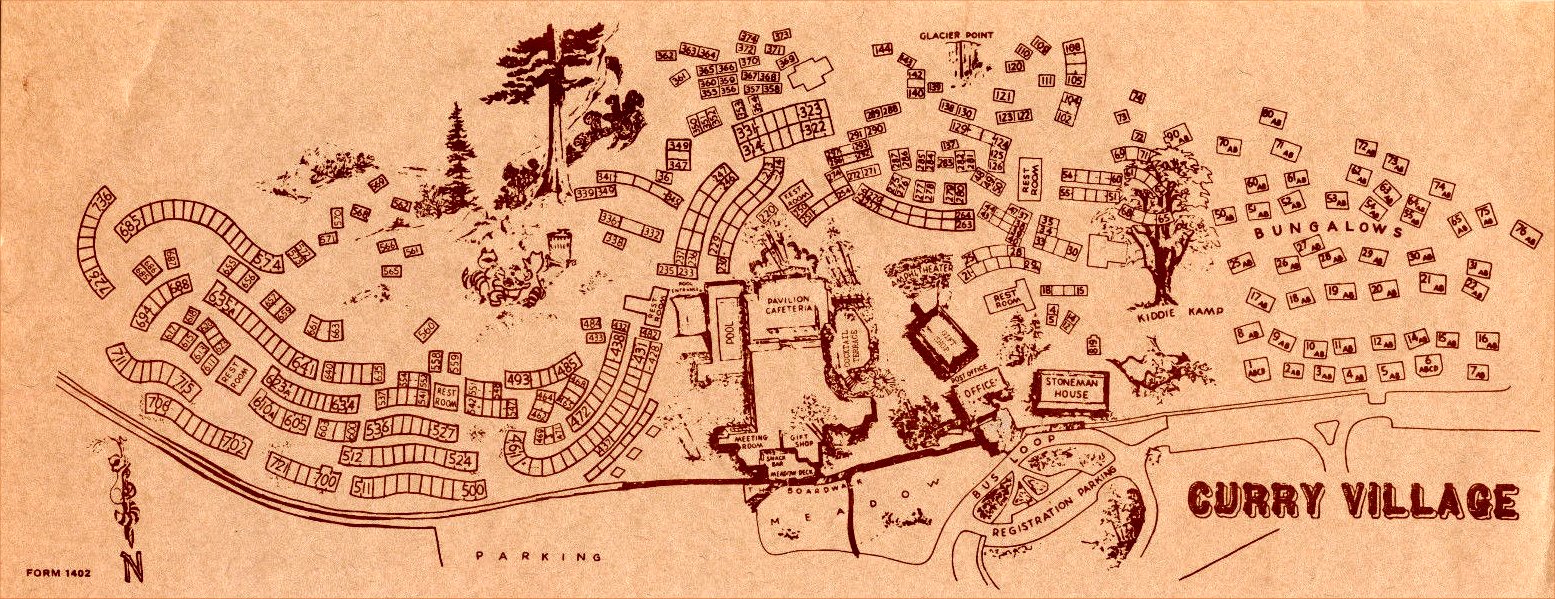
- Curry Village (1978)
- 1983
- Foresta Map
from Sargent, Yosemite’s Rustic Outpost (1983)
- 1985
- Maps from “Yosemite National Park California” visitor’s leaflet (NPS, 1985)
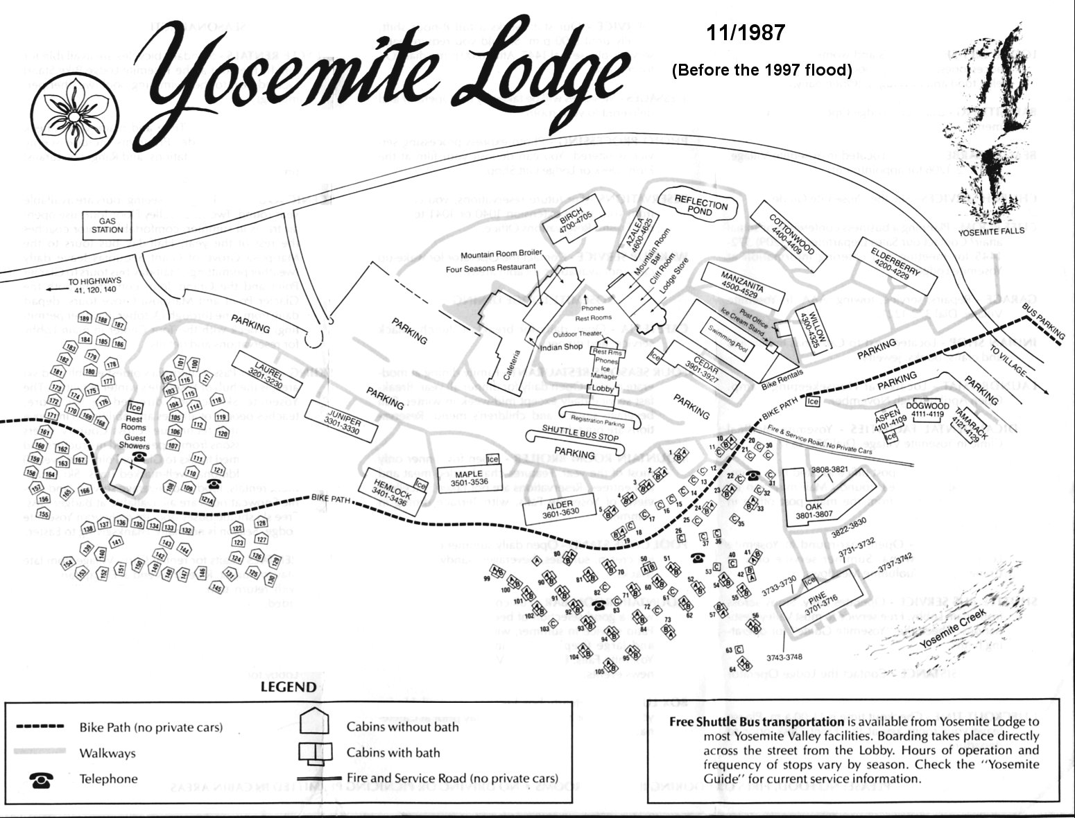
- 1987
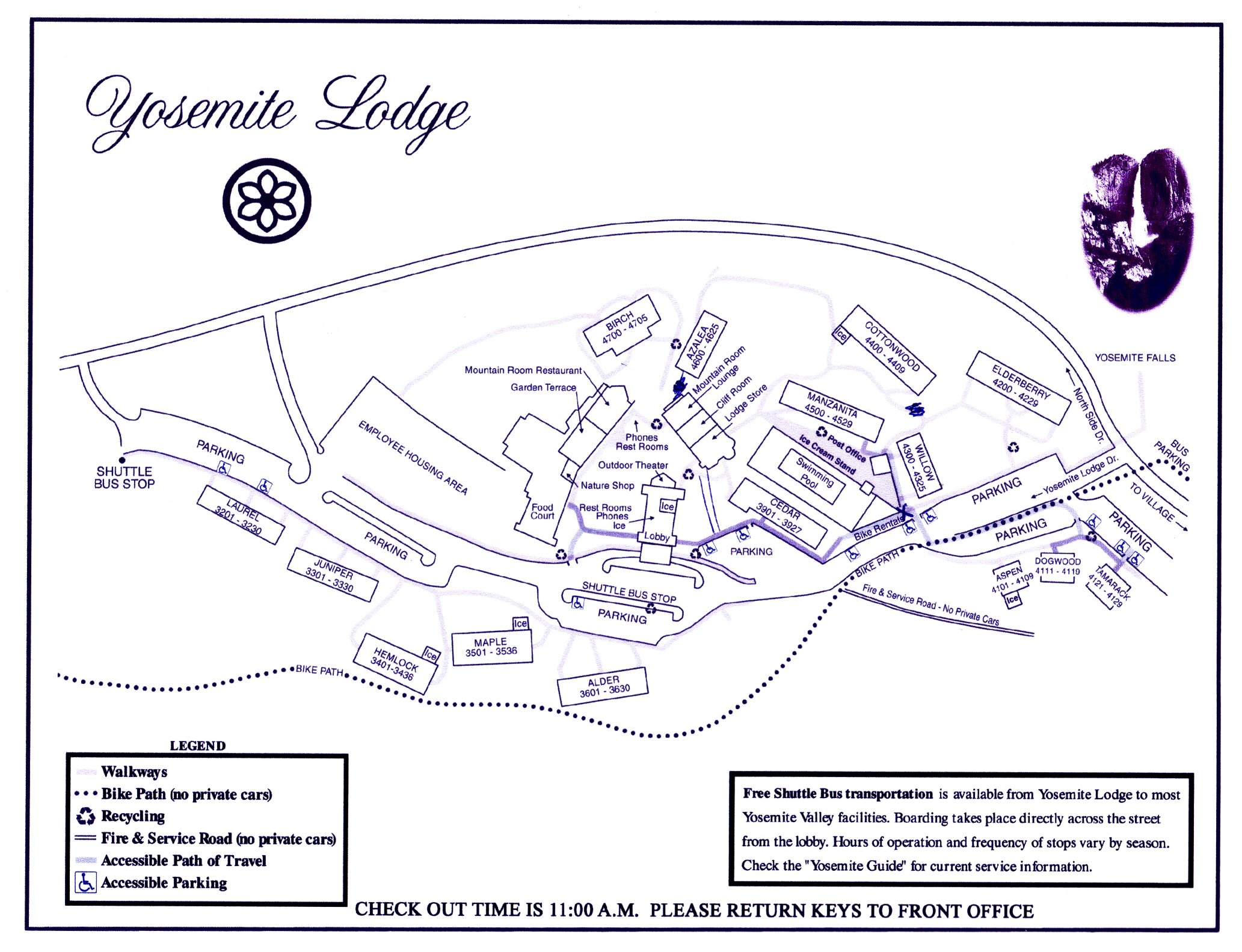
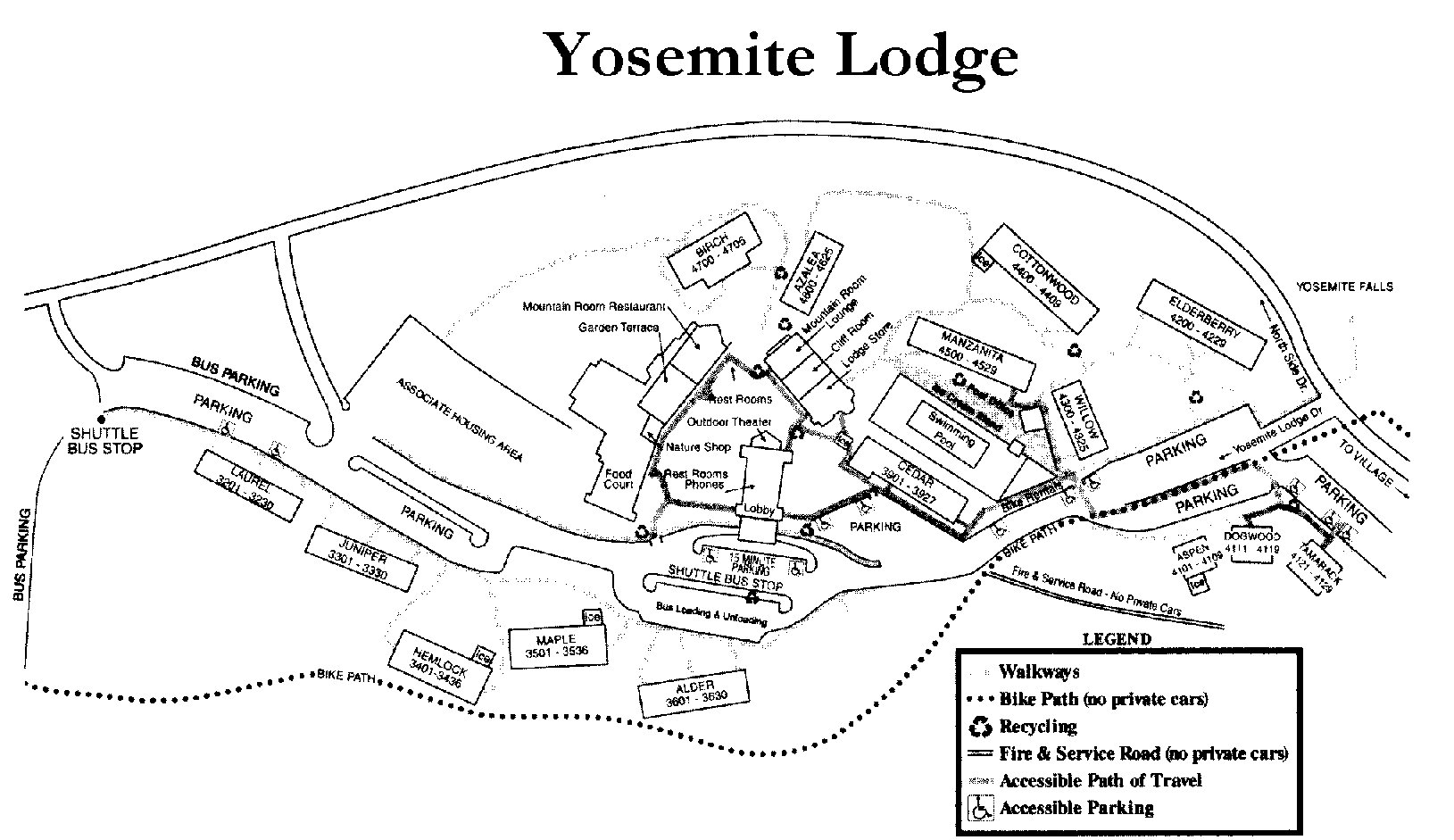
- Yosemite Lodge
(before the 1997 flood) (YP & CC, 1987)
- Historical Base Maps from Yosemite: the Park and its Resources (1987) by Linda W. Greene
- 1990
- Maps from “Yosemite National Park California” visitor’s leaflet (NPS, 1990)
- 1994
- Maps from “Yosemite National Park California” visitor’s leaflet
(NPS, 1994)
- 1998
- Maps from “Yosemite Official Map & Guide” (NPS, 1998)
- 1999
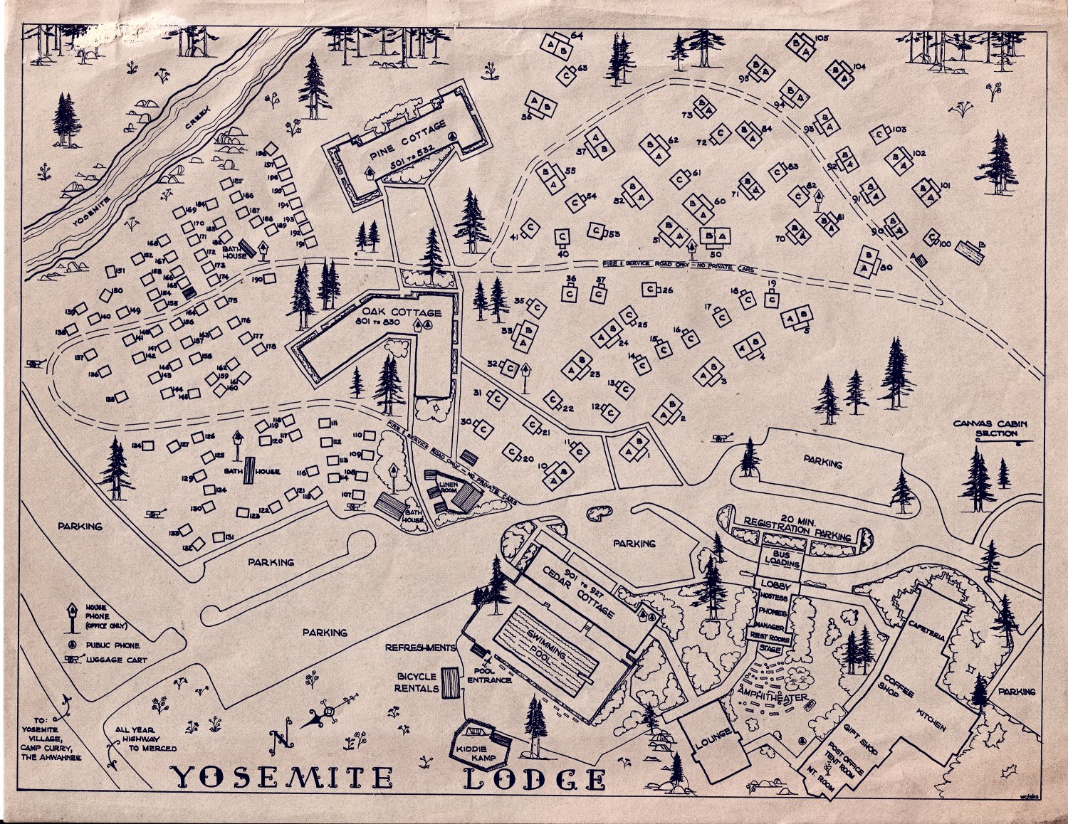
- “Yosemite Lodge”
[after the 1997 flood, YP & CC, 1999]
(courtesy of Jeff Hunt)
- 2001
- “Yosemite Lodge”
(YP & CC, Oct. 2001)
- 2003
- Maps from “Yosemite National Park California” visitor’s leaflet
(NPS, 2003)
- 2008
- Maps from “Yosemite National Park California” visitor’s leaflet
(NPS, 2008)
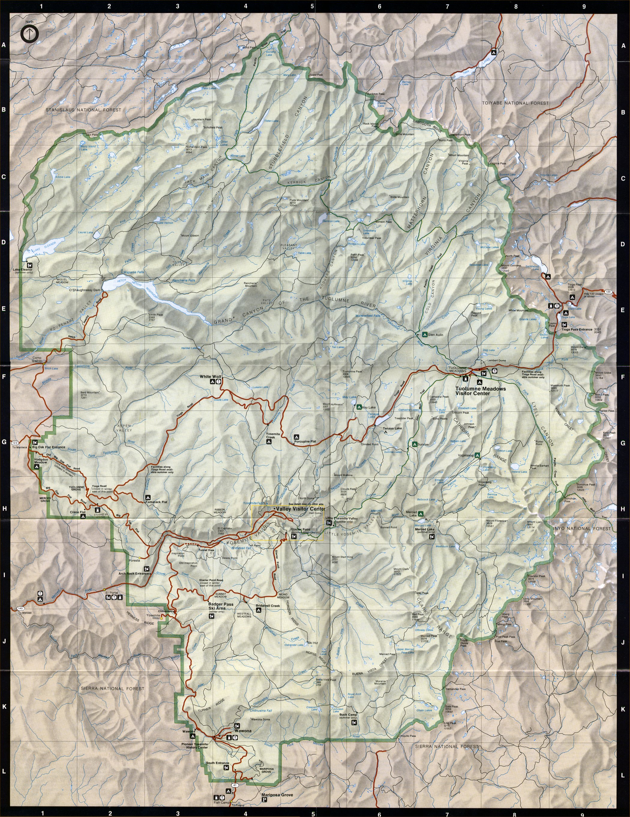
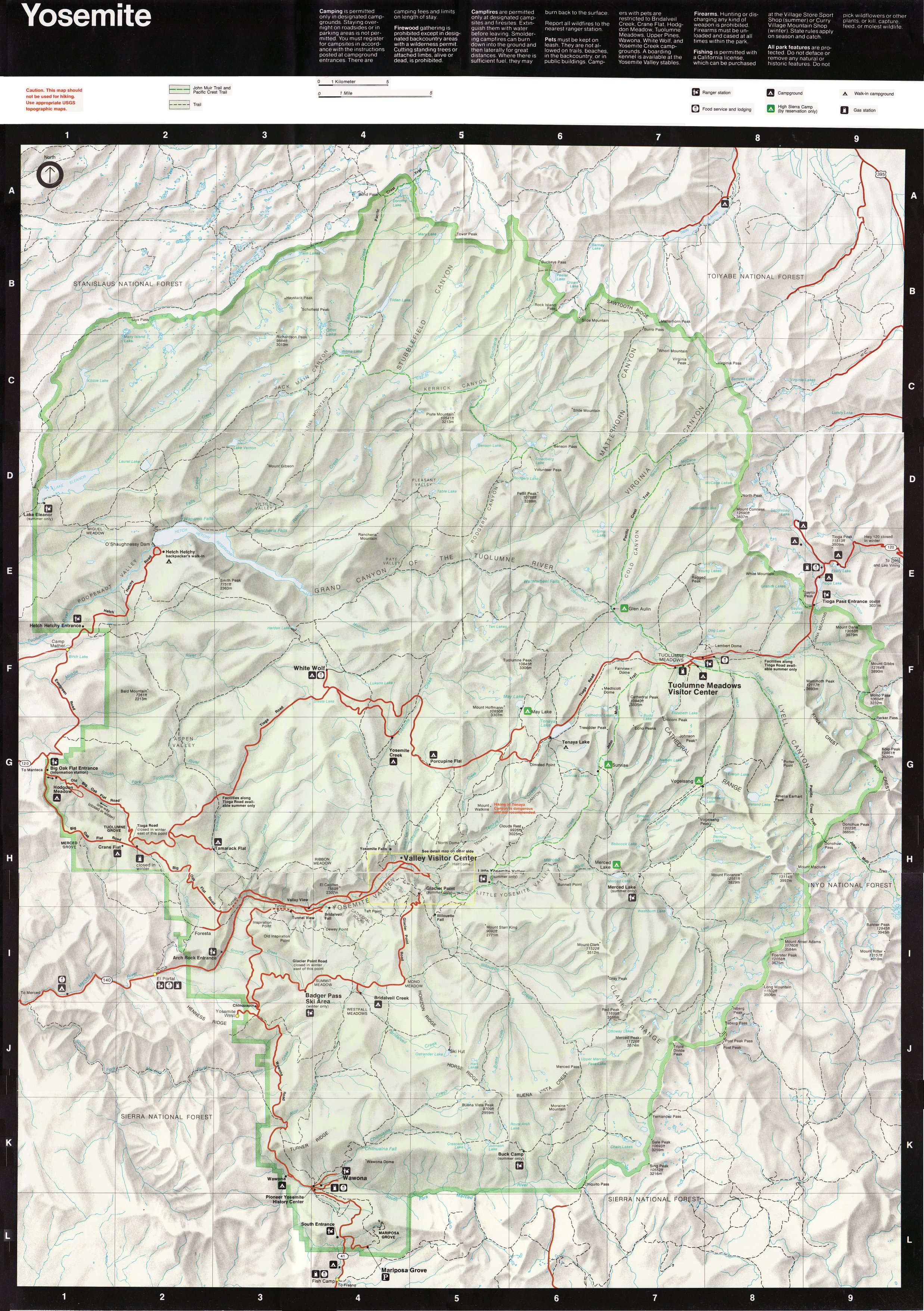
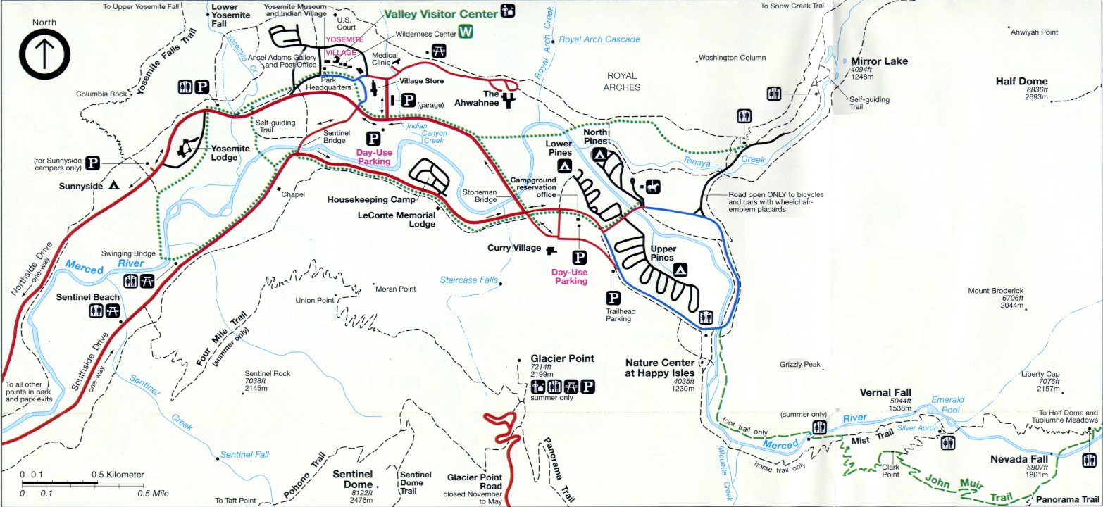
- Today
-
Present-day (contemporary) Yosemite maps
are listed separately:
Disclaimer
We provide these historical maps as a free service.
Historical maps, by their nature, are not accurate nor up-to-date.
These maps are provided “as is” in the hope that it will be useful, but
WITHOUT ANY WARRANTY, to the extent permitted by law; without even the
implied warranty of MERCHANTABILITY or FITNESS FOR A PARTICULAR PURPOSE.
Copyright © 2004-2011 Dan Anderson. All rights reserved.
Last updated
19 June 2018.
If you have questions or comments,
please send a message to
Dan Anderson.
http://www.yosemite.ca.us/library/maps/
![Little Yosemite [Valley] Reservoir Site](little_yosemite_dam_1889.jpg)
![“[Yosemite] Prescribed Fire History 1970 to Present”](yosemite_prescribed_fire_history_1970_2011.jpg)